

U.S. Route 13 in Maryland
Encyclopedia
U.S. Route 13 is a U.S. Highway running from Fayetteville, North Carolina
north to Morrisville, Pennsylvania
. In the U.S. state
of Maryland
, the route runs 42.48 mi (68.36 km) from the Virginia
border south of Pocomoke City
in Worcester County
north to the Delaware
border in Delmar
, Wicomico County
, where the route intersects Delaware/Maryland Route 54
, which runs along the state line. The majority of the route within Maryland is a four-lane divided highway
that passes through rural areas of woodland and farmland. The route also runs through a few municipalities including Pocomoke City and Princess Anne
and it bypasses Salisbury
and Fruitland
to the east on the Salisbury Bypass, which is a freeway. US 13 intersects many major roads including the southern terminus of U.S. Route 113
in Pocomoke City, Maryland Route 413
in Westover
, and Maryland Route 12
and U.S. Route 50
where the route is on the Salisbury Bypass. The route shares a concurrency
with US 50 along a portion of the Salisbury Bypass.
US 13 was designated through Maryland when the U.S. Highway System was established in 1926, running along existing roads. It formed a part of the Ocean Highway
, a road that connected the New York City
area to Florida
, and still carries that name for much of its route in Maryland. Many realignments of the route occurred over the years, with one by 1940 that moved the road to a new alignment between Greenhill and Princess Anne and from north of Princess Anne to Salisbury, another by 1960 that bypassed Princess Anne, and one by 1975 that bypassed Pocomoke City. By 1983, US 13 was moved to the limited-access Salisbury Bypass that had opened in stages. Many former alignments of US 13 in Maryland are still part of the state highway system. U.S. Route 13 Business has been designated along former alignments through Pocomoke City and Salisbury (see also US 13 Business Pocomoke City and US 13 Business Salisbury
) while the original alignments of the route through Princess Anne and Delmar have been designated Maryland Route 675
, and a portion of the former route north of Princess Anne has been designated as Maryland Route 529
.
, U.S. Route 13 heads north on Ocean Highway, a four-lane, 55 mph (88.5 km/h) divided highway
that runs a short distance to the east of the Bay Coast Railroad
line. Upon entering Maryland, US 13 features a welcome center in the northbound direction. It continues north through wooded areas before heading into a mix of farmland and woodland with some residences and businesses along the road. As the road approaches Pocomoke City
, more businesses start to line the road. Before entering Pocomoke City, U.S. Route 13 Business heads northwest from US 13 on Market Street into the downtown area. Past this intersection, the road enters Pocomoke City, where the speed limit drops to 50 mph (80.5 km/h). The route crosses Maryland Route 366
(Stockton Road), which itself has its western terminus at US 13 Business, and continues north past a shopping center, meeting the southern terminus of U.S. Route 113
, as well as Maryland Route 250A (Old Virginia Road), along the eastern edge of town. Continuing around the northern edge of the town, the route passes residential areas to the southwest and rural areas to the northeast before heading into a commercial district and intersecting Maryland Route 756
(Old Snow Hill Rd). US 13 turns west into wooded areas before crossing the Pocomoke River
upstream of US 13 Business.
 Upon crossing the Pocomoke River, US 13 heads into Somerset County
and intersects the northern terminus of US 13 Business and the southern terminus of Maryland Route 364
(Dividing Creek Road). From here, the speed limit increases back to 55 mph (88.5 km/h) and the route curves to the northwest and runs through rural countryside. It features an intersection with the eastern terminus of Maryland Route 667
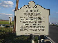
(Rehobeth Road), and the route continues from farmland into heavy woodland. US 13 heads back into agricultural areas where it intersects many unsigned suffixed segments of Maryland Route 920
which are mostly short, dead-end roads. The route continues west and northwest before it intersects Maryland Route 673 (Sam Barnes Road), which provides a connection to southbound Maryland Route 413
and Crisfield
. Past MD 673, US 13 turns north and meets the northern terminus of MD 413 (Crisfield Highway), with access to that route only in the southbound direction.
Now running north-northeast, the highway heads through heavy woodland, with trees in the median. US 13 intersects Maryland Route 640 (Revells Neck Road), which heads west to serve the Eastern Correctional Instiution. From here, the road heads north through a mix of woods and farms, running a short distance to the west of a Norfolk Southern rail line. It is eventually paralleled to the west by the main segment of unsigned Maryland Route 920 (Market Lane), which serves as a frontage road
. Along this stretch, more development starts to line the road as it approaches Princess Anne
. After the northern terminus of MD 920, Maryland Route 675
heads north from US 13 into downtown Princess Anne on Somerset Avenue (US 13's original alignment through Princess Anne). The route curves northwest again as it bypasses the town.
Skirting the western edge of the town, the route intersects Maryland Route 363
(Deal Island Road/Manokin Avenue) next to Manokin River Park. Continuing north, the route soon intersects Maryland Route 362
and passes by some businesses past that intersection. The next intersection is for Maryland Route 822 (UMES Boulevard), which heads east to provide access to the University of Maryland Eastern Shore
campus. US 13 curves northeast and exits the town, intersecting the northern terminus of MD 675 in the town's outskirts. It continues through wooded areas, again closely paralleling the Norfolk Southern rail line. US 13 intersects the northern terminus of Maryland Route 529
, a rural route that heads south back to Princess Anne on Loretto Road. Past MD 529, the road continues northeast, intersecting Peggy Neck Road. From here, the highway heads through more woodland before passing through the community of Eden
and continuing into open farmland.
 US 13 crosses the Passerdyke Creek into Wicomico County
, where it continues northeast as South Fruitland Boulevard through a mix of woods and farms. Shortly after entering Wicomico County, the route diverges from US 13 Business
at a semi-directional wye junction. US 13 Business continues towards Fruitland and downtown Salisbury
on South Fruitland Boulevard while US 13 turns northeast and upgrades into the Salisbury Bypass, a four-lane, 65 mph (104.6 km/h) freeway.
Bypassing the Salisbury area to the east, the route heads through farmland and meets Maryland Route 513
(St. Lukes Road) at a diamond interchange
. MD 513 provides access from the US 13 bypass into Fruitland. Continuing northeast through a mix of farmland and woodland, with some housing developments nearby, US 13 meets Maryland Route 12
(Snow Hill Road) at a partial cloverleaf interchange. MD 12 serves as a direct link between Salisbury and Snow Hill
, connecting with U.S. Route 113 in Snow Hill. Turning north near Parker Pond the highway crosses over Maryland Route 350
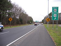
(Mt. Hermon Road) with no interchange between the routes, and continues north to another partial interchange with U.S. Route 50
and U.S. Route 50 Business
to the east of Salisbury.
The interchange between US 13, US 50, and US 50 Business, modified from a full cloverleaf with the completion of the Salisbury Bypass west of US 13 to US 50, is the site of the eastern terminus of US 50 Business, US 50's original route through Salisbury. US 50 joins US 13 at this interchange, and the two routes run concurrent
along 3 miles (5 km) of the Salisbury Bypass. Just beyond the interchange, the road passes over Maryland Route 346
(Old Ocean City Road) with no interchange. The Salisbury Bypass turns to the west and meets the northern terminus of US 13 Business (North Salisbury Boulevard) at the original northern terminus of the bypass. US 13 separates from US 50 at this interchange and rejoins its original northward route, while US 50 continues west on the Salisbury Bypass to rejoin its original route northwest of Salisbury.
US 13, now known as North Salisbury Boulevard, continues north into a commercial area on a six-lane, 50 mph (80.5 km/h) divided highway, immediately passing by The Centre at Salisbury
shopping mall. The road passes numerous businesses before crossing Leonard Pond, as the road narrows to five lanes (with two lanes southbound and three lanes northbound), and becomes Ocean Highway again. It passes by a set of weigh station
s located on both sides of the road and intersects the southern terminus of a separate Maryland Route 675
, which follows US 13's original route through Delmar
on Bi State Boulevard. US 13 continues north as a four-lane, 55 mph (88.5 km/h) highway (with two lanes in each direction), through a mix of farms and woods with some businesses, skirting Delmar to the east. The route intersects Delaware/Maryland Route 54
(Maryland Delaware Line Road), which runs along the Delaware
-Maryland border, and US 13 continues north into Delaware.
 The entire route of US 13 in Maryland is part of the Ocean Highway
, an Atlantic
coastal highway stretching from Jacksonville, Florida
to New Brunswick, New Jersey
that served as the quickest route between the New York City
area and Florida
before the introduction of the Interstate Highway System
. US 13 is one of only four U.S. Routes that form the highway and Maryland was one of the states that participated in the highway's formation.
and entered Somerset County on a now-severed alignment south of its successor route. The route headed west to Peach Orchard Road and turned north, passing through what is now the parking lot for a Sysco
warehouse. It crossed the present-day alignment and followed Costen Road, crossing the current alignment of US 13 again before following Greenhill Lane to an alignment that no longer exists. From there, US 13 followed Old Princess Anne Road north to Princess Anne, where it ran along present MD 675 (Somerset Avenue) in that town. North of Princess Anne, the route followed present MD 529 and crossing the current alignment of US 13 again, following Allen Road before shifting onto Camden Avenue, which the route followed through Fruitland and into Salisbury. Where US 50 Business is today, US 13 moved to Division Street and continued north on its present corridor. Past Leonard Pond, US 13 ran along what is now a dead-end alignment connecting it to present-day MD 675 (Bi State Boulevard) again, following that road to Delmar and the state line.
A bypass of Princess Anne was completed by 1960, with the old alignment of US 13 through the town becoming MD 675. The route was also dualized north of the town and north of Salisbury, where a new alignment bypassed Delmar to the east. The former alignment was designated as U.S. Route 13 Alternate, eventually becoming MD 675. Between MD 413 and the Worcester County line, the road was moved onto its present corridor, and south of Pocomoke City it was dualized. US 13 would be completely dualized within Maryland by 1975. Also by this time, a bypass of Pocomoke City was built for US 13, with the former route (Market Street) designated as MD 675 before later becoming U.S. Route 13 Business.
. The entire length of the Salisbury Bypass was finished by 1983, and the US 13 designation was moved to the bypass, with the route through Salisbury designated as U.S. Route 13 Business.
After the extension of the bypass west to US 50
opened on October 19, 2002, the two routes are now cosigned for three miles (5 km) along the Salisbury Bypass. This concurrent section features separate mile markers for both US 13 and US 50, with shields on the mile markers to differentiate between the two routes.
Fayetteville, North Carolina
Fayetteville is a city located in Cumberland County, North Carolina, United States. It is the county seat of Cumberland County, and is best known as the home of Fort Bragg, a U.S. Army post located northwest of the city....
north to Morrisville, Pennsylvania
Morrisville, Bucks County, Pennsylvania
Morrisville is a borough in Bucks County, Pennsylvania, United States. The population was 8,728 at the 2010 census.-Geography:Morrisville is located at . It is situated on the Delaware River directly across from Trenton, New Jersey...
. In the U.S. state
U.S. state
A U.S. state is any one of the 50 federated states of the United States of America that share sovereignty with the federal government. Because of this shared sovereignty, an American is a citizen both of the federal entity and of his or her state of domicile. Four states use the official title of...
of Maryland
Maryland
Maryland is a U.S. state located in the Mid Atlantic region of the United States, bordering Virginia, West Virginia, and the District of Columbia to its south and west; Pennsylvania to its north; and Delaware to its east...
, the route runs 42.48 mi (68.36 km) from the Virginia
Virginia
The Commonwealth of Virginia , is a U.S. state on the Atlantic Coast of the Southern United States. Virginia is nicknamed the "Old Dominion" and sometimes the "Mother of Presidents" after the eight U.S. presidents born there...
border south of Pocomoke City
Pocomoke City, Maryland
Pocomoke City, dubbed "the friendliest town on the Eastern Shore", is a city in Worcester County, Maryland, United States. Although renamed in a burst of civic enthusiasm in 1878, the city is regularly referred to by its inhabitants simply as Pocomoke...
in Worcester County
Worcester County, Maryland
-2010:Whereas according to the 2010 U.S. Census Bureau:*82.0% White*13.6% Black*0.3% Native American*1.1% Asian*0.0% Native Hawaiian or Pacific Islander*1.7% Two or more races*1.3% Other races*3.2% Hispanic or Latino -2000:...
north to the Delaware
Delaware
Delaware is a U.S. state located on the Atlantic Coast in the Mid-Atlantic region of the United States. It is bordered to the south and west by Maryland, and to the north by Pennsylvania...
border in Delmar
Delmar, Maryland
Delmar is a town in Wicomico County, Maryland, United States. The population was 3,003 at the 2010 census. It is included in the Salisbury, Maryland Metropolitan Statistical Area. When the population is added to "twin city" Delmar, Delaware the town's total population is 4,600...
, Wicomico County
Wicomico County, Maryland
As of the census of 2010, there were 98,733 people, 37,220 households, and 24,172 families residing in the county. The population density was 261.7 people per square mile . There were 41,192 housing units at an average density of 109.2 per square mile...
, where the route intersects Delaware/Maryland Route 54
Delaware/Maryland Route 54
Delaware Route 54 and Maryland Route 54 are adjoining state highways in the U.S. states of Delaware and Maryland. Route 54 runs from MD 313 in Mardela Springs, Maryland east to DE 1 in Fenwick Island, Delaware...
, which runs along the state line. The majority of the route within Maryland is a four-lane divided highway
Divided Highway
Divided Highway is a compilation album by American rock band The Doobie Brothers, released in 2003. . All tracks are taken from the albums Cycles and Brotherhood .-Track listing:...
that passes through rural areas of woodland and farmland. The route also runs through a few municipalities including Pocomoke City and Princess Anne
Princess Anne, Maryland
Princess Anne is a town in Somerset County, Maryland, United States. The population was 2,313 at the 2000 census. It is the county seat of Somerset County.Princess Anne is included in the Salisbury, Maryland Metropolitan Statistical Area....
and it bypasses Salisbury
Salisbury, Maryland
-Demographics:Salisbury is the principal city of the Salisbury-Ocean Pines CSA, a Combined Statistical Area that includes the Salisbury metropolitan area and the Ocean Pines micropolitan area , which had a combined population of 176,657 at the 2010 census.As of the census of 2000, there were...
and Fruitland
Fruitland, Maryland
Fruitland is a city in Wicomico County, Maryland, United States. The population was 4,866 at the 2010 census. It is included in the Salisbury, Maryland Metropolitan Statistical Area.-Geography:Fruitland is located at ....
to the east on the Salisbury Bypass, which is a freeway. US 13 intersects many major roads including the southern terminus of U.S. Route 113
U.S. Route 113
U.S. Route 113 is a spur of US 13 in the U.S. states of Maryland and Delaware. The U.S. Highway runs from US 13 in Pocomoke City, Maryland north to Delaware Route 1 in Milford, Delaware...
in Pocomoke City, Maryland Route 413
Maryland Route 413
Maryland Route 413 is a state highway in Somerset County in the U.S. state of Maryland. The route runs from a dead end at Crisfield's city dock, which is located on the Tangier Sound, northeast to U.S. Route 13 in Westover. It is the main highway leading into Crisfield, and is known as...
in Westover
Westover, Maryland
Westover is an unincorporated community in Somerset County, Maryland, United States. It is located on Maryland Route 413 near its terminus at U.S. Route 13. The small community is home to many important services in Somerset County....
, and Maryland Route 12
Maryland Route 12
Maryland Route 12 is a state highway on the Eastern Shore in the U.S. state of Maryland. The route runs from the Virginia border south of Stockton, Worcester County, where it continues into Virginia as State Route 679, north to Main Street in the city of Salisbury in Wicomico County...
and U.S. Route 50
U.S. Route 50 in Maryland
U.S. Route 50 is a major east–west route of the U.S. Highway system, stretching just over from Ocean City, Maryland on the Atlantic Ocean to West Sacramento, California. In the U.S. state of Maryland, US 50 exists in two sections. The longer of these serves as a major route connecting...
where the route is on the Salisbury Bypass. The route shares a concurrency
Concurrency (road)
A concurrency, overlap, or coincidence in a road network is an instance of one physical road bearing two or more different highway, motorway, or other route numbers...
with US 50 along a portion of the Salisbury Bypass.
US 13 was designated through Maryland when the U.S. Highway System was established in 1926, running along existing roads. It formed a part of the Ocean Highway
Ocean Highway
Ocean Highway was a designation established early in the 20th century for a combination of roadways and water-crossings for motor vehicles which would generally traverse as close as possible to the Atlantic Ocean along the East Coast of the United States from Jacksonville, Florida to New Brunswick,...
, a road that connected the New York City
New York City
New York is the most populous city in the United States and the center of the New York Metropolitan Area, one of the most populous metropolitan areas in the world. New York exerts a significant impact upon global commerce, finance, media, art, fashion, research, technology, education, and...
area to Florida
Florida
Florida is a state in the southeastern United States, located on the nation's Atlantic and Gulf coasts. It is bordered to the west by the Gulf of Mexico, to the north by Alabama and Georgia and to the east by the Atlantic Ocean. With a population of 18,801,310 as measured by the 2010 census, it...
, and still carries that name for much of its route in Maryland. Many realignments of the route occurred over the years, with one by 1940 that moved the road to a new alignment between Greenhill and Princess Anne and from north of Princess Anne to Salisbury, another by 1960 that bypassed Princess Anne, and one by 1975 that bypassed Pocomoke City. By 1983, US 13 was moved to the limited-access Salisbury Bypass that had opened in stages. Many former alignments of US 13 in Maryland are still part of the state highway system. U.S. Route 13 Business has been designated along former alignments through Pocomoke City and Salisbury (see also US 13 Business Pocomoke City and US 13 Business Salisbury
U.S. Route 13 Business (Salisbury, Maryland)
U.S. Route 13 Business is a business route of U.S. Route 13 in the U.S. state of Maryland. The highway runs between US 13 south of Fruitland and US 13 and US 50 on the north side of Salisbury...
) while the original alignments of the route through Princess Anne and Delmar have been designated Maryland Route 675
Maryland Route 675
Maryland Route 675 is a collection of state highways in the U.S. state of Maryland. These two highways are sections of old alignment of U.S. Route 13 in Princess Anne in Somerset County and Delmar in northern Wicomico County. MD 675 was designated after US 13 bypassed Princess Anne in the late...
, and a portion of the former route north of Princess Anne has been designated as Maryland Route 529
Maryland Route 529
Maryland Route 529 is a state highway in the U.S. state of Maryland. The state highway runs from MD 675 in Princess Anne north to U.S. Route 13 near Eden in northern Somerset County. MD 529 is the old alignment of US 13. The state highway was designated from Princess Anne through Allen to...
.
Worcester County
Entering the state from VirginiaVirginia
The Commonwealth of Virginia , is a U.S. state on the Atlantic Coast of the Southern United States. Virginia is nicknamed the "Old Dominion" and sometimes the "Mother of Presidents" after the eight U.S. presidents born there...
, U.S. Route 13 heads north on Ocean Highway, a four-lane, 55 mph (88.5 km/h) divided highway
Divided Highway
Divided Highway is a compilation album by American rock band The Doobie Brothers, released in 2003. . All tracks are taken from the albums Cycles and Brotherhood .-Track listing:...
that runs a short distance to the east of the Bay Coast Railroad
Bay Coast Railroad
The Bay Coast Railroad operates the former Eastern Shore Railroad line from Pocomoke City, Maryland, to Norfolk, Virginia. The Bay Coast Railroad interchanges with the Norfolk Southern Railway at both Norfolk, Virginia and Pocomoke City, Maryland.-History:...
line. Upon entering Maryland, US 13 features a welcome center in the northbound direction. It continues north through wooded areas before heading into a mix of farmland and woodland with some residences and businesses along the road. As the road approaches Pocomoke City
Pocomoke City, Maryland
Pocomoke City, dubbed "the friendliest town on the Eastern Shore", is a city in Worcester County, Maryland, United States. Although renamed in a burst of civic enthusiasm in 1878, the city is regularly referred to by its inhabitants simply as Pocomoke...
, more businesses start to line the road. Before entering Pocomoke City, U.S. Route 13 Business heads northwest from US 13 on Market Street into the downtown area. Past this intersection, the road enters Pocomoke City, where the speed limit drops to 50 mph (80.5 km/h). The route crosses Maryland Route 366
Maryland Route 366
Maryland Route 366 is a state highway in the U.S. state of Maryland. Known for much of its length as Stockton Road, the state highway runs from U.S. Route 13 Business in Pocomoke City east to the entrance of George Island Landing on Chincoteague Bay...
(Stockton Road), which itself has its western terminus at US 13 Business, and continues north past a shopping center, meeting the southern terminus of U.S. Route 113
U.S. Route 113
U.S. Route 113 is a spur of US 13 in the U.S. states of Maryland and Delaware. The U.S. Highway runs from US 13 in Pocomoke City, Maryland north to Delaware Route 1 in Milford, Delaware...
, as well as Maryland Route 250A (Old Virginia Road), along the eastern edge of town. Continuing around the northern edge of the town, the route passes residential areas to the southwest and rural areas to the northeast before heading into a commercial district and intersecting Maryland Route 756
Maryland Route 756
Maryland Route 756 is a state highway in the U.S. state of Maryland. Known as Old Snow Hill Road, the state highway runs from U.S. Route 13 east to US 113 within Pocomoke City. MD 756 is the original alignment of US 113 in Pocomoke City...
(Old Snow Hill Rd). US 13 turns west into wooded areas before crossing the Pocomoke River
Pocomoke River
The Pocomoke River stretches approximately from southern Delaware through southeastern Maryland in the United States. At its mouth, the river is essentially an arm of Chesapeake Bay, whereas the upper river flows through a series of relatively inaccessible wetlands called the Great Cypress Swamp,...
upstream of US 13 Business.
Somerset County
Somerset County, Maryland
-2010:Whereas according to the 2010 U.S. Census Bureau:*53.5% White*42.3% Black*0.3% Native American*0.7% Asian*0.0% Native Hawaiian or Pacific Islander*1.7% Two or more races*1.5% Other races*3.3% Hispanic or Latino -2000:...
and intersects the northern terminus of US 13 Business and the southern terminus of Maryland Route 364
Maryland Route 364
Maryland Route 364 is a state highway in the U.S. state of Maryland. Known as Dividing Creek Road, the state highway runs from U.S. Route 13 in West Pocomoke north to Pocomoke State Forest. MD 364 parallels the Pocomoke River and provides access to Pocomoke River State Park...
(Dividing Creek Road). From here, the speed limit increases back to 55 mph (88.5 km/h) and the route curves to the northwest and runs through rural countryside. It features an intersection with the eastern terminus of Maryland Route 667
Maryland Route 667
Maryland Route 667 is a state highway in Somerset County in the U.S. state of Maryland. The east–west route runs from the city of Crisfield, which is located on the Tangier Sound, to U.S. Route 13 west of Pocomoke, and passes through Hopewell, Marion, Hudson's Corner, and Rehobeth along...
(Rehobeth Road), and the route continues from farmland into heavy woodland. US 13 heads back into agricultural areas where it intersects many unsigned suffixed segments of Maryland Route 920
Maryland Route 920
Maryland Route 920 is a collection of unsigned state highways in the U.S. state of Maryland. These 19 highways are service roads constructed to restore access to private property or county highways whose access was compromised by the expansion of U.S...
which are mostly short, dead-end roads. The route continues west and northwest before it intersects Maryland Route 673 (Sam Barnes Road), which provides a connection to southbound Maryland Route 413
Maryland Route 413
Maryland Route 413 is a state highway in Somerset County in the U.S. state of Maryland. The route runs from a dead end at Crisfield's city dock, which is located on the Tangier Sound, northeast to U.S. Route 13 in Westover. It is the main highway leading into Crisfield, and is known as...
and Crisfield
Crisfield, Maryland
Crisfield is a city in Somerset County, Maryland, United States, located on the Tangier Sound, an arm of the Chesapeake Bay. The population was 2,723 at the 2000 census. It is included in the Salisbury, Maryland Metropolitan Statistical Area...
. Past MD 673, US 13 turns north and meets the northern terminus of MD 413 (Crisfield Highway), with access to that route only in the southbound direction.
Now running north-northeast, the highway heads through heavy woodland, with trees in the median. US 13 intersects Maryland Route 640 (Revells Neck Road), which heads west to serve the Eastern Correctional Instiution. From here, the road heads north through a mix of woods and farms, running a short distance to the west of a Norfolk Southern rail line. It is eventually paralleled to the west by the main segment of unsigned Maryland Route 920 (Market Lane), which serves as a frontage road
Frontage road
A frontage road is a non-limited access road running parallel to a higher-speed road, usually a freeway, and feeding it at appropriate points of access...
. Along this stretch, more development starts to line the road as it approaches Princess Anne
Princess Anne, Maryland
Princess Anne is a town in Somerset County, Maryland, United States. The population was 2,313 at the 2000 census. It is the county seat of Somerset County.Princess Anne is included in the Salisbury, Maryland Metropolitan Statistical Area....
. After the northern terminus of MD 920, Maryland Route 675
Maryland Route 675
Maryland Route 675 is a collection of state highways in the U.S. state of Maryland. These two highways are sections of old alignment of U.S. Route 13 in Princess Anne in Somerset County and Delmar in northern Wicomico County. MD 675 was designated after US 13 bypassed Princess Anne in the late...
heads north from US 13 into downtown Princess Anne on Somerset Avenue (US 13's original alignment through Princess Anne). The route curves northwest again as it bypasses the town.
Skirting the western edge of the town, the route intersects Maryland Route 363
Maryland Route 363
Maryland Route 363 is a state highway in the U.S. state of Maryland. Known for almost all of its length as Deal Island Road, the state highway runs from a dead end in the community of Wenona at the southern end of Deal Island east to Mansion Avenue in Princess Anne just east of the highway's...
(Deal Island Road/Manokin Avenue) next to Manokin River Park. Continuing north, the route soon intersects Maryland Route 362
Maryland Route 362
Maryland Route 362 is a state highway in the U.S. state of Maryland. Known as Mount Vernon Road, the state highway runs from the beginning of state maintenance in Mount Vernon east to MD 675 in Princess Anne. MD 362 connects Princess Anne with northwestern Somerset County as well as...
and passes by some businesses past that intersection. The next intersection is for Maryland Route 822 (UMES Boulevard), which heads east to provide access to the University of Maryland Eastern Shore
University of Maryland Eastern Shore
University of Maryland Eastern Shore located on 776 acres in Princess Anne, Maryland, United States, is part of the University System of Maryland...
campus. US 13 curves northeast and exits the town, intersecting the northern terminus of MD 675 in the town's outskirts. It continues through wooded areas, again closely paralleling the Norfolk Southern rail line. US 13 intersects the northern terminus of Maryland Route 529
Maryland Route 529
Maryland Route 529 is a state highway in the U.S. state of Maryland. The state highway runs from MD 675 in Princess Anne north to U.S. Route 13 near Eden in northern Somerset County. MD 529 is the old alignment of US 13. The state highway was designated from Princess Anne through Allen to...
, a rural route that heads south back to Princess Anne on Loretto Road. Past MD 529, the road continues northeast, intersecting Peggy Neck Road. From here, the highway heads through more woodland before passing through the community of Eden
Eden, Maryland
Eden is a census-designated place in Somerset County, Maryland, United States. The population was 793 at the 2000 census. It is included in the Salisbury, Maryland Metropolitan Statistical Area.-Geography:Eden is located at ....
and continuing into open farmland.
Wicomico County
Wicomico County, Maryland
As of the census of 2010, there were 98,733 people, 37,220 households, and 24,172 families residing in the county. The population density was 261.7 people per square mile . There were 41,192 housing units at an average density of 109.2 per square mile...
, where it continues northeast as South Fruitland Boulevard through a mix of woods and farms. Shortly after entering Wicomico County, the route diverges from US 13 Business
U.S. Route 13 Business (Salisbury, Maryland)
U.S. Route 13 Business is a business route of U.S. Route 13 in the U.S. state of Maryland. The highway runs between US 13 south of Fruitland and US 13 and US 50 on the north side of Salisbury...
at a semi-directional wye junction. US 13 Business continues towards Fruitland and downtown Salisbury
Salisbury, Maryland
-Demographics:Salisbury is the principal city of the Salisbury-Ocean Pines CSA, a Combined Statistical Area that includes the Salisbury metropolitan area and the Ocean Pines micropolitan area , which had a combined population of 176,657 at the 2010 census.As of the census of 2000, there were...
on South Fruitland Boulevard while US 13 turns northeast and upgrades into the Salisbury Bypass, a four-lane, 65 mph (104.6 km/h) freeway.
Bypassing the Salisbury area to the east, the route heads through farmland and meets Maryland Route 513
Maryland Route 513
Maryland Route 513 is a state highway in the U.S. state of Maryland. Known for much of its length as Cedar Lane, the state highway runs from Jackson Road just south of the interchange with U.S. Route 13 north to US 13 Business within Fruitland...
(St. Lukes Road) at a diamond interchange
Diamond interchange
A diamond interchange is a common type of road junction, used where a freeway crosses a minor road. The freeway itself is grade-separated from the minor road, one crossing the other over a bridge...
. MD 513 provides access from the US 13 bypass into Fruitland. Continuing northeast through a mix of farmland and woodland, with some housing developments nearby, US 13 meets Maryland Route 12
Maryland Route 12
Maryland Route 12 is a state highway on the Eastern Shore in the U.S. state of Maryland. The route runs from the Virginia border south of Stockton, Worcester County, where it continues into Virginia as State Route 679, north to Main Street in the city of Salisbury in Wicomico County...
(Snow Hill Road) at a partial cloverleaf interchange. MD 12 serves as a direct link between Salisbury and Snow Hill
Snow Hill, Maryland
Snow Hill is a town in Worcester County, Maryland, United States. The population was 2,409 at the 2000 census. It is the county seat of Worcester County.-History:...
, connecting with U.S. Route 113 in Snow Hill. Turning north near Parker Pond the highway crosses over Maryland Route 350
Maryland Route 350
Maryland Route 350 is a state highway in the U.S. state of Maryland. Known as Mount Hermon Road, the state highway runs from Main Street in Salisbury east to MD 354 in Powellville. MD 350 provides access to a large area of farmland and forest in southeastern Wicomico County as well as...
(Mt. Hermon Road) with no interchange between the routes, and continues north to another partial interchange with U.S. Route 50
U.S. Route 50 in Maryland
U.S. Route 50 is a major east–west route of the U.S. Highway system, stretching just over from Ocean City, Maryland on the Atlantic Ocean to West Sacramento, California. In the U.S. state of Maryland, US 50 exists in two sections. The longer of these serves as a major route connecting...
and U.S. Route 50 Business
U.S. Route 50 Business (Salisbury, Maryland)
U.S. Route 50 Business is a business route of U.S. Route 50 in the U.S. state of Maryland. The highway runs between US 50 on the northwest side of Salisbury and US 50 on the east side of Salisbury, the county seat of Wicomico County...
to the east of Salisbury.
The interchange between US 13, US 50, and US 50 Business, modified from a full cloverleaf with the completion of the Salisbury Bypass west of US 13 to US 50, is the site of the eastern terminus of US 50 Business, US 50's original route through Salisbury. US 50 joins US 13 at this interchange, and the two routes run concurrent
Concurrency (road)
A concurrency, overlap, or coincidence in a road network is an instance of one physical road bearing two or more different highway, motorway, or other route numbers...
along 3 miles (5 km) of the Salisbury Bypass. Just beyond the interchange, the road passes over Maryland Route 346
Maryland Route 346
Maryland Route 346 is a state highway in the U.S. state of Maryland. The state highway runs from U.S. Route 50 Business in Salisbury east to US 50 in Berlin...
(Old Ocean City Road) with no interchange. The Salisbury Bypass turns to the west and meets the northern terminus of US 13 Business (North Salisbury Boulevard) at the original northern terminus of the bypass. US 13 separates from US 50 at this interchange and rejoins its original northward route, while US 50 continues west on the Salisbury Bypass to rejoin its original route northwest of Salisbury.
US 13, now known as North Salisbury Boulevard, continues north into a commercial area on a six-lane, 50 mph (80.5 km/h) divided highway, immediately passing by The Centre at Salisbury
The Centre at Salisbury
The Centre at Salisbury is a super-regional mall owned by the Macerich corporation in Salisbury, Maryland. The mall's main anchor stores include Sears, Boscov's, Macy's, JCPenney and Dick's Sporting Goods, and it also features a 16 screen cinema stadium-style Regal Cinemas movie theater that...
shopping mall. The road passes numerous businesses before crossing Leonard Pond, as the road narrows to five lanes (with two lanes southbound and three lanes northbound), and becomes Ocean Highway again. It passes by a set of weigh station
Weigh station
A weigh station is a checkpoint along a highway to inspect vehicular weights. Usually, trucks and commercial vehicles are subject to the inspection....
s located on both sides of the road and intersects the southern terminus of a separate Maryland Route 675
Maryland Route 675
Maryland Route 675 is a collection of state highways in the U.S. state of Maryland. These two highways are sections of old alignment of U.S. Route 13 in Princess Anne in Somerset County and Delmar in northern Wicomico County. MD 675 was designated after US 13 bypassed Princess Anne in the late...
, which follows US 13's original route through Delmar
Delmar, Maryland
Delmar is a town in Wicomico County, Maryland, United States. The population was 3,003 at the 2010 census. It is included in the Salisbury, Maryland Metropolitan Statistical Area. When the population is added to "twin city" Delmar, Delaware the town's total population is 4,600...
on Bi State Boulevard. US 13 continues north as a four-lane, 55 mph (88.5 km/h) highway (with two lanes in each direction), through a mix of farms and woods with some businesses, skirting Delmar to the east. The route intersects Delaware/Maryland Route 54
Delaware/Maryland Route 54
Delaware Route 54 and Maryland Route 54 are adjoining state highways in the U.S. states of Delaware and Maryland. Route 54 runs from MD 313 in Mardela Springs, Maryland east to DE 1 in Fenwick Island, Delaware...
(Maryland Delaware Line Road), which runs along the Delaware
Delaware
Delaware is a U.S. state located on the Atlantic Coast in the Mid-Atlantic region of the United States. It is bordered to the south and west by Maryland, and to the north by Pennsylvania...
-Maryland border, and US 13 continues north into Delaware.
Ocean Highway
Ocean Highway
Ocean Highway was a designation established early in the 20th century for a combination of roadways and water-crossings for motor vehicles which would generally traverse as close as possible to the Atlantic Ocean along the East Coast of the United States from Jacksonville, Florida to New Brunswick,...
, an Atlantic
Atlantic Ocean
The Atlantic Ocean is the second-largest of the world's oceanic divisions. With a total area of about , it covers approximately 20% of the Earth's surface and about 26% of its water surface area...
coastal highway stretching from Jacksonville, Florida
Jacksonville, Florida
Jacksonville is the largest city in the U.S. state of Florida in terms of both population and land area, and the largest city by area in the contiguous United States. It is the county seat of Duval County, with which the city government consolidated in 1968...
to New Brunswick, New Jersey
New Brunswick, New Jersey
New Brunswick is a city in Middlesex County, New Jersey, USA. It is the county seat and the home of Rutgers University. The city is located on the Northeast Corridor rail line, southwest of Manhattan, on the southern bank of the Raritan River. At the 2010 United States Census, the population of...
that served as the quickest route between the New York City
New York City
New York is the most populous city in the United States and the center of the New York Metropolitan Area, one of the most populous metropolitan areas in the world. New York exerts a significant impact upon global commerce, finance, media, art, fashion, research, technology, education, and...
area and Florida
Florida
Florida is a state in the southeastern United States, located on the nation's Atlantic and Gulf coasts. It is bordered to the west by the Gulf of Mexico, to the north by Alabama and Georgia and to the east by the Atlantic Ocean. With a population of 18,801,310 as measured by the 2010 census, it...
before the introduction of the Interstate Highway System
Interstate Highway System
The Dwight D. Eisenhower National System of Interstate and Defense Highways, , is a network of limited-access roads including freeways, highways, and expressways forming part of the National Highway System of the United States of America...
. US 13 is one of only four U.S. Routes that form the highway and Maryland was one of the states that participated in the highway's formation.
Original 1926 plan
When the U.S. Highway System was started in 1926, US 13 was placed along existing roads in the state. Originally, it entered from Virginia along its current alignment and ran along Market Street (present-day US 13 Business) in Pocomoke City. It crossed the Pocomoke River on a drawbridgeDrawbridge
A drawbridge is a type of movable bridge typically associated with the entrance of a castle surrounded by a moat. The term is often used to describe all different types of movable bridges, like bascule bridges and lift bridges.-Castle drawbridges:...
and entered Somerset County on a now-severed alignment south of its successor route. The route headed west to Peach Orchard Road and turned north, passing through what is now the parking lot for a Sysco
SYSCO
Sysco Corporation is the global leader in marketing and distributing food products to restaurants, healthcare and educational facilities, hotels and inns, and other foodservice and hospitality businesses...
warehouse. It crossed the present-day alignment and followed Costen Road, crossing the current alignment of US 13 again before following Greenhill Lane to an alignment that no longer exists. From there, US 13 followed Old Princess Anne Road north to Princess Anne, where it ran along present MD 675 (Somerset Avenue) in that town. North of Princess Anne, the route followed present MD 529 and crossing the current alignment of US 13 again, following Allen Road before shifting onto Camden Avenue, which the route followed through Fruitland and into Salisbury. Where US 50 Business is today, US 13 moved to Division Street and continued north on its present corridor. Past Leonard Pond, US 13 ran along what is now a dead-end alignment connecting it to present-day MD 675 (Bi State Boulevard) again, following that road to Delmar and the state line.
Major realignments
By 1940, US 13 bypassed Camden Avenue with a new alignment, which is currently Fruitland Boulevard and Salisbury Boulevard. The new alignment continued south to Princess Anne. The Loretto Road and Allen Road portions of the old alignment became MD 529, while the Camden Avenue portion became Maryland Route 663. Also by this time, US 13 was shifted to its current corridor between Greenhill and Princess Anne, with Old Princess Anne Road becoming Maryland Route 598. By 1960, MD 663 was replaced by MD 529, the MD 529 designation was removed from Allen Road, and MD 598 was removed from the state highway system. The MD 529 designation was removed from Camden Avenue by the 1990s.A bypass of Princess Anne was completed by 1960, with the old alignment of US 13 through the town becoming MD 675. The route was also dualized north of the town and north of Salisbury, where a new alignment bypassed Delmar to the east. The former alignment was designated as U.S. Route 13 Alternate, eventually becoming MD 675. Between MD 413 and the Worcester County line, the road was moved onto its present corridor, and south of Pocomoke City it was dualized. US 13 would be completely dualized within Maryland by 1975. Also by this time, a bypass of Pocomoke City was built for US 13, with the former route (Market Street) designated as MD 675 before later becoming U.S. Route 13 Business.
Salisbury Bypass
Eventually, construction started on a limited-access bypass to the east of Salisbury for US 13. By 1975, the first segment of the new Salisbury Bypass was opened, from a partial interchange with US 13's original route north of Salisbury to Maryland Route 12 southeast of the city. By 1981, the bypass was completed south to MD 513 near FruitlandFruitland, Maryland
Fruitland is a city in Wicomico County, Maryland, United States. The population was 4,866 at the 2010 census. It is included in the Salisbury, Maryland Metropolitan Statistical Area.-Geography:Fruitland is located at ....
. The entire length of the Salisbury Bypass was finished by 1983, and the US 13 designation was moved to the bypass, with the route through Salisbury designated as U.S. Route 13 Business.
After the extension of the bypass west to US 50
U.S. Route 50 in Maryland
U.S. Route 50 is a major east–west route of the U.S. Highway system, stretching just over from Ocean City, Maryland on the Atlantic Ocean to West Sacramento, California. In the U.S. state of Maryland, US 50 exists in two sections. The longer of these serves as a major route connecting...
opened on October 19, 2002, the two routes are now cosigned for three miles (5 km) along the Salisbury Bypass. This concurrent section features separate mile markers for both US 13 and US 50, with shields on the mile markers to differentiate between the two routes.
Junction list
| County | Location | Mile |
Destinations | Notes |
|---|---|---|---|---|
| Worcester Worcester County, Maryland -2010:Whereas according to the 2010 U.S. Census Bureau:*82.0% White*13.6% Black*0.3% Native American*1.1% Asian*0.0% Native Hawaiian or Pacific Islander*1.7% Two or more races*1.3% Other races*3.2% Hispanic or Latino -2000:... |
0.00 | Virginia Virginia The Commonwealth of Virginia , is a U.S. state on the Atlantic Coast of the Southern United States. Virginia is nicknamed the "Old Dominion" and sometimes the "Mother of Presidents" after the eight U.S. presidents born there... state line |
||
| Pocomoke City Pocomoke City, Maryland Pocomoke City, dubbed "the friendliest town on the Eastern Shore", is a city in Worcester County, Maryland, United States. Although renamed in a burst of civic enthusiasm in 1878, the city is regularly referred to by its inhabitants simply as Pocomoke... |
3.91 | Former US 13 | ||
| 4.23 | ||||
| 4.55 | ||||
| 5.44 | Former US 113 | |||
| Somerset Somerset County, Maryland -2010:Whereas according to the 2010 U.S. Census Bureau:*53.5% White*42.3% Black*0.3% Native American*0.7% Asian*0.0% Native Hawaiian or Pacific Islander*1.7% Two or more races*1.5% Other races*3.3% Hispanic or Latino -2000:... |
West Pocomoke West Pocomoke, Maryland West Pocomoke is a census-designated place in Somerset County, Maryland, United States. The population was 498 at the 2000 census. It is included in the Salisbury, Maryland Metropolitan Statistical Area.-Geography:... |
6.57 | Former US 13 | |
| Costen | 8.41 | |||
| Westover Westover, Maryland Westover is an unincorporated community in Somerset County, Maryland, United States. It is located on Maryland Route 413 near its terminus at U.S. Route 13. The small community is home to many important services in Somerset County.... |
14.18 | Northbound access to MD 413 Maryland Route 413 Maryland Route 413 is a state highway in Somerset County in the U.S. state of Maryland. The route runs from a dead end at Crisfield's city dock, which is located on the Tangier Sound, northeast to U.S. Route 13 in Westover. It is the main highway leading into Crisfield, and is known as... |
||
| 14.77 | Northbound exit and southbound entrance only | |||
| 16.04 | Leads to Eastern Correctional Institute | |||
| King's Creek | 17.12 | Frontage road | ||
| 18.08 | ||||
| Princess Anne Princess Anne, Maryland Princess Anne is a town in Somerset County, Maryland, United States. The population was 2,313 at the 2000 census. It is the county seat of Somerset County.Princess Anne is included in the Salisbury, Maryland Metropolitan Statistical Area.... |
||||
| 18.18 | Former US 13 | |||
| 19.73 | ||||
| 20.45 | ||||
| 20.88 | Provides access to University of Maryland Eastern Shore University of Maryland Eastern Shore University of Maryland Eastern Shore located on 776 acres in Princess Anne, Maryland, United States, is part of the University System of Maryland... |
|||
| 21.73 | Former US 13, northbound exit and entrance | |||
| 23.23 | Former US 13 | |||
| Wicomico Wicomico County, Maryland As of the census of 2010, there were 98,733 people, 37,220 households, and 24,172 families residing in the county. The population density was 261.7 people per square mile . There were 41,192 housing units at an average density of 109.2 per square mile... |
Fruitland Fruitland, Maryland Fruitland is a city in Wicomico County, Maryland, United States. The population was 4,866 at the 2010 census. It is included in the Salisbury, Maryland Metropolitan Statistical Area.-Geography:Fruitland is located at .... |
27.42 | Northbound entrance, southbound exit; Former US 13 |
|
| South end of expressway section | ||||
| 29.32 | ||||
| 31.94 | ||||
| Salisbury Salisbury, Maryland -Demographics:Salisbury is the principal city of the Salisbury-Ocean Pines CSA, a Combined Statistical Area that includes the Salisbury metropolitan area and the Ocean Pines micropolitan area , which had a combined population of 176,657 at the 2010 census.As of the census of 2000, there were... |
||||
| 35.33 | South end of US 50 overlap, US 13 northbound has access to Hobbs Road | |||
| 38.42 | North end of US 50 overlap Former US 13 |
|||
| North end of expressway section | ||||
| 40.60 | Former US 13 | |||
| Delmar Delmar, Maryland Delmar is a town in Wicomico County, Maryland, United States. The population was 3,003 at the 2010 census. It is included in the Salisbury, Maryland Metropolitan Statistical Area. When the population is added to "twin city" Delmar, Delaware the town's total population is 4,600... |
42.48 |   |
Road forms boundary between states | |
| Delaware Delaware Delaware is a U.S. state located on the Atlantic Coast in the Mid-Atlantic region of the United States. It is bordered to the south and west by Maryland, and to the north by Pennsylvania... state line |
||||