

U.S. Route 101 in Oregon
Encyclopedia
U.S. state
A U.S. state is any one of the 50 federated states of the United States of America that share sovereignty with the federal government. Because of this shared sovereignty, an American is a citizen both of the federal entity and of his or her state of domicile. Four states use the official title of...
of Oregon
Oregon
Oregon is a state in the Pacific Northwest region of the United States. It is located on the Pacific coast, with Washington to the north, California to the south, Nevada on the southeast and Idaho to the east. The Columbia and Snake rivers delineate much of Oregon's northern and eastern...
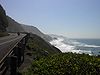
, U.S. Route 101, a major north–south U.S. Highway, runs through the state along the coastline near the Pacific Ocean
Pacific Ocean
The Pacific Ocean is the largest of the Earth's oceanic divisions. It extends from the Arctic in the north to the Southern Ocean in the south, bounded by Asia and Australia in the west, and the Americas in the east.At 165.2 million square kilometres in area, this largest division of the World...
. In Oregon, it runs from the Oregon–California
California
California is a state located on the West Coast of the United States. It is by far the most populous U.S. state, and the third-largest by land area...
border, south of Brookings
Brookings, Oregon
Brookings is a city in Curry County, Oregon, United States. It was named after John E. Brookings, president of the Brookings Lumber and Box Company, which founded the city in 1908. As of the 2010 census the population was 6,336. The total population of the Brookings area is over 13,000, which...
, to the Oregon–Washington border on the Columbia River
Columbia River
The Columbia River is the largest river in the Pacific Northwest region of North America. The river rises in the Rocky Mountains of British Columbia, Canada, flows northwest and then south into the U.S. state of Washington, then turns west to form most of the border between Washington and the state...
, between Astoria, Oregon
Astoria, Oregon
Astoria is the county seat of Clatsop County, Oregon, United States. Situated near the mouth of the Columbia River, the city was named after the American investor John Jacob Astor. His American Fur Company founded Fort Astoria at the site in 1811...
and Megler, Washington
Megler, Washington
Megler is a small community located in Pacific County in the U.S. state of Washington. Named for legislator Joseph G. Megler, the community is located at the mouth of the Columbia River on the north shore of the river...
.
U.S. 101 is known in Oregon as the Oregon Coast Highway No. 9 (see Oregon highways and routes), as it serves the Oregon Coast
Oregon Coast
The Oregon Coast is a region of the U.S. state of Oregon. It runs generally north-south along the Pacific Ocean, forming the western border of the state; the region is bounded to the east by the Oregon Coast Range. The Oregon Coast stretches approximately from the Columbia River in the north to...
region. Much of the highway runs between the Pacific Ocean
Pacific Ocean
The Pacific Ocean is the largest of the Earth's oceanic divisions. It extends from the Arctic in the north to the Southern Ocean in the south, bounded by Asia and Australia in the west, and the Americas in the east.At 165.2 million square kilometres in area, this largest division of the World...
and the Oregon Coast Range
Oregon Coast Range
The Oregon Coast Range, often called simply the Coast Range and sometimes the Pacific Coast Range, is a mountain range, in the Pacific Coast Ranges physiographic region, in the U.S. state of Oregon along the Pacific Ocean...
, thus U.S. 101 is frequently mountainous in character. For most of its length it is a 2-lane undivided highway. Many parts of the highway are subject to closure due to landslide
Landslide
A landslide or landslip is a geological phenomenon which includes a wide range of ground movement, such as rockfalls, deep failure of slopes and shallow debris flows, which can occur in offshore, coastal and onshore environments...
s caused by excessive rainfall, and in many parts of the coast, U.S. 101 is the only viable route connecting certain coastal communities. Thus, in many cases when landslides block U.S. 101, the detour requires traveling inland to Interstate 5
Interstate 5 in Oregon
In the U.S. state of Oregon, Interstate 5 traverses the state from north to south, passing through the major cities of Portland, Salem, Eugene, and Medford.-Route description:...
and then back again.
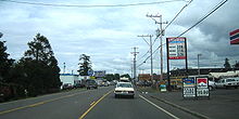
U.S. 101 is often the main street through many coastal towns in Oregon, which can cause significant traffic delays. This is especially true in Lincoln City
Lincoln City, Oregon
Lincoln City is a city in Lincoln County, Oregon, United States. It is named after the county. The population was 7,930 at the 2010 census.- History :...
, owing to a combination of geography and the fact that the city is a particularly popular tourist destination.
Brookings to Coos Bay
The run of U.S. 101 in OregonOregon
Oregon is a state in the Pacific Northwest region of the United States. It is located on the Pacific coast, with Washington to the north, California to the south, Nevada on the southeast and Idaho to the east. The Columbia and Snake rivers delineate much of Oregon's northern and eastern...
(running from south to north) starts at the border between Oregon and California
California
California is a state located on the West Coast of the United States. It is by far the most populous U.S. state, and the third-largest by land area...
, south of the twin cities of Brookings
Brookings, Oregon
Brookings is a city in Curry County, Oregon, United States. It was named after John E. Brookings, president of the Brookings Lumber and Box Company, which founded the city in 1908. As of the 2010 census the population was 6,336. The total population of the Brookings area is over 13,000, which...
and Harbor
Harbor, Oregon
Harbor is an unincorporated community in Curry County, Oregon, United States. It is located across the Chetco River from the city of Brookings. For statistical purposes, the United States Census Bureau has defined Harbor as a census-designated place . The census definition of the area may not...
(and north of Crescent City, California
Crescent City, California
Crescent City is the county seat and only incorporated city in Del Norte County, California. Named for the crescent-shaped stretch of sandy beach south of the city, Crescent City had a total population of 7,643 in the 2010 census, up from 4,006 in the 2000 census...
). The highway is mostly a two-lane road, running along the Southern Oregon coastline. Access to this section (other than 101) is via US Route 199 or OR Route 42 through the Kalmiopsis Wilderness
Kalmiopsis Wilderness
Kalmiopsis Wilderness is a wilderness area in the Klamath Mountains of southwestern Oregon, within the Rogue River-Siskiyou National Forest. It was designated wilderness by the United States Congress in 1964 and now comprises a total of...
, just east of the highway. Access is also possible through National Forest Route 23 (NF-23 - Bear Camp) but that route is not maintained through the winter months.
Other coastal towns in this stretch of U.S. 101 include Pistol River
Pistol River, Oregon
Pistol River is an unincorporated community in Curry County, Oregon, United States. It is located near the Pistol River and the Pistol River State Scenic Viewpoint, just off U.S. Route 101....
, Gold Beach
Gold Beach, Oregon
Gold Beach is a city in and the county seat of Curry County, Oregon, United States, on the Oregon Coast. The population was 1,897 at the 2000 census.-History:...
, Wedderburn
Wedderburn, Oregon
Wedderburn is an unincorporated coastal community in Curry County, Oregon, United States. It is located across the mouth of Rogue River from Gold Beach, on U.S. Route 101. The Isaac Lee Patterson Bridge connects Wedderburn with Gold Beach....
, and Port Orford
Port Orford, Oregon
Port Orford is a city in Curry County, Oregon, United States. It is on the southern Oregon Coast, at the northern end of what coastal Oregonians call the Banana Belt, because the weather from Port Orford south is noticeably warmer than the weather north of nearby Cape Blanco...
. North of Port Orford is the Cape Blanco
Cape Blanco (Oregon)
Cape Blanco is a prominent headland on the Pacific Ocean coast of southwestern Oregon in the United States, forming the westernmost point in the state. It contests with Cape Alava in Washington for the title of westernmost point in the contiguous United States...
region, and the westernmost point in the U.S. Highway system. After passing through Sixes
Sixes, Oregon
Sixes is an unincorporated community in Curry County, Oregon, United States. It is located on U.S. Route 101 and the Sixes River, east of Cape Blanco and the Cape Blanco Lighthouse....
, Denmark
Denmark, Oregon
Denmark is an unincorporated community in Curry County, Oregon, United States, between Bandon and Port Orford where U.S. Route 101 crosses Willow Creek....
, and Langlois
Langlois, Oregon
Langlois is an unincorporated community in Curry County, Oregon, United States, on the Oregon Coast. Langlois was once famous for its blue cheese, until the cheese factory burned down in the 1950s. It was never rebuilt.- External links :* * *...
, U.S. 101 enters the resort town of Bandon
Bandon, Oregon
- Economy :Like many communities on the Oregon coast, Bandon had significant fishing and timber industries, which were greatly diminished by the 1980s, though some remnants still exist. Bandon's current economy revolves around wood products, fishing, tourism, and agriculture...
on the mouth of the Coquille River
Coquille River
The Coquille River is a stream long, in southwestern Oregon in the United States. It drains a mountainous area of of the Southern Oregon Coast Range into the Pacific Ocean. Its watershed is located between that of the Coos River to the north and the Rogue River to the south.-Geography:The river,...
.
The stretch of U.S. 101 between Brookings and Gold Beach includes the highest bridge in Oregon, the Thomas Creek Bridge
Thomas Creek Bridge
Thomas Creek Bridge crosses Thomas Creek in Curry County, Oregon, U.S. It is on US Route 101 and lies within the boundaries of Samuel H. Boardman State Scenic Corridor....
. With its roadbed at 345 feet above Thomas Creek, is the 15th highest bridge in the U.S.
North of Bandon, U.S. 101 heads inland for a while, while a spur route provides access to the Charleston Peninsula. Approaching the city of Coos Bay
Coos Bay, Oregon
Coos Bay is a city located in Coos County, Oregon, United States, where the Coos River enters Coos Bay on the Pacific Ocean. The city borders the city of North Bend, and together they are often referred to as one entity called either Coos Bay-North Bend or the Bay Area...
, U.S. 101 becomes an expressway
Limited-access road
A limited-access road known by various terms worldwide, including limited-access highway, dual-carriageway and expressway, is a highway or arterial road for high-speed traffic which has many or most characteristics of a controlled-access highway , including limited or no access to adjacent...
after an interchange with Oregon Route 42, then soon enters the downtown core. It continues through Coos Bay (the city) along the western edge of Coos Bay (the bay), soon entering the city of North Bend
North Bend, Oregon
North Bend is a city in Coos County, Oregon, in the United States with a population of 9,695 as of the 2010 census. North Bend is surrounded on three sides by Coos Bay, an S-shaped water inlet and estuary where the Coos River enters Coos Bay on the Pacific Ocean, and borders the city of Coos Bay,...
. North of North Bend, it crosses over the mouth of the bay on the Conde McCullough Memorial Bridge
Conde McCullough Memorial Bridge
The Conde B. McCullough Memorial Bridge, formerly the Coos Bay Bridge, is a cantilever bridge that spans Coos Bay on U.S. Route 101 near North Bend, Oregon....
, followed by a second bridge over Haynes Inlet.
Coos Bay to Lincoln City
.jpg)
Oregon Dunes National Recreation Area
The Oregon Dunes National Recreation Area is located on the Oregon Coast, stretching approximately 40 miles north from the Coos River in North Bend, to the Siuslaw River, in Florence. The NRA is part of Siuslaw National Forest and is administered by the United States Forest Service...
, through the communities of Hauser
Hauser, Oregon
Hauser is an unincorporated community in Coos County, Oregon, United States. It is located on U.S. Route 101, about seven miles south of Lakeside and six miles north of North Bend. Hauser is on the edge of the Oregon Dunes National Recreation Area near North Slough, a tributary of Coos Bay once...
, Lakeside
Lakeside, Oregon
Lakeside is a city in Coos County, Oregon, United States. The population was 1,371 at the 2000 census.-Geography:According to the United States Census Bureau, the city has a total area of , of which is land and is water.-Demographics:...
, and Winchester Bay
Winchester Bay, Oregon
Winchester Bay is an unincorporated community in Douglas County, Oregon, United States. For statistical purposes, the United States Census Bureau has defined Winchester Bay as a census-designated place...
before coming into the city of Reedsport
Reedsport, Oregon
Reedsport is a city in Douglas County, Oregon, United States. As of the 2010 census, the population was 4,154.- History :Reedsport was established on the estuary of the Umpqua River on January 7, 1852. It was named for a local settler, Alfred W. Reed, who founded the city in 1912...
on the mouth of the Umpqua River
Umpqua River
The Umpqua River on the Pacific coast of Oregon in the United States is approximately long. One of the principal rivers of the Oregon Coast and known for bass and shad, the river drains an expansive network of valleys in the mountains west of the Cascade Range and south of the Willamette Valley,...
. The highway continues north from there, passing through the dunes and through the towns of Gardiner
Gardiner, Oregon
Gardiner is an unincorporated community in Douglas County, Oregon, United States, across the Umpqua River from Reedsport. It is located on U.S. Route 101....
, Westlake
Westlake, Oregon
Westlake is an unincorporated community on Siltcoos Lake in Lane County, Oregon, United States, approximately seven miles south of Florence. Its area is included in the city limits of the incorporated city of Dunes City...
, Dunes City
Dunes City, Oregon
Dunes City is a city in Lane County, Oregon, United States. The population was 1,303 at the 2010 census.- Geography :According to the United States Census Bureau, the city has a total area of , of which is land and is water.- Demographics :...
, and Glenada
Glenada, Oregon
Glenada is an unincorporated community in Lane County, Oregon, United States, across the Siuslaw River from the city of Florence on U.S. Route 101.-History:...
. The next major town is Florence
Florence, Oregon
Florence is a city in Lane County, Oregon, United States. As of the 2010 census, the city had a total population of 8,466.-History:The Florence area was originally inhabited by the Siuslaw tribe of Native Americans. Some state that the city was named for state senator A. B...
on the Siuslaw River
Siuslaw River
The Siuslaw River is a river, approximately 110 mi long, along the Pacific coast of Oregon in the United States. It drains an area of approximately in the Central Oregon Coast Range southwest of the Willamette Valley and north of the watershed of the Umpqua River.It rises in the mountains...
.
The next stretch of U.S. 101 (between Florence and Newport) closely follows the coastline, providing a wide view of the ocean. Towns between these two cities include Yachats
Yachats, Oregon
Yachats is a small coastal city in Lincoln County, Oregon, United States. According to Oregon Geographic Names, the name comes from the Siletz language, and means "dark water at the foot of the mountain". There is a range of differing etymologies, however. William Bright says the name comes from...
, Waldport
Waldport, Oregon
Waldport is a city in Lincoln County, Oregon, United States. The population was 2,050 at the 2000 census. The city is located on the Alsea River and Alsea Bay, south of Newport and north of Yachats.-Geography:...
, and Seal Rock
Seal Rock, Oregon
Seal Rock is an unincorporated coastal community in Lincoln County, Oregon, United States, between Newport and Waldport on U.S. Route 101.The community of Seal Rock is named for the Seal Rocks, a ledge of partially submerged rocks that parallel the shore for about...
. Eventually, the highway crosses the Yaquina Bay Bridge
Yaquina Bay Bridge
The Yaquina Bay Bridge is an arch bridge that spans Yaquina Bay south of Newport, Oregon. It is one of the most recognizable of the U.S. Route 101 bridges designed by Conde McCullough....
into Newport
Newport, Oregon
Newport is a city in Lincoln County, Oregon, United States. It was incorporated in 1882, though the name dates back to the establishment of a post office in 1868...
. Just before the bridge lies the Oregon Coast Aquarium
Oregon Coast Aquarium
The Oregon Coast Aquarium is an aquarium in Newport in the U.S. state of Oregon. Opened in 1992, the facility sits on along Yaquina Bay near the Pacific Ocean. From January 1996 until September 9, 1998 when he was shipped to Vestmannaeyjar, Iceland this aquarium was home to Keiko, the orca who...
; on the other side of the bridge is the famed Newport waterfront.
The next stretch of 101, between Newport and Lincoln City, is rather mountainous, as the Coast Range protrudes into the ocean. Cities on the route include Depoe Bay
Depoe Bay, Oregon
Depoe Bay is a city in Lincoln County, Oregon, United States, located on U.S. Route 101 next to the Pacific Ocean. The population was 1,174 at the 2000 census, with an unofficial estimated population of 1,355 in 2007...
, Otter Rock
Otter Rock, Oregon
Otter Rock is an unincorporated community in Lincoln County, Oregon, United States. It is located on U.S. Route 101 on the Oregon Coast.Otter Rock post office was established in 1913, and takes its name from a rock located about a half mile offshore and three and a quarter miles north of Yaquina Head...
(accessible via a side road), and the Gleneden Beach
Gleneden Beach, Oregon
Gleneden Beach is an unincorporated community in Lincoln County, Oregon, United States. It is located on the Oregon Coast five miles south of Lincoln City, just south of the Salishan Spa and Golf Resort, along U.S. Route 101.- External links:**...
/Salishan area, famed for its resorts. Near Siletz Bay is the abandoned
Ghost town
A ghost town is an abandoned town or city. A town often becomes a ghost town because the economic activity that supported it has failed, or due to natural or human-caused disasters such as floods, government actions, uncontrolled lawlessness, war, or nuclear disasters...
community of Kernville
Kernville, Oregon
Kernville is an unincorporated community in Lincoln County, Oregon, United States. It is located near the intersection of U.S. Route 101 and Oregon Route 229, where the Siletz River enters Siletz Bay. There are two communities, known as "old" and "new" Kernville, in close proximity. Old Kernville...
, followed by Lincoln City
Lincoln City, Oregon
Lincoln City is a city in Lincoln County, Oregon, United States. It is named after the county. The population was 7,930 at the 2010 census.- History :...
.
Lincoln City to Astoria
The stretch of U.S. 101 through Lincoln City is infamous for its clogged traffic; the city is over seven miles (11 km) long (but only a few blocks wide in spots), and is sandwiched between the ocean on the west, and Devils Lake and mountains to the east. In many parts of town, the highway is a two-lane road. Adding to the traffic is a casinoCasino
In modern English, a casino is a facility which houses and accommodates certain types of gambling activities. Casinos are most commonly built near or combined with hotels, restaurants, retail shopping, cruise ships or other tourist attractions...
in the northern part of town. Much of the traffic departs U.S. 101 north of Lincoln City, at an interchange with Oregon Route 18.
North of Lincoln City is the town of Neskowin
Neskowin, Oregon
Neskowin is an unincorporated community in Tillamook County, Oregon, United States, near where Slab Creek empties into the Pacific Ocean. For statistical purposes, the United States Census Bureau has defined Neskowin as a census-designated place . The census definition of the area may not...
and the Nestucca Bay
Nestucca Bay
Nestucca Bay is a small S-shaped inlet of the Pacific Ocean located in northwest Oregon in the United States. It is located near the town of Pacific City in southwestern Tillamook County, approximately 12 mi south of Cape Lookout. The Nestucca and Little Nestucca rivers enter the bay from the...
area. A side road, the Three Capes Scenic Route, provides access to the seaside towns of Pacific City
Pacific City, Oregon
Pacific City is a census-designated place and unincorporated community in Tillamook County, Oregon, United States. The population was 1,027 at the 2000 census...
and Sandlake, then goes over Cape Lookout
Cape Lookout (Oregon)
Cape Lookout is a sharp rocky promontory along the Pacific Ocean coast of northwestern Oregon in the United States. It is located in southwestern Tillamook County, approximately 10 mi southwest of Tillamook, just south of Netarts Bay...
and on to Netarts
Netarts, Oregon
Netarts is an unincorporated community in Tillamook County, Oregon, United States; it is a census-designated place . The population was 744 at the 2000 census.-Geography:...
, Oceanside
Oceanside, Oregon
Oceanside is a census-designated place and unincorporated community in Tillamook County, Oregon, United States. The population was 326 at the 2000 census.-Geography:...
and Cape Meares
Cape Meares
Cape Meares is a small headland on the Pacific coast in Tillamook County, Oregon, United States. The cape forms a high steep bluff on the south end of Tillamook Bay, approximately five miles northwest of the city of Tillamook...
before meeting 101 again at Tillamook
Tillamook, Oregon
The city of Tillamook is the county seat of Tillamook County, Oregon, United States. The city is located on the southeast end of Tillamook Bay on the Pacific Ocean. The population was 4,352 at the 2000 census...
. 101 instead heads inland, passing through the towns of Cloverdale
Cloverdale, Oregon
Cloverdale, Oregon may refer to:*Cloverdale, Oregon *Cloverdale, Deschutes County, Oregon *Cloverdale, Lane County, Oregon...
, Hebo
Hebo, Oregon
Hebo is an unincorporated community in Tillamook County, Oregon, United States. For statistical purposes, the United States Census Bureau has defined Hebo as a census-designated place . The census definition of the area may not precisely correspond to local understanding of the area with the same...
, Beaver
Beaver, Oregon
Beaver is an unincorporated community in Tillamook County, Oregon, United States, located on U.S. Route 101 and the Nestucca River, about 12 miles south of Tillamook. For statistical purposes, the United States Census Bureau has defined Beaver as a census-designated place...
and Hemlock. The next major town is the city of Tillamook
Tillamook, Oregon
The city of Tillamook is the county seat of Tillamook County, Oregon, United States. The city is located on the southeast end of Tillamook Bay on the Pacific Ocean. The population was 4,352 at the 2000 census...
.
North of Tillamook, the highway passes on the eastern shore of Tillamook Bay
Tillamook Bay
Tillamook Bay is a small inlet of the Pacific Ocean, approximately 6 mi long and 2 mi wide, on the northwest coast of the U.S. state of Oregon...
, through towns such as Bay City
Bay City, Oregon
Bay City is a city in Tillamook County, Oregon, United States. The population was 1,286 at the 2010 census.-Geography:According to the United States Census Bureau, the city has a total area of , of which, of it is land and of it is water....
and Garibaldi
Garibaldi, Oregon
Garibaldi is a city in Tillamook County, Oregon, United States. The population was 895 in 2007 according to Portland State University.-History:...
, before reuniting with the ocean. It then continues north along the Pacific through towns such as Rockaway Beach
Rockaway Beach, Oregon
Rockaway Beach is a city in Tillamook County, Oregon, United States. The population was 1,267 at the 2000 census.-History:The community of Rockaway was established as a seaside resort in 1909 by the Rockaway Beach Company. It was named after Rockaway Beach on Long Island in New York. Rockaway post...
and Manhattan Beach
Manhattan Beach State Recreation Site
Manhattan Beach State Recreation Site is a state park in the U.S. state of Oregon. Administered by the Oregon Parks and Recreation Department, the park is open to the public and is fee-free. Amenities at the park, which is north of Rockaway Beach along U.S. Route 101, include picnicking, fishing,...
; the next major towns are Nehalem
Nehalem, Oregon
Nehalem is a city in Tillamook County, Oregon, United States. Incorporated in 1889, the city is located on the Nehalem River at Nehalem Bay of the Pacific Ocean. It is bisected by U.S. Route 101. The population was 203 at the 2000 census.-History:...
and Manzanita
Manzanita, Oregon
Manzanita is a coastal city in Tillamook County, Oregon, United States. It is located on U.S. Route 101 about 25 miles south of Seaside and 25 miles north of Tillamook. The population was 564 as of the 2000 census.-History:...
, both on Nehalem Bay
Nehalem Bay
The Nehalem Bay is a bay formed by the confluence of the Nehalem River into the Pacific Ocean in northern Oregon.The city of Nehalem is situated on US Highway 101 between Garibaldi in the south and Cannon Beach in the north....
. The highway then continues north along the coastline through rugged terrain until it reaches the city of Cannon Beach
Cannon Beach, Oregon
Cannon Beach is a city in Clatsop County, Oregon, United States. The population was 1,588 as of the 2000 census. The 2007 estimate is 1,680 residents.- History :...
. Unlike most coastal cities in Oregon, a bypass (in two-lane freeway
Two-lane freeway
A two-lane expressway is an expressway with only one lane in each direction, and usually no median barrier. It may be built that way because of constraints, or may be intended for expansion once traffic volumes rise. The term super two is often used by roadgeeks for this type of road, but traffic...
configuration) was built around Cannon Beach; U.S. 101 follows the bypass alignment. A few miles north of Cannon Beach is an interchange with U.S. Route 26
U.S. Route 26 in Oregon
In the U.S. state of Oregon, U.S. Route 26 is a major cross-state state highway, connecting U.S. Route 101 on the Oregon Coast near Seaside with the Idaho state line east of Nyssa. Local highway names include the Sunset Highway No. 47, Mount Hood Highway No. 26, and John Day Highway No...
, followed by the city of Seaside
Seaside, Oregon
Seaside is a city in Clatsop County, Oregon, United States. The name Seaside is derived from Seaside House, a historic summer resort built in the 1870s by railroad magnate Ben Holladay. The city's population was 6,457 at the 2010 census.-History:...
. (Until recently, U.S. 26 continued north towards Astoria, sharing an alignment with U.S. 101; however ODOT
ODOT
ODOT could stand for:* Ohio Department of Transportation* Oklahoma Department of Transportation* Oregon Department of Transportation...
truncated U.S. 26 to its current terminus at the interchange with 101 several years ago.)
Gearhart, Oregon
Gearhart is a city in Clatsop County, Oregon, United States. The population was 995 at the 2000 census. The 2007 estimate is 1,185 residents.- Geography :...
; a spur route (Oregon Route 104
Oregon Route 104
Oregon Route 104, known as the Fort Stevens Highway No. 104 , is an Oregon state highway which connects US 101 near Warrenton with Fort Stevens State Park....
) provides access to Fort Stevens State Park. U.S. 101 soon enters the city of Warrenton, Oregon
Warrenton, Oregon
Warrenton is a city in Clatsop County, Oregon, United States. The city is named for D.K. Warren, an early settler. The population was 4,096 at the 2000 census.- History :...
(where Business 101, which is more of a scenic route, providing access to the Astoria-Warrenton Airport, Fort Clatsop
Fort Clatsop
Fort Clatsop was the encampment of the Lewis and Clark Expedition in the Oregon Country near the mouth of the Columbia River during the winter of 1805-1806...
, and Miles Crossing) and then crosses Youngs Bay
Youngs Bay
Youngs Bay, or Youngs River Bay, is located in the northwestern corner of the U.S. state of Oregon. The Youngs River meets the Columbia River at this point, which is situated between Astoria and Warrenton. There are two bridges that cross the bay, with the busiest being Old Youngs Bay Bridge, a...
into Astoria, Oregon
Astoria, Oregon
Astoria is the county seat of Clatsop County, Oregon, United States. Situated near the mouth of the Columbia River, the city was named after the American investor John Jacob Astor. His American Fur Company founded Fort Astoria at the site in 1811...
. 101 passes through the northwestern edge of Astoria, until an intersection with U.S. Route 30. At this intersection, 101 climbs a 360-degree access road onto the Astoria-Megler Bridge
Astoria-Megler Bridge
The Astoria–Megler Bridge is a steel girder continuous truss bridge that spans the Columbia River between Astoria, Oregon and Point Ellice near Megler, Washington, in the United States. The span is from the mouth of the river, and was the last segment of U.S. Route 101 between Olympia, Washington...
over the Columbia River
Columbia River
The Columbia River is the largest river in the Pacific Northwest region of North America. The river rises in the Rocky Mountains of British Columbia, Canada, flows northwest and then south into the U.S. state of Washington, then turns west to form most of the border between Washington and the state...
, and crosses into the state of Washington.
Major intersections
- Note: mileposts do not reflect actual mileage because of realignments.
County Location Milepoint Destinations Notes Curry Curry County, OregonCurry County is a county located in the U.S. state of Oregon. In 2010, its population was 22,364. The county is named for George Law Curry, a governor of the Oregon Territory. The seat of the county is Gold Beach.-Economy:...363.11 California state line Brookings Brookings, OregonBrookings is a city in Curry County, Oregon, United States. It was named after John E. Brookings, president of the Brookings Lumber and Box Company, which founded the city in 1908. As of the 2010 census the population was 6,336. The total population of the Brookings area is over 13,000, which...354.83 Carpenterville Highway (OR 255 Oregon Route 255Oregon Route 255 is an Oregon state highway running from US 101 near Gold Beach to US 101 near Brookings. OR 255 is known as the Carpenterville Highway No. 255...
north)339.71 Pistol River Pistol River, OregonPistol River is an unincorporated community in Curry County, Oregon, United States. It is located near the Pistol River and the Pistol River State Scenic Viewpoint, just off U.S. Route 101....
, CarpentervilleCarpenterville, OregonCarpenterville is an unincorporated community in Curry County, Oregon, United States. It is located on the old Oregon Coast Highway , about 16 miles north of Brookings....South end of OR 255 overlap 337.97 Pistol River Road (OR 255 Oregon Route 255Oregon Route 255 is an Oregon state highway running from US 101 near Gold Beach to US 101 near Brookings. OR 255 is known as the Carpenterville Highway No. 255...
north)North end of OR 255 overlap 334.87 Myers Creek Road (OR 255 Oregon Route 255Oregon Route 255 is an Oregon state highway running from US 101 near Gold Beach to US 101 near Brookings. OR 255 is known as the Carpenterville Highway No. 255...
south)Port Orford Port Orford, OregonPort Orford is a city in Curry County, Oregon, United States. It is on the southern Oregon Coast, at the northern end of what coastal Oregonians call the Banana Belt, because the weather from Port Orford south is noticeably warmer than the weather north of nearby Cape Blanco...300.99 9th Street (OR 251 Oregon Route 251Oregon Route 251 is an Oregon state highway running from Port Orford Heads State Park to Port Orford. OR 251 is known as the Port Orford Highway No. 251...
) – Port Orford Heads State ParkPort Orford Heads State ParkPort Orford Heads State Park, a coastal state park in northwest Curry County, Oregon, in the city of Port Orford. It was established in 1976, and is administered by the Oregon Parks and Recreation Department.-Location:...296.48 Cape Blanco State Park (OR 250 Oregon Route 250Oregon Route 250 is an Oregon state highway running from Cape Blanco State Park to OR 101 near Sixes. OR 250 is known as the Cape Blanco Highway No. 250...
)Coos Coos County, Oregon-National protected areas:*Bandon Marsh National Wildlife Refuge*Oregon Islands National Wildlife Refuge *Siskiyou National Forest *Siuslaw National Forest - Incorporated cities:- Unincorporated communities and CDPs:-See also:...Bandon Bandon, Oregon- Economy :Like many communities on the Oregon coast, Bandon had significant fishing and timber industries, which were greatly diminished by the 1980s, though some remnants still exist. Bandon's current economy revolves around wood products, fishing, tourism, and agriculture...261.57 244.31 Interchange Bunker Hill Bunker Hill, OregonBunker Hill is a census-designated place in Coos County, Oregon, United States. As of the 2010 census the population was 1,444.-Geography:...239.51 Coos River Coos RiverThe Coos River flows for about into Coos Bay along the Pacific coast of southwest Oregon in the United States. Formed by the confluence of its major tributaries, the South Fork Coos River and the Millicoma River, it drains an important timber-producing region of the Southern Oregon Coast Range...
, AlleganyAllegany, OregonAllegany is an unincorporated community in Coos County, Oregon, United States east of Coos Bay. According to Oregon Geographic Names, a post office was established there in 1893, and it is unknown why this spelling was chosen rather than the more common form, Allegheny, used for many features in...
(OR 241Oregon Route 241Oregon Route 241 is an Oregon state highway running from US Route 101 in Coos Bay to Nesika County Park in Coos County. OR 241 is known as the Coos River Highway No. 241...
)Coos Bay Coos Bay, OregonCoos Bay is a city located in Coos County, Oregon, United States, where the Coos River enters Coos Bay on the Pacific Ocean. The city borders the city of North Bend, and together they are often referred to as one entity called either Coos Bay-North Bend or the Bay Area...238.32 Coos Bay City Center Coos Bay, OregonCoos Bay is a city located in Coos County, Oregon, United States, where the Coos River enters Coos Bay on the Pacific Ocean. The city borders the city of North Bend, and together they are often referred to as one entity called either Coos Bay-North Bend or the Bay Area...
, CharlestonCharleston, OregonCharleston is an unincorporated community in Coos County, Oregon, United States. It is located at the ocean entrance to Coos Bay. According to the local chamber of commerce, it is the area's "commercial and sport fishing center", and the community also provides services for the seafood processing...
, Sunset Bay State ParkSunset Bay State ParkSunset Bay State Park is a state park in the U.S. state of Oregon, administered by the Oregon Parks and Recreation Department. It is located about south of Cape Arago Lighthouse, and outside the town of Charleston on Coos Bay....
, Shore Acres State ParkShore Acres State ParkShore Acres State Park is an Oregon State Park located on the Cape Arago Highway south of Coos Bay, Oregon, United States. The park features of formal gardens including a rose-testing plot and Japanese lily pond. During autumn, winter and spring, visitors gather on the tall sandstone cliffs...
, Cape Arago State ParkCape Arago State ParkCape Arago State Park is a state park in the U.S. state of Oregon, administered by the Oregon Parks and Recreation Department....Former Empire-Coos Bay Highway North Bend North Bend, OregonNorth Bend is a city in Coos County, Oregon, in the United States with a population of 9,695 as of the 2010 census. North Bend is surrounded on three sides by Coos Bay, an S-shaped water inlet and estuary where the Coos River enters Coos Bay on the Pacific Ocean, and borders the city of Coos Bay,...235.42 North Bend City Center North Bend, OregonNorth Bend is a city in Coos County, Oregon, in the United States with a population of 9,695 as of the 2010 census. North Bend is surrounded on three sides by Coos Bay, an S-shaped water inlet and estuary where the Coos River enters Coos Bay on the Pacific Ocean, and borders the city of Coos Bay,...
, Southwest Oregon Regional AirportSouthwest Oregon Regional AirportSouthwest Oregon International Airport , formerly known as North Bend International Airport, is a public airport located in the city of North Bend, in Coos County, Oregon, USA. It is operated by the Coos County Airport District and serves the entire county.The airport changed its name in April 2006...
, CharlestonCharleston, OregonCharleston is an unincorporated community in Coos County, Oregon, United States. It is located at the ocean entrance to Coos Bay. According to the local chamber of commerce, it is the area's "commercial and sport fishing center", and the community also provides services for the seafood processing...
, Sunset Bay State ParkSunset Bay State ParkSunset Bay State Park is a state park in the U.S. state of Oregon, administered by the Oregon Parks and Recreation Department. It is located about south of Cape Arago Lighthouse, and outside the town of Charleston on Coos Bay....
, Shore Acres State ParkShore Acres State ParkShore Acres State Park is an Oregon State Park located on the Cape Arago Highway south of Coos Bay, Oregon, United States. The park features of formal gardens including a rose-testing plot and Japanese lily pond. During autumn, winter and spring, visitors gather on the tall sandstone cliffs...
, Cape Arago State ParkCape Arago State ParkCape Arago State Park is a state park in the U.S. state of Oregon, administered by the Oregon Parks and Recreation Department....
(OR 540Oregon Route 540Oregon Route 540 is an Oregon state highway running from North Bend to Cape Arago State Park. OR 540 is known as the Cape Arago Highway No. 240...
)Douglas Douglas County, Oregon-National protected areas:* Crater Lake National Park * Rogue River-Siskiyou National Forest * Siuslaw National Forest * Umpqua National Forest * Willamette National Forest -Adjacent counties:* Lane County, Oregon -...Reedsport Reedsport, OregonReedsport is a city in Douglas County, Oregon, United States. As of the 2010 census, the population was 4,154.- History :Reedsport was established on the estuary of the Umpqua River on January 7, 1852. It was named for a local settler, Alfred W. Reed, who founded the city in 1912...211.58 Lane Lane County, Oregon-National protected areas:*Oregon Islands National Wildlife Refuge *Siuslaw National Forest *Umpqua National Forest *Willamette National Forest -Government:...Florence Florence, OregonFlorence is a city in Lane County, Oregon, United States. As of the 2010 census, the city had a total population of 8,466.-History:The Florence area was originally inhabited by the Siuslaw tribe of Native Americans. Some state that the city was named for state senator A. B...190.23 Lincoln Lincoln County, Oregon-National protected areas:*Oregon Islands National Wildlife Refuge *Siletz Bay National Wildlife Refuge*Siuslaw National Forest -Demographics:...Waldport Waldport, OregonWaldport is a city in Lincoln County, Oregon, United States. The population was 2,050 at the 2000 census. The city is located on the Alsea River and Alsea Bay, south of Newport and north of Yachats.-Geography:...155.90 Newport Newport, OregonNewport is a city in Lincoln County, Oregon, United States. It was incorporated in 1882, though the name dates back to the establishment of a post office in 1868...140.36 132.45 Otter Rock Otter Rock, OregonOtter Rock is an unincorporated community in Lincoln County, Oregon, United States. It is located on U.S. Route 101 on the Oregon Coast.Otter Rock post office was established in 1913, and takes its name from a rock located about a half mile offshore and three and a quarter miles north of Yaquina Head...
, Devils Punch Bowl State Park (OR 182Oregon Route 182Oregon Route 182 is an Oregon state highway running from Devils Punch Bowl State Park in Lincoln County to US 101 near Newport, Oregon, United States. OR 182 is known as the Otter Rock Highway No. 182 . It is long and runs east–west, entirely within Lincoln County...
)120.02 , Siletz River Siletz RiverThe Siletz River flows about to the Pacific Ocean through coastal mountains in the U.S. state of Oregon. Formed by the confluence of its north and south forks near Valsetz in Polk County, it winds through the Central Oregon Coast Range. The river, draining a watershed of , empties into Siletz Bay,...Otis Junction Otis Junction, OregonOtis Junction is an unincorporated locale in Lincoln County, Oregon, United States, at the junction of the former route of U.S. Route 101 and Oregon Route 18, a half mile south of Otis. It is a mile and a half east of where OR 18 intersects with the modern route of U.S. 101.Otis Junction is the...105.09 Interchange Tillamook Tillamook County, OregonTillamook County is a county located in the U.S. state of Oregon. The county is named for the Tillamook, a Native American tribe who were living in the area in the early 19th century at the time of European American settlement. In 2010, the county's population was 25,250...91.37 Little Nestucca River Little Nestucca RiverThe Little Nestucca River is a river, approximately 20 mi long, on the Pacific coast of northwest Oregon in the United States. It drains an area of the Central Oregon Coast Range west of the Willamette Valley....
(OR 130)Hebo Hebo, OregonHebo is an unincorporated community in Tillamook County, Oregon, United States. For statistical purposes, the United States Census Bureau has defined Hebo as a census-designated place . The census definition of the area may not precisely correspond to local understanding of the area with the same...84.94 Tillamook Tillamook, OregonThe city of Tillamook is the county seat of Tillamook County, Oregon, United States. The city is located on the southeast end of Tillamook Bay on the Pacific Ocean. The population was 4,352 at the 2000 census...65.77 , Cape Lookout State Park Cape Lookout State ParkCape Lookout State Park is a state park on Cape Lookout in the U.S. state of Oregon. It is located in Tillamook County, south of the city of Tillamook, on a sand spit between Netarts Bay and the Pacific Ocean....
, Forest GroveForest Grove, OregonForest Grove is a city in Washington County, Oregon, United States, west of Portland. Originally a small farm town, it is now primarily a bedroom suburb of Portland. Settled in the 1840s, the town was platted in 1850 and then incorporated in 1872 and was the first city in Washington County...
, PortlandPortland, OregonPortland is a city located in the Pacific Northwest, near the confluence of the Willamette and Columbia rivers in the U.S. state of Oregon. As of the 2010 Census, it had a population of 583,776, making it the 29th most populous city in the United States...Nehalem Junction 46.50 Cannon Beach Cannon Beach, OregonCannon Beach is a city in Clatsop County, Oregon, United States. The population was 1,588 as of the 2000 census. The 2007 estimate is 1,680 residents.- History :...30.62 Tolovana Park Tolovana Park, OregonTolovana Park is an unincorporated community in Clatsop County, Oregon, United States. Tolovana Park is located along the Pacific coast south of Cannon Beach. Tolovana Park has a post office with ZIP code 97145....Interchange 29.53 Sunset Boulevard – Cannon Beach City Center Cannon Beach, OregonCannon Beach is a city in Clatsop County, Oregon, United States. The population was 1,588 as of the 2000 census. The 2007 estimate is 1,680 residents.- History :...
, Ecola State ParkInterchange 28.37 Cannon Beach City Center Cannon Beach, OregonCannon Beach is a city in Clatsop County, Oregon, United States. The population was 1,588 as of the 2000 census. The 2007 estimate is 1,680 residents.- History :...
, Ecola State ParkInterchange; no northbound exit Clatsop Clatsop County, OregonClatsop County is a county located in the U.S. state of Oregon. The county is named for the Clatsop tribe of Native Americans, who lived along the coast of the Pacific Ocean prior to European settlement. As of 2010, the population was 37,039. The county seat is Astoria.-Economy:The principal...Cannon Beach Junction 25.27 Interchange 9.48 Columbia Beach Road (OR 104 Oregon Route 104Oregon Route 104, known as the Fort Stevens Highway No. 104 , is an Oregon state highway which connects US 101 near Warrenton with Fort Stevens State Park....
) – WarrentonWarrenton, OregonWarrenton is a city in Clatsop County, Oregon, United States. The city is named for D.K. Warren, an early settler. The population was 4,096 at the 2000 census.- History :...
, Hammond, Fort Stevens State ParkWarrenton Warrenton, OregonWarrenton is a city in Clatsop County, Oregon, United States. The city is named for D.K. Warren, an early settler. The population was 4,096 at the 2000 census.- History :...7.53 – Lewis & Clark National Park Fort Clatsop Visitor Center Northbound entrance and exit 7.53 Alternate Highway 101 (OR 104S) 7.07 Marlin Avenue (Warrenton-Astoria Highway) – Warrenton Warrenton, OregonWarrenton is a city in Clatsop County, Oregon, United States. The city is named for D.K. Warren, an early settler. The population was 4,096 at the 2000 census.- History :...
, U.S. Coast Guard Air Station Astoria, Lewis & Clark National Park6.57 Harbor Drive (Warrenton-Astoria Highway) – Warrenton Warrenton, OregonWarrenton is a city in Clatsop County, Oregon, United States. The city is named for D.K. Warren, an early settler. The population was 4,096 at the 2000 census.- History :...
, Hammond, Fort Stevens State Park4.91 Youngs Bay Bridge over Youngs Bay Youngs BayYoungs Bay, or Youngs River Bay, is located in the northwestern corner of the U.S. state of Oregon. The Youngs River meets the Columbia River at this point, which is situated between Astoria and Warrenton. There are two bridges that cross the bay, with the busiest being Old Youngs Bay Bridge, a...Astoria Astoria, OregonAstoria is the county seat of Clatsop County, Oregon, United States. Situated near the mouth of the Columbia River, the city was named after the American investor John Jacob Astor. His American Fur Company founded Fort Astoria at the site in 1811...4.32 – Clatsop County Fairgrounds, Jewell Jewell, OregonJewell is an unincorporated community in Clatsop County, Oregon, United States. The logging community is located at the junction of Oregon Route 103 and Oregon Route 202, near the Nehalem River.-History:...3.80 0.00 Astoria – Megler Bridge over Columbia River Columbia RiverThe Columbia River is the largest river in the Pacific Northwest region of North America. The river rises in the Rocky Mountains of British Columbia, Canada, flows northwest and then south into the U.S. state of Washington, then turns west to form most of the border between Washington and the state...
Washington state line