
Tsunami warning system
Encyclopedia
A Tsunami warning system (TWS) is used to detect tsunami
s in advance and issue warnings to prevent loss of life and damage. It consists of two equally important components: a network of sensors to detect tsunamis and a communications infrastructure to issue timely alarms to permit evacuation of coastal areas. There are two distinct types of tsunami warning systems: international and regional. When operating, the seismic alerts are used to instigate the watches and warnings. Then, data from observed sea level height (either shore-based tide gauges or DART
buoys) are used to verify the existence of a tsunami. Other systems have been proposed to augment the warning procedures. For example, it has been suggested that the duration and frequency content of t-wave energy (which is earthquake energy trapped in the ocean SOFAR channel
) is indicative of an earthquake's tsunami potential.Salzberg, 2006
in the 1920s. More advanced systems were developed in the wake of the April 1, 1946 (caused by the 1946 Aleutian Islands earthquake) and May 23, 1960 (caused by the 1960 Valdivia earthquake) tsunamis which caused massive devastation in Hilo, Hawaii. While tsunamis travel at between 500 and 1,000 km/h (around 0.14 and 0.28 km/s) in open water, earthquakes can be detected almost at once as seismic wave
s travel with a typical speed of 4 km/s (around 14,400 km/h). This gives time for a possible tsunami forecast to be made and warnings to be issued to threatened areas, if warranted. Unfortunately, until a reliable model is able to predict which earthquakes will produce significant tsunamis, this approach will produce many more false alarms than verified warnings.
are issued by the Pacific Tsunami Warning Center
(PTWC), operated by the United States
NOAA in Ewa Beach, Hawaii. NOAA's West Coast and Alaska Tsunami Warning Center
(WCATWC) in Palmer, Alaska
issues warnings for the west coast of North America, including Alaska, Canada, and the western coterminous United States. PTWC was established in 1949, following the 1946 Aleutian Island earthquake
and a tsunami that resulted in 165 casualties on Hawaii and in Alaska; WCATWC was founded in 1967. International coordination is achieved through the International Coordination Group for the Tsunami Warning System in the Pacific, established by the Intergovernmental Oceanographic Commission
of UNESCO
.http://ioc.unesco.org/itsu/
which killed almost 230,000 people, a United Nations
conference was held in January 2005 in Kobe
, Japan
, and decided that as an initial step towards an International Early Warning Programme
, the UN should establish an Indian Ocean Tsunami Warning System
. This then resulted in a system of warnings in Indonesia.
of UNESCO
Assembly during its 23rd Session in June 2005, through Resolution XXIII.14, took place in Rome on 21 and 22 November, 2005.
The Meeting, hosted by the Government of Italy (Italian Ministry of Foreign Affairs and Ministry for Environment and Protection of the Territory), was attended by more than 150 participants from 24 countries, 13 organizations and numerous observers.
has said it will review or test its Tsunami protocol in February 2010 as a regional pilot.
and moment magnitude
of an underwater quake and the probable tsunami arrival times can be quickly calculated, it is almost always impossible to know whether underwater ground shifts have occurred which will result in tsunami waves. As a result, false alarms can occur with these systems, but due to the highly localised nature of these extremely quick warnings, disruption is small.
, e-mail
, fax
, radio
, texting and telex
, often using hardened dedicated systems) enabling emergency messages to be sent to the emergency service
s and armed forces
, as well to population-alerting systems (e.g. siren
s).
CWarn is a non-profit making organization that sends free text alerts to members of a pending tsunami by SMS
. The information sent to end user is based on their location (latitude
and longitude
).
. A devastating tsunami occurred off the coast of Hokkaidō
in Japan as a result of an earthquake on July 12, 1993
. As a result, 202 people on the small island of Okushiri, Hokkaido
lost their lives, and hundreds more were missing or injured. This tsunami struck just three to five minutes after the quake, and most victims were caught while fleeing for higher ground and secure places after surviving the earthquake.
While there remains the potential for sudden devastation from a tsunami, warning systems can be effective. For example, if there were a very large subduction zone earthquake
(moment magnitude
9.0) off the west coast of the United States
, people in Japan
, would therefore have more than 12 hours (and likely warnings from warning systems in Hawaii and elsewhere) before any tsunami arrived, giving them some time to evacuate areas likely to be affected.
Tsunami
A tsunami is a series of water waves caused by the displacement of a large volume of a body of water, typically an ocean or a large lake...
s in advance and issue warnings to prevent loss of life and damage. It consists of two equally important components: a network of sensors to detect tsunamis and a communications infrastructure to issue timely alarms to permit evacuation of coastal areas. There are two distinct types of tsunami warning systems: international and regional. When operating, the seismic alerts are used to instigate the watches and warnings. Then, data from observed sea level height (either shore-based tide gauges or DART
Deep-ocean Assessment and Reporting of Tsunamis
The Deep-ocean Assessment and Reporting of Tsunamis system is a component of an enhanced tsunami warning system.- Stations :...
buoys) are used to verify the existence of a tsunami. Other systems have been proposed to augment the warning procedures. For example, it has been suggested that the duration and frequency content of t-wave energy (which is earthquake energy trapped in the ocean SOFAR channel
Sofar channel
The SOFAR channel , or deep sound channel , is a horizontal layer of water in the ocean at which depth the speed of sound is minimal. The SOFAR channel acts as a waveguide for sound, and low frequency sound waves within the channel may travel thousands of miles before dissipating...
) is indicative of an earthquake's tsunami potential.Salzberg, 2006
History & Forecasting
The first rudimentary system to alert communities of an impending tsunami was attempted in HawaiiHawaii
Hawaii is the newest of the 50 U.S. states , and is the only U.S. state made up entirely of islands. It is the northernmost island group in Polynesia, occupying most of an archipelago in the central Pacific Ocean, southwest of the continental United States, southeast of Japan, and northeast of...
in the 1920s. More advanced systems were developed in the wake of the April 1, 1946 (caused by the 1946 Aleutian Islands earthquake) and May 23, 1960 (caused by the 1960 Valdivia earthquake) tsunamis which caused massive devastation in Hilo, Hawaii. While tsunamis travel at between 500 and 1,000 km/h (around 0.14 and 0.28 km/s) in open water, earthquakes can be detected almost at once as seismic wave
Seismic wave
Seismic waves are waves of energy that travel through the earth, and are a result of an earthquake, explosion, or a volcano that imparts low-frequency acoustic energy. Many other natural and anthropogenic sources create low amplitude waves commonly referred to as ambient vibrations. Seismic waves...
s travel with a typical speed of 4 km/s (around 14,400 km/h). This gives time for a possible tsunami forecast to be made and warnings to be issued to threatened areas, if warranted. Unfortunately, until a reliable model is able to predict which earthquakes will produce significant tsunamis, this approach will produce many more false alarms than verified warnings.
Pacific Ocean
Tsunami warnings for most of the Pacific OceanPacific Ocean
The Pacific Ocean is the largest of the Earth's oceanic divisions. It extends from the Arctic in the north to the Southern Ocean in the south, bounded by Asia and Australia in the west, and the Americas in the east.At 165.2 million square kilometres in area, this largest division of the World...
are issued by the Pacific Tsunami Warning Center
Pacific Tsunami Warning Center
The Pacific Tsunami Warning Center is one of two tsunami warning centers that are operated by NOAA in the United States. Headquartered in Ewa Beach, Hawaii, the PTWC is part of an international tsunami warning system program and serves as the operational center for TWS of the Pacific issuing...
(PTWC), operated by the United States
United States
The United States of America is a federal constitutional republic comprising fifty states and a federal district...
NOAA in Ewa Beach, Hawaii. NOAA's West Coast and Alaska Tsunami Warning Center
West Coast and Alaska Tsunami Warning Center
The West Coast and Alaska Tsunami Warning Center is one of two tsunami warning centers that are operated by NOAA in the United States. Headquartered in Palmer, Alaska, the WCATWC is part of an international tsunami warning system program and serves as the operational center for TWS of all coastal...
(WCATWC) in Palmer, Alaska
Palmer, Alaska
Palmer is the borough seat of the Matanuska-Susitna Borough in the state of Alaska, USA. It is part of the Anchorage Metropolitan Statistical Area. As of the 2010 census, the population of the city is 5,937....
issues warnings for the west coast of North America, including Alaska, Canada, and the western coterminous United States. PTWC was established in 1949, following the 1946 Aleutian Island earthquake
Aleutian Island earthquake
The 1946 Aleutian Islands earthquake was an earthquake near the Aleutian Islands on April 1, 1946. It was followed by a Pacific-wide tsunami. The earthquake was a magnitude 7.8, with its epicenter at 52.8°N, 163.5°W, and focal depth of 25 km. It resulted in 165 casualties and over $26...
and a tsunami that resulted in 165 casualties on Hawaii and in Alaska; WCATWC was founded in 1967. International coordination is achieved through the International Coordination Group for the Tsunami Warning System in the Pacific, established by the Intergovernmental Oceanographic Commission
Intergovernmental Oceanographic Commission
The Intergovernmental Oceanographic Commission was established by resolution 2.31 adopted by the General Conference of UNESCO. It first met in Paris at Unesco Headquarters from 19 to 27 October 1961. Initially, 40 States became members of the Commission.The IOC is composed of its Member States ,...
of UNESCO
UNESCO
The United Nations Educational, Scientific and Cultural Organization is a specialized agency of the United Nations...
.http://ioc.unesco.org/itsu/
Indian Ocean (ICG/IOTWS)
After the 2004 Indian Ocean Tsunami2004 Indian Ocean earthquake
The 2004 Indian Ocean earthquake was an undersea megathrust earthquake that occurred at 00:58:53 UTC on Sunday, December 26, 2004, with an epicentre off the west coast of Sumatra, Indonesia. The quake itself is known by the scientific community as the Sumatra-Andaman earthquake...
which killed almost 230,000 people, a United Nations
United Nations
The United Nations is an international organization whose stated aims are facilitating cooperation in international law, international security, economic development, social progress, human rights, and achievement of world peace...
conference was held in January 2005 in Kobe
Kobe
, pronounced , is the fifth-largest city in Japan and is the capital city of Hyōgo Prefecture on the southern side of the main island of Honshū, approximately west of Osaka...
, Japan
Japan
Japan is an island nation in East Asia. Located in the Pacific Ocean, it lies to the east of the Sea of Japan, China, North Korea, South Korea and Russia, stretching from the Sea of Okhotsk in the north to the East China Sea and Taiwan in the south...
, and decided that as an initial step towards an International Early Warning Programme
International Early Warning Programme
The International Early Warning Programme , was first proposed at the Second International Early Warning Conference in 2003 in Bonn, Germany...
, the UN should establish an Indian Ocean Tsunami Warning System
Indian Ocean Tsunami Warning System
The Indian Ocean Tsunami Warning System is a tsunami warning system set up to provide warning to inhabitants of nations bordering the Indian Ocean of approaching tsunamis. It was agreed to in a United Nations conference held in January 2005 in Kobe, Japan as an initial step towards an International...
. This then resulted in a system of warnings in Indonesia.
North Eastern Atlantic, the Mediterranean and connected Seas (ICG/NEAMTWS)
The First United Session of the Inter-governmental Coordination Group for the Tsunami Early Warning and Mitigation System in the North Eastern Atlantic, the Mediterranean and connected Seas (ICG/NEAMTWS), established by the Intergovernmental Oceanographic CommissionIntergovernmental Oceanographic Commission
The Intergovernmental Oceanographic Commission was established by resolution 2.31 adopted by the General Conference of UNESCO. It first met in Paris at Unesco Headquarters from 19 to 27 October 1961. Initially, 40 States became members of the Commission.The IOC is composed of its Member States ,...
of UNESCO
UNESCO
The United Nations Educational, Scientific and Cultural Organization is a specialized agency of the United Nations...
Assembly during its 23rd Session in June 2005, through Resolution XXIII.14, took place in Rome on 21 and 22 November, 2005.
The Meeting, hosted by the Government of Italy (Italian Ministry of Foreign Affairs and Ministry for Environment and Protection of the Territory), was attended by more than 150 participants from 24 countries, 13 organizations and numerous observers.
Caribbean
A Caribbean-wide tsunami warning system has been planned to be instituted by the year 2010, by member nations representatives who met in Panama City in March 2008. Panama's last major tsunami killed 4,500 people in 1882. BarbadosBarbados
Barbados is an island country in the Lesser Antilles. It is in length and as much as in width, amounting to . It is situated in the western area of the North Atlantic and 100 kilometres east of the Windward Islands and the Caribbean Sea; therein, it is about east of the islands of Saint...
has said it will review or test its Tsunami protocol in February 2010 as a regional pilot.
Regional warning systems
Regional (or local) warning system centres use seismic data about nearby recent earthquakes to determine if there is a possible local threat of a tsunami. Such systems are capable of issuing warnings to the general public (via public address systems and sirens) in less than 15 minutes. Although the epicenterEpicenter
The epicenter or epicentre is the point on the Earth's surface that is directly above the hypocenter or focus, the point where an earthquake or underground explosion originates...
and moment magnitude
Moment magnitude scale
The moment magnitude scale is used by seismologists to measure the size of earthquakes in terms of the energy released. The magnitude is based on the seismic moment of the earthquake, which is equal to the rigidity of the Earth multiplied by the average amount of slip on the fault and the size of...
of an underwater quake and the probable tsunami arrival times can be quickly calculated, it is almost always impossible to know whether underwater ground shifts have occurred which will result in tsunami waves. As a result, false alarms can occur with these systems, but due to the highly localised nature of these extremely quick warnings, disruption is small.
Conveying the warning
Detection and prediction of tsunamis is only half the work of the system. Of equal importance is the ability to warn the populations of the areas that will be affected. All tsunami warning systems feature multiple lines of communications (such as SMSSMS
SMS is a form of text messaging communication on phones and mobile phones. The terms SMS or sms may also refer to:- Computer hardware :...
E-mail
Electronic mail, commonly known as email or e-mail, is a method of exchanging digital messages from an author to one or more recipients. Modern email operates across the Internet or other computer networks. Some early email systems required that the author and the recipient both be online at the...
, fax
Fax
Fax , sometimes called telecopying, is the telephonic transmission of scanned printed material , normally to a telephone number connected to a printer or other output device...
, radio
Radio
Radio is the transmission of signals through free space by modulation of electromagnetic waves with frequencies below those of visible light. Electromagnetic radiation travels by means of oscillating electromagnetic fields that pass through the air and the vacuum of space...
, texting and telex
Teleprinter
A teleprinter is a electromechanical typewriter that can be used to communicate typed messages from point to point and point to multipoint over a variety of communication channels that range from a simple electrical connection, such as a pair of wires, to the use of radio and microwave as the...
, often using hardened dedicated systems) enabling emergency messages to be sent to the emergency service
Emergency service
Emergency services are organizations which ensure public safety and health by addressing different emergencies. Some agencies exist solely for addressing certain types of emergencies whilst others deal with ad hoc emergencies as part of their normal responsibilities...
s and armed forces
Armed forces
The armed forces of a country are its government-sponsored defense, fighting forces, and organizations. They exist to further the foreign and domestic policies of their governing body, and to defend that body and the nation it represents from external aggressors. In some countries paramilitary...
, as well to population-alerting systems (e.g. siren
Siren (noisemaker)
A siren is a loud noise making device. Most modern ones are civil defense or air raid sirens, tornado sirens, or the sirens on emergency service vehicles such as ambulances, police cars and fire trucks. There are two general types: pneumatic and electronic....
s).
CWarn is a non-profit making organization that sends free text alerts to members of a pending tsunami by SMS
SMS
SMS is a form of text messaging communication on phones and mobile phones. The terms SMS or sms may also refer to:- Computer hardware :...
. The information sent to end user is based on their location (latitude
Latitude
In geography, the latitude of a location on the Earth is the angular distance of that location south or north of the Equator. The latitude is an angle, and is usually measured in degrees . The equator has a latitude of 0°, the North pole has a latitude of 90° north , and the South pole has a...
and longitude
Longitude
Longitude is a geographic coordinate that specifies the east-west position of a point on the Earth's surface. It is an angular measurement, usually expressed in degrees, minutes and seconds, and denoted by the Greek letter lambda ....
).
Shortcomings
With the speed at which tsunami waves travel through open water, no system can protect against a very sudden tsunami, where the coast in question is too close to the epicenterEpicenter
The epicenter or epicentre is the point on the Earth's surface that is directly above the hypocenter or focus, the point where an earthquake or underground explosion originates...
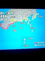
. A devastating tsunami occurred off the coast of Hokkaidō
Hokkaido
, formerly known as Ezo, Yezo, Yeso, or Yesso, is Japan's second largest island; it is also the largest and northernmost of Japan's 47 prefectural-level subdivisions. The Tsugaru Strait separates Hokkaido from Honshu, although the two islands are connected by the underwater railway Seikan Tunnel...
in Japan as a result of an earthquake on July 12, 1993
1993 Hokkaidō earthquake
The occurred at 13:17:12 UTC on in the Sea of Japan near the island of Hokkaido. It had a magnitude of 7.7 on the moment magnitude scale and a maximum felt intensity of VIII on the Mercalli intensity scale. It triggered a major tsunami that caused deaths on Hokkaidō and in southeastern Russia,...
. As a result, 202 people on the small island of Okushiri, Hokkaido
Okushiri, Hokkaido
is a town encompassing all of Okushiri Island, located in Okushiri District, Hiyama, Hokkaidō, Japan.As of 2008, the town has an estimated population of 3,442 and a density of 24.5 persons per km²...
lost their lives, and hundreds more were missing or injured. This tsunami struck just three to five minutes after the quake, and most victims were caught while fleeing for higher ground and secure places after surviving the earthquake.
While there remains the potential for sudden devastation from a tsunami, warning systems can be effective. For example, if there were a very large subduction zone earthquake
Earthquake
An earthquake is the result of a sudden release of energy in the Earth's crust that creates seismic waves. The seismicity, seismism or seismic activity of an area refers to the frequency, type and size of earthquakes experienced over a period of time...
(moment magnitude
Moment magnitude scale
The moment magnitude scale is used by seismologists to measure the size of earthquakes in terms of the energy released. The magnitude is based on the seismic moment of the earthquake, which is equal to the rigidity of the Earth multiplied by the average amount of slip on the fault and the size of...
9.0) off the west coast of the United States
United States
The United States of America is a federal constitutional republic comprising fifty states and a federal district...
, people in Japan
Japan
Japan is an island nation in East Asia. Located in the Pacific Ocean, it lies to the east of the Sea of Japan, China, North Korea, South Korea and Russia, stretching from the Sea of Okhotsk in the north to the East China Sea and Taiwan in the south...
, would therefore have more than 12 hours (and likely warnings from warning systems in Hawaii and elsewhere) before any tsunami arrived, giving them some time to evacuate areas likely to be affected.
See also
- Deep-ocean Assessment and Reporting of Tsunamis (DART)Deep-ocean Assessment and Reporting of TsunamisThe Deep-ocean Assessment and Reporting of Tsunamis system is a component of an enhanced tsunami warning system.- Stations :...
- Sound Fixing and Ranging (SOFAR) channelSofar channelThe SOFAR channel , or deep sound channel , is a horizontal layer of water in the ocean at which depth the speed of sound is minimal. The SOFAR channel acts as a waveguide for sound, and low frequency sound waves within the channel may travel thousands of miles before dissipating...
External links
- International Tsunami warnings delivered to mobile phones
- A 24/7 mobile SMS Intergrated Tsunami Watcher Service
- Space Applications for Disaster Monitoring
- How does the Tsunami Warning System Work? from the NOAA Tsunami website
- Pacific Tsunami Warning Center
- West Coast and Alaska Tsunami Warning Center
- DART
- Tsunami Detector for Indian Ocean Web & Mobile application that reports probability of tsunami occurrences from LIVE USGS data.
- Envirtech Tsunami Warning System, based on real time seafloor observatories measuring seismic waves and sea levels
- NOAA Tsunami Warnings and Forecasts
- DEWS - Distant Early Warning System for the Indian Ocean Region
- Indian Ocean Tsunami Warning Center
- Jakarta Tsunami Information Centre
- GITEWS German Indonesian Tsunami Early Warning System
- Tsunami Warning Signs on the Enshu Coast of Japan Shore & Beach, Vol. 78, No. 1, pp. 52-54, 2010
- Use of Radio Spectrum for Meteorology: Weather, Water and Climate Monitoring and Prediction
- Emergency and Disaster relief
- Emergency Radiocommunications