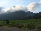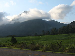
Tsitsikamma Mountains
Encyclopedia

Mountain range
A mountain range is a single, large mass consisting of a succession of mountains or narrowly spaced mountain ridges, with or without peaks, closely related in position, direction, formation, and age; a component part of a mountain system or of a mountain chain...
located in the Garden Route
Garden Route
The Garden Route is a popular stretch of the south-eastern coast of South Africa. It stretches from Heidelberg in the Western Cape to the Storms River which is crossed along the N2 coastal highway over the Paul Sauer Bridge in the extreme western reach of the neighbouring Eastern Cape...
region of the southern South Africa
South Africa
The Republic of South Africa is a country in southern Africa. Located at the southern tip of Africa, it is divided into nine provinces, with of coastline on the Atlantic and Indian oceans...
n coast in the Western Cape
Western Cape
The Western Cape is a province in the south west of South Africa. The capital is Cape Town. Prior to 1994, the region that now forms the Western Cape was part of the much larger Cape Province...
and Eastern Cape
Eastern Cape
The Eastern Cape is a province of South Africa. Its capital is Bhisho, but its two largest cities are Port Elizabeth and East London. It was formed in 1994 out of the "independent" Xhosa homelands of Transkei and Ciskei, together with the eastern portion of the Cape Province...
provinces. Stretching just over 80 km from the Keurbooms River in the west just north of Plettenberg Bay
Plettenberg Bay
Plettenberg Bay, nicknamed Plet or Plett, is the primary town of the Bitou Local Municipality in the Western Cape Province of South Africa. As of the census of 2001, there were 29149 population...
, to Kareedouw Pass in the east near the town of Kareedouw
Kareedouw
Kareedouw is a town in the Eastern Cape province of South Africa. It is the administrative centre for the Kou-Kamma Municipality in the Cacadu District of the Eastern Cape.The town's name derives from the Khoe phrase meaning "path by the karee trees"...
. The range consists almost exclusively of Table Mountain sandstone
Table Mountain sandstone
The Table Mountain Sandstone is a group of rock formations within the Cape Supergroup sequence of rocks. Although still widely used in common parlance, the term TMS is no longer formally recognized; the correct name is the "Table Mountain Group" . The sequence is dominated by quartzites of very...
which is extremely erosion-resistant. Peak Formosa is the highest point in the range at 1675 m. The climate of the range is extremely mild, with temperature variations only between 10 °C and 25 °C generally and rainfall exceeding 1000 mm per annum, thus the region supports verdant fynbos
Fynbos
Fynbos is the natural shrubland or heathland vegetation occurring in a small belt of the Western Cape of South Africa, mainly in winter rainfall coastal and mountainous areas with a Mediterranean climate...
and Afromontane
Knysna-Amatole montane forests
The Knysna-Amatole montane forests ecoregion, of the Tropical and subtropical moist broadleaf forests Biome, is in South Africa. It covers an Afromontane area of in South Africa's Eastern Cape and Western Cape provinces.-Setting:...
temperate gallery forest
Gallery forest
Gallery forests are evergreen forests that form as corridors along rivers or wetlands and project into landscapes that are otherwise only sparsely treed such as savannas, grasslands or deserts....
habitats. Snow sometimes occurs on the highest peaks in winter.
The topography of the mountains is interesting, in that the range rises abruptly from the south at a very defined line that runs almost due east-west at the 34° south latitude. This is due to the very regular nature of the rise of the Table Mountain Sandstone in a anticline
Anticline
In structural geology, an anticline is a fold that is convex up and has its oldest beds at its core. The term is not to be confused with antiform, which is a purely descriptive term for any fold that is convex up. Therefore if age relationships In structural geology, an anticline is a fold that is...
fold structure above the grade of the surrounding Tsitsikamma coastal plateau.
The Region
The Tsitsikamma National ParkTsitsikamma National Park
The Tsitsikamma National Park is a coastal reserve on the Garden Route in South Africa. It is well known for indigenous forests, dramatic coastline, and the Otter Trail. On 6 March 2009 it was amalgamated with the Wilderness National Park and various other areas of land to form the Garden Route...
lies just to the south of the range on the Indian Ocean
Indian Ocean
The Indian Ocean is the third largest of the world's oceanic divisions, covering approximately 20% of the water on the Earth's surface. It is bounded on the north by the Indian Subcontinent and Arabian Peninsula ; on the west by eastern Africa; on the east by Indochina, the Sunda Islands, and...
. The region between the range and the ocean also bears the name Tsitsikamma and is characterised by some cattle farms, sparse settlements and dense Afromontane
Knysna-Amatole montane forests
The Knysna-Amatole montane forests ecoregion, of the Tropical and subtropical moist broadleaf forests Biome, is in South Africa. It covers an Afromontane area of in South Africa's Eastern Cape and Western Cape provinces.-Setting:...
(Temperate) gallery forest. This region sits on a 200m high plateau between the mountains and steep cliffs which drop into the Indian Ocean
Indian Ocean
The Indian Ocean is the third largest of the world's oceanic divisions, covering approximately 20% of the water on the Earth's surface. It is bounded on the north by the Indian Subcontinent and Arabian Peninsula ; on the west by eastern Africa; on the east by Indochina, the Sunda Islands, and...
. Bloukrans Bridge
Bloukrans Bridge
The Bloukrans Bridge is an arch bridge located near Nature's Valley, Western Cape, South Africa. The construction, which was completed in 1984, stands at height of 216m above the Bloukrans River, making it the highest single span arch bridge in the world...
forms the boundary between the Eastern
Eastern Cape
The Eastern Cape is a province of South Africa. Its capital is Bhisho, but its two largest cities are Port Elizabeth and East London. It was formed in 1994 out of the "independent" Xhosa homelands of Transkei and Ciskei, together with the eastern portion of the Cape Province...
and Western Cape
Western Cape
The Western Cape is a province in the south west of South Africa. The capital is Cape Town. Prior to 1994, the region that now forms the Western Cape was part of the much larger Cape Province...
provinces, and sports the highest bungee jump in the world.
Tsitsikamma means 'place of much water'.

