
.gif)
State Route 68 (Utah)
Encyclopedia
State Route 68 is a state highway
in the U.S. state of Utah
. It is a major thoroughfare throughout the Wasatch Front
as it runs north–south for 70.832 miles (113.993 km), linking U.S. Route 6 (US-6) near Elberta
to US-89 in Bountiful
. The route intersects several major freeways and highways in the Salt Lake City metropolitan area
including Interstate 215
(I-215), I-80, and I-15. The route is more commonly referred to as Redwood Road, after the street it is routed along throughout Salt Lake County. The highway is also routed for a short distance along 500 South and 200 West in Bountiful
and Camp Williams Road in Utah County. The route is a surface street for its entire length.
SR-68 became a state highway in 1931, at which time the route ran from then–US-40 (North Temple Street) in Salt Lake City
to present-day US-89 in Lehi
. In 1933, the route was extended north to US-89 in Becks. SR-68 was routed onto Redwood Road in 1943, taking over what had been designated SR-153. In 1960, SR-68 switched alignments with SR-249 to follow Redwood Road and 2300 North to Bountiful; the route was extended south to Elberta at this time also. SR-249 was extended west along a proposed roadway to 2200 West and 2200 North in 1961 before being removed in 1969. In 2001, SR-68 was extended south on a former piece of SR-106
in Bountiful.
, the most driven-on portion of SR-68 is between I-215 and 5400 South, with 66,635 cars-per-day traveling between these two points in 2007. The lowest traffic is recorded at the beginning point of the route through Elberta, with an average of 1,120 cars per day. Traffic along SR-68 in Elberta has increased 135 percent, and the segment between I-215 and 5400 West has increased 13 percent since 1998.
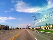
with US-6 marks the southern terminus of the route as it starts north on a two-lane undivided highway. The highway exits Elberta and continues north along the sparsely-populated portion of western Utah County
. The southwestern shore of Utah Lake
appears as the road briefly turns northeast. The route passes the failed planned community
of Mosida before turning north again. Once more turning northeast, the highway approaches the western shore of the lake and runs parallel to it before once more turning north. After turning northwest, the highway enters Saratoga Springs
. Exiting the community, the route turns north near Utah Lake's northern shore and intersects with SR-73 west of Lehi
and east of Eagle Mountain
. Past this intersection, the route turns northwest and passes slightly east of Camp Williams.
 The highway then enters Salt Lake County
and the Salt Lake City metropolitan area
. SR-68 is one of two roads that connect Utah and Salt Lake Counties through a bottleneck in the Wasatch Front
called Point of the Mountain, referring to the Traverse Mountains. The low lying area through this neck is occupied by the former Denver and Rio Grande Western Railroad
. SR-68 is routed on the western slope of the canyon, The other highway, Interstate 15
(I-15)/US-89, is routed higher up Point of the Mountain. As the route enters Bluffdale
on Redwood Road, it turns northeast and intersects with SR-140
; the Utah State Prison
is located on this road east of the junction. SR-68 then turns north and widens to four lanes before crossing SR-154, commonly known as the Bangerter Highway. Soon reverting to two lanes, the route exits Bluffdale and enters Riverton
, gaining two lanes in each direction as it passes SR-71. Continuing north, it enters South Jordan
. It intersects with SR-151
and SR-209
, gaining one more lane in each direction beyond the latter intersection, and enters West Jordan
and central Salt Lake County.
Soon reaching Taylorsville
, the highway intersects I-215
. Shortly thereafter, the road passes Salt Lake Community College
and enters West Valley City
. It soon reaches a single-point urban interchange
at SR-201 that lies on the border of West Valley City and Salt Lake City. The highway loses one lane in each direction past the frontage road of SR-201. West of Salt Lake City, the highway passes over the surplus canal of the Jordan River
as it goes through the neighborhoods of Glendale
and Poplar Grove
. It arrives at an interchange with I-80 east of Salt Lake City International Airport
. The road loses one lane northbound beyond 1000 North as it proceeds through the neighborhood of Rose Park
in the northwestern portion of the city; the second southbound lane is lost north of 1300 North. The highway crosses the Jordan River before exiting the county.
and North Salt Lake
, SR-68 reaches a second interchange with I-215 at its exit 28. The road briefly turns northeast before drifting north again and gaining one lane in each direction. Before passing Skypark Airport
, the highway loses one lane in each direction. Redwood Road turns east onto 500 South and enters Bountiful
. Past an interchange at I-15, the route gains one passing lane and turns south onto 200 West, a two-lane undivided road. The highway turns southwest and defaults onto southbound US-89.
 In 1931, the state legislature
added State Route 68 to the state highway system. It followed Redwood Road from US-40 (North Temple Street) south to the present SR-73
and then used SR-73 east to US-50
/US-89/US-91 (now solely US-89) in Lehi
. The state added 900 West and Warm Springs Road from US-40 north to US-89/US-91 at Becks as SR-153 in 1933. Becks is the name of a rail siding
, 4 miles (6 km) north of downtown Salt Lake, that briefly served as the terminus of a commuter rail line to Beck's Hot Springs. In 1943 SR-153 was moved west to Redwood Road, returning to Becks via 2300 North. This brought the north end of SR-68 and the south end of SR-153 together, and two years later SR-68 was extended north to absorb SR-153. In 1953, Redwood Road north of 2300 North became SR-249, which turned east at 500 South in Davis County
to end at US-89/US-91 (500 West) in Bountiful
.
To provide for route continuity on a truck bypass route of Salt Lake City
, SR-68 and SR-249 were swapped in 1960, bringing the north end of SR-68 to Bountiful and making SR-249 a short connection on 2300 North. At the same time, SR-68 was extended south from the intersection with SR-73 around the west side of Utah Lake
to US-6 at Elberta
, with the portion east to Lehi becoming an extension of SR-73. SR-249 was extended west along a proposed roadway to 2200 West and 2200 North in 1961, "in order to provide an adequate road from the north to the Salt Lake City municipal airport
", but in 1969 the entire route was removed from the state highway system. SR-68 was extended slightly east at its north end, from 500 West (US-89) to 200 West (SR-106), in 1975, and, in 2001, with the removal of SR-106 through downtown Bountiful from the state highway system, SR-68 was extended south along 200 West, formerly SR-106, to Parkin Junction on US-89.
When the highway was established in 1931, it ran from Lehi
to Salt Lake City. The state subsequently extended it south into Elberta
and north into Bountiful. The road was routed along its current alignment of Redwood Road in 1943. The road has been moved and extended multiple times, with the most recent change being in 2001 when SR-106 was deleted from the state highway system.
State highway
State highway, state road or state route can refer to one of three related concepts, two of them related to a state or provincial government in a country that is divided into states or provinces :#A...
in the U.S. state of Utah
Utah
Utah is a state in the Western United States. It was the 45th state to join the Union, on January 4, 1896. Approximately 80% of Utah's 2,763,885 people live along the Wasatch Front, centering on Salt Lake City. This leaves vast expanses of the state nearly uninhabited, making the population the...
. It is a major thoroughfare throughout the Wasatch Front
Wasatch Front
The Wasatch Front is a metropolitan region in the north-central part of the U.S. state of Utah. It consists of a chain of cities and towns stretched along the Wasatch Range from approximately Santaquin in the south to Brigham City in the north...
as it runs north–south for 70.832 miles (113.993 km), linking U.S. Route 6 (US-6) near Elberta
Elberta, Utah
Elberta is a census-designated place in Utah County, Utah, United States. It is part of the Provo–Orem, Utah Metropolitan Statistical Area. The population was 278 at the 2000 census. It is also known as "The Slant". It was founded as "Mt. Nebo". After the water failed in 1901 most of the...
to US-89 in Bountiful
Bountiful, Utah
Bountiful is a city in Davis County, Utah, United States. As of the 2010 census, the city population was 42,552, a three percent increase over the 2000 figure of 41,301...
. The route intersects several major freeways and highways in the Salt Lake City metropolitan area
Salt Lake City metropolitan area
The Salt Lake City Metropolitan Statistical Area, as defined by the United States Census Bureau, is an area consisting of three counties in north central Utah, anchored by Salt Lake City. As of the 2000 census, the MSA had a population of 968,858. As of July 1, 2009 the U.S...
including Interstate 215
Interstate 215 (Utah)
Interstate 215 , also known locally as the belt route or two-fifteen, is an auxiliary interstate in the U.S. state of Utah that forms a 270-degree loop around Salt Lake City and many of its suburbs...
(I-215), I-80, and I-15. The route is more commonly referred to as Redwood Road, after the street it is routed along throughout Salt Lake County. The highway is also routed for a short distance along 500 South and 200 West in Bountiful
Bountiful, Utah
Bountiful is a city in Davis County, Utah, United States. As of the 2010 census, the city population was 42,552, a three percent increase over the 2000 figure of 41,301...
and Camp Williams Road in Utah County. The route is a surface street for its entire length.
SR-68 became a state highway in 1931, at which time the route ran from then–US-40 (North Temple Street) in Salt Lake City
Salt Lake City, Utah
Salt Lake City is the capital and the most populous city of the U.S. state of Utah. The name of the city is often shortened to Salt Lake or SLC. With a population of 186,440 as of the 2010 Census, the city lies in the Salt Lake City metropolitan area, which has a total population of 1,124,197...
to present-day US-89 in Lehi
Lehi, Utah
-Attractions:Lehi Roller MillsLehi Roller Mills was founded in 1906 by a co-op of farmers. George G. Robinson purchased the mill in 1910, and since then it has remained in the family. It is run today by grandson R. Sherman Robinson....
. In 1933, the route was extended north to US-89 in Becks. SR-68 was routed onto Redwood Road in 1943, taking over what had been designated SR-153. In 1960, SR-68 switched alignments with SR-249 to follow Redwood Road and 2300 North to Bountiful; the route was extended south to Elberta at this time also. SR-249 was extended west along a proposed roadway to 2200 West and 2200 North in 1961 before being removed in 1969. In 2001, SR-68 was extended south on a former piece of SR-106
Utah State Route 106
State Route 106 is a state highway in the U.S. state of Utah, running northerly from Bountiful to Farmington. Most of the road is the old route of US-89/US-91, and once extended further along that old alignment in each direction.-Route description:...
in Bountiful.
Route description
On averageAnnual average daily traffic
Average Annual daily traffic, abbreviated AADT, is a measure used primarily in transportation planning and transportation engineering. It is the total volume of vehicle traffic of a highway or road for a year divided by 365 days. AADT is a useful and simple measurement of how busy the road is...
, the most driven-on portion of SR-68 is between I-215 and 5400 South, with 66,635 cars-per-day traveling between these two points in 2007. The lowest traffic is recorded at the beginning point of the route through Elberta, with an average of 1,120 cars per day. Traffic along SR-68 in Elberta has increased 135 percent, and the segment between I-215 and 5400 West has increased 13 percent since 1998.
Utah County
A four-way intersection in ElbertaElberta, Utah
Elberta is a census-designated place in Utah County, Utah, United States. It is part of the Provo–Orem, Utah Metropolitan Statistical Area. The population was 278 at the 2000 census. It is also known as "The Slant". It was founded as "Mt. Nebo". After the water failed in 1901 most of the...
with US-6 marks the southern terminus of the route as it starts north on a two-lane undivided highway. The highway exits Elberta and continues north along the sparsely-populated portion of western Utah County
Utah County, Utah
Utah County is a county located in the U.S. state of Utah. As of 2000, the population was 368,536 and by 2008 was estimated at 530,837. It was named for the Spanish name for the Ute Indians. The county seat and largest city is Provo...
. The southwestern shore of Utah Lake
Utah Lake
Utah Lake is a freshwater lake in the U.S. state of Utah. On the western side of Utah Valley, the lake is overlooked by Mount Timpanogos and Mount Nebo. The lake's only river outlet, the Jordan River, is a tributary of the Great Salt Lake and is highly regulated with pumps. Evaporation accounts...
appears as the road briefly turns northeast. The route passes the failed planned community
Planned community
A planned community, or planned city, is any community that was carefully planned from its inception and is typically constructed in a previously undeveloped area. This contrasts with settlements that evolve in a more ad hoc fashion. Land use conflicts are less frequent in planned communities since...
of Mosida before turning north again. Once more turning northeast, the highway approaches the western shore of the lake and runs parallel to it before once more turning north. After turning northwest, the highway enters Saratoga Springs
Saratoga Springs, Utah
Saratoga Springs is a city in Utah County, Utah, United States. The elevation is 4,505 feet. It is part of the Provo–Orem, Utah Metropolitan Statistical Area. The city is a relatively new development along the northern shores of Utah Lake. It was incorporated on December 31, 1997 and has...
. Exiting the community, the route turns north near Utah Lake's northern shore and intersects with SR-73 west of Lehi
Lehi, Utah
-Attractions:Lehi Roller MillsLehi Roller Mills was founded in 1906 by a co-op of farmers. George G. Robinson purchased the mill in 1910, and since then it has remained in the family. It is run today by grandson R. Sherman Robinson....
and east of Eagle Mountain
Eagle Mountain, Utah
Eagle Mountain is a city in Utah County, Utah, United States. It is part of the Provo–Orem, Utah Metropolitan Statistical Area. The city is located to the west of the Lake Mountains, which are west of Utah Lake. It was incorporated December 3, 1996 and has been rapidly growing ever since. The...
. Past this intersection, the route turns northwest and passes slightly east of Camp Williams.
Salt Lake County
Salt Lake County, Utah
Salt Lake County is a county located in the U.S. state of Utah. It had a population of 1,029,655 at the 2010 census. Its county seat and largest city is Salt Lake City, the state capital. It occupies Salt Lake Valley, as well as parts of the surrounding mountains, the Oquirrh Mountains to the west...
and the Salt Lake City metropolitan area
Salt Lake City metropolitan area
The Salt Lake City Metropolitan Statistical Area, as defined by the United States Census Bureau, is an area consisting of three counties in north central Utah, anchored by Salt Lake City. As of the 2000 census, the MSA had a population of 968,858. As of July 1, 2009 the U.S...
. SR-68 is one of two roads that connect Utah and Salt Lake Counties through a bottleneck in the Wasatch Front
Wasatch Front
The Wasatch Front is a metropolitan region in the north-central part of the U.S. state of Utah. It consists of a chain of cities and towns stretched along the Wasatch Range from approximately Santaquin in the south to Brigham City in the north...
called Point of the Mountain, referring to the Traverse Mountains. The low lying area through this neck is occupied by the former Denver and Rio Grande Western Railroad
Denver and Rio Grande Western Railroad
The Denver & Rio Grande Western Railroad , often shortened to Rio Grande or D&RGW, formerly the Denver & Rio Grande Railroad, is a defunct U.S. railroad company. The railroad started as a narrow gauge line running south from Denver, Colorado in 1870; however, served mainly as a transcontinental...
. SR-68 is routed on the western slope of the canyon, The other highway, Interstate 15
Interstate 15 in Utah
In the U.S. state of Utah, Interstate 15 runs north–south through the southwestern and central portions of the state, passing through many of the population centers of that state, including St. George, Provo, Salt Lake City, and Ogden, the latter three being part of the urban area known as...
(I-15)/US-89, is routed higher up Point of the Mountain. As the route enters Bluffdale
Bluffdale, Utah
Bluffdale is a city in Salt Lake County, Utah, USA. It is part of the Salt Lake City, Utah Metropolitan Statistical Area. The population was 4,700 according to the 2000 census...
on Redwood Road, it turns northeast and intersects with SR-140
Utah State Route 140
State Route 140 is a long state highway in the U.S. state of Utah. It runs from SR 68 in Bluffdale to Interstate 15 .- Route description :...
; the Utah State Prison
Utah State Prison
Utah State Prison, or USP, is one of two prisons managed by the Utah Department of Corrections' Division of Institutional Operations. It is located in Draper, Utah, United States, about 20 miles southwest of Salt Lake City.-History:...
is located on this road east of the junction. SR-68 then turns north and widens to four lanes before crossing SR-154, commonly known as the Bangerter Highway. Soon reverting to two lanes, the route exits Bluffdale and enters Riverton
Riverton, Utah
Riverton is a city in Salt Lake County, Utah, United States. It is part of the Salt Lake City, Utah Metropolitan Statistical Area. The population was 38,753 at the 2010 census. Riverton is one of the fastest-growing cities in the state of Utah, and was ranked by CNN Money Magazine as the 60th best...
, gaining two lanes in each direction as it passes SR-71. Continuing north, it enters South Jordan
South Jordan, Utah
South Jordan is a city in the U.S. state of Utah. The city lies in the Salt Lake Valley between the peaks of the Oquirrh Mountains and the peaks of the Wasatch Mountains and is part of the Salt Lake City metropolitan area...
. It intersects with SR-151
Utah State Route 151
State Route 151 , sometimes known as the South Jordan Parkway, is a state highway in the U.S. state of Utah connecting SR-154 and South Jordan to I-15 and Sandy. The route spans in southern Salt Lake County. The route was formed in 1987 as a connection between SR-68 and I-15, including a proposed...
and SR-209
Utah State Route 209
State Route 209 is a state highway in the U.S. state of Utah, following 9000 South and other east–west streets south of Salt Lake City...
, gaining one more lane in each direction beyond the latter intersection, and enters West Jordan
West Jordan, Utah
West Jordan is a city in Salt Lake County, Utah, United States. West Jordan is a rapidly growing suburb of Salt Lake City and has a mixed economy. According to the 2010 Census, the city had a population of 103,712, placing it as the fourth most populated in the state. The city occupies the...
and central Salt Lake County.
Soon reaching Taylorsville
Taylorsville, Utah
Taylorsville is a city in Salt Lake County, Utah, United States. It is part of the Salt Lake City, Utah Metropolitan Statistical Area. The population was 57,439 at the 2000 census...
, the highway intersects I-215
Interstate 215 (Utah)
Interstate 215 , also known locally as the belt route or two-fifteen, is an auxiliary interstate in the U.S. state of Utah that forms a 270-degree loop around Salt Lake City and many of its suburbs...
. Shortly thereafter, the road passes Salt Lake Community College
Salt Lake Community College
Salt Lake Community College is the largest higher education institution with the most diverse student body in Utah . The College offers and operates throughout the Salt Lake valley. Even with its large student body, the College maintains a student to faculty ratio of just 20 to 1...
and enters West Valley City
West Valley City, Utah
West Valley City is a city in Salt Lake County and a suburb of Salt Lake City in the U.S. state of Utah. The population was 129,480 at the 2010 census,...
. It soon reaches a single-point urban interchange
Single-point urban interchange
A single-point urban interchange , also called a single-point interchange or single-point diamond interchange , is a type of highway interchange...
at SR-201 that lies on the border of West Valley City and Salt Lake City. The highway loses one lane in each direction past the frontage road of SR-201. West of Salt Lake City, the highway passes over the surplus canal of the Jordan River
Jordan River (Utah)
The Jordan River in the U.S. state of Utah is a river about long. Regulated by pumps at its headwaters at Utah Lake, it flows northward through the Salt Lake Valley and empties into the Great Salt Lake. Four of Utah's five largest cities—Salt Lake City, West Valley City, West Jordan and...
as it goes through the neighborhoods of Glendale
Glendale, Salt Lake City, Utah
Glendale is a neighborhood on the West side of Salt Lake City, Utah. Glendale is situated South of the Rose Park and Fair Park neighborhoods. The neighborhood was originally developed as Glendale Gardens which is where Glendale Middle School derives its name. Mountain View Elementary was...
and Poplar Grove
Poplar Grove, Salt Lake City, Utah
Poplar Grove is a western neighborhood of Salt Lake City, Utah. It lies north of Glendale and south of Rose Park. It is one of the smallest neighborhoods in Salt Lake and is often confused with areas around it, including Glendale, Rose Park, and Fair Park...
. It arrives at an interchange with I-80 east of Salt Lake City International Airport
Salt Lake City International Airport
Salt Lake City International Airport is a major public airport in Utah. A joint civil-military facility, it is located in western Salt Lake City, approximately four miles from the central business district...
. The road loses one lane northbound beyond 1000 North as it proceeds through the neighborhood of Rose Park
Rose Park, Salt Lake City, Utah
Rose Park is a neighborhood located in the northwest area of Salt Lake City, Utah and is among the most ethnically diverse areas in Utah. Its name comes from the area's original developer, who arranged part of the area's streets in the shape of several roses, with one of its main streets, American...
in the northwestern portion of the city; the second southbound lane is lost north of 1300 North. The highway crosses the Jordan River before exiting the county.
Davis County
Entering Davis CountyDavis County, Utah
Davis County is a county located in the U.S. state of Utah. As of 2010 the population was 306,479, a 28.2% increase over the 2000 figure of 238,994. It was named for Daniel C. Davis, captain in the Mormon Battalion. The county is part of the Ogden–Clearfield Metropolitan Statistical Area as...
and North Salt Lake
North Salt Lake, Utah
North Salt Lake is a city in Davis County, Utah, United States. It is part of the Ogden–Clearfield, Utah Metropolitan Statistical Area. The population was 8,749 at the 2000 census.-Geography:North Salt Lake is located at ....
, SR-68 reaches a second interchange with I-215 at its exit 28. The road briefly turns northeast before drifting north again and gaining one lane in each direction. Before passing Skypark Airport
Skypark Airport
Skypark Airport is a public use airport located three nautical miles southwest of the central business district of Bountiful, a city in Davis County, Utah, United States. It is privately owned by Skypark Airport Assoc., LLC.- Facilities and aircraft :...
, the highway loses one lane in each direction. Redwood Road turns east onto 500 South and enters Bountiful
Bountiful, Utah
Bountiful is a city in Davis County, Utah, United States. As of the 2010 census, the city population was 42,552, a three percent increase over the 2000 figure of 41,301...
. Past an interchange at I-15, the route gains one passing lane and turns south onto 200 West, a two-lane undivided road. The highway turns southwest and defaults onto southbound US-89.
History
Utah State Legislature
The Utah State Legislature is the state legislature of the U.S. state of Utah. It is a bicameral body, comprising the Utah House of Representatives, with 75 Representatives, and the Utah Senate, with 29 State Senators...
added State Route 68 to the state highway system. It followed Redwood Road from US-40 (North Temple Street) south to the present SR-73
Utah State Route 73
State Route 73 is a state highway in the U.S. state of Utah, connecting the Rush and Utah Valleys.-Route description:SR-73 begins at an intersection with SR-36 in the Rush Valley, northeast of the town of the same name...
and then used SR-73 east to US-50
U.S. Route 50 in Utah
The Utah portion of U.S. Route 50, commonly abbreviated US-50, crosses the center of the state. The highway serves no major population centers in Utah, with the largest city along its path being Delta. Most of the route passes through desolate, remote areas. Through the eastern half of the state...
/US-89/US-91 (now solely US-89) in Lehi
Lehi, Utah
-Attractions:Lehi Roller MillsLehi Roller Mills was founded in 1906 by a co-op of farmers. George G. Robinson purchased the mill in 1910, and since then it has remained in the family. It is run today by grandson R. Sherman Robinson....
. The state added 900 West and Warm Springs Road from US-40 north to US-89/US-91 at Becks as SR-153 in 1933. Becks is the name of a rail siding
Rail siding
A siding, in rail terminology, is a low-speed track section distinct from a running line or through route such as a main line or branch line or spur. It may connect to through track or to other sidings at either end...
, 4 miles (6 km) north of downtown Salt Lake, that briefly served as the terminus of a commuter rail line to Beck's Hot Springs. In 1943 SR-153 was moved west to Redwood Road, returning to Becks via 2300 North. This brought the north end of SR-68 and the south end of SR-153 together, and two years later SR-68 was extended north to absorb SR-153. In 1953, Redwood Road north of 2300 North became SR-249, which turned east at 500 South in Davis County
Davis County, Utah
Davis County is a county located in the U.S. state of Utah. As of 2010 the population was 306,479, a 28.2% increase over the 2000 figure of 238,994. It was named for Daniel C. Davis, captain in the Mormon Battalion. The county is part of the Ogden–Clearfield Metropolitan Statistical Area as...
to end at US-89/US-91 (500 West) in Bountiful
Bountiful, Utah
Bountiful is a city in Davis County, Utah, United States. As of the 2010 census, the city population was 42,552, a three percent increase over the 2000 figure of 41,301...
.
To provide for route continuity on a truck bypass route of Salt Lake City
Salt Lake City, Utah
Salt Lake City is the capital and the most populous city of the U.S. state of Utah. The name of the city is often shortened to Salt Lake or SLC. With a population of 186,440 as of the 2010 Census, the city lies in the Salt Lake City metropolitan area, which has a total population of 1,124,197...
, SR-68 and SR-249 were swapped in 1960, bringing the north end of SR-68 to Bountiful and making SR-249 a short connection on 2300 North. At the same time, SR-68 was extended south from the intersection with SR-73 around the west side of Utah Lake
Utah Lake
Utah Lake is a freshwater lake in the U.S. state of Utah. On the western side of Utah Valley, the lake is overlooked by Mount Timpanogos and Mount Nebo. The lake's only river outlet, the Jordan River, is a tributary of the Great Salt Lake and is highly regulated with pumps. Evaporation accounts...
to US-6 at Elberta
Elberta, Utah
Elberta is a census-designated place in Utah County, Utah, United States. It is part of the Provo–Orem, Utah Metropolitan Statistical Area. The population was 278 at the 2000 census. It is also known as "The Slant". It was founded as "Mt. Nebo". After the water failed in 1901 most of the...
, with the portion east to Lehi becoming an extension of SR-73. SR-249 was extended west along a proposed roadway to 2200 West and 2200 North in 1961, "in order to provide an adequate road from the north to the Salt Lake City municipal airport
Salt Lake City International Airport
Salt Lake City International Airport is a major public airport in Utah. A joint civil-military facility, it is located in western Salt Lake City, approximately four miles from the central business district...
", but in 1969 the entire route was removed from the state highway system. SR-68 was extended slightly east at its north end, from 500 West (US-89) to 200 West (SR-106), in 1975, and, in 2001, with the removal of SR-106 through downtown Bountiful from the state highway system, SR-68 was extended south along 200 West, formerly SR-106, to Parkin Junction on US-89.
When the highway was established in 1931, it ran from Lehi
Lehi, Utah
-Attractions:Lehi Roller MillsLehi Roller Mills was founded in 1906 by a co-op of farmers. George G. Robinson purchased the mill in 1910, and since then it has remained in the family. It is run today by grandson R. Sherman Robinson....
to Salt Lake City. The state subsequently extended it south into Elberta
Elberta, Utah
Elberta is a census-designated place in Utah County, Utah, United States. It is part of the Provo–Orem, Utah Metropolitan Statistical Area. The population was 278 at the 2000 census. It is also known as "The Slant". It was founded as "Mt. Nebo". After the water failed in 1901 most of the...
and north into Bountiful. The road was routed along its current alignment of Redwood Road in 1943. The road has been moved and extended multiple times, with the most recent change being in 2001 when SR-106 was deleted from the state highway system.
Major intersections
| County | Location | Mile | Junction | Notes |
|---|---|---|---|---|
| Utah Utah County, Utah Utah County is a county located in the U.S. state of Utah. As of 2000, the population was 368,536 and by 2008 was estimated at 530,837. It was named for the Spanish name for the Ute Indians. The county seat and largest city is Provo... |
Elberta Elberta, Utah Elberta is a census-designated place in Utah County, Utah, United States. It is part of the Provo–Orem, Utah Metropolitan Statistical Area. The population was 278 at the 2000 census. It is also known as "The Slant". It was founded as "Mt. Nebo". After the water failed in 1901 most of the... |
0.000 | ||
| Lehi Lehi, Utah -Attractions:Lehi Roller MillsLehi Roller Mills was founded in 1906 by a co-op of farmers. George G. Robinson purchased the mill in 1910, and since then it has remained in the family. It is run today by grandson R. Sherman Robinson.... |
32.726 | |||
| Salt Lake Salt Lake County, Utah Salt Lake County is a county located in the U.S. state of Utah. It had a population of 1,029,655 at the 2010 census. Its county seat and largest city is Salt Lake City, the state capital. It occupies Salt Lake Valley, as well as parts of the surrounding mountains, the Oquirrh Mountains to the west... |
Bluffdale Bluffdale, Utah Bluffdale is a city in Salt Lake County, Utah, USA. It is part of the Salt Lake City, Utah Metropolitan Statistical Area. The population was 4,700 according to the 2000 census... |
40.058 | ||
| 40.825 | ||||
| Riverton Riverton, Utah Riverton is a city in Salt Lake County, Utah, United States. It is part of the Salt Lake City, Utah Metropolitan Statistical Area. The population was 38,753 at the 2010 census. Riverton is one of the fastest-growing cities in the state of Utah, and was ranked by CNN Money Magazine as the 60th best... |
42.311 | |||
| South Jordan South Jordan, Utah South Jordan is a city in the U.S. state of Utah. The city lies in the Salt Lake Valley between the peaks of the Oquirrh Mountains and the peaks of the Wasatch Mountains and is part of the Salt Lake City metropolitan area... |
45.068 | |||
| West Jordan West Jordan, Utah West Jordan is a city in Salt Lake County, Utah, United States. West Jordan is a rapidly growing suburb of Salt Lake City and has a mixed economy. According to the 2010 Census, the city had a population of 103,712, placing it as the fourth most populated in the state. The city occupies the... |
46.811 | |||
| 48.314 | ||||
| Taylorsville Taylorsville, Utah Taylorsville is a city in Salt Lake County, Utah, United States. It is part of the Salt Lake City, Utah Metropolitan Statistical Area. The population was 57,439 at the 2000 census... |
50.642 | Interchange | ||
| 51.317 | ||||
| 52.313 | ||||
| West Valley City West Valley City, Utah West Valley City is a city in Salt Lake County and a suburb of Salt Lake City in the U.S. state of Utah. The population was 129,480 at the 2010 census,... |
54.308 | |||
| 56.104 | Interchange | |||
| Salt Lake City | 59.045 | – Airport Salt Lake City International Airport Salt Lake City International Airport is a major public airport in Utah. A joint civil-military facility, it is located in western Salt Lake City, approximately four miles from the central business district... , City Center Downtown Salt Lake City Downtown is the oldest district in Salt Lake City. The grid from which the entire city is laid out originates at Temple Square, the location of the Salt Lake Temple.-Location:... |
Interchange | |
| 59.462 | North Temple | Former SR-186 | ||
| Davis Davis County, Utah Davis County is a county located in the U.S. state of Utah. As of 2010 the population was 306,479, a 28.2% increase over the 2000 figure of 238,994. It was named for Daniel C. Davis, captain in the Mormon Battalion. The county is part of the Ogden–Clearfield Metropolitan Statistical Area as... |
North Salt Lake North Salt Lake, Utah North Salt Lake is a city in Davis County, Utah, United States. It is part of the Ogden–Clearfield, Utah Metropolitan Statistical Area. The population was 8,749 at the 2000 census.-Geography:North Salt Lake is located at .... |
63.652 | – Airport Salt Lake City International Airport Salt Lake City International Airport is a major public airport in Utah. A joint civil-military facility, it is located in western Salt Lake City, approximately four miles from the central business district... |
Interchange |
| Woods Cross Woods Cross, Utah Woods Cross is a city in Davis County, Utah, United States. It is part of the Ogden–Clearfield, Utah Metropolitan Statistical Area. The population was 9,761 as of the 2010 census... |
67.191 | 500 South to Legacy Parkway Legacy Parkway Legacy Parkway is a four-lane freeway completely within Davis County in the northern part of the U.S. state of Utah, running from Interstate 215 in North Salt Lake to Interstate 15 and US-89 in Farmington. Construction began in 2006 and was completed in 2008, with the freeway opening in September... |
||
| 68.938 | Interchange | |||
| Bountiful Bountiful, Utah Bountiful is a city in Davis County, Utah, United States. As of the 2010 census, the city population was 42,552, a three percent increase over the 2000 figure of 41,301... |
69.211 | |||
| Woods Cross Woods Cross, Utah Woods Cross is a city in Davis County, Utah, United States. It is part of the Ogden–Clearfield, Utah Metropolitan Statistical Area. The population was 9,761 as of the 2010 census... |
70.832 | Interchange |