

St. Croix River (Wisconsin-Minnesota)
Encyclopedia
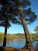
The St. Croix River is a tributary
of the Mississippi River
, approximately 164 miles (263.9 km) long, in the U.S. state
s of Wisconsin
and Minnesota
. The lower 125 miles (201.2 km) of the river form the border between Wisconsin and Minnesota. The river is a National Scenic Riverway
under the protection of the National Park Service
. A hydroelectric
plant at St. Croix Falls supplies power to the Minneapolis-St. Paul metropolitan area.
, approximately 20 miles (32.2 km) south of Lake Superior
. It flows south to Gordon
, then southwest. It is joined by the Namekagon River
in northern Burnett County, where it becomes significantly wider. A few miles downstream the St. Croix meets the boundary between Minnesota and Wisconsin, which it demarcates for another 130 miles (209.2 km) until its confluence
with the Mississippi River
.
Other major tributaries include the Kettle River
, Snake River
, and Sunrise River
joining from the west, and the Apple River
, Willow River
, and Kinnickinnic River
joining from the east. Just below Stillwater, Minnesota
the river widens into Lake St. Croix, and eventually joins the Mississippi River
at Prescott, Wisconsin
, approximately 20 miles (32.2 km) southeast of St. Paul, Minnesota.
, are protected as the St. Croix National Scenic Riverway. The free-flowing nature of the river is interrupted only by a hydroelectric dam operated by the Northern States Power Company
at St. Croix Falls, Wisconsin
.
The lower 27 miles (43.5 km) below the dam, including both sides of the river along the Minnesota-Wisconsin border, are protected as part of the Lower St. Croix National Scenic Riverway. This area includes the Dalles of the St. Croix River, a scenic gorge located near Interstate Park
, south of St. Croix Falls, Wisconsin
.
The St. Croix River Improvement Association (later the St. Croix River Association) was a volunteer group that operated sporadically from 1911 to 1989. The Association's major areas of concern included maintaining a navigable flow of water, barring construction that could have a negative impact on the river, ending pollution of the river, and gaining federal protection for it. Its members were mainly residents of communities along the Minnesota side of the St. Croix River, who were concerned about restoring and preserving the river.
: "There is another River which falls ... into the Meschasipi ... We named it The River of the Grave, or Mausoleum, because the Savages buried there one of their Men ... who was bitten by a Rattlesnake." In the original French
, this is translated as "Rivière Tombeaux".
Jean-Baptiste-Louis Franquelin
's 1688 map recorded a "Fort St. Croix" on the upper reaches of the river. The name "Rivière de Sainte-Croix" was applied to the river sometime in 1688 or 1689, and this more auspicious name supplanted Father Hennepin's earlier designation.
On Carte de la Louisiane et du cours du Mississippi (1718) by Guillaume Delisle
and on A Map of North America (1768) by John Blair, the St. Croix River—more specifically what was then known as the east branch of the St. Croix River (known today as the Namekagon River
)—is shown as the Ouasisacadeba, a French
representation of the Dakota
name for the St. Croix River. On the 1778 Mitchell Map
, the river is simply titled "Ouadeba", which represents the Dakota watpá meaning "river".
The upper portion of river—originally called the north branch of the St. Croix River—was known to the Ojibwa
as Manoominikeshiinh-ziibi (Ricing-Rail
River). Downstream of its confluence with the Namekagon, the Ojibwa
renamed the river as Gichi-ziibi (Big River) or Okijii-ziibi (Pipestem River)
At the time of European settlement of the valley, Dakota and Ojibwe were engaged in a long and deadly war with each other. Consequently, the portion of the river below the confluence with Trade River
is called Jiibayaatig-ziibi (Grave-marker River) in the Ojibwe language
, reinforcing the earlier "Rivière Tombeaux" name in their language.
On Map of the Territories of Michigan and Ouisconsin (1830) by John Farmer, the St. Croix River is shown as the "Chippewa River". However, by 1843, Joseph Nicollet
's Hydrographical Basin of the Upper Mississippi River reinforced the name provided by Franquelin's 1688 map.
, Dakota and nine other American Indian tribes
. The Indians mainly lived on wild rice
, fish, and game. By the eighteenth century, the Ojibwe and Dakota were the two primary tribes that inhabited the area, until around 1745, when the Dakota were forever driven from the St. Croix Valley as a result of the Battle of Kathio
.
and his men in the fall and winter of 1679-1680. For the next eighty years the area was primarily under French influence, and the fur trade
grew throughout the first half of the 18th century, with beaver
pelts as the prize trade good. French trade in the upper valley was dominated by the Ojibwe and tied to Lake Superior
traders, whereas in the lower valley the Dakota assisted in trading with merchants based out of St. Louis
downstream. After the end of the French and Indian War
in 1763, British traders entered the area, and grew in numbers and influence with the help of the powerful North West Company
.
with the Ojibwe was signed at St. Peters (now Mendota)
which ceded to the United States government a vast tract of land in what today is north central Wisconsin and east central Minnesota, roughly bounded by the Prairie du Chien Line
in the south, Mississippi River in the west, St. Croix and Chippewa River
watersheds in the north, and a 25-mile parallel east of the Wisconsin River
in the east. This opened the region to logging
. The river was important to the transportation of lumber
downstream, from the areas where it was being cut to the sawmill
s that processed it. During the 1840s, important sawmills were located at St. Croix Falls and Marine on St. Croix
, but as the 1850s progressed Stillwater
became the primary lumber destination. During this time the population of Stillwater boomed, several additional sawmills were opened, and the town saw an influx of capital, primarily from lumber companies based downriver in St. Louis, Missouri
. In 1856 construction began on a boom site two miles north of Stillwater, which was used to store and sort the lumber floating downstream and remained in operation for over fifty years. The St. Croix Boom Site
is now a wayside rest and National Historic Landmark
along Minnesota State Highway 95
.
The vast white pine
forests in the upper valley provided the forest product
s that built the towns along Lake St. Croix, Minneapolis and St. Paul; the St. Croix along with the forest reserves in the river valleys of the nearby Red Cedar
, Chippewa, and Rum
provided supplies for the building of Winona, Minnesota
, Davenport, Iowa
, Rock Island, Illinois
, and St. Louis.
The lumber industry continued to grow throughout the latter half of the 19th century, with progressively larger spring drives and consequent dangers to navigation on the river above Stillwater. Logs were frequently caught in log jam
s at the narrow Dalles of the St. Croix River, and in 1883 the blockade was so severe it took almost two months before the flow of logs was re-established. At its peak in 1890, logging in the St. Croix River valley produced 450000000 board feet (1,061,881.7 m³) of lumber and logs. The lumber industry continued until the last major log drive in 1912 marked the end of the rich white pine forests of the area.
It was along the banks of the St. Croix, in the milltown of Stillwater
, that the state of Minnesota was first proposed in 1848.
 The St. Croix is a popular recreational river. Common uses include boating
, fishing
, camping
and canoeing
. Highways along both sides of the river offer scenic drives punctuated by small towns offering restaurants, shopping (especially antiques
, books and gifts), bed and breakfast
s, historical tours and other common tourist activities.
Public lands along the St. Croix River include:
The St. Croix River is mentioned in the band Rocket Club
's song "North Country" as a symbol for the singer's desire to "head up North."
Tributary
A tributary or affluent is a stream or river that flows into a main stem river or a lake. A tributary does not flow directly into a sea or ocean...
of the Mississippi River
Mississippi River
The Mississippi River is the largest river system in North America. Flowing entirely in the United States, this river rises in western Minnesota and meanders slowly southwards for to the Mississippi River Delta at the Gulf of Mexico. With its many tributaries, the Mississippi's watershed drains...
, approximately 164 miles (263.9 km) long, in the U.S. state
U.S. state
A U.S. state is any one of the 50 federated states of the United States of America that share sovereignty with the federal government. Because of this shared sovereignty, an American is a citizen both of the federal entity and of his or her state of domicile. Four states use the official title of...
s of Wisconsin
Wisconsin
Wisconsin is a U.S. state located in the north-central United States and is part of the Midwest. It is bordered by Minnesota to the west, Iowa to the southwest, Illinois to the south, Lake Michigan to the east, Michigan to the northeast, and Lake Superior to the north. Wisconsin's capital is...
and Minnesota
Minnesota
Minnesota is a U.S. state located in the Midwestern United States. The twelfth largest state of the U.S., it is the twenty-first most populous, with 5.3 million residents. Minnesota was carved out of the eastern half of the Minnesota Territory and admitted to the Union as the thirty-second state...
. The lower 125 miles (201.2 km) of the river form the border between Wisconsin and Minnesota. The river is a National Scenic Riverway
Saint Croix National Scenic Riverway
The Saint Croix National Scenic Riverway is a federally protected system of riverways located in eastern Minnesota and northwestern Wisconsin. It protects of river, including the St. Croix River , and the Namekagon River , as well as adjacent land along the rivers. The St...
under the protection of the National Park Service
National Park Service
The National Park Service is the U.S. federal agency that manages all national parks, many national monuments, and other conservation and historical properties with various title designations...
. A hydroelectric
Hydroelectricity
Hydroelectricity is the term referring to electricity generated by hydropower; the production of electrical power through the use of the gravitational force of falling or flowing water. It is the most widely used form of renewable energy...
plant at St. Croix Falls supplies power to the Minneapolis-St. Paul metropolitan area.
Geography and hydrography
The St. Croix River rises in the northwestern corner of Wisconsin, out of Upper St. Croix Lake in Douglas County, near Solon SpringsSolon Springs, Wisconsin
Solon Springs is a village in Douglas County, Wisconsin, United States. The population was 576 at the 2000 census. The village is located within the Town of Solon Springs.-Transportation:U.S. Highway 53 serves as a main arterial route in the community...
, approximately 20 miles (32.2 km) south of Lake Superior
Lake Superior
Lake Superior is the largest of the five traditionally-demarcated Great Lakes of North America. It is bounded to the north by the Canadian province of Ontario and the U.S. state of Minnesota, and to the south by the U.S. states of Wisconsin and Michigan. It is the largest freshwater lake in the...
. It flows south to Gordon
Gordon, Douglas County, Wisconsin
Gordon is a town in Douglas County, Wisconsin, United States. The population was 645 at the 2000 census. The census-designated place of Gordon is located in the town,-Transportation:U.S...
, then southwest. It is joined by the Namekagon River
Namekagon River
The Namekagon River is a tributary of the St. Croix River. It is approximately 95 mi long and is located in northwestern Wisconsin in the United States. Its course is protected as part of the St. Croix National Scenic Riverway....
in northern Burnett County, where it becomes significantly wider. A few miles downstream the St. Croix meets the boundary between Minnesota and Wisconsin, which it demarcates for another 130 miles (209.2 km) until its confluence
Confluence
Confluence, in geography, describes the meeting of two or more bodies of water.Confluence may also refer to:* Confluence , a property of term rewriting systems...
with the Mississippi River
Mississippi River
The Mississippi River is the largest river system in North America. Flowing entirely in the United States, this river rises in western Minnesota and meanders slowly southwards for to the Mississippi River Delta at the Gulf of Mexico. With its many tributaries, the Mississippi's watershed drains...
.
Other major tributaries include the Kettle River
Kettle River (Minnesota)
The Kettle is a tributary of the St. Croix River, about 80 mi long, in eastern Minnesota in the United States. Via the St. Croix River, it is part of the watershed of the Mississippi River. The river's English name is due to the large number of large rounded holes in the sandstone in and around...
, Snake River
Snake River (St. Croix River)
The Snake River is a tributary of the St. Croix River in east central Minnesota in the United States. It is one of three streams in Minnesota with this name . Its name is a translation from the Ojibwa Ginebigo-ziibi after the Dakota peoples who made their homes along this river...
, and Sunrise River
Sunrise River
The Sunrise River is a short tributary of the St. Croix River in east-central Minnesota in the United States. It is formed at the town of Stacy in Chisago County by the confluence of its West Branch, which rises in southwestern Isanti County and briefly enters Anoka County; and its South Branch,...
joining from the west, and the Apple River
Apple River (Wisconsin)
The Apple River is a tributary of the St. Croix River, about 70 mi long, in northwestern Wisconsin in the United States. Via the St. Croix, it is part of the watershed of the Mississippi River....
, Willow River
Willow River (St. Croix River)
Willow River is a river in St. Croix County, Wisconsin, United States and a tributary of the St. Croix River. Its headwaters are found near the village of Deer Park . The river at one time dumped into the lower St. Croix river in between Hudson and North Hudson...
, and Kinnickinnic River
Kinnickinnic River (St. Croix River)
The Kinnickinnic River, called the Kinni for short, is a 25-mile-long river in northwestern Wisconsin in the United States. It is listed as a Class I trout stream. The Kinnickinnic River arises from springs in St. Croix County and flows in a southwesterly direction before emptying into the St....
joining from the east. Just below Stillwater, Minnesota
Stillwater, Minnesota
As of the census of 2000, there were 15,143 people, 5,797 households, and 4,115 families residing in the city. The population density was 2,340.0 people per square mile . There were 5,926 housing units at an average density of 915.7 per square mile...
the river widens into Lake St. Croix, and eventually joins the Mississippi River
Mississippi River
The Mississippi River is the largest river system in North America. Flowing entirely in the United States, this river rises in western Minnesota and meanders slowly southwards for to the Mississippi River Delta at the Gulf of Mexico. With its many tributaries, the Mississippi's watershed drains...
at Prescott, Wisconsin
Prescott, Wisconsin
Prescott is a city in Pierce County, Wisconsin at the confluence of the St. Croix River and Mississippi River. The population was 4,258 at the 2010 census, making it the second-largest city in the county after River Falls, and the largest entirely within Pierce County.Prescott was home to the...
, approximately 20 miles (32.2 km) southeast of St. Paul, Minnesota.
Conservation efforts
The St. Croix River was one of the original eight rivers to have significant portions placed under protection by the National Wild and Scenic Rivers Act of 1968. The upper reaches of the river in Wisconsin below the St. Croix Flowage, 15 miles (24.1 km) downstream from its source, as well as the Namekagon RiverNamekagon River
The Namekagon River is a tributary of the St. Croix River. It is approximately 95 mi long and is located in northwestern Wisconsin in the United States. Its course is protected as part of the St. Croix National Scenic Riverway....
, are protected as the St. Croix National Scenic Riverway. The free-flowing nature of the river is interrupted only by a hydroelectric dam operated by the Northern States Power Company
Northern States Power Company
Northern States Power Company was a publicly-traded S&P 500 electric and natural gas utility holding company based in Minneapolis, Minnesota that is now a subsidiary of Xcel Energy .-History:...
at St. Croix Falls, Wisconsin
St. Croix Falls, Wisconsin
St. Croix Falls is a city in Polk County, Wisconsin, United States. The population was 2,033 at the 2000 census. The city is located within the Town of St. Croix Falls....
.
The lower 27 miles (43.5 km) below the dam, including both sides of the river along the Minnesota-Wisconsin border, are protected as part of the Lower St. Croix National Scenic Riverway. This area includes the Dalles of the St. Croix River, a scenic gorge located near Interstate Park
Interstate Park
Interstate Park comprises two adjacent state parks on the Minnesota-Wisconsin border, both named Interstate State Park. They straddle the Dalles of the St. Croix River, a deep basalt gorge with glacial potholes and other rock formations. The Wisconsin park is and the Minnesota park is . The...
, south of St. Croix Falls, Wisconsin
St. Croix Falls, Wisconsin
St. Croix Falls is a city in Polk County, Wisconsin, United States. The population was 2,033 at the 2000 census. The city is located within the Town of St. Croix Falls....
.
The St. Croix River Improvement Association (later the St. Croix River Association) was a volunteer group that operated sporadically from 1911 to 1989. The Association's major areas of concern included maintaining a navigable flow of water, barring construction that could have a negative impact on the river, ending pollution of the river, and gaining federal protection for it. Its members were mainly residents of communities along the Minnesota side of the St. Croix River, who were concerned about restoring and preserving the river.
Naming
Father Louis Hennepin wrote in 1683, from information probably provided by Daniel Greysolon, Sieur du LhutDaniel Greysolon, Sieur du Lhut
Daniel Greysolon, Sieur du Lhut was a French soldier and explorer who is the first European known to have visited the area where the city of Duluth, Minnesota is now located and the headwaters of the Mississippi River near Grand Rapids...
: "There is another River which falls ... into the Meschasipi ... We named it The River of the Grave, or Mausoleum, because the Savages buried there one of their Men ... who was bitten by a Rattlesnake." In the original French
French language
French is a Romance language spoken as a first language in France, the Romandy region in Switzerland, Wallonia and Brussels in Belgium, Monaco, the regions of Quebec and Acadia in Canada, and by various communities elsewhere. Second-language speakers of French are distributed throughout many parts...
, this is translated as "Rivière Tombeaux".
Jean-Baptiste-Louis Franquelin
Jean-Baptiste-Louis Franquelin
Jean-Baptiste-Louis Franquelin was born at Saint-Michel de Villebernin, France in 1651. He died in France around 1712. He was a cartographer, a royal hydrographer, and a teacher of navigation. He was also the first official cartographer in Canada....
's 1688 map recorded a "Fort St. Croix" on the upper reaches of the river. The name "Rivière de Sainte-Croix" was applied to the river sometime in 1688 or 1689, and this more auspicious name supplanted Father Hennepin's earlier designation.
On Carte de la Louisiane et du cours du Mississippi (1718) by Guillaume Delisle
Guillaume Delisle
Guillaume Delisle was a French cartographer who lived in Paris.His father, Claude Delisle studied law and then later settled in Paris as private teacher in geography and history, and afterwards filled the office of royal censor...
and on A Map of North America (1768) by John Blair, the St. Croix River—more specifically what was then known as the east branch of the St. Croix River (known today as the Namekagon River
Namekagon River
The Namekagon River is a tributary of the St. Croix River. It is approximately 95 mi long and is located in northwestern Wisconsin in the United States. Its course is protected as part of the St. Croix National Scenic Riverway....
)—is shown as the Ouasisacadeba, a French
French language
French is a Romance language spoken as a first language in France, the Romandy region in Switzerland, Wallonia and Brussels in Belgium, Monaco, the regions of Quebec and Acadia in Canada, and by various communities elsewhere. Second-language speakers of French are distributed throughout many parts...
representation of the Dakota
Dakota language
Dakota is a Siouan language spoken by the Dakota people of the Sioux tribes. Dakota is closely related to and mutually intelligible with the Lakota language.-Dialects:...
name for the St. Croix River. On the 1778 Mitchell Map
Mitchell Map
The Mitchell Map is a map made by John Mitchell , which was reprinted several times during the second half of the 18th century. The Mitchell Map was used as a primary map source during the Treaty of Paris for defining the boundaries of the newly independent United States...
, the river is simply titled "Ouadeba", which represents the Dakota watpá meaning "river".
The upper portion of river—originally called the north branch of the St. Croix River—was known to the Ojibwa
Ojibwa
The Ojibwe or Chippewa are among the largest groups of Native Americans–First Nations north of Mexico. They are divided between Canada and the United States. In Canada, they are the third-largest population among First Nations, surpassed only by Cree and Inuit...
as Manoominikeshiinh-ziibi (Ricing-Rail
Rallidae
The rails, or Rallidae, are a large cosmopolitan family of small to medium-sized birds. The family exhibits considerable diversity and the family also includes the crakes, coots, and gallinules...
River). Downstream of its confluence with the Namekagon, the Ojibwa
Ojibwa
The Ojibwe or Chippewa are among the largest groups of Native Americans–First Nations north of Mexico. They are divided between Canada and the United States. In Canada, they are the third-largest population among First Nations, surpassed only by Cree and Inuit...
renamed the river as Gichi-ziibi (Big River) or Okijii-ziibi (Pipestem River)
At the time of European settlement of the valley, Dakota and Ojibwe were engaged in a long and deadly war with each other. Consequently, the portion of the river below the confluence with Trade River
Trade River, Wisconsin
Trade River is an unincorporated community in the town of Anderson in southwestern Burnett County, in northwestern Wisconsin, United States. The settlement consists of a church and a few residences....
is called Jiibayaatig-ziibi (Grave-marker River) in the Ojibwe language
Ojibwe language
Ojibwe , also called Anishinaabemowin, is an indigenous language of the Algonquian language family. Ojibwe is characterized by a series of dialects that have local names and frequently local writing systems...
, reinforcing the earlier "Rivière Tombeaux" name in their language.
On Map of the Territories of Michigan and Ouisconsin (1830) by John Farmer, the St. Croix River is shown as the "Chippewa River". However, by 1843, Joseph Nicollet
Joseph Nicollet
Joseph Nicolas Nicollet , also known as Jean-Nicolas Nicollet, was a French geographer and mathematician known for mapping the Upper Mississippi River basin during the 1830s....
's Hydrographical Basin of the Upper Mississippi River reinforced the name provided by Franquelin's 1688 map.
History
The river valley and the surrounding area was originally occupied by the semi-nomadic OjibweOjibwa
The Ojibwe or Chippewa are among the largest groups of Native Americans–First Nations north of Mexico. They are divided between Canada and the United States. In Canada, they are the third-largest population among First Nations, surpassed only by Cree and Inuit...
, Dakota and nine other American Indian tribes
Native Americans in the United States
Native Americans in the United States are the indigenous peoples in North America within the boundaries of the present-day continental United States, parts of Alaska, and the island state of Hawaii. They are composed of numerous, distinct tribes, states, and ethnic groups, many of which survive as...
. The Indians mainly lived on wild rice
Wild rice
Wild rice is four species of grasses forming the genus Zizania, and the grain which can be harvested from them. The grain was historically gathered and eaten in both North America and China...
, fish, and game. By the eighteenth century, the Ojibwe and Dakota were the two primary tribes that inhabited the area, until around 1745, when the Dakota were forever driven from the St. Croix Valley as a result of the Battle of Kathio
Battle of Kathio
-Summary:The Battle of Kathio, or Battle of Izatys, was an oral tradition of the Chippewa reporting a battle fought in 1750 between Chippewas and the Sioux at the village of Kathio, or Izatys, on the Rum River next to Mille Lacs Lake....
.
Fur trade
The first Europeans to arrive in the area were Sieur du LhutDaniel Greysolon, Sieur du Lhut
Daniel Greysolon, Sieur du Lhut was a French soldier and explorer who is the first European known to have visited the area where the city of Duluth, Minnesota is now located and the headwaters of the Mississippi River near Grand Rapids...
and his men in the fall and winter of 1679-1680. For the next eighty years the area was primarily under French influence, and the fur trade
Fur trade
The fur trade is a worldwide industry dealing in the acquisition and sale of animal fur. Since the establishment of world market for in the early modern period furs of boreal, polar and cold temperate mammalian animals have been the most valued...
grew throughout the first half of the 18th century, with beaver
Beaver
The beaver is a primarily nocturnal, large, semi-aquatic rodent. Castor includes two extant species, North American Beaver and Eurasian Beaver . Beavers are known for building dams, canals, and lodges . They are the second-largest rodent in the world...
pelts as the prize trade good. French trade in the upper valley was dominated by the Ojibwe and tied to Lake Superior
Lake Superior
Lake Superior is the largest of the five traditionally-demarcated Great Lakes of North America. It is bounded to the north by the Canadian province of Ontario and the U.S. state of Minnesota, and to the south by the U.S. states of Wisconsin and Michigan. It is the largest freshwater lake in the...
traders, whereas in the lower valley the Dakota assisted in trading with merchants based out of St. Louis
St. Louis, Missouri
St. Louis is an independent city on the eastern border of Missouri, United States. With a population of 319,294, it was the 58th-largest U.S. city at the 2010 U.S. Census. The Greater St...
downstream. After the end of the French and Indian War
French and Indian War
The French and Indian War is the common American name for the war between Great Britain and France in North America from 1754 to 1763. In 1756, the war erupted into the world-wide conflict known as the Seven Years' War and thus came to be regarded as the North American theater of that war...
in 1763, British traders entered the area, and grew in numbers and influence with the help of the powerful North West Company
North West Company
The North West Company was a fur trading business headquartered in Montreal from 1779 to 1821. It competed with increasing success against the Hudson's Bay Company in what was to become Western Canada...
.
Logging
The 1837 Treaty of St. PetersTreaty of St. Peters
Treaty of St. Peters may be one of two treaties conducted between the United States and Native American peoples, conducted at the confluence of the Minnesota River with the Mississippi River, in what today is Mendota, Minnesota....
with the Ojibwe was signed at St. Peters (now Mendota)
Mendota, Minnesota
Mendota is a city in Dakota County, Minnesota, United States. The name comes from the Dakota word for "where the waters meet." The population was 198 at the 2010 census.-History:...
which ceded to the United States government a vast tract of land in what today is north central Wisconsin and east central Minnesota, roughly bounded by the Prairie du Chien Line
Treaty of Prairie du Chien
The Treaty of Prairie du Chien may refer to any of several treaties made and signed in Prairie du Chien, Wisconsin between the United States, representatives from the Sioux, Sac and Fox, Menominee, Ioway, Winnebago and the Anishinaabeg Native American peoples.-1825:The first treaty of Prairie du...
in the south, Mississippi River in the west, St. Croix and Chippewa River
Chippewa River (Wisconsin)
The Chippewa River in Wisconsin flows approximately 183 miles through west-central and northwestern Wisconsin. It was once navigable for approximately 50 miles of its length, from the Mississippi River, by Durand, northeast to Eau Claire. Its catchment defines a portion of the northern boundary...
watersheds in the north, and a 25-mile parallel east of the Wisconsin River
Wisconsin River
-External links:* * * , Wisconsin Historical Society* * * *...
in the east. This opened the region to logging
Logging
Logging is the cutting, skidding, on-site processing, and loading of trees or logs onto trucks.In forestry, the term logging is sometimes used in a narrow sense concerning the logistics of moving wood from the stump to somewhere outside the forest, usually a sawmill or a lumber yard...
. The river was important to the transportation of lumber
Timber floating
Timber floating may refer to:*Log driving*Timber rafting...
downstream, from the areas where it was being cut to the sawmill
Sawmill
A sawmill is a facility where logs are cut into boards.-Sawmill process:A sawmill's basic operation is much like those of hundreds of years ago; a log enters on one end and dimensional lumber exits on the other end....
s that processed it. During the 1840s, important sawmills were located at St. Croix Falls and Marine on St. Croix
Marine on St. Croix, Minnesota
Marine on St. Croix is a city in Washington County, Minnesota, United States. The population was 689 at the 2010 census.-Geography:According to the United States Census Bureau, the city has a total area of , of which, of it is land and of it is water. Minnesota State Highway 95 serves as a main...
, but as the 1850s progressed Stillwater
Stillwater, Minnesota
As of the census of 2000, there were 15,143 people, 5,797 households, and 4,115 families residing in the city. The population density was 2,340.0 people per square mile . There were 5,926 housing units at an average density of 915.7 per square mile...
became the primary lumber destination. During this time the population of Stillwater boomed, several additional sawmills were opened, and the town saw an influx of capital, primarily from lumber companies based downriver in St. Louis, Missouri
St. Louis, Missouri
St. Louis is an independent city on the eastern border of Missouri, United States. With a population of 319,294, it was the 58th-largest U.S. city at the 2010 U.S. Census. The Greater St...
. In 1856 construction began on a boom site two miles north of Stillwater, which was used to store and sort the lumber floating downstream and remained in operation for over fifty years. The St. Croix Boom Site
St. Croix Boom Site
The St. Croix Boom Site is a National Historic Landmark located on the St. Croix River upstream of Stillwater, Minnesota. The site was founded by Stillwater lumber barons, including Isaac Staples, in 1856 after the demise of the original St. Croix Boom Company, which had operated a log boom further...
is now a wayside rest and National Historic Landmark
National Historic Landmark
A National Historic Landmark is a building, site, structure, object, or district, that is officially recognized by the United States government for its historical significance...
along Minnesota State Highway 95
Minnesota State Highway 95
Minnesota State Highway 95 is a highway in east-central Minnesota, which runs from its intersection with State Highway 23 near St. Cloud and continues east and south to its southern terminus at its intersection with U.S...
.
The vast white pine
Eastern White Pine
Pinus strobus, commonly known as the eastern white pine, is a large pine native to eastern North America, occurring from Newfoundland west to Minnesota and southeastern Manitoba, and south along the Appalachian Mountains to the northern edge of Georgia.It is occasionally known as simply white pine,...
forests in the upper valley provided the forest product
Forest product
A forest product is any material derived from a forest for commercial use, such as lumber, paper, or forage for livestock. Wood, by far the dominant commercial forest product, is used for many industrial purposes, such as the finished structural materials used for the construction of buildings, or...
s that built the towns along Lake St. Croix, Minneapolis and St. Paul; the St. Croix along with the forest reserves in the river valleys of the nearby Red Cedar
Red Cedar River (Wisconsin)
The Red Cedar River in northwestern Wisconsin, is a tributary of the Chippewa River, flowing approximately 85 miles from Lake Chetek, a reservoir in southwestern Sawyer County, through a small chain of lakes, including Birch Lake at Birchwood, Balsam Lake in Washburn County and Red Cedar Lake in...
, Chippewa, and Rum
Rum River
The Rum River is a slow, meandering channel that connects Minnesota's Mille Lacs Lake with the Mississippi River. It runs for through the farming communities of Onamia, Milaca, Princeton, Cambridge, and Isanti before ending at the Twin Cities suburb of Anoka, roughly 20 miles northwest of downtown...
provided supplies for the building of Winona, Minnesota
Winona, Minnesota
Winona is a city in and the county seat of Winona County, in the U.S. State of Minnesota. Located in picturesque bluff country on the Mississippi River, its most noticeable physical landmark is Sugar Loaf....
, Davenport, Iowa
Davenport, Iowa
Davenport is a city located along the Mississippi River in Scott County, Iowa, United States. Davenport is the county seat of and largest city in Scott County. Davenport was founded on May 14, 1836 by Antoine LeClaire and was named for his friend, George Davenport, a colonel during the Black Hawk...
, Rock Island, Illinois
Rock Island, Illinois
Rock Island is the county seat of Rock Island County, Illinois, United States. The population was 40,884 at the 2010 census. Located on the Mississippi River, it is one of the Quad Cities, along with neighboring Moline, East Moline, and the Iowa cities of Davenport and Bettendorf. The Quad Cities...
, and St. Louis.
The lumber industry continued to grow throughout the latter half of the 19th century, with progressively larger spring drives and consequent dangers to navigation on the river above Stillwater. Logs were frequently caught in log jam
Log jam
A log jam is an accumulation of Large Woody Debris that can span an entire stream or river channel.-Effects on stream/river geomorphology:...
s at the narrow Dalles of the St. Croix River, and in 1883 the blockade was so severe it took almost two months before the flow of logs was re-established. At its peak in 1890, logging in the St. Croix River valley produced 450000000 board feet (1,061,881.7 m³) of lumber and logs. The lumber industry continued until the last major log drive in 1912 marked the end of the rich white pine forests of the area.
It was along the banks of the St. Croix, in the milltown of Stillwater
Stillwater, Minnesota
As of the census of 2000, there were 15,143 people, 5,797 households, and 4,115 families residing in the city. The population density was 2,340.0 people per square mile . There were 5,926 housing units at an average density of 915.7 per square mile...
, that the state of Minnesota was first proposed in 1848.
Cities and towns
|
Oak Park Heights, Minnesota Oak Park Heights is a city in Washington County, Minnesota, United States. The population was 4,339 at the 2010 census.-Geography:According to the United States Census Bureau, the city has a total area of , all land... Osceola, Wisconsin Osceola is a village in Polk County, Wisconsin, United States. The population was 2,421 at the 2000 census. The village is located mostly within the Town of Osceola.The downtown features Cascade Falls, a waterfall with a crest, located on Osceola Creek.... Point Douglas, Minnesota Point Douglas is a ghost town in section 8 of Denmark Township, Washington County, Minnesota, United States. It is located across the St Croix River from Prescott, Wisconsin.-History:... Prescott, Wisconsin Prescott is a city in Pierce County, Wisconsin at the confluence of the St. Croix River and Mississippi River. The population was 4,258 at the 2010 census, making it the second-largest city in the county after River Falls, and the largest entirely within Pierce County.Prescott was home to the... St. Croix Falls, Wisconsin St. Croix Falls is a city in Polk County, Wisconsin, United States. The population was 2,033 at the 2000 census. The city is located within the Town of St. Croix Falls.... St. Marys Point, Minnesota St. Marys Point is a city in Washington County, Minnesota, United States. The population was 368 at the 2010 census.-Geography:According to the United States Census Bureau, the city has a total area of , all of it land. County 18 serves as a main route.... Solon Springs, Wisconsin Solon Springs is a village in Douglas County, Wisconsin, United States. The population was 576 at the 2000 census. The village is located within the Town of Solon Springs.-Transportation:U.S. Highway 53 serves as a main arterial route in the community... Stillwater, Minnesota As of the census of 2000, there were 15,143 people, 5,797 households, and 4,115 families residing in the city. The population density was 2,340.0 people per square mile . There were 5,926 housing units at an average density of 915.7 per square mile... Taylors Falls, Minnesota As of the census of 2000, there were 951 people, 369 households, and 247 families residing in the city. The population density was 255.6 people per square mile . There were 386 housing units at an average density of 103.7 per square mile... |
Bridge crossings
Significant bridge crossings of the St. Croix River are listed below, ordered from source to mouth.- Scott Bridge in Douglas County, Wisconsin.
- County Road T bridge in Douglas County, Wisconsin.
- C.C.C. Bridge in Burnett County, Wisconsin.
- Wisconsin State Highway 35 bridge near Danbury, WisconsinDanbury, WisconsinDanbury is an unincorporated census-designated place in Burnett County, Wisconsin, United States. The community is located in the northwest corner of the Town of Swiss. Its ZIP code is 54830. As of the 2010 census, its population is 172...
. - Minnesota State Highway 48Minnesota State Highway 48Minnesota State Highway 48 is a highway in east-central Minnesota, which runs from its interchange with Interstate Highway 35 in Hinckley and continues east to its eastern terminus at the Wisconsin state line , where it becomes Wisconsin Highway 77.Highway 48 is in length and passes through the...
to Wisconsin State Highway 77 bridge near Danbury, WisconsinDanbury, WisconsinDanbury is an unincorporated census-designated place in Burnett County, Wisconsin, United States. The community is located in the northwest corner of the Town of Swiss. Its ZIP code is 54830. As of the 2010 census, its population is 172...
. - Minnesota State Highway 70Minnesota State Highway 70Minnesota State Highway 70 is a highway in east-central Minnesota, which runs from its intersection with State Highway 65 in Brunswick and continues east to its eastern terminus at the Wisconsin state line , where it becomes Wisconsin Highway 70 upon crossing the St...
to Wisconsin State Highway 70 bridge near Grantsburg, WisconsinGrantsburg, WisconsinGrantsburg is a village in Burnett County in the U.S. state of Wisconsin. The population was 1,369 at the 2000 census. The village is located within the Town of Grantsburg.-Claim to fame:...
. - U.S. Highway 8 bridge between Taylors Falls, MinnesotaTaylors Falls, MinnesotaAs of the census of 2000, there were 951 people, 369 households, and 247 families residing in the city. The population density was 255.6 people per square mile . There were 386 housing units at an average density of 103.7 per square mile...
and St. Croix Falls, WisconsinSt. Croix Falls, WisconsinSt. Croix Falls is a city in Polk County, Wisconsin, United States. The population was 2,033 at the 2000 census. The city is located within the Town of St. Croix Falls....
. - Minnesota State Highway 243Minnesota State Highway 243-External links:***...
bridge at Osceola, WisconsinOsceola, WisconsinOsceola is a village in Polk County, Wisconsin, United States. The population was 2,421 at the 2000 census. The village is located mostly within the Town of Osceola.The downtown features Cascade Falls, a waterfall with a crest, located on Osceola Creek....
. - Soo Line High BridgeSoo Line High BridgeThe Soo Line High Bridge is a steel deck arch bridge over the St. Croix River between Stillwater, Minnesota and Somerset, Wisconsin. It was designed by bridge architect C.A.P. Turner and built by the American Bridge Company...
north of Stillwater, MinnesotaStillwater, MinnesotaAs of the census of 2000, there were 15,143 people, 5,797 households, and 4,115 families residing in the city. The population density was 2,340.0 people per square mile . There were 5,926 housing units at an average density of 915.7 per square mile...
. This private, rail-only bridge is 2682 feet (817.5 m) long and 184 feet (56.1 m) above the river. It roughly marks the northern limit of zebra musselZebra musselThe zebra mussel, Dreissena polymorpha, is a small freshwater mussel. This species was originally native to the lakes of southeast Russia being first described in 1769 by a German zoologist Peter Simon Pallas in the Ural, Volga and Dnieper rivers. They are still found nearby, as Pontic and Caspian...
infestation in the St. Croix. - The Stillwater lift bridge, built 1931, between Stillwater, MinnesotaStillwater, MinnesotaAs of the census of 2000, there were 15,143 people, 5,797 households, and 4,115 families residing in the city. The population density was 2,340.0 people per square mile . There were 5,926 housing units at an average density of 915.7 per square mile...
and Houlton, WisconsinHoulton, WisconsinHoulton is an unincorporated census-designated place located in St. Croix County, Wisconsin, United States. Houlton is located across the St. Croix River from Stillwater, Minnesota, in the town of St. Joseph. Houlton has a post office with ZIP code 54082. As of the 2010 census, its population was...
. - Union Pacific RailroadUnion Pacific RailroadThe Union Pacific Railroad , headquartered in Omaha, Nebraska, is the largest railroad network in the United States. James R. Young is president, CEO and Chairman....
swing bridge at Hudson, WisconsinHudson, WisconsinHudson is a city in St. Croix County, Wisconsin, United States. As of the 2010 United States Census, its population was 18,937, making it the principal and largest city of the Minneapolis - St. Paul metropolitan area . The Hudson area however had a population of 39,713... - Interstate 94Interstate 94Interstate 94 is the northernmost east–west Interstate Highway, connecting the Great Lakes and Intermountain regions of the United States. I-94's western terminus is in Billings, Montana at a junction with Interstate 90; its eastern terminus is the U.S...
bridge at Hudson, Wisconsin. - U.S. Highway 10 drawbridge at Prescott, WisconsinPrescott, WisconsinPrescott is a city in Pierce County, Wisconsin at the confluence of the St. Croix River and Mississippi River. The population was 4,258 at the 2010 census, making it the second-largest city in the county after River Falls, and the largest entirely within Pierce County.Prescott was home to the...
. - BNSF RailwayBNSF RailwayThe BNSF Railway is a wholly owned subsidiary of Berkshire Hathaway Inc., and is headquartered in Fort Worth, Texas. It is one of seven North American Class I railroads and the second largest freight railroad network in North America, second only to the Union Pacific Railroad, its primary...
lift bridge at Prescott, Wisconsin.
Commerce and recreation
Boating
Boating is the leisurely activity of travelling by boat, or the recreational use of a boat whether powerboats, sailboats, or man-powered vessels , focused on the travel itself, as well as sports activities, such as fishing or water skiing...
, fishing
Fishing
Fishing is the activity of trying to catch wild fish. Fish are normally caught in the wild. Techniques for catching fish include hand gathering, spearing, netting, angling and trapping....
, camping
Camping
Camping is an outdoor recreational activity. The participants leave urban areas, their home region, or civilization and enjoy nature while spending one or several nights outdoors, usually at a campsite. Camping may involve the use of a tent, caravan, motorhome, cabin, a primitive structure, or no...
and canoeing
Canoeing
Canoeing is an outdoor activity that involves a special kind of canoe.Open canoes may be 'poled' , sailed, 'lined and tracked' or even 'gunnel-bobbed'....
. Highways along both sides of the river offer scenic drives punctuated by small towns offering restaurants, shopping (especially antiques
Antiques
An antique is an old collectible item. It is collected or desirable because of its age , beauty, rarity, condition, utility, personal emotional connection, and/or other unique features...
, books and gifts), bed and breakfast
Bed and breakfast
A bed and breakfast is a small lodging establishment that offers overnight accommodation and breakfast, but usually does not offer other meals. Since the 1980s, the meaning of the term has also extended to include accommodations that are also known as "self-catering" establishments...
s, historical tours and other common tourist activities.
Public lands along the St. Croix River include:
- Governor Knowles State ForestGovernor Knowles State ForestGovernor Knowles State Forest is a 19,753 acre unit of the Wisconsin state park system that stretches for along the St. Croix River. It is managed as a wilderness buffer for the Saint Croix National Scenic Riverway. On the east the state forest is bordered by county forests and two state...
(Wisconsin) - Saint Croix State Forest (Minnesota)
- Saint Croix State ParkSaint Croix State ParkSt. Croix State Park is a state park in Pine County, Minnesota, USA. The park follows the shore of the St. Croix River for and contains the last of the Kettle River. At it is the largest Minnesota state park. It was developed as a Recreational Demonstration Area in the 1930s...
(Minnesota) - Chengwatana State ForestChengwatana State ForestThe Chengwatana State Forest is a state forest located in Pine and Chisago counties in Minnesota. Its name is derived from the , meaning white-pine town, after the nearby ghost town and township...
(Minnesota) - Wild River State ParkWild River State ParkWild River State Park is a state park of Minnesota, USA, curving along of the St. Croix River. This long, narrow park is shaped somewhat like a sideways 'S', with development largely concentrated in the lower third. The remote upper sections flank the mouth of a tributary called the Sunrise...
(Minnesota) - Interstate ParkInterstate ParkInterstate Park comprises two adjacent state parks on the Minnesota-Wisconsin border, both named Interstate State Park. They straddle the Dalles of the St. Croix River, a deep basalt gorge with glacial potholes and other rock formations. The Wisconsin park is and the Minnesota park is . The...
(Minnesota and Wisconsin) - William O'Brien State ParkWilliam O'Brien State ParkWilliam O'Brien State Park is a state park of Minnesota, USA, along the St. Croix River. Its hiking trails traverse rolling glacial moraine, riparian zones, restored oak savanna, wooded areas and bogs...
(Minnesota) - Afton State ParkAfton State ParkAfton State Park is a state park of Minnesota, USA, on the St. Croix River in Washington County. Its hiking trails offer views of the river, rolling glacial moraine, and bluffland it preserves. It is a popular place for birdwatching, picnics, camping, and other typical outdoor recreational...
(Minnesota) - St. Croix Boom SiteSt. Croix Boom SiteThe St. Croix Boom Site is a National Historic Landmark located on the St. Croix River upstream of Stillwater, Minnesota. The site was founded by Stillwater lumber barons, including Isaac Staples, in 1856 after the demise of the original St. Croix Boom Company, which had operated a log boom further...
(Minnesota)
The St. Croix River is mentioned in the band Rocket Club
Rocket Club
Rocket Club is an American country music band composed of Chris Hawkey , Luke Kramer , Brian Kroening , Joel Sayles , Don Smithmier , and Billy Thommes...
's song "North Country" as a symbol for the singer's desire to "head up North."
Further reading
- McMahon, Eileen M., and Theodore J. Karamanski. North Woods River: The St. Croix River in Upper Midwest History. (Madison: University of Wisconsin Press, 2009. xii, 338 pp. isbn 978-0-299-23424-9