

Soil Moisture and Ocean Salinity satellite
Encyclopedia
The Soil Moisture and Ocean Salinity Satellite (SMOS) is a part of ESA
's Living Planet Programme
intended to provide new insights into Earth's water cycle
and climate
. In addition, it will provide better weather forecasting and will also monitor snow and ice accumulation.
on a Rockot
rocket. The first data from the MIRAS
(Microwave
Imaging Radiometer
using Aperture
Synthesis) instrument was received on 20 November 2009. The SMOS programme cost is about €315 million ($465 million; £280 million). It is led by ESA but with significant input from French and Spanish interests.
The satellite is part of ESA's Earth Explorer programme – eight spacecraft that will do innovative science in obtaining data on issues of pressing environment
al concern. The first is already in orbit – a mission called GOCE
, which is mapping variations in the pull of gravity across the Earth's surface. SMOS is the second Explorer to launch; and a third spacecraft, known as CryoSat-2
(the first CryoSat
failed on launch), was launched on 8 April 2010. CryoSat will assess the state of the world's ice cover.
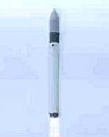 The satellite was launched on 2 November 2009 (04:50 (01:50 GMT)) to a nearly circular orbit of 763 km by a “Rockot
”, a modified Russian
Intercontinental Ballistic Missile
(ICBM) SS-19 launched from a decommissioned SS-19 launcher from Northern Russia's Plesetsk Cosmodrome
. The SMOS satellite was launched together with the Proba-2
, a technology demonstration satellite.
Soil moisture is an important aspect of climate, and therefore forecasting
. Plants transpire water from depths lower than 1 meter in many places and satellites like SMOS can only provide moisture content down to a few centimeters, but using repeated measurements in a day, the satellite can extrapolate soil moisture. The SMOS team of ESA hope to work with farmers around the world, including the United States Department of Agriculture
to use as ground-based calibration for models determining soil moisture, as it may help to better understand crop yield
s over wide regions.
Information from SMOS is expected to help improve short and medium-term weather forecasts, and also have practical applications in areas such as agriculture and water resource management. In addition, climate models should benefit from having a more precise picture of the scale and speed of movement of water in the different components of the hydrological cycle.
(MIRAS). Some eight metres across, it has the look of helicopter rotor blades; the instrument creates images of radiation emitted in the microwave
L-band (1.4 GHz). MIRAS will measure changes in the wetness of the land and in the salinity of seawater by observing variations in the natural microwave emission coming up off the surface of the planet.
Satellite Operations Ground Segment will operate the spacecraft with telecommunications from ESA's S-band facility located in Kiruna
, Sweden
. The Data Processing Ground Segment (CDTI
, Villafranca
, Spain
) will process SMOS data through the X-band. Higher level processing of information will be done by scientists globally.
European Space Agency
The European Space Agency , established in 1975, is an intergovernmental organisation dedicated to the exploration of space, currently with 18 member states...
's Living Planet Programme
Living Planet Programme
The Living Planet Programme is a programme within the European Space Agency which is managed by the Earth Observation Programmes Directorate...
intended to provide new insights into Earth's water cycle
Water cycle
The water cycle, also known as the hydrologic cycle or H2O cycle, describes the continuous movement of water on, above and below the surface of the Earth. Water can change states among liquid, vapor, and solid at various places in the water cycle...
and climate
Climate
Climate encompasses the statistics of temperature, humidity, atmospheric pressure, wind, rainfall, atmospheric particle count and other meteorological elemental measurements in a given region over long periods...
. In addition, it will provide better weather forecasting and will also monitor snow and ice accumulation.
History
The project was proposed in November 1998; in 2004 the project passed ESA-phase "C/D" and, after several delays, it was launched on 2 November 2009 from Plesetsk CosmodromePlesetsk Cosmodrome
Plesetsk Cosmodrome is a Russian spaceport, located in Arkhangelsk Oblast, about 800 km north of Moscow and approximately 200 km south of Arkhangelsk.-Overview:...
on a Rockot
Rockot
The Rokot , also transliterated as a the pun Rockot, is a Russian space launch vehicle that can launch a payload of 1,950 kilograms into a 200 kilometre high Earth orbit with 63° inclination. It is a derivative of the UR-100N intercontinental ballistic missile , supplied and operated by Eurockot...
rocket. The first data from the MIRAS
Microwave Imaging Radiometer with Aperture Synthesis
Microwave Imaging Radiometer with Aperture Synthesis is the major instrument on the Soil Moisture and Ocean Salinity satellite . MIRAS is a planar antenna composed of a central body and three telescoping, deployable arms, in total 69 receivers on the Unit...
(Microwave
Microwave
Microwaves, a subset of radio waves, have wavelengths ranging from as long as one meter to as short as one millimeter, or equivalently, with frequencies between 300 MHz and 300 GHz. This broad definition includes both UHF and EHF , and various sources use different boundaries...
Imaging Radiometer
Radiometer
A radiometer is a device for measuring the radiant flux of electromagnetic radiation. Generally, the term radiometer denotes an infrared radiation detector, yet it also includes detectors operating on any electromagnetic wavelength....
using Aperture
Aperture
In optics, an aperture is a hole or an opening through which light travels. More specifically, the aperture of an optical system is the opening that determines the cone angle of a bundle of rays that come to a focus in the image plane. The aperture determines how collimated the admitted rays are,...
Synthesis) instrument was received on 20 November 2009. The SMOS programme cost is about €315 million ($465 million; £280 million). It is led by ESA but with significant input from French and Spanish interests.
The satellite is part of ESA's Earth Explorer programme – eight spacecraft that will do innovative science in obtaining data on issues of pressing environment
Environmental science
Environmental science is an interdisciplinary academic field that integrates physical and biological sciences, to the study of the environment, and the solution of environmental problems...
al concern. The first is already in orbit – a mission called GOCE
Goce
Goce is an opera composed by Kiril Makedonski in tribute to Gotse Delchev. The work was commissioned to be the very first opera performed by the Macedonian National Opera Company. It premiered on May 24, 1954 and it is the first opera to be written in the Macedonian language....
, which is mapping variations in the pull of gravity across the Earth's surface. SMOS is the second Explorer to launch; and a third spacecraft, known as CryoSat-2
CryoSat-2
CryoSat-2 is a European Space Agency environmental research satellite which was launched in April 2010. It provides scientists with data about the polar ice caps and tracks changes in the thickness of the ice with a resolution of about . This information is useful for monitoring climate change...
(the first CryoSat
CryoSat
CryoSat is an ESA programme which will monitor variations in the extent and thickness of polar ice through use of a satellite in low Earth orbit. The information provided about the behaviour of coastal glaciers that drain thinning ice sheets will be key to better predictions of future sea-level rise...
failed on launch), was launched on 8 April 2010. CryoSat will assess the state of the world's ice cover.
Launcher
Rockot
The Rokot , also transliterated as a the pun Rockot, is a Russian space launch vehicle that can launch a payload of 1,950 kilograms into a 200 kilometre high Earth orbit with 63° inclination. It is a derivative of the UR-100N intercontinental ballistic missile , supplied and operated by Eurockot...
”, a modified Russian
Russians
The Russian people are an East Slavic ethnic group native to Russia, speaking the Russian language and primarily living in Russia and neighboring countries....
Intercontinental Ballistic Missile
Intercontinental ballistic missile
An intercontinental ballistic missile is a ballistic missile with a long range typically designed for nuclear weapons delivery...
(ICBM) SS-19 launched from a decommissioned SS-19 launcher from Northern Russia's Plesetsk Cosmodrome
Plesetsk Cosmodrome
Plesetsk Cosmodrome is a Russian spaceport, located in Arkhangelsk Oblast, about 800 km north of Moscow and approximately 200 km south of Arkhangelsk.-Overview:...
. The SMOS satellite was launched together with the Proba-2
Proba-2
PROBA2 is the second satellite in the European Space Agency's series of PROBA low-cost satellites that are being used to validate new spacecraft technologies while also carrying scientific instruments. PROBA2 is a small satellite developed under an ESA General Support Technology Program contract...
, a technology demonstration satellite.
Science
The goal of the SMOS mission is to monitor surface soil moisture with an accuracy of 4% (at 35–50 km spatial resolution). This aspect is managed by the HYDROS project. Project Aquarius will attempt to monitor sea surface salinity with an accuracy of 0.1 psu (10–30 day average and a spatial resolution of 200 km x 200 km).Soil moisture is an important aspect of climate, and therefore forecasting
Forecasting
Forecasting is the process of making statements about events whose actual outcomes have not yet been observed. A commonplace example might be estimation for some variable of interest at some specified future date. Prediction is a similar, but more general term...
. Plants transpire water from depths lower than 1 meter in many places and satellites like SMOS can only provide moisture content down to a few centimeters, but using repeated measurements in a day, the satellite can extrapolate soil moisture. The SMOS team of ESA hope to work with farmers around the world, including the United States Department of Agriculture
United States Department of Agriculture
The United States Department of Agriculture is the United States federal executive department responsible for developing and executing U.S. federal government policy on farming, agriculture, and food...
to use as ground-based calibration for models determining soil moisture, as it may help to better understand crop yield
Crop yield
In agriculture, crop yield is not only a measure of the yield of cereal per unit area of land under cultivation, yield is also the seed generation of the plant itself...
s over wide regions.
Information from SMOS is expected to help improve short and medium-term weather forecasts, and also have practical applications in areas such as agriculture and water resource management. In addition, climate models should benefit from having a more precise picture of the scale and speed of movement of water in the different components of the hydrological cycle.
Instrumentation
The SMOS satellite carries a new type of instrument called Microwave Imaging Radiometer with Aperture SynthesisMicrowave Imaging Radiometer with Aperture Synthesis
Microwave Imaging Radiometer with Aperture Synthesis is the major instrument on the Soil Moisture and Ocean Salinity satellite . MIRAS is a planar antenna composed of a central body and three telescoping, deployable arms, in total 69 receivers on the Unit...
(MIRAS). Some eight metres across, it has the look of helicopter rotor blades; the instrument creates images of radiation emitted in the microwave
Microwave
Microwaves, a subset of radio waves, have wavelengths ranging from as long as one meter to as short as one millimeter, or equivalently, with frequencies between 300 MHz and 300 GHz. This broad definition includes both UHF and EHF , and various sources use different boundaries...
L-band (1.4 GHz). MIRAS will measure changes in the wetness of the land and in the salinity of seawater by observing variations in the natural microwave emission coming up off the surface of the planet.
Operations and ground segment
The CNESCNES
The is the French government space agency . Established under President Charles de Gaulle in 1961, its headquarters are located in central Paris and it is under the supervision of the French Ministries of Defence and Research...
Satellite Operations Ground Segment will operate the spacecraft with telecommunications from ESA's S-band facility located in Kiruna
Kiruna
Kiruna is the northernmost city in Sweden, situated in Lapland province, with 18,154 inhabitants in 2005. It is the seat of Kiruna Municipality Kiruna (Northern Sami: Giron, Finnish: Kiiruna) is the northernmost city in Sweden, situated in Lapland province, with 18,154 inhabitants in 2005. It is...
, Sweden
Sweden
Sweden , officially the Kingdom of Sweden , is a Nordic country on the Scandinavian Peninsula in Northern Europe. Sweden borders with Norway and Finland and is connected to Denmark by a bridge-tunnel across the Öresund....
. The Data Processing Ground Segment (CDTI
Centre for the Development of Industrial Technology
The Centre for the Development of Industrial Technology is a public organization for technology development in the Kingdom of Spain. In the Spanish language, the Centre is known as the Centro para el Desarrollo Tecnologico Industrial. It was part of the Ministry of Industry, Commerce and Tourism,...
, Villafranca
Villafranca
Villafranca is a town and municipality located in the province and the autonomous community of Navarre, northern Spain.-External links:*...
, Spain
Spain
Spain , officially the Kingdom of Spain languages]] under the European Charter for Regional or Minority Languages. In each of these, Spain's official name is as follows:;;;;;;), is a country and member state of the European Union located in southwestern Europe on the Iberian Peninsula...
) will process SMOS data through the X-band. Higher level processing of information will be done by scientists globally.
See also
- Gravity Recovery and Climate ExperimentGravity Recovery and Climate ExperimentThe Gravity Recovery And Climate Experiment , a joint mission of NASA and the German Space Agency, has been making detailed measurements of Earth's gravity field since its launch in March 2002....
(GRACE) NASA - launch 2002 - ICESatICESatICESat , part of NASA's Earth Observing System, was a satellite mission for measuring ice sheet mass balance, cloud and aerosol heights, as well as land topography and vegetation characteristics...
NASA - launch 2003
- Gravity Field and Steady-State Ocean Circulation ExplorerGravity Field and Steady-State Ocean Circulation ExplorerThe Gravity Field and Steady-State Ocean Circulation Explorer is an ESA satellite that was launched on March 17, 2009. It is a satellite carrying a highly sensitive gravity gradiometer which detects fine density differences in the crust and oceans of the Earth.GOCE data will have many uses,...
(GOCE) ESA - launch 2009 - CryoSat-2CryoSat-2CryoSat-2 is a European Space Agency environmental research satellite which was launched in April 2010. It provides scientists with data about the polar ice caps and tracks changes in the thickness of the ice with a resolution of about . This information is useful for monitoring climate change...
ESA - launch 2010
External links
- ESA – SMOS home page.
- SMOS Project Germany
- SMOS Processor Prototype Page
- SMOS Barcelona Expert Centre