
Sierra Blanca
Encyclopedia
Sierra Blanca is a range of volcanic mountains in Lincoln
and Otero
counties of south-central New Mexico
. The range is about 40 miles (64.4 km) from north to south and 20 miles (32.2 km) wide, and is dominated by Sierra Blanca Peak, whose highest point is at 11981 ft (3,652 m). The peak is located 10 miles (16.1 km) west-northwest of Ruidoso
and 30 miles (48 km) north-northeast of Alamogordo
.
, and part of this is protected as the White Mountain Wilderness Area. However, much of the southern half of the range, including the summit of Sierra Blanca Peak, is part of the Mescalero Apache Indian Reservation, and requires a permit for access. To the south, across the valley of the Rio Tularosa, lie the Sacramento Mountains
. To the north is Carrizo Mountain, and to the northeast lie the Capitan Mountains
. On the west side, the range rises high above the Tularosa Basin
.
The range serves as the headwaters for the Rio Ruidoso
, Rio Tularosa, and Rio Bonito, as well as numerous arroyos
draining into the Tularosa Basin, including Nogal Arroyo at the north end of the range.
 Sierra Blanca Peak is the highest point in southern New Mexico, and is one of the southernmost points at which alpine ecosystems occur in the United States. Rising 8000 feet (2400 m) above the adjacent Tularosa Basin, it has the highest prominence
in the state, and is the southernmost high peak in the contiguous United States (all higher peaks are farther north). The peak can be seen for many miles, particularly within the Tularosa Basin, and is visible from as far away as Sandia Crest
near Albuquerque.
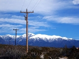
The eastern foothills of the Sierra Blanca range include the town of Ruidoso
, and the area has a number of popular hiking and camping destinations.
The ski resort
located on Sierra Blanca Peak (which is located mostly within the Lincoln National Forest
and managed by the Mescalero Apache Indian Reservation) is called Ski Apache
, and it is one of southern New Mexico's two ski resorts, the other called Ski Cloudcroft.
s. An ancient and heavily eroded volcanic pile, it is the largest mid-Tertiary
volcanic complex east of the Rio Grande
with an estimated volume of erupted products of 185 cubic miles (771.1 km³). Eruptions began about 38 million years ago, and extended over a twelve-million-year period. Most of the eruptions produced volumnious lava flows and breccia
s, with numerous intrusive dike
s emplaced throughout the complex. The final activity produced the intrusions which form the present-day Sierra Blanca Peak. Erosion and block faulting
after volcanism ceased exposed the intrusions and produced the mountain range's current form, modified somewhat by Pleistocene
glaciation.
Lincoln County, New Mexico
-2010:Whereas according to the 2010 U.S. Census Bureau:*85.1% White*0.5% Black*2.4% Native American*0.4% Asian*0.0% Native Hawaiian or Pacific Islander*2.5% Two or more races*9.1% Other races*29.8% Hispanic or Latino -2000:...
and Otero
Otero County, New Mexico
-2010:Whereas according to the 2010 U.S. Census Bureau:*72.7% White*3.5% Black*6.7% Native American*1.2% Asian*0.2% Native Hawaiian or Pacific Islander*4.2% Two or more races*11.2% Other races*34.5% Hispanic or Latino -2000:...
counties of south-central New Mexico
New Mexico
New Mexico is a state located in the southwest and western regions of the United States. New Mexico is also usually considered one of the Mountain States. With a population density of 16 per square mile, New Mexico is the sixth-most sparsely inhabited U.S...
. The range is about 40 miles (64.4 km) from north to south and 20 miles (32.2 km) wide, and is dominated by Sierra Blanca Peak, whose highest point is at 11981 ft (3,652 m). The peak is located 10 miles (16.1 km) west-northwest of Ruidoso
Ruidoso, New Mexico
Ruidoso is a village in Lincoln County, New Mexico, United States, adjacent to the Lincoln National Forest. The population was 8,029 at the 2010 census...
and 30 miles (48 km) north-northeast of Alamogordo
Alamogordo, New Mexico
Alamogordo is the county seat of Otero County and a city in south-central New Mexico, United States. A desert community lying in the Tularosa Basin, it is bordered on the east by the Sacramento Mountains. It is the nearest city to Holloman Air Force Base. The population was 35,582 as of the 2000...
.
Geography
The majority of the Sierra Blanca range is within the Lincoln National ForestLincoln National Forest
The Lincoln National Forest is a protected national forest in the State of New Mexico in the southwestern United States. It was established in 1902 and covers 1,103,828 acres...
, and part of this is protected as the White Mountain Wilderness Area. However, much of the southern half of the range, including the summit of Sierra Blanca Peak, is part of the Mescalero Apache Indian Reservation, and requires a permit for access. To the south, across the valley of the Rio Tularosa, lie the Sacramento Mountains
Sacramento Mountains
The Sacramento Mountains are a mountain range in the south-central part of the U.S. state of New Mexico, lying just east of Alamogordo in Otero County...
. To the north is Carrizo Mountain, and to the northeast lie the Capitan Mountains
Capitan Mountains
The Capitan Mountains are a mountain range in Lincoln County, in south-central New Mexico in the southwestern United States. The range is about 20 miles long from east to west and about 6 miles wide, formed from a large, elongated granite intrusion similar to the round one that produced Carrizo...
. On the west side, the range rises high above the Tularosa Basin
Tularosa Basin
The Tularosa Basin is a graben basin in the Basin and Range Province and within the Chihuahuan Desert, east of the Rio Grande in southern New Mexico, in the Southwestern United States.-Geography:...
.
The range serves as the headwaters for the Rio Ruidoso
Rio Ruidoso
The Rio Ruidoso is a long river located in the Sierra Blanca and Sacramento Mountains in Lincoln County and Otero County, New Mexico in the United States and is part of the Rio Ruidoso Watershed...
, Rio Tularosa, and Rio Bonito, as well as numerous arroyos
Arroyo (creek)
An arroyo , a Spanish word translated as brook, and also called a wash is usually a dry creek or stream bed—gulch that temporarily or seasonally fills and flows after sufficient rain. Wadi is a similar term in Africa. In Spain, a rambla has a similar meaning to arroyo.-Types and processes:Arroyos...
draining into the Tularosa Basin, including Nogal Arroyo at the north end of the range.
Topographic prominence
In topography, prominence, also known as autonomous height, relative height, shoulder drop , or prime factor , categorizes the height of the mountain's or hill's summit by the elevation between it and the lowest contour line encircling it and no higher summit...
in the state, and is the southernmost high peak in the contiguous United States (all higher peaks are farther north). The peak can be seen for many miles, particularly within the Tularosa Basin, and is visible from as far away as Sandia Crest
Sandia Mountains
The Sandia Mountains name posu gai hoo-oo, "where water slides down arroyo") are a mountain range located in Bernalillo and Sandoval counties, immediately to the east of the city of Albuquerque in New Mexico in the southwestern United States. The range is largely within the Cibola National...
near Albuquerque.
The eastern foothills of the Sierra Blanca range include the town of Ruidoso
Ruidoso, New Mexico
Ruidoso is a village in Lincoln County, New Mexico, United States, adjacent to the Lincoln National Forest. The population was 8,029 at the 2010 census...
, and the area has a number of popular hiking and camping destinations.
The ski resort
Ski resort
A ski resort is a resort developed for skiing and other winter sports. In Europe a ski resort is a town or village in a ski area - a mountainous area, where there are ski trails and supporting services such as hotels and other accommodation, restaurants, equipment rental and a ski lift system...
located on Sierra Blanca Peak (which is located mostly within the Lincoln National Forest
Lincoln National Forest
The Lincoln National Forest is a protected national forest in the State of New Mexico in the southwestern United States. It was established in 1902 and covers 1,103,828 acres...
and managed by the Mescalero Apache Indian Reservation) is called Ski Apache
Ski Apache
Ski Apache is a ski resort in southern New Mexico, on the slopes of Sierra Blanca. It is owned and operated, since 1963, by the Mescalero Apache Tribe. The resort is home to Ross Anderson, an acclaimed speed skier of Native American descent, who is the resort's marketing manager...
, and it is one of southern New Mexico's two ski resorts, the other called Ski Cloudcroft.
Volcanology
Sierra Blanca is a massive complex of volcanic rocks including pyroclastic materials, lava flows, and intrusionIntrusion
An intrusion is liquid rock that forms under Earth's surface. Magma from under the surface is slowly pushed up from deep within the earth into any cracks or spaces it can find, sometimes pushing existing country rock out of the way, a process that can take millions of years. As the rock slowly...
s. An ancient and heavily eroded volcanic pile, it is the largest mid-Tertiary
Tertiary
The Tertiary is a deprecated term for a geologic period 65 million to 2.6 million years ago. The Tertiary covered the time span between the superseded Secondary period and the Quaternary...
volcanic complex east of the Rio Grande
Rio Grande
The Rio Grande is a river that flows from southwestern Colorado in the United States to the Gulf of Mexico. Along the way it forms part of the Mexico – United States border. Its length varies as its course changes...
with an estimated volume of erupted products of 185 cubic miles (771.1 km³). Eruptions began about 38 million years ago, and extended over a twelve-million-year period. Most of the eruptions produced volumnious lava flows and breccia
Breccia
Breccia is a rock composed of broken fragments of minerals or rock cemented together by a fine-grained matrix, that can be either similar to or different from the composition of the fragments....
s, with numerous intrusive dike
Dike (geology)
A dike or dyke in geology is a type of sheet intrusion referring to any geologic body that cuts discordantly across* planar wall rock structures, such as bedding or foliation...
s emplaced throughout the complex. The final activity produced the intrusions which form the present-day Sierra Blanca Peak. Erosion and block faulting
Fault-block mountain
Fault-block landforms are formed when large areas of bedrock are widely broken up by faults creating large vertical displacements of continental crust....
after volcanism ceased exposed the intrusions and produced the mountain range's current form, modified somewhat by Pleistocene
Pleistocene
The Pleistocene is the epoch from 2,588,000 to 11,700 years BP that spans the world's recent period of repeated glaciations. The name pleistocene is derived from the Greek and ....
glaciation.
See also
- Lincoln National ForestLincoln National ForestThe Lincoln National Forest is a protected national forest in the State of New Mexico in the southwestern United States. It was established in 1902 and covers 1,103,828 acres...
- Fort Stanton – Snowy River Cave National Conservation AreaFort Stanton – Snowy River Cave National Conservation AreaThe Fort Stanton – Snowy River Cave National Conservation Area is a National Conservation Area in the eastern foothills of the Sierra Blanca, between Capitan and Lincoln in south central New Mexico...
- Mountain peaks of North AmericaMountain peaks of North AmericaThis article comprises three sortable tables of major mountain peaks of greater North America.This article defines greater North America as the portion of the continental landmass of the Americas extending northward from Panama plus the islands surrounding that landmass...
- Mountain peaks of the United StatesMountain peaks of the United StatesThis article comprises three sortable tables of the major mountain peaks of the United States of America.Topographic elevation is the vertical distance above the reference geoid, a precise mathematical model of the Earth's sea level as an equipotential gravitational surface...
- Mescalero Apache Indian Reservation
- Rio RuidosoRio RuidosoThe Rio Ruidoso is a long river located in the Sierra Blanca and Sacramento Mountains in Lincoln County and Otero County, New Mexico in the United States and is part of the Rio Ruidoso Watershed...
- Sacramento MountainsSacramento MountainsThe Sacramento Mountains are a mountain range in the south-central part of the U.S. state of New Mexico, lying just east of Alamogordo in Otero County...