

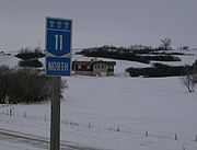
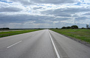
Saskatchewan Highway 11
Encyclopedia
Saskatchewan
Saskatchewan is a prairie province in Canada, which has an area of . Saskatchewan is bordered on the west by Alberta, on the north by the Northwest Territories, on the east by Manitoba, and on the south by the U.S. states of Montana and North Dakota....
, Canada
Canada
Canada is a North American country consisting of ten provinces and three territories. Located in the northern part of the continent, it extends from the Atlantic Ocean in the east to the Pacific Ocean in the west, and northward into the Arctic Ocean...
that connects the province's three largest cities: Regina
Regina, Saskatchewan
Regina is the capital city of the Canadian province of Saskatchewan. The city is the second-largest in the province and a cultural and commercial centre for southern Saskatchewan. It is governed by Regina City Council. Regina is the cathedral city of the Roman Catholic and Romanian Orthodox...
, Saskatoon
Saskatoon
Saskatoon is a city in central Saskatchewan, Canada, on the South Saskatchewan River. Residents of the city of Saskatoon are called Saskatonians. The city is surrounded by the Rural Municipality of Corman Park No. 344....
and Prince Albert
Prince Albert, Saskatchewan
Prince Albert is the third-largest city in Saskatchewan, Canada. It is situated in the centre of the province on the banks of the North Saskatchewan River. The city is known as the "Gateway to the North" because it is the last major centre along the route to the resources of northern Saskatchewan...
. It is a structural pavement major arterial highway which is approximately 395 kilometres (245.4 mi) long. It is also known as the Louis Riel
Louis Riel
Louis David Riel was a Canadian politician, a founder of the province of Manitoba, and a political and spiritual leader of the Métis people of the Canadian prairies. He led two resistance movements against the Canadian government and its first post-Confederation Prime Minister, Sir John A....
Trail after the 19th century Métis
Métis people (Canada)
The Métis are one of the Aboriginal peoples in Canada who trace their descent to mixed First Nations parentage. The term was historically a catch-all describing the offspring of any such union, but within generations the culture syncretised into what is today a distinct aboriginal group, with...
leader. It runs from Highway 6
Saskatchewan Highway 6
Highway 6 is a paved undivided major provincial highway in the Canadian province of Saskatchewan. It runs from Montana Highway 16 at the Saskatchewan border with the US near the Canada customs port of Regway to Highway 55 near Choiceland. Highway 6 is about long. The CanAm Highway comprises ...
north of Regina until Highway 2
Saskatchewan Highway 2
Highway 2 is a provincial highway in the Canadian province of Saskatchewan. It is the longest Saskatchewan Highway, at 809 km . The highway is partially divided and undivided. However, only about near Moose Jaw, near Chamberlain, and near Prince Albert are divided highway...
south of Prince Albert. Historically the southern portion between Regina and Saskatoon was Provincial Highway 11, and followed the Dominion Survey lines on the square, and the northern portion between Saskatoon and Prince Albert was Provincial Highway 12.
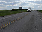
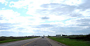
From Regina to Saskatoon, Highway 11 is a four-lane divided
Dual carriageway
A dual carriageway is a class of highway with two carriageways for traffic travelling in opposite directions separated by a central reservation...
highway except in the village of Chamberlain
Chamberlain, Saskatchewan
Chamberlain is a village in south-central Saskatchewan, Canada. Health Department statistics for 2003 put its population at 116 and the new census of 2006 cites 108 for the new population....
, where the road narrows to two lanes through the community, including its intersection with Highway 2
Saskatchewan Highway 2
Highway 2 is a provincial highway in the Canadian province of Saskatchewan. It is the longest Saskatchewan Highway, at 809 km . The highway is partially divided and undivided. However, only about near Moose Jaw, near Chamberlain, and near Prince Albert are divided highway...
south to Moose Jaw
Moose Jaw, Saskatchewan
Moose Jaw is a city in south-central Saskatchewan, Canada on the Moose Jaw River. It is situated on the Trans-Canada Highway, west of Regina. Residents of Moose Jaw are known as Moose Javians. It is best known as a retirement and tourist city that serves as a hub to the hundreds of small towns...
. All intersections in this segment are at-grade except for the section from Regina to Lumsden
Lumsden, Saskatchewan
-History:Settlers first arrived in 1881 and the area came to be commonly known as Happy Hollow. When the Qu'Appelle, Long Lake and Saskatchewan Railway came through the community in 1889, the name was changed to Lumsden after Hugh Lumsden, a senior engineer with the railroad.The town has been...
and in Saskatoon. Highway 11 passes through Saskatoon, following the south leg of Circle Drive, the Idylwyld Freeway and Idylwyld Drive through the city, including its downtown. Motorists seeking to bypass downtown can follow the northeast Circle Drive bypass, although this is not officially part of Highway 11.
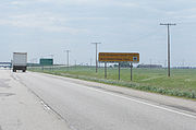
North of Saskatoon, the road continues as a four-lane highway past the community of Warman
Warman, Saskatchewan
-History:The town of Warman was born when the Canadian National Railway running from Humboldt to North Battleford intersected with the Canadian Pacific Railway running from Regina to Prince Albert. This took place in the fall of 1904....
until a point just south of Hague
Hague, Saskatchewan
-Location:-External links:*...
, at which it narrows to two lanes. It then passes through the communities of Hague
Hague, Saskatchewan
-Location:-External links:*...
, Rosthern
Rosthern, Saskatchewan
Rosthern is a town at the juncture of Highway 11 and Highway 312 in the central area of Saskatchewan, Canada. It is located roughly halfway between the cities of Prince Albert, Saskatchewan and Saskatoon, Saskatchewan.-History:...
, and Duck Lake. Highway 11 then runs through the Nisbet Provincial Forest
Nisbet Provincial Forest
The Nisbet Provincial Forest is a provincially protected mixed-wood forest surrounded by Aspen parkland in Central Saskatchewan Canada. It consists of a north block north of the city of Prince Albert, Saskatchewan and a south block between Duck Lake, Saskatchewan and MacDowall, Saskatchewan...
and past the hamlet of MacDowall before it meets Highway 2
Saskatchewan Highway 2
Highway 2 is a provincial highway in the Canadian province of Saskatchewan. It is the longest Saskatchewan Highway, at 809 km . The highway is partially divided and undivided. However, only about near Moose Jaw, near Chamberlain, and near Prince Albert are divided highway...
approximately 3 kilometres (1.9 mi) south of Prince Albert. Highway 11 ends here, although the signage runs concurrent with Highway 2 to the Prince Albert city limits (the 3 kilometre stretch is marked as Highway 2/11), where the actual end shield for Highway 11 is seen. The Ministry of Highways and Infrastructure
Ministry of Highways and Infrastructure (Saskatchewan)
The Ministry of Highways and Infrastructure or Highways and Infrastructure — Government of Saskatchewan Ministry of Highways is divided into the Operations, Policy and Programs, and Corporate Services Divisions and the Communications Branch. The ministry is the employer of over 1,476...
announced in 2009 that it has receiving federal funding, which will allow twinning of Highway 11 between Saskatoon and Prince Albert to be complete by 2012.
Regina and Sherwood No. 159
Regina, Saskatchewan
Regina is the capital city of the Canadian province of Saskatchewan. The city is the second-largest in the province and a cultural and commercial centre for southern Saskatchewan. It is governed by Regina City Council. Regina is the cathedral city of the Roman Catholic and Romanian Orthodox...
, the capital of the province. Hwy 11 begins at the junction with the Trans Canada Highway
Saskatchewan Highway 1
Highway 1 is the Saskatchewan section of the Trans-Canada Highway mainland route. The total distance of the Trans-Canada Highway in Saskatchewan is . The highway traverses Saskatchewan from the western border with Alberta, from Highway 1, to Manitoba where it continues as Highway 1, PTH 1. The...
as a 7 km (4.3 mi) concurrency with Hwy 6
Saskatchewan Highway 6
Highway 6 is a paved undivided major provincial highway in the Canadian province of Saskatchewan. It runs from Montana Highway 16 at the Saskatchewan border with the US near the Canada customs port of Regway to Highway 55 near Choiceland. Highway 6 is about long. The CanAm Highway comprises ...
. Besides being the provincial capital, Regina is a cultural and commercial metropole for both southern Saskatchewan and adjacent areas in the neighbouring American states of North Dakota
North Dakota
North Dakota is a state located in the Midwestern region of the United States of America, along the Canadian border. The state is bordered by Canada to the north, Minnesota to the east, South Dakota to the south and Montana to the west. North Dakota is the 19th-largest state by area in the U.S....
and Montana
Montana
Montana is a state in the Western United States. The western third of Montana contains numerous mountain ranges. Smaller, "island ranges" are found in the central third of the state, for a total of 77 named ranges of the Rocky Mountains. This geographical fact is reflected in the state's name,...
. Hwy 11 begins in a moist mixed grassland region known as the Regina Plain ecoregion. Ipsco a North American steel company is located in the Sherwood Industrial Park (SIP) north of Regina. The final chapter for the namesake of the Louis Riel Trail (LRT) occurred in Regina
Regina, Saskatchewan
Regina is the capital city of the Canadian province of Saskatchewan. The city is the second-largest in the province and a cultural and commercial centre for southern Saskatchewan. It is governed by Regina City Council. Regina is the cathedral city of the Roman Catholic and Romanian Orthodox...
. It was here that Métis leader Louis Riel was tried
Trial of Louis Riel
The Trial of Louis Riel is arguably the most famous trial in the history of Canada. In 1885, Louis Riel had been a leader of a resistance movement by the Métis and First Nations people of western Canada against the Canadian government in what is now the modern province of Saskatchewan...
and hung on September 18, 1885 for treason. In the spring of 2008, Tourism, Parks, Culture and Sport Minister Christine Tell proclaimed in Duck Lake, that "the 125th commemoration, in 2010, of the 1885 Northwest Resistance is an excellent opportunity to tell the story of the prairie Métis and First Nations peoples' struggle with Government forces and how it has shaped Canada today." The length of the route is an asphalt concrete
Asphalt concrete
Asphalt concrete is a composite material commonly used in construction projects such as road surfaces, airports and parking lots. It consists of asphalt and mineral aggregate mixed together, then laid down in layers and compacted...
primary weight highway which is part of the national highway system NHS)
The Ministry of Highways and Infrastructure
Ministry of Highways and Infrastructure (Saskatchewan)
The Ministry of Highways and Infrastructure or Highways and Infrastructure — Government of Saskatchewan Ministry of Highways is divided into the Operations, Policy and Programs, and Corporate Services Divisions and the Communications Branch. The ministry is the employer of over 1,476...
(SHS) South Central Planning Committee manages the construction and maintenance of the highway near Regina which handles approximately 11,000 vehicles per day (VPD) in the Average Annual Daily Traffic (AADT) count.
Lumsden No. 189
Saskatchewan Highway 6
Highway 6 is a paved undivided major provincial highway in the Canadian province of Saskatchewan. It runs from Montana Highway 16 at the Saskatchewan border with the US near the Canada customs port of Regway to Highway 55 near Choiceland. Highway 6 is about long. The CanAm Highway comprises ...
(Albert Street) at Regina's north end and intersects Pasqua Street before reaching the city limits. Once out of Regina, it then passes the junction of Hwy 734
Saskatchewan Highway 734
Highway 734 is a highway in the Canadian province of Saskatchewan. It runs from Highway 11 near Lumsden to Highway 364. Highway 734 is about 52 km long.Highway 734 passes near the communities of Brora and Zehner....
. A steep decline begins into the Qu'Appelle Valley meeting Hwy 20
Saskatchewan Highway 20
Highway 20 is a major road intended for travel by the public between Highway 11 Lumsden to Highway 3 at Birch Hills. Saskatchewan's main roadways are located in the central/southern geographical land area of rolling prairie and grass land in a western Canadian prairie province. This highway is one...
and Lumsden
Lumsden, Saskatchewan
-History:Settlers first arrived in 1881 and the area came to be commonly known as Happy Hollow. When the Qu'Appelle, Long Lake and Saskatchewan Railway came through the community in 1889, the name was changed to Lumsden after Hugh Lumsden, a senior engineer with the railroad.The town has been...
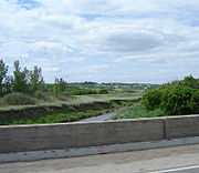
at the lowest depression the bridge over the Qu'appelle River
Qu'Appelle River
The Qu'Appelle River is a Canadian river that flows 430 km east from Lake Diefenbaker in southwestern Saskatchewan to join the Assiniboine River in Manitoba, just south of Lake of the Prairies, near the village of St. Lazare....
. The village
Village
A village is a clustered human settlement or community, larger than a hamlet with the population ranging from a few hundred to a few thousand , Though often located in rural areas, the term urban village is also applied to certain urban neighbourhoods, such as the West Village in Manhattan, New...
of Lumsden was created in 1890 in conjunction with the coming of the CNR
Canadian National Railway
The Canadian National Railway Company is a Canadian Class I railway headquartered in Montreal, Quebec. CN's slogan is "North America's Railroad"....
. When Saskatchewan became a province the Local Improvement District was formed, becoming the Rural Municipality
Rural municipality
A rural municipality, often abbreviated RM, is a form of municipality in the Canadian provinces of Manitoba and Saskatchewan, perhaps best comparable to counties or townships in the western United States...
of Lumsden No. 189
Lumsden No. 189, Saskatchewan
Lumsden No. 189 is a rural municipality located in south-western Saskatchewan, Canada. It is located in Division No.6.Lumsden No. 189 completely surrounds the town of Lumsden. Other communities that are located at its perimeters include Buena Vista, Craven, Disley, Lumsden Beach, and Regina Beach....
in 1912. One of the many administrative concerns of the RM was road construction and maintenance. The Qu'Appelle Valley provides a scenic route as the LRT traverses the Qu'Appelle River. Lumsden Historical Museum, The town of Lumsden
Lumsden, Saskatchewan
-History:Settlers first arrived in 1881 and the area came to be commonly known as Happy Hollow. When the Qu'Appelle, Long Lake and Saskatchewan Railway came through the community in 1889, the name was changed to Lumsden after Hugh Lumsden, a senior engineer with the railroad.The town has been...
, located on the Qu'Appelle River is at the bottom of the valley. The AADT within the valley declines to over 7,000 vpd after Lumsden. The northern hill out of the Qu'appelle Valley meets the intersection of Hwy 54
Saskatchewan Highway 54
Highway 54 is a provincial highway in the Canadian province of Saskatchewan. It runs from Highway 11, 6 km west of Lumsden, to Regina Beach along Last Mountain Lake.-References:*...
, which provides access to Regina Beach on Long Lake.(Last Mountain Lake
Last Mountain Lake
Last Mountain Lake, also known as Long Lake, is a prairie lake formed from glaciation 11,000 years ago. It is located in south central Saskatchewan, Canada, about 40 km northwest of the city of Regina adjacent to the Qu'Appelle Valley, which it flows south into through Last Mountain Creek...
). The Arm River Plain is well-suited to agricultural venture and doyote, red fox, and jack rabbit may be spotted. There are archaeological sites along the Arm River Valley including a bison kill site and also in this area Bigmouth Buffalo (Ictiobus cyprinellus) along with varieties of sedge are flora
Flora of Saskatchewan
The native flora of the Saskatchewan includes vascular plants, plus additional species of other plants and plant-like organisms such as algae, lichens and other fungi, and mosses...
of special concern. The SHS Central Planning Transportation Committee manages the route from here to just south of Saskatoon.
Dufferin No. 190
Saskatchewan Highway 642
Highway 642 is a highway in the Canadian province of Saskatchewan. It runs from Highway 1 near Belle Plaine to Highway 11 near Bethune. Highway 642 is about 37 km long.Highway 642 also passes near Stony Beach....
intersection features the small hamlet
Hamlet
The Tragical History of Hamlet, Prince of Denmark, or more simply Hamlet, is a tragedy by William Shakespeare, believed to have been written between 1599 and 1601...
of Bethune, Saskatchewan to the north and Hwy 354
Saskatchewan Highway 354
Highway 354 is a highway in the Canadian province of Saskatchewan. It runs from Highway 11 near Bethune to Highway 733. Highway 354 is about 16 km long....
. There is a picnic area north of Bethune. In the Allan Hills is the village
Village
A village is a clustered human settlement or community, larger than a hamlet with the population ranging from a few hundred to a few thousand , Though often located in rural areas, the term urban village is also applied to certain urban neighbourhoods, such as the West Village in Manhattan, New...
of Findlater
Findlater, Saskatchewan
-Notable people:*Joy Coghill , O.C., is a Canadian actor, director, and writer.- See also :* List of communities in Saskatchewan* Villages of Saskatchewan-External links:*******-Footnotes:...
with 49 residents on the south side of the LRT, and picnic site on the north. In 2.3 kilometres (1.4 mi) is the northbound turnoff for Hwy 2
Saskatchewan Highway 2
Highway 2 is a provincial highway in the Canadian province of Saskatchewan. It is the longest Saskatchewan Highway, at 809 km . The highway is partially divided and undivided. However, only about near Moose Jaw, near Chamberlain, and near Prince Albert are divided highway...
to Prince Albert
Prince Albert
Prince Albert was the husband and consort of Queen Victoria.Prince Albert may also refer to:-Royalty:*Prince Albert Edward or Edward VII of the United Kingdom , son of Albert and Victoria...
. This commences the 11.6 kilometres (7.2 mi) concurrency with Hwy 2
Saskatchewan Highway 2
Highway 2 is a provincial highway in the Canadian province of Saskatchewan. It is the longest Saskatchewan Highway, at 809 km . The highway is partially divided and undivided. However, only about near Moose Jaw, near Chamberlain, and near Prince Albert are divided highway...
into the town of Chamberlain
Chamberlain, Saskatchewan
Chamberlain is a village in south-central Saskatchewan, Canada. Health Department statistics for 2003 put its population at 116 and the new census of 2006 cites 108 for the new population....
.
Sarnia No. 221
ChamberlainChamberlain, Saskatchewan
Chamberlain is a village in south-central Saskatchewan, Canada. Health Department statistics for 2003 put its population at 116 and the new census of 2006 cites 108 for the new population....
, a village
Village
A village is a clustered human settlement or community, larger than a hamlet with the population ranging from a few hundred to a few thousand , Though often located in rural areas, the term urban village is also applied to certain urban neighbourhoods, such as the West Village in Manhattan, New...
of 108 residents is at the intersection of the LRT, Hwy 2
Saskatchewan Highway 2
Highway 2 is a provincial highway in the Canadian province of Saskatchewan. It is the longest Saskatchewan Highway, at 809 km . The highway is partially divided and undivided. However, only about near Moose Jaw, near Chamberlain, and near Prince Albert are divided highway...
south to Moose Jaw, and Hwy 733
Saskatchewan Highway 733
Highway 733 is a highway in the Canadian province of Saskatchewan. It runs from Highway 11 near Chamberlain to Highway 354. Highway 733 is about 30 km long....
. A Surveyor and Ox Cart created by Davidson welder, farmer and sculptor Don Wilkins was erected in Chamberlain. are two sculptures A large sculpture of the prairie flower Prairie Lilies is also erected at Chamberlain.
Census
A census is the procedure of systematically acquiring and recording information about the members of a given population. It is a regularly occurring and official count of a particular population. The term is used mostly in connection with national population and housing censuses; other common...
Division No. 6
Division No. 6, Saskatchewan
Division No. 6, Saskatchewan, Canada, is one of the eighteen census divisions within the province, as defined by Statistics Canada. It is located in the south-central part of the province. The most populous community in this division is Regina, the provincial capital.According to the 2006 census,...
.
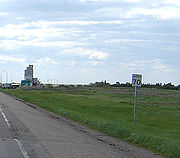
Craik No. 222
Saskatchewan Highway 732
Highway 732 is a highway in the Canadian province of Saskatchewan. It runs from Highway 627 to Highway 2 near Penzance. Highway 732 is about 54 km long.Highway 732 also connects with Highways 643 and 11, near Craik....
. Hwy 732 is a paved road which travels through the Iskwao Creek Valley. In 3.3 kilometres (2.1 mi) is the intersection with Hwy 643
Saskatchewan Highway 643
Highway 643 is a highway in the Canadian province of Saskatchewan. It runs from Highway 735 to Township Road 243 near Craik. Highway 643 is about 82 km long....
where Craik is nestled within the triangle made by these three highways, Hwy 643
Saskatchewan Highway 643
Highway 643 is a highway in the Canadian province of Saskatchewan. It runs from Highway 735 to Township Road 243 near Craik. Highway 643 is about 82 km long....
, Hwy 732 and Hwy 11. Craik & District Regional Park are located 2 kilometres (1.2 mi) north east of Craik
Craik, Saskatchewan
Craik is a town in south central Saskatchewan, Canada, incorporated on August 1, 1907. It is strategically located along Provincial Highway 11 in the RM of Craik No...
.
The buffalo hunter with buffalo gun and Red River cart sculptures made by Don Wilkins, President of the LRT Association, are erected at Craik. "Red River Cart First used in the Red River area to bring in meat from the buffalo hunt, the Red River Cart was later used in freighting. Constructed entirely of wood and tied together with leather, these carts were extremely stable and would be drawn through mud and marsh, floated and carried loads of 500 to 1000 pounds." The Craik Sustainable Living Project (CSLP) Eco-Centre and “dugout house” a typical 19th century living quarters can be toured with Pelican Eco-Tours. The park features Arm Lake which is the reservoir created from damming the Squaw Valley Creek which used to run from the Qu'Appelle River in the Eyebrow Hills north east just south of Davidson
Davidson, Saskatchewan
Davidson is a town in south central Saskatchewan, Canada. It is located 104 km southeast of Saskatoon beside provincial highway 11. It is located almost exactly halfway between Saskatoon and Regina and was a popular stopping-off point for travellers before Hwy...
. The Arm River Valley is visible north of Chamberlain and continues to run parallel to the LRT from Bethune to Craik. Craik and District Golf Course is a 9 hole green golf course 1/2 mile east of the LRT. Craik has been sponsoring development and education about “ecovillage
Ecovillage
Ecovillages are intentional communities with the goal of becoming more socially, economically and ecologically sustainable. Some aim for a population of 50–150 individuals. Larger ecovillages of up to 2,000 individuals exist as networks of smaller subcommunities to create an ecovillage model that...
s”, sustainable housing development.
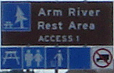
Arm River No. 252
Village
A village is a clustered human settlement or community, larger than a hamlet with the population ranging from a few hundred to a few thousand , Though often located in rural areas, the term urban village is also applied to certain urban neighbourhoods, such as the West Village in Manhattan, New...
of Girvin at the Hwy 749
Saskatchewan Highway 749
Highway 749 is a highway in the Canadian province of Saskatchewan. It runs from Highway 19 near Elbow to Highway 2 near Liberty. Highway 749 is about 82 km long....
which features The Buffalo (and Red River Cart) sculpture, the first piece made by Don Wilkins and features the buffalo a vital part of the fur trading and Métis life in the 18th and 19th centuries.
"Spirit of the Plain This work is intended as a symbolic tribute to those peoples, native and non-native, past and present, who have found harmony under the prairie sky and achieved a calm rhythm with the natural forces of this great land..."
Daivdson
Davidson, Saskatchewan
Davidson is a town in south central Saskatchewan, Canada. It is located 104 km southeast of Saskatoon beside provincial highway 11. It is located almost exactly halfway between Saskatoon and Regina and was a popular stopping-off point for travellers before Hwy...
, a town of over 950 residents is the halfway point between Saskatoon and Regina. Ditto the giant coffee pot and coffee cup in Davidson were erected in 1996 offering hospitality and a cup of coffee at the halfway rest stop.
Davidson, Saskatchewan
Davidson is a town in south central Saskatchewan, Canada. It is located 104 km southeast of Saskatoon beside provincial highway 11. It is located almost exactly halfway between Saskatoon and Regina and was a popular stopping-off point for travellers before Hwy...
on the LRT and provides 9-hole grass greens. Davidson Campground and Swimming Pool is located near the golf course. This area is a part of the
Saskatoon—Biggar Economic Region and the Mid Sask Rural Economic Development Authority (REDA). Between the Qu'appelle Valley and the town of Dundurn on either side of Davidson, the AADT is approximately 5,000 vpd.
Willner No. 253
Traveling another 14.7 kilometres (9.1 mi) northwest is the junction with Allen Road, and following that is the intersection of Knob Hill Road. Townline Road which is south of BladworthBladworth, Saskatchewan
-Architecture:Bladworth is the site of a Saskatchewan Municipal Heritage property, a two story brick house clearly visible from adjacent Highway 11. The J. Fred Johnston house is named for its builder, a Saskatchewan entrepreneur, Liberal Member of Parliament and later a Senator, from 1943 to...
which is a village of 70 residents near the intersecting line between Willner
Willner No. 253, Saskatchewan
- Rural Municipality #253- Willner :Willner #253 is a small municipality in south central Saskatchewan between the RM of Arm River and the RM of Loreburn. It is located in Division 5.- Rm Profile :According to the Canada 2001 Census:* Population: 281...
and McCraney
McCraney No. 282, Saskatchewan
McCraney No. 282 is a rural municipality in south-central Saskatchewan, Canada. It is located in Division #11.- Community Profile :According to the Canada 2001 Census:* Population: 431* % Change : -9.8* Dwellings: 149* Area : 948.74...
rural municipalities
Rural municipality
A rural municipality, often abbreviated RM, is a form of municipality in the Canadian provinces of Manitoba and Saskatchewan, perhaps best comparable to counties or townships in the western United States...
. Just 4 kilometres (2.5 mi) north of Bladworth are the Black & Silver Lakes waterfowl nesting areas. The distance between Bladworth and Kenaston
Kenaston, Saskatchewan
-Ethnic Roots:* Slovak and Scandinavian ethnic bloc settlements were near Kenaston.*Croatian immigrants settled in this area around Kenaston. Croatian family backgrounds are set out in this article -Notable natives:...
is 19.5 kilometres (12.1 mi).
McCraney No. 282
Bonnington Springs Campground is located at KenastonKenaston, Saskatchewan
-Ethnic Roots:* Slovak and Scandinavian ethnic bloc settlements were near Kenaston.*Croatian immigrants settled in this area around Kenaston. Croatian family backgrounds are set out in this article -Notable natives:...
. Kenaston was originally named Bonnington Springs and is located at the intersection with Hwy 15
Saskatchewan Highway 15
Highway 15 is a highway in the Canadian province of Saskatchewan. It runs from Highway 4, 5 km south of Rosetown, to Highway 16 near Bredenbury. Highway 15 is about 444 km long. The Outlook Bridge caries Highway 15 across the South Saskatchewan River.Major communities that Highway 15 passes near...
. Kenaston, the with the logo, Blizzard Capital of Saskatchewan, features a large sculpture of a Snowman built in 1983, but not visible from the highway. Between Kenaston and Hwy 764
Saskatchewan Highway 764
Highway 764 is a highway in the Canadian province of Saskatchewan. It runs from Highway 219 to Highway 397/Highway 763 near Allan. Highway 764 is about 83 km long....
intersection is a length of 24 kilometres (14.9 mi) and the locality of Strong, now just a ghost town. Residents belong to SARM Division No. 5
SARM Division No. 5
SARM Division No. 5 is a division of the Saskatchewan Association of Rural Municipalities within the province of Saskatchewan, Canada. It is located in the north central area of the province. There are 57 rural municipalities in this division. The current Director for Division 5 is Murray...
and are enumerated in Census
Census
A census is the procedure of systematically acquiring and recording information about the members of a given population. It is a regularly occurring and official count of a particular population. The term is used mostly in connection with national population and housing censuses; other common...
Division No. 11
Division No. 11, Saskatchewan
Division No. 11, Saskatchewan, Canada, is one of the eighteen census divisions within the province, as defined by Statistics Canada. It is located in the central part of the province and includes the largest city in the province, Saskatoon. According to the 2006 census, 244,273 people lived in this...
which resulted in a population of about 250 Kenaston residents.
Rosedale No. 283
Hanley, Saskatchewan
Hanley is a town in south-central Saskatchewan, Canada. It is located 65 km south of Saskatoon. Population 510. It was named after Hanley in Staffordshire, England by early founders. It is also the seat for the rural municipality of Rosedale....
, a town of over 450, is located at the intersection of Hwy 764
Saskatchewan Highway 764
Highway 764 is a highway in the Canadian province of Saskatchewan. It runs from Highway 219 to Highway 397/Highway 763 near Allan. Highway 764 is about 83 km long....
. Hanley erected in 2000, a stone monument honoring its historic Opera House. At the intersection with Indi Road is a marker in commemoration of Indi Siding. To the west of the road is Indi Lake, and to the east, Theressa Lake which has now become a portion of Blackstrap Lake. It is 8.3 kilometres (5.2 mi) between Indi siding and the intersection of Hwy 211
Saskatchewan Highway 211
Highway 211 is a highway in the Canadian province of Saskatchewan. It connects Highway 11 near Dundurn to the main access road for Blackstrap Provincial Park and Township Road 330...
.
Dundurn No. 314
Dundurn, Saskatchewan
-Sites of interest:Blackstrap Provincial park and Blackstrap Ski Hill a conservation area with man made lake as well as a man made mountain is located 7 kilometers or 5 miles to the east of town. In 1969, 1970 Mount Blackstrap was constructed to host the 1971 Canada Winter Games which were awarded...
. The 1971 Canada Winter Games were hosted at this venue which sported ski run and ski jump. Blackstrap Provincial Park can be accessed by turning west onto Hwy 211. Wilson Museum can be seen on the outskirts of the town of Dundurn from the LRT. Dundurn is a town of approximately 650 which is located at the intersection of Hwy 211 and the AADT is around 6,000 vpd.
The Bone Gatherer and horse and cart statues are visible from the LRT at Dundurn. Vast quantities of buffalo bones were gathered across the prairie in the last years of the 19th century. The bones were shipped by rail to be made into fertilizer. The huge herds of buffalo roaming the prairie were a thing of the past.
"Dundurn. Honoring the Past Striving for a bright future. Dundurn, located in the heartland of the great Northern Bison range was known to buffalo hunters as Round Prairie. Cree, Métis and Dakota Sioux chose the wooded hills of this historic land as a good place to stay. Cattle ranching was [sic] established here in 1886 and since then the growth and prosperity of our community has been, to a great extent, dependent on the agricultural sector. The horse drawn Red River car and Bone Picker are reminiscent of an era ending when the skeletal remains of approximately 2,000,000 buffalo were gathered in the vicinity of Dundurn and Hanley. The influx of homesteaders, beginning in 1903, marked a new chapter in our story of progress and continuity." The Strehlow Road intersection marks the old access road to the locality of Strehlow as well Haultain Road which is the next junction marks the old access road to the locality of Haultain. The former Haultain one room school house site is now located on the Canadian Forces Base Dundurn grounds.
Saskatchewan International Raceway
Saskatchewan International Raceway, also known as SIR, is a drag racing facility located 13 kilometers south of Saskatoon, Saskatchewan, Canada...
is a drag racing venue located along the LRT, 13 kilometres (8.1 mi) south of Saskatoon
Saskatoon
Saskatoon is a city in central Saskatchewan, Canada, on the South Saskatchewan River. Residents of the city of Saskatoon are called Saskatonians. The city is surrounded by the Rural Municipality of Corman Park No. 344....
. Another 2.3 kilometres (1.4 mi) along the LRT is the intersection with Floral Road to the east marking the birthplace town of Gordie Howe
Gordie Howe
Gordon "Gordie" Howe, OC is a Canadian retired professional ice hockey player who played for the Detroit Red Wings and Hartford Whalers of the National Hockey League , and the Houston Aeros and New England Whalers in the World Hockey Association . Howe is often referred to as Mr...
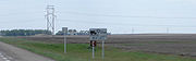
, and Grasswood Road on the west is at a small commercial area. Between Grasswood and Saskatoon the AADT increases to over 8,000 vpd, and the remainder of the route is within the jurisdiction of the SHS North Central Transportation Planning Committee. The Saskatoon Plain section of the moist mixed grassland of dark brown soils is suitable for cereal grains, feed grains and forage crops.
Corman Park No. 344
Saskatchewan Highway 16
Highway 16 is a provincial paved highway in the Canadian province of Saskatchewan. It is the Saskatchewan section of the Yellowhead Highway, and also the Trans-Canada Highway Yellowhead section. The main purpose of this highway is to connect Saskatchewan with Canadian cities such as Edmonton and...
turn off encompasses 22.9 kilometres (14.2 mi) and entails going around Saskatoon on Circle Drive.
Numerous attractions in Saskatoon
Saskatoon
Saskatoon is a city in central Saskatchewan, Canada, on the South Saskatchewan River. Residents of the city of Saskatoon are called Saskatonians. The city is surrounded by the Rural Municipality of Corman Park No. 344....
, the largest city of Saskatchewan
Saskatchewan
Saskatchewan is a prairie province in Canada, which has an area of . Saskatchewan is bordered on the west by Alberta, on the north by the Northwest Territories, on the east by Manitoba, and on the south by the U.S. states of Montana and North Dakota....
, include the Forestry Farm park and zoo, Mendel Art Gallery, and the Wanuskewin National Heritage Park. The cloverleaf interchange
Cloverleaf interchange
A cloverleaf interchange is a two-level interchange in which left turns, reverse direction in left-driving regions, are handled by ramp roads...
at Circle Drive in Saskatoon
Saskatoon
Saskatoon is a city in central Saskatchewan, Canada, on the South Saskatchewan River. Residents of the city of Saskatoon are called Saskatonians. The city is surrounded by the Rural Municipality of Corman Park No. 344....
was one of the first two SK interchanges which opened in 1967. ]] "Future site of the Idylwyld Drive and Circle Drive South interchange. This project is funded by the Federal Asia-Pacific Gateway and corridor initiative program and the Province of Saskatchewan." is the quotation on a sign erected at the future site of the next Circle Drive interchange. After crossing the South Saskatchewan River
South Saskatchewan River
The South Saskatchewan River is a major river in Canada that flows through the provinces of Alberta and Saskatchewan....
on the Senator Sid Buckwold Bridge (freeway bridge) are the end points at Idylwyld Drive North of both Hwy 14
Saskatchewan Highway 14
Highway 14 is a highway in the Canadian province of Saskatchewan. It runs from the intersection of Idylwyld Drive and 22nd Street in downtown Saskatoon, westward to the Albertan border where it becomes Highway 13. It is approximately 261 km long.Prior to the 1970's, Highway 14 ran the width...
and Hwy 7
Saskatchewan Highway 7
Saskatchewan Highway 7 is a major paved undivided provincial highway in the Canadian province of Saskatchewan, running from the Alberta border to Saskatoon...
along 22nd Street. At 23 Street East, is the end point of Hwy 5
Saskatchewan Highway 5
This article focuses on the current designated Saskatchewan Highway 5, for Provincial Highway 5, Evergreen route portion, north west of Saskatoon see Saskatchewan Highway 16....
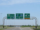
also at the Idylwyld Drive North, LRT concurrency. The 2.8 kilometres (1.7 mi) concurrency with the Yellowhead Highway
Saskatchewan Highway 16
Highway 16 is a provincial paved highway in the Canadian province of Saskatchewan. It is the Saskatchewan section of the Yellowhead Highway, and also the Trans-Canada Highway Yellowhead section. The main purpose of this highway is to connect Saskatchewan with Canadian cities such as Edmonton and...
begins at the intersection with Circle Drive
Circle Drive
Circle Drive is a major road constructed as a ring road in Saskatoon, Saskatchewan, Canada. The northeastern portion of the road is part of the Yellowhead Highway.-History:...
in the north industrial. The end of this concurrency marks the beginning of the next 3 kilometres (1.9 mi) concurrency with Hwy 12
Saskatchewan Highway 12
Highway 12 is a major highway in the Canadian province of Saskatchewan. It begins in Saskatoon at the intersection of Idylwyld Drive and 22nd Street, initially running north on Idylwyld concurrently with Highway 11. Just outside Saskatoon's northern city limits, Highway 11 branches off and Highway...
, before the LRT branches off from due north to a north-east direction of travel.
At the intersection of Hwy 784
Saskatchewan Highway 784
Highway 784 is a highway in the Canadian province of Saskatchewan. It runs from Highway 4 to Highway 41 near Aberdeen. Highway 784 is about 124 km long.Highway 784 also passes near Struan, Dalmeny, Warman, and Clarkboro...
is the town of Warman with over 4,700 residents and the AADT is about 10,000 vpd. Turning west on Hwy 784
Saskatchewan Highway 784
Highway 784 is a highway in the Canadian province of Saskatchewan. It runs from Highway 4 to Highway 41 near Aberdeen. Highway 784 is about 124 km long.Highway 784 also passes near Struan, Dalmeny, Warman, and Clarkboro...
is the Clarkboro ferry route across the South Saskatchewan River
South Saskatchewan River
The South Saskatchewan River is a major river in Canada that flows through the provinces of Alberta and Saskatchewan....
.

Osler, Saskatchewan
-External links:**...
has 926 residents and is located at the intersection with Hwy 393. The AADT on the stretch of highway between Osler and Warman declines to about 7,700 vpd. A Vintage Car on a Pole is a large roadside attraction which can be seen at Osler. Another 1.6 kilometre (0.994196378639691 mi) of travel along the LRT is the intersection with Hwy 394
Saskatchewan Highway 394
Highway 394 is a highway in the Canadian province of Saskatchewan. It starts near an intersection between Highway 16 and Haight Road/Zimmerman Road/Range Road 3044 near Saskatoon, and goes eastward to Highway 316 north of Clavet. Highway 394 does not pass through any communities, and its signage...
at the north end of Osler.
Rosthern No. 403
The town of HagueHague, Saskatchewan
-Location:-External links:*...
with approximately 700 residents, is 1.1 kilometre (0.683510010314787 mi) south of the intersection with Hwy 785
Saskatchewan Highway 785
Highway 785 is a highway in the Canadian province of Saskatchewan. It runs from Highway 12 to Highway 41 near Aberdeen. Highway 785 is about 53 km long.Highway 785 also passes near Hague. It connects with Highways 11 and 784....
. The intersection Hwy 312
Saskatchewan Highway 312
Highway 312 is a highway in the Canadian province of Saskatchewan. It runs from Highway 12 to Highway 2 near Wakaw. Highway 312 is about 78 km long....
is north of Hague
Hague, Saskatchewan
-Location:-External links:*...
by 17.6 kilometres (10.9 mi) and Rosthern
Rosthern, Saskatchewan
Rosthern is a town at the juncture of Highway 11 and Highway 312 in the central area of Saskatchewan, Canada. It is located roughly halfway between the cities of Prince Albert, Saskatchewan and Saskatoon, Saskatchewan.-History:...
is nestled just south of this intersection. Traffic has again declined with the greater distance from Saskatoon and Rosthern, with an average of 5,000 vpd between Warman and Hague, and about 4,500 vpd between Hague and Rosthern. Rosthern, a town of over 1300 people is located in the "valley of the converging branches of the North and South Saskatchewan Rivers." The South Saskatchewan and North Saskatchewan River provide two important fish habitats for the province of Saskatchewan. There are 32 species of fish in the South Saskatchewan, and 25 species in the North Saskatchewan.
is located to the east of town at the tourism office and is visible from the LRT. The Station Arts center has converted the historic CN Station into an art gallery and summer theater center and is located at Rosthern
Rosthern, Saskatchewan
Rosthern is a town at the juncture of Highway 11 and Highway 312 in the central area of Saskatchewan, Canada. It is located roughly halfway between the cities of Prince Albert, Saskatchewan and Saskatoon, Saskatchewan.-History:...
. This section of the LRT travels through the Waldheim Plain of the Aspen parkland prairie ecoregion which features fescue grasslands dotted with Aspen tree bluffs. Black loamy soil types are excellent for specialty crops as well as grain and cereals which makes agriculture the predominant economic industry. Seager Wheeler's Maple Grove Farm
Seager Wheeler's Maple Grove Farm
Seager Wheeler's Maple Grove Farm is a National Historic Site of Canada. Seager Wheeler's Maple Grove Farm was a farm owned and operated by agronomist Seager Wheeler "Wheat King of the prairies or "The Wheat Wizard of Rosthern who developed dry land farming techniques as well as fruit and...
, a National Historic Site, is located 7 kilometres (4.3 mi) east of Rosthern by taking Hwy 312
Saskatchewan Highway 312
Highway 312 is a highway in the Canadian province of Saskatchewan. It runs from Highway 12 to Highway 2 near Wakaw. Highway 312 is about 78 km long....
from the LRT. Seager Wheeler
Seager Wheeler
Seager Wheeler, MBE an agronomist by profession, was designated as a person of national historic significance in 1988 by the Canadian federal government and inducted into the Saskatchewan Agricultural Hall of Fame. Wheeler produced viable economic wheat and fruit strains for a short prairie...
(1868–1961) was a famous farmer developing hardy wheat varieties for the Saskatchewan short growing season.
Saskatchewan Highway 312
Highway 312 is a highway in the Canadian province of Saskatchewan. It runs from Highway 12 to Highway 2 near Wakaw. Highway 312 is about 78 km long....
provides access to the Batoche National Historic Site which features the Caron house, St. Antoine de Padoue church and rectory. Batoche is where Louis Riel fought his final battles in the North-West Rebellion
North-West Rebellion
The North-West Rebellion of 1885 was a brief and unsuccessful uprising by the Métis people of the District of Saskatchewan under Louis Riel against the Dominion of Canada...
of 1885. The Métis adopted a river lot system for settlement near Batoche along the South Saskatchewan River. The coming of the surveyor marking the plains into square quarter sections disrupted the established way of life. The Métis were offered scrip between 1886 and 1902 as compensation for their loss of land. Scrip land entitlement comprised 240 acre (0.9712464 km²). The available lands were not along the original river valley, or near the original settlement, so many Métis sold their scrip for money. Fish Creek near Batoche was originally named Tourond's Coulee, Northwest Territories (NWT)
Territorial evolution of Canada
The federation of Canada was created in 1867 when three colonies of British North America were united. One of these colonies split into two new provinces, three other colonies joined later...
. The Battle of Fish Creek
Battle of Fish Creek
The Battle of Fish Creek , fought April 24, 1885 at Fish Creek, Saskatchewan, was a major Métis victory over the Dominion forces attempting to quell Louis Riel's North-West Rebellion...
memorial is near Batoche, and St. Laurent de Grandin features the St. Laurent Shrine. The intersection of Hwy 212
Saskatchewan Highway 212
Highway 212 is a highway in the Canadian province of Saskatchewan. It runs from Highway 11/Highway 783 near Duck Lake to the Fort Carlton Provincial Historic Park. Highway 212 is about 33 km long....
is north of Hague
Hague, Saskatchewan
-Location:-External links:*...
by 18.1 kilometres (11.2 mi).
Duck Lake No. 463

Saskatchewan Highway 312
Highway 312 is a highway in the Canadian province of Saskatchewan. It runs from Highway 12 to Highway 2 near Wakaw. Highway 312 is about 78 km long....
intersection and Fort Carlton Provincial Historic Park is west of the LRT on Hwy 212
Saskatchewan Highway 212
Highway 212 is a highway in the Canadian province of Saskatchewan. It runs from Highway 11/Highway 783 near Duck Lake to the Fort Carlton Provincial Historic Park. Highway 212 is about 33 km long....
. This historic fur trade center was also an integral part of the North West Resistance. Duck Lake along route 11 also re-tells the story of the North-West Rebellion
North-West Rebellion
The North-West Rebellion of 1885 was a brief and unsuccessful uprising by the Métis people of the District of Saskatchewan under Louis Riel against the Dominion of Canada...
in murals on town buildings. Duck Lake Regional Interpretive Center relates the history of first nations, Métis and an immigrant pioneer Society to the area. As well, Glen Scrimshaw Art Gallery provides a showing of local artist Glen Scrimshaw. After Duck Lake the average vpd again decelines to just aboe 3,000 AADT. Traveling 26.9 kilometres (16.7 mi) along the LRT is MacDowall which is west of the LRT. Noah's Ark Family Fun Park is 5.5 kilometres (3.4 mi) north of MacDowall and provides a petting zoo and 18-hole miniature golf course. Nisbet Plain ecoregion, a part of the Boreal transition of the Boreal Plain is evident as the landscape changes to a mix of agricultural activities and forested areas. The black and dark gray soils are very fertile for a wide variety of crops. Along with aspen, white spruce, tamarack and jack pine are evident. Deer, moose, elk along with the occasional black bear can be seen along the route in this area.
Prince Albert No. 461
Saskatchewan Highway 2
Highway 2 is a provincial highway in the Canadian province of Saskatchewan. It is the longest Saskatchewan Highway, at 809 km . The highway is partially divided and undivided. However, only about near Moose Jaw, near Chamberlain, and near Prince Albert are divided highway...
where the approximate AADT increases near the city of Prince Albert to 6,000 vpd. The final stretches of the LRT is in the boreal Nisbet Forest. Trails through the forest are enjoyed by snowmobilers, cross-country skiers, horseback riders, hikers, and campers
History

Chamberlain and Aylesbury were first linked via a highway in 1929, before this date transportation between the two was by a variety of trails. The summer of 1929 also started another road leaving the Qu'Appelle River
Qu'Appelle River
The Qu'Appelle River is a Canadian river that flows 430 km east from Lake Diefenbaker in southwestern Saskatchewan to join the Assiniboine River in Manitoba, just south of Lake of the Prairies, near the village of St. Lazare....
valley east. Construction required building up low spots with elevating graders and dump wagons operated by horses. The elevating grader was to till unbroken soil and turn it towards a conveyor which lifted the dirt into the dump wagons. This process used 8 horses pulling in the front, and another eight at the rear pushing. The fresno crew constructed the level areas. Ditches were constructed on a 7% grade and filled with field rock to help prevent erosion. One of the main problems constructing the highway was the heavy field stone knolls. This highway served until 1949 and was finally upgraded and extended to Regina.
"The upland collection area for the underground streams comes together on top of the valley near Chamberlain. The surveyors for the construction of the No.11 highway (LRT) had to curve the right-of-way to avoid this area. Another interesting diversion that the highway surveyors had to make, at the insistence of local residents, was to go around a large stone that had a metal marker spike in it, likely set up and recorded by early explorers. This site is now marked on the LRT with a large silhouette buffalo statue made by Don Wilkins."
A large white house erected in 1904 by Wells family north of Davidson and can be seen from the LRT. The Wells family came north from Chicago and started The Wells Land & Cattle Co. becoming land agents for settlers from the agents. The Wells Land & Cattle Co. purchased land around Davidson, Arm River and Qu'Appelle River for homestead settlement. In the mid 1940's tractors replaced horses in the field, and motorized vehicles replaced horses on the road. The evolution of highways began with dirt trails which were upgraded to gravel highways which were graded finally coming to modern all weather paved roads. 1971, the Department of Highways was moved from Hawarden to Kenaston closer to the main Highway, which was Hwy 11. Hanley erected in 2000, a stone monument honoring its historic Opera House. The 1924 Hanley Opera House was a center of cultural activity in the area. The Opera House featured Mary Pickford, Harry Lauder, Boris Karloff and the Chatauqua performers to name a few between its inception and 1967 when the new Centennial Hall was used for performances. The original Opera House was demolished in the 1980s as it was unsafe.
Roads were provided and maintained through a committee formed in 1907 by Local Improvement District 15.B.3 around Hanley. The early challenges were the hilly area and creek to the east. Early prairie roads were trails which became so rutted that they could barely be crossed over. To make roads out of these trails horse drawn blade graders were used to level out hummocks and fill badger holes. Horse drawn slush scrapers filled in sloughs. More advanced fresno scrapers replaced the slush scrapers as they could make longer and wider swaths across the sloughs. By ploughing the prairie soil at the road allowance, and then using road graders to pull in the dirt roads could be made wide enough for the first cars of the area. The rural municipality
Rural municipality
A rural municipality, often abbreviated RM, is a form of municipality in the Canadian provinces of Manitoba and Saskatchewan, perhaps best comparable to counties or townships in the western United States...
of Rosedale No. 283
Rosedale No. 283, Saskatchewan
Rosedale No. 283, Saskatchewan is a rural municipality in central Saskatchewan, Canada along Highway 11 between Saskatoon and Regina. The two Local Improvement Districts of LID 15 B 3 and LID 15 C 3 combined together to form Rural Municipality of Rosedale No. 283, Saskatchewan...
was incorporated December 13, 1909.
Winter trails in the horse and buggy days would have two tracks across the prairie several feet higher than the prairie sod due to the snow built up on them. Summer raised roads were built up by using two horse scrapers digging an area alongside the highway, then using the loose dirt to widen the highway. Sixteen and twenty four horses were often needed to pull the graders, and several drivers were required. Any work done by a farmer would reduce his payment in taxes.
The 1926 highway map of Saskatchewan marks the route of Provincial Highway 11 following along the CNR line using township and range roads, so travel is in lines straight north, changing direction to west travel at 90 degree angles from Regina through to Saskatoon. Only Provincial Highway 12 is marked in the same fashion between Saskatoon and Prince Albert on the 1926 highway map of Saskatchewan, which has formed the base of the northern section of the LRT. The current Saskatchewan Highway 12 travels between Saskatoon
Saskatoon
Saskatoon is a city in central Saskatchewan, Canada, on the South Saskatchewan River. Residents of the city of Saskatoon are called Saskatonians. The city is surrounded by the Rural Municipality of Corman Park No. 344....
and Shell Lake
Shell Lake, Saskatchewan
Shell Lake is a village located in the Rural Municipality of Spiritwood No. 496, Saskatchewan. It was formerly part of the Rural Municipality of Shell Lake No. 495, Saskatchewan before it was absorbed in the RM of Spiritwood. The Shell Lake murders took place on a nearby farm....
. Federal funding became available for Provincial Highway projects following the completion of the Trans Canada Highway
Saskatchewan Highway 1
Highway 1 is the Saskatchewan section of the Trans-Canada Highway mainland route. The total distance of the Trans-Canada Highway in Saskatchewan is . The highway traverses Saskatchewan from the western border with Alberta, from Highway 1, to Manitoba where it continues as Highway 1, PTH 1. The...
. The Trans Canada Highway was the first highway receiving national expenditure across all provinces. Highway 11 was considered an important transportation route from a national perspective, and therefore received funding under the National Highways Project. On June 20, 2001 the entire length of Hwy 11 was re-named the LRT at a ceremony which took place at the Duck Lake Regional Interpretive Centre. The LRT connects major sites of the 1885 North-West Rebellion
North-West Rebellion
The North-West Rebellion of 1885 was a brief and unsuccessful uprising by the Métis people of the District of Saskatchewan under Louis Riel against the Dominion of Canada...
. Mid-Lakes Community coalition, Saskatchewan Highway 11 communities and municipalities, the Saskatchewan Métis Nation, and the Saskatchewan History and Folk Lore Society approached Highways and Transportation Minister Pat Atkinson about the designation. Saskatchewan Highway 11 is the actual course followed by the RCMP and Louis Riel to arrive at Regina
Regina, Saskatchewan
Regina is the capital city of the Canadian province of Saskatchewan. The city is the second-largest in the province and a cultural and commercial centre for southern Saskatchewan. It is governed by Regina City Council. Regina is the cathedral city of the Roman Catholic and Romanian Orthodox...
for the trial of Louis Riel
Trial of Louis Riel
The Trial of Louis Riel is arguably the most famous trial in the history of Canada. In 1885, Louis Riel had been a leader of a resistance movement by the Métis and First Nations people of western Canada against the Canadian government in what is now the modern province of Saskatchewan...
. The LRT sign features a red river cart featured in yellow on a blue background.
Maintenance
Dual carriageway
A dual carriageway is a class of highway with two carriageways for traffic travelling in opposite directions separated by a central reservation...
between Prince Albert and Saskatoon. Amongst the upcoming projects which have received approval are:
"paving of two sections of Highway 11 including 12.1 kilometres (7.5 mi) of highway north of Osler to south of Hague, and 11.3 kilometres (7 mi) of highway north of Macdowall to the Junction of Highway 2." The 12 kilometres (7.5 mi) segment between Warman
Warman, Saskatchewan
-History:The town of Warman was born when the Canadian National Railway running from Humboldt to North Battleford intersected with the Canadian Pacific Railway running from Regina to Prince Albert. This took place in the fall of 1904....
and Osler
Osler, Saskatchewan
-External links:**...
should be completed end of October, 2008. "The Saskatoon bedroom communities of Warman and Osler are dynamic and growing, with traffic counts in the range of 7,500 vehicles per day on this section of Highway 11"
In 2002 a resurfacing project of 8.4 kilometres (5.2 mi) of Highway 11 was undertaken on a section 2.3 kilometres (1.4 mi) north of Macdowall. The approval for the $680,000 tender was awarded by Highways and Transportation Minister Mark Wartman.
Earlier maintenance included $897,000 for paving of 12.3 kilometres (7.6 mi) near Hanley
Hanley, Saskatchewan
Hanley is a town in south-central Saskatchewan, Canada. It is located 65 km south of Saskatoon. Population 510. It was named after Hanley in Staffordshire, England by early founders. It is also the seat for the rural municipality of Rosedale....
for a project cost of $897,000. Highways and Transportation Minister Judy Bradley awarded contracts for work in 1999.
The first asphalt rubber project occurred July 2007 on Saskatchewan Highway 11. Close to 8 kilometres (5 mi) near Davidson
Davidson, Saskatchewan
Davidson is a town in south central Saskatchewan, Canada. It is located 104 km southeast of Saskatoon beside provincial highway 11. It is located almost exactly halfway between Saskatoon and Regina and was a popular stopping-off point for travellers before Hwy...
show the rubberized asphalt road surface on the right lane at a cost of $126,800. The next rubberized asphalt project in the summer of 2007, was 4 kilometres (2.5 mi) through the town of Chamberlain
Chamberlain, Saskatchewan
Chamberlain is a village in south-central Saskatchewan, Canada. Health Department statistics for 2003 put its population at 116 and the new census of 2006 cites 108 for the new population....
. The $1.4 million spent here included the rubberized asphalt pavement surface, curbs and catch basins.
"The mining, exploration, and oil and gas sectors across northern Saskatchewan funnel thousands of heavy trucks through Prince Albert on a daily basis. Improving this vital gateway will not only make travel safer and far more efficient for commercial traffic, but it will enhance the drive for thousand of visitors who head north each year to take advantage of our northern lakes"
Future plans
Pinkie RoadPinkie Road
Pinkie Road is a proposed 4 lane twinned highway connector road linking two National Highway System routes as a part of the Asia-Pacific Gateway and Corridor Initiative . Highway 1 and Highway 11 will be linked by this new route, west of Regina, Saskatchewan. The City of Regina, Sherwood No...
is a proposed 4 lane twinned
Dual carriageway
A dual carriageway is a class of highway with two carriageways for traffic travelling in opposite directions separated by a central reservation...
highway connector road linking two National Highway System routes as a part of the Asia-Pacific Gateway and Corridor Initiative (APGCI). Hwy 1
Saskatchewan Highway 1
Highway 1 is the Saskatchewan section of the Trans-Canada Highway mainland route. The total distance of the Trans-Canada Highway in Saskatchewan is . The highway traverses Saskatchewan from the western border with Alberta, from Highway 1, to Manitoba where it continues as Highway 1, PTH 1. The...
, the Trans Canada Highway and Hwy 11 will be linked by this new route west of Regina.
Major intersections from south to north
External links
- : Louis Riel Trail official website
- Google Maps: Highway 11 through Regina, Saskatchewan, Prince Albert
- Unofficial Saskatchewan Highways website
- Batoche Photographs
- Saskatchewan Road Map Travel Guide:#11 Highway 11
- Mid-Lakes Community Coalition Home Page - Saskatchewan
- Saskatchewan Highway 11 pictures
- Welcome to the Duck Lake Regional Interpretive Centre!
- Three Rivers Trail Association