

San Francisco congestion pricing
Encyclopedia
Traffic congestion
Traffic congestion is a condition on road networks that occurs as use increases, and is characterized by slower speeds, longer trip times, and increased vehicular queueing. The most common example is the physical use of roads by vehicles. When traffic demand is great enough that the interaction...
user fee for vehicles traveling into the most congested areas of the city of San Francisco at certain periods of peak demand. The charge would be combined with other traffic reduction projects. The proposed congestion pricing
Congestion pricing
Congestion pricing or congestion charges is a system of surcharging users of a transport network in periods of peak demand to reduce traffic congestion. Examples include some toll-like road pricing fees, and higher peak charges for utilities, public transport and slots in canals and airports...
charge is part of a mobility and pricing study being carried out by the San Francisco County Transportation Authority
San Francisco County Transportation Authority
The San Francisco County Transportation Authority is a state chartered sub-regional transportation planning and programming agency for San Francisco County. SFCTA is a separate legal entity, with its own administrative structure, policies, staff, budget, and with separate borrowing capacity...
(SFCTA) to reduce congestion at and near central locations and to reduce its associated environmental impacts, including cutting greenhouse gas emissions. The funds raised through the charge will be used for public transit improvement projects, and for pedestrian and bike infrastructure and enhancements.
This initiative is supported by the U.S. Department of Transportation. To go into effect it will need approval at the local and state legislative levels. As the New York congestion pricing
New York congestion pricing
New York congestion pricing was a proposed traffic congestion fee for vehicles traveling into or within the Manhattan central business district of New York City...
scheme stalled in 2008, if approved, San Francisco would be the first city in the United States
United States
The United States of America is a federal constitutional republic comprising fifty states and a federal district...
to implement a congestion charge, similar to those existing in Singapore, London
London congestion charge
The London congestion charge is a fee charged for some categories of motor vehicle to travel at certain times within the Congestion Charge Zone , a traffic area in London. The charge aims to reduce congestion, and raise investment funds for London's transport system...
, Stockholm
Stockholm congestion tax
The Stockholm congestion tax , also found referred to as the Stockholm congestion charge, is a congestion pricing system implemented as a tax levied on most vehicles entering and exiting central Stockholm, Sweden...
, and Milan
Ecopass
The Ecopass program is a traffic pollution charge implemented in Milan, Italy, as an urban toll for some motorists traveling within a designated traffic restricted zone or ZTL , corresponding to the central Cerchia dei Bastioni area and encircling around . The Ecopass was implemented as a one-year...
.
The initial charging scenarios considered were presented in public meetings held in December 2008, and the final draft proposal was discussed by the San Francisco Board of Supervisors
San Francisco Board of Supervisors
The San Francisco Board of Supervisors is the legislative body within the government of the City and County of San Francisco, California, United States.-Government and politics:...
(SFBS) in December 2010. This proposal calls for implementing a six-month to one-year trial by 2015. The SFBS decided to exclude the Southern Gateway scenario and authorized SFCTA to seek federal financing to continue further planning for the two Northeast Cordon options.
Background
The San Francisco County Transportation AuthoritySan Francisco County Transportation Authority
The San Francisco County Transportation Authority is a state chartered sub-regional transportation planning and programming agency for San Francisco County. SFCTA is a separate legal entity, with its own administrative structure, policies, staff, budget, and with separate borrowing capacity...
(SFCTA) began exploring the possibility of introducing congestion pricing
Congestion pricing
Congestion pricing or congestion charges is a system of surcharging users of a transport network in periods of peak demand to reduce traffic congestion. Examples include some toll-like road pricing fees, and higher peak charges for utilities, public transport and slots in canals and airports...
in 2004, as part of the Countywide Transportation Plan and motivated by the initial success of the London congestion charge
London congestion charge
The London congestion charge is a fee charged for some categories of motor vehicle to travel at certain times within the Congestion Charge Zone , a traffic area in London. The charge aims to reduce congestion, and raise investment funds for London's transport system...
. Since then, several initiatives and plans have been studied. The Bay Area Toll Authority
Bay Area Toll Authority
The Bay Area Toll Authority was created by the California State Legislature in 1997 to administer the base $1 auto toll on the San Francisco Bay Area's seven state-owned toll bridges. On January 1, 1998, the Metropolitan Transportation Commission — the transportation planning, financing and...
implemented a congestion pricing
Congestion pricing
Congestion pricing or congestion charges is a system of surcharging users of a transport network in periods of peak demand to reduce traffic congestion. Examples include some toll-like road pricing fees, and higher peak charges for utilities, public transport and slots in canals and airports...
tolls
Toll bridge
A toll bridge is a bridge over which traffic may pass upon payment of a toll, or fee.- History :The practice of collecting tolls on bridges probably harks back to the days of ferry crossings where people paid a fee to be ferried across stretches of water. As boats became impractical to carry large...
at the San Francisco-Oakland Bay Bridge
San Francisco-Oakland Bay Bridge
The San Francisco – Oakland Bay Bridge is a pair of bridges spanning San Francisco Bay of California, in the United States. Forming part of Interstate 80 and of the direct road route between San Francisco and Oakland, it carries approximately 270,000 vehicles per day on its two decks...
in July 2010.
Doyle Drive congestion pricing
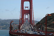
San Francisco's first evaluation of a congestion pricing project was the proposal to implement such scheme at the Doyle Drive, a major approach to the Golden Gate BridgeGolden Gate Bridge
The Golden Gate Bridge is a suspension bridge spanning the Golden Gate, the opening of the San Francisco Bay into the Pacific Ocean. As part of both U.S. Route 101 and California State Route 1, the structure links the city of San Francisco, on the northern tip of the San Francisco Peninsula, to...
. In August 2007 the United States Department of Transportation
United States Department of Transportation
The United States Department of Transportation is a federal Cabinet department of the United States government concerned with transportation. It was established by an act of Congress on October 15, 1966, and began operation on April 1, 1967...
selected five metropolitan areas to initiate congestion pricing demonstration projects under the Urban Partnerships Congestion Initiative, for billion of federal funding, and the San Francisco Bay Area
San Francisco Bay Area
The San Francisco Bay Area, commonly known as the Bay Area, is a populated region that surrounds the San Francisco and San Pablo estuaries in Northern California. The region encompasses metropolitan areas of San Francisco, Oakland, and San Jose, along with smaller urban and rural areas...
was awarded with a $158 million grant for this purpose. Later the city later withdrew its proposal to implement congestion pricing at the Doyle Drive as part of the Urban Partnerships Congestion Initiative, and instead it will be implementing a USD 47 million rehabilitation project to relief traffic congestion near the Golden Gate Bridge.
SFpark variable pricing initiative
Also as part of the USDoT's Urban Partnerships Congestion Initiative, San Francisco will receive USD $27 million in federal funds, approved in October 2008, to implement in 2010 an innovative parking plan called SFpark that will use rush hour pricing based on advanced technology through variable pricingVariable pricing
Most firms use a fixed price policy. That is, they examine the situation, determine an appropriate price, and leave the price fixed at that amount until the situation changes, at which point they go through the process again...
according to actual demand. This new system will allow drivers to find available parking spots by checking variable message signs, phoning a 511 service, or via the internet. Users will also be able to pay with their credit, debit or Smart Trip cards, or using their cell phones.
Mobility, Access and Pricing Study
In 2006, San Francisco authorities began a feasibility study to evaluate how congestion pricing fits to resolve the city's problems. This study was financed with a million grant from the Federal Highway AdministrationFederal Highway Administration
The Federal Highway Administration is a division of the United States Department of Transportation that specializes in highway transportation. The agency's major activities are grouped into two "programs," the Federal-aid Highway Program and the Federal Lands Highway Program...
's Value Pricing Program, with matching funds from local sources. The study is called the Mobility, Access and Pricing Study (MAPS). The San Francisco Mayor, Gavin Newsom
Gavin Newsom
Gavin Christopher Newsom is an American politician who is the 49th and current Lieutenant Governor of California. Previously, he was the 42nd Mayor of San Francisco, and was elected in 2003 to succeed Willie Brown, becoming San Francisco's youngest mayor in 100 years. Newsom was re-elected in 2007...
, has endorsed the concept, and he said in early 2008 that "a sensible congestion pricing plan is the single greatest step we can take to protect our environment and improve our quality of life."
The first results from the study showed that the pricing scheme is feasible from an economical, administrative and technical point of view. From the beginning, the mobility study was designed to have input from San Francisco's residents, businesses, travelers, and other stakeholders during the entire process, and the study team has been guided by several advisory committees at different stages of the development of the plan. As public participation is considered crucial, several public workshops are planned to share information and gather input from the public. The results of the two-year study were first presented to SFCTA Board of Supervisors on November 2008, and then the various pricing scenarios considered in the MAPS and other plan details were presented in two public meetings and another one online held in December 2008.
The next step is to present the revised plan to the Board of Supervisors by February 2009 in order to decide if the 11 member Board recommend to continue with the congestion pricing plan. The plan will need approval at the local and state legislative levels, and possibly some non-objection at the federal level. Still has not been decided if San Francisco residents will vote to approved the plan's implementation. Final study results are expected for late 2009, and SFCTA staff estimates that if the proposal moves forward in 2009, implementation will still take several years, as at least two to three years would be spent doing the environmental studies required by law.
Bay Bridge congestion tolls
In July 2010 congestion pricingCongestion pricing
Congestion pricing or congestion charges is a system of surcharging users of a transport network in periods of peak demand to reduce traffic congestion. Examples include some toll-like road pricing fees, and higher peak charges for utilities, public transport and slots in canals and airports...
tolls
Toll bridge
A toll bridge is a bridge over which traffic may pass upon payment of a toll, or fee.- History :The practice of collecting tolls on bridges probably harks back to the days of ferry crossings where people paid a fee to be ferried across stretches of water. As boats became impractical to carry large...
were implemented at the San Francisco-Oakland Bay Bridge
San Francisco-Oakland Bay Bridge
The San Francisco – Oakland Bay Bridge is a pair of bridges spanning San Francisco Bay of California, in the United States. Forming part of Interstate 80 and of the direct road route between San Francisco and Oakland, it carries approximately 270,000 vehicles per day on its two decks...
. The Bay Bridge congestion pricing scheme charges a toll from 5 a.m. to 10 a.m. and 3 p.m. to 7 p.m., Monday through Friday. During weekends cars pay . Carpools before the implementation were exempted but now they pay . The toll remained at the previous toll of at all other times on weekdays.
The Bay Area Toll Authority
Bay Area Toll Authority
The Bay Area Toll Authority was created by the California State Legislature in 1997 to administer the base $1 auto toll on the San Francisco Bay Area's seven state-owned toll bridges. On January 1, 1998, the Metropolitan Transportation Commission — the transportation planning, financing and...
reported that by October 2010 fewer users are driving during the peak hours and more vehicles are crossing the Bay Bridge before and after the 5-10 a.m. period in which the congestion toll goes into effect. According to a study contracted to the University of California, Berkeley
University of California, Berkeley
The University of California, Berkeley , is a teaching and research university established in 1868 and located in Berkeley, California, USA...
, commute delays in the first six months have dropped by an average of 15 percent compared with 2009. When the congestion tolls were proposed, the agency expected the scheme to produce a 20 to 30 percent drop in commute traffic. The study also found a decrease in the number of carpools since the first fee for carpools was introduced, with a reduction of 10,800 carpoolers when figures from September 2009 and 2010 are compared. The UC Berkeley study also provides evidence that some people are using BART to get to work in San Francisco instead of paying the higher tolls on the Bay Bridge during rush hour.
Description of the 2008 proposal
Despite the fact the MAPS is still in a stage of further development, several details are still being refined considering the public feedback. The following section presents a summary of the plan as presented to the Board of Supervisors and discussed in the December 2008 public meetings.Charging area
Several scenarios are being considered regarding the best location to collect the congestion tolls. The following are the main alternatives:- Charging the fee at the city's major entry points: the Bay BridgeSan Francisco-Oakland Bay BridgeThe San Francisco – Oakland Bay Bridge is a pair of bridges spanning San Francisco Bay of California, in the United States. Forming part of Interstate 80 and of the direct road route between San Francisco and Oakland, it carries approximately 270,000 vehicles per day on its two decks...
, the Golden Gate BridgeGolden Gate BridgeThe Golden Gate Bridge is a suspension bridge spanning the Golden Gate, the opening of the San Francisco Bay into the Pacific Ocean. As part of both U.S. Route 101 and California State Route 1, the structure links the city of San Francisco, on the northern tip of the San Francisco Peninsula, to...
, and the freeways to the south, Highway 101 and Interstate 280Interstate 280 (California)Interstate 280 is a 57-mile long north–south Interstate Highway in the San Francisco Bay Area of Northern California. It connects San Jose and San Francisco, running along just to the west of the cities of San Francisco Peninsula for most of its route.I-280 from its northern end at King...
; or - Changing the fee over a closed downtown zone, for those entering the Civic CenterCivic Center, San Francisco, CaliforniaThe Civic Center in San Francisco, California, is an area of a few blocks north of the intersection of Market Street and Van Ness Avenue that contains many of the city's largest government and cultural institutions. It has two large plazas and a number of buildings in classical architectural style...
, downtown and South of Market. This would be a twin triangle area bounded by Washington, Jones, Turk and Harrison streets and Van Ness AvenueVan Ness Avenue (San Francisco)Van Ness Avenue is a north-south thoroughfare in San Francisco, California, running from Market St north to the Bay. Originally named Marlette Street, the street was renamed Van Ness Avenue in honor of the city's seventh mayor, James Van Ness. Van Ness Avenue begins at Market Street near the Civic...
.
However, there are concerns among the planner participating in the study that charging at the city's gateways would reduce traffic from outside San Francisco and encouraging more driving among city residents, while the downtown zone might be too small, thus potentially causing problems in adjacent neighborhoods by drivers bypassing the downtown charge zone. So two other scenarios were considered:
- A double-ring, charging both at the major city entrances and at the downtown zone, but with different prices, at the gateways and at downtown.
- A northeast cordon over a larger toll zone that would include downtown and Civic Center, and also Fisherman's WharfFisherman's Wharf, San Francisco, CaliforniaFisherman's Wharf is a neighborhood and popular tourist attraction in San Francisco, California. It roughly encompasses the northern waterfront area of San Francisco from Ghirardelli Square or Van Ness Avenue east to Pier 35 or Kearny Street...
, North BeachNorth Beach, San Francisco, CaliforniaNorth Beach is a neighborhood in the northeast of San Francisco adjacent to Chinatown, Fisherman's Wharf and Russian Hill. The neighborhood is San Francisco's Little Italy, and has historically been home to a large Italian American population. It still holds many Italian restaurants today, though...
and other neighborhoods. The boundaries would include the waterfront on the north and east, Divisadero and CastroThe Castro, San Francisco, CaliforniaThe Castro District, commonly referenced as The Castro, is a neighborhood in Eureka Valley in San Francisco, California. The Castro is one of America's first and best-known gay neighborhoods, and it is currently its largest...
streets on the west and 18th Street on the south.
Congestion fee
The study found that the congestion fees should be between and , and concluded that a fee of is the most likely to maximize benefits and minimize impacts. Because social variables are very important, the final amount to be charged will be decided by the mayor and the SFCTA Board of Supervisors. For this reason, the final amount might be different. The congestion fee will be charged to enter, leave or pass through parts of the city on weekdays at each travel peak, between 6:00 and 9:00 a.m. and 4:00 to 7:00 p.m.,Fees will be charged using the existing FasTrak
FasTrak
FasTrak is the electronic toll collection system used in the state of California in the United States. The system is used statewide on all of the toll roads, toll bridges, and high occupancy/toll and express toll lanes along the California Freeway and Expressway System.As with other ETC systems,...
transponder
Transponder
In telecommunication, the term transponder has the following meanings:...
s used for tolling on the Bay Area
San Francisco Bay Area
The San Francisco Bay Area, commonly known as the Bay Area, is a populated region that surrounds the San Francisco and San Pablo estuaries in Northern California. The region encompasses metropolitan areas of San Francisco, Oakland, and San Jose, along with smaller urban and rural areas...
bridges, and a network of cameras. Drivers will be allowed to pay by telephone, text message, online, mail or at designated stores. Among others, the study considered to exempt driver with disabilities, low-income drivers, and residents within the toll zones. Also discounts for commercial fleets were considered. Taxi drivers will be exempted and rental cars would be charged a fleet rate. Carpool
Carpool
Carpooling , is the sharing of car journeys so that more than one person travels in a car....
ers probably would not get a discount because they already have toll-free pass through the Bay Area bridges. The study made the assumption that tolls at the Bay Area bridges will remain the same.
Financing and costs
The estimated cost to implement and operate congestion pricing in San Francisco still is unknown, because it will depend on the program design according to the final alternative selected for implementation and the specific technology used.The study established as a goal that the system has to be self-funded, meaning that revenues from the congestion pricing fees should pay for the costs of maintenance and operation, and other necessary improvements. The experiences with the London congestion charge
London congestion charge
The London congestion charge is a fee charged for some categories of motor vehicle to travel at certain times within the Congestion Charge Zone , a traffic area in London. The charge aims to reduce congestion, and raise investment funds for London's transport system...
and the Stockholm congestion tax
Stockholm congestion tax
The Stockholm congestion tax , also found referred to as the Stockholm congestion charge, is a congestion pricing system implemented as a tax levied on most vehicles entering and exiting central Stockholm, Sweden...
have demonstrated that indeed is possible to cover operating costs. The study will explore alternative sources to finance the initial start up costs, including up to recently made available by the federal government for these type of programs.
Expected results
The study estimated that the congestion charge could raise between million and million a year, funds that could be invested in transportation improvements, including increasing capacity on BART, MuniSan Francisco Municipal Railway
The San Francisco Municipal Railway is the public transit system for the city and county of San Francisco, California. In 2006, it served with an operating budget of about $700 million...
and other Bay Area transit agencies serving San Francisco. The study also found that congestion pricing could reduce peak-hour delays by 30% and reduced car-related greenhouse gases by 15%.
Description of the 2010 proposal
The San Francisco County Transportation AuthoritySan Francisco County Transportation Authority
The San Francisco County Transportation Authority is a state chartered sub-regional transportation planning and programming agency for San Francisco County. SFCTA is a separate legal entity, with its own administrative structure, policies, staff, budget, and with separate borrowing capacity...
(SFCTA) announced in November 2010 the results of the updated feasibility analysis. The final 2010 study refined the Phase 1 alternatives based on further detailed studies, the feedback received during the 2008 public audiences, and the experience of the Stockholm congestion tax
Stockholm congestion tax
The Stockholm congestion tax , also found referred to as the Stockholm congestion charge, is a congestion pricing system implemented as a tax levied on most vehicles entering and exiting central Stockholm, Sweden...
, which is considered by SFCTA a more similar case to San Francisco’s context than the London congestion charge
London congestion charge
The London congestion charge is a fee charged for some categories of motor vehicle to travel at certain times within the Congestion Charge Zone , a traffic area in London. The charge aims to reduce congestion, and raise investment funds for London's transport system...
.
The following section presents a summary of the plan presented for discussion to the San Francisco Board of Supervisors
San Francisco Board of Supervisors
The San Francisco Board of Supervisors is the legislative body within the government of the City and County of San Francisco, California, United States.-Government and politics:...
(SFBS) on December 14, 2010. The SFBS decided to exclude the Southern Gateway scenario and authorized SFCTA to seek federal funding to continue further planning for the two Northeast Cordon options and to enter into environmental review. SFCTA will submit a grant for up to $2 million in federal funding for the next phase of the study.
Charging area and congestion fee
The study proposes three alternatives:- Northeast Cordon: with a fee during the morning and evening peak commute times from 6:30 to 9:30 a.m. and 3:30 to 6:30 p.m. and charged when coming into or out of the northeast section of San Francisco; bordered by Laguna Street on the west, 18th Street on the south, and the Bay. SFCTA considers that this alternative "provides the greatest congestion reduction in the city’s most congested areas, while also delivering substantial additional benefits for transit performance, environmental quality, and sustainable growth."
- Modified Northeast Cordon (Pilot): with a fee charged only when leaving that area during the evening commute, between 3:30 and 6:30 p.m.
- Southern Gateway (Pilot): with a fee in both directions during the morning and evening peaks on the major arteries at the San Francisco/San Mateo County border, at Interstate 280Interstate 280 (California)Interstate 280 is a 57-mile long north–south Interstate Highway in the San Francisco Bay Area of Northern California. It connects San Jose and San Francisco, running along just to the west of the cities of San Francisco Peninsula for most of its route.I-280 from its northern end at King...
, Highway 101U.S. Route 101U.S. Route 101, or U.S. Highway 101, is an important north–south U.S. highway that runs through the states of California, Oregon, and Washington, on the West Coast of the United States...
, Skyline BoulevardCalifornia State Route 35State Route 35 in the U.S. state of California, generally known as Skyline Boulevard, is a two-lane road running along the western ridge of Silicon Valley in California. It runs from Highway 17 to San Francisco at State Route 1. It provides scenic views of both the Santa Cruz Mountains, the...
, Lake Merced Boulevard, San Jose Avenue, Mission StreetMission StreetMission Street is a north-south arterial thoroughfare in San Francisco, California that runs from the city's southern border to its northeast corner. The street and the Mission District through which it runs were named for the Spanish Mission Dolores, several blocks away from the modern route. Only...
, Geneva Avenue, Junipero Serra BoulevardJunipero Serra BoulevardJunipero Serra Boulevard is a major boulevard in and south of San Francisco. Within the city, it forms part of the route of State Route 1, the shortest connection between Interstate 280 and the Golden Gate Bridge. The remainder, in San Mateo County, has been bypassed or replaced by I-280, the...
and Bayshore Boulevard. A resident discount could be considered for households living with a certain distance of the San Mateo County line. According to the SFCTA report this option weights in geographic equity, as automobile travel from San Francisco’s northern and eastern approaches is already subject to bridge tolls, and in the case of the San Francisco – Oakland Bay Bridge, elevated peak-period tolls on weekdays were recently introduced. On the other hand, the land-based border with San Mateo County currently does not have any form of pricing in effect, and the PeninsulaSan Francisco PeninsulaThe San Francisco Peninsula is a peninsula in the San Francisco Bay Area that separates the San Francisco Bay from the Pacific Ocean. On its northern tip is the City and County of San Francisco. Its southern base is in Santa Clara County, including the cities of Palo Alto, Los Altos, and Mountain...
and South Bay travel markets are more dominated by automobile travel than the other regional travel corridors to and from the city.
Discount policy
Based on technical analysis of the impact of discounts on system performance and financial feasibility, the range of discount policies applied in other cities with congestion pricing programs, and extensive discussions with stakeholders and feedback from the public, the proposal recommends a limited set of discounts summarized in the following table:| Summary of Potential Discounts and Fee Categories | |
|---|---|
| Type of Driver/Group | Level of Discount |
| Mass transit vehicles | Free |
| Taxicab Taxicab A taxicab, also taxi or cab, is a type of vehicle for hire with a driver, used by a single passenger or small group of passengers, often for a non-shared ride. A taxicab conveys passengers between locations of their choice... s |
Free |
| Zone residents | 50% |
| Bridge toll-payers | |
| Low-income (Lifeline Value) | 50% |
| Disabled Disability A disability may be physical, cognitive, mental, sensory, emotional, developmental or some combination of these.Many people would rather be referred to as a person with a disability instead of handicapped... motorists |
50% |
| Daily maximum charge | One-way fee x 2 |
| Carpool Carpool Carpooling , is the sharing of car journeys so that more than one person travels in a car.... |
None |
| Low-emission vehicles | None |
| Commercial vehicles/shuttles | Fleet rate |
| Rental cars, carsharing Carsharing Car sharing or Carsharing is a model of car rental where people rent cars for short periods of time, often by the hour. They are attractive to customers who make only occasional use of a vehicle, as well as others who would like occasional access to a vehicle of a different type than they use... vehicles |
Fleet rate |
Trial period
The 2010 proposal recommends implementing a trial program with any of the two pilot options, with a duration between six-month to one-year trial in 2015. The objective of this trial is to evaluate public reaction and the effectiveness of the scheme.Expected results
The study estimated that the congestion charge could raise between million and million a year even when accounting for the 50 percent discount for low-income people and other users. The funds raised through the charge will be used for public transit improvement projects, and for pedestrian and bike infrastructure and enhancements.The feasibility study concluded that the Northeast Cordon option would reduce vehicle trips to and from the core downtown area (Focus Area) during peak periods by more than 15 percent, and an approximately 10 percent increase in peak-period transit mode share to the Focus Area. The analysis also found that the Northeast Cordon program would result in an annual social benefit of more than while the Southern Gateway’s benefits would be approximately .
Concerns and controversy
There were several negative reactions, concerns and criticisms as a result of the December 2008 public meetings and online hearing where the preliminary findings of the MAPS (Mobility, Access and Pricing Study) were discussed. One participant questioned the rationale for having to pay to drive on a public street. Others considered that congestion pricing is a regressive taxRegressive tax
A regressive tax is a tax imposed in such a manner that the tax rate decreases as the amount subject to taxation increases. "Regressive" describes a distribution effect on income or expenditure, referring to the way the rate progresses from high to low, where the average tax rate exceeds the...
imposing a greater burden on those without a good option to ride public transit and on low-income commuters. Other considered too expensive to pay USD 6.00 for a short duration trips. Zone residents with children and inflexible schedules complaint they would be unfairly affected. Another major concern is the lack of reliability and capacity of San Francisco's existing network of transit services, limiting commuters to switch to public transport once the congestion pricing is implemented.
The San Francisco Chamber of Commerce has also expressed concerns because of the burden it might put on retail sales, worsened by the ongoing recession caused by the financial and global economic crises, driving business away as people will go shop elsewhere in the region. A telephone poll, conducted by the Chamber of Commerce by late January 2009, showed that 61% of the voters opposed the congestion fee for driving downtown.
Staff working on the MAPS study have responded they are aware of the social consequences and therefore several mitigation measures have been included and are being considered, such as selecting a charge area that is big enough in order to avoid causing problems in adjacent neighborhoods; offering discounts to some drivers such as taxi cabs, low-income and disable drives; and charging half price for residents within the charge zone.
See also
- Congestion pricingCongestion pricingCongestion pricing or congestion charges is a system of surcharging users of a transport network in periods of peak demand to reduce traffic congestion. Examples include some toll-like road pricing fees, and higher peak charges for utilities, public transport and slots in canals and airports...
- London congestion chargeLondon congestion chargeThe London congestion charge is a fee charged for some categories of motor vehicle to travel at certain times within the Congestion Charge Zone , a traffic area in London. The charge aims to reduce congestion, and raise investment funds for London's transport system...
- Milan Ecopass (traffic charge)EcopassThe Ecopass program is a traffic pollution charge implemented in Milan, Italy, as an urban toll for some motorists traveling within a designated traffic restricted zone or ZTL , corresponding to the central Cerchia dei Bastioni area and encircling around . The Ecopass was implemented as a one-year...
- New York congestion pricingNew York congestion pricingNew York congestion pricing was a proposed traffic congestion fee for vehicles traveling into or within the Manhattan central business district of New York City...
- Pareto efficiencyPareto efficiencyPareto efficiency, or Pareto optimality, is a concept in economics with applications in engineering and social sciences. The term is named after Vilfredo Pareto, an Italian economist who used the concept in his studies of economic efficiency and income distribution.Given an initial allocation of...
- Pigovian taxPigovian taxA Pigovian tax is a tax levied on a market activity that generates negative externalities. The tax is intended to correct the market outcome. In the presence of negative externalities, the social cost of a market activity is not covered by the private cost of the activity...
- Road space rationingRoad space rationingRoad space rationing is a travel demand management strategy aimed to reduce the negative externalities generated by peak urban travel demand in excess of available supply or road capacity, through artificially restricting demand by rationing the scarce common good road capacity, especially...
- Singapore's Electronic Road Pricing
- Stockholm congestion taxStockholm congestion taxThe Stockholm congestion tax , also found referred to as the Stockholm congestion charge, is a congestion pricing system implemented as a tax levied on most vehicles entering and exiting central Stockholm, Sweden...
- Tragedy of the CommonsTragedy of the commonsThe tragedy of the commons is a dilemma arising from the situation in which multiple individuals, acting independently and rationally consulting their own self-interest, will ultimately deplete a shared limited resource, even when it is clear that it is not in anyone's long-term interest for this...
- Transport economicsTransport economicsTransport economics is a branch of economics that deals with the allocation of resources within the transport sector and has strong linkages with civil engineering. Transport economics differs from some other branches of economics in that the assumption of a spaceless, instantaneous economy does...
- Urban Partnership AgreementUrban Partnership AgreementThe Urban Partnership Agreement is an effort of the United States Department of Transportation and agencies in four metropolitan areas across the country which are testing out several technologies as an effort to reduce congestion in urban areas. The metro areas of Miami, Florida, Minneapolis,...
External links
- Official site of the Mobility, Access, and Pricing Study
- San Francisco Mobility, Access and Pricing Study Draft Final Report, December 2010
Video