
Salt Plains National Wildlife Refuge
Encyclopedia
The Salt Plains National Wildlife Refuge is part of the United States
system of National Wildlife Refuge
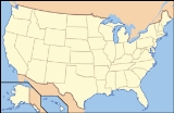
s. It is located in Alfalfa County
in northern Oklahoma
, north of Jet
(pop. 230), along Great Salt Plains Lake
, which is formed by a dam on the Salt Fork of the Arkansas River.
The refuge was established March 26, 1930 by executive order of President
Herbert Hoover
and contains 32080 acres (130 km²) of protected land as habitat to approximately 312 species of birds and 30 species of mammals. It was designated a National Natural Landmark
in June 1983.
. Bison
and other game came to the area to eat the salt and the heavy-wooded and well-watered area along the Salt Fork River was like an oasis in the surrounding grassland of the Great Plains
. Salt Plains refuge is divided into almost equal areas of non-vegetated salt flat, open water, and vegetated land. Marshes, woods, grassland, and cropland dot the refuge. Management tools used to enhance the habitat for wildlife include farming, grazing, prescribed burns, construction of ponds, and wetland draining and flooding.
The refuge was created to be a resting and breeding ground for migratory
waterfowl
especially during fall and spring. The entire refuge is designated critical habitat for the endangered Whooping Crane
, mostly seen during fall migration, but also in the spring. In addition, the refuge is home to endangered least terns, threatened snowy plovers, threatened bald eagles, peregrine falcons and more. Large populations of American White Pelicans migrate through in August/September, staying on the Great Salt Plains Reservoir. Great Salt Plains is one of the most important habitats for shorebirds in the Western hemisphere.
The Ralstin Island Rookery
(closed to the public) boasts being Oklahoma's largest Rookery. The island of 7 acres (28,328 m²) hosts more than 30,000 birds during breeding season. Over 30 species nest in the colony
, including the white-faced ibis
, great blue herons and most notably, the tricolored heron
.
concentrations high enough to grow selenite crystals. The selenite crystals found there have an hourglass-shaped sand inclusion that is not known to occur in selenite crystals found elsewhere in the world. Digging for crystals is allowed from April 1 through October 15 and visitors come from all over the world to find them.
Hiking. The Sandpiper Trail begins near the Nature Center and Refuge Office and leads 0.35 miles (563.3 m) to the edge of the salt flats and a birding observation platform. The Eagle Roost Nature Trail is a 1.25 miles (2 km) loop also beginning near the nature center. The trail goes through wooded and open areas, beneath towering Cottonwood trees, past marshes and ponds, and to a shore and water bird watching area on Sand Creek Bay.
Driving tour. The Harold F. Miller Auto tour also begins near the nature center. It is 2.5 miles (4 km) long and ends at Highway 11. The dirt road passes by ponds and fields where crops for wildlife are cultivated. White-tailed deer
and other wildlife are common. A trail of 0.25 miles (402.3 m) leads to Casey Marsh Tower where waterfowl is abundant and Bald Eagles can be seen in fall and winter.
Hunting. 1250 acres (5 km²) of the refuge north of Highway 11 are open for hunting. State laws apply, except for deer which may be hunted by permit only. Hunting is permitted for pheasant
, Northern bobwhite quail, Mourning Dove
, duck
s, geese
, and Sandhill Crane
s.
Fishing. Fishing is permitted from April 1 to October 15 on most of the refuge. Closed areas are marked by buoys or signs. Fishing in Bonham Pond is permitted only for children under 14 and mobility handicapped persons and is catch and release. Salt Plains Lake is noted for large Channel
and other catfish. Other game fish include Striped bass
, Largemouth bass
, crappie
, White bass
, panfish, and walleye
. State laws apply for bag limits and seasons and the use of boats in the river and creeks is prohibited.
military
Chemical Agent Identification Sets. The burial of vials was standard procedure for removing them from service at that time. There was no record of a disposal site at the salt plains. Crystal digging was suspended from April 2007 until April 2009, while the risk of allowing digging again was evaluated. 171 vials and at least a dozen incendiary devices were removed from the location.
The salt plains were also used as a bombing and strafing
range during World War II. There are still remnants of this use left on the plains.
They are part of a short series, which includes:
Other videos:
United States
The United States of America is a federal constitutional republic comprising fifty states and a federal district...
system of National Wildlife Refuge
National Wildlife Refuge
National Wildlife Refuge is a designation for certain protected areas of the United States managed by the United States Fish and Wildlife Service. The National Wildlife Refuge System is the world's premiere system of public lands and waters set aside to conserve America's fish, wildlife and plants...
s. It is located in Alfalfa County
Alfalfa County, Oklahoma
Alfalfa County is a county located in the U.S. state of Oklahoma. As of 2000, the population is 6,105. Its county seat is Cherokee. Alfalfa County was formed in 1907 from Woods County. The county is named after William H...
in northern Oklahoma
Oklahoma
Oklahoma is a state located in the South Central region of the United States of America. With an estimated 3,751,351 residents as of the 2010 census and a land area of 68,667 square miles , Oklahoma is the 28th most populous and 20th-largest state...
, north of Jet
Jet, Oklahoma
Jet is a town in Alfalfa County, Oklahoma, United States. The population was 230 at the 2000 census.-Geography:Jet is located at .According to the United States Census Bureau, the town has a total area of , all of it land....
(pop. 230), along Great Salt Plains Lake
Great Salt Plains Lake
Great Salt Plains Lake is a reservoir located within the Salt Plains National Wildlife Refuge in Alfalfa County, Oklahoma in the United States named because of the salt flats in the area and for the Salt Fork Arkansas River, which is dammed to form the lake....
, which is formed by a dam on the Salt Fork of the Arkansas River.
The refuge was established March 26, 1930 by executive order of President
President
A president is a leader of an organization, company, trade union, university, or country.Etymologically, a president is one who presides, who sits in leadership...
Herbert Hoover
Herbert Hoover
Herbert Clark Hoover was the 31st President of the United States . Hoover was originally a professional mining engineer and author. As the United States Secretary of Commerce in the 1920s under Presidents Warren Harding and Calvin Coolidge, he promoted partnerships between government and business...
and contains 32080 acres (130 km²) of protected land as habitat to approximately 312 species of birds and 30 species of mammals. It was designated a National Natural Landmark
National Natural Landmark
The National Natural Landmark program recognizes and encourages the conservation of outstanding examples of the natural history of the United States. It is the only natural areas program of national scope that identifies and recognizes the best examples of biological and geological features in...
in June 1983.
Refuge description
The Salt Plains were a favorite hunting ground for American IndiansIndigenous peoples of the Americas
The indigenous peoples of the Americas are the pre-Columbian inhabitants of North and South America, their descendants and other ethnic groups who are identified with those peoples. Indigenous peoples are known in Canada as Aboriginal peoples, and in the United States as Native Americans...
. Bison
Bison
Members of the genus Bison are large, even-toed ungulates within the subfamily Bovinae. Two extant and four extinct species are recognized...
and other game came to the area to eat the salt and the heavy-wooded and well-watered area along the Salt Fork River was like an oasis in the surrounding grassland of the Great Plains
Great Plains
The Great Plains are a broad expanse of flat land, much of it covered in prairie, steppe and grassland, which lies west of the Mississippi River and east of the Rocky Mountains in the United States and Canada. This area covers parts of the U.S...
. Salt Plains refuge is divided into almost equal areas of non-vegetated salt flat, open water, and vegetated land. Marshes, woods, grassland, and cropland dot the refuge. Management tools used to enhance the habitat for wildlife include farming, grazing, prescribed burns, construction of ponds, and wetland draining and flooding.
The refuge was created to be a resting and breeding ground for migratory
Bird migration
Bird migration is the regular seasonal journey undertaken by many species of birds. Bird movements include those made in response to changes in food availability, habitat or weather. Sometimes, journeys are not termed "true migration" because they are irregular or in only one direction...
waterfowl
Waterfowl
Waterfowl are certain wildfowl of the order Anseriformes, especially members of the family Anatidae, which includes ducks, geese, and swans....
especially during fall and spring. The entire refuge is designated critical habitat for the endangered Whooping Crane
Whooping Crane
The whooping crane , the tallest North American bird, is an endangered crane species named for its whooping sound. Along with the Sandhill Crane, it is one of only two crane species found in North America. The whooping crane's lifespan is estimated to be 22 to 24 years in the wild...
, mostly seen during fall migration, but also in the spring. In addition, the refuge is home to endangered least terns, threatened snowy plovers, threatened bald eagles, peregrine falcons and more. Large populations of American White Pelicans migrate through in August/September, staying on the Great Salt Plains Reservoir. Great Salt Plains is one of the most important habitats for shorebirds in the Western hemisphere.
The Ralstin Island Rookery
Rookery
A rookery is a colony of breeding animals, generally birds. A rook is a Northern European and Central Asian member of the crow family, which nest in prominent colonies at the tops of trees. The term is applied to the nesting place of birds, such as crows and rooks, the source of the term...
(closed to the public) boasts being Oklahoma's largest Rookery. The island of 7 acres (28,328 m²) hosts more than 30,000 birds during breeding season. Over 30 species nest in the colony
Colony
In politics and history, a colony is a territory under the immediate political control of a state. For colonies in antiquity, city-states would often found their own colonies. Some colonies were historically countries, while others were territories without definite statehood from their inception....
, including the white-faced ibis
Ibis
The ibises are a group of long-legged wading birds in the family Threskiornithidae....
, great blue herons and most notably, the tricolored heron
Tricolored Heron
The Tricolored Heron formerly known in North America as the Louisiana Heron, is a small heron. It is a resident breeder from the Gulf states of the USA and northern Mexico south through Central America and the Caribbean to central Brazil and Peru...
.
Recreation
Selenite crystals. A designated area of the 11000 acres (44.5 km²) salt flats at the refuge has gypsumGypsum
Gypsum is a very soft sulfate mineral composed of calcium sulfate dihydrate, with the chemical formula CaSO4·2H2O. It is found in alabaster, a decorative stone used in Ancient Egypt. It is the second softest mineral on the Mohs Hardness Scale...
concentrations high enough to grow selenite crystals. The selenite crystals found there have an hourglass-shaped sand inclusion that is not known to occur in selenite crystals found elsewhere in the world. Digging for crystals is allowed from April 1 through October 15 and visitors come from all over the world to find them.
Hiking. The Sandpiper Trail begins near the Nature Center and Refuge Office and leads 0.35 miles (563.3 m) to the edge of the salt flats and a birding observation platform. The Eagle Roost Nature Trail is a 1.25 miles (2 km) loop also beginning near the nature center. The trail goes through wooded and open areas, beneath towering Cottonwood trees, past marshes and ponds, and to a shore and water bird watching area on Sand Creek Bay.
Driving tour. The Harold F. Miller Auto tour also begins near the nature center. It is 2.5 miles (4 km) long and ends at Highway 11. The dirt road passes by ponds and fields where crops for wildlife are cultivated. White-tailed deer
White-tailed Deer
The white-tailed deer , also known as the Virginia deer or simply as the whitetail, is a medium-sized deer native to the United States , Canada, Mexico, Central America, and South America as far south as Peru...
and other wildlife are common. A trail of 0.25 miles (402.3 m) leads to Casey Marsh Tower where waterfowl is abundant and Bald Eagles can be seen in fall and winter.
Hunting. 1250 acres (5 km²) of the refuge north of Highway 11 are open for hunting. State laws apply, except for deer which may be hunted by permit only. Hunting is permitted for pheasant
Pheasant
Pheasants refer to some members of the Phasianinae subfamily of Phasianidae in the order Galliformes.Pheasants are characterised by strong sexual dimorphism, males being highly ornate with bright colours and adornments such as wattles and long tails. Males are usually larger than females and have...
, Northern bobwhite quail, Mourning Dove
Mourning Dove
The Mourning Dove is a member of the dove family . The bird is also called the Turtle Dove or the American Mourning Dove or Rain Dove, and formerly was known as the Carolina Pigeon or Carolina Turtledove. It is one of the most abundant and widespread of all North American birds...
, duck
Duck
Duck is the common name for a large number of species in the Anatidae family of birds, which also includes swans and geese. The ducks are divided among several subfamilies in the Anatidae family; they do not represent a monophyletic group but a form taxon, since swans and geese are not considered...
s, geese
Goose
The word goose is the English name for a group of waterfowl, belonging to the family Anatidae. This family also includes swans, most of which are larger than true geese, and ducks, which are smaller....
, and Sandhill Crane
Sandhill Crane
The Sandhill Crane is a large crane of North America and extreme northeastern Siberia. The common name of this bird references habitat like that at the Platte River, on the edge of Nebraska's Sandhills in the American Midwest...
s.
Fishing. Fishing is permitted from April 1 to October 15 on most of the refuge. Closed areas are marked by buoys or signs. Fishing in Bonham Pond is permitted only for children under 14 and mobility handicapped persons and is catch and release. Salt Plains Lake is noted for large Channel
Channel catfish
Channel catfish, Ictalurus punctatus, is North America's most numerous catfish species. It is the official fish of Missouri, Iowa, Nebraska, Kansas, and Tennessee, and is informally referred to as a "channel cat". In the United States they are the most fished catfish species with approximately 8...
and other catfish. Other game fish include Striped bass
Striped bass
The striped bass is the state fish of Maryland, Rhode Island, South Carolina, and the state saltwater fish of New York, Virginia, and New Hampshire...
, Largemouth bass
Largemouth bass
The largemouth bass is a species of black bass in the sunfish family native to North America . It is also known as widemouth bass, bigmouth, black bass, bucketmouth, Potter's fish, Florida bass, Florida largemouth, green bass, green trout, linesides, Oswego bass, southern largemouth...
, crappie
Crappie
Crappie is a genus of freshwater fish in the sunfish family of order Perciformes. The type species is P. annularis, the white crappie...
, White bass
White bass
The white bass or sand bass The white bass or sand bass The white bass or sand bass (MoroneIt is the state fish of Oklahoma.- Range :White bass are distributed widely across the United States, particularly in the midwest. They are very abundant in Pennsylvania and the area around Lake Erie...
, panfish, and walleye
Walleye
Walleye is a freshwater perciform fish native to most of Canada and to the northern United States. It is a North American close relative of the European pikeperch...
. State laws apply for bag limits and seasons and the use of boats in the river and creeks is prohibited.
Chemical weapons
In 2007, a Boy Scout digging for crystals uncovered a collection of 7.5-inch vials containing chemicals such as mustard gas, lewisite, chloropicrin and phosgene. The vials were part of World War IIWorld War II
World War II, or the Second World War , was a global conflict lasting from 1939 to 1945, involving most of the world's nations—including all of the great powers—eventually forming two opposing military alliances: the Allies and the Axis...
military
Military
A military is an organization authorized by its greater society to use lethal force, usually including use of weapons, in defending its country by combating actual or perceived threats. The military may have additional functions of use to its greater society, such as advancing a political agenda e.g...
Chemical Agent Identification Sets. The burial of vials was standard procedure for removing them from service at that time. There was no record of a disposal site at the salt plains. Crystal digging was suspended from April 2007 until April 2009, while the risk of allowing digging again was evaluated. 171 vials and at least a dozen incendiary devices were removed from the location.
The salt plains were also used as a bombing and strafing
Strafing
Strafing is the practice of attacking ground targets from low-flying aircraft using aircraft-mounted automatic weapons. This means, that although ground attack using automatic weapons fire is very often accompanied with bombing or rocket fire, the term "strafing" does not specifically include the...
range during World War II. There are still remnants of this use left on the plains.
Informational Videos
Official Great Salt Plains Videos were created and are hosted on YouTube.They are part of a short series, which includes:
- Let's Go Crystal Digging
- Great Salt Plains National Wildlife Refuge
- Let's Explore a Birding Paradise
- Parks, Trails and Memorials of Alfalfa County
- Byron State Fish Hatchery
- Oklahoma Great Salt Plains State Park
Other videos: