

Rowe, Massachusetts
Encyclopedia
Rowe is a town
in Franklin County
, Massachusetts
, United States
. The population was 351 at the 2000 census. It is part of the Springfield, Massachusetts
Metropolitan Statistical Area
.
 Rowe was the site of fishing and foraging for local Native American
tribes. The area was first visited by white settlers in 1744, and was the site of a fort to guard against raids. In 1762, the town lands were purchased by the Rev. Cornelius Jones, who named it "Myrifield" after the Greek
word for "thousand." The town had enough settlers by 1785 to have it incorporated as a town, renamed by the Massachusetts General Court
after John Rowe, a prominent Boston merchant. The town of Rowe grew around mills on the river, but also had other industries, including sulfur, talc and soapstone mining. This was nowhere more evident than in the now abandoned settlement at the Davis Mine
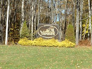
. In the late 1880s, with the addition of the railroad along the river, the area had become somewhat of a small resort town. But, by the advent of the 1900s, most industry had begun to dry up, leaving the town fairly rural until the 1950s. At that point, with the "baby boom" underway, Rowe became the site of Yankee Rowe Nuclear Power Station, the first nuclear power plant
in New England, near the Sherman Dam along the Vermont border. The plant was in operation from 1960 to 1992, and the plant is now completely decommissioned, with the nuclear waste set to be transported to Yucca Mountain's containment facilities upon their completion in 2020.
, the town has a total area of 24.1 square miles (62.4 km²), of which, 23.5 square miles (60.9 km²) of it is land and 0.5 square miles (1.3 km²) of it (2.16%) is water. Rowe lies along the northern border of Franklin County and Massachusetts, bordered by Windham County
, Vermont
to the north and along the western border of the county with Berkshire County
. The town is bordered by Whitingham
, Vermont
to the north, Heath
to the east, Charlemont
to the south, and Florida
and Monroe
to the west. Rowe is located 23 miles west-northwest of Greenfield
, 53 miles north-northwest of Springfield
, and 112 west-northwest of Boston.
Rowe lies along the eastern bank of the Deerfield River
, which is dammed near the Vermont border to form the Sherman Reservoir. The town also has two other large bodies of water, the Upper Bear Swamp Reservoir and Pelham Lake, which feeds Pelham Brook, a tributary of the river. The town is hilly, with two main ridges on either side of Pelham Brook. Near the southwest corner of town is Negus Mountain, along the western ridge, and along the eastern ridge lies Todd Mountain and Adams Mountain, the highest point in town. Much of the land southeast of Pelham Lake is part of the Pelham Lake Park, which extends to the mountains. There are also two small units of Monroe State Forest in town.
Rowe is one of a handful of small towns in Massachusetts which has no state highways. (Nearly half of these towns are on Martha's Vineyard
and Nantucket, with the majority of the rest in Central and Western Massachusetts.) The nearest state highways are Route 8A, which runs through neighboring Heath, and Route 2 (the Mohawk Trail
), which runs through Charlemont and Florida. The nearest interstate, Interstate 91
, passes through the center of the county, near the junction of the Deerfield River and the Connecticut River
. A short section of railroad tracks leading westward to the Hoosac Tunnel
passes through the southwest corner of town, but the town is otherwise not served by rail, bus or air service. The nearest bus and small air service is in North Adams, the nearest Amtrak
service is in Pittsfield, and the nearest national air service can be reached at Albany International Airport
in New York.
of 2000, there were 351 people, 154 households, and 105 families residing in the town. By population, Rowe ranks 24th out of the 26 cities and towns in Franklin County, and 344th out of the 351 cities and towns in Massachusetts. The population density
was 14.9 people per square mile (5.8/km²), which ranks 24th in the county and 345th in the Commonwealth. There were 209 housing units at an average density of 8.9 per square mile (3.4/km²). The racial makeup of the town was 99.72% White, 0.28% from other races
. Hispanic or Latino of any race were 1.14% of the population.
There were 154 households out of which 22.7% had children under the age of 18 living with them, 59.1% were married couples
living together, 5.8% had a female householder with no husband present, and 31.8% were non-families. 26.0% of all households were made up of individuals and 11.0% had someone living alone who was 65 years of age or older. The average household size was 2.28 and the average family size was 2.75.
In the town the population was spread out with 19.7% under the age of 18, 4.3% from 18 to 24, 21.1% from 25 to 44, 36.2% from 45 to 64, and 18.8% who were 65 years of age or older. The median age was 48 years. For every 100 females there were 90.8 males. For every 100 females age 18 and over, there were 93.2 males.
The median income for a household in the town was $41,944, and the median income for a family was $53,750. Males had a median income of $32,143 versus $28,438 for females. The per capita income
for the town was $28,134. None of the families and 2.8% of the population were living below the poverty line, including no under eighteens and 3.1% of those over 64.
form of government, and is led by a board of selectmen
.
The town has a police station, which also patrols neighboring Monroe, as well as a fire station, a library connected to the regional library network, and a post office, all of which are located near the Town Hall at the center of town. The nearest hospital, North Adams Regional Hospital, is located in North Adams.
On the state level, Rowe is represented in the Massachusetts House of Representatives
as part of the First Berkshire district, which includes the northern portion of Berkshire County as well as several towns in northwest Franklin County. In the Massachusetts Senate
, the town is part of the Berkshire, Hampshire and Franklin district, which includes all of Berkshire County and the western portions of Hampshire and Franklin Counties. The town is patrolled by the Second (Shelburne Falls) Station of Troop "B" of the Massachusetts State Police
.
On the national level, Rowe is represented in the United States House of Representatives
as part of Massachusetts's 1st congressional district
, and has been represented by John Olver
of Amherst
since June 1991. Massachusetts is represented in the United States Senate
by senior Senator John Kerry
and junior Senator Scott Brown
in Buckland
. There is a private academy in neighboring Charlemont, and other private and religious schools in nearby North Adams
.
The nearest community college, Greenfield Community College
, is located in Greenfield. The nearest state college is Massachusetts College of Liberal Arts
in North Adams, and the nearest state university is the University of Massachusetts Amherst
. The nearest private college is Williams College
in Williamstown, with several others located southeast in the Northampton area.
options for youth, as well as adult conferences and spiritual retreats.
New England town
The New England town is the basic unit of local government in each of the six New England states. Without a direct counterpart in most other U.S. states, New England towns are conceptually similar to civil townships in other states, but are incorporated, possessing powers like cities in other...
in Franklin County
Franklin County, Massachusetts
-Demographics:As of the census of 2000, there were 71,535 people, 29,466 households, and 18,416 families residing in the county. The population density was 102 people per square mile . There were 31,939 housing units at an average density of 46 per square mile...
, Massachusetts
Massachusetts
The Commonwealth of Massachusetts is a state in the New England region of the northeastern United States of America. It is bordered by Rhode Island and Connecticut to the south, New York to the west, and Vermont and New Hampshire to the north; at its east lies the Atlantic Ocean. As of the 2010...
, United States
United States
The United States of America is a federal constitutional republic comprising fifty states and a federal district...
. The population was 351 at the 2000 census. It is part of the Springfield, Massachusetts
Springfield, Massachusetts
Springfield is the most populous city in Western New England, and the seat of Hampden County, Massachusetts, United States. Springfield sits on the eastern bank of the Connecticut River near its confluence with three rivers; the western Westfield River, the eastern Chicopee River, and the eastern...
Metropolitan Statistical Area
Springfield, Massachusetts metropolitan area
The Springfield Metropolitan Area is a region that is socio-economically and culturally tied to the City of Springfield, Massachusetts. The U.S. Office of Management and Budget defines the Springfield metropolitan statistical area as consisting of three counties in Western Massachusetts. As of...
.
History
Native Americans in the United States
Native Americans in the United States are the indigenous peoples in North America within the boundaries of the present-day continental United States, parts of Alaska, and the island state of Hawaii. They are composed of numerous, distinct tribes, states, and ethnic groups, many of which survive as...
tribes. The area was first visited by white settlers in 1744, and was the site of a fort to guard against raids. In 1762, the town lands were purchased by the Rev. Cornelius Jones, who named it "Myrifield" after the Greek
Greek language
Greek is an independent branch of the Indo-European family of languages. Native to the southern Balkans, it has the longest documented history of any Indo-European language, spanning 34 centuries of written records. Its writing system has been the Greek alphabet for the majority of its history;...
word for "thousand." The town had enough settlers by 1785 to have it incorporated as a town, renamed by the Massachusetts General Court
Massachusetts General Court
The Massachusetts General Court is the state legislature of the Commonwealth of Massachusetts. The name "General Court" is a hold-over from the Colonial Era, when this body also sat in judgment of judicial appeals cases...
after John Rowe, a prominent Boston merchant. The town of Rowe grew around mills on the river, but also had other industries, including sulfur, talc and soapstone mining. This was nowhere more evident than in the now abandoned settlement at the Davis Mine
Davis, Massachusetts
Davis, Massachusetts is the abandoned location of the Davis Pyrite Mine. Once the largest iron pyrite-mine in Massachusetts, Davis grew to be a decent sized mining village at the beginnings of the Second Industrial Revolution . But, in 1911, a non-fatal collapse of the mine due to “poor mining...
. In the late 1880s, with the addition of the railroad along the river, the area had become somewhat of a small resort town. But, by the advent of the 1900s, most industry had begun to dry up, leaving the town fairly rural until the 1950s. At that point, with the "baby boom" underway, Rowe became the site of Yankee Rowe Nuclear Power Station, the first nuclear power plant
Nuclear power plant
A nuclear power plant is a thermal power station in which the heat source is one or more nuclear reactors. As in a conventional thermal power station the heat is used to generate steam which drives a steam turbine connected to a generator which produces electricity.Nuclear power plants are usually...
in New England, near the Sherman Dam along the Vermont border. The plant was in operation from 1960 to 1992, and the plant is now completely decommissioned, with the nuclear waste set to be transported to Yucca Mountain's containment facilities upon their completion in 2020.
Neighborhoods
The following are locally known neighborhood/village areas within the Rowe town borders:- Camp Rowe 42.690°N 72.898°W
- DavisDavis, MassachusettsDavis, Massachusetts is the abandoned location of the Davis Pyrite Mine. Once the largest iron pyrite-mine in Massachusetts, Davis grew to be a decent sized mining village at the beginnings of the Second Industrial Revolution . But, in 1911, a non-fatal collapse of the mine due to “poor mining...
42.683°N 72.865°W - Monroe Bridge 42.722°N 72.941°W
- Rowe 42.693°N 72.900°W
- ZoarZoar, MassachusettsZoar is a village within the town of Rowe in Franklin County, Massachusetts, United States.-External links:* *...
42.653°N 72.931°W
Geography
According to the United States Census BureauUnited States Census Bureau
The United States Census Bureau is the government agency that is responsible for the United States Census. It also gathers other national demographic and economic data...
, the town has a total area of 24.1 square miles (62.4 km²), of which, 23.5 square miles (60.9 km²) of it is land and 0.5 square miles (1.3 km²) of it (2.16%) is water. Rowe lies along the northern border of Franklin County and Massachusetts, bordered by Windham County
Windham County, Vermont
Windham County is a county located in the U.S. state of Vermont. As of 2010, the population was 44,513. Its shire town is Newfane.-Geography:According to the U.S...
, Vermont
Vermont
Vermont is a state in the New England region of the northeastern United States of America. The state ranks 43rd in land area, , and 45th in total area. Its population according to the 2010 census, 630,337, is the second smallest in the country, larger only than Wyoming. It is the only New England...
to the north and along the western border of the county with Berkshire County
Berkshire County, Massachusetts
Berkshire County is a non-governmental county located on the western edge of the U.S. state of Massachusetts. As of the 2010 census, the population was 131,219. Its largest city and traditional county seat is Pittsfield...
. The town is bordered by Whitingham
Whitingham, Vermont
Whitingham is a town in Windham County, Vermont, United States. The town was named for Nathan Whiting, a landholder. The population was 1,298 at the 2000 census. Whitingham is the birthplace of Brigham Young, the second President of The Church of Jesus Christ of Latter-day Saints and founder of...
, Vermont
Vermont
Vermont is a state in the New England region of the northeastern United States of America. The state ranks 43rd in land area, , and 45th in total area. Its population according to the 2010 census, 630,337, is the second smallest in the country, larger only than Wyoming. It is the only New England...
to the north, Heath
Heath, Massachusetts
Heath is a town in Franklin County, Massachusetts, United States. The population was 805 at the 2000 census. It is part of the Springfield, Massachusetts Metropolitan Statistical Area.- History :...
to the east, Charlemont
Charlemont, Massachusetts
Charlemont is a town in Franklin County, Massachusetts, United States. The population was 1,358 at the 2000 census. It is part of the Springfield, Massachusetts Metropolitan Statistical Area.- History :...
to the south, and Florida
Florida, Massachusetts
Florida is a town in Berkshire County, Massachusetts, United States. It is part of the Pittsfield, Massachusetts Metropolitan Statistical Area. The population was 676 at the 2000 census. It is home to the east portal of the Hoosac Tunnel, as well as Whitcomb Summit , the highest point of the Mohawk...
and Monroe
Monroe, Massachusetts
Monroe is a town in Franklin County, Massachusetts, United States. The population was 93 at the 2000 census. By area, population and population density, it is the smallest town in the county; and is the second-smallest town by population in the Commonwealth, with only Gosnold having fewer...
to the west. Rowe is located 23 miles west-northwest of Greenfield
Greenfield, Massachusetts
Greenfield is a city in Franklin County, Massachusetts, United States. The population was 17,456 at the 2010 census. It is the county seat of Franklin County. Greenfield is home to Greenfield Community College, the Pioneer Valley Symphony Orchestra, and the Franklin County Fair...
, 53 miles north-northwest of Springfield
Springfield, Massachusetts
Springfield is the most populous city in Western New England, and the seat of Hampden County, Massachusetts, United States. Springfield sits on the eastern bank of the Connecticut River near its confluence with three rivers; the western Westfield River, the eastern Chicopee River, and the eastern...
, and 112 west-northwest of Boston.
Rowe lies along the eastern bank of the Deerfield River
Deerfield River
Deerfield River is a river that runs for from southern Vermont through northwestern Massachusetts to the Connecticut River. The Deerfield was historically influential in the settlement of western Franklin County, Massachusetts, and its namesake town...
, which is dammed near the Vermont border to form the Sherman Reservoir. The town also has two other large bodies of water, the Upper Bear Swamp Reservoir and Pelham Lake, which feeds Pelham Brook, a tributary of the river. The town is hilly, with two main ridges on either side of Pelham Brook. Near the southwest corner of town is Negus Mountain, along the western ridge, and along the eastern ridge lies Todd Mountain and Adams Mountain, the highest point in town. Much of the land southeast of Pelham Lake is part of the Pelham Lake Park, which extends to the mountains. There are also two small units of Monroe State Forest in town.
Rowe is one of a handful of small towns in Massachusetts which has no state highways. (Nearly half of these towns are on Martha's Vineyard
Martha's Vineyard
Martha's Vineyard is an island located south of Cape Cod in Massachusetts, known for being an affluent summer colony....
and Nantucket, with the majority of the rest in Central and Western Massachusetts.) The nearest state highways are Route 8A, which runs through neighboring Heath, and Route 2 (the Mohawk Trail
Mohawk Trail
- External links :* *...
), which runs through Charlemont and Florida. The nearest interstate, Interstate 91
Interstate 91
Interstate 91 is an Interstate Highway in the New England region of the United States. It provides the primary north–south thoroughfare in the western part of New England...
, passes through the center of the county, near the junction of the Deerfield River and the Connecticut River
Connecticut River
The Connecticut River is the largest and longest river in New England, and also an American Heritage River. It flows roughly south, starting from the Fourth Connecticut Lake in New Hampshire. After flowing through the remaining Connecticut Lakes and Lake Francis, it defines the border between the...
. A short section of railroad tracks leading westward to the Hoosac Tunnel
Hoosac Tunnel
The Hoosac Tunnel is a 4.75-mile-long railroad tunnel in western Massachusetts which passes through the Hoosac Range, an extension of Vermont's Green Mountains. Work began in 1848 and was finally completed in 1875...
passes through the southwest corner of town, but the town is otherwise not served by rail, bus or air service. The nearest bus and small air service is in North Adams, the nearest Amtrak
Amtrak
The National Railroad Passenger Corporation, doing business as Amtrak , is a government-owned corporation that was organized on May 1, 1971, to provide intercity passenger train service in the United States. "Amtrak" is a portmanteau of the words "America" and "track". It is headquartered at Union...
service is in Pittsfield, and the nearest national air service can be reached at Albany International Airport
Albany International Airport
Albany International Airport is a public use airport located six nautical miles northwest of the central business district of Albany, in Albany County, New York, United States. It is owned by the Albany County Airport Authority....
in New York.
Demographics
As of the censusCensus
A census is the procedure of systematically acquiring and recording information about the members of a given population. It is a regularly occurring and official count of a particular population. The term is used mostly in connection with national population and housing censuses; other common...
of 2000, there were 351 people, 154 households, and 105 families residing in the town. By population, Rowe ranks 24th out of the 26 cities and towns in Franklin County, and 344th out of the 351 cities and towns in Massachusetts. The population density
Population density
Population density is a measurement of population per unit area or unit volume. It is frequently applied to living organisms, and particularly to humans...
was 14.9 people per square mile (5.8/km²), which ranks 24th in the county and 345th in the Commonwealth. There were 209 housing units at an average density of 8.9 per square mile (3.4/km²). The racial makeup of the town was 99.72% White, 0.28% from other races
Race (United States Census)
Race and ethnicity in the United States Census, as defined by the Federal Office of Management and Budget and the United States Census Bureau, are self-identification data items in which residents choose the race or races with which they most closely identify, and indicate whether or not they are...
. Hispanic or Latino of any race were 1.14% of the population.
There were 154 households out of which 22.7% had children under the age of 18 living with them, 59.1% were married couples
Marriage
Marriage is a social union or legal contract between people that creates kinship. It is an institution in which interpersonal relationships, usually intimate and sexual, are acknowledged in a variety of ways, depending on the culture or subculture in which it is found...
living together, 5.8% had a female householder with no husband present, and 31.8% were non-families. 26.0% of all households were made up of individuals and 11.0% had someone living alone who was 65 years of age or older. The average household size was 2.28 and the average family size was 2.75.
In the town the population was spread out with 19.7% under the age of 18, 4.3% from 18 to 24, 21.1% from 25 to 44, 36.2% from 45 to 64, and 18.8% who were 65 years of age or older. The median age was 48 years. For every 100 females there were 90.8 males. For every 100 females age 18 and over, there were 93.2 males.
The median income for a household in the town was $41,944, and the median income for a family was $53,750. Males had a median income of $32,143 versus $28,438 for females. The per capita income
Per capita income
Per capita income or income per person is a measure of mean income within an economic aggregate, such as a country or city. It is calculated by taking a measure of all sources of income in the aggregate and dividing it by the total population...
for the town was $28,134. None of the families and 2.8% of the population were living below the poverty line, including no under eighteens and 3.1% of those over 64.
Government
Rowe employs the open town meetingOpen town meeting
An open town meeting is a form of town meeting in which all registered voters of a town may vote . This form of government is typical of smaller municipalities in the New England region of the United States....
form of government, and is led by a board of selectmen
Board of selectmen
The board of selectmen is commonly the executive arm of the government of New England towns in the United States. The board typically consists of three or five members, with or without staggered terms.-History:...
.
The town has a police station, which also patrols neighboring Monroe, as well as a fire station, a library connected to the regional library network, and a post office, all of which are located near the Town Hall at the center of town. The nearest hospital, North Adams Regional Hospital, is located in North Adams.
On the state level, Rowe is represented in the Massachusetts House of Representatives
Massachusetts House of Representatives
The Massachusetts House of Representatives is the lower house of the Massachusetts General Court, the state legislature of the Commonwealth of Massachusetts. It is composed of 160 members elected from single-member electoral districts across the Commonwealth. Representatives serve two-year terms...
as part of the First Berkshire district, which includes the northern portion of Berkshire County as well as several towns in northwest Franklin County. In the Massachusetts Senate
Massachusetts Senate
The Massachusetts Senate is the upper house of the Massachusetts General Court, the bicameral state legislature of the Commonwealth of Massachusetts. The Senate comprises 40 elected members from 40 single-member senatorial districts in the state...
, the town is part of the Berkshire, Hampshire and Franklin district, which includes all of Berkshire County and the western portions of Hampshire and Franklin Counties. The town is patrolled by the Second (Shelburne Falls) Station of Troop "B" of the Massachusetts State Police
Massachusetts State Police
The Massachusetts State Police is an agency of the Commonwealth of Massachusetts' Executive Office of Public Safety and Security responsible for criminal law enforcement and traffic vehicle regulation across the state...
.
On the national level, Rowe is represented in the United States House of Representatives
United States House of Representatives
The United States House of Representatives is one of the two Houses of the United States Congress, the bicameral legislature which also includes the Senate.The composition and powers of the House are established in Article One of the Constitution...
as part of Massachusetts's 1st congressional district
Massachusetts's 1st congressional district
Massachusetts's 1st congressional district is in western and central Massachusetts. The largest Massachusetts district in area, it covers about one-third of the state and is more rural than the rest. It has the state's highest point, Mount Greylock...
, and has been represented by John Olver
John Olver
John Walter Olver is the U.S. Representative for , serving since 1991. He is a member of the Democratic Party. Early in his career, he was a chemistry professor and served in both chambers of the Massachusetts General Court....
of Amherst
Amherst, Massachusetts
Amherst is a town in Hampshire County, Massachusetts, United States in the Connecticut River valley. As of the 2010 census, the population was 37,819, making it the largest community in Hampshire County . The town is home to Amherst College, Hampshire College, and the University of Massachusetts...
since June 1991. Massachusetts is represented in the United States Senate
United States Senate
The United States Senate is the upper house of the bicameral legislature of the United States, and together with the United States House of Representatives comprises the United States Congress. The composition and powers of the Senate are established in Article One of the U.S. Constitution. Each...
by senior Senator John Kerry
John Kerry
John Forbes Kerry is the senior United States Senator from Massachusetts, the 10th most senior U.S. Senator and chairman of the Senate Foreign Relations Committee. He was the presidential nominee of the Democratic Party in the 2004 presidential election, but lost to former President George W...
and junior Senator Scott Brown
Scott Brown
Scott Brown is a United States senator.Scott Brown may also refer to:-Sportsmen:*Scott Brown , American college football coach of Kentucky State...
Education
Rowe's school system is a sub-system in the nine-town Mohawk Trail Regional School District, which serves much of western Franklin County. Town students attend the Rowe Elementary School from pre-kindergarten through sixth grades, and all students in the district attend Mohawk Trail Regional High SchoolMohawk Trail Regional High School
Mohawk Trail Regional High School is located on Route 112 in Buckland, Massachusetts, United States. The public school currently serves nine towns, grades 7-12.- History :...
in Buckland
Buckland, Massachusetts
Buckland is a town in Franklin County, Massachusetts, United States. The population was 1,991 at the 2000 census. The town shares the village of Shelburne Falls with neighboring Shelburne...
. There is a private academy in neighboring Charlemont, and other private and religious schools in nearby North Adams
North Adams, Massachusetts
North Adams is a city in Berkshire County, Massachusetts, United States. It is part of the Pittsfield, Massachusetts Metropolitan Statistical Area. The population was 13,708 as of the 2010 census, making it the least populous city in the state...
.
The nearest community college, Greenfield Community College
Greenfield Community College
Greenfield Community College is a two-year Community College in Greenfield, Massachusetts. It was founded in 1962, currently has an annual enrollment of 3,000, is regionally known for its art program, its small-town atmosphere, and its setting amid picturesque old farmland at the foot of...
, is located in Greenfield. The nearest state college is Massachusetts College of Liberal Arts
Massachusetts College of Liberal Arts
The Massachusetts College of Liberal Arts is a public, residential, liberal arts college that offers both undergraduate and graduate programs. Located in North Adams, Massachusetts, it is part of the state university system of Massachusetts. It is a member of the Council of Public Liberal Arts...
in North Adams, and the nearest state university is the University of Massachusetts Amherst
University of Massachusetts Amherst
The University of Massachusetts Amherst is a public research and land-grant university in Amherst, Massachusetts, United States and the flagship of the University of Massachusetts system...
. The nearest private college is Williams College
Williams College
Williams College is a private liberal arts college located in Williamstown, Massachusetts, United States. It was established in 1793 with funds from the estate of Ephraim Williams. Originally a men's college, Williams became co-educational in 1970. Fraternities were also phased out during this...
in Williamstown, with several others located southeast in the Northampton area.
Points of interest
Rowe Camp and Conference Center is a Unitarian Universalist organization that began in 1924. It is a 501(c)3 non-profit, offering a variety of summer campSummer camp
Summer camp is a supervised program for children or teenagers conducted during the summer months in some countries. Children and adolescents who attend summer camp are known as campers....
options for youth, as well as adult conferences and spiritual retreats.