

Path 26
Encyclopedia
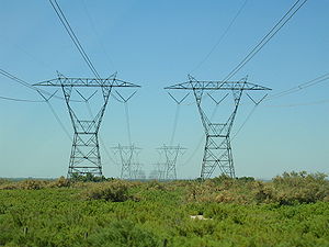
Path 26 is a set of three Southern California Edison
(SCE) 500 kV
power line
s, located primarily in Los Angeles County
, and extending into Kern
and Ventura Counties
, all in California
. The Path 26 lines are located in: the San Joaquin Valley
of the southern Central Valley; the Tehachapi Mountains
and other central Transverse Ranges
; and the Antelope Valley
section of the Mojave Desert
.
(PG&E) and the Southwestern United States
(SCE), Path 26 is a southern extension of Path 15
and Path 66
, and a crucial link between the two regions' grids.
of electrical power
north to south. The capacity for south to north power transmission is 3,000 MW.
close to State Route 14
and Soledad Pass near Acton
east of the Santa Clarita Valley
. The same Vincent substation is linked to Path 46
and Path 61
via two SCE 500 kV lines that head southeast to Lugo substation. As for these SCE 500 kV wires, like Path 15 to the north, the three 500 kV wires are never built together for the entire length of the route. Straight from the substation, all three lines head north-northwest. The westernmost SCE 500 kV line splits away and runs west of the other two SCE 500 kV lines.
After crossing State Route 14, two 500 kV wires built by Los Angeles Department of Water and Power
(LADW&P) join the eastern two SCE 500 kV wires. Some point west of Palmdale
, one line (SCE) continues northwest and the other three (one SCE, two LADW&P) head west. The lone SCE line continuing northwest (with 230 kV lines) runs close to the Antelope Valley California Poppy Reserve
, famed for its California Poppy
flowers. The one SCE line that ran west of the other two SCE lines (now separated) re-joins the single SCE 500 kV running west with the two LADW&P lines. The four 500 kV lines run together for some distance until, at some point in the mountains, the two SCE lines continue to head west and the two LADW&P lines turn southwest and head for Sylmar in the San Fernando Valley
(close to the Sylmar Converter Station southern terminus of the Pacific Intertie
HVDC line). The two SCE lines heading west meet up with Interstate 5
on the arid foothills
of the Sierra Pelona Mountains
to the east of Pyramid Lake
. The lines parallel I-5 crossing Tejon Pass
(running on the eastern foothills of Frazier Mountain
) and run out of sight for a while as they cross the high woodlands of the northern San Emigdio Mountains
at their highest point at around 5350 ft (1,630.7 m).
As for the third line, north of Lancaster
and State Route 138
, it runs through a remote, roadless area of the Tehachapi Mountains with two 230 kV lines. Although it runs across sparse to dense oak woodlands
at around 5300 ft (1,615 m), it is not easy to spot it on Google Earth
since its right of way is not as clear cut as Path 15 and Path 66
to the north. Due to this, the line is not readily seen again until it crosses State Route 184
as a PG&E power line. Somewhere to the east of State Route 184, in the mountains, the line changes from SCE towers to PG&E towers. By the time the all three lines are visible to Interstate 5
, they roughly parallel each other until all three lines, two SCE and one PG&E, terminate at the massive Midway substation in Buttonwillow
in the San Joaquin Valley. Two pairs of PG&E 500 kV lines heading north and southwest (separated), form Path 15.
along the northern foothills of the San Gabriel Mountains
. Another LADW&P line joins the four-line transmission corridor, resulting in a large path of five power lines. However, one LADW&P splits off from the other four lines and heads southeast. Soon after, the SCE lines split away from the remaining two LADW&P lines and head southeast as well. They cross the lone LADW&P line that split away and Interstate 15 as they head to the Lugo substation northeast of Cajon Pass
. The lines terminate at Lugo, where one SCE Path 61
500 kV line, two SCE Path 46
500 kV lines, and three other SCE 500 kV lines end.
Southern California Edison
Southern California Edison , the largest subsidiary of Edison International , is the primary electricity supply company for much of Southern California, USA. It provides 14 million people with electricity...
(SCE) 500 kV
Volt
The volt is the SI derived unit for electric potential, electric potential difference, and electromotive force. The volt is named in honor of the Italian physicist Alessandro Volta , who invented the voltaic pile, possibly the first chemical battery.- Definition :A single volt is defined as the...
power line
Electric power transmission
Electric-power transmission is the bulk transfer of electrical energy, from generating power plants to Electrical substations located near demand centers...
s, located primarily in Los Angeles County
Los Angeles County, California
Los Angeles County is a county in the U.S. state of California. As of 2010 U.S. Census, the county had a population of 9,818,605, making it the most populous county in the United States. Los Angeles County alone is more populous than 42 individual U.S. states...
, and extending into Kern
Kern County, California
Spreading across the southern end of the California Central Valley, Kern County is the fifth-largest county by population in California. Its economy is heavily linked to agriculture and to petroleum extraction, and there is a strong aviation and space presence. Politically, it has generally...
and Ventura Counties
Ventura County, California
Ventura County is a county in the southern part of the U.S. state of California. It is located on California's Pacific coast. It is often referred to as the Gold Coast, and has a reputation of being one of the safest populated places and one of the most affluent places in the country...
, all in California
California
California is a state located on the West Coast of the United States. It is by far the most populous U.S. state, and the third-largest by land area...
. The Path 26 lines are located in: the San Joaquin Valley
San Joaquin Valley
The San Joaquin Valley is the area of the Central Valley of California that lies south of the Sacramento – San Joaquin River Delta in Stockton...
of the southern Central Valley; the Tehachapi Mountains
Tehachapi Mountains
The Tehachapi Mountains , regionally also called The Tehachapis, are a mountain range in the Transverse Ranges system of California in the Western United States...
and other central Transverse Ranges
Transverse Ranges
The Transverse Ranges are a group of mountain ranges of southern California, in the Pacific Coast Ranges physiographic region that runs along the Pacific coast from Alaska to Mexico in North America. The Transverse Ranges begin at the southern end of the California Coast Ranges and lie between...
; and the Antelope Valley
Antelope Valley
The Antelope Valley in California, United States, is located in northern Los Angeles County and the southeastern portion of Kern County, California, and constitutes the western tip of the Mojave Desert...
section of the Mojave Desert
Mojave Desert
The Mojave Desert occupies a significant portion of southeastern California and smaller parts of central California, southern Nevada, southwestern Utah and northwestern Arizona, in the United States...
.
Power grids link
Path 26 forms Southern California Edison's (SCE) intertie (link) with Pacific Gas & Electric (PG&E) to the north. Since PG&E's power grid and SCE's grid both have interconnections to elsewhere, in the Pacific NorthwestPacific Northwest
The Pacific Northwest is a region in northwestern North America, bounded by the Pacific Ocean to the west and, loosely, by the Rocky Mountains on the east. Definitions of the region vary and there is no commonly agreed upon boundary, even among Pacific Northwesterners. A common concept of the...
(PG&E) and the Southwestern United States
Southwestern United States
The Southwestern United States is a region defined in different ways by different sources. Broad definitions include nearly a quarter of the United States, including Arizona, California, Colorado, Nevada, New Mexico, Oklahoma, Texas and Utah...
(SCE), Path 26 is a southern extension of Path 15
Path 15
Path 15 is an portion of the north-south power transmission corridor in California, U.S. It forms a part of the Pacific AC Intertie and the California-Oregon Transmission Project....
and Path 66
Path 66
Path 66 is the name of several 500 kV power lines that were built by Western Area Power Administration , Pacific Gas & Electric , and PacifiCorp in the early 1970s to 1990s and totally completed in 1993...
, and a crucial link between the two regions' grids.
Power transmission capacity
The three Path 26 500 kV lines can transmit 3,700 MWWatt
The watt is a derived unit of power in the International System of Units , named after the Scottish engineer James Watt . The unit, defined as one joule per second, measures the rate of energy conversion.-Definition:...
of electrical power
Electric power
Electric power is the rate at which electric energy is transferred by an electric circuit. The SI unit of power is the watt.-Circuits:Electric power, like mechanical power, is represented by the letter P in electrical equations...
north to south. The capacity for south to north power transmission is 3,000 MW.
Route
Path 26 - Vincent to Midway
The Path, starting from the south, starts at the large Vincent substationElectrical substation
A substation is a part of an electrical generation, transmission, and distribution system. Substations transform voltage from high to low, or the reverse, or perform any of several other important functions...
close to State Route 14
California State Route 14
State Route 14 is a north–south state highway in the U.S. state of California, largely in the Mojave Desert. The southern portion of the highway is signed as the Antelope Valley Freeway. The route connects Interstate 5, or Golden State Freeway, near Santa Clarita and with U.S. Route 395 near...
and Soledad Pass near Acton
Acton, California
Acton was founded in 1887 by gold miners who were working in the Red Rover Mine. It was named after Acton, Massachusetts by one of the miners. Two of the best-known gold mines located in Acton were the Red Rover mine and the Governors mine. Mining of gold, copper, and titanium ore continued into...
east of the Santa Clarita Valley
Santa Clarita Valley
The Santa Clarita Valley is the valley of the Santa Clara River in Southern California. It stretches through Los Angeles County and Ventura County. Its main population center is the city of Santa Clarita. The valley was part of the Rancho San Francisco Mexican land grant...
. The same Vincent substation is linked to Path 46
Path 46
Path 46, also called West of Colorado River, Arizona-California West-of-the-River Path , is a set of many alternating current high-voltage transmission lines that are located in southeast California and Nevada up to the Colorado River...
and Path 61
Path 61
Path 61 or the Lugo - Victorville 500 kV Line is a relatively short AC 500 kV power line that runs from Southern California Edison's Lugo substation southwest of Hesperia to Los Angeles Department of Water and Power's Victorville substation north of Victorville, California...
via two SCE 500 kV lines that head southeast to Lugo substation. As for these SCE 500 kV wires, like Path 15 to the north, the three 500 kV wires are never built together for the entire length of the route. Straight from the substation, all three lines head north-northwest. The westernmost SCE 500 kV line splits away and runs west of the other two SCE 500 kV lines.
After crossing State Route 14, two 500 kV wires built by Los Angeles Department of Water and Power
Los Angeles Department of Water and Power
The Los Angeles Department of Water and Power is the largest municipal utility in the United States, serving over four million residents. It was founded in 1902 to supply water and electricity to residents and businesses in Los Angeles and surrounding communities...
(LADW&P) join the eastern two SCE 500 kV wires. Some point west of Palmdale
Palmdale, California
Palmdale is a city located in the center of northern Los Angeles County, California, United States.Palmdale was the first community within the Antelope Valley to incorporate as a city on August 24, 1962; 47 years later, voters approved creating a charter city in November, 2009. Palmdale is...
, one line (SCE) continues northwest and the other three (one SCE, two LADW&P) head west. The lone SCE line continuing northwest (with 230 kV lines) runs close to the Antelope Valley California Poppy Reserve
Antelope Valley California Poppy Reserve
Antelope Valley California Poppy Reserve is a state-protected reserve of California, USA, harboring the most consistent blooms of California poppies, the state flower. The reserve is located in the rural westside of Antelope Valley in northern Los Angeles County, west of Lancaster. The reserve...
, famed for its California Poppy
California poppy
The California poppy is a perennial and annual plant, native to the United States, and the official state flower of California.- Description :...
flowers. The one SCE line that ran west of the other two SCE lines (now separated) re-joins the single SCE 500 kV running west with the two LADW&P lines. The four 500 kV lines run together for some distance until, at some point in the mountains, the two SCE lines continue to head west and the two LADW&P lines turn southwest and head for Sylmar in the San Fernando Valley
San Fernando Valley
The San Fernando Valley is an urbanized valley located in the Los Angeles metropolitan area of southern California, United States, defined by the dramatic mountains of the Transverse Ranges circling it...
(close to the Sylmar Converter Station southern terminus of the Pacific Intertie
Pacific Intertie
The Pacific DC Intertie is an electric power transmission line that transmits electricity from the Pacific Northwest to the Los Angeles area using high voltage direct current...
HVDC line). The two SCE lines heading west meet up with Interstate 5
Interstate 5 in California
Interstate 5 is a major north–south route of the Interstate Highway System in the U.S. state of California. It begins at the Mexico – United States border at the San Ysidro crossing, goes north across the length of California and crosses into Oregon south of the Medford-Ashland metropolitan...
on the arid foothills
Foothills
Foothills are geographically defined as gradual increases in elevation at the base of a mountain range. They are a transition zone between plains and low relief hills to the adjacent topographically high mountains.-Examples:...
of the Sierra Pelona Mountains
Sierra Pelona Mountains
The Sierra Pelona Mountains , or the Sierra Pelona Ridge, is a mountain range in the Transverse Ranges of Southern California.. They are located within Los Angeles and Kern Counties.-Geography:...
to the east of Pyramid Lake
Pyramid Lake (California)
Pyramid Lake is an artificial lake formed by Pyramid Dam on Piru Creek, near Castaic, California. The reservoir lies on the border between the Angeles National Forest and the Los Padres National Forest in the northwestern portion of Los Angeles County....
. The lines parallel I-5 crossing Tejon Pass
Tejon Pass
The Tejon Pass is a mountain pass at the southwest end of the Tehachapi Mountains linking Southern to Central California.-Geography:The apex of the pass is near the northwesternmost corner of Los Angeles County, north of Gorman...
(running on the eastern foothills of Frazier Mountain
Frazier Mountain
Frazier Mountain is a broad, pine-forested peak in the Transverse Ranges within the Los Padres National Forest, in Ventura County, California. At , Frazier is the fifth-highest mountain in the Transverse Ranges of Southern California....
) and run out of sight for a while as they cross the high woodlands of the northern San Emigdio Mountains
San Emigdio Mountains
The San Emigdio Mountains are a part of the Transverse Ranges in Southern California, extending from Interstate 5 at Lebec and Gorman on the east to Highway 33–166 on the west. They link the Tehachapis and Temblor Range and form the southern wall of the San Joaquin Valley.The range is within Los...
at their highest point at around 5350 ft (1,630.7 m).
As for the third line, north of Lancaster
Lancaster, California
Lancaster is a charter city in northern Los Angeles County, in the high desert, near the Kern County line. Lancaster currently ranks as the 30th largest city in California, and the 148th largest city in the United States. Lancaster is the principal city within the Antelope Valley...
and State Route 138
California State Route 138
State Route 138 is an east–west state highway generally following the northern foothills of the San Gabriel Mountains of southern California, USA from its junction with Interstate 5 south of Gorman eastward to Mount Anderson Junction, its eastern junction with State Route 18 south of...
, it runs through a remote, roadless area of the Tehachapi Mountains with two 230 kV lines. Although it runs across sparse to dense oak woodlands
California oak woodland
California oak woodland is a plant community found throughout the California chaparral and woodlands ecoregion of California in the United States and northwestern Baja California in Mexico...
at around 5300 ft (1,615 m), it is not easy to spot it on Google Earth
Google Earth
Google Earth is a virtual globe, map and geographical information program that was originally called EarthViewer 3D, and was created by Keyhole, Inc, a Central Intelligence Agency funded company acquired by Google in 2004 . It maps the Earth by the superimposition of images obtained from satellite...
since its right of way is not as clear cut as Path 15 and Path 66
Path 66
Path 66 is the name of several 500 kV power lines that were built by Western Area Power Administration , Pacific Gas & Electric , and PacifiCorp in the early 1970s to 1990s and totally completed in 1993...
to the north. Due to this, the line is not readily seen again until it crosses State Route 184
California State Route 184
State Route 184 is a state route in Kern County, California, locally known as “Weedpatch Highway.” It is mainly a 2-lane conventional highway, expanding to four lanes in Bakersfield, and Lamont. It connects the local agricultural land south of Bakersfield, and east of SR 99/I-5, to a major...
as a PG&E power line. Somewhere to the east of State Route 184, in the mountains, the line changes from SCE towers to PG&E towers. By the time the all three lines are visible to Interstate 5
Interstate 5 in California
Interstate 5 is a major north–south route of the Interstate Highway System in the U.S. state of California. It begins at the Mexico – United States border at the San Ysidro crossing, goes north across the length of California and crosses into Oregon south of the Medford-Ashland metropolitan...
, they roughly parallel each other until all three lines, two SCE and one PG&E, terminate at the massive Midway substation in Buttonwillow
Buttonwillow, California
Buttonwillow is a census-designated place in the San Joaquin Valley, in Kern County, California, United States. Buttonwilliow is located west of Bakersfield, at an elevation of 269 feet . The population was 1,508 at the 2010 census, up from 1,266 at the 2000 census...
in the San Joaquin Valley. Two pairs of PG&E 500 kV lines heading north and southwest (separated), form Path 15.
Connecting wires to Path 46 - Vincent to Lugo
Adjacent to the Path 26 wires, two other SCE 500 kV also begin in Vincent substation. The two 500 kV power lines head northeast from Vincent to meet up with LADW&P's two other 500 kV wires from and then all four lines head east in the Antelope ValleyAntelope Valley
The Antelope Valley in California, United States, is located in northern Los Angeles County and the southeastern portion of Kern County, California, and constitutes the western tip of the Mojave Desert...
along the northern foothills of the San Gabriel Mountains
San Gabriel Mountains
The San Gabriel Mountains Range is located in northern Los Angeles County and western San Bernardino County, California, United States. The mountain range lies between the Los Angeles Basin and the Mojave Desert, with Interstate 5 to the west and Interstate 15 to the east...
. Another LADW&P line joins the four-line transmission corridor, resulting in a large path of five power lines. However, one LADW&P splits off from the other four lines and heads southeast. Soon after, the SCE lines split away from the remaining two LADW&P lines and head southeast as well. They cross the lone LADW&P line that split away and Interstate 15 as they head to the Lugo substation northeast of Cajon Pass
Cajon Pass
Cajon Pass is a moderate-elevation mountain pass between the San Bernardino Mountains and the San Gabriel Mountains in Southern California in the United States. It was created by the movements of the San Andreas Fault...
. The lines terminate at Lugo, where one SCE Path 61
Path 61
Path 61 or the Lugo - Victorville 500 kV Line is a relatively short AC 500 kV power line that runs from Southern California Edison's Lugo substation southwest of Hesperia to Los Angeles Department of Water and Power's Victorville substation north of Victorville, California...
500 kV line, two SCE Path 46
Path 46
Path 46, also called West of Colorado River, Arizona-California West-of-the-River Path , is a set of many alternating current high-voltage transmission lines that are located in southeast California and Nevada up to the Colorado River...
500 kV lines, and three other SCE 500 kV lines end.