

Passamaquoddy Bay
Encyclopedia
Inlet
An inlet is a narrow body of water between islands or leading inland from a larger body of water, often leading to an enclosed body of water, such as a sound, bay, lagoon or marsh. In sea coasts an inlet usually refers to the actual connection between a bay and the ocean and is often called an...
of the Bay of Fundy
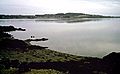
Bay of Fundy
The Bay of Fundy is a bay on the Atlantic coast of North America, on the northeast end of the Gulf of Maine between the Canadian provinces of New Brunswick and Nova Scotia, with a small portion touching the U.S. state of Maine...
, between the U.S. state
U.S. state
A U.S. state is any one of the 50 federated states of the United States of America that share sovereignty with the federal government. Because of this shared sovereignty, an American is a citizen both of the federal entity and of his or her state of domicile. Four states use the official title of...
of Maine
Maine
Maine is a state in the New England region of the northeastern United States, bordered by the Atlantic Ocean to the east and south, New Hampshire to the west, and the Canadian provinces of Quebec to the northwest and New Brunswick to the northeast. Maine is both the northernmost and easternmost...
and the Canadian
Canada
Canada is a North American country consisting of ten provinces and three territories. Located in the northern part of the continent, it extends from the Atlantic Ocean in the east to the Pacific Ocean in the west, and northward into the Arctic Ocean...
province of New Brunswick
New Brunswick
New Brunswick is one of Canada's three Maritime provinces and is the only province in the federation that is constitutionally bilingual . The provincial capital is Fredericton and Saint John is the most populous city. Greater Moncton is the largest Census Metropolitan Area...
, at the mouth of the St. Croix River
St. Croix River (Maine-New Brunswick)
The St. Croix River is a river in northeastern North America, in length, that forms part of the Canada – United States border between Maine and New Brunswick . The river rises in the Chiputneticook Lakes and flows south and southeast, between Calais and St. Stephen...
. Most of the bay lies within Canada
Canada
Canada is a North American country consisting of ten provinces and three territories. Located in the northern part of the continent, it extends from the Atlantic Ocean in the east to the Pacific Ocean in the west, and northward into the Arctic Ocean...
, with its western shore bounded by Washington County, Maine
Washington County, Maine
Washington County is a county located in the U.S. state of Maine. In 2010, its population was 32,856. Its county seat is Machias.Sometimes referred to as "Sunrise County" because it is the easternmost county in the United States, and it is often where the rising sun first shines on the 48...
. The southernmost point is formed by West Quoddy Head on the U.S. mainland in Lubec, Maine
Lubec, Maine
Lubec is a town in Washington County, Maine, United States. The population was 1,652 at the 2000 census. Lubec is the easternmost town in the contiguous United States . However, the Aleutian Islands in Alaska extend into the eastern hemisphere, and if territories are included, Point Udall in the...
; and is then bounded northeastwardly by Campobello Island, New Brunswick
Campobello Island, New Brunswick
Campobello Island is a Canadian island located at the entrance to Passamaquoddy Bay, adjacent to the entrance to Cobscook Bay, and within the Bay of Fundy...
and Deer Island, New Brunswick
Deer Island, New Brunswick
Deer Island is a Canadian island located in the Bay of Fundy at the entrance to Passamaquoddy Bay.Elizabeth Rolfe died here in 1635. She was born in 1620 to English colonist John Rolfe and his third wife Jane Pierce. Her husband was John Milner of Nansemond, Virginia. At 45 km², the island is the...
; thence, running to shores by mainland Charlotte County, New Brunswick
Charlotte County, New Brunswick
Charlotte County is located in the southwestern portion of New Brunswick, Canada.In most of the county, fishing and aquaculture dominate the local economy, although the town of St. Andrews is a tourist mecca and St...
.
Overview
Treaty of Ghent
The Treaty of Ghent , signed on 24 December 1814, in Ghent , was the peace treaty that ended the War of 1812 between the United States of America and the United Kingdom of Great Britain and Ireland...
, ending the War of 1812
War of 1812
The War of 1812 was a military conflict fought between the forces of the United States of America and those of the British Empire. The Americans declared war in 1812 for several reasons, including trade restrictions because of Britain's ongoing war with France, impressment of American merchant...
, included a provision for the appointment of "commissioners to divide the islands of Passamaquoddy Bay between the United States and Great Britain" (see John Holmes). Nevertheless, confusions and ambiguities on this issue persisted.
The southern boundaries of the bay are sometimes confused, since Deer Island sections off the large open waters of the bay; however, the terminology of the Passamaquoddy Bay Treaty of 1910 specifies that Passamaquoddy Bay runs south of Treat Island (one of the islands that now comprise the city of Eastport, Maine), between Campobello Island and Lubec, Maine...
"Now, therefore, upon the evidence and arguments so presented, and after taking into consideration all actions, of the respective Governments and of their representatives authorized in that behalf and of the local governments on either side of the line, whether prior or subsequent to such treaties and award, tending to aid in the interpretation thereof, the High Contracting Parties hereby agree that the location of the international boundary line between the United States and the Dominion of Canada from a point in Passamaquoddy Bay accurately defined in the Treaty between Great Britain and the United State's of April 11, 1908, as, lying between Treat Island and Friar Head, and extending thence through Passamaquoddy Bay and to, the middle of Grand Manan Channel, shall run in a series of seven connected straight lines for the distances and in the directions as follows...."
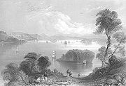
The largest community on Passamaquoddy Bay proper is St. Andrews, New Brunswick
St. Andrews, New Brunswick
St. Andrews is a Canadian town in Charlotte County, New Brunswick.It is sometimes referred to in tourism marketing by its unofficial nickname "St. Andrews-by-the-sea".-Geography:St...
, although the twin communities of Calais
Calais, Maine
Calais is a city in Washington County, Maine, United States. The city has three United States border crossings or also known as a Port of entry with the busiest being on the St. Croix River bordering St. Stephen, New Brunswick, Canada...
-St. Stephen
St. Stephen, New Brunswick
St. Stephen is a Canadian town in Charlotte County, New Brunswick, situated on the east bank of the St. Croix River at .-Climate:...
are sometimes included, despite being located on the St. Croix River. The city of Eastport, Maine
Eastport, Maine
Eastport is a small city in Washington County, Maine, United States. The population was 1,640 at the 2000 census. The principal island is Moose Island, which is connected to the mainland by causeway...
lies between Passamaquoddy Bay and Cobscook Bay, to the city's west. The narrow passage between Maine and Deer Island is known as Western Passage. The passage between Eastport, Maine, and Friar Bay, Campobello Island, is known as Friar Roads.
The three entrances into Passamaquoddy Bay from the Bay of Fundy are Letete Passage northeast of Deer Island, Head Harbour Passage to the southeast of Deer Island and northwest of Campobello Island, and Quoddy Narrows, between southern Lubec, Maine, and southern Campobello Island. Running north from West Quoddy Head in Lubec, the passages known as Quoddy Narrows, Lubec Channel, Lubec Narrows, Friar Roads, and Western Passage also host the International Boundary between Canada and the United States.
The Head Harbour Passage is the deepwater entry to the Bay. The U.S. and Canadian governments agree that the passage is Canadian. The U.S. government believes that it is a territorial sea in which international law gives commercial vessels a right of passage. The Canadian government believes that it can regulate passage, and is considering doing so to prevent the use by supertankers carrying cargo to liquified natural gas plants proposed for the American coast of the bay.
Smuggling
After the American Revolution, Passamaquoddy Bay was the scene of a thriving smugglingSmuggling
Smuggling is the clandestine transportation of goods or persons, such as out of a building, into a prison, or across an international border, in violation of applicable laws or other regulations.There are various motivations to smuggle...
trade. Smuggling peaked in 1808 during Jefferson's Embargo, when smugglers illegally moved tens of thousands of barrels of American flour from American territory into New Brunswick
New Brunswick
New Brunswick is one of Canada's three Maritime provinces and is the only province in the federation that is constitutionally bilingual . The provincial capital is Fredericton and Saint John is the most populous city. Greater Moncton is the largest Census Metropolitan Area...
. During the War of 1812, a thriving illicit trade in British manufactured goods existed. After the War of 1812, the primary smuggled good was gypsum from Nova Scotia
Nova Scotia
Nova Scotia is one of Canada's three Maritime provinces and is the most populous province in Atlantic Canada. The name of the province is Latin for "New Scotland," but "Nova Scotia" is the recognized, English-language name of the province. The provincial capital is Halifax. Nova Scotia is the...
, which was usually deposited directly into American vessels on or near the border. Smuggling was winked at by both officials and locals in the region, who discouraged outside intervention by British or American authorities who wanted to stop or control it.
Film References
Walt Disney Productions' 1977 musical filmMusical film
The musical film is a film genre in which songs sung by the characters are interwoven into the narrative, sometimes accompanied by dancing. The songs usually advance the plot or develop the film's characters, though in some cases they serve merely as breaks in the storyline, often as elaborate...
Pete's Dragon
Pete's Dragon
Pete's Dragon is a 1977 live-action/animated musical film from Walt Disney Productions and the first Disney film to be recorded in the Dolby Stereo sound system...
starring Helen Reddy
Helen Reddy
Helen Reddy , often referred to as "The Queen of 70s Pop", is an Australian-American singer and actress. In the 1970s, she enjoyed international success, especially in the United States, where she placed fifteen singles in the Top 40 of the Billboard Hot 100. Six of those 15 songs made the Top 10...
and Mickey Rooney
Mickey Rooney
Mickey Rooney is an American film actor and entertainer whose film, television, and stage appearances span nearly his entire lifetime. He has won multiple awards, including an Honorary Academy Award, a Golden Globe and an Emmy Award...
along with Jim Dale
Jim Dale
Jim Dale, MBE is an English actor, voice artist, singer and songwriter. He is best known in the United Kingdom for his many appearances in the Carry On series of films and in the US for narrating the Harry Potter audiobook series, for which he received two Grammy Awards, and the ABC series Pushing...
and Red Buttons and introducing Sean Marshall as Pete takes place in the fictional town of "Passamaquoddy", although the film does not state whether the fictional town is patterned after towns on the Maine side or towns on the New Brunswick side.
However, several descriptions of town elements such as the Boathouse suggest the Canadian side, while descriptions of caves near the shore suggest the American side of the bay. For several years after the film was released, both the Maine and New Brunswick tourist trades featured short tours to see where the film was `intended'. Of course, as there are many artistic interpretations of this, as the years wore on, many barely related locales made their way onto the tours.
The Passamaquoddy Tidal Power Project/"Quoddy Dam" Project
A proposed development project for eastern Maine, envisioned by hydroelectric engineer Dexter Cooper, involving the construction of a tidal harnessTidal power
Tidal power, also called tidal energy, is a form of hydropower that converts the energy of tides into useful forms of power - mainly electricity....
for electricity generation
Electricity generation
Electricity generation is the process of generating electric energy from other forms of energy.The fundamental principles of electricity generation were discovered during the 1820s and early 1830s by the British scientist Michael Faraday...
was initiated in 1935 under U.S. Public Works Administration
Public Works Administration
The Public Works Administration , part of the New Deal of 1933, was a large-scale public works construction agency in the United States headed by Secretary of the Interior Harold L. Ickes. It was created by the National Industrial Recovery Act in June 1933 in response to the Great Depression...
funding and with the blessing of President Franklin Delano Roosevelt, whose summer home was on nearby Campobello Island, New Brunswick, Canada.
Also known as the Quoddy Project, it proposed impounding Cobscook Bay
Cobscook Bay
Cobscook Bay is located in Washington County in the state of Maine. It opens into the Bay of Fundy immediately south of the city of Eastport and adjacent to Passamaquoddy Bay...
and part of Passamaquoddy Bay with a series of dams and control structures to exploit the resulting water level difference to generate electrical power. The electric turbines for power generation would have been located at the isthmus on Moose Island, Eastport, with the water passing between Passamaquoddy Bay and Cobscook Bay, with the "used" generating water released from impoundment at low tide.
Part of this project was completed by the construction of dikes
Levee
A levee, levée, dike , embankment, floodbank or stopbank is an elongated naturally occurring ridge or artificially constructed fill or wall, which regulates water levels...
built between Pleasant Point
Passamaquoddy Pleasant Point Reservation
Passamaquoddy Pleasant Point Reservation, also known as Sipayik, is an Indian reservation in Washington County, Maine, United States. The population was 640 at the 2000 census.-Geography:...
–Carlow Island–Moose Island. The project was suspended one year later after the United States Congress
United States Congress
The United States Congress is the bicameral legislature of the federal government of the United States, consisting of the Senate and the House of Representatives. The Congress meets in the United States Capitol in Washington, D.C....
refused further funding, thus the actual barrier dams never being built. The dike barriers now underlie the former Maine Central Railroad and the current Maine Highway 190, as well as between Treat Island (in Eastport) and Dudley Island (in Lubec, Maine).
Several iterations and variations on the project later ensued, but never began construction.
External links
- Treaty between His Majesty and the United States of America respecting the Boundary between Canada and the United States in Passamaquoddy Bay, &c
- The Tides Institute, Eastport Maine
- Information and resources about Passamaquoddy Bay
- An online directory to Charlotte County, Passamaquoddy Bay
- Save Passamaquoddy Bay 3-Nation Alliance
- Old Sow Whirlpool, in Passamaquoddy Bay
- review of the Half Moon cove Tidal Power Project in Perry/Eastport Maine