
Parks in Omaha, Nebraska
Encyclopedia
Park
A park is a protected area, in its natural or semi-natural state, or planted, and set aside for human recreation and enjoyment, or for the protection of wildlife or natural habitats. It may consist of rocks, soil, water, flora and fauna and grass areas. Many parks are legally protected by...
s in Omaha, Nebraska
Omaha, Nebraska
Omaha is the largest city in the state of Nebraska, United States, and is the county seat of Douglas County. It is located in the Midwestern United States on the Missouri River, about 20 miles north of the mouth of the Platte River...
. It includes cemeteries and golf courses. Most parks in Omaha are governed by the City of Omaha Parks and Recreation Department.
History
In 1854 Alfred D. JonesAlfred D. Jones
Alfred D. Jones was a lawyer, surveyor and politician in the 1900s in the Midwestern United States. In 1846 he platted Fort Des Moines, Iowa, and in 1854 he platted Omaha, Nebraska...
drew four parks on the original map of Omaha City. They were called Jefferson Square
Jefferson Square (Omaha)
Jefferson Square was the last of three original public parks extant in Omaha, Nebraska. Bounded by North 15th, 16th, Chicago and Cass Streets, the park was dedicated November 25, 1865. It was razed by the city March 18, 1969 to make way for the construction of Interstate 480 in Downtown Omaha...
, which was paved over by I-480
Interstate 480 (Iowa-Nebraska)
Interstate 480 is an auxiliary Interstate Highway, a mere long, that connects Interstate 80 in downtown Omaha, Nebraska, with Interstate 29 in Council Bluffs, Iowa. The portion of I-480 in Nebraska has been named the Gerald R. Ford Freeway, named in honor of the former President, who was a...
; Washington Park, which is where the Paxton Block currently sits at North 16th and Farnam Streets; Capitol Square, where Omaha Central High School
Omaha Central High School
Omaha Central High School, originally known as Omaha High School, was founded in 1859.The current building, located in Downtown Omaha, Nebraska, was designed by John Latenser, Sr. and built between 1900 and 1912...
is now located, and; an unnamed tract overlooking the river with Davenport Street on the north, Jackson Street on the south, North 8th on the east and North 9th Street on the west. Jefferson Square lasted until 1969, when it was razed to make way for a new interstate in downtown Omaha
Downtown Omaha
Downtown Omaha is the central business, government and social core of the Omaha-Council Bluffs metropolitan area, and is located in Omaha, Nebraska. The boundaries are 20th Street on the west to the Missouri River on the east and the centerline of Leavenworth Street on the south to the centerline...
. The riverfront from the interstate south to the headquarters of ConAgra Foods
ConAgra Foods
ConAgra Foods, Inc. is an American packaged foods company. ConAgra's products are available in supermarkets, as well as restaurants and food service establishments. Its headquarters are located in Omaha, Nebraska...
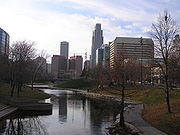
is now the Heartland of America Park
Heartland of America Park
The Heartland of America Park is a public park located at 800 Douglas Street in downtown Omaha, Nebraska USA. The park is situated between Interstate 80 and the Missouri River, and is adjacent to Gene Leahy Mall and the Old Market and connects to Lewis & Clark Landing.-History:The area where the...
.
Hanscom Park
Hanscom Park
Hanscom Park is a historic neighborhood in Midtown Omaha, Nebraska. Its namesake public park is one of the oldest parks in Omaha, donated to the City in 1872. U.S. President Gerald R. Ford was born in a house in the Hanscom Park neighborhood...
became Omaha's first park. Miller
Miller Park (Omaha, Nebraska)
The Miller Park neighborhood in North Omaha, Nebraska is a historically significant community housing a historic district and several notable historic places. It is located between Sorenson Parkway on the south and Redick Avenue on the north, Florence Boulevard on the east and 30th Street on the west...
, Fontenelle
Fontenelle Park
Fontenelle Park is a public park located at 4575 Ames Avenue, at the intersection with Fontenelle Boulevard in North Omaha, Nebraska. In the late 1940s the park made headlines across the Midwestern United States as the possible home of a minor league baseball team.-History:Land for the park was...
, Elmwood
Elmwood Park (Omaha)
The Elmwood Park neighborhood in Omaha, Nebraska is a historically significant area that was developed in the late 19th and early 20th century. It extends from Leavenworth Street on the north to Center Street on the south; from South 50th Street on the east to South 72nd Street on the west...
and Riverview were Omaha's largest parks in 1920. (Riverview Park Zoo eventually became Henry Doorly Zoo
Henry Doorly Zoo
The Omaha's Henry Doorly Zoo is a zoo in Omaha, Nebraska, located at 3701 South 10th Street.It is accredited by the Association of Zoos and Aquariums and a member of the World Association of Zoos and Aquariums. Its mission is conservation, research, recreation, and education.Omaha's Henry Doorly...
.) Levi Carter Park
Levi Carter Park
Levi Carter Park is located at 3100 Abbott Drive in East Omaha, Nebraska. It was named after one of Omaha's original industrialists, Levi Carter, who ran a white lead smelter in the area.-History:...
was its largest, at 220 acre (0.8903092 km²). Other parks in the system that year were Bemis, Deer, Kountze Park, Curtis Turner, Harold Gifford, Mercer, Jefferson Square, Hixenbaugh, Burt playground, Bluff View, Spring Lake
Spring Lake (Omaha, Nebraska)
Spring Lake, also historically called Syndicate Park, is a historic neighborhood in Omaha, Nebraska. It is bounded by I-80 on the north, Missouri Avenue on the south, Highway 75 on the west and South 13th Street on the east. Spring Lake is also the name of an area park and elementary school...
, Highland, McKinley, Clear View and Morton.
Omaha's boulevard system
Boulevards in Omaha
Boulevards in Omaha are part of a park and boulevard system originally designed in 1889 by Horace Cleveland. There are more than one hundred and fifty kilometers of boulevards throughout the city of Omaha, Nebraska today...
was designed to be part of the parks system in 1889 by renowned landscape architect Horace Cleveland
Horace Cleveland
Horace William Shaler Cleveland was a noted American landscape architect, sometimes considered second only to Frederick Law Olmsted...
.
Administration
The Department of Parks, Recreation, and Public Property is the City of OmahaGovernment of Omaha
The government of the City of Omaha, Nebraska consists of the Mayor of Omaha, the Omaha City Council and various departments of the City of Omaha, which in located in Douglas County, Nebraska. The city of Omaha was founded in 1854 and incorporated in 1857....
's agency responsible for administering public parks.
Current parks


| Parks in Omaha alphabetical | |||
|---|---|---|---|
| Name | Location | Notes | |
| 22nd and Willis Park | |||
| Adams Park Adams Park (Omaha, Nebraska) Adams Park is located at 3121 Bedford Avenue in North Omaha, Nebraska. The community surrounding the park recently became the focus of urban planning by the Omaha Chamber of Commerce to promote redevelopment in the area.- History :... |
3121 Bedford Avenue | Created in 1960, includes a playground Playground A playground or play area is a place with a specific design for children be able to play there. It may be indoors but is typically outdoors... , picnic Picnic In contemporary usage, a picnic can be defined simply as a pleasure excursion at which a meal is eaten outdoors , ideally taking place in a beautiful landscape such as a park, beside a lake or with an interesting view and possibly at a public event such as before an open air theatre performance,... area, an overlook, paths Trail A trail is a path with a rough beaten or dirt/stone surface used for travel. Trails may be for use only by walkers and in some places are the main access route to remote settlements... , restrooms, and open space Urban open space In land use planning, urban open space is open space areas for “parks”, “green spaces”, and other open areas. The landscape of urban open spaces can range from playing fields to highly maintained environments to relatively natural landscapes. They are commonly open to public access, however, urban... . There are ball fields, tennis court Tennis court A tennis court is where the game of tennis is played. It is a firm rectangular surface with a low net stretched across the center. The same surface can be used to play both doubles and singles.-Dimensions:... s and an outdoor tournament-quality basketball Basketball Basketball is a team sport in which two teams of five players try to score points by throwing or "shooting" a ball through the top of a basketball hoop while following a set of rules... complex with glass backboard Backboard (basketball) A backboard is a piece of basketball equipment. It is a raised vertical board with a basket attached. It is made of a flat, rigid piece of material, often plexiglass. It is usually rectangular as used in NBA, NCAA and international basketball... s, scoreboard Scoreboard A scoreboard is a large board for publicly displaying the score in a game or match. Most levels of sport from high school and above use at least one scoreboard for keeping score, measuring time, and displaying statistics. Scoreboards in the past used a mechanical clock and numeral cards to... s and fan Fan (person) A Fan, sometimes also called aficionado or supporter, is a person with a liking and enthusiasm for something, such as a band or a sports team. Fans of a particular thing or person constitute its fanbase or fandom... seating. |
|
| Albright Park | |||
| Andersen Park | 134th and Cottner streets, Millard | ||
| Applewood Heights Park | |||
| Armbrust Park | |||
| Athletic Park | |||
| Autumn Heights Park | |||
| Barrington Park | 764 N. 164th st | ||
| Bay Meadows Park | |||
| Bedford Place Park | |||
| Bemis Park | 3434 Cuming Street | Founded in 1891, includes 10 acres (40,468.6 m²) with a playground Playground A playground or play area is a place with a specific design for children be able to play there. It may be indoors but is typically outdoors... , tennis courts, walking paths, picnic area and shelter located in the Bemis Park Landmark Heritage District Bemis Park Landmark Heritage District The Bemis Park Landmark Heritage District is located in north Omaha, Nebraska. Situated from Cuming Street to Hawthorne Avenue, Glenwood Avenue to 33rd Street, Bemis Park was annexed into Omaha in 1887, and developed from 1889-1922. The district was designated an Omaha Landmark in... . |
|
| Benson Lions Park | 2005 North 66th Street | 2 acres (8,093.7 m²) with a playground and ball field. | |
| Benson Park Benson Park Benson Park is located at 7028 Military Avenue in the Benson neighborhood of Omaha, Nebraska. The park includes an ice rink, a lake and pavilion, as well as a scenic picnic area.-History:... |
7002 Military Avenue | 200 acre (0.809372 km²) with playground, football and soccer fields, horseshoe pits, basketball Basketball court In basketball, the basketball court is the playing surface, consisting of a rectangular floor with tiles at either end. In professional or organized basketball, especially when played indoors, it is usually made out of a wood, often maple, and highly polished... and tennis court Tennis court A tennis court is where the game of tennis is played. It is a firm rectangular surface with a low net stretched across the center. The same surface can be used to play both doubles and singles.-Dimensions:... s, fishing Fishing Fishing is the activity of trying to catch wild fish. Fish are normally caught in the wild. Techniques for catching fish include hand gathering, spearing, netting, angling and trapping.... , walking paths, indoor ice rink Ice rink An ice rink is a frozen body of water and/or hardened chemicals where people can skate or play winter sports. Besides recreational ice skating, some of its uses include ice hockey, figure skating and curling as well as exhibitions, contests and ice shows... , lagoon Lagoon A lagoon is a body of shallow sea water or brackish water separated from the sea by some form of barrier. The EU's habitat directive defines lagoons as "expanses of shallow coastal salt water, of varying salinity or water volume, wholly or partially separated from the sea by sand banks or shingle,... , and a pavilion Pavilion (structure) In architecture a pavilion has two main meanings.-Free-standing structure:Pavilion may refer to a free-standing structure sited a short distance from a main residence, whose architecture makes it an object of pleasure. Large or small, there is usually a connection with relaxation and pleasure in... . Created in 1931. |
|
| Bent Creek Park | |||
| Bluff View Park | |||
| Bowling Green Park | 7065 Blondo Street | 7 acres (28,328 m²) with a playground, ball field, basketball court, football field and walking trails. | |
| Boyd Park | 4201 North 16th Street | Location of Omaha Central High School Omaha Central High School Omaha Central High School, originally known as Omaha High School, was founded in 1859.The current building, located in Downtown Omaha, Nebraska, was designed by John Latenser, Sr. and built between 1900 and 1912... 's baseball field. |
|
| Brookside Park | |||
| Brown Park Brown Park Brown Park is located at 5708 South 15th Street in the Brown Park neighborhood of South Omaha, Nebraska. The baseball field at the park is more than 100 years old, and hosted games played by Ty Cobb, Babe Ruth, Lou Gehrig, and others.- Baseball :... |
|||
| Bryan Park | |||
| Cancer Survivor Park | 1111 S. 105th St. | ||
| Candlewood II | |||
| Carol Gast Memorial Park | 3501 Ames Avenue | Located next to Butler-Gast YMCA. | |
| Levi Carter Park Levi Carter Park Levi Carter Park is located at 3100 Abbott Drive in East Omaha, Nebraska. It was named after one of Omaha's original industrialists, Levi Carter, who ran a white lead smelter in the area.-History:... |
3100 Abbott Drive | Carter Lake has opportunities for water skiing Water skiing thumb|right|A slalom skier making a turn on a slalom waterski.Waterskiing is a sport where an individual is pulled behind a boat or a cable ski installation on a body of water, skimming the surface.-History:... , fishing and boating Boating Boating is the leisurely activity of travelling by boat, or the recreational use of a boat whether powerboats, sailboats, or man-powered vessels , focused on the travel itself, as well as sports activities, such as fishing or water skiing... . The park has baseball field Baseball field A baseball field, also called a ball field or a baseball diamond, is the field upon which the game of baseball is played. The terms "baseball field" and "ball field" are also often used as synonyms for ballpark.-Specifications:... s, football fields, and basketball court Basketball court In basketball, the basketball court is the playing surface, consisting of a rectangular floor with tiles at either end. In professional or organized basketball, especially when played indoors, it is usually made out of a wood, often maple, and highly polished... s, as well as paths Trail A trail is a path with a rough beaten or dirt/stone surface used for travel. Trails may be for use only by walkers and in some places are the main access route to remote settlements... , picnic Picnic In contemporary usage, a picnic can be defined simply as a pleasure excursion at which a meal is eaten outdoors , ideally taking place in a beautiful landscape such as a park, beside a lake or with an interesting view and possibly at a public event such as before an open air theatre performance,... areas, shelters, restrooms, a pavilion Pavilion (structure) In architecture a pavilion has two main meanings.-Free-standing structure:Pavilion may refer to a free-standing structure sited a short distance from a main residence, whose architecture makes it an object of pleasure. Large or small, there is usually a connection with relaxation and pleasure in... and open space Urban open space In land use planning, urban open space is open space areas for “parks”, “green spaces”, and other open areas. The landscape of urban open spaces can range from playing fields to highly maintained environments to relatively natural landscapes. They are commonly open to public access, however, urban... . Founded in 1891. |
|
| Center Park Center Park Center Park, located at 2121 26th Avenue South, is a subsidized high-rise building complex located in Seattle, Washington, designed to provide living accommodation to physically or mentally challenged individuals and their caretakers. The apartments were built in the 1960s by Ida May Daly, a... |
|||
| Christie Heights Park | |||
| Churchich Park | 50th and C streets | ||
| Clarkson Park | |||
| Cody Park | |||
| Colonial Acres Park | |||
| Columbus Park | |||
| Conagra Park | |||
| Conestoga Park | |||
| Conoco Park | |||
| Cottonwood Heights Park | |||
| Cottonwood park | 728 S. 154th st | ||
| Country Club Manor Park | |||
| Crosskey Villages Park | |||
| Cuming Corner Park | |||
| Democracy Park | |||
| Dewey Park | |||
| Discovery Park | |||
| Discovery Soccer Complex | |||
| Dorothy Patach Park | |||
| Dodge Park | 11001 John J. Pershing Drive | Fishing, water skiing and boating on the Missouri River Missouri River The Missouri River flows through the central United States, and is a tributary of the Mississippi River. It is the longest river in North America and drains the third largest area, though only the thirteenth largest by discharge. The Missouri's watershed encompasses most of the American Great... , as well as hiking Hiking Hiking is an outdoor activity which consists of walking in natural environments, often in mountainous or other scenic terrain. People often hike on hiking trails. It is such a popular activity that there are numerous hiking organizations worldwide. The health benefits of different types of hiking... , Baseball fields, soccer fields, horseshoe pits, and tennis courts, a picnic area, pavilions, historical monument Monument A monument is a type of structure either explicitly created to commemorate a person or important event or which has become important to a social group as a part of their remembrance of historic times or cultural heritage, or simply as an example of historic architecture... s and a campground. Founded in 1930. |
|
| Elmwood Park Elmwood Park (Omaha) The Elmwood Park neighborhood in Omaha, Nebraska is a historically significant area that was developed in the late 19th and early 20th century. It extends from Leavenworth Street on the north to Center Street on the south; from South 50th Street on the east to South 72nd Street on the west... |
802 S. 60th st adjacent to the University of Nebraska at Omaha | 1889 | |
| Englewood Park | |||
| Erskine Park | |||
| Escalante Hills Park | |||
| Essex Park | |||
| Esther Pilster Park | |||
| Eugene T. Mahoney State Park Eugene T. Mahoney State Park Eugene T. Mahoney State Park is a state park of Nebraska, USA, on the Platte River. The park is located just off Interstate 80 near Ashland, Nebraska, approximately from the Omaha – Council Bluffs metropolitan area.- History :... |
|||
| Faye Boulevard Park | |||
| Filmore Park | |||
| Florence Park | 3015 State Street | Located in historic Florence Florence, Nebraska Florence is a neighborhood in Omaha, Nebraska on the city's north end and originally one of the oldest cities in Nebraska. It was incorporated by the Nebraska Territorial Legislature on March 10, 1857. The site of Winter Quarters for Mormon migrants traveling west, it has the oldest cemetery for... , this park is 2.6 acres (10,521.8 m²) and includes a playground, walking paths, a historical monument and a shelter area. |
|
| Fontenelle Park Fontenelle Park Fontenelle Park is a public park located at 4575 Ames Avenue, at the intersection with Fontenelle Boulevard in North Omaha, Nebraska. In the late 1940s the park made headlines across the Midwestern United States as the possible home of a minor league baseball team.-History:Land for the park was... |
4575 Ames Avenue | Founded in 1893, currently has 108 acre (0.43706088 km²) with a lagoon, playground and paths, basketball courts, tennis courts, football fields, and a nine-hole golf course Golf course A golf course comprises a series of holes, each consisting of a teeing ground, fairway, rough and other hazards, and a green with a flagstick and cup, all designed for the game of golf. A standard round of golf consists of playing 18 holes, thus most golf courses have this number of holes... . |
|
| Forest Lawn Park | |||
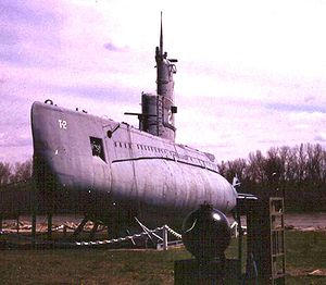
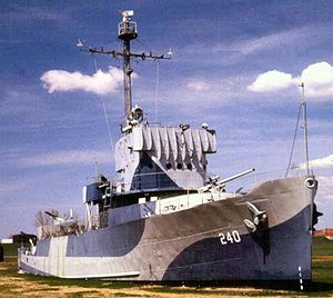
| Freedom Park | 2497 Freedom Park Road | Home of the Nebraska Cricket Club, USS Hazard (AM-240) USS Hazard (AM-240) USS Hazard was an which served in the United States Navy during World War II.Hazard was launched on 1 October 1944 and was commissioned on 30 December 1944. The vessel was built by the Winslow Marine Railway and Shipbuilding Corporation of Winslow, Washington... and the USS Marlin (SST-2) USS Marlin (SST-2) USS Marlin , originally USS T-2 , was a T-1-class training submarine in commission from 1953 to 1973. She was the second submarine of the United States Navy to be named for the marlin, a large game fish. She was one of the smallest operational submarines ever built for the U.S... . |
|
| Gallagher Park | 2936 North 52nd Street | 18 acres (72,843.5 m²) including a playground, ball fields, a swimming pool and a historical monument to the former Krug Park Krug Park (Omaha) Krug Park was an amusement park located at 2936 North 52nd Street in the Benson neighborhood of Omaha, Nebraska, USA at the turn of the 20th century. In 1930, Krug Park was the site of the worst roller coaster accident in the nation up to that time.- History :Charles Tietz, an early Omaha... . |
|
| Grace Young Park | 6317 Military Avenue | 2.4 acres (9,712.5 m²), including a playground, ball field and basketball court. | |
| Gene Leahy Mall Gene Leahy Mall Gene Leahy Mall, also known locally as Central Park or The Mall, is a park located at 1302 Farnam on the Mall in Downtown Omaha, Nebraska and bordered by South 10th Street. The Mall is encircled by a long pathway that wraps around a large lagoon. There are also waterfalls, two huge slides, a... |
1302 Farnam on the Mall | ||
| Gifford Park Gifford Park Gifford Park is a historic neighborhood in midtown Omaha, Nebraska. It is roughly bounded by the North Freeway on the east, North 38th Street on the west, Dodge Street on the south and Cuming Street on the north. Its namesake park was added to the City parks network in 1916... |
|||
| Gifford River Drive Park | |||
| Glenn Cunningham Lake Glenn Cunningham Lake Glenn Cunningham Lake is located in Omaha, Nebraska, United States. The park is located along 96th Street with entrances at State Highway 36, State Street, 96th Street and Rainwood Road. The lake is a part of Little Papillion Creek, which is part of the Papillion Creek watershed.Glenn Cunningham... |
8660 Lake Cunningham Road | 1977 | |
| Grace Young Park | |||
| Graham Park | |||
| Greentree Park | |||
| H.H. Harper Park | |||
| Hanscom Park Hanscom Park Hanscom Park is a historic neighborhood in Midtown Omaha, Nebraska. Its namesake public park is one of the oldest parks in Omaha, donated to the City in 1872. U.S. President Gerald R. Ford was born in a house in the Hanscom Park neighborhood... |
1899 South 32nd Avenue | 1889 | |
| Harrison Heights Park | |||
| Harvey Oaks Park | |||
| Heartland of America Park Heartland of America Park The Heartland of America Park is a public park located at 800 Douglas Street in downtown Omaha, Nebraska USA. The park is situated between Interstate 80 and the Missouri River, and is adjacent to Gene Leahy Mall and the Old Market and connects to Lewis & Clark Landing.-History:The area where the... |
|||
| Hefflinger Park Hefflinger Park The Heffllinger Park is located on 112th and Maple Street in West Omaha, Nebraska. Hefflinger Park opened in August 2006 in partnership with the City of Omaha. The Omaha Dog Park is a area within the park that also includes a play area for dogs under 30 pounds.... |
|||
| Highland Park | |||
| Hillsborough Park Hillsborough Park Hillsborough Park is a large parkland area in Hillsborough, Sheffield, South Yorkshire, England. The park was created in 1897 by the Dixon Family, who built Hillsborough Hall. It is now owned by Sheffield City Council and the hall is used as a library.... |
|||
| Hillside Little League Park | |||
| Himebaugh Park | |||
| Hitchcock Park Hitchcock Park Hitchcock Park is a public park located at 4220 "Q" Street in South Omaha, Nebraska. The park is regarded as a "popular South Omaha spot," along with the Henry Doorly Zoo and Rosenblatt Stadium. Due to a settlement between the U.S. Government and the City of Omaha, the park is subject to all... |
|||
| Hummel Park Hummel Park Hummel Park is located at 11808 John J. Pershing Drive in North Omaha, Nebraska. Developed on of land donated to the City of Omaha in 1930, the park was named after J.B. Hummel, a long time superintendent of Omaha's Parks and Recreation Department.-About:... |
11808 John J. Pershing Drive | 202 acre (0.81746572 km²) including a historical monument for Fort Lisa. The park was created in 1930. | |
| James F. Lynch Park | |||
| John P. Munnley Park | |||
| Karen Park | |||
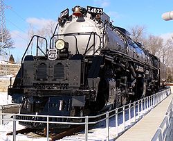
| Kenefick Park Kenefick Park Kenefick Park is located at 100 Bancroft Street in South Omaha, Nebraska. Located next to the Lauritzen Gardens, Omaha's botanical gardens, the park features "two of the greatest locomotives ever to power Union Pacific Railroad."-About:... |
100 Bancroft Street (next to the Lauritzen Gardens) | ||
| Kellom Greenbelt Park | |||
| Kellom Park | 2310 Nicholas Street | A 6 acres (24,281.2 m²) park. | |
| Keystone Park Keystone Park Keystone Park is a former baseball ground located in Philadelphia, Pennsylvania. The ground was home to the Philadelphia Keystones of the Union Association in 1884.... |
|||
| Kingswood Park | |||
| Kiwanis Park Kiwanis Park Kiwanis Park is a 3,500 seat baseball field located in Moncton, New Brunswick. The field was donated to the City of Moncton in 1953 by the local Kiwanis Club. It is the largest baseball field in Canada east of Quebec City. The field is the current home of the Moncton Mets and Moncton's newest New... |
|||
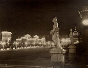
| Kountze Park Kountze Park (Omaha, Nebraska) Kountze Park is an urban public park located at 1920 Pinkney Street in the Kountze Place neighborhood of North Omaha, Nebraska, in the United States, and is historically significant as the site of the Trans-Mississippi Exposition of 1898.-About:... |
1920 Pinkney Street | 10 acres (40,468.6 m²) including a playground, ball field, basketball courts, tennis courts, a community center, shelter area and restrooms. | |
| Lake Forest Estates Park | |||
| Lake Forest Park | |||
| Lake James Park | |||
| Lamp Park | |||
| Leavenworth Park | |||
| Lee Valley Park Lee Valley Park Lee Valley Regional Park is a long linear park, much of it green spaces, running through the northeast of London, Essex and Hertfordshire from the River Thames to Ware in Hertfordshire, England through areas such as Hackney, Tottenham, Enfield, Stratford, Tower Hamlets, Walthamstow, Cheshunt,... |
|||
| Lewis & Clark Landing Lewis & Clark Landing The Lewis and Clark Landing is a public park located at 515 North Riverfront Drive in downtown Omaha, Nebraska. This park is situated along the eight-foot-tall river walk of the Missouri River just north of U.S. Interstate 480.- History :... |
|||
| Little Elmwood Park | |||
| Kenifick Park | 100 Bancroft Avenue | ||
| Mandan Park | |||
| Maple Village Park | |||
| McKinley Park | |||
| Meadow Lane Park | |||
| Memorial Park Memorial Park (Omaha) Memorial Park is a park located at 6005 Underwood Avenue near the Dundee neighborhood of Omaha, Nebraska. The park was created as a memorial for all of the men and women from Douglas County that have served in the armed forces.-History:... |
6008 Underwood Avenue | 1948 | |
| Mercer Park | |||
| Metcalfe Park | |||
| Miami Playground | |||
| Michael Thell NEA Park | |||
| Miguel Keith Park | |||
| Millard Heights Park | |||
| Millard Highlands Park | |||
| Miller Park Miller Park (park) Miller Park is located at 6201 North 30th Street in North Omaha, Nebraska. Bounded by Redick and Kansas Avenues on the north and south and 24th and 30th Streets on the east and west, respectively, the park was added to the city of Omaha in 1891.-History:... |
6201 North 30th Street | Founded in 1891, the park includes a lake, artesian well fountain, golf course, trails, picnic areas, pavilion, playground, baseball fields and soccer fields. | |
| Miller's Landing Park | |||
| Mockingbird Heights Park | |||
| Montclair/Westbrook Park | |||
| Morton Park | |||
| Mount Vernon Garden | |||
| Myott Park | |||
| North Oaks Park | |||
| Northwest Park | |||
| Norwick Park | |||
| Oak Heights Park | |||
| Oakbrook Park | |||
| Oaks Park, Omaha | |||
| Omaha Botanical Gardens Omaha Botanical Gardens Omaha Botanical Gardens , officially known as Lauritzen Gardens, Omaha's Botanical Center, are a botanical gardens and an arboretum located at 100 Bancroft Street, Omaha, Nebraska. The gardens are open daily during business hours; an admission fee is charged.-About:The gardens began in 1982,... (aka Lauritzen Gardens) |
2001 South 6th Street | 1982 | |
| One Pacific Place Park | |||
| Orchard Park | |||
| Pacific Meadows Park | |||
| Palomino Hills Park | |||
| Park East Park | |||
| Parkside Park | |||
| Peterson Park | |||
| Pheasant Run Park | |||
| Pinewood Park | |||
| Pipal Park Pipal Park Pipal Park is located at 7770 Hascall Street in southwest Omaha, Nebraska. Pipal Park was one of the areas struck by one of the most destructive tornados in the history of the USA. The tornado devastated parts of Omaha including Pipal Park on May 5, 1975... |
7802 Hascall St | ||
| Prairie Lane Park | |||
| Pulaski Park Pulaski Park (Omaha) Pulaski Park is a park located at 4065 G Street in Omaha, Nebraska 68107.- History :General Casimir Pulaski 1745-1779. "An officer famous throughout Europe for his bravery and conduct in defense of the liberties of his country against... great invading powers. - Omaha Polish Landmarks :Pulaski... |
|||
| Rambleridge Park Rambleridge Park Ramble Ridge Park was developed in the late 1970s at 11424 Fort Street in Omaha, Nebraska. The park includes a lagoon, walking trails, soccer fields and a large green space for miscellaneous activities. A small playground is located farther in the neighborhood and can be reached after a short walk... |
11424 Fort Street | ||
| Raven Oaks Park | 7901 Raven Oaks Drive | ||
| Regency Park | |||
| Ridgefield Park | |||
| Riverview Park | |||
| Roanoke Park | |||
| Rock Glen Park | |||
| Rockbrook Park | |||
| Roxbury Park | |||
| Saddle Hills Park | |||
| Sandoz Park | |||
| Schroeder-Vogel Park | |||
| Seymour Smith Park Seymour Smith Park Seymour Smith Park is an urban park located at 68th and Harrison Streets in Omaha, Nebraska.-Facilities:The park has recreational athletic facilities including a baseball field, football pitches, disc golf, and tennis courts. The baseball field hosts American Legion Baseball and the UNO Mavericks... |
6802 Harrison Street | 1962 | |
| Signal Hill Park | |||
| Somerset Park Somerset Park (Omaha, Nebraska) Somerset Park is a public park located along Wenninghoff Road and North 86th Street in northwest Omaha, Nebraska. It is bordered on the west side by the Little Papillion Creek. The first phase of Somerset Park was created in 1994. The space includes a park, covered picnic area, walking paths,... |
Wenninghoff Road and North 86th Street | 1994 | |
| Spaulding Park | |||
| Spring Lake Park Spring Lake (Omaha, Nebraska) Spring Lake, also historically called Syndicate Park, is a historic neighborhood in Omaha, Nebraska. It is bounded by I-80 on the north, Missouri Avenue on the south, Highway 75 on the west and South 13th Street on the east. Spring Lake is also the name of an area park and elementary school... |
|||
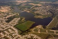
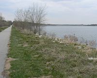
| Standing Bear Lake Standing Bear Lake Standing Bear Lake, also known as Dam Site 16, is a park located at 6404 North 132nd street in West Omaha, Nebraska.The park has a lake with boating in the summertime, and ice skating in the winter... |
6404 N. 132nd st | 1977 | |
| Stillmeadow Park | |||
| Storz Rugby Complex | North 16th and Storz Expressway | ||
| Sunny Slope Park | |||
| Swanson Park | |||
| Templeton Mini-Park | |||
| Timber Creek Park | |||
| Tomahawk Hills Park | |||
| Towl Park | |||
| Tranquility Park | |||
| Trendwood Park | |||
| Turner Park | |||
| Unity Park | |||
| Upland Park Upland Park Upland Park is a public park located at 3014 Jefferson Street in South Omaha, Nebraska. The park and surrounding neighborhood were opened in 1913.... |
|||
| Walnut Grove Park | |||
| Walnut Hill Park | |||
| Wentworth Park Wentworth Park Wentworth Park is a multi-purpose sporting facility in the suburb of Glebe in New South Wales, Australia.that is used for various sports including rugby union, rugby league, soccer and greyhound racing. Wentworth Park is located 2 kilometres from the Sydney central business district... |
|||
| West Fairacres Park | |||
| Westchester Park | |||
| Western Trails Park | |||
| Westgate Park Westgate Park Westgate Park was a former baseball stadium located in San Diego, California. The ballpark was home to the San Diego Padres of the Pacific Coast League from 1958 to 1967.The ballpark was located in the Mission Valley region of San Diego... |
|||
| Westroads Parkway | |||
| Westwood Heights Park | |||
| Woodhaven Park | |||
| Yale Park Yale Park Yale Park is a public waterfront park located on the shores of Yale Lake in Washington, United States. Besides a great view of Mt. St. Helens, Yale Park provides 30 picnic sites, parking for 130 cars and 80 trailers, a boat ramp with four lanes and a swimming beach.... |
3377 Lake street | ||
| Young Park | 411½ N. Elmwood Road | ||
| Youngman Connector Park | 163rd and Farnam Streets | ||
| Zorinsky Lake Park Zorinsky Lake Park Zorinsky Lake Park is a park located at 156th and F streets in West Omaha, Nebraska. Named after Senator Edward Zorinsky of Omaha, the park has a lake offering boating and fishing. The park is surrounded by of public land, including dedicated to wildlife management... |
156th and F streets | 1993 |
External links
- Parks in Omaha - Info about parks and public places in Omaha

