
Wheatfield, New York
Encyclopedia
Town
A town is a human settlement larger than a village but smaller than a city. The size a settlement must be in order to be called a "town" varies considerably in different parts of the world, so that, for example, many American "small towns" seem to British people to be no more than villages, while...
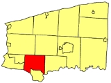
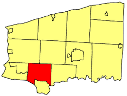
in Niagara County
Niagara County, New York
Niagara County is a county located in the U.S. state of New York. As of the 2010 census, the population was 216,469. The county seat is Lockport. The county name is from the Iroquois word Onguiaahra; meaning the strait or thunder of waters. It is the location of Niagara Falls and Fort Niagara, and...
, New York
New York
New York is a state in the Northeastern region of the United States. It is the nation's third most populous state. New York is bordered by New Jersey and Pennsylvania to the south, and by Connecticut, Massachusetts and Vermont to the east...
, United States
United States
The United States of America is a federal constitutional republic comprising fifty states and a federal district...
. The population was 18,117 at the 2010 census. The name stems from the agricultural use of the town lands: Growing Wheat
Wheat
Wheat is a cereal grain, originally from the Levant region of the Near East, but now cultivated worldwide. In 2007 world production of wheat was 607 million tons, making it the third most-produced cereal after maize and rice...
.
The Town of Wheatfield is east of Niagara Falls International Airport
Niagara Falls International Airport
-Traffic figures:Niagara Falls International received 56,943 passengers in 2008. As per Federal Aviation Administration records, the airport had 660 passenger boardings in calendar year 2005 and 1,409 unscheduled enplanements in 2006....
.
History
Niagara, New York
Niagara is a town in Niagara County, New York, United States. As of the 2010 census, the town had a total population of 8,378. The town is named after the famous waterfall Niagara Falls....
. It is situated in the southwest part of the county, surrounded by the Town of Lewiston and Town of Cambria to the north, Town of Pendleton to the east, City of North Tonawanda and Niagara River to the south, and the City of Niagara Falls and Town of Niagara to the west.
The first town meeting was held on June 6, 1836, in the schoolhouse of District No. 7, on the north line of the Town. Soil of the Town is generally clay loam and somewhat difficult to cultivate, but heavy crops of wheat can be grown on the land, thus giving the Town its name - Wheatfield.
Within Wheatfield, starting in 1843, German immigrants established the communities of Bergholz, St. Johnsburg, Walmore, Martinsville, and Gratwick. The latter two towns are now part of North Tonawanda.
Later other communities were formed at railroad stops and along some well traveled highways. The River Road section of the Town became a prosperous farm section in the 1920s that included the showplace "Wheatfield Farms". Along the river, there were vacation cottages, beaches, an amusement park, and nightclubs. Permanent housing has replaced many of the cottages and remnants of some bygone structures are still visible as one travels along River Road today.
During World War II, industries located in the Town. The largest was Bell AeroSpace Company which produced the World War II fighter plane, P-39 Airacobra, and later, products for the aerospace industry. During the post war period, other small industries and businesses were established in the Town, especially those serving the tourist trade such as motels and restaurants.
Growth and prosperity in the Town continued as families migrated from nearby communities creating new neighborhoods. During this period, Summit Park Mall was built and opened in 1972 to serve the people of Wheatfield and nearby communities.
The largest spurt of growth in the Town began in the 1980s and still continues today with many new housing developments emerging and new industrial and business parks being built. The population of the Town now exceeds 13,000, which classifies it as a town of the first class. Even with the growth of the Town, farming is still carried on with dairy farming being our main enterprise.
Probably the earliest settler on the site of North Tonawanda was George N. Burger, who came in 1809 and built a log tavern on the river; he remained a resident until about 1825. Joshua Pettit came in 1810 and settled near the Niagara Iron Works, where he opened a tavern. He was the father of Mrs. Daniel C. Jacobs and Mrs. Whitman Jacobs. Stephen Jacobs, a soldier at the battle of Bunker Hill, located on the river two miles (3 km) below in 1817, where he purchased 196 acre (0.79318456 km²) of Augustus Porter, paying eight dollars an acre. He died in Niagara Falls in January, 1840. William Vandervoorte settled here in 1825, occupying a log house which tradition says was the only one then in existence. It was his intention to make a business of purchasing staves and timber for the Boston market, and ultimately to open a mercantile business. In 1828 he finished the first public house in the place, which was called the Niagara; it was burned in 1844. Later he purchased 1000 acres (4 km²) of land of the Holland Company and sold to Prussian immigrants the largest part of their possessions on Tonawanda Creek and its vicinity. He established the first bank in 1836. As before indicated, little progress of a business nature was made here until the opening of the Erie Canal. The interior of the town was still almost an unbroken wilderness and as late as 1850 a large part of the area of the town was unimproved.
Das Haus
Das Haus is the heritage museum of the Historical Society of North German Settlements in Western New York. It is an original log house built in 1843 by immigrants who left Germany to find religious freedom. In the Town of Wheatfield they founded the communities of Bergholz, Martinsville and Walmore, and later St. Johnsburg.Emigration historian Eugene Camann, founder and curator, is the fourth generation of his family to live in the village, also home to his descendants, the fifth, sixth and seventh generations. He bought the 1843 log house and converted it into the museum, largely with artifacts and items he spent a lifetime collecting. The museum is sponsored and maintained by the Historical Society of North German Settlements in Western New York.
In Das Haus and in a replica barn called Der Stall, the museum shows the German style of the building they used later, as well as items typical of rural life in the Town during the 19th century. The Town of Wheatfield Garden Club maintains planting typical of that time.
The museum is open on Sunday afternoons from 2 to 4 P.M. starting with the third Sunday in May and running through the third Sunday in October. Appointments can also be made. For more information or a list of publications issued by the society, write to the address above or contact Wilma Lass, 716-731-9905 or Elaine Timm, 716-998-5897 or etimm01@aol.com
Original First Officers
Supervisor: Tyler SenseTown Clerk: Taylor Turpin
Assessors: Isaac Smith, James Sweeney, Hiram Parks.
Justices of The Peace: L. B. Warden, John Sweeney.
Commissioners of Highways: Elias Parks, Matthew Gray.
Collector: Stewart Milliman.
Overseer of the Poor: William Towsley.
Constables: Milliman, Daniel Jacobs, Calvin Champlin, Seth Roberts
Commissioners of Schools: Isaac Young, James Sweeney, Loyal Edwards.
Officials of the Township of Wheatfield (Town of Wheatfield)
Supervisor: Robert CliffeTown Clerk: Kathy Harrington
Assessors: Bridgette Grawe
Attorney: Robert O'Toole
Planning Board: Richard W. Muscatello
Commissioners of Highways: Art Kroening
Historian: Walter Bissett
Zoning Board of Appeals: Terrence McIntyre
Constables: Robin Zastrow
Superintendent of Schools: Carl Militello
Economic Development Committee: John Petrozzi
Firearms Permit Review Board: Paul Cozad
Drainage Committee: Neal Klettke
Website Task Force Committee: Don Wallace
Geography
According to the United States Census BureauUnited States Census Bureau
The United States Census Bureau is the government agency that is responsible for the United States Census. It also gathers other national demographic and economic data...
, the town has a total area of 28.6 square miles (74.1 km²), of which 27.9 square miles (72.3 km²) is land and 0.7 square miles (1.8 km²) 2.41% is water.
The Niagara River
Niagara River
The Niagara River flows north from Lake Erie to Lake Ontario. It forms part of the border between the Province of Ontario in Canada and New York State in the United States. There are differing theories as to the origin of the name of the river...
is part of the western border of the town.
Adjacent Cities & Towns
- City of North TonawandaNorth Tonawanda, New YorkNorth Tonawanda is a city in Niagara County, New York, United States. The population was 31,568 at the 2000 census. It is part of the Buffalo–Niagara Falls Metropolitan Statistical Area. The city is named after Tonawanda Creek, its south border...
- south - City of Niagara FallsNiagara Falls, New YorkNiagara Falls is a city in Niagara County, New York, United States. As of the 2010 census, the city had a total population of 50,193, down from the 55,593 recorded in the 2000 census. It is across the Niagara River from Niagara Falls, Ontario , both named after the famed Niagara Falls which they...
- west - Town of NiagaraNiagara, New YorkNiagara is a town in Niagara County, New York, United States. As of the 2010 census, the town had a total population of 8,378. The town is named after the famous waterfall Niagara Falls....
- west - Town of LewistonLewiston, New YorkLewiston is a village in Niagara County, New York, United States. The population was 2,781 at the 2000 census. The village is named after Morgan Lewis, an early 19th-century governor of New York. It is part of the Buffalo–Niagara Falls Metropolitan Statistical Area.The Village of Lewiston,...
- northwest - Town of CambriaCambria, New YorkCambria is a town in Niagara County, New York, USA. The population was 5,839 at the 2010 census. Cambria is an early name for Wales.The Town of Cambria is in the center of Niagara County.New York State Route 93 passes through the town.- History :...
- northeast - Town of PendletonPendleton, New YorkPendleton is a town on the southern edge of Niagara County, New York, United States. It is east of the city of Niagara Falls and southwest of the city of Lockport. The population was 6,397 at the 2010 census.- History :...
- east - Erie CountyErie County, New YorkErie County is a county located in the U.S. state of New York. As of the 2010 census, the population was 919,040. The county seat is Buffalo. The county's name comes from Lake Erie, which in turn comes from the Erie tribe of American Indians who lived south and east of the lake before 1654.Erie...
, Town of AmherstAmherst, New YorkAmherst is a town in Erie County, New York, United States. As of the 2010 census, the town had a total population of 122,366. This represents an increase of 5.0% from the 2000 census. The town is named for Jeffrey Amherst, a British Army officer of the colonial period...
- southeast - Erie County, Town of Grand IslandGrand Island, New YorkGrand Island is a town and an island in Erie County, New York, USA. As of the 2010 census, the town population is 20,374. This represents an increase of 9.41% from the 2000 census figure . The current town name derives from the French name La Grande Île, as Grand Island is the largest island in...
- southwest
Major Highways in the Town of Wheatfield
 U.S. Route 62U.S. Route 62U.S. Route 62 runs from the US-Mexico border at El Paso, Texas to Niagara Falls, New York, near the United States-Canada border. It is the only east-west US Route that connects Mexico and Canada.Parts of U.S...
(Niagara Falls Blvd.), North-South highway that crosses the town from Amherst town line to Niagara Falls city line.

 New York State Route 265New York State Route 265New York State Route 265 is a state highway located in the western part of New York in the United States. NY 265 is a north–south route that roughly parallels the western parts of the Niagara River in Erie County and Niagara County...
/ New York State Route 384New York State Route 384New York State Route 384 is a state highway in Western New York in the United States. It is a north–south route extending from the city of Buffalo, Erie County to the city of Niagara Falls, Niagara County, and is one of several routes directly connecting the two cities. The southern terminus...
(River Rd.), North-South Highway through west part of town that parallels the Niagara River with both New York Routes NY 265 and NY 384; from the Niagara Falls city line to the North Tonawanda city line.
 New York State Route 425New York State Route 425New York State Route 425 is a New York state highway that runs from NY 18 in Wilson, New York on the shore of Lake Ontario to a connection with Interstate 290 in the Town of Tonawanda...
(Shawnee Rd.), North-South roadway through the town from North Tonawanda city line to Cambria town line.
 New York State Route 429New York State Route 429New York State Route 429 is a north–south state highway located entirely within Niagara County, New York, in the United States. It extends for from an intersection with NY 265 and NY 384 in North Tonawanda to a junction with NY 104 on the border between the towns of Cambria...
(Ward Rd.), North-South roadway through the town from the North Tonawanda city line to the Lewiston town line.
Demographics
Wheatfield, NY is considered to be a part of the BuffaloBuffalo, New York
Buffalo is the second most populous city in the state of New York, after New York City. Located in Western New York on the eastern shores of Lake Erie and at the head of the Niagara River across from Fort Erie, Ontario, Buffalo is the seat of Erie County and the principal city of the...
-Niagara Metro Area.
As of the population estimates in July 2005, the town's current population is 15,768, which is an 11.9% increase from 2000, in fact this is one of the fastest growing towns in the State of New York. This makes it the fastest growing town or city in Western New York
Western New York
Western New York is the westernmost region of the state of New York. It includes the cities of Buffalo, Rochester, Niagara Falls, the surrounding suburbs, as well as the outlying rural areas of the Great Lakes lowlands, the Genesee Valley, and the Southern Tier. Some historians, scholars and others...
.
As of the census
Census
A census is the procedure of systematically acquiring and recording information about the members of a given population. It is a regularly occurring and official count of a particular population. The term is used mostly in connection with national population and housing censuses; other common...
of 2000, there were 14,086 people, 5,305 households, and 3,893 families residing in the town. The population density
Population density
Population density is a measurement of population per unit area or unit volume. It is frequently applied to living organisms, and particularly to humans...
was 504.6 people per square mile (194.9/km²). There were 5,555 housing units at an average density of 199.0 per square mile (76.8/km²). The racial makeup of the town was 97.44% White, 0.99% African American, 0.43% Native American, 0.49% Asian, 0.04% Pacific Islander, 0.08% from other races
Race (United States Census)
Race and ethnicity in the United States Census, as defined by the Federal Office of Management and Budget and the United States Census Bureau, are self-identification data items in which residents choose the race or races with which they most closely identify, and indicate whether or not they are...
, and 0.55% from two or more races. Hispanic or Latino of any race were 0.58% of the population.
There were 5,305 households out of which 32.3% had children under the age of 18 living with them, 63.6% were married couples
Marriage
Marriage is a social union or legal contract between people that creates kinship. It is an institution in which interpersonal relationships, usually intimate and sexual, are acknowledged in a variety of ways, depending on the culture or subculture in which it is found...
living together, 6.7% had a female householder with no husband present, and 26.6% were non-families. 22.6% of all households were made up of individuals and 10.6% had someone living alone who was 65 years of age or older. The average household size was 2.58 and the average family size was 3.04.
In the town the population was spread out with 23.5% under the age of 18, 6.4% from 18 to 24, 29.1% from 25 to 44, 25.2% from 45 to 64, and 15.8% who were 65 years of age or older. The median age was 40 years. For every 100 females there were 93.0 males. For every 100 females age 18 and over, there were 90.3 males.
The median income for a household in the town was $51,700, and the median income for a family was $61,315. Males had a median income of $42,076 versus $27,233 for females. The per capita income
Per capita income
Per capita income or income per person is a measure of mean income within an economic aggregate, such as a country or city. It is calculated by taking a measure of all sources of income in the aggregate and dividing it by the total population...
for the town was $22,184. About 2.5% of families and 4.2% of the population were below the poverty line, including 3.5% of those under age 18 and 5.9% of those age 65 or over.
Public schools
Niagara Wheatfield Senior High School: Grades 9 - 12Edward Town Middle School: Grades 6 - 8
Colonial Village Elementary School: Grades PreK - 5
Errick Road Elementary School: Grades PreK - 5
West Street Elementary School Grades PreK - 5
Tuscarora Indian School: Grades PreK - 6
Private schools
Wheatfield Christian Academy: Grades PreK - 12St. Peter's Lutheran Church and School
St. Peter's Lutheran Church and School
St. Peter's Lutheran Church and School is a former member of the ELCA. St Peter's Lutheran joined the Lutheran Congregations in Mission for Christ .-Background:...
: Grades PreK - 8
Holy Ghost Lutheran School: Grades PreK - 8
St. John Lutheran School: Grades PreK - 8
Additional information about Wheatfield
Within the Town of Wheatfield there is a Boy Scout troop 833Scouting in New York
Scouting in New York has a long history, from the 1910s to the present day, serving thousands of youth in programs that suit the environment in which they live...
and a Cub Scout Pack 833
Cub Scouts (Boy Scouts of America)
Cub Scouting is part of the Scouting program of the Boy Scouts of America , available to boys from first through fifth-grade, or 7 to 11½ years of age and their families. Its membership is the largest of the three BSA Scouting Divisions...
pack, located at Adams Fire Company on Nash Road.
John Wayne Bobbitt graduated from Niagara Wheatfield Senior Highschool in 1985.
Wheatfield does not have a post office, so residents use the nearest one and in as a result have that town or city name as an address. They use North Tonawanda, NY's, Niagara Falls
Niagara Falls, New York
Niagara Falls is a city in Niagara County, New York, United States. As of the 2010 census, the city had a total population of 50,193, down from the 55,593 recorded in the 2000 census. It is across the Niagara River from Niagara Falls, Ontario , both named after the famed Niagara Falls which they...
's or Sanborn
Sanborn, New York
Sanborn is a hamlet in the Towns of Cambria Wheatfield, New York and Lewiston, New York, USA, on the southeast corner of the intersection of New York State Route 429 and New York State Route 31. Originally called South Pekin after the formerly thriving hamlet of Pekin to the north, Sanborn was...
's zip code.
Communities and locations in Wheatfield
(Most communities in Wheatfield are connected through urban sprawlUrban sprawl
Urban sprawl, also known as suburban sprawl, is a multifaceted concept, which includes the spreading outwards of a city and its suburbs to its outskirts to low-density and auto-dependent development on rural land, high segregation of uses Urban sprawl, also known as suburban sprawl, is a...
).
- Bergholz – A hamletHamlet (place)A hamlet is usually a rural settlement which is too small to be considered a village, though sometimes the word is used for a different sort of community. Historically, when a hamlet became large enough to justify building a church, it was then classified as a village...
in the northwestern part of the town near the airport. - HoffmanHoffman, New YorkHoffman, New York is an unincorporated hamlet in the towns of Pendleton and Wheatfield in Niagara County, New York, USA.-References:...
– A location on the eastern border of the town. - NashvilleNashville, New YorkNashville, New York is an unincorporated hamlet in the town of Wheatfield in Niagara County, New York, USA.-References:...
– A location on US-62 in the southeast part of the town. - Niagara Falls International Airport (IAG) – Part of the airportAirportAn airport is a location where aircraft such as fixed-wing aircraft, helicopters, and blimps take off and land. Aircraft may be stored or maintained at an airport...
is in the northern part of the town. - SawyerSawyer, New YorkSawyer, New York is an unincorporated hamlet in the town of Wheatfield in Niagara County, New York, USA.-References:...
– A hamlet on US-62 adjacent to the City of North Tonawanda. - ShawneeShawnee, New YorkShawnee, New York is an unincorporated hamlet in the town of Wheatfield in Niagara County, New York, USA.-References:...
– A hamlet on US-62 (Niagara Falls Boulevard). - St. JohnsburgSaint Johnsburg, New YorkSt. Johnsburg, New York is an unincorporated hamlet in the town of Wheatfield in Niagara County, New York, USA.-References:...
– A hamlet on US-62 near the center of the town. - WalmoreWalmore, New YorkWalmore, New York is an unincorporated hamlet in the town of Wheatfield in Niagara County, New York, USA.-References:...
– A hamlet in the northwest part of the town on Lockport Road.
External links
- Das Haus Museum Official Website
- Town of Wheatfield webpage
- Wheatfield history
- Wheatfield Jr. Blades the local Jr. B hockey team
- Troop 833 Website Boy Scout Troop 833 Website
- Das Haus - German Heritage Museum information
| North: Sanborn Sanborn, New York Sanborn is a hamlet in the Towns of Cambria Wheatfield, New York and Lewiston, New York, USA, on the southeast corner of the intersection of New York State Route 429 and New York State Route 31. Originally called South Pekin after the formerly thriving hamlet of Pekin to the north, Sanborn was... , Lewiston Lewiston (town), New York Lewiston is a town in Niagara County, New York United States. The population was 16,262 at the 2010 census. The town and its contained village are named after Morgan Lewis, a governor of New York.... |
||
| West: Niagara Falls Niagara Falls, New York Niagara Falls is a city in Niagara County, New York, United States. As of the 2010 census, the city had a total population of 50,193, down from the 55,593 recorded in the 2000 census. It is across the Niagara River from Niagara Falls, Ontario , both named after the famed Niagara Falls which they... , Town of Niagara Niagara, New York Niagara is a town in Niagara County, New York, United States. As of the 2010 census, the town had a total population of 8,378. The town is named after the famous waterfall Niagara Falls.... |
Town Of Wheatfield | East: Pendleton Pendleton, New York Pendleton is a town on the southern edge of Niagara County, New York, United States. It is east of the city of Niagara Falls and southwest of the city of Lockport. The population was 6,397 at the 2010 census.- History :... |
| Southwest: Grand Island Grand Island, New York Grand Island is a town and an island in Erie County, New York, USA. As of the 2010 census, the town population is 20,374. This represents an increase of 9.41% from the 2000 census figure . The current town name derives from the French name La Grande Île, as Grand Island is the largest island in... , Niagara River Niagara River The Niagara River flows north from Lake Erie to Lake Ontario. It forms part of the border between the Province of Ontario in Canada and New York State in the United States. There are differing theories as to the origin of the name of the river... |
South: N. Tonawanda North Tonawanda, New York North Tonawanda is a city in Niagara County, New York, United States. The population was 31,568 at the 2000 census. It is part of the Buffalo–Niagara Falls Metropolitan Statistical Area. The city is named after Tonawanda Creek, its south border... , Erie Canal Erie Canal The Erie Canal is a waterway in New York that runs about from Albany, New York, on the Hudson River to Buffalo, New York, at Lake Erie, completing a navigable water route from the Atlantic Ocean to the Great Lakes. The canal contains 36 locks and encompasses a total elevation differential of... |
Southeast: Amherst Amherst, New York Amherst is a town in Erie County, New York, United States. As of the 2010 census, the town had a total population of 122,366. This represents an increase of 5.0% from the 2000 census. The town is named for Jeffrey Amherst, a British Army officer of the colonial period... |