
Neder-Betuwe
Encyclopedia
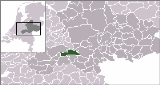
 Neder-Betuwe is a municipality
Municipality
A municipality is essentially an urban administrative division having corporate status and usually powers of self-government. It can also be used to mean the governing body of a municipality. A municipality is a general-purpose administrative subdivision, as opposed to a special-purpose district...
in the eastern Netherlands
Netherlands
The Netherlands is a constituent country of the Kingdom of the Netherlands, located mainly in North-West Europe and with several islands in the Caribbean. Mainland Netherlands borders the North Sea to the north and west, Belgium to the south, and Germany to the east, and shares maritime borders...
.
Geography
The municipal boundaries are for a large part defined by the riverRiver
A river is a natural watercourse, usually freshwater, flowing towards an ocean, a lake, a sea, or another river. In a few cases, a river simply flows into the ground or dries up completely before reaching another body of water. Small rivers may also be called by several other names, including...
Waal to the south, the river Rhine to the North and the Amsterdam-Rhine Canal
Amsterdam-Rhine Canal
The Amsterdam–Rhine Canal or Amsterdam-Rijnkanaal is a canal in the Netherlands that was built to connect the port city of Amsterdam to the main shipping artery of the Rhine...
to the west. Because of the location between the two rivers the area is as narrow as 3 km near Opheusden.
The area is basically a polder
Polder
A polder is a low-lying tract of land enclosed by embankments known as dikes, that forms an artificial hydrological entity, meaning it has no connection with outside water other than through manually-operated devices...
, dikes protect the former floodplain
Floodplain
A floodplain, or flood plain, is a flat or nearly flat land adjacent a stream or river that stretches from the banks of its channel to the base of the enclosing valley walls and experiences flooding during periods of high discharge...
from flooding. Since it was a floodplain the area is relatively flat and the soil is mainly clay
Clay
Clay is a general term including many combinations of one or more clay minerals with traces of metal oxides and organic matter. Geologic clay deposits are mostly composed of phyllosilicate minerals containing variable amounts of water trapped in the mineral structure.- Formation :Clay minerals...
with layers of sand
Sand
Sand is a naturally occurring granular material composed of finely divided rock and mineral particles.The composition of sand is highly variable, depending on the local rock sources and conditions, but the most common constituent of sand in inland continental settings and non-tropical coastal...
and gravel
Gravel
Gravel is composed of unconsolidated rock fragments that have a general particle size range and include size classes from granule- to boulder-sized fragments. Gravel can be sub-categorized into granule and cobble...
underneath.
Culture and history
ArchaeologicalArchaeology
Archaeology, or archeology , is the study of human society, primarily through the recovery and analysis of the material culture and environmental data that they have left behind, which includes artifacts, architecture, biofacts and cultural landscapes...
excavations have found remains dating back to the stone age
Stone Age
The Stone Age is a broad prehistoric period, lasting about 2.5 million years , during which humans and their predecessor species in the genus Homo, as well as the earlier partly contemporary genera Australopithecus and Paranthropus, widely used exclusively stone as their hard material in the...
and Iron Age
Iron Age
The Iron Age is the archaeological period generally occurring after the Bronze Age, marked by the prevalent use of iron. The early period of the age is characterized by the widespread use of iron or steel. The adoption of such material coincided with other changes in society, including differing...
although it is not known if the area was permanently inhabited. The Neder-Betuwe area is along the northernmost border or Limes
Limes
A limes was a border defense or delimiting system of Ancient Rome. It marked the boundaries of the Roman Empire.The Latin noun limes had a number of different meanings: a path or balk delimiting fields, a boundary line or marker, any road or path, any channel, such as a stream channel, or any...
of the Roman empire
Roman Empire
The Roman Empire was the post-Republican period of the ancient Roman civilization, characterised by an autocratic form of government and large territorial holdings in Europe and around the Mediterranean....
. Evidence suggests that a Roman fort (Castra
Castra
The Latin word castra, with its singular castrum, was used by the ancient Romans to mean buildings or plots of land reserved to or constructed for use as a military defensive position. The word appears in both Oscan and Umbrian as well as in Latin. It may have descended from Indo-European to Italic...
) was maintained where the town of Kesteren now is.
Around 1300 the first dikes were put up to protect the inhabitants and agricultural lands from flooding.
Most churches are reformed
Reformed churches
The Reformed churches are a group of Protestant denominations characterized by Calvinist doctrines. They are descended from the Swiss Reformation inaugurated by Huldrych Zwingli but developed more coherently by Martin Bucer, Heinrich Bullinger and especially John Calvin...
, there are no Catholic churches in the Neder-Betuwe area. The eastern municipal border also marks an invisible religious border, to the east a considerable part of the population is Catholic. This can be explained by the presence of a dike called the Spanjaardsdijk or Spaniards Dike which was built before or during the Eighty Years' War. The local ruler was Protestant, the rulers to the east were Catholic.
During World War II
World War II
World War II, or the Second World War , was a global conflict lasting from 1939 to 1945, involving most of the world's nations—including all of the great powers—eventually forming two opposing military alliances: the Allies and the Axis...
the area saw a lot of fighting. During the German invasion in May 1940 the area was attacked since it was on the southern flank of the attack towards the Grebbeberg. In September 1944 the area again came under fire during and after operation Market Garden
Operation Market Garden
Operation Market Garden was an unsuccessful Allied military operation, fought in the Netherlands and Germany in the Second World War. It was the largest airborne operation up to that time....
. The narrowest part of the Betuwe
Betuwe
The Betuwe is an area in the Netherlands in the province of Gelderland...
became the western front of the allied
Allies of World War II
The Allies of World War II were the countries that opposed the Axis powers during the Second World War . Former Axis states contributing to the Allied victory are not considered Allied states...
bridgehead
Bridgehead
A bridgehead is a High Middle Ages military term, which antedating the invention of cannons was in the original meaning expressly a referent term to the military fortification that protects the end of a bridge...
in the area. Opheusden
Opheusden
Opheusden is a town in the Dutch province of Gelderland. It is a part of the municipality of Neder-Betuwe, and lies about 5 km south of Wageningen....
was basically ruined because of the constant fighting between the Germans an de 101st Airborne Division
101st Airborne Division
The 101st Airborne Division—the "Screaming Eagles"—is a U.S. Army modular light infantry division trained for air assault operations. During World War II, it was renowned for its role in Operation Overlord, the D-Day landings on 6 June 1944, in Normandy, France, Operation Market Garden, the...
and later British forces and the 1st Belgian Infantry Brigade
1st Belgian Infantry Brigade
The Belgian 1st Infantry Brigade, also known as the "Brigade Piron", after its commander, Jean-Baptiste Piron, was a Belgian and Luxembourger army unit which fought in World War II...
. Ochten
Ochten
Ochten is a town in the Dutch province of Gelderland. It is a part of the municipality of Neder-Betuwe, and lies about 10 km southwest of Wageningen....
was flattened by British forces using artillery
Artillery
Originally applied to any group of infantry primarily armed with projectile weapons, artillery has over time become limited in meaning to refer only to those engines of war that operate by projection of munitions far beyond the range of effect of personal weapons...
and mortars
Mortar (weapon)
A mortar is an indirect fire weapon that fires explosive projectiles known as bombs at low velocities, short ranges, and high-arcing ballistic trajectories. It is typically muzzle-loading and has a barrel length less than 15 times its caliber....
from south of the Waal.
Transport
The highway A15 runs east to west through Neder-Betuwe. A provincial road crosses the Rhine near Kesteren and another provincial road crosses the Waal near Echteld. A railway line through the area was built in 1882, connecting GeldermalsenGeldermalsen
Geldermalsen is a municipality and a town in the western Netherlands. The municipality of Geldermalsen was formed on the 1st of January 1978 when former municipalities Beesd, Buurmalsen, Deil and Geldermalsen were joined. The new municipality with approximately 10.173 hectares is one of the...
and Amersfoort
Amersfoort
Amersfoort is a municipality and the second largest city of the province of Utrecht in central Netherlands. The city is growing quickly but has a well-preserved and protected medieval centre. Amersfoort is one of the largest railway junctions in the country, because of its location on two of the...
to Nijmegen. A new dedicated freight railway line called the Betuweroute
Betuweroute
The Betuweroute is a double track freight railway from Rotterdam to Germany. Betuweroute is the official name, after the Betuwe area through which it passes, but the line is popularly referred to as Betuwelijn, after an older track in the same region. The Germans have named their part the...
was opened on June 16, 2007. This line connects the port of Rotterdam
Port of Rotterdam
The Port of Rotterdam is the largest port in Europe, located in the city of Rotterdam, Netherlands. From 1962 until 2004 it was the world's busiest port, now overtaken by first Shanghai and then Singapore...
to Germany
Germany
Germany , officially the Federal Republic of Germany , is a federal parliamentary republic in Europe. The country consists of 16 states while the capital and largest city is Berlin. Germany covers an area of 357,021 km2 and has a largely temperate seasonal climate...
and beyond.
A ferry
Ferry
A ferry is a form of transportation, usually a boat, but sometimes a ship, used to carry primarily passengers, and sometimes vehicles and cargo as well, across a body of water. Most ferries operate on regular, frequent, return services...
operates a service across the Rhine between Opheusden
Opheusden
Opheusden is a town in the Dutch province of Gelderland. It is a part of the municipality of Neder-Betuwe, and lies about 5 km south of Wageningen....
and Wageningen
Wageningen
' is a municipality and a historical town in the central Netherlands, in the province of Gelderland. It is famous for Wageningen University, which specializes in life sciences. The city has 37,414 inhabitants , of which many thousands are students...
. During summer months a small ferry transports people between Dodewaard and Druten
Druten
Druten is a municipality and a town in the eastern Netherlands. The municipality covers the eastern part of the Land van Maas en Waal region of the province of Gelderland...
, mainly tourists, across the river Waal as part of several recreational bicycle
Bicycle
A bicycle, also known as a bike, pushbike or cycle, is a human-powered, pedal-driven, single-track vehicle, having two wheels attached to a frame, one behind the other. A person who rides a bicycle is called a cyclist, or bicyclist....
routes.
Economy
The local economy runs mostly on agriculture (fruit plantations and tree nurseries) and some factories. The economy blossomed after the completion of the railway line through the area making it possible to transport fresh fruit. A considerable part of the local population works outside the municipal boundaries.Disused powerplant
In Dodewaard a nuclear power plantNuclear power plant
A nuclear power plant is a thermal power station in which the heat source is one or more nuclear reactors. As in a conventional thermal power station the heat is used to generate steam which drives a steam turbine connected to a generator which produces electricity.Nuclear power plants are usually...
with a boiling water reactor
Boiling water reactor
The boiling water reactor is a type of light water nuclear reactor used for the generation of electrical power. It is the second most common type of electricity-generating nuclear reactor after the pressurized water reactor , also a type of light water nuclear reactor...
has been decommissioned. It was operational in the period 1968-1997. It had a capacity of 58 MW.
In 2003 the last fissionable material was removed. Parts of the plant were demolished, the main building is in a 40-year waiting period of "safe enclosure" from 2005-2045, before being demolished. The main source of radioactivity is cobalt
Cobalt
Cobalt is a chemical element with symbol Co and atomic number 27. It is found naturally only in chemically combined form. The free element, produced by reductive smelting, is a hard, lustrous, silver-gray metal....
-60 with a half-life
Half-life
Half-life, abbreviated t½, is the period of time it takes for the amount of a substance undergoing decay to decrease by half. The name was originally used to describe a characteristic of unstable atoms , but it may apply to any quantity which follows a set-rate decay.The original term, dating to...
of 5.27 years, hence it is reduced by a factor 193 in 40 years. Waiting longer is not as effective, since at that time the main source of radioactivity will become nickel
Nickel
Nickel is a chemical element with the chemical symbol Ni and atomic number 28. It is a silvery-white lustrous metal with a slight golden tinge. Nickel belongs to the transition metals and is hard and ductile...
-63 with a half-life of 100.1 years.
The spent uranium and the uranium left when operation was discontinued were transported to BNFL
BNFL
British Nuclear Fuels Limited was a nuclear energy and fuels company owned by the UK Government. It was a former manufacturer and transporter of nuclear fuel , ran reactors, generated and sold electricity, reprocessed and managed spent fuel , and decommissioned nuclear plants and other similar...
in Sellafield
Sellafield
Sellafield is a nuclear reprocessing site, close to the village of Seascale on the coast of the Irish Sea in Cumbria, England. The site is served by Sellafield railway station. Sellafield is an off-shoot from the original nuclear reactor site at Windscale which is currently undergoing...
for nuclear reprocessing
Nuclear reprocessing
Nuclear reprocessing technology was developed to chemically separate and recover fissionable plutonium from irradiated nuclear fuel. Reprocessing serves multiple purposes, whose relative importance has changed over time. Originally reprocessing was used solely to extract plutonium for producing...
.
See also nuclear reactors in the Netherlands.
Evacuation
In February 1995 OchtenOchten
Ochten is a town in the Dutch province of Gelderland. It is a part of the municipality of Neder-Betuwe, and lies about 10 km southwest of Wageningen....
received international media attention because of a weakened dike after a prolonged period of high waterlevels in the rivers. This situation and the state of other dikes forced 250,000 people in this region to evacuate. The riverlevels had been unusually high for almost two months, reaching record heights during the first days of February. Although the dike started to shift a huge rescue operation managed to stabilise the dike. Several months later the already planned strengthening of the dike started with almost no opposition. Some people who opposed the strengthening before the evacuation, mainly because of NIMBY
NIMBY
NIMBY or Nimby is an acronym for the phrase "not in my back yard". The term is used pejoratively to describe opposition by residents to a proposal for a new development close to them. Opposing residents themselves are sometimes called Nimbies...
ism, were harassed by some locals.
Population centres
Dodewaard, Echteld, IJzendoornIJzendoorn
IJzendoorn is a village in the Dutch province of Gelderland. It is a part of the municipality of Neder-Betuwe, and lies about 8 km east of Tiel.IJzendoorn was a separate municipality between 1818 and 1923, when it was merged with Echteld....
, Kesteren, Ochten
Ochten
Ochten is a town in the Dutch province of Gelderland. It is a part of the municipality of Neder-Betuwe, and lies about 10 km southwest of Wageningen....
and Opheusden
Opheusden
Opheusden is a town in the Dutch province of Gelderland. It is a part of the municipality of Neder-Betuwe, and lies about 5 km south of Wageningen....
.
External links
- Official Website
- Nuclear power plant (in Dutch)