
Murray Valley Highway
Encyclopedia
The Murray Valley Highway ( /
/ ) is a popular tourist route, which follows the south side of the Murray River
in Victoria
, Australia
. The route effectively acts as the northern-most highway in Victoria. The western end of route B400 is the Murray River bridge
at Robinvale
, although the Murray Valley Highway crosses that bridge as National Route 16 to connect with the Sturt Highway
2 km further north. Historically, the Murray Valley Highway continued west to connect with the Calder Highway
at Hattah instead of crossing the river. The eastern end is in the foothills of the Great Dividing Range
at Corryong
. There has also been a contemporary re-alignment of the Eastern end; whereby the highway used to go through Thologogong, Walwa and Towong (the current 'Murray River Rd' C546).
The route also extends further east and crosses the border into New South Wales as the Alpine Way
.
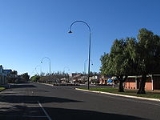
Most of the highway is fairly straight and flat, much of it through irrigated farm
land. It becomes hillier and more winding east of Wodonga
, with a moderately steep mountain pass near Koetong, between Tallangatta and Corryong.
The major towns along the route are Robinvale
, Swan Hill
, Kerang
, Cohuna
, Echuca
, Nathalia
, Strathmerton
, Cobram
, Yarrawonga
, Rutherglen
, Wodonga
, Tallangatta
and Corryong
.
/) is a popular tourist route, which follows the south side of the Murray RiverMurray River
The Murray River is Australia's longest river. At in length, the Murray rises in the Australian Alps, draining the western side of Australia's highest mountains and, for most of its length, meanders across Australia's inland plains, forming the border between New South Wales and Victoria as it...
in Victoria
Victoria (Australia)
Victoria is the second most populous state in Australia. Geographically the smallest mainland state, Victoria is bordered by New South Wales, South Australia, and Tasmania on Boundary Islet to the north, west and south respectively....
, Australia
Australia
Australia , officially the Commonwealth of Australia, is a country in the Southern Hemisphere comprising the mainland of the Australian continent, the island of Tasmania, and numerous smaller islands in the Indian and Pacific Oceans. It is the world's sixth-largest country by total area...
. The route effectively acts as the northern-most highway in Victoria. The western end of route B400 is the Murray River bridge
Murray River crossings
The Murray River in south-eastern Australia has been a significant barrier to land-based travel and trade. This article lists and briefly describes all of the recognised crossing points. Many of these had also developed as river ports for transport of goods along the Murray...
at Robinvale
Robinvale, Victoria
Robinvale is a town on the south bank of the Murray River in northern Victoria, Australia. It is connected by a bridge to Euston on the other side of the river in New South Wales. At the 2006 census, Robinvale had a population of 2214.-History:...
, although the Murray Valley Highway crosses that bridge as National Route 16 to connect with the Sturt Highway
Sturt Highway
The Sturt Highway is an Australian highway in New South Wales, Victoria, and South Australia. It is part of the Auslink National network and is part of the main highway route between Sydney and Adelaide.-Route:...
2 km further north. Historically, the Murray Valley Highway continued west to connect with the Calder Highway
Calder Highway
Calder Highway is a Highway linking Ravenswood South in Victoria, to Mildura. North of the Victoria/New South Wales border, the highway continues north to Broken Hill, Tibooburra and the New South Wales/Queensland border as the Silver City Highway, under the standard national route shield as far...
at Hattah instead of crossing the river. The eastern end is in the foothills of the Great Dividing Range
Great Dividing Range
The Great Dividing Range, or the Eastern Highlands, is Australia's most substantial mountain range and the third longest in the world. The range stretches more than 3,500 km from Dauan Island off the northeastern tip of Queensland, running the entire length of the eastern coastline through...
at Corryong
Corryong, Victoria
Corryong is a small town in Victoria, Australia. It is located east of Albury-Wodonga, near the upper reaches of the Murray River and thus close to the New South Wales border. At the 2006 Census in Australia, Corryong had a population of 1,228....
. There has also been a contemporary re-alignment of the Eastern end; whereby the highway used to go through Thologogong, Walwa and Towong (the current 'Murray River Rd' C546).
The route also extends further east and crosses the border into New South Wales as the Alpine Way
Alpine Way
The Alpine Way is a State highway in New South Wales, Australia.The Alpine Way starts near Jindabyne on the eastern side of the Snowy Mountains. It runs south-west past Thredbo and crosses the crest of the Great Dividing Range at Dead Horse Gap...
.
Most of the highway is fairly straight and flat, much of it through irrigated farm
Farm
A farm is an area of land, or, for aquaculture, lake, river or sea, including various structures, devoted primarily to the practice of producing and managing food , fibres and, increasingly, fuel. It is the basic production facility in food production. Farms may be owned and operated by a single...
land. It becomes hillier and more winding east of Wodonga
Wodonga, Victoria
Wodonga is a small city on the Victorian side of the border with New South Wales, north-east of Melbourne, Australia. Adjacent to Wodonga across the border is the New South Wales city of Albury. Wodonga is located wholly within the boundaries of the City of Wodonga LGA...
, with a moderately steep mountain pass near Koetong, between Tallangatta and Corryong.
The major towns along the route are Robinvale
Robinvale, Victoria
Robinvale is a town on the south bank of the Murray River in northern Victoria, Australia. It is connected by a bridge to Euston on the other side of the river in New South Wales. At the 2006 census, Robinvale had a population of 2214.-History:...
, Swan Hill
Swan Hill, Victoria
Swan Hill is a city in the northwest of Victoria, Australia. It is located on the Murray Valley Highway, on the south bank of the Murray River, downstream from the junction of the Loddon River. At the 2006 census, Swan Hill had a population of 9,684.-History:...
, Kerang
Kerang, Victoria
Kerang is a rural town on the Loddon River in northern Victoria in Australia. It is the commercial centre to an irrigation district based on livestock, horticulture, lucerne and grain. It is located north-west of Melbourne on the Murray Valley Highway a few kilometres north of its intersection...
, Cohuna
Cohuna, Victoria
Cohuna is a town situated north of Melbourne, on the Murray Valley Highway, in northern Victoria, Australia. At the 2006 census, Cohuna had a population of 1,893.-History:...
, Echuca
Echuca, Victoria
Echuca is a town located on the banks of the Murray River and Campaspe river in Victoria, Australia. The Border town Moama is on the northern side of the Murray river in New South Wales. It is the administrative centre and largest settlement in the Shire of Campaspe...
, Nathalia
Nathalia, Victoria
Nathalia is a town in northern Victoria, Australia. The town is located within the Shire of Moira Local government area on the banks of Broken Creek and on the Murray Valley Highway. At the 2006 census, Nathalia had a population of 1,431....
, Strathmerton
Strathmerton, Victoria
Strathmerton is a small country town in Victoria, Australia.It is located in the Shire of Moira Local Government Area on the Murray Valley Highway, about west of Cobram and previously known as the most northerly point in Victoria North of Melbourne at the start of the Goulburn Valley Highway...
, Cobram
Cobram, Victoria
Cobram is a town in Australia. Cobram is located on the Murray River which forms the border between Victoria and New South Wales. Cobram along with the nearby towns of Numurkah and Yarrawonga is part of Shire of Moira. Its twin town of Barooga is located on the north side of the Murray River....
, Yarrawonga
Yarrawonga, Victoria
Yarrawonga is a town in the Shire of Moira Local Government Area in the Australian state of Victoria. The town is situated on the south bank of the Murray River, the border between Victoria and New South Wales and is located approximately north-east of the state capital, Melbourne. Yarrawonga's...
, Rutherglen
Rutherglen, Victoria
Rutherglen is a small town in north-eastern Victoria, Australia, near the Murray River border with New South Wales. The town was named after the Scottish town of Rutherglen which lies just outside Glasgow...
, Wodonga
Wodonga, Victoria
Wodonga is a small city on the Victorian side of the border with New South Wales, north-east of Melbourne, Australia. Adjacent to Wodonga across the border is the New South Wales city of Albury. Wodonga is located wholly within the boundaries of the City of Wodonga LGA...
, Tallangatta
Tallangatta, Victoria
Tallangatta is a small town in north-eastern Victoria, Australia. At the 2006 census, Tallangatta had a population of 950.The town is situated on the banks of the Mitta Arm of Lake Hume, approximately south-east of Albury-Wodonga along the Murray Valley Highway.-History:Tallangatta was founded in...
and Corryong
Corryong, Victoria
Corryong is a small town in Victoria, Australia. It is located east of Albury-Wodonga, near the upper reaches of the Murray River and thus close to the New South Wales border. At the 2006 Census in Australia, Corryong had a population of 1,228....
.
Major intersections and towns
| Murray Valley Highway |
|||
| Northbound | Distance to Mildura (km) |
Distance to Melbourne (km) |
Southbound |
.svg.png) Sturt Highway Sturt Highway The Sturt Highway is an Australian highway in New South Wales, Victoria, and South Australia. It is part of the Auslink National network and is part of the main highway route between Sydney and Adelaide.-Route:...  to Mildura to MilduraMildura, Victoria Mildura is a regional city in northwestern Victoria, Australia and seat of the Rural City of Mildura local government area. It is located in the Sunraysia region, and is on the banks of the Murray River. The current population is estimated at just over 30,000.Mildura is a major agricultural centre... , Renmark Renmark, South Australia Renmark is a town in South Australia's rural Riverland area, and is located 254 km northeast of Adelaide, on the banks of the River Murray. The Sturt Highway between Adelaide and Sydney runs through the town; Renmark is the last major town encountered in South Australia when driving this route. It... and Adelaide Adelaide Adelaide is the capital city of South Australia and the fifth-largest city in Australia. Adelaide has an estimated population of more than 1.2 million... Sturt Highway Sturt Highway The Sturt Highway is an Australian highway in New South Wales, Victoria, and South Australia. It is part of the Auslink National network and is part of the main highway route between Sydney and Adelaide.-Route:... to BalranaldBalranald, New South Wales Balranald is a town and local government area in the Riverina district of New South Wales, Australia. At the 2006 census the population was 1,216.... , Hay Hay, New South Wales Hay is a town in the western Riverina region of south western New South Wales , Australia. It is the administrative centre of Hay Shire Local Government Area and the centre of a prosperous and productive agricultural district on the wide Hay Plains.... and Sydney Sydney Sydney is the most populous city in Australia and the state capital of New South Wales. Sydney is located on Australia's south-east coast of the Tasman Sea. As of June 2010, the greater metropolitan area had an approximate population of 4.6 million people... |
|||
| End Murray Valley Highway |
81 | 475 | Start Murray Valley Highway |
| Start |
84 | 472 | End |
| MURRAY RIVER Murray River The Murray River is Australia's longest river. At in length, the Murray rises in the Australian Alps, draining the western side of Australia's highest mountains and, for most of its length, meanders across Australia's inland plains, forming the border between New South Wales and Victoria as it... |
MURRAY RIVER Murray River The Murray River is Australia's longest river. At in length, the Murray rises in the Australian Alps, draining the western side of Australia's highest mountains and, for most of its length, meanders across Australia's inland plains, forming the border between New South Wales and Victoria as it... |
||
| NEW SOUTH WALES STATE BORDER VICTORIA |
|||
| End |
84 | 472 | Start |
| Robinvale Robinvale, Victoria Robinvale is a town on the south bank of the Murray River in northern Victoria, Australia. It is connected by a bridge to Euston on the other side of the river in New South Wales. At the 2006 census, Robinvale had a population of 2214.-History:... |
85 | 471 | Robinvale Robinvale, Victoria Robinvale is a town on the south bank of the Murray River in northern Victoria, Australia. It is connected by a bridge to Euston on the other side of the river in New South Wales. At the 2006 census, Robinvale had a population of 2214.-History:... |
| Manangatang Manangatang, Victoria Manangatang is a remote town in north-west Victoria, Australia. At the 2006 census, Manangatang had a population of 448. It is sometimes noted for its unusual name, from an Aboriginal term - "manang" meaning land and "kaaiti" meaning water.... , Sea Lake Sea Lake, Victoria Sea Lake is a town in the Mallee district of north-west Victoria, Australia and is situated on the southern shores of Lake Tyrrell. The town is located on the Calder Highway, north-west of Melbourne, and west of Swan Hill. Sea Lake is in the heart of Australia's "wheat belt", and is the main... Robinvale-Sea Lake Road |
87 | 469 | Manangatang Manangatang, Victoria Manangatang is a remote town in north-west Victoria, Australia. At the 2006 census, Manangatang had a population of 448. It is sometimes noted for its unusual name, from an Aboriginal term - "manang" meaning land and "kaaiti" meaning water.... , Sea Lake Sea Lake, Victoria Sea Lake is a town in the Mallee district of north-west Victoria, Australia and is situated on the southern shores of Lake Tyrrell. The town is located on the Calder Highway, north-west of Melbourne, and west of Swan Hill. Sea Lake is in the heart of Australia's "wheat belt", and is the main... Robinvale-Sea Lake Road |
| Hattah Hattah, Victoria Hattah is a locality in Victoria, Australia located approximately 70 km south of Mildura. Located adjacent to Hattah is the Hattah-Kulkyne National Park.... Hattah-Robinvale Road |
102 | 454 | Hattah Hattah, Victoria Hattah is a locality in Victoria, Australia located approximately 70 km south of Mildura. Located adjacent to Hattah is the Hattah-Kulkyne National Park.... Hattah-Robinvale Road |
| continues as |
175 | 381 | Tooleybuc Tooleybuc, New South Wales Tooleybuc is a town in the western Riverina district of New South Wales, Australia. The town is located on the Mallee Highway, south west of the state capital, Sydney and north west of Melbourne. Situated on the banks of the Murray River across from Piangil in the neighbouring state of... , Balranald Balranald, New South Wales Balranald is a town and local government area in the Riverina district of New South Wales, Australia. At the 2006 census the population was 1,216.... , Sydney Sydney Sydney is the most populous city in Australia and the state capital of New South Wales. Sydney is located on Australia's south-east coast of the Tasman Sea. As of June 2010, the greater metropolitan area had an approximate population of 4.6 million people... Tooleybuc Road  |
| Tooleybuc Tooleybuc, New South Wales Tooleybuc is a town in the western Riverina district of New South Wales, Australia. The town is located on the Mallee Highway, south west of the state capital, Sydney and north west of Melbourne. Situated on the banks of the Murray River across from Piangil in the neighbouring state of... , Balranald Balranald, New South Wales Balranald is a town and local government area in the Riverina district of New South Wales, Australia. At the 2006 census the population was 1,216.... , Sydney Sydney Sydney is the most populous city in Australia and the state capital of New South Wales. Sydney is located on Australia's south-east coast of the Tasman Sea. As of June 2010, the greater metropolitan area had an approximate population of 4.6 million people... Tooleybuc Road |
duplexes with |
||
| duplexes with |
177 | 379 | Ouyen Ouyen, Victoria Ouyen is a town in Victoria, Australia, located in the Rural City of Mildura at the junction of the Calder Highway and Mallee Highway, south of Mildura and north-west of Melbourne. At the 2006 census the town had a population of 1,061.-History:... , Adelaide Adelaide Adelaide is the capital city of South Australia and the fifth-largest city in Australia. Adelaide has an estimated population of more than 1.2 million... Mallee Highway Mallee Highway The Mallee Highway runs east from Tailem Bend in South Australia through cereal-growing farmland at the southern end of the Murray Mallee to Pinnaroo near the border with Victoria, where it crosses route... |
| Ouyen Ouyen, Victoria Ouyen is a town in Victoria, Australia, located in the Rural City of Mildura at the junction of the Calder Highway and Mallee Highway, south of Mildura and north-west of Melbourne. At the 2006 census the town had a population of 1,061.-History:... , Adelaide Adelaide Adelaide is the capital city of South Australia and the fifth-largest city in Australia. Adelaide has an estimated population of more than 1.2 million... Mallee Highway Mallee Highway The Mallee Highway runs east from Tailem Bend in South Australia through cereal-growing farmland at the southern end of the Murray Mallee to Pinnaroo near the border with Victoria, where it crosses route... |
continues as |
||
| Nyah Nyah, Victoria Nyah is a town in northern Victoria, Australia. The town is located on the Murray Valley Highway, in the Rural City of Swan Hill Local Government Area, 365 kilometres north west of the state capital, Melbourne... |
192 | 364 | Nyah Nyah, Victoria Nyah is a town in northern Victoria, Australia. The town is located on the Murray Valley Highway, in the Rural City of Swan Hill Local Government Area, 365 kilometres north west of the state capital, Melbourne... |
PIANGIL RAIL LINE .svg.png) |
217 | 339 | PIANGIL RAIL LINE |
| Northbound | Distance to Swan Hill (km) |
Distance to Melbourne (km) |
Southbound |
| Town Centre Swan Hill, Victoria Swan Hill is a city in the northwest of Victoria, Australia. It is located on the Murray Valley Highway, on the south bank of the Murray River, downstream from the junction of the Loddon River. At the 2006 census, Swan Hill had a population of 9,684.-History:... , Sea Lake Sea Lake, Victoria Sea Lake is a town in the Mallee district of north-west Victoria, Australia and is situated on the southern shores of Lake Tyrrell. The town is located on the Calder Highway, north-west of Melbourne, and west of Swan Hill. Sea Lake is in the heart of Australia's "wheat belt", and is the main... Sea Lake-Swan Hill Road Moulamein Moulamein, New South Wales Moulamein is a small town in New South Wales, Australia, in the Wakool Shire. At the 2006 census, Moulamein had a population of 349 people. Moulamein is the oldest town in the Riverina.... , Deniliquin Moulamein Road .svg.png) |
0 | 337 | Swan Hill Swan Hill, Victoria Swan Hill is a city in the northwest of Victoria, Australia. It is located on the Murray Valley Highway, on the south bank of the Murray River, downstream from the junction of the Loddon River. At the 2006 census, Swan Hill had a population of 9,684.-History:... |
| Swan Hill Swan Hill, Victoria Swan Hill is a city in the northwest of Victoria, Australia. It is located on the Murray Valley Highway, on the south bank of the Murray River, downstream from the junction of the Loddon River. At the 2006 census, Swan Hill had a population of 9,684.-History:... |
Moulamein Moulamein, New South Wales Moulamein is a small town in New South Wales, Australia, in the Wakool Shire. At the 2006 census, Moulamein had a population of 349 people. Moulamein is the oldest town in the Riverina.... , Deniliquin Moulamein Road Town Centre Swan Hill, Victoria Swan Hill is a city in the northwest of Victoria, Australia. It is located on the Murray Valley Highway, on the south bank of the Murray River, downstream from the junction of the Loddon River. At the 2006 census, Swan Hill had a population of 9,684.-History:... , Sea Lake Sea Lake, Victoria Sea Lake is a town in the Mallee district of north-west Victoria, Australia and is situated on the southern shores of Lake Tyrrell. The town is located on the Calder Highway, north-west of Melbourne, and west of Swan Hill. Sea Lake is in the heart of Australia's "wheat belt", and is the main... Sea Lake-Swan Hill Road |
||
| Wycheproof Wycheproof, Victoria Wycheproof is a small regional locality in the centre of the Shire of Buloke, in north western Victoria, Australia. As of the 2006 census, it had a population of 686... , Donald Donald, Victoria Donald is a town in Victoria, Australia, located on the Richardson River, at the junction of Sunraysia Highway and Borung Highway, in the Shire of Buloke. The town is named after William Donald, a Scottish pastoralist who was the first settler in the area in 1844... Donald-Swan Hill Road |
5 | 332 | Wycheproof Wycheproof, Victoria Wycheproof is a small regional locality in the centre of the Shire of Buloke, in north western Victoria, Australia. As of the 2006 census, it had a population of 686... , Donald Donald, Victoria Donald is a town in Victoria, Australia, located on the Richardson River, at the junction of Sunraysia Highway and Borung Highway, in the Shire of Buloke. The town is named after William Donald, a Scottish pastoralist who was the first settler in the area in 1844... Donald-Swan Hill Road |
| SWAN HILL RAIL LINE |
9 | 328 | SWAN HILL RAIL LINE |
| Lake Boga Lake Boga, Victoria Lake Boga is a town in Victoria, Australia. It is situated within the Rural City of Swan Hill within the Mallee region of north-west Victoria. At the 2006 census, Lake Boga had a population of 725... |
16 | 321 | Lake Boga Lake Boga, Victoria Lake Boga is a town in Victoria, Australia. It is situated within the Rural City of Swan Hill within the Mallee region of north-west Victoria. At the 2006 census, Lake Boga had a population of 725... |
| SWAN HILL RAIL LINE |
53 | 284 | SWAN HILL RAIL LINE |
| To Boort Boort, Victoria Boort is a town in Victoria, Australia, located next to Lake Boort, in the Shire of Loddon. At the 2006 census, Boort had a population of 773. The town is known for its native birdlife... ; Quambatook Quambatook, Victoria Quambatook is a town in northern Victoria, Australia. The town is located on the Avoca River in the Shire of Gannawarra Local Government Area, from the state capital, Melbourne. At the 2006 census, Quambatook had a population of 253.... , Donald Donald, Victoria Donald is a town in Victoria, Australia, located on the Richardson River, at the junction of Sunraysia Highway and Borung Highway, in the Shire of Buloke. The town is named after William Donald, a Scottish pastoralist who was the first settler in the area in 1844... Kerang-Quambatook Road |
57 | 280 | To Boort Boort, Victoria Boort is a town in Victoria, Australia, located next to Lake Boort, in the Shire of Loddon. At the 2006 census, Boort had a population of 773. The town is known for its native birdlife... ; Quambatook Quambatook, Victoria Quambatook is a town in northern Victoria, Australia. The town is located on the Avoca River in the Shire of Gannawarra Local Government Area, from the state capital, Melbourne. At the 2006 census, Quambatook had a population of 253.... , Donald Donald, Victoria Donald is a town in Victoria, Australia, located on the Richardson River, at the junction of Sunraysia Highway and Borung Highway, in the Shire of Buloke. The town is named after William Donald, a Scottish pastoralist who was the first settler in the area in 1844... Kerang-Quambatook Road |
| To Murrabit Murrabit, Victoria Murrabit is a town in north east Victoria, Australia. The town is located on the Murray River, from the state capital, Melbourne and from Swan Hill... ; Town Centre Kerang, Victoria Kerang is a rural town on the Loddon River in northern Victoria in Australia. It is the commercial centre to an irrigation district based on livestock, horticulture, lucerne and grain. It is located north-west of Melbourne on the Murray Valley Highway a few kilometres north of its intersection... , Koondrook Koondrook, Victoria Koondrook is a town situated on the Murray River, Victoria, Australia. The town is located in the Shire of Gannawarra Local government area, north west of the state capital, Melbourne. At the 2006 census, Koondrook had a population of 802.-History:... Kerang-Koondrook Road |
59 | 278 | Kerang Kerang, Victoria Kerang is a rural town on the Loddon River in northern Victoria in Australia. It is the commercial centre to an irrigation district based on livestock, horticulture, lucerne and grain. It is located north-west of Melbourne on the Murray Valley Highway a few kilometres north of its intersection... |
| Kerang Kerang, Victoria Kerang is a rural town on the Loddon River in northern Victoria in Australia. It is the commercial centre to an irrigation district based on livestock, horticulture, lucerne and grain. It is located north-west of Melbourne on the Murray Valley Highway a few kilometres north of its intersection... |
To Murrabit Murrabit, Victoria Murrabit is a town in north east Victoria, Australia. The town is located on the Murray River, from the state capital, Melbourne and from Swan Hill... ; Town Centre Kerang, Victoria Kerang is a rural town on the Loddon River in northern Victoria in Australia. It is the commercial centre to an irrigation district based on livestock, horticulture, lucerne and grain. It is located north-west of Melbourne on the Murray Valley Highway a few kilometres north of its intersection... , Koondrook Koondrook, Victoria Koondrook is a town situated on the Murray River, Victoria, Australia. The town is located in the Shire of Gannawarra Local government area, north west of the state capital, Melbourne. At the 2006 census, Koondrook had a population of 802.-History:... Kerang-Koondrook Road |
||
| Bendigo Bendigo, Victoria Bendigo is a major regional city in the state of Victoria, Australia, located very close to the geographical centre of the state and approximately north west of the state capital Melbourne. It is the second largest inland city and fourth most populous city in the state. The estimated urban... , Melbourne Melbourne Melbourne is the capital and most populous city in the state of Victoria, and the second most populous city in Australia. The Melbourne City Centre is the hub of the greater metropolitan area and the Census statistical division—of which "Melbourne" is the common name. As of June 2009, the greater... Loddon Valley Highway Loddon Valley Highway The Loddon Valley Highway runs roughly north-west from Bendigo to Kerang on the Murray Valley Highway. Previously assigned State Route 141, it was later designated as B260....  |
62 | 275 | Bendigo Bendigo, Victoria Bendigo is a major regional city in the state of Victoria, Australia, located very close to the geographical centre of the state and approximately north west of the state capital Melbourne. It is the second largest inland city and fourth most populous city in the state. The estimated urban... , Melbourne Melbourne Melbourne is the capital and most populous city in the state of Victoria, and the second most populous city in Australia. The Melbourne City Centre is the hub of the greater metropolitan area and the Census statistical division—of which "Melbourne" is the common name. As of June 2009, the greater... Loddon Valley Highway Loddon Valley Highway The Loddon Valley Highway runs roughly north-west from Bendigo to Kerang on the Murray Valley Highway. Previously assigned State Route 141, it was later designated as B260.... |
| Westbound | Distance to Swan Hill (km) |
Distance to Echuca (km) |
Eastbound |
| SWAN HILL RAIL LINE |
63 | 89 | SWAN HILL RAIL LINE |
| Koondrook Koondrook, Victoria Koondrook is a town situated on the Murray River, Victoria, Australia. The town is located in the Shire of Gannawarra Local government area, north west of the state capital, Melbourne. At the 2006 census, Koondrook had a population of 802.-History:... , Barham Barham, New South Wales Barham is a town in the western Riverina district of New South Wales, Australia. The town is located 823 kilometres south west of the state capital, Sydney and 303 kilometres north west of Melbourne. Situated on the banks of the Murray River across from Koondrook in the neighbouring state of... Cohuna-Koondrook Road |
89 | 63 | Koondrook Koondrook, Victoria Koondrook is a town situated on the Murray River, Victoria, Australia. The town is located in the Shire of Gannawarra Local government area, north west of the state capital, Melbourne. At the 2006 census, Koondrook had a population of 802.-History:... , Barham Barham, New South Wales Barham is a town in the western Riverina district of New South Wales, Australia. The town is located 823 kilometres south west of the state capital, Sydney and 303 kilometres north west of Melbourne. Situated on the banks of the Murray River across from Koondrook in the neighbouring state of... Cohuna-Koondrook Road |
| Leitchville Leitchville, Victoria Leitchville is a town in northern Victoria, Australia. The town is located in the Shire of Gannawarra Local Government Area, 262 kilometres of the state capital, Melbourne... Cohuna-Leitchville Road |
91 | 61 | Cohuna Cohuna, Victoria Cohuna is a town situated north of Melbourne, on the Murray Valley Highway, in northern Victoria, Australia. At the 2006 census, Cohuna had a population of 1,893.-History:... |
| Cohuna Cohuna, Victoria Cohuna is a town situated north of Melbourne, on the Murray Valley Highway, in northern Victoria, Australia. At the 2006 census, Cohuna had a population of 1,893.-History:... |
Leitchville Leitchville, Victoria Leitchville is a town in northern Victoria, Australia. The town is located in the Shire of Gannawarra Local Government Area, 262 kilometres of the state capital, Melbourne... , Pyramid Hill Pyramid Hill, Victoria Pyramid Hill is a town in Victoria, Australia located in the Shire of Loddon. It is located north of Melbourne and north of Bendigo. At the 2006 census, Pyramid Hill had a population of 465. The town has its own railway station.... Cohuna-Leitchville Road |
||
| Leitchville Leitchville, Victoria Leitchville is a town in northern Victoria, Australia. The town is located in the Shire of Gannawarra Local Government Area, 262 kilometres of the state capital, Melbourne... , Pyramid Hill Pyramid Hill, Victoria Pyramid Hill is a town in Victoria, Australia located in the Shire of Loddon. It is located north of Melbourne and north of Bendigo. At the 2006 census, Pyramid Hill had a population of 465. The town has its own railway station.... Kerang-Leitchville Road |
106 | 46 | Leitchville Leitchville, Victoria Leitchville is a town in northern Victoria, Australia. The town is located in the Shire of Gannawarra Local Government Area, 262 kilometres of the state capital, Melbourne... , Pyramid Hill Pyramid Hill, Victoria Pyramid Hill is a town in Victoria, Australia located in the Shire of Loddon. It is located north of Melbourne and north of Bendigo. At the 2006 census, Pyramid Hill had a population of 465. The town has its own railway station.... Kerang-Leitchville Road |
| Town Centre Echuca, Victoria Echuca is a town located on the banks of the Murray River and Campaspe river in Victoria, Australia. The Border town Moama is on the northern side of the Murray river in New South Wales. It is the administrative centre and largest settlement in the Shire of Campaspe... , Moama Moama, New South Wales Moama is a town in the Riverina district of southern New South Wales, Australia, in the Murray Shire Local Government Area. The town is directly across the Murray River from the larger tourist town of Echuca in the neighbouring state of Victoria, to which it is connected by a bridge... Warren Street |
152 | 0 | Echuca Echuca, Victoria Echuca is a town located on the banks of the Murray River and Campaspe river in Victoria, Australia. The Border town Moama is on the northern side of the Murray river in New South Wales. It is the administrative centre and largest settlement in the Shire of Campaspe... |
| Town Centre Echuca, Victoria Echuca is a town located on the banks of the Murray River and Campaspe river in Victoria, Australia. The Border town Moama is on the northern side of the Murray river in New South Wales. It is the administrative centre and largest settlement in the Shire of Campaspe... , Moama Moama, New South Wales Moama is a town in the Riverina district of southern New South Wales, Australia, in the Murray Shire Local Government Area. The town is directly across the Murray River from the larger tourist town of Echuca in the neighbouring state of Victoria, to which it is connected by a bridge... Warren Street |
|||
| Westbound | Distance to Swan Hill (km) |
Distance to Wodonga (km) |
Eastbound |
| continues as |
153.5 | 236.1 | Rochester Rochester, Victoria Rochester is a small town in country Victoria, Australia. It is located 180 km north of Melbourne with a mixture of rural and semi-rural communities on the northern Campaspe River, between Bendigo and the Murray River port of Echuca... , Bendigo Bendigo, Victoria Bendigo is a major regional city in the state of Victoria, Australia, located very close to the geographical centre of the state and approximately north west of the state capital Melbourne. It is the second largest inland city and fourth most populous city in the state. The estimated urban... , Melbourne Melbourne Melbourne is the capital and most populous city in the state of Victoria, and the second most populous city in Australia. The Melbourne City Centre is the hub of the greater metropolitan area and the Census statistical division—of which "Melbourne" is the common name. As of June 2009, the greater... Northern Highway  |
| Rochester Rochester, Victoria Rochester is a small town in country Victoria, Australia. It is located 180 km north of Melbourne with a mixture of rural and semi-rural communities on the northern Campaspe River, between Bendigo and the Murray River port of Echuca... , Bendigo Bendigo, Victoria Bendigo is a major regional city in the state of Victoria, Australia, located very close to the geographical centre of the state and approximately north west of the state capital Melbourne. It is the second largest inland city and fourth most populous city in the state. The estimated urban... , Melbourne Melbourne Melbourne is the capital and most populous city in the state of Victoria, and the second most populous city in Australia. The Melbourne City Centre is the hub of the greater metropolitan area and the Census statistical division—of which "Melbourne" is the common name. As of June 2009, the greater... Northern Highway |
duplexes with |
||
| duplexes with |
155.3 | 234.3 | Town Centre Echuca, Victoria Echuca is a town located on the banks of the Murray River and Campaspe river in Victoria, Australia. The Border town Moama is on the northern side of the Murray river in New South Wales. It is the administrative centre and largest settlement in the Shire of Campaspe... , Moama Moama, New South Wales Moama is a town in the Riverina district of southern New South Wales, Australia, in the Murray Shire Local Government Area. The town is directly across the Murray River from the larger tourist town of Echuca in the neighbouring state of Victoria, to which it is connected by a bridge... , Deniliquin Northern Highway  |
| Town Centre Echuca, Victoria Echuca is a town located on the banks of the Murray River and Campaspe river in Victoria, Australia. The Border town Moama is on the northern side of the Murray river in New South Wales. It is the administrative centre and largest settlement in the Shire of Campaspe... , Moama Moama, New South Wales Moama is a town in the Riverina district of southern New South Wales, Australia, in the Murray Shire Local Government Area. The town is directly across the Murray River from the larger tourist town of Echuca in the neighbouring state of Victoria, to which it is connected by a bridge... , Deniliquin Northern Highway |
continues as |
||
| ECHUCA RAIL LINE |
155.6 | 234 | ECHUCA RAIL LINE |
| Westbound | Distance to Echuca (km) |
Distance to Wodonga (km) |
Eastbound |
| Kyabram Kyabram, Victoria Kyabram is located in the centre of a rich irrigation district in the Goulburn River Valley, 200 kilometres north of Melbourne, Victoria, Australia. Kyabram, the second largest town in the Shire of Campaspe. is situated between the towns of Echuca and Shepparton and is close to the Murray River... Echuca-Kyabram Road |
0 | 233 | Kyabram Kyabram, Victoria Kyabram is located in the centre of a rich irrigation district in the Goulburn River Valley, 200 kilometres north of Melbourne, Victoria, Australia. Kyabram, the second largest town in the Shire of Campaspe. is situated between the towns of Echuca and Shepparton and is close to the Murray River... Echuca-Kyabram Road |
| Echuca Echuca, Victoria Echuca is a town located on the banks of the Murray River and Campaspe river in Victoria, Australia. The Border town Moama is on the northern side of the Murray river in New South Wales. It is the administrative centre and largest settlement in the Shire of Campaspe... |
|||
| Tongala Tongala, Victoria Tongala is a small town between Kyabram and Echuca in the Goulburn River valley in northern Victoria, Australia, part of the Shire of Campaspe. At the 2006 census, Tongala had a population of 1623.-History:... , Kyabram Kyabram, Victoria Kyabram is located in the centre of a rich irrigation district in the Goulburn River Valley, 200 kilometres north of Melbourne, Victoria, Australia. Kyabram, the second largest town in the Shire of Campaspe. is situated between the towns of Echuca and Shepparton and is close to the Murray River... Kyabram-Tongala Road |
18 | 215 | Tongala Tongala, Victoria Tongala is a small town between Kyabram and Echuca in the Goulburn River valley in northern Victoria, Australia, part of the Shire of Campaspe. At the 2006 census, Tongala had a population of 1623.-History:... , Kyabram Kyabram, Victoria Kyabram is located in the centre of a rich irrigation district in the Goulburn River Valley, 200 kilometres north of Melbourne, Victoria, Australia. Kyabram, the second largest town in the Shire of Campaspe. is situated between the towns of Echuca and Shepparton and is close to the Murray River... Kyabram-Tongala Road |
| Kyabram Kyabram, Victoria Kyabram is located in the centre of a rich irrigation district in the Goulburn River Valley, 200 kilometres north of Melbourne, Victoria, Australia. Kyabram, the second largest town in the Shire of Campaspe. is situated between the towns of Echuca and Shepparton and is close to the Murray River... John Allen Road |
28 | 205 | Kyabram Kyabram, Victoria Kyabram is located in the centre of a rich irrigation district in the Goulburn River Valley, 200 kilometres north of Melbourne, Victoria, Australia. Kyabram, the second largest town in the Shire of Campaspe. is situated between the towns of Echuca and Shepparton and is close to the Murray River... John Allen Road |
To  Tatura TaturaTatura, Victoria Tatura is a town 17 km west-south-west of Shepparton in Victoria, Australia located 3 km off the Midland Highway, forming part of the City of Greater Shepparton. At the 2006 census, Tatura had a population of 3,533, however the true figure is believed to be close to 4,400. Attractions... ; Shepparton Shepparton, Victoria Shepparton is a city located on the floodplain of the Goulburn River in the north east of Victoria, Australia approximately north-east of Melbourne. It is the fifth largest city in Victoria, Australia. The estimated population of Shepparton's statistical area is 48,926.It began as a sheep station... Echuca-Mooroopna Road |
30 | 203 | To Tatura Tatura, Victoria Tatura is a town 17 km west-south-west of Shepparton in Victoria, Australia located 3 km off the Midland Highway, forming part of the City of Greater Shepparton. At the 2006 census, Tatura had a population of 3,533, however the true figure is believed to be close to 4,400. Attractions... ; Shepparton Shepparton, Victoria Shepparton is a city located on the floodplain of the Goulburn River in the north east of Victoria, Australia approximately north-east of Melbourne. It is the fifth largest city in Victoria, Australia. The estimated population of Shepparton's statistical area is 48,926.It began as a sheep station... Echuca-Mooroopna Road |
| GOULBURN RIVER Goulburn River (Victoria) The Goulburn River is a major inland river in Victoria, Australia.The headwaters of the Goulburn River rise in the western end of the Victoria Alps, near Mount Buller. The Eildon Dam creates Lake Eildon, a major storage of water for irrigation... |
36 | 197 | GOULBURN RIVER Goulburn River (Victoria) The Goulburn River is a major inland river in Victoria, Australia.The headwaters of the Goulburn River rise in the western end of the Victoria Alps, near Mount Buller. The Eildon Dam creates Lake Eildon, a major storage of water for irrigation... |
| Shepparton Shepparton, Victoria Shepparton is a city located on the floodplain of the Goulburn River in the north east of Victoria, Australia approximately north-east of Melbourne. It is the fifth largest city in Victoria, Australia. The estimated population of Shepparton's statistical area is 48,926.It began as a sheep station... , Barmah Barmah, Victoria Barmah is a town in Victoria, with the distinction of being located north of the southerly border with New South Wales. At the 2006 census, Barmah had a population of 201.... Barmah-Shepparton Road |
51 | 182 | Barmah Barmah, Victoria Barmah is a town in Victoria, with the distinction of being located north of the southerly border with New South Wales. At the 2006 census, Barmah had a population of 201.... , Shepparton Shepparton, Victoria Shepparton is a city located on the floodplain of the Goulburn River in the north east of Victoria, Australia approximately north-east of Melbourne. It is the fifth largest city in Victoria, Australia. The estimated population of Shepparton's statistical area is 48,926.It began as a sheep station... Barmah-Shepparton Road |
| Numurkah Numurkah, Victoria Numurkah is a town in Victoria, Australia, located on the Goulburn Valley Highway, north of Shepparton, in the Shire of Moira. At the 2006 census, Numurkah had a population of 4,643.- History :... , Katamatite Katamatite, Victoria Katamatite is a rural township in Victoria, Australia about 46 kilometres north east of Shepparton. At the 2006 census, Katamatite had a population of 212.... Katamatite-Nathalia Road |
54 | 179 | Numurkah Numurkah, Victoria Numurkah is a town in Victoria, Australia, located on the Goulburn Valley Highway, north of Shepparton, in the Shire of Moira. At the 2006 census, Numurkah had a population of 4,643.- History :... , Katamatite Katamatite, Victoria Katamatite is a rural township in Victoria, Australia about 46 kilometres north east of Shepparton. At the 2006 census, Katamatite had a population of 212.... Katamatite-Nathalia Road |
| Nathalia Nathalia, Victoria Nathalia is a town in northern Victoria, Australia. The town is located within the Shire of Moira Local government area on the banks of Broken Creek and on the Murray Valley Highway. At the 2006 census, Nathalia had a population of 1,431.... |
55 | 178 | Nathalia Nathalia, Victoria Nathalia is a town in northern Victoria, Australia. The town is located within the Shire of Moira Local government area on the banks of Broken Creek and on the Murray Valley Highway. At the 2006 census, Nathalia had a population of 1,431.... |
| continues as |
89 | 144 | Numurkah Numurkah, Victoria Numurkah is a town in Victoria, Australia, located on the Goulburn Valley Highway, north of Shepparton, in the Shire of Moira. At the 2006 census, Numurkah had a population of 4,643.- History :... , Shepparton Shepparton, Victoria Shepparton is a city located on the floodplain of the Goulburn River in the north east of Victoria, Australia approximately north-east of Melbourne. It is the fifth largest city in Victoria, Australia. The estimated population of Shepparton's statistical area is 48,926.It began as a sheep station... , Melbourne Melbourne Melbourne is the capital and most populous city in the state of Victoria, and the second most populous city in Australia. The Melbourne City Centre is the hub of the greater metropolitan area and the Census statistical division—of which "Melbourne" is the common name. As of June 2009, the greater... Goulburn Valley Highway Goulburn Valley Highway The Goulburn Valley Highway / is a highway located in Victoria, Australia. The section north beyond the Hume Freeway is part of the Melbourne to Brisbane National Highway and is the main link between these two cities as well as a major link between Victoria and inland New South Wales...  |
| Numurkah Numurkah, Victoria Numurkah is a town in Victoria, Australia, located on the Goulburn Valley Highway, north of Shepparton, in the Shire of Moira. At the 2006 census, Numurkah had a population of 4,643.- History :... , Shepparton Shepparton, Victoria Shepparton is a city located on the floodplain of the Goulburn River in the north east of Victoria, Australia approximately north-east of Melbourne. It is the fifth largest city in Victoria, Australia. The estimated population of Shepparton's statistical area is 48,926.It began as a sheep station... , Melbourne Melbourne Melbourne is the capital and most populous city in the state of Victoria, and the second most populous city in Australia. The Melbourne City Centre is the hub of the greater metropolitan area and the Census statistical division—of which "Melbourne" is the common name. As of June 2009, the greater... Goulburn Valley Highway Goulburn Valley Highway The Goulburn Valley Highway / is a highway located in Victoria, Australia. The section north beyond the Hume Freeway is part of the Melbourne to Brisbane National Highway and is the main link between these two cities as well as a major link between Victoria and inland New South Wales... |
duplexes with |
||
| Strathmerton Strathmerton, Victoria Strathmerton is a small country town in Victoria, Australia.It is located in the Shire of Moira Local Government Area on the Murray Valley Highway, about west of Cobram and previously known as the most northerly point in Victoria North of Melbourne at the start of the Goulburn Valley Highway... |
93 | 140 | Strathmerton Strathmerton, Victoria Strathmerton is a small country town in Victoria, Australia.It is located in the Shire of Moira Local Government Area on the Murray Valley Highway, about west of Cobram and previously known as the most northerly point in Victoria North of Melbourne at the start of the Goulburn Valley Highway... |
| TOCUMWAL RAIL LINE |
94 | 139 | TOCUMWAL RAIL LINE |
| duplexes with |
103.2 | 129.8 | Tocumwal Tocumwal, New South Wales Tocumwal is a town in the southern Riverina region of New South Wales, Australia in the Berrigan Shire Local Government Area, near the Victorian border. The town is situated on the banks of the Murray River, north of the city of Melbourne. The Newell Highway, part of the main road route between... , Finley Finley, New South Wales Finley is a town in the Riverina region of New South Wales, Australia. It is the largest town in the Berrigan Shire Local Government Area. At the 2006 census, Finley had a population of 2,054 people.... , Brisbane Brisbane Brisbane is the capital and most populous city in the Australian state of Queensland and the third most populous city in Australia. Brisbane's metropolitan area has a population of over 2 million, and the South East Queensland urban conurbation, centred around Brisbane, encompasses a population of... Goulburn Valley Highway Goulburn Valley Highway The Goulburn Valley Highway / is a highway located in Victoria, Australia. The section north beyond the Hume Freeway is part of the Melbourne to Brisbane National Highway and is the main link between these two cities as well as a major link between Victoria and inland New South Wales... |
| Tocumwal Tocumwal, New South Wales Tocumwal is a town in the southern Riverina region of New South Wales, Australia in the Berrigan Shire Local Government Area, near the Victorian border. The town is situated on the banks of the Murray River, north of the city of Melbourne. The Newell Highway, part of the main road route between... , Finley Finley, New South Wales Finley is a town in the Riverina region of New South Wales, Australia. It is the largest town in the Berrigan Shire Local Government Area. At the 2006 census, Finley had a population of 2,054 people.... , Brisbane Brisbane Brisbane is the capital and most populous city in the Australian state of Queensland and the third most populous city in Australia. Brisbane's metropolitan area has a population of over 2 million, and the South East Queensland urban conurbation, centred around Brisbane, encompasses a population of... Goulburn Valley Highway Goulburn Valley Highway The Goulburn Valley Highway / is a highway located in Victoria, Australia. The section north beyond the Hume Freeway is part of the Melbourne to Brisbane National Highway and is the main link between these two cities as well as a major link between Victoria and inland New South Wales... |
continues as |
||
| Benalla Benalla, Victoria Benalla is a city of just over 9,000 people located just off the Hume Freeway in north-eastern Victoria, Australia, about southwest of Wangaratta. Its Local Government Area is the Rural City of Benalla.- Overview :... Benalla-Tocumwal Road |
103.3 | 129.7 | Katamatite Katamatite, Victoria Katamatite is a rural township in Victoria, Australia about 46 kilometres north east of Shepparton. At the 2006 census, Katamatite had a population of 212.... , Benalla Benalla, Victoria Benalla is a city of just over 9,000 people located just off the Hume Freeway in north-eastern Victoria, Australia, about southwest of Wangaratta. Its Local Government Area is the Rural City of Benalla.- Overview :... Benalla-Tocumwal Road |
| Katamatite Katamatite, Victoria Katamatite is a rural township in Victoria, Australia about 46 kilometres north east of Shepparton. At the 2006 census, Katamatite had a population of 212.... , Benalla Benalla, Victoria Benalla is a city of just over 9,000 people located just off the Hume Freeway in north-eastern Victoria, Australia, about southwest of Wangaratta. Its Local Government Area is the Rural City of Benalla.- Overview :... Cobram South Road |
107 | 126 | Benalla Benalla, Victoria Benalla is a city of just over 9,000 people located just off the Hume Freeway in north-eastern Victoria, Australia, about southwest of Wangaratta. Its Local Government Area is the Rural City of Benalla.- Overview :... Cobram South Road |
| To Barooga Barooga, New South Wales Barooga is a border town in the Riverina region of New South Wales, Australia, situated just north of the Murray River which forms the border withVictoria. It is located in the Berrigan Shire Council Local Government Area... ; Town Centre Cobram, Victoria Cobram is a town in Australia. Cobram is located on the Murray River which forms the border between Victoria and New South Wales. Cobram along with the nearby towns of Numurkah and Yarrawonga is part of Shire of Moira. Its twin town of Barooga is located on the north side of the Murray River.... , Tocumwal Tocumwal, New South Wales Tocumwal is a town in the southern Riverina region of New South Wales, Australia in the Berrigan Shire Local Government Area, near the Victorian border. The town is situated on the banks of the Murray River, north of the city of Melbourne. The Newell Highway, part of the main road route between... Cobram-Koonoomoo Road |
108 | 125 | Cobram Cobram, Victoria Cobram is a town in Australia. Cobram is located on the Murray River which forms the border between Victoria and New South Wales. Cobram along with the nearby towns of Numurkah and Yarrawonga is part of Shire of Moira. Its twin town of Barooga is located on the north side of the Murray River.... |
| Cobram Cobram, Victoria Cobram is a town in Australia. Cobram is located on the Murray River which forms the border between Victoria and New South Wales. Cobram along with the nearby towns of Numurkah and Yarrawonga is part of Shire of Moira. Its twin town of Barooga is located on the north side of the Murray River.... |
To Barooga Barooga, New South Wales Barooga is a border town in the Riverina region of New South Wales, Australia, situated just north of the Murray River which forms the border withVictoria. It is located in the Berrigan Shire Council Local Government Area... ; Town Centre Cobram, Victoria Cobram is a town in Australia. Cobram is located on the Murray River which forms the border between Victoria and New South Wales. Cobram along with the nearby towns of Numurkah and Yarrawonga is part of Shire of Moira. Its twin town of Barooga is located on the north side of the Murray River.... , Tocumwal Tocumwal, New South Wales Tocumwal is a town in the southern Riverina region of New South Wales, Australia in the Berrigan Shire Local Government Area, near the Victorian border. The town is situated on the banks of the Murray River, north of the city of Melbourne. The Newell Highway, part of the main road route between... Cobram-Koonoomoo Road |
||
| COBRAM RAIL LINE |
108.1 | 124.9 | COBRAM RAIL LINE |
| continues as |
143.8 | 89.2 | To Katamatite Katamatite, Victoria Katamatite is a rural township in Victoria, Australia about 46 kilometres north east of Shepparton. At the 2006 census, Katamatite had a population of 212.... ; Benalla Benalla, Victoria Benalla is a city of just over 9,000 people located just off the Hume Freeway in north-eastern Victoria, Australia, about southwest of Wangaratta. Its Local Government Area is the Rural City of Benalla.- Overview :... Benalla-Yarrawonga Road |
| To Katamatite Katamatite, Victoria Katamatite is a rural township in Victoria, Australia about 46 kilometres north east of Shepparton. At the 2006 census, Katamatite had a population of 212.... ; Benalla Benalla, Victoria Benalla is a city of just over 9,000 people located just off the Hume Freeway in north-eastern Victoria, Australia, about southwest of Wangaratta. Its Local Government Area is the Rural City of Benalla.- Overview :... Benalla-Yarrawonga Road |
duplexes with |
||
| OAKLANDS RAIL LINE Oaklands railway line, Victoria The Oaklands railway line is a freight only railway line in north eastern Victoria, Australia. The line branches from the main North East railway at Benalla station until it connects with the New South Wales railway network at Oaklands, New South Wales.... |
144 | 89 | OAKLANDS RAIL LINE Oaklands railway line, Victoria The Oaklands railway line is a freight only railway line in north eastern Victoria, Australia. The line branches from the main North East railway at Benalla station until it connects with the New South Wales railway network at Oaklands, New South Wales.... |
| duplexes with |
145 | 88 | Yarrawonga Yarrawonga, Victoria Yarrawonga is a town in the Shire of Moira Local Government Area in the Australian state of Victoria. The town is situated on the south bank of the Murray River, the border between Victoria and New South Wales and is located approximately north-east of the state capital, Melbourne. Yarrawonga's... |
| Town Centre Yarrawonga, Victoria Yarrawonga is a town in the Shire of Moira Local Government Area in the Australian state of Victoria. The town is situated on the south bank of the Murray River, the border between Victoria and New South Wales and is located approximately north-east of the state capital, Melbourne. Yarrawonga's... , Mulwala Mulwala, New South Wales Mulwala is a town in the Corowa Shire Local Government Area in the Riverina district of New South Wales, Australia. The town is situated on Lake Mulwala, an artificial lake formed by the damming of the Murray River. At the 2006 census, Mulwala had a population of 1,986 people... , Corowa Corowa, New South Wales Corowa is a town in the state of New South Wales in Australia. It is on the bank of the Murray River, the border between New South Wales and Victoria, opposite the Victorian town of Wahgunyah. Corowa is the administrative centre of Corowa Shire... Belmore Street |
Town Centre Yarrawonga, Victoria Yarrawonga is a town in the Shire of Moira Local Government Area in the Australian state of Victoria. The town is situated on the south bank of the Murray River, the border between Victoria and New South Wales and is located approximately north-east of the state capital, Melbourne. Yarrawonga's... , Mulwala Mulwala, New South Wales Mulwala is a town in the Corowa Shire Local Government Area in the Riverina district of New South Wales, Australia. The town is situated on Lake Mulwala, an artificial lake formed by the damming of the Murray River. At the 2006 census, Mulwala had a population of 1,986 people... , Corowa Corowa, New South Wales Corowa is a town in the state of New South Wales in Australia. It is on the bank of the Murray River, the border between New South Wales and Victoria, opposite the Victorian town of Wahgunyah. Corowa is the administrative centre of Corowa Shire... Belmore Street |
||
| Yarrawonga Yarrawonga, Victoria Yarrawonga is a town in the Shire of Moira Local Government Area in the Australian state of Victoria. The town is situated on the south bank of the Murray River, the border between Victoria and New South Wales and is located approximately north-east of the state capital, Melbourne. Yarrawonga's... |
continues as |
||
| Wangaratta Wangaratta, Victoria Wangaratta is a cathedral city of almost 17,000 people in the northeast of Victoria, Australia, about from Melbourne along the Hume Highway, with Benalla to the southwest, and Albury-Wodonga to the northeast. It is located at the junction of the Ovens and King rivers which flow from the... Wangaratta-Yarrawonga Road |
164 | 69 | Wangaratta Wangaratta, Victoria Wangaratta is a cathedral city of almost 17,000 people in the northeast of Victoria, Australia, about from Melbourne along the Hume Highway, with Benalla to the southwest, and Albury-Wodonga to the northeast. It is located at the junction of the Ovens and King rivers which flow from the... Wangaratta-Yarrawonga Road |
| Wangaratta Wangaratta, Victoria Wangaratta is a cathedral city of almost 17,000 people in the northeast of Victoria, Australia, about from Melbourne along the Hume Highway, with Benalla to the southwest, and Albury-Wodonga to the northeast. It is located at the junction of the Ovens and King rivers which flow from the... , Corowa Corowa, New South Wales Corowa is a town in the state of New South Wales in Australia. It is on the bank of the Murray River, the border between New South Wales and Victoria, opposite the Victorian town of Wahgunyah. Corowa is the administrative centre of Corowa Shire... Three Chain Road |
186 | 47 | Wahgunyah Wahgunyah, Victoria Wahgunyah is a small town in northeastern Victoria, Australia. It is located on the southern bank of the Murray River, opposite Corowa, New South Wales. Wahgunyah is approximately north of Rutherglen and west of Albury and Wodonga. At the 2006 census, Wahgunyah had a population of 809... , Corowa Corowa, New South Wales Corowa is a town in the state of New South Wales in Australia. It is on the bank of the Murray River, the border between New South Wales and Victoria, opposite the Victorian town of Wahgunyah. Corowa is the administrative centre of Corowa Shire... , Wangaratta Wangaratta, Victoria Wangaratta is a cathedral city of almost 17,000 people in the northeast of Victoria, Australia, about from Melbourne along the Hume Highway, with Benalla to the southwest, and Albury-Wodonga to the northeast. It is located at the junction of the Ovens and King rivers which flow from the... Three Chain Road |
| continues as |
190 | 43 | Rutherglen Rutherglen, Victoria Rutherglen is a small town in north-eastern Victoria, Australia, near the Murray River border with New South Wales. The town was named after the Scottish town of Rutherglen which lies just outside Glasgow... |
| Wahgunyah Wahgunyah, Victoria Wahgunyah is a small town in northeastern Victoria, Australia. It is located on the southern bank of the Murray River, opposite Corowa, New South Wales. Wahgunyah is approximately north of Rutherglen and west of Albury and Wodonga. At the 2006 census, Wahgunyah had a population of 809... , Corowa Corowa, New South Wales Corowa is a town in the state of New South Wales in Australia. It is on the bank of the Murray River, the border between New South Wales and Victoria, opposite the Victorian town of Wahgunyah. Corowa is the administrative centre of Corowa Shire... Rutherglen-Wahgunyah Road  |
Wahgunyah Wahgunyah, Victoria Wahgunyah is a small town in northeastern Victoria, Australia. It is located on the southern bank of the Murray River, opposite Corowa, New South Wales. Wahgunyah is approximately north of Rutherglen and west of Albury and Wodonga. At the 2006 census, Wahgunyah had a population of 809... , Corowa Corowa, New South Wales Corowa is a town in the state of New South Wales in Australia. It is on the bank of the Murray River, the border between New South Wales and Victoria, opposite the Victorian town of Wahgunyah. Corowa is the administrative centre of Corowa Shire... Rutherglen-Wahgunyah Road |
||
| duplexes with |
|||
| duplexes with |
191 | 42 | Springhurst, Chiltern Chiltern, Victoria Chiltern is a town in Victoria, Australia, located in the north east of the state between Wangaratta and Wodonga, in the Shire of Indigo. At the 2006 census, Chiltern had a population of 1063. The town is close to the Chiltern-Mount Pilot National Park... Chiltern-Rutherglen Road  |
| Springhurst, Chiltern Chiltern, Victoria Chiltern is a town in Victoria, Australia, located in the north east of the state between Wangaratta and Wodonga, in the Shire of Indigo. At the 2006 census, Chiltern had a population of 1063. The town is close to the Chiltern-Mount Pilot National Park... Chiltern-Rutherglen Road |
|||
| Rutherglen Rutherglen, Victoria Rutherglen is a small town in north-eastern Victoria, Australia, near the Murray River border with New South Wales. The town was named after the Scottish town of Rutherglen which lies just outside Glasgow... |
continues as |
||
| WAHGUNYAH RAIL LINE |
191.1 | 41.9 | WAHGUNYAH RAIL LINE |
| Chiltern Chiltern, Victoria Chiltern is a town in Victoria, Australia, located in the north east of the state between Wangaratta and Wodonga, in the Shire of Indigo. At the 2006 census, Chiltern had a population of 1063. The town is close to the Chiltern-Mount Pilot National Park... , Howlong Howlong, New South Wales Howlong is a town west of Albury, and is situated on the Murray River which separates the Australian states of New South Wales and Victoria. The town is located on the Riverina Highway. There is a bridge across the Murray into Victoria. Howlong is in the Corowa Shire Local government area... Chiltern-Howlong Road |
206 | 27 | Howlong Howlong, New South Wales Howlong is a town west of Albury, and is situated on the Murray River which separates the Australian states of New South Wales and Victoria. The town is located on the Riverina Highway. There is a bridge across the Murray into Victoria. Howlong is in the Corowa Shire Local government area... , Chiltern Chiltern, Victoria Chiltern is a town in Victoria, Australia, located in the north east of the state between Wangaratta and Wodonga, in the Shire of Indigo. At the 2006 census, Chiltern had a population of 1063. The town is close to the Chiltern-Mount Pilot National Park... Chiltern-Howlong Road |
| Howlong Howlong, New South Wales Howlong is a town west of Albury, and is situated on the Murray River which separates the Australian states of New South Wales and Victoria. The town is located on the Riverina Highway. There is a bridge across the Murray into Victoria. Howlong is in the Corowa Shire Local government area... Barnawartha-Howlong Road |
212 | 21 | Howlong Howlong, New South Wales Howlong is a town west of Albury, and is situated on the Murray River which separates the Australian states of New South Wales and Victoria. The town is located on the Riverina Highway. There is a bridge across the Murray into Victoria. Howlong is in the Corowa Shire Local government area... Barnawartha-Howlong Road |
| NORTH EAST RAIL LINE | 217.4 | 15.6 | NORTH EAST RAIL LINE |
| Murray Valley Highway continues from Hume Freeway  |
217.5 | 15.5 | Wangaratta Wangaratta, Victoria Wangaratta is a cathedral city of almost 17,000 people in the northeast of Victoria, Australia, about from Melbourne along the Hume Highway, with Benalla to the southwest, and Albury-Wodonga to the northeast. It is located at the junction of the Ovens and King rivers which flow from the... , Seymour Seymour, Victoria Seymour is a township in the Shire of Mitchell in the state of Victoria, Australia and is located north of Melbourne. At the 2006 census, Seymour had a population of 6,063... , Melbourne Melbourne Melbourne is the capital and most populous city in the state of Victoria, and the second most populous city in Australia. The Melbourne City Centre is the hub of the greater metropolitan area and the Census statistical division—of which "Melbourne" is the common name. As of June 2009, the greater... Hume Freeway  |
| continues as Hume Freeway to Wodonga Wodonga, Victoria Wodonga is a small city on the Victorian side of the border with New South Wales, north-east of Melbourne, Australia. Adjacent to Wodonga across the border is the New South Wales city of Albury. Wodonga is located wholly within the boundaries of the City of Wodonga LGA... |
|||
| Westbound | Distance to Melbourne (km) |
Distance to Corryong (km) |
Eastbound |
| continues as Hume Freeway to Melbourne Melbourne Melbourne is the capital and most populous city in the state of Victoria, and the second most populous city in Australia. The Melbourne City Centre is the hub of the greater metropolitan area and the Census statistical division—of which "Melbourne" is the common name. As of June 2009, the greater... |
319 | 123 | Murray Valley Highway duplexes with Old Hume Highway Old Hume Highway The Old Hume Highway may be described as any part of an earlier route of the Hume Highway, which traverses Victoria and New South Wales between the cities of Melbourne and Sydney in Australia...  and continues from Hume Freeway |
| Albury Albury, New South Wales Albury is a major regional city in New South Wales, Australia, located on the Hume Highway on the northern side of the Murray River. It is located wholly within the boundaries of the City of Albury Local Government Area... Old Hume Highway Old Hume Highway The Old Hume Highway may be described as any part of an earlier route of the Hume Highway, which traverses Victoria and New South Wales between the cities of Melbourne and Sydney in Australia... Sydney Sydney Sydney is the most populous city in Australia and the state capital of New South Wales. Sydney is located on Australia's south-east coast of the Tasman Sea. As of June 2010, the greater metropolitan area had an approximate population of 4.6 million people... Hume Freeway |
|||
| duplexes with |
320 | 122 | Wodonga Wodonga, Victoria Wodonga is a small city on the Victorian side of the border with New South Wales, north-east of Melbourne, Australia. Adjacent to Wodonga across the border is the New South Wales city of Albury. Wodonga is located wholly within the boundaries of the City of Wodonga LGA... |
| Town Centre Wodonga, Victoria Wodonga is a small city on the Victorian side of the border with New South Wales, north-east of Melbourne, Australia. Adjacent to Wodonga across the border is the New South Wales city of Albury. Wodonga is located wholly within the boundaries of the City of Wodonga LGA... , Beechworth Beechworth, Victoria Beechworth is a well-preserved historical town located in the north-east of Victoria, Australia, famous for its major growth during the gold rush days of the mid-1850s... Old Hume Highway Old Hume Highway The Old Hume Highway may be described as any part of an earlier route of the Hume Highway, which traverses Victoria and New South Wales between the cities of Melbourne and Sydney in Australia... |
Town Centre Wodonga, Victoria Wodonga is a small city on the Victorian side of the border with New South Wales, north-east of Melbourne, Australia. Adjacent to Wodonga across the border is the New South Wales city of Albury. Wodonga is located wholly within the boundaries of the City of Wodonga LGA... , Beechworth Beechworth, Victoria Beechworth is a well-preserved historical town located in the north-east of Victoria, Australia, famous for its major growth during the gold rush days of the mid-1850s... Old Hume Highway Old Hume Highway The Old Hume Highway may be described as any part of an earlier route of the Hume Highway, which traverses Victoria and New South Wales between the cities of Melbourne and Sydney in Australia... |
||
| Wodonga Wodonga, Victoria Wodonga is a small city on the Victorian side of the border with New South Wales, north-east of Melbourne, Australia. Adjacent to Wodonga across the border is the New South Wales city of Albury. Wodonga is located wholly within the boundaries of the City of Wodonga LGA... |
continues as |
||
| NORTH EAST RAIL LINE |
321 | 121 | NORTH EAST RAIL LINE |
| Albury Albury, New South Wales Albury is a major regional city in New South Wales, Australia, located on the Hume Highway on the northern side of the Murray River. It is located wholly within the boundaries of the City of Albury Local Government Area... , Sydney Sydney Sydney is the most populous city in Australia and the state capital of New South Wales. Sydney is located on Australia's south-east coast of the Tasman Sea. As of June 2010, the greater metropolitan area had an approximate population of 4.6 million people... Bandiana Link  |
324 | 118 | Albury Albury, New South Wales Albury is a major regional city in New South Wales, Australia, located on the Hume Highway on the northern side of the Murray River. It is located wholly within the boundaries of the City of Albury Local Government Area... , Sydney Sydney Sydney is the most populous city in Australia and the state capital of New South Wales. Sydney is located on Australia's south-east coast of the Tasman Sea. As of June 2010, the greater metropolitan area had an approximate population of 4.6 million people... Bandiana Link |
| Mount Beauty Mount Beauty, Victoria Mount Beauty is a town in Victoria, Australia. It is in the Alpine Shire local government area.The town was originally established by the State Electricity Commission of Victoria to house construction workers from the Kiewa Hydroelectric Scheme in 1949, passing to the control of the local shire... , Falls Creek Falls Creek, Victoria Falls Creek is a ski-in, ski-out ski resort in north-eastern Victoria, Australia. It is located about 350 kilometres by road from Melbourne in the Alpine National Park, with the nearest town Mount Beauty, approximately 30 kilometres away. The resort lies between an altitude of 1,210 and 1,830... Kiewa Valley Highway Kiewa Valley Highway Kiewa Valley Highway traverses alpine regions of Victoria, Australia for a distance of . In the 1950s the road was sealed and realigned to Mount Beauty to permit the transport of materials for the construction of the Kiewa Hydroelectric Scheme...  |
326 | 116 | Mount Beauty Mount Beauty, Victoria Mount Beauty is a town in Victoria, Australia. It is in the Alpine Shire local government area.The town was originally established by the State Electricity Commission of Victoria to house construction workers from the Kiewa Hydroelectric Scheme in 1949, passing to the control of the local shire... , Falls Creek Falls Creek, Victoria Falls Creek is a ski-in, ski-out ski resort in north-eastern Victoria, Australia. It is located about 350 kilometres by road from Melbourne in the Alpine National Park, with the nearest town Mount Beauty, approximately 30 kilometres away. The resort lies between an altitude of 1,210 and 1,830... Kiewa Valley Highway Kiewa Valley Highway Kiewa Valley Highway traverses alpine regions of Victoria, Australia for a distance of . In the 1950s the road was sealed and realigned to Mount Beauty to permit the transport of materials for the construction of the Kiewa Hydroelectric Scheme... |
| Hume Dam Bonegilla Road |
333 | 109 | Hume Dam Bonegilla Road |
To  Dartmouth DartmouthDartmouth, Victoria Dartmouth is a town in Victoria, Australia.It was established in 1973 as a construction camp for workers working on the Dartmouth Dam and the Post Office opened on 1 March 1973... , Omeo Omeo, Victoria Omeo is a town in Victoria, Australia, located on the Great Alpine Road, east of Mount Hotham, in the Shire of East Gippsland. At the 2006 census, Omeo had a population of 452. The name is derived from the Aboriginal word for 'mountains' or 'hills'... ; Tangambalanga Tangambalanga, Victoria Tangambalanga , or Tangam for short, is a small town in north-eastern Victoria, Australia. It is located approximately south-east of the regional centre of Wodonga, in the Kiewa Valley, and from the Hume Weir... Kiewa East Road |
349 | 93 | Tangambalanga Tangambalanga, Victoria Tangambalanga , or Tangam for short, is a small town in north-eastern Victoria, Australia. It is located approximately south-east of the regional centre of Wodonga, in the Kiewa Valley, and from the Hume Weir... , Yackandandah Yackandandah, Victoria Yackandandah is a small tourist town in northeast Victoria, Australia. It is near the regional cities of Wodonga and Albury, and is close to the tourist town of Beechworth. At the 2006 census, Yackandandah had a population of 663.- History :... Kiewa East Road |
| Tallangatta Tallangatta, Victoria Tallangatta is a small town in north-eastern Victoria, Australia. At the 2006 census, Tallangatta had a population of 950.The town is situated on the banks of the Mitta Arm of Lake Hume, approximately south-east of Albury-Wodonga along the Murray Valley Highway.-History:Tallangatta was founded in... |
361 | 81 | Tallangatta Tallangatta, Victoria Tallangatta is a small town in north-eastern Victoria, Australia. At the 2006 census, Tallangatta had a population of 950.The town is situated on the banks of the Mitta Arm of Lake Hume, approximately south-east of Albury-Wodonga along the Murray Valley Highway.-History:Tallangatta was founded in... |
| Omeo Omeo, Victoria Omeo is a town in Victoria, Australia, located on the Great Alpine Road, east of Mount Hotham, in the Shire of East Gippsland. At the 2006 census, Omeo had a population of 452. The name is derived from the Aboriginal word for 'mountains' or 'hills'... , Bairnsdale Bairnsdale, Victoria Bairnsdale is a small city in Gippsland, Victoria, Australia. With a population at the 2006 census of 11,282, it is a major regional centre of eastern Victoria along with Traralgon and Sale.... Omeo Highway Omeo Highway The Omeo Highway is a 157 kilometre road in eastern Victoria, Australia, connecting north-east Victoria to Gippsland over parts of the Victorian Alps....  |
367 | 75 | Omeo Omeo, Victoria Omeo is a town in Victoria, Australia, located on the Great Alpine Road, east of Mount Hotham, in the Shire of East Gippsland. At the 2006 census, Omeo had a population of 452. The name is derived from the Aboriginal word for 'mountains' or 'hills'... , Bairnsdale Bairnsdale, Victoria Bairnsdale is a small city in Gippsland, Victoria, Australia. With a population at the 2006 census of 11,282, it is a major regional centre of eastern Victoria along with Traralgon and Sale.... Omeo Highway Omeo Highway The Omeo Highway is a 157 kilometre road in eastern Victoria, Australia, connecting north-east Victoria to Gippsland over parts of the Victorian Alps.... |
| Granya Murray River Road |
377 | 65 | Granya Murray River Road |
| Walwa Walwa, Victoria Walwa , is a town in the Shire of Towong in north east Victoria, Australia. The town is located 1 kilometre from the Murray River on the former Murray Valley highway between Wodonga and Corryong... , Jingellic Jingellic, New South Wales Jingellic is a small town that straddles the boundaries of the Greater Hume Shire and Tumbarumba Shire Local Government Areas in southern New South Wales, Australia... Shelley-Jingellic Road |
404 | 38 | Walwa Walwa, Victoria Walwa , is a town in the Shire of Towong in north east Victoria, Australia. The town is located 1 kilometre from the Murray River on the former Murray Valley highway between Wodonga and Corryong... , Jingellic Jingellic, New South Wales Jingellic is a small town that straddles the boundaries of the Greater Hume Shire and Tumbarumba Shire Local Government Areas in southern New South Wales, Australia... Shelley-Jingellic Road |
| Cudgewa Cudgewa, Victoria Cudgewa is a town in the Australian state of Victoria. The town is located adjacent to the Murray Valley Highway, north east of the state capital, Melbourne. Part of the Shire of Towong Local Government Area, at the 2006 census Cudgewa and the surrounding district had a population of... , Tintaldra Tintaldra, Victoria Tintaldra is a town in north east Victoria, Australia. The town is located on the upper reaches of the Murray River, north east of the state capital, Melbourne and east of Wodonga... Cudgewa-Tintaldra Road |
425 | 17 | Cudgewa Cudgewa, Victoria Cudgewa is a town in the Australian state of Victoria. The town is located adjacent to the Murray Valley Highway, north east of the state capital, Melbourne. Part of the Shire of Towong Local Government Area, at the 2006 census Cudgewa and the surrounding district had a population of... , Tintaldra Tintaldra, Victoria Tintaldra is a town in north east Victoria, Australia. The town is located on the upper reaches of the Murray River, north east of the state capital, Melbourne and east of Wodonga... Cudgewa-Tintaldra Road |
| Benambra Benambra, Victoria Benambra is a small town located 28 kilometres north-east of Omeo and 430 kilometres east of the state capital Melbourne, in the Australian Alps of East Gippsland, Victoria, Australia. Other nearby towns include Swifts Creek, Ensay, and the major town of Bairnsdale... , Omeo Omeo, Victoria Omeo is a town in Victoria, Australia, located on the Great Alpine Road, east of Mount Hotham, in the Shire of East Gippsland. At the 2006 census, Omeo had a population of 452. The name is derived from the Aboriginal word for 'mountains' or 'hills'... , Mount Hotham Mount Hotham Mount Hotham is a mountain in Victoria, Australia. It is home to Hotham Alpine Resort. The mountain is located approximately north east of Melbourne, from Sydney, and from Adelaide by road. Mt Hotham's summit rises to an altitude of above sea level... , Bairnsdale Bairnsdale, Victoria Bairnsdale is a small city in Gippsland, Victoria, Australia. With a population at the 2006 census of 11,282, it is a major regional centre of eastern Victoria along with Traralgon and Sale.... Benambra-Corryong Road  |
435 | 7 | Benambra Benambra, Victoria Benambra is a small town located 28 kilometres north-east of Omeo and 430 kilometres east of the state capital Melbourne, in the Australian Alps of East Gippsland, Victoria, Australia. Other nearby towns include Swifts Creek, Ensay, and the major town of Bairnsdale... , Omeo Omeo, Victoria Omeo is a town in Victoria, Australia, located on the Great Alpine Road, east of Mount Hotham, in the Shire of East Gippsland. At the 2006 census, Omeo had a population of 452. The name is derived from the Aboriginal word for 'mountains' or 'hills'... Benambra-Corryong Road |
| Corryong Corryong, Victoria Corryong is a small town in Victoria, Australia. It is located east of Albury-Wodonga, near the upper reaches of the Murray River and thus close to the New South Wales border. At the 2006 Census in Australia, Corryong had a population of 1,228.... |
442 | 0 | Corryong Corryong, Victoria Corryong is a small town in Victoria, Australia. It is located east of Albury-Wodonga, near the upper reaches of the Murray River and thus close to the New South Wales border. At the 2006 Census in Australia, Corryong had a population of 1,228.... |
| Westbound | Distance to Melbourne (km) |
Distance to Jindabyne (km) |
Eastbound |
| Towong Towong, Victoria Towong is a bounded rural locality of the Shire of Towong Local Government Area in Victoria, Australia. Towong is on the Murray River close to Corryong. At the 2006 census, Towong had a population of 281.-Upper Murray Football League:... , Tintaldra Tintaldra, Victoria Tintaldra is a town in north east Victoria, Australia. The town is located on the upper reaches of the Murray River, north east of the state capital, Melbourne and east of Wodonga... Murray River Road |
449 | 129 | Towong Towong, Victoria Towong is a bounded rural locality of the Shire of Towong Local Government Area in Victoria, Australia. Towong is on the Murray River close to Corryong. At the 2006 census, Towong had a population of 281.-Upper Murray Football League:... , Tintaldra Tintaldra, Victoria Tintaldra is a town in north east Victoria, Australia. The town is located on the upper reaches of the Murray River, north east of the state capital, Melbourne and east of Wodonga... Murray River Road |
| Start Murray Valley Highway from Alpine Way Alpine Way The Alpine Way is a State highway in New South Wales, Australia.The Alpine Way starts near Jindabyne on the eastern side of the Snowy Mountains. It runs south-west past Thredbo and crosses the crest of the Great Dividing Range at Dead Horse Gap... |
456 | 122 | End Murray Valley Highway |
| VICTORIA STATE BORDER NEW SOUTH WALES |
|||
| MURRAY RIVER Murray River The Murray River is Australia's longest river. At in length, the Murray rises in the Australian Alps, draining the western side of Australia's highest mountains and, for most of its length, meanders across Australia's inland plains, forming the border between New South Wales and Victoria as it... |
456 | 122 | MURRAY RIVER Murray River The Murray River is Australia's longest river. At in length, the Murray rises in the Australian Alps, draining the western side of Australia's highest mountains and, for most of its length, meanders across Australia's inland plains, forming the border between New South Wales and Victoria as it... |
| continues as Alpine Way Alpine Way The Alpine Way is a State highway in New South Wales, Australia.The Alpine Way starts near Jindabyne on the eastern side of the Snowy Mountains. It runs south-west past Thredbo and crosses the crest of the Great Dividing Range at Dead Horse Gap... to Jindabyne Jindabyne, New South Wales Jindabyne is a town in south-east New South Wales, Australia that overlooks Lake Jindabyne near the Snowy Mountains, in Snowy River Shire. It is a popular holiday destination, especially in winter, due to its proximity to several ski resorts throughout the Kosciuszko National Park, including... / Cooma Cooma, New South Wales -Education: is Cooma's only public high school, it serves the town and seven of the neighbouring rural towns and villages such as Berridale, Jindabyne, Nimmitabel, Bredbo and Dalgety.... |
|||