

Monuments and Historic Sites of Zambia
Encyclopedia
This page gives lists of the National Monuments and other historic sites of Zambia
, with a one- or two-line description providing links to details given on other pages.
However, only about 15% of the country’s land area has been adequately surveyed for cultural heritage and, due to a shortage of funds, the condition of most of the listed sites is not known.
Under the National Heritage Conservation Commission Act of 1989, Section 27, heritage sites can be declared as 'National Monuments' by the Minister, and they then become protected and regulated by the details of the Act. They are listed below, grouped under various headings for ease of reference (these are not headings used in the Act).
Zambia
Zambia , officially the Republic of Zambia, is a landlocked country in Southern Africa. The neighbouring countries are the Democratic Republic of the Congo to the north, Tanzania to the north-east, Malawi to the east, Mozambique, Zimbabwe, Botswana and Namibia to the south, and Angola to the west....
, with a one- or two-line description providing links to details given on other pages.
National Heritage Conservation Commission
The Institution mandated by Cap 173 of the Laws of Zambia to manage and Conserve Zambia's outstanding Cultural and Natural Heritage resources is the National Heritage Conservation Commission (NHCC) which has its headquarters in [Lusaka]. According to ICOMOS (see references), the NHCC’s profile report, it lists over 3000 heritage sites in Zambia, including:- historic/architectural/buildings (over 384 sites)
- historic sites (over 180 sites)
- anthropological sites (over 189 sites)
- engineering industrial structures (over 62 sites)
- archaeological sites (over 2000 sites)
- geomorphological sites, geophysical sites, palaeontological, ecology and other sites.
However, only about 15% of the country’s land area has been adequately surveyed for cultural heritage and, due to a shortage of funds, the condition of most of the listed sites is not known.
Under the National Heritage Conservation Commission Act of 1989, Section 27, heritage sites can be declared as 'National Monuments' by the Minister, and they then become protected and regulated by the details of the Act. They are listed below, grouped under various headings for ease of reference (these are not headings used in the Act).
Prehistoric monuments
- Ayrshire Farm Rock Engravings, LusakaLusakaLusaka is the capital and largest city of Zambia. It is located in the southern part of the central plateau, at an elevation of about 1,300 metres . It has a population of about 1.7 million . It is a commercial centre as well as the centre of government, and the four main highways of Zambia head...
- Chifubwa Stream Cave 6.4 km from SolweziSolweziSolwezi is the capital of the North Western Province of Zambia. Solwezi has approximately 65,000 inhabitants at an elevation of 1235 m above sea level...
at 12°13' S 26°25' E. - Gwisho Hot Springs, Lochinvar National ParkLochinvar National ParkThe Lochinvar National Park lies south west of Lusaka in Zambia, on the south side of the Kafue River.The national park straddles two of Zambia's ecoregions: Zambezian and Mopane woodlands in the south, and Zambezian flooded grasslands over most of the park...
, MonzeMonzeMonze is a small town in the Southern Province of Zambia and is about 180 km south-west of Lusaka. It is the administrative centre of Monze District....
: Late Stone Age human skeletons from about 4,000 years ago. - Ing-ombe Ilede, Lusitu, is an archaeological site near the town of SiavongaSiavongaSiavonga is a town in the Southern Province of Zambia, lying on the north shore of Lake Kariba. It is Zambia's principal tourism centre for the lake, with accommodation, boating and fishing tours on offer....
, at 16°11' S 28°19' E. - Kalemba Rock Shelter, ChadizaChadizaChadiza is a town in the Eastern Province of Zambia, and is headquarters of Chadiza District. It lies 35 km south of the Great East Road and about 80 km south-south-west of Chipata on a plateau studded by isolated rocky hills, between the middle Luangwa valley and the...
District, with many rock paintings, at 14°7' S 32°30' E. - Kalundu Mound, KalomoKalomoKalomo is a town in southern Zambia, lying north east of Livingstone, on the main road and railway line to Lusaka. It is home to the Batonga people. It was the first administrative centre of Northern Rhodesia, serving until the capital city was established at Livingstone in 1911...
, site of a village from at least the ninth century until the twelfth century. - Kasamba Stream Grinding Grooves, SamfyaSamfyaSamfya is a town located in the Zambian province of Luapula. It is the center of Samfya District. The town is located on the south-western shore of Lake Bangweulu, on the longest stretch of well-defined shore of that lake...
— Iron Age site 1.6 km south of boma where axes and iron implements were sharpened, at 11°20' S 29°33' E. - Kundabwika Rock Painting — near Kundabwika Falls, 96 km north-west of MporokosoMporokosoMporokoso is a town in the Northern Province of Zambia, lying at an elevation of nearly 1500 m on the flat plateau about 75 km south east of Lake Mweru Wantipa and 100 km south-west of Lake Tanganyika...
at 9°13' S 29°19' E. - Leopard's Hill Cave, LusakaLusakaLusaka is the capital and largest city of Zambia. It is located in the southern part of the central plateau, at an elevation of about 1,300 metres . It has a population of about 1.7 million . It is a commercial centre as well as the centre of government, and the four main highways of Zambia head...
District. - Libala Limestone, LusakaLusakaLusaka is the capital and largest city of Zambia. It is located in the southern part of the central plateau, at an elevation of about 1,300 metres . It has a population of about 1.7 million . It is a commercial centre as well as the centre of government, and the four main highways of Zambia head...
next to Lusaka Primary School along Chilimbulu road. - Makwe Rock Shelter, KateteKateteKatete is a small town in the Eastern Province of Zambia, and is headquarters of Katete District. The town is at the foot of rocky hills which lie to its east, including Mpangwe Hill and Kangarema Hill, which rise to 1600 m and are surrounded by cultivated fields...
: Late Stone Age site which yielded many tools, (6000 years old) 3.2 km S of Kondwelani School, at 14°24' S, 31°56' E - Maramba Quarry Site, LivingstoneLivingstone, ZambiaLivingstone or Maramba is a historic colonial city and present capital of the Southern Province of Zambia, a tourism centre for the Victoria Falls lying north of the Zambezi River, and a border town with road and rail connections to Zimbabwe on the other side of the Falls...
— first stratified site of the Middle Pleistocene Hope Fountain Culture in Southern Africa, north side of town. - Mkomo Rock Shelter — Iron Age rock shelter and paintings, 64 km west of ChipataChipataChipata, population 98,416, is the capital of the Eastern Province of Zambia. The two languages spoken are Nyanja and English, though you might find some Indian languages, as there is a large number of Zambian Indians located in the town...
at 13°54' S 32°12' E. - Mumbwa CavesMumbwaMumbwa is a town in the Central Province of Zambia, lying on the Great West Road. Its district covers the western part of the Central Province bordering Kaoma and Western Province to the west, Namwala and Southern Province to the south, Lusaka and Lusaka Province to the east, Kasempa and...
— in Central Province these caves contain burial sites and evidence of iron smelting and are the site of the Kaonde people's Musaka Jikubi Ceremony. 14°59' S 27°02' E. - Munwa Stream Rock Engravings — in Mwense district at 20°29' S 28°40' E.
- Mwela Rock Paintings, KasamaKasama, ZambiaKasama is the capital of the Northern Province of Zambia, situated on the central-southern African plateau at an elevation of about 1400 m. Its population, according to the 2000 census, is approximately 200,000. It grew considerably in the 1970s and 1980s after construction of the TAZARA Railway...
, 4.8 km from centre, north of the Kasama-Isoka road at 10°10' S 31°13' E. - Nachikufu Cave, MpikaMpikaMpika is a town in the Northern Province of Zambia, lying at the junction of the Great North Road to Kasama and Mbala and the Tanzam Highway to Dar es Salaam, Tanzania. It also has a railway station on the TAZARA Railway about 5 km away. Mpika is situated between the Muchinga Escarpment to...
District — 18,000-year-old rock paintings in a cave at 12°15' S 31°10' E. - Nachitalo Hill, MkushiMkushiMkushi is a town in Zambia, lying on the Great North Road and the Tazara railway, north east of Kapiri Mposhi. The Changwena Falls and Fort Elwes lie nearby...
District — rock art 55 km south of Ndola near Msofu mission at 13°32' S 28°59' E. - Nsalu Cave & Rock Painting, SerenjeSerenjeSerenje is a district in Zambia. There is also the town of Serenje lying just off the Great North Road and TAZARA Railway. The British, during the time that Northern Rhodesia was a British protectorate, designated Serenje as a BOMA . To this day, the locals refer to Serenje Town as the BOMA....
District — 12,000-year-old rock paintings 30 km north of Kanona at 12°40 ' S 30°45' E. - Nyambwezu Rock Shelter, MwinilungaMwinilungaMwinilunga is a town in the North-Western Province of Zambia and headquarters of a district of that name. It lies on the West Lunga River, not far from the borders with the Democratic Republic of the Congo and Angola.- Overview :...
District, at Nyambwezu Falls, with paintings similar to Chifubwa Stream Cave, probably about 3,000 years old, at 12°00' 25°10' E. - Rocklands Farm Rock Paintings 16.km SE of ChipataChipataChipata, population 98,416, is the capital of the Eastern Province of Zambia. The two languages spoken are Nyanja and English, though you might find some Indian languages, as there is a large number of Zambian Indians located in the town...
, two groups of rock paintings on the west side of Katotola Kopje. - Sebanzi Hill, Lochinvar National ParkLochinvar National ParkThe Lochinvar National Park lies south west of Lusaka in Zambia, on the south side of the Kafue River.The national park straddles two of Zambia's ecoregions: Zambezian and Mopane woodlands in the south, and Zambezian flooded grasslands over most of the park...
, MonzeMonzeMonze is a small town in the Southern Province of Zambia and is about 180 km south-west of Lusaka. It is the administrative centre of Monze District....
: 2.7 km WSW of the ranch House, the site of a large Iron Age Village, apparently occupied by the ancestors of the Tonga tribe from about A.D. 1100. - Sutherland's Farm Site, LivingstoneLivingstone, ZambiaLivingstone or Maramba is a historic colonial city and present capital of the Southern Province of Zambia, a tourism centre for the Victoria Falls lying north of the Zambezi River, and a border town with road and rail connections to Zimbabwe on the other side of the Falls...
, including two former terraces of the Maramba River, the lower of which contains a home and workshop site of the Great Handaxe Culture. - Thandwe Rock Shelter, ChipataChipataChipata, population 98,416, is the capital of the Eastern Province of Zambia. The two languages spoken are Nyanja and English, though you might find some Indian languages, as there is a large number of Zambian Indians located in the town...
District, rock paintings, at 13°49' S 32°28' E - Twickenham Road Archaeological Site, Twickenham Road, Olympia Park, LusakaLusakaLusaka is the capital and largest city of Zambia. It is located in the southern part of the central plateau, at an elevation of about 1,300 metres . It has a population of about 1.7 million . It is a commercial centre as well as the centre of government, and the four main highways of Zambia head...
. - Twin Rivers Kopje, 24 km south-west of LusakaLusakaLusaka is the capital and largest city of Zambia. It is located in the southern part of the central plateau, at an elevation of about 1,300 metres . It has a population of about 1.7 million . It is a commercial centre as well as the centre of government, and the four main highways of Zambia head...
. - Victoria Falls Trust Area Archaeological Sites, LivingstoneLivingstone, ZambiaLivingstone or Maramba is a historic colonial city and present capital of the Southern Province of Zambia, a tourism centre for the Victoria Falls lying north of the Zambezi River, and a border town with road and rail connections to Zimbabwe on the other side of the Falls...
— 5.6 km west of town on north side of Sesheke road, Early to Later Stone Age sites which are the key for determining the Stone Age cultural sequence in the Upper Zambezi Valley - Zawi Hill Rock Paintings, 32 km north of ChipataChipataChipata, population 98,416, is the capital of the Eastern Province of Zambia. The two languages spoken are Nyanja and English, though you might find some Indian languages, as there is a large number of Zambian Indians located in the town...
near Kamukwe Village.
Monuments from the colonial era
- Administrator's House, Kalomo — capital of North-Western RhodesiaNorth-Western RhodesiaNorth-Western Rhodesia in south central Africa was formed and administered from 1891 under charter by the British South Africa Company which in 1890 had signed a treaty with King Lewanika of the Barotse, the most powerful traditional ruler in the territory...
, up to 1911. - Castle Hotel, LundaziLundaziLundazi is a town in eastern Zambia, lying near the border with Malawi, around 110 miles from Chipata. It is home to an airstrip, schools and a hotel in the form of a Norman castle. The building of the castle was begun in 1948 by an Englishman called Errol Buton, who reputedly sketched out its...
, built 1956. - Livingstone MemorialLivingstone MemorialThe Livingstone Memorial built in 1902 marks the spot where missionary explorer David Livingstone died on 1 or 4 May 1873 in Chief Chitambo's village at Ilala near the edge of the Bangweulu Swamps in Zambia. His heart was buried there under a mpundu tree by his loyal attendants Chuma, Suza...
, MpikaMpikaMpika is a town in the Northern Province of Zambia, lying at the junction of the Great North Road to Kasama and Mbala and the Tanzam Highway to Dar es Salaam, Tanzania. It also has a railway station on the TAZARA Railway about 5 km away. Mpika is situated between the Muchinga Escarpment to...
district — built in 1902 to mark the site where David LivingstoneDavid LivingstoneDavid Livingstone was a Scottish Congregationalist pioneer medical missionary with the London Missionary Society and an explorer in Africa. His meeting with H. M. Stanley gave rise to the popular quotation, "Dr...
died in 1873. - Fort Elwes — fort with stone walls on the Congo PedicleCongo PedicleThe Congo Pedicle refers to the southeast salient of the Katanga Province of the Democratic Republic of Congo which sticks into neighbouring Zambia almost dividing it into two lobes, like the wings of a butterfly. In area the pedicle is similar in size to Wales or New Jersey...
border north of MkushiMkushiMkushi is a town in Zambia, lying on the Great North Road and the Tazara railway, north east of Kapiri Mposhi. The Changwena Falls and Fort Elwes lie nearby...
. - Fort Monze — 1890s, one of the earliest colonial police posts, 12 km SSW of MonzeMonzeMonze is a small town in the Southern Province of Zambia and is about 180 km south-west of Lusaka. It is the administrative centre of Monze District....
. - Fort Young 21 km SSE of ChipataChipataChipata, population 98,416, is the capital of the Eastern Province of Zambia. The two languages spoken are Nyanja and English, though you might find some Indian languages, as there is a large number of Zambian Indians located in the town...
on the Nsadzu-Mpezeni road at 13°50' S 32°40' E. - Mpongwe Fortified Camp, MpongweMpongweThe Mpongwe are an ethnic group in Gabon, notable as the earliest known dwellers around the Estuary, where Libreville is now located.The Mpongwe language identifies them as a subgroup of the Myènè people of the Bantus, who are believed to have been in the area for some 2,000 years, although the...
, consisting of a raised bank and double ditch constructed during a period of raiding into the area by the neighbours of the Lima people, probably about 1870 at 13°31' S 28°9' E. - Niamkolo Church, MpulunguMpulunguMpulungu is a town in the Northern Province of Zambia, at the southern tip of Lake Tanganyika.From Mpulungu, boats reach DR Congo, Tanzania and Burundi...
— the oldest surviving church building in Zambia, dating from 1895, near MpulunguMpulunguMpulungu is a town in the Northern Province of Zambia, at the southern tip of Lake Tanganyika.From Mpulungu, boats reach DR Congo, Tanzania and Burundi...
on Lake TanganyikaLake TanganyikaLake Tanganyika is an African Great Lake. It is estimated to be the second largest freshwater lake in the world by volume, and the second deepest, after Lake Baikal in Siberia; it is also the world's longest freshwater lake...
. - Nkala Old Boma — built in 1901 as a fortified police camp, at the top of Kapilika Nakalomwe Hill just outside Kafue National ParkKafue National ParkKafue National Park is the largest national park in Zambia, covering an area of about 22,400 km² . It is the second largest park in Africa and is home to over 55 different species of animals....
. - Old Drift, Livingstone — the first colonial settlement dating from the 1890s, next to a good river crossing point; its cemetery is in the game park section of the Mosi-oa-Tunya National ParkMosi-oa-Tunya National ParkMosi-oa-Tunya National Park is an UNESCO World Heritage site that is home to one half of the Mosi-oa-Tunya — 'The Smoke Which Thunders' — known worldwide as Victoria Falls on the Zambezi River...
. - Old Government House, Livingstone — the main government office and governor's residence 1907-1935 when Livingstone was the capital of North-Western RhodesiaNorth-Western RhodesiaNorth-Western Rhodesia in south central Africa was formed and administered from 1891 under charter by the British South Africa Company which in 1890 had signed a treaty with King Lewanika of the Barotse, the most powerful traditional ruler in the territory...
and Northern RhodesiaNorthern RhodesiaNorthern Rhodesia was a territory in south central Africa, formed in 1911. It became independent in 1964 as Zambia.It was initially administered under charter by the British South Africa Company and formed by it in 1911 by amalgamating North-Western Rhodesia and North-Eastern Rhodesia...
. - Tanganyika Victoria Memorial Institute, Mbala: Technical Institute built around 1905 in memory of Queen Victoria.
- "The Good News" Monument, Mbala District: commemorating the launching of the London Missionary SocietyLondon Missionary SocietyThe London Missionary Society was a non-denominational missionary society formed in England in 1795 by evangelical Anglicans and Nonconformists, largely Congregationalist in outlook, with missions in the islands of the South Pacific and Africa...
's steamship, The Good News, in 1884. On the Lovu or Lufubu River 6.4 km upstream from Lake TanganyikaLake TanganyikaLake Tanganyika is an African Great Lake. It is estimated to be the second largest freshwater lake in the world by volume, and the second deepest, after Lake Baikal in Siberia; it is also the world's longest freshwater lake...
at 8°35' S 30°45' E. - Von Lettow-Vorbeck MemorialVon Lettow-Vorbeck MemorialThe Von Lettow-Vorbeck Memorial in the Northern Province of Zambia commemorates the final cessation of hostilities of World War I, three days after the Armistice in Europe.-The reasons for the Memorial:The Memorial bears a plaque which reads:...
— located near the north end of Chambeshi Bridge at the spot where German East AfricaGerman East AfricaGerman East Africa was a German colony in East Africa, which included what are now :Burundi, :Rwanda and Tanganyika . Its area was , nearly three times the size of Germany today....
n forces agreed a cease-fire on 14 November 1918 marking the end of World War IWorld War IWorld War I , which was predominantly called the World War or the Great War from its occurrence until 1939, and the First World War or World War I thereafter, was a major war centred in Europe that began on 28 July 1914 and lasted until 11 November 1918...
.
Independence monuments
- Bwacha House Number E1376, Musuku Road, Bwacha Township, KabweKabweKabwe is the capital of the Zambian Central Province with a population estimated at 210,000. Formerly named Broken Hill, it was founded when the Broken Hill lead and zinc deposits were discovered in 1902. Kabwe also has a claim to being the birthplace of Zambian politics...
, where on 8 March 1958 Dr K D Kuanda was elected President of the Zambia African National Congress. - Chilenje House 394, LusakaLusakaLusaka is the capital and largest city of Zambia. It is located in the southern part of the central plateau, at an elevation of about 1,300 metres . It has a population of about 1.7 million . It is a commercial centre as well as the centre of government, and the four main highways of Zambia head...
occupied by Dr. K. D. Kaunda 1960-2. - Former House of Rt Hon. Prime Minister Robert Gabriel Mugabe of Zimbabwe at Chalimbana Teacher Training College, LusakaLusakaLusaka is the capital and largest city of Zambia. It is located in the southern part of the central plateau, at an elevation of about 1,300 metres . It has a population of about 1.7 million . It is a commercial centre as well as the centre of government, and the four main highways of Zambia head...
. - Freedom House, Freedom Way, LusakaLusakaLusaka is the capital and largest city of Zambia. It is located in the southern part of the central plateau, at an elevation of about 1,300 metres . It has a population of about 1.7 million . It is a commercial centre as well as the centre of government, and the four main highways of Zambia head...
, from where the United National Independence Party (UNIP) manifesto of 1962 was launched. - Kabompo House No. J11a Kabompo Township, KabompoKabompoKabompo is a town in north-western of Zambia, lying on the Kabompo River with a population over 88,000 people and the M8 road. It is surrounded by teak forest and is home to a Roman Catholic mission....
, to which Dr K. D. Kaunda was restricted by the Colonial authorities from March to July, 1959. - Lubwa House of Dr Kenneth David Kaunda in ChinsaliChinsaliChinsali is a town in the Northern Province of Zambia, and is headquarters of Chinsali District. It lies 15 km west of the Great North Road and about 180 km north-north-east of Mpika...
District at 10°35' S 32°1' E, occupied from 1945 by the first President of the Republic of Zambia while he was headmaster of Lubwa Upper Primary School. - Matero House No. 3144, Monze Road, Matero Township, LusakaLusakaLusaka is the capital and largest city of Zambia. It is located in the southern part of the central plateau, at an elevation of about 1,300 metres . It has a population of about 1.7 million . It is a commercial centre as well as the centre of government, and the four main highways of Zambia head...
. - Old Chilenje House Number 280, Luwembu Street, Old Chilenje, LusakaLusakaLusaka is the capital and largest city of Zambia. It is located in the southern part of the central plateau, at an elevation of about 1,300 metres . It has a population of about 1.7 million . It is a commercial centre as well as the centre of government, and the four main highways of Zambia head...
, the first office of the Zambia African National Congress.
Other Historic monuments
- Big Tree, KabweKabweKabwe is the capital of the Zambian Central Province with a population estimated at 210,000. Formerly named Broken Hill, it was founded when the Broken Hill lead and zinc deposits were discovered in 1902. Kabwe also has a claim to being the birthplace of Zambian politics...
: a fig tree with a 50 m wide canopy on the east side of Broadway, which served as a meeting place on many occasions during the early years of the township's history. Visible on Google Earth at 14°26'37.8 S 28°26'32.9E.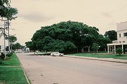
- Chichele Mofu Tree − a large Mofu mahogany tree in Chichele National Forest 13 km west of NdolaNdolaNdola is the third largest city in Zambia, with a population of 495,000 . It is the industrial, commercial, on the Copperbelt, Zambia's copper-mining region, and capital of Copperbelt Province. It is also the commercial capital city of Zambia and has one of the three international airports, others...
. - Dag Hammerskjold Memorial — where the then United Nations Secretary-General was killed in a plane crash on 18 September 1961, in the Ndola West Forest Reserve about 11 km west of NdolaNdolaNdola is the third largest city in Zambia, with a population of 495,000 . It is the industrial, commercial, on the Copperbelt, Zambia's copper-mining region, and capital of Copperbelt Province. It is also the commercial capital city of Zambia and has one of the three international airports, others...
at 12°58'32 S 28°31'13 E. - Football Heroes Burial Site, Independence Stadium, LusakaLusakaLusaka is the capital and largest city of Zambia. It is located in the southern part of the central plateau, at an elevation of about 1,300 metres . It has a population of about 1.7 million . It is a commercial centre as well as the centre of government, and the four main highways of Zambia head...
, where 30 victims of the 1993 Gabon Air Disaster are buried including the 18 members of the Zambia national football team. - Ntembwe of Mwase Lundazi — an irregular earthwork bank and ditch which was a baKafula village until about 1850, in LundaziLundaziLundazi is a town in eastern Zambia, lying near the border with Malawi, around 110 miles from Chipata. It is home to an airstrip, schools and a hotel in the form of a Norman castle. The building of the castle was begun in 1948 by an Englishman called Errol Buton, who reputedly sketched out its...
at 12°24' S 33°22' E. - Old National Assembly, LusakaLusakaLusaka is the capital and largest city of Zambia. It is located in the southern part of the central plateau, at an elevation of about 1,300 metres . It has a population of about 1.7 million . It is a commercial centre as well as the centre of government, and the four main highways of Zambia head...
: also known as the Old Secretariat and Legco, in Independence Avenue, Lusaka. Built 1932 and site of historic legislative events important to Zambia's history during colonial and post-independence times. - Slave Tree, NdolaNdolaNdola is the third largest city in Zambia, with a population of 495,000 . It is the industrial, commercial, on the Copperbelt, Zambia's copper-mining region, and capital of Copperbelt Province. It is also the commercial capital city of Zambia and has one of the three international airports, others...
− a large fig tree at Moffat Avenue and Livingstone Road, where slaves were bought and sold by Swahili slave traders.
Industrial monuments
- Collier Monument — to prospector William Collier’s 1902 discovery of copper ore at the Roan Antelope Mine in LuanshyaLuanshyaLuanshya is a town in Zambia, in the Copperbelt Province near Ndola. It has a population of 117,579 .Luanshya was founded in the early part of the 20th century after a prospector/explorer, William Collier, shot and killed a Roan Antelope on the banks of the Luanshya River, discovering a copper...
. - Lusaka Thermal Power Station, Great East Road, LusakaLusakaLusaka is the capital and largest city of Zambia. It is located in the southern part of the central plateau, at an elevation of about 1,300 metres . It has a population of about 1.7 million . It is a commercial centre as well as the centre of government, and the four main highways of Zambia head...
. - Moir And Bell Monument: MufuliraMufuliraMufulira is a town in the Copperbelt Province of Zambia. It grew up in the 1930s around the site of the Mufulira Copper Mine on its north-western edge...
Copper Mines, where the prospectors, J. Moir and G. Bell, discovered copper-bearing ore in 1923. - Zambezi Sawmills (Mulobezi) Railway Locomotive ShedsMulobezi RailwayThe Mulobezi Railway was constructed to carry timber from Mulobezi to Livingstone in the Southern Province of Zambia, when the country was Northern Rhodesia...
at LivingstoneLivingstone, ZambiaLivingstone or Maramba is a historic colonial city and present capital of the Southern Province of Zambia, a tourism centre for the Victoria Falls lying north of the Zambezi River, and a border town with road and rail connections to Zimbabwe on the other side of the Falls...
— c1920, now the site of the Livingstone Railway Museum.
Natural monuments
- Lunsemfwa Wonder Gorge and Bell PointLunsemfwa RiverThe Lunsemfwa River is a tributary of the Lukasashi and Luangwa Rivers in Zambia and part of the Zambezi River basin. It is a popular river for fishing, containing large populations of tigerfish and bream....
: MkushiMkushiMkushi is a town in Zambia, lying on the Great North Road and the Tazara railway, north east of Kapiri Mposhi. The Changwena Falls and Fort Elwes lie nearby...
District at the confluence of the Lunsemfwa and Mkushi Rivers at 14°39' S 29°07' E.
- Chipoma Falls on the Chimanabuwi River, 24 km SSW of ChinsaliChinsaliChinsali is a town in the Northern Province of Zambia, and is headquarters of Chinsali District. It lies 15 km west of the Great North Road and about 180 km north-north-east of Mpika...
at 10°46' S 32°01' E. - Chirundu Fossil Forest — 50,000-year-old fossil trees, 21 km west of ChirunduChirundu, ZambiaChirundu, Zambia is a town in Zambia at the border with Zimbabwe and is a key point on the Great North Road. It is the site of two of the five major road or rail bridges across the Zambezi river, the Chirundu Bridges....
at 16°02' S 28°40' E. - Chisimba FallsChisimba FallsThe Luombe River 7.2 km from Chilubula Mission in Kasama District makes a beautiful water fall called: Chishimba Falls . The Luome river joins the Lukulu River shortly after the falls....
on the Luombe River 7.2 km from Chilubula Mission in KasamaKasama, ZambiaKasama is the capital of the Northern Province of Zambia, situated on the central-southern African plateau at an elevation of about 1400 m. Its population, according to the 2000 census, is approximately 200,000. It grew considerably in the 1970s and 1980s after construction of the TAZARA Railway...
District. - Hippo Pool, ChingolaChingolaChingola is a city in Zambia's Copperbelt Province, the country's copper-mining region, with a population of 157,340 . It is the home of Nchanga Copper Mine, a deep-shaft high-grade content copper mining operation, which subsequently led to the development of two open pit operations, Chingola...
on the Kafue RiverKafue RiverThe Kafue River sustains one of the world's great wildlife environments. It is a major tributary of the Zambezi, and of Zambia's principal rivers, it is the most central and the most urban, and the longest and largest lying wholly within Zambia....
. - Kalambo FallsKalambo FallsKalambo Falls on the Kalambo River is a 772ft single drop waterfall on the border of Zambia and Tanzania at the southeast end of Lake Tanganyika. The falls are some of the tallest uninterrupted falls in Africa...
, Mbala District — falls and archaeological site of early human habitation (the falls is shared with TanzaniaTanzaniaThe United Republic of Tanzania is a country in East Africa bordered by Kenya and Uganda to the north, Rwanda, Burundi, and the Democratic Republic of the Congo to the west, and Zambia, Malawi, and Mozambique to the south. The country's eastern borders lie on the Indian Ocean.Tanzania is a state...
. - Kundabwika Falls on the Kalungwishi RiverKalungwishi RiverThe Kalungwishi River flows west in northern Zambia into Lake Mweru. It is known for its waterfalls, including the Lumangwe Falls, Kabweluma Falls, Kundabwiku Falls and Mumbuluma Falls....
in Kaputa District at 9°13' S 29°19' E - Kundalila FallsKundalila FallsThe Kaombe River in Zambia falls over the lip of the Muchinga escarpment and makes an exciting waterfall near the small town of Kanona in the Serenje District.The waterfall is called Kundalila Falls which means "crying dove" in the local Bemba language....
on the Kaombe River, 12.8 km SE of Kanona in Serenje DistrictSerenje DistrictSerenje District is a district of Zambia, located in Central Province. The capital lies at Serenje. As of the 2000 Zambian Census, the district had a population of 132,836 people.-References:...
. - Lake Chirengwa (Sunken Lake) 14 km E of NdolaNdolaNdola is the third largest city in Zambia, with a population of 495,000 . It is the industrial, commercial, on the Copperbelt, Zambia's copper-mining region, and capital of Copperbelt Province. It is also the commercial capital city of Zambia and has one of the three international airports, others...
at 12°58' S 28°45' E. - Lake KashibaLake KashibaLake Kashiba is situated south-west of Luanshya in Zambia, close to Mpongwe and St Anthony's Mission.-Hydrography:Lake Kashiba is the best known of the several small, very deep pools in the Ndola district called "the sunken lakes." They are found in limestone and were caused by the action of water...
SW of LuanshyaLuanshyaLuanshya is a town in Zambia, in the Copperbelt Province near Ndola. It has a population of 117,579 .Luanshya was founded in the early part of the 20th century after a prospector/explorer, William Collier, shot and killed a Roan Antelope on the banks of the Luanshya River, discovering a copper...
: a 100 m deep sunken lake at 13°27'S, 27°56'E. - Lumangwe FallsLumangwe FallsLumangwe Falls on the Kalungwishi River in northern Zambia is the largest waterfall wholly within that country, with a height of 30-40 m and a width of 160 m. The falls is 80 km from Mporokoso on the Kawambwa road...
on the Kalungwishi River between MporokosoMporokosoMporokoso is a town in the Northern Province of Zambia, lying at an elevation of nearly 1500 m on the flat plateau about 75 km south east of Lake Mweru Wantipa and 100 km south-west of Lake Tanganyika...
and KawambwaKawambwaKawambwa is a town in the Zambian province of Luapula located on the edge of the northern Zambian plateau above the Luapula valley at an altitude of 1300 m...
Districts at 9°32'35 S 29°23'16 E. - Ntumbachushi FallsNtumbachushi FallsNtumbachushi Falls are situated on the Ngona River in Luapula Province, Zambia where it runs over the edge of the northern Zambian plateau into the valley of the Luapula River....
on the Ngona River, KawambwaKawambwaKawambwa is a town in the Zambian province of Luapula located on the edge of the northern Zambian plateau above the Luapula valley at an altitude of 1300 m...
District, at 9°52'S, 28°58'E - Zambezi Source, MwinilungaMwinilungaMwinilunga is a town in the North-Western Province of Zambia and headquarters of a district of that name. It lies on the West Lunga River, not far from the borders with the Democratic Republic of the Congo and Angola.- Overview :...
District: source of the Zambezi river and a botanical reserve, part of Zambezi Source National Forest.
List of Other Historic Sites
These are not declared national monuments but are probably on the larger NHCC list of historic sites. It is an informal and incomplete list of sites — please add (with references if possible) even if you are unsure of their NHCC status.- Chilubula Mission, Kayembi — the first mission of the White Fathers in the territory built 1895 by Father Joseph Dupont, known as 'Moto Moto', it features a large church and well-preserved buildings.
- Otto Beit Bridge, ChirunduChirundu, ZambiaChirundu, Zambia is a town in Zambia at the border with Zimbabwe and is a key point on the Great North Road. It is the site of two of the five major road or rail bridges across the Zambezi river, the Chirundu Bridges....
— 1939, first modern suspension bridge with parallel cables built outside the USA (shared with Zimbabwe). - High Court, Livingstone — built in 1910 to coincide with the visit of the Duke and Duchess of Connaught
- Broken Hill Mine, KabweKabweKabwe is the capital of the Zambian Central Province with a population estimated at 210,000. Formerly named Broken Hill, it was founded when the Broken Hill lead and zinc deposits were discovered in 1902. Kabwe also has a claim to being the birthplace of Zambian politics...
— one of the first mines in Zambia (1906) and site of the Broken Hill ManRhodesian ManKabwe skull or Kabwe cranium, or Broken Hill 1 is a hominin fossil that was frequently classified as belonging to Homo rhodesiensis. The cranium was found in an lead and zinc mine in Broken Hill, Northern Rhodesia in 1921 by Tom Zwiglaar, a Swiss miner...
fossil find commemorated by a memorial at the municipal offices. - Kilwa IslandKilwa IslandKilwa Island is an island on Lake Mweru, Zambia. It was known to Arab and Swahili traders of ivory, copper and slaves who used Kilwa Island on the lake as a base at one time....
, Lake MweruLake MweruLake Mweru is a freshwater lake on the longest arm of Africa's second-longest river, the Congo. Located on the border between Zambia and Democratic Republic of the Congo, it makes up 110 km of the total length of the Congo, lying between its Luapula River and Luvua River segments.Mweru...
— site of 19th Century slave traders’ stockade. - Lwimbe Petroglyphs —about 15 km west of KasamaKasama, ZambiaKasama is the capital of the Northern Province of Zambia, situated on the central-southern African plateau at an elevation of about 1400 m. Its population, according to the 2000 census, is approximately 200,000. It grew considerably in the 1970s and 1980s after construction of the TAZARA Railway...
. - Girls Boarding School, MbereshiMbereshiMbereshi is a village in the Luapula Province of Zambia, named after the Mbereshi River on its north side. It was the site of a large mission founded in 1900 by the London Missionary Society. In 1915 the mission established the first girls' school in the territory, as well as a boy's school and a...
— 1915, first African girls’ school in the country, now a mission house. - Mulungushi Rock, KabweKabweKabwe is the capital of the Zambian Central Province with a population estimated at 210,000. Formerly named Broken Hill, it was founded when the Broken Hill lead and zinc deposits were discovered in 1902. Kabwe also has a claim to being the birthplace of Zambian politics...
— since 1960, site of independence movement conferences. - Mumbwa, the first CopperbeltMumbwaMumbwa is a town in the Central Province of Zambia, lying on the Great West Road. Its district covers the western part of the Central Province bordering Kaoma and Western Province to the west, Namwala and Southern Province to the south, Lusaka and Lusaka Province to the east, Kasempa and...
— the first commercial copper mines in Zambia were the Sable Antelope mine and Hippo mine in MumbwaMumbwaMumbwa is a town in the Central Province of Zambia, lying on the Great West Road. Its district covers the western part of the Central Province bordering Kaoma and Western Province to the west, Namwala and Southern Province to the south, Lusaka and Lusaka Province to the east, Kasempa and...
, now heritage sites. - North-Western Hotel, LivingstoneNorth-Western Hotel, LivingstoneThe Northwestern Hotel is located in Livingstone, Zambia and was built in 1907 by Mrs and Mr Freddie Mills. It was actually the second hotel of that name; the previous North Western Hotel built in 1906 by railway contractors Pauling and Co was converted into government offices.Activities such as...
— built 1909 by 'Mopane' Clarke. - Saint Andrews Church, Livingstone — built 1910-11 in memory of David Livingstone and still in use.
- Shiwa HouseShiwa NganduShiwa Ngandu is a grand English-style country house and estate in the Northern Province of Zambia, about 12 km west of the Tanzam highway and half-way between Mpika and Chinsali. Its name is based on a small lake nearby, Lake Ishiba Ng'andu which in the Bemba language means 'lake of the royal...
— 'manor house' built in 1922 by Sir Stewart Gore-BrowneStewart Gore-BrowneLieutenant Colonel Sir Stewart Gore-Browne, DSO, , called Chipembele by Africans, was a soldier, pioneer white settler, builder, politician and supporter of independence in Northern Rhodesia .- Early life :...
at his Shiwa NganduShiwa NganduShiwa Ngandu is a grand English-style country house and estate in the Northern Province of Zambia, about 12 km west of the Tanzam highway and half-way between Mpika and Chinsali. Its name is based on a small lake nearby, Lake Ishiba Ng'andu which in the Bemba language means 'lake of the royal...
estate. - Victoria Falls BridgeVictoria Falls BridgeThe Victoria Falls Bridge crosses the Zambezi River just below the Victoria Falls and is built over the Second Gorge of the falls. As the river is the border between Zimbabwe and Zambia, the bridge links the two countries and has border posts on the approaches to both ends, at the towns of Victoria...
, LivingstoneLivingstone, ZambiaLivingstone or Maramba is a historic colonial city and present capital of the Southern Province of Zambia, a tourism centre for the Victoria Falls lying north of the Zambezi River, and a border town with road and rail connections to Zimbabwe on the other side of the Falls...
— 1905, first major bridge and first railway (shared with Zimbabwe)
General references
- Zambia Magazine online
- The Northern Rhodesia Journal online
- Zambia Horizon online David Phillipson: "Signposts to a Nation's Heritage", pp 1–4 (No date). Accessed 28 February 2007.