
Modoc, Indiana
Encyclopedia
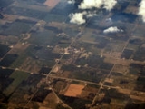
Modoc is a town in Union Township
, Randolph County
, Indiana
, United States
. The population was 196 at the 2010 census.
According to the United States Census Bureau
, the town has a total area of 0.1 square mile (0.258998811 km²), all of it land. Modoc, is about 25 miles southeast of Muncie, Indiana
, and is about 25 miles northwest of Richmond, Indiana
. The town is also about 60 miles from the cities of Indianapolis, Indiana
, Dayton, Ohio
, and Cincinnati, Ohio
.
of 2000, there were 225 people, 84 households, and 63 families residing in the town. The population density
was 1,908.1 people per square mile (723.9/km²). There were 90 housing units at an average density of 763.2 per square mile (289.6/km²). The racial makeup of the town was 96.00% White, 1.33% African American, 0.44% Pacific Islander, and 2.22% from two or more races. Hispanic or Latino of any race were 0.89% of the population.
There were 84 households out of which 39.3% had children under the age of 18 living with them, 57.1% were married couples
living together, 14.3% had a female householder with no husband present, and 25.0% were non-families. 22.6% of all households were made up of individuals and 8.3% had someone living alone who was 65 years of age or older. The average household size was 2.68 and the average family size was 3.06.
In the town the population was spread out with 28.9% under the age of 18, 9.3% from 18 to 24, 31.6% from 25 to 44, 19.1% from 45 to 64, and 11.1% who were 65 years of age or older. The median age was 34 years. For every 100 females there were 108.3 males. For every 100 females age 18 and over, there were 97.5 males.
The median income for a household in the town was $28,333, and the median income for a family was $32,708. Males had a median income of $31,250 versus $24,375 for females. The per capita income
for the town was $13,230. About 12.3% of families and 14.6% of the population were below the poverty line, including 14.6% of those under the age of eighteen and 21.9% of those sixty five or over.
. Henry Conley
,an American Civil War
veteran, is also from the town of Modoc.
.
and U.S. 36
is a 120 acre (486,000 m²) landfill
owned by the Balkema family of Kalamazoo, Michigan
, located in Randolph County, Indiana
. In addition to Randolph County, it serves Delaware
, Madison
, Jay
, Wayne
, and Henry Counties
in Indiana
, as well as Darke
and Miami Counties
in Ohio
. Randolph Farms was built on a limestone
hill
, directly over sand and gravel aquifer
s, near the drainage basin
s of White River
and Whitewater River
.
. The mascot of the school is the Rocket. Their colors are royal blue and gold.
is a proprietor of the town of Modoc. Conley Street in Modoc is named after him.
Union Township, Randolph County, Indiana
- Cemeteries :Union Township has 9 cemeteries.*Buena Vista Cemetery*Huntsville Cemetery*Little Creek Cemetery*Nettle Creek Baptist Cemetery*Riverside Cemetery*Salem Cemetery*Scott Cemetery*Union Baptist Cemetery*Union Chapel Cemetery-Noteworthy Residents:...
, Randolph County
Randolph County, Indiana
Randolph County is a county located in the U.S. state of Indiana. As of 2010, the population was 26,171. The county seat is Winchester.-History:...
, Indiana
Indiana
Indiana is a US state, admitted to the United States as the 19th on December 11, 1816. It is located in the Midwestern United States and Great Lakes Region. With 6,483,802 residents, the state is ranked 15th in population and 16th in population density. Indiana is ranked 38th in land area and is...
, United States
United States
The United States of America is a federal constitutional republic comprising fifty states and a federal district...
. The population was 196 at the 2010 census.
Geography
Modoc is located at 40°2′47"N 85°7′34"W (40.046323, -85.126125).According to the United States Census Bureau
United States Census Bureau
The United States Census Bureau is the government agency that is responsible for the United States Census. It also gathers other national demographic and economic data...
, the town has a total area of 0.1 square mile (0.258998811 km²), all of it land. Modoc, is about 25 miles southeast of Muncie, Indiana
Muncie, Indiana
Muncie is a city in Center Township, Delaware County in east central Indiana, best known as the home of Ball State University and the birthplace of the Ball Corporation. It is the principal city of the Muncie, Indiana, Metropolitan Statistical Area, which has a population of 118,769...
, and is about 25 miles northwest of Richmond, Indiana
Richmond, Indiana
Richmond is a city largely within Wayne Township, Wayne County, in east central Indiana, United States, which borders Ohio. The city also includes the Richmond Municipal Airport, which is in Boston Township and separated from the rest of the city...
. The town is also about 60 miles from the cities of Indianapolis, Indiana
Indianapolis, Indiana
Indianapolis is the capital of the U.S. state of Indiana, and the county seat of Marion County, Indiana. As of the 2010 United States Census, the city's population is 839,489. It is by far Indiana's largest city and, as of the 2010 U.S...
, Dayton, Ohio
Dayton, Ohio
Dayton is the 6th largest city in the U.S. state of Ohio and the county seat of Montgomery County, the fifth most populous county in the state. The population was 141,527 at the 2010 census. The Dayton Metropolitan Statistical Area had a population of 841,502 in the 2010 census...
, and Cincinnati, Ohio
Cincinnati, Ohio
Cincinnati is a city in the U.S. state of Ohio. Cincinnati is the county seat of Hamilton County. Settled in 1788, the city is located to north of the Ohio River at the Ohio-Kentucky border, near Indiana. The population within city limits is 296,943 according to the 2010 census, making it Ohio's...
.
Demographics
As of the censusCensus
A census is the procedure of systematically acquiring and recording information about the members of a given population. It is a regularly occurring and official count of a particular population. The term is used mostly in connection with national population and housing censuses; other common...
of 2000, there were 225 people, 84 households, and 63 families residing in the town. The population density
Population density
Population density is a measurement of population per unit area or unit volume. It is frequently applied to living organisms, and particularly to humans...
was 1,908.1 people per square mile (723.9/km²). There were 90 housing units at an average density of 763.2 per square mile (289.6/km²). The racial makeup of the town was 96.00% White, 1.33% African American, 0.44% Pacific Islander, and 2.22% from two or more races. Hispanic or Latino of any race were 0.89% of the population.
There were 84 households out of which 39.3% had children under the age of 18 living with them, 57.1% were married couples
Marriage
Marriage is a social union or legal contract between people that creates kinship. It is an institution in which interpersonal relationships, usually intimate and sexual, are acknowledged in a variety of ways, depending on the culture or subculture in which it is found...
living together, 14.3% had a female householder with no husband present, and 25.0% were non-families. 22.6% of all households were made up of individuals and 8.3% had someone living alone who was 65 years of age or older. The average household size was 2.68 and the average family size was 3.06.
In the town the population was spread out with 28.9% under the age of 18, 9.3% from 18 to 24, 31.6% from 25 to 44, 19.1% from 45 to 64, and 11.1% who were 65 years of age or older. The median age was 34 years. For every 100 females there were 108.3 males. For every 100 females age 18 and over, there were 97.5 males.
The median income for a household in the town was $28,333, and the median income for a family was $32,708. Males had a median income of $31,250 versus $24,375 for females. The per capita income
Per capita income
Per capita income or income per person is a measure of mean income within an economic aggregate, such as a country or city. It is calculated by taking a measure of all sources of income in the aggregate and dividing it by the total population...
for the town was $13,230. About 12.3% of families and 14.6% of the population were below the poverty line, including 14.6% of those under the age of eighteen and 21.9% of those sixty five or over.
Noteworthy Residents
A notable former resident of Modoc is Amy Lindsay-Fuller. She played basketball for Union High School. Then she played NCAA basketball for Ball State UniversityBall State University
Ball State University is a state-run research university located in Muncie, Indiana. It is also known as Ball State or simply BSU.Located on the northwest side of the city, Ball State's campus spans and includes 106 buildings...
. Henry Conley
Henry Conley
Henry Conley is a Civil War veteran, and founded the Town of Modoc, Indiana. Conley street in Modoc is named after him....
,an American Civil War
American Civil War
The American Civil War was a civil war fought in the United States of America. In response to the election of Abraham Lincoln as President of the United States, 11 southern slave states declared their secession from the United States and formed the Confederate States of America ; the other 25...
veteran, is also from the town of Modoc.
Origin of Modoc
There are several legends to how the town of Modoc got its name. One of them said that a man travelling on the train threw out a cigar box containing the name Modoc, and that Henry Conley, one of the first settlers of the town, picked it up and suggested to bystanders that it would be a good name for the town. Another theory is that Modoc was named after the Modoc Indian tribe which was located in northern CaliforniaCalifornia
California is a state located on the West Coast of the United States. It is by far the most populous U.S. state, and the third-largest by land area...
.
Highways
Major highways and roads that serve Modoc include Indiana 1Indiana State Road 1
State Road 1 is a north–south state highway in the eastern portion of the U.S. state of Indiana. Its southern terminus is at U.S. Highway 50 in east-central Dearborn County, just east of Lawrenceburg. Its northern terminus is at U.S...
and U.S. 36
U.S. Route 36
U.S. Route 36 is an east–west United States highway that runs for from Rocky Mountain National Park, Colorado to Uhrichsville, Ohio. The highway's western terminus is at Deer Ridge Junction, an intersection in Rocky Mountain National Park, Colorado, where it meets U.S. Route 34. Its eastern...
Randolph Farms Landfill
Randolph Farms LandfillRandolph Farms Landfill
Randolph Farms Landfill is a 120 acre landfill owned by the Balkema family of Kalamazoo, Michigan, located in Modoc, Indiana. In addition to Randolph County, it serves Delaware, Madison, Jay, Wayne, and Henry Counties in Indiana, as well as Darke and Miami Counties in Ohio.The owners of the...
is a 120 acre (486,000 m²) landfill
Landfill
A landfill site , is a site for the disposal of waste materials by burial and is the oldest form of waste treatment...
owned by the Balkema family of Kalamazoo, Michigan
Kalamazoo, Michigan
The area on which the modern city stands was once home to Native Americans of the Hopewell culture, who migrated into the area sometime before the first millennium. Evidence of their early residency remains in the form of a small mound in downtown's Bronson Park. The Hopewell civilization began to...
, located in Randolph County, Indiana
Randolph County, Indiana
Randolph County is a county located in the U.S. state of Indiana. As of 2010, the population was 26,171. The county seat is Winchester.-History:...
. In addition to Randolph County, it serves Delaware
Delaware County, Indiana
As of the census of 2000, there were 118,769 people, 47,131 households, and 29,692 families residing in the county. The population density was 302 people per square mile . There were 51,032 housing units at an average density of 130 per square mile...
, Madison
Madison County, Indiana
As of the census of 2000, there were 133,358 people, 53,052 households, and 36,234 families residing in the county. The population density was 295 people per square mile . There were 56,939 housing units at an average density of 126 per square mile...
, Jay
Jay County, Indiana
As of the census of 2000, there were 21,806 people, 8,405 households, and 6,017 families residing in the county. The population density was 57 people per square mile . There were 9,074 housing units at an average density of 24 per square mile...
, Wayne
Wayne County, Indiana
Wayne County is a county located in the U.S. state of Indiana. As of the 2010 census, the population was 68,917. The county seat is Richmond.-History:...
, and Henry Counties
Henry County, Indiana
As of the census of 2000, there were 48,508 people, 19,486 households, and 13,971 families residing in the county. The population density was 124 people per square mile . There were 20,592 housing units at an average density of 52 per square mile...
in Indiana
Indiana
Indiana is a US state, admitted to the United States as the 19th on December 11, 1816. It is located in the Midwestern United States and Great Lakes Region. With 6,483,802 residents, the state is ranked 15th in population and 16th in population density. Indiana is ranked 38th in land area and is...
, as well as Darke
Darke County, Ohio
As of the census of 2000, there were 53,309 people, 20,419 households, and 14,905 families residing in the county. The population density was 89 people per square mile . There were 21,583 housing units at an average density of 36 per square mile...
and Miami Counties
Miami County, Ohio
As of the census of 2000, there were 98,868 people, 38,437 households, and 27,943 families residing in the county. The population density was 243 people per square mile . There were 40,554 housing units at an average density of 100 per square mile...
in Ohio
Ohio
Ohio is a Midwestern state in the United States. The 34th largest state by area in the U.S.,it is the 7th‑most populous with over 11.5 million residents, containing several major American cities and seven metropolitan areas with populations of 500,000 or more.The state's capital is Columbus...
. Randolph Farms was built on a limestone
Limestone
Limestone is a sedimentary rock composed largely of the minerals calcite and aragonite, which are different crystal forms of calcium carbonate . Many limestones are composed from skeletal fragments of marine organisms such as coral or foraminifera....
hill
Hill
A hill is a landform that extends above the surrounding terrain. Hills often have a distinct summit, although in areas with scarp/dip topography a hill may refer to a particular section of flat terrain without a massive summit A hill is a landform that extends above the surrounding terrain. Hills...
, directly over sand and gravel aquifer
Aquifer
An aquifer is a wet underground layer of water-bearing permeable rock or unconsolidated materials from which groundwater can be usefully extracted using a water well. The study of water flow in aquifers and the characterization of aquifers is called hydrogeology...
s, near the drainage basin
Drainage basin
A drainage basin is an extent or an area of land where surface water from rain and melting snow or ice converges to a single point, usually the exit of the basin, where the waters join another waterbody, such as a river, lake, reservoir, estuary, wetland, sea, or ocean...
s of White River
White River (Indiana)
The White River is a two-forked river that flows through central and southern Indiana and is the main tributary to the Wabash River. Via the west fork, considered to be the main stem of the river by the U.S. Board on Geographic Names, the White River is long.-West Fork:The West Fork, long, is...
and Whitewater River
Whitewater River (Indiana)
The Whitewater River is a tributary of the Great Miami River in southeastern Indiana and southwestern Ohio in the United States. It is formed by the confluence of two forks, the West Fork and East Fork....
.
Education
Modoc's high school is Union High School (Modoc)Union High School (Modoc)
Union High School a.k.a UHS is a small high school located in Union Township, Modoc, Indiana. Although the official name is Union Township High School. It is one of five high schools in Randolph County, Indiana. In 2004 Union High School was named an Indiana Four Star School by the Indiana...
. The mascot of the school is the Rocket. Their colors are royal blue and gold.
H. C. Conley
Henry ConleyHenry Conley
Henry Conley is a Civil War veteran, and founded the Town of Modoc, Indiana. Conley street in Modoc is named after him....
is a proprietor of the town of Modoc. Conley Street in Modoc is named after him.
The I. B. & W. Railroad
Modoc, like many other small towns, probably would not have been built if the I. B. & W. Railroad had not made its way across southern Randolph County, in 1878. The location was poorly drained, but it had the advantage of being rather flat. It was plagued, for many years, by typhoid fever outbreaks. The railroad was built by many contractors. The railroad came through Modoc from the west, and met the contractors, who were building the next section east, in what was then a strip of timber about one-half mile east of where the depot was located.County communities
| Farmland Farmland, Indiana Farmland is a town in Monroe Township, Randolph County, Indiana, United States. The population was 1,333 at the 2010 census.-Geography:Farmland is located at .... |
Losantville Losantville, Indiana Losantville is a town in Union Township, Randolph County, Indiana, United States. The population was 237 at the 2010 census.-Geography:Losantville is located at .... |
Lynn Lynn, Indiana Lynn is a town in Washington Township, Randolph County, Indiana, United States. The population was 1,097 at the 2010 census.-Geography:Lynn is located at .... |
Parker Parker City, Indiana Parker City is a town in Monroe Township, Randolph County, Indiana, United States. The population was 1,419 at the 2010 census.-Geography:Parker City is located at .According to the United States Census Bureau, the town has a total area of , all of it land... |
| Ridgeville Ridgeville, Indiana Ridgeville is a town in Franklin Township, Randolph County, Indiana, United States, along the Mississinewa River. The population was 843 at the 2000 census.- Geography :Ridgeville is located at .... |
Saratoga Saratoga, Indiana Saratoga is a town in Ward Township, Randolph County, Indiana, United States. The population was 254 at the 2010 census.-Geography:Saratoga is located at .... |
Union City Union City, Indiana Union City is a city in Wayne Township, Randolph County, Indiana, United States. As of the 2010 census, the city had a population of 3,584.Union City was a stop along the Pittsburgh, Cincinnati, Chicago and St. Louis Railroad, a forerunner of the Pennsylvania Railroad that connected Pittsburgh to... |
Winchester Winchester, Indiana Winchester is a city in White River Township, Randolph County, Indiana, United States. The population was 4,935 at the 2010 census. The city is the county seat of Randolph County... |
Neighboring communities
| Hagerstown Hagerstown, Indiana Hagerstown is a town in Jefferson Township, Wayne County, Indiana, United States. As of the 2010 census, the population was 1,787.-Geography:Hagerstown is located at .... |
Richmond Richmond, Indiana Richmond is a city largely within Wayne Township, Wayne County, in east central Indiana, United States, which borders Ohio. The city also includes the Richmond Municipal Airport, which is in Boston Township and separated from the rest of the city... |
Muncie Muncie, Indiana Muncie is a city in Center Township, Delaware County in east central Indiana, best known as the home of Ball State University and the birthplace of the Ball Corporation. It is the principal city of the Muncie, Indiana, Metropolitan Statistical Area, which has a population of 118,769... |
Selma Selma, Indiana Selma is a town located in Liberty Township, Delaware County, Indiana. As of the 2010 census, the town had a total population of 866. It is part of the Muncie, IN Metropolitan Statistical Area.- Geography :... |
| Cambridge City Cambridge City, Indiana Cambridge City is a town in Jackson Township, Wayne County, Indiana, United States. The population was 1,870 at the 2010 census.-Geography:Cambridge City is located at .... |
New Castle New Castle, Indiana As of the census of 2000, there were 17,780 people, 7,462 households, and 4,805 families residing in the city. The population density was 2,987.5 people per square mile . There were 8,042 housing units at an average density of 1,351.3 per square mile... |
Mooreland Mooreland, Indiana Mooreland is a town in Blue River Township, Henry County, Indiana, United States. The population was 375 at the 2010 census.-Geography:Mooreland is located at .... |
Fountain City Fountain City, Indiana Fountain City, formerly Newport, is a town in Wayne County, Indiana, United States. The population was 796 at the 2010 census. It was formerly known as Newport... |
Nearby Major U.S. Cities
| Indianapolis Indianapolis, Indiana Indianapolis is the capital of the U.S. state of Indiana, and the county seat of Marion County, Indiana. As of the 2010 United States Census, the city's population is 839,489. It is by far Indiana's largest city and, as of the 2010 U.S... |
Ft. Wayne Fort Wayne, Indiana Fort Wayne is a city in the US state of Indiana and the county seat of Allen County. The population was 253,691 at the 2010 Census making it the 74th largest city in the United States and the second largest in Indiana... |
Cincinnati Cincinnati, Ohio Cincinnati is a city in the U.S. state of Ohio. Cincinnati is the county seat of Hamilton County. Settled in 1788, the city is located to north of the Ohio River at the Ohio-Kentucky border, near Indiana. The population within city limits is 296,943 according to the 2010 census, making it Ohio's... |
Dayton Dayton, Ohio Dayton is the 6th largest city in the U.S. state of Ohio and the county seat of Montgomery County, the fifth most populous county in the state. The population was 141,527 at the 2010 census. The Dayton Metropolitan Statistical Area had a population of 841,502 in the 2010 census... |
| Chicago | Louisville Louisville, Kentucky Louisville is the largest city in the U.S. state of Kentucky, and the county seat of Jefferson County. Since 2003, the city's borders have been coterminous with those of the county because of a city-county merger. The city's population at the 2010 census was 741,096... |
Detroit Detroit, Michigan Detroit is the major city among the primary cultural, financial, and transportation centers in the Metro Detroit area, a region of 5.2 million people. As the seat of Wayne County, the city of Detroit is the largest city in the U.S. state of Michigan and serves as a major port on the Detroit River... |
Cleveland Cleveland, Ohio Cleveland is a city in the U.S. state of Ohio and is the county seat of Cuyahoga County, the most populous county in the state. The city is located in northeastern Ohio on the southern shore of Lake Erie, approximately west of the Pennsylvania border... |