
Maryland Route 806
Encyclopedia
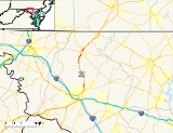
Maryland Route 806 is a state highway
in the U.S. state of Maryland
. The state highway runs a total of 4.05 miles (6.5 km) in two segments from U.S. Route 15
(US 15) near Catoctin Furnace
north to Roddy Creek Road near Thurmont
. MD 806A, which has a length of 3.04 miles (4.9 km) from Catoctin Furnace to Thurmont, and MD 806R, which extends 1.01 miles (1.6 km) on the north side of Thurmont, are separated by a section of municipally-maintained road on the south side of Thurmont and a segment of MD 550
north of MD 77
. MD 806 is the old alignment of US 15 through Catoctin Furnace and Thurmont. The state highway was originally constructed in the 1910s. MD 806 was assigned to the highway when US 15 bypassed Thurmont in the late 1950s. The state highway became a split route in the late 1980s. There have been several other segments of MD 806 along former sections of US 15 in Frederick County
, including portions around Lewistown
and south of Frederick
.
and the eastern boundary of Cunningham Falls State Park
. The state highway crosses Little Hunting Creek and passes the site of the Catoctin Furnace
and the Catoctin Wildlife Preserve and Zoo. Just south of the zoo, MD 806 has access to US 15 and the Manor Area of Cunningham Falls State Park via a two-way spur to US 15, which closely parallels MD 806 at that point. The state highway veers away from US 15 and intersects Blue Mountain Road, which heads west as unsigned US 15G to provide another access point to the parallel divided highway. MD 806 traverses High Run then reaches its northern terminus at the southern town limit of Thurmont.
The roadway, which was formerly part of MD 806, continues north as municipally-maintained Frederick Road through a commercial area. Frederick Road intersects Thurmont Boulevard, which heads west to a diamond interchange with US 15. The old highway crosses Hunting Creek and turns north onto Water Street to pass through downtown Thurmont. At MD 77 (Main Street), the old alignment becomes a state highway again as part of MD 550, which heads east with MD 77 along Main Street and north along Church Street, which passes under the Maryland Midland Railway
. The Church Street portion of MD 550 is also signed as MD 806. The next official segment of MD 806 (officially MD 806R) begins at MD 550 and follows Emmitsburg Road northeast out of the town of Thurmont. As MD 806 approaches US 15, the road makes a right angle turn to the east and its name changes to Albert Staub Road. The state highway makes a sharp turn to the northeast and crosses Owens Creek to its northern terminus at Roddy Creek Road. Roddy Creek Road heads east toward the Roddy Road Covered Bridge
and west to an intersection with US 15.
between 1915 and 1919. The highways through Catoctin Furnace and Thurmont were designated US 15 in 1927 and widened to 20 feet (6.1 m) around 1930.
Construction on the Thurmont Bypass from Catoctin Furnace to Owens Creek began in 1956. The new highway, which was constructed as the first roadway of an ultimate divided highway, was completed in 1958. US 15 moved to its present alignment and the old road was designated as the first section of MD 806. The northern terminus of the Thurmont section of MD 806 was originally just north of the right angle turn from Emmitsburg Road to Albert Staub Road, where MD 806 met then two-lane US 15 at an oblique intersection. When US 15 was reconstructed as a divided highway from MD 550 north toward Emmitsburg in 1983, MD 806's original terminus was removed. MD 806 was moved onto Albert Staub Road, which was extended north over a new bridge over Owens Creek to its present terminus. MD 806 was split into MD 806A and MD 806R when the highway from the southern town limit of Thurmont to MD 77 was transferred to municipal maintenance around 1989.
Several other sections of the old alignment of US 15 have been marked as sections of MD 806. US 15 bypassed Lewistown in 1962. The old alignment along Hessong Bridge Road and Angleberger Road was a segment of MD 806 until it was transferred to county maintenance around 1985. US 15 originally followed what is now MD 85
from Tuscarora
to Frederick. When US 15 was moved to Washington National Pike (now Interstate 270
) and the Frederick Freeway after the latter freeway was completed in 1959, the portion of US 15 between Washington National Pike and MD 355
became a segment of MD 806. The segment of MD 806 south of Frederick became part of MD 85 in 1971. Other portions of the old alignment of US 15 that were part of MD 806 include Hansonville Road between Frederick and Lewistown; Auburn Road between Lewistown and Catoctin Furnace; and Franklinville Road, St. Anthony Road, and Old Emmitsburg Road between Thurmont and Emmitsburg.
.
{| class=wikitable
!Location
!Mile
!Destinations
!Notes
|-
|rowspan=3|Catoctin Furnace
|0.00
|
|Southern terminus of MD 806A
|-
|1.29
|
|Two-way spur to US 15
|-
|2.31
|Blue Mountain Road to
|Blue Mountain Road west is unsigned US 15G
|-
|rowspan=4|Thurmont
|3.04
|Frederick Road north
|Northern terminus of MD 806A; Thurmont
town limit
|-
|colspan=3 align=center|Former MD 806 continues as municipally-maintained Frederick Road and Water Street toward MD 77
and MD 550
|-
|0.00
|
|Southern terminus of MD 806R
|-
|1.01
|Roddy Creek Road to
|Northern terminus of MD 806R
auxiliary routes.
State highway
State highway, state road or state route can refer to one of three related concepts, two of them related to a state or provincial government in a country that is divided into states or provinces :#A...
in the U.S. state of Maryland
Maryland
Maryland is a U.S. state located in the Mid Atlantic region of the United States, bordering Virginia, West Virginia, and the District of Columbia to its south and west; Pennsylvania to its north; and Delaware to its east...
. The state highway runs a total of 4.05 miles (6.5 km) in two segments from U.S. Route 15
U.S. Route 15 in Maryland
U.S. Route 15 is a part of the U.S. Highway System that runs from Walterboro, South Carolina to Painted Post, New York. In Maryland, the highway runs from the Virginia state line at the Potomac River in Point of Rocks north to the Pennsylvania state line near Emmitsburg. US 15 is...
(US 15) near Catoctin Furnace
Catoctin Furnace, Maryland
Catoctin Furnace is an unincorporated community in Frederick County, Maryland, United States. It is the site of the Catoctin Furnace Historic District.-References:...
north to Roddy Creek Road near Thurmont
Thurmont, Maryland
Thurmont is a town in Frederick County, Maryland, United States. The population was 5,588 at the 2000 census. The town is located in the northern part of Frederick County , approximately ten miles from the Pennsylvania border, along U.S. Highway 15...
. MD 806A, which has a length of 3.04 miles (4.9 km) from Catoctin Furnace to Thurmont, and MD 806R, which extends 1.01 miles (1.6 km) on the north side of Thurmont, are separated by a section of municipally-maintained road on the south side of Thurmont and a segment of MD 550
Maryland Route 550
Maryland Route 550 is a state highway in the U.S. state of Maryland. The state highway runs from MD 26 in Libertytown north to Pen Mar Road in Fort Ritchie...
north of MD 77
Maryland Route 77
Maryland Route 77 is a state highway in the U.S. state of Maryland. The state highway runs from MD 64 in Smithsburg east to MD 194 in Keymar. MD 77 is the main east–west highway of northern Frederick County...
. MD 806 is the old alignment of US 15 through Catoctin Furnace and Thurmont. The state highway was originally constructed in the 1910s. MD 806 was assigned to the highway when US 15 bypassed Thurmont in the late 1950s. The state highway became a split route in the late 1980s. There have been several other segments of MD 806 along former sections of US 15 in Frederick County
Frederick County, Maryland
Frederick County is a county located in the western part of the U.S. state of Maryland, bordering the southern border of Pennsylvania and the northeastern border of Virginia. As of the 2010 Census, the population was 233,385....
, including portions around Lewistown
Lewistown, Frederick County, Maryland
Lewistown is an unincorporated community in Frederick County, Maryland, United States.-References:...
and south of Frederick
Frederick, Maryland
Frederick is a city in north-central Maryland. It is the county seat of Frederick County, the largest county by area in the state of Maryland. Frederick is an outlying community of the Washington-Arlington-Alexandria, DC-VA-MD-WV Metropolitan Statistical Area, which is part of a greater...
.
Route description
MD 806 begins at an intersection with US 15 (Catoctin Mountain Highway) and Auburn Road, the old alignment of US 15 that heads south closely paralleling the southbound lanes of US 15. The state highway, officially MD 806A, heads north as two-lane Catoctin Furnace Road through the community of Catoctin Furnace. MD 806 parallels the northbound lanes of US 15, which itself parallels the eastern edge of Catoctin MountainCatoctin Mountain
Catoctin Mountain, along with the geologically associated Bull Run Mountains, comprises the easternmost mountain ridge of the Blue Ridge Mountains, which are in turn a part of the Appalachian Mountains range...
and the eastern boundary of Cunningham Falls State Park
Cunningham Falls State Park
Cunningham Falls State Park is a Maryland State Park located west of Thurmont, Maryland, USA, in the Catoctin Mountains. It features a man-made lake and its namesake waterfall, Cunningham Falls. Cunningham Falls is a cascading waterfall. It is the largest waterfall in Maryland. Catoctin...
. The state highway crosses Little Hunting Creek and passes the site of the Catoctin Furnace
Catoctin Furnace
Catoctin Furnace was constructed in 1774 by four brothers Thomas, Baker, Roger and James Johnson to produce pig iron from locally mined hematite.In blast by 1776,...
and the Catoctin Wildlife Preserve and Zoo. Just south of the zoo, MD 806 has access to US 15 and the Manor Area of Cunningham Falls State Park via a two-way spur to US 15, which closely parallels MD 806 at that point. The state highway veers away from US 15 and intersects Blue Mountain Road, which heads west as unsigned US 15G to provide another access point to the parallel divided highway. MD 806 traverses High Run then reaches its northern terminus at the southern town limit of Thurmont.
The roadway, which was formerly part of MD 806, continues north as municipally-maintained Frederick Road through a commercial area. Frederick Road intersects Thurmont Boulevard, which heads west to a diamond interchange with US 15. The old highway crosses Hunting Creek and turns north onto Water Street to pass through downtown Thurmont. At MD 77 (Main Street), the old alignment becomes a state highway again as part of MD 550, which heads east with MD 77 along Main Street and north along Church Street, which passes under the Maryland Midland Railway
Maryland Midland Railway
The Maryland Midland Railway is a Class III short-line railroad operating about 63 miles of track in central Maryland. It was originally headquartered in the former Western Maryland Railway station in Union Bridge, Maryland, however it is now located in a new facility across the street from the...
. The Church Street portion of MD 550 is also signed as MD 806. The next official segment of MD 806 (officially MD 806R) begins at MD 550 and follows Emmitsburg Road northeast out of the town of Thurmont. As MD 806 approaches US 15, the road makes a right angle turn to the east and its name changes to Albert Staub Road. The state highway makes a sharp turn to the northeast and crosses Owens Creek to its northern terminus at Roddy Creek Road. Roddy Creek Road heads east toward the Roddy Road Covered Bridge
Roddy Road Covered Bridge
The Roddy Road Covered Bridge is a small, one lane king post wooden covered bridge near Thurmont, Frederick County, Maryland. It crosses Owen’s Creek near Thurmont. It is 40 feet long, 16 feet wide, with a 12 foot-8 inch clearance...
and west to an intersection with US 15.
History
The two sections of MD 806 through Catoctin Furnace and Thurmont and the intervening town streets are the old alignment of US 15. Originally part of the Frederick and Emmitsburg Turnpike, the highway was one of the original state roads marked for improvement by the Maryland State Roads Commission in 1909. The commission purchased the turnpike in 1911 and resurfaced the turnpike south of Thurmont with a 14 feet (4.3 m) wide macadam surface in 1915. The same type of surface was applied along the turnpike right-of-way from Thurmont to EmmitsburgEmmitsburg, Maryland
-Demographics:As of the census of 2000, there were 2,290 people, 811 households, and 553 families residing in the town. The population density was 1,992.9 people per square mile . There were 862 housing units at an average density of 750.2 per square mile...
between 1915 and 1919. The highways through Catoctin Furnace and Thurmont were designated US 15 in 1927 and widened to 20 feet (6.1 m) around 1930.
Construction on the Thurmont Bypass from Catoctin Furnace to Owens Creek began in 1956. The new highway, which was constructed as the first roadway of an ultimate divided highway, was completed in 1958. US 15 moved to its present alignment and the old road was designated as the first section of MD 806. The northern terminus of the Thurmont section of MD 806 was originally just north of the right angle turn from Emmitsburg Road to Albert Staub Road, where MD 806 met then two-lane US 15 at an oblique intersection. When US 15 was reconstructed as a divided highway from MD 550 north toward Emmitsburg in 1983, MD 806's original terminus was removed. MD 806 was moved onto Albert Staub Road, which was extended north over a new bridge over Owens Creek to its present terminus. MD 806 was split into MD 806A and MD 806R when the highway from the southern town limit of Thurmont to MD 77 was transferred to municipal maintenance around 1989.
Several other sections of the old alignment of US 15 have been marked as sections of MD 806. US 15 bypassed Lewistown in 1962. The old alignment along Hessong Bridge Road and Angleberger Road was a segment of MD 806 until it was transferred to county maintenance around 1985. US 15 originally followed what is now MD 85
Maryland Route 85
Maryland Route 85 is a state highway in the U.S. state of Maryland. Known as Buckeystown Pike, the state highway runs from MD 28 in Tuscarora north to the Frederick city limit north of Interstate 70 , where the highway continues north as East Street. MD 85 connects Tuscarora and Buckeystown in...
from Tuscarora
Tuscarora, Maryland
Tuscarora is a small village in southern Frederick County, Maryland. Maryland Route 28 runs through the village. The community was named for Tuscarora Creek that runs in the area. There is an old, small post office that is in the area along Route 28. The area was formerly named Licksville after...
to Frederick. When US 15 was moved to Washington National Pike (now Interstate 270
Interstate 270 (Maryland)
Interstate 270 is a auxiliary Interstate Highway in the U.S. state of Maryland that travels between Interstate 495 just north of Bethesda, Montgomery County and Interstate 70 in the city of Frederick in Frederick County. It consists of the mainline as well as a spur that provides access to and...
) and the Frederick Freeway after the latter freeway was completed in 1959, the portion of US 15 between Washington National Pike and MD 355
Maryland Route 355
Maryland Route 355 is a north–south road in western central Maryland in the United States. The southern terminus of the route is at the Washington, D.C. border in Friendship Heights, Montgomery County, where it continues south as Wisconsin Avenue into Washington. The northern terminus is...
became a segment of MD 806. The segment of MD 806 south of Frederick became part of MD 85 in 1971. Other portions of the old alignment of US 15 that were part of MD 806 include Hansonville Road between Frederick and Lewistown; Auburn Road between Lewistown and Catoctin Furnace; and Franklinville Road, St. Anthony Road, and Old Emmitsburg Road between Thurmont and Emmitsburg.
Junction list
The entire route is in Frederick CountyFrederick County, Maryland
Frederick County is a county located in the western part of the U.S. state of Maryland, bordering the southern border of Pennsylvania and the northeastern border of Virginia. As of the 2010 Census, the population was 233,385....
.
{| class=wikitable
!Location
!Mile
!Destinations
!Notes
|-
|rowspan=3|Catoctin Furnace
Catoctin Furnace, Maryland
Catoctin Furnace is an unincorporated community in Frederick County, Maryland, United States. It is the site of the Catoctin Furnace Historic District.-References:...
|0.00
|
|Southern terminus of MD 806A
|-
|1.29
|
|Two-way spur to US 15
|-
|2.31
|Blue Mountain Road to
|Blue Mountain Road west is unsigned US 15G
|-
|rowspan=4|Thurmont
Thurmont, Maryland
Thurmont is a town in Frederick County, Maryland, United States. The population was 5,588 at the 2000 census. The town is located in the northern part of Frederick County , approximately ten miles from the Pennsylvania border, along U.S. Highway 15...
|3.04
|Frederick Road north
|Northern terminus of MD 806A; Thurmont
Thurmont, Maryland
Thurmont is a town in Frederick County, Maryland, United States. The population was 5,588 at the 2000 census. The town is located in the northern part of Frederick County , approximately ten miles from the Pennsylvania border, along U.S. Highway 15...
town limit
|-
|colspan=3 align=center|Former MD 806 continues as municipally-maintained Frederick Road and Water Street toward MD 77
Maryland Route 77
Maryland Route 77 is a state highway in the U.S. state of Maryland. The state highway runs from MD 64 in Smithsburg east to MD 194 in Keymar. MD 77 is the main east–west highway of northern Frederick County...
and MD 550
Maryland Route 550
Maryland Route 550 is a state highway in the U.S. state of Maryland. The state highway runs from MD 26 in Libertytown north to Pen Mar Road in Fort Ritchie...
|-
|0.00
|
|Southern terminus of MD 806R
|-
|1.01
|Roddy Creek Road to
|Northern terminus of MD 806R
Auxiliary routes
MD 806 has three existing unsignedUnsigned highway
An unsigned highway is a highway that has been assigned a route number, but does not bear conventional road markings that would normally be used to identify the route with that number...
auxiliary routes.
- MD 806I is the designation for the unnamed 0.53 mile (0.8529502 km) service road that runs north along the southbound side of US 15 from an intersection with US 15 past Willow Road to a dead end north of Frederick.
- MD 806N is the designation for the unnamed 0.09 mile (0.1448406 km) service road that runs north along the southbound side of US 15 from Hayward Road north to an intersection with US 15. The route originally ran to a cul-de-sac until it was realigned to end at US 15 in 2010.
- MD 806O is the designation for the unnamed 0.04 mile (0.0643736 km) service road that runs north along the southbound side of US 15 from Lohr Road to a dead end between Thurmont and Emmitsburg.