
Magdalena Department
Encyclopedia
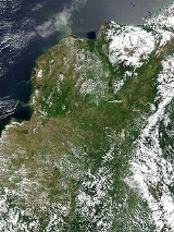
Magdalena is a department
of Colombia
, located to the north of the country by the Caribbean Sea
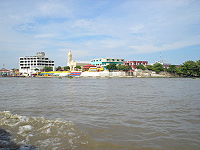
. The capital of the Magdalena Department is Santa Marta
and was named after the Magdalena River
. It inherited the name of one of the original nine states of the United States of Colombia
that its current territory integrated.
n Caribbean Region.
On the north
it borders the Caribbean Sea
.
On the northeast
it borders the La Guajira Department, being divided by the Palomino River.
On the east it borders with the Cesar Department
, which is in part divided by the Guaraní River.
On the west
, it is divided by the Magdalena River
, and it borders the departments of Atlantico
in the Northwest
, and Bolívar
in the West and Southwest.
s which are very different in composition and importance.
Sierra Nevada’s Northern Slope
The drainage basin of the Sierra Nevada’s western slope is located in the northern part of the department. The Sierra Nevada de Santa Marta
creates different rivers that run mainly through the municipality of Santa Marta
, and that finally end up draining into the Caribbean Sea
.
The rivers that form part of this basin are:
Sierra Nevada’s Southwestern Slope
This basin gathers its waters from the rivers coming from the southern and western slopes of the Sierra Nevada. The basin irrigates great extensions of the municipalities of Ciénaga
, Zona Bananera
, Fundación
, Aracataca
, and El Retén
, which are the heart of the agricultural and livestock economy of the department.
The rivers that form part of this basin are:
It also consists of a small number of arroyos
that only flow during the rainy seasons.
This basin also encompasses the Ciénaga Grande de Santa Marta
, the largest marsh
in the north of the country, which is formed by 16 smaller marshes that are connected by means of arms
within the march. The balance of the march is a delicate one that depends on the fresh waters coming from the Sierra Nevada, and the periodical flooding of the Magdalena River
, and the salt water coming from the mouth of the March to the sea, that is carried by the current and winds into the marshland.
Magdalena Basin
 The Magdalena River Basin is the largest drainage basin in the department, it is formed by the Magdalena River
and its tributaries
that feed on to the river and the Marsh.
The Mompóx Depression is found within this basin, this depression runs from the Zapatosa Marsh to the delta of the Magdalena River. This depression collects the most water in the department as its where the Cauca River
, Cesar River
, and the San Jorge River drain its waters. The Magdalena River is by far the most affluent river of these, and during the rainy season when it overflows, it causes the other rivers to flow backwards, not before overflowing the marshes and sometimes flooding some valleys.
Ariguaní Basin
The Ariguaní River
drains into the Magdalena River through the Zapatosa Marsh and washes over the central valleys of the departments of Magdalena and Cesar
that are the principal areas of agriculture and animal husbandry
in the Caribbean Region.
Marshes
The department of Magdalena is characterized by its many marshes and extensive marshland valleys. The whole western side of the department its dotted with marshes and lakes due to the Magdalena River that borders the department on this side. Most of this marshes are located in the northwestern side. The permanent marshes are, Chilloa, La Rinconada, Tesca, Pijiño, Juan Criollo, Jaraba, Playa Afuera, Ciénaga Grande de Santa Marta
, and Zapatosa.
The Ciénaga Grande de Santa Marta, is the biggest and by far the most important marsh
in the department of Magdalena and one of the most important marshes in the country. It is located in the northwest of the department and is separated from the sea by a very thin margin of land, only a few meters away. It has an extension of 4,280 km², of which 730 km² are just water mirrors with a depth of 2 to 6 meters.
The Zapatosa Marsh, located in the municipality of El Plato in the southernmost part of the department, it is shared with the Cesar Department
, who controls most of its waters. It has an extension of 310 km² and at its deepest it reaches about 8m. In it many rivers of different importance merge. The Zapatosa Marsh drains into the Magdalena River by an arm of about 16 km of length.
. Its Climate
is mainly dictated by its global positioning, and because the department of Magdalena is located on the Intertropical Convergence Zone
it possess an inter-tropical climate
. Temperature
in the department is affected by ocean current
s, precipitation
and atmospheric pressure
, it mainly has a hot temperatures with high humidity, but temperatures vary as altitude raises.
The altitude
of the department goes from 0m to 5,775m above sea levels, the drastic changes of altitude divide the territory into what is called thermal floors. There are no solid or determined divides between these floors as local factors can affect the temperature
. The first 200m of altitude are considered the warm lands, they occupy a great extension of the departmental territory, the average temperature is of 30°C
. The main urban centers are located in the warm lands, including all of the downtown urban area of Santa Marta. The altitude increase because of the Sierra Nevada de Santa Marta, an isolated mountain, the highest at sea level, and temperatures raise as it goes up.
s that blow from the North and Northeast creating a greater cloud accumulation and precipitation. The winds that crash into the mountain ascend in an Orographic lift
, this cooler air cannot hold the moisture as well as warm air and this effectively raises the relative humidity
, creating cloud
s and frequently precipitation
. The clouds that manage to pass over the mountain, move hastily downwards creating foehn winds that raise the temperature of the area west of the Sierra, which include the Santa Marta, and Ciénaga.
In the coastal area, drought
s are cause by the diversion of the cold and warm katabatic wind
s coming down the Sierra, however the sea breeze
s help to cool down temperatures a bit, but by because of their direction, they end up extending the drought effects farther inland.
takes place between April and November, with a period of less intensity between June and August. The dry season
takes place during December and March.
The Mompox Depression presents its own climatic conditions due to its many permanent bodies of water, like the different ciénagas or mashes, and rivers and lakes. This wet habitat, permanently exposed to solar radiation
, makes for a very humid
environment, with an average annual rain
fall of between 1,500 to 2,000mm, these rains are Convection rains as they are created by evaporation of its waters by high temperatures, this is typical precipitation around the equatorial belt.
Due to its complicated geography, the precipitation in the department ranges from 250mm in the driest areas, to 4,000mm in the cold floors of the Sierra Nevada.
 The territory of Magdalena has an area of approximately 23,188 km², small compared to other regions, but in its territory various types of different ecoregion
s are found. From the beaches and sea landscape in the North, the snow covered peaks in the Sierra, the swampy marshes in the west, the cloud forest
s, to the grasslands inland, the urban districts, the farmlands, the dry desert like, the deep rain forest, the rocky rivers to many other small ecosystems. These ecosystem support different fauna
and flora
and house many delicate species.
, in the Magdalena Department 8 different distinct ecoregion
s are found in its territory.
, and 1 District
, the municipalities are governed by a democratically elected Municipal Mayor
and a Municipal council
, and the Touristic, Cultural and Historic District of Santa Marta is administered by the Municipality of Santa Marta
and has special distinction within the country.
Departments of Colombia
Colombia is an unitary republic formed by thirty-two departments and a Capital District . Each department has a Governor and a Department Assembly , elected by popular vote for a four-year period. The governor cannot be re-elected in consecutive periods...
of Colombia
Colombia
Colombia, officially the Republic of Colombia , is a unitary constitutional republic comprising thirty-two departments. The country is located in northwestern South America, bordered to the east by Venezuela and Brazil; to the south by Ecuador and Peru; to the north by the Caribbean Sea; to the...
, located to the north of the country by the Caribbean Sea
Caribbean Sea
The Caribbean Sea is a sea of the Atlantic Ocean located in the tropics of the Western hemisphere. It is bounded by Mexico and Central America to the west and southwest, to the north by the Greater Antilles, and to the east by the Lesser Antilles....
. The capital of the Magdalena Department is Santa Marta
Santa Marta
Santa Marta is the capital city of the Colombian department of Magdalena in the Caribbean Region. It was founded in July 29, 1525 by the Spanish conqueror Rodrigo de Bastidas, which makes it the oldest remaining city in Colombia...
and was named after the Magdalena River
Magdalena River
The Magdalena River is the principal river of Colombia, flowing northward about through the western half of the country. It takes its name from the biblical figure Mary Magdalene. It is navigable through much of its lower reaches, in spite of the shifting sand bars at the mouth of its delta, as...
. It inherited the name of one of the original nine states of the United States of Colombia
United States of Colombia
The United States of Colombia was the name adopted in 1861 through the Rionegro Constitution for the nation which had been known as the Republic of New Granada since the dissolution of the federation of Gran Colombia in 1830-1831....
that its current territory integrated.
Location
The Department of Magdalena is located on the North Coast of the ColombiaColombia
Colombia, officially the Republic of Colombia , is a unitary constitutional republic comprising thirty-two departments. The country is located in northwestern South America, bordered to the east by Venezuela and Brazil; to the south by Ecuador and Peru; to the north by the Caribbean Sea; to the...
n Caribbean Region.
On the north
North
North is a noun, adjective, or adverb indicating direction or geography.North is one of the four cardinal directions or compass points. It is the opposite of south and is perpendicular to east and west.By convention, the top side of a map is north....
it borders the Caribbean Sea
Caribbean Sea
The Caribbean Sea is a sea of the Atlantic Ocean located in the tropics of the Western hemisphere. It is bounded by Mexico and Central America to the west and southwest, to the north by the Greater Antilles, and to the east by the Lesser Antilles....
.
On the northeast
Cardinal direction
The four cardinal directions or cardinal points are the directions of north, east, south, and west, commonly denoted by their initials: N, E, S, W. East and west are at right angles to north and south, with east being in the direction of rotation and west being directly opposite. Intermediate...
it borders the La Guajira Department, being divided by the Palomino River.
On the east it borders with the Cesar Department
Cesar Department
Cesar Department or simply Cesar is a department of Colombia located in the north of the country in the Caribbean region, bordering to the north with the Department of La Guajira, to the west with the Department of Magdalena and Department of Bolivar, to the south with Department of Santander, to...
, which is in part divided by the Guaraní River.
On the west
West
West is a noun, adjective, or adverb indicating direction or geography.West is one of the four cardinal directions or compass points. It is the opposite of east and is perpendicular to north and south.By convention, the left side of a map is west....
, it is divided by the Magdalena River
Magdalena River
The Magdalena River is the principal river of Colombia, flowing northward about through the western half of the country. It takes its name from the biblical figure Mary Magdalene. It is navigable through much of its lower reaches, in spite of the shifting sand bars at the mouth of its delta, as...
, and it borders the departments of Atlantico
Atlántico Department
Atlántico is a department of Colombia, located in northern Colombia with the Caribbean sea to its north, the Bolívar Department to its south, and the Magdalena Department to its east separated by the Magdalena River...
in the Northwest
Cardinal direction
The four cardinal directions or cardinal points are the directions of north, east, south, and west, commonly denoted by their initials: N, E, S, W. East and west are at right angles to north and south, with east being in the direction of rotation and west being directly opposite. Intermediate...
, and Bolívar
Bolívar Department
Bolívar is a department of Colombia. It was named after one of the original nine states of the United States of Colombia. It is located to the north of the country, extending from the coast at Cartagena near the mouth of the Magdalena River, then south along the river to a border with Antioquia.Its...
in the West and Southwest.
Basins
The territory of the Department of Magdalena is formed by four drainage basinDrainage basin
A drainage basin is an extent or an area of land where surface water from rain and melting snow or ice converges to a single point, usually the exit of the basin, where the waters join another waterbody, such as a river, lake, reservoir, estuary, wetland, sea, or ocean...
s which are very different in composition and importance.
Sierra Nevada’s Northern Slope
The drainage basin of the Sierra Nevada’s western slope is located in the northern part of the department. The Sierra Nevada de Santa Marta
Sierra Nevada de Santa Marta
The Sierra Nevada de Santa Marta is an isolated mountain range apart from the Andes chain that runs through Colombia. Reaching an altitude of 5,700 metres above sea level just 42 km from the Caribbean coast, the Sierra Nevada is the world's highest coastal range...
creates different rivers that run mainly through the municipality of Santa Marta
Santa Marta
Santa Marta is the capital city of the Colombian department of Magdalena in the Caribbean Region. It was founded in July 29, 1525 by the Spanish conqueror Rodrigo de Bastidas, which makes it the oldest remaining city in Colombia...
, and that finally end up draining into the Caribbean Sea
Caribbean Sea
The Caribbean Sea is a sea of the Atlantic Ocean located in the tropics of the Western hemisphere. It is bounded by Mexico and Central America to the west and southwest, to the north by the Greater Antilles, and to the east by the Lesser Antilles....
.
The rivers that form part of this basin are:
- Palomino River
- Don Diego River
- Buritaca River
- Guachaca River
- Mendiguaca River
- Piedras River
- Manzanares River
- Gaira River
Sierra Nevada’s Southwestern Slope
This basin gathers its waters from the rivers coming from the southern and western slopes of the Sierra Nevada. The basin irrigates great extensions of the municipalities of Ciénaga
Ciénaga, Magdalena
Ciénaga is a municipality and a town in the Magdalena Department, Colombia, second largest population center in this department, after the city of Santa Marta. It is situated at 11° 00' North, 74° 15' West, between the Sierra Nevada de Santa Marta, the Caribbean Sea and the Ciénaga Grande de Santa...
, Zona Bananera
Zona Bananera, Magdalena
Zona Bananera is a municipality of the Magdalena Department in northern Colombia. Its main town is Prado Sevilla.-External links:...
, Fundación
Fundación
Fundación is a town and municipality of the Colombian Department of Magdalena. Its people are known as Fundanenses. The primary economic activity is livestock-raising, for production of both meat and milk. Other crops are: corn, yuca, oranges, bananas, beans, sesame, sorghum, rice, tomatoes,...
, Aracataca
Aracataca
Aracataca is a municipality located in the Department of Magdalena, in Colombia's Caribbean Region. Aracataca is a river town founded in 1885. The town stands beside the river of the same name, the Aracataca river that flows from the nearby Sierra Nevada de Santa Marta mountain range into the...
, and El Retén
El Retén
El Retén is a town and municipality of the Magdalena Department in northern Colombia.-External links:...
, which are the heart of the agricultural and livestock economy of the department.
The rivers that form part of this basin are:
- Frío River
- Sevilla River
- Tucurinca River
- Aracataca River
- Fundación River
- Rosa Creek
It also consists of a small number of arroyos
Arroyo (creek)
An arroyo , a Spanish word translated as brook, and also called a wash is usually a dry creek or stream bed—gulch that temporarily or seasonally fills and flows after sufficient rain. Wadi is a similar term in Africa. In Spain, a rambla has a similar meaning to arroyo.-Types and processes:Arroyos...
that only flow during the rainy seasons.
This basin also encompasses the Ciénaga Grande de Santa Marta
Ciénaga Grande de Santa Marta
The Ciénaga Grande de Santa Marta is the largest of the swampy marshes located between the Magdalena River and the Sierra Nevada de Santa Marta, weakly separated from the Caribbean Sea by a narrow strait....
, the largest marsh
Marsh
In geography, a marsh, or morass, is a type of wetland that is subject to frequent or continuous flood. Typically the water is shallow and features grasses, rushes, reeds, typhas, sedges, other herbaceous plants, and moss....
in the north of the country, which is formed by 16 smaller marshes that are connected by means of arms
Arm (geography)
In geography, an arm is a narrow extension, inlet, or smaller reach, of water from a much larger body of water, like an ocean, sea, or lake. Although different geographically, a sound or bay may be called an arm....
within the march. The balance of the march is a delicate one that depends on the fresh waters coming from the Sierra Nevada, and the periodical flooding of the Magdalena River
Magdalena River
The Magdalena River is the principal river of Colombia, flowing northward about through the western half of the country. It takes its name from the biblical figure Mary Magdalene. It is navigable through much of its lower reaches, in spite of the shifting sand bars at the mouth of its delta, as...
, and the salt water coming from the mouth of the March to the sea, that is carried by the current and winds into the marshland.
Magdalena Basin
Magdalena River
The Magdalena River is the principal river of Colombia, flowing northward about through the western half of the country. It takes its name from the biblical figure Mary Magdalene. It is navigable through much of its lower reaches, in spite of the shifting sand bars at the mouth of its delta, as...
and its tributaries
Tributary
A tributary or affluent is a stream or river that flows into a main stem river or a lake. A tributary does not flow directly into a sea or ocean...
that feed on to the river and the Marsh.
The Mompóx Depression is found within this basin, this depression runs from the Zapatosa Marsh to the delta of the Magdalena River. This depression collects the most water in the department as its where the Cauca River
Cauca River
The Cauca River is a river in Colombia that lies between the Occidental and Central cordilleras. Born in southwestern Colombia near the city of Popayán, it joins the Magdalena River near Pinillos in Bolívar Department, and the combined river eventually flows out into the Caribbean Sea. It has a...
, Cesar River
Cesar River
The Cesar River is a river in northern Colombia which is a part of the Magdalena Basin. It separates the Sierra Nevada de Santa Marta from the mountain ranges of the Serrania del Perija an extension of the Cordillera Oriental...
, and the San Jorge River drain its waters. The Magdalena River is by far the most affluent river of these, and during the rainy season when it overflows, it causes the other rivers to flow backwards, not before overflowing the marshes and sometimes flooding some valleys.
Ariguaní Basin
The Ariguaní River
Ariguaní River
Ariguaní River is a river in northern Colombia's Caribbean Region born in the Sierra Nevada de Santa Marta mountain range in the area of the municipality of Pueblo Bello. The Ariguaní is an affluent of the Cesar River and flows from north to south into it near the town of El Paso...
drains into the Magdalena River through the Zapatosa Marsh and washes over the central valleys of the departments of Magdalena and Cesar
Cesar Department
Cesar Department or simply Cesar is a department of Colombia located in the north of the country in the Caribbean region, bordering to the north with the Department of La Guajira, to the west with the Department of Magdalena and Department of Bolivar, to the south with Department of Santander, to...
that are the principal areas of agriculture and animal husbandry
Animal husbandry
Animal husbandry is the agricultural practice of breeding and raising livestock.- History :Animal husbandry has been practiced for thousands of years, since the first domestication of animals....
in the Caribbean Region.
Marshes
The department of Magdalena is characterized by its many marshes and extensive marshland valleys. The whole western side of the department its dotted with marshes and lakes due to the Magdalena River that borders the department on this side. Most of this marshes are located in the northwestern side. The permanent marshes are, Chilloa, La Rinconada, Tesca, Pijiño, Juan Criollo, Jaraba, Playa Afuera, Ciénaga Grande de Santa Marta
Ciénaga Grande de Santa Marta
The Ciénaga Grande de Santa Marta is the largest of the swampy marshes located between the Magdalena River and the Sierra Nevada de Santa Marta, weakly separated from the Caribbean Sea by a narrow strait....
, and Zapatosa.
The Ciénaga Grande de Santa Marta, is the biggest and by far the most important marsh
Marsh
In geography, a marsh, or morass, is a type of wetland that is subject to frequent or continuous flood. Typically the water is shallow and features grasses, rushes, reeds, typhas, sedges, other herbaceous plants, and moss....
in the department of Magdalena and one of the most important marshes in the country. It is located in the northwest of the department and is separated from the sea by a very thin margin of land, only a few meters away. It has an extension of 4,280 km², of which 730 km² are just water mirrors with a depth of 2 to 6 meters.
The Zapatosa Marsh, located in the municipality of El Plato in the southernmost part of the department, it is shared with the Cesar Department
Cesar Department
Cesar Department or simply Cesar is a department of Colombia located in the north of the country in the Caribbean region, bordering to the north with the Department of La Guajira, to the west with the Department of Magdalena and Department of Bolivar, to the south with Department of Santander, to...
, who controls most of its waters. It has an extension of 310 km² and at its deepest it reaches about 8m. In it many rivers of different importance merge. The Zapatosa Marsh drains into the Magdalena River by an arm of about 16 km of length.
Climate
The Department of Magdalena, because of its terrain, and proximity to the sea has an unstable weatherWeather
Weather is the state of the atmosphere, to the degree that it is hot or cold, wet or dry, calm or stormy, clear or cloudy. Most weather phenomena occur in the troposphere, just below the stratosphere. Weather refers, generally, to day-to-day temperature and precipitation activity, whereas climate...
. Its Climate
Climate
Climate encompasses the statistics of temperature, humidity, atmospheric pressure, wind, rainfall, atmospheric particle count and other meteorological elemental measurements in a given region over long periods...
is mainly dictated by its global positioning, and because the department of Magdalena is located on the Intertropical Convergence Zone
Intertropical Convergence Zone
The Intertropical Convergence Zone , known by sailors as The Doldrums, is the area encircling the earth near the equator where winds originating in the northern and southern hemispheres come together....
it possess an inter-tropical climate
Tropical climate
A tropical climate is a climate of the tropics. In the Köppen climate classification it is a non-arid climate in which all twelve months have mean temperatures above...
. Temperature
Temperature
Temperature is a physical property of matter that quantitatively expresses the common notions of hot and cold. Objects of low temperature are cold, while various degrees of higher temperatures are referred to as warm or hot...
in the department is affected by ocean current
Ocean current
An ocean current is a continuous, directed movement of ocean water generated by the forces acting upon this mean flow, such as breaking waves, wind, Coriolis effect, cabbeling, temperature and salinity differences and tides caused by the gravitational pull of the Moon and the Sun...
s, precipitation
Precipitation (meteorology)
In meteorology, precipitation In meteorology, precipitation In meteorology, precipitation (also known as one of the classes of hydrometeors, which are atmospheric water phenomena is any product of the condensation of atmospheric water vapor that falls under gravity. The main forms of precipitation...
and atmospheric pressure
Atmospheric pressure
Atmospheric pressure is the force per unit area exerted into a surface by the weight of air above that surface in the atmosphere of Earth . In most circumstances atmospheric pressure is closely approximated by the hydrostatic pressure caused by the weight of air above the measurement point...
, it mainly has a hot temperatures with high humidity, but temperatures vary as altitude raises.
The altitude
Altitude
Altitude or height is defined based on the context in which it is used . As a general definition, altitude is a distance measurement, usually in the vertical or "up" direction, between a reference datum and a point or object. The reference datum also often varies according to the context...
of the department goes from 0m to 5,775m above sea levels, the drastic changes of altitude divide the territory into what is called thermal floors. There are no solid or determined divides between these floors as local factors can affect the temperature
Temperature
Temperature is a physical property of matter that quantitatively expresses the common notions of hot and cold. Objects of low temperature are cold, while various degrees of higher temperatures are referred to as warm or hot...
. The first 200m of altitude are considered the warm lands, they occupy a great extension of the departmental territory, the average temperature is of 30°C
Celsius
Celsius is a scale and unit of measurement for temperature. It is named after the Swedish astronomer Anders Celsius , who developed a similar temperature scale two years before his death...
. The main urban centers are located in the warm lands, including all of the downtown urban area of Santa Marta. The altitude increase because of the Sierra Nevada de Santa Marta, an isolated mountain, the highest at sea level, and temperatures raise as it goes up.
Winds
The presence of the Sierra Nevada in this area of the country has consequences in the climate of the department, the SNSM stands windward blocking the path of the Trade windTrade wind
The trade winds are the prevailing pattern of easterly surface winds found in the tropics, within the lower portion of the Earth's atmosphere, in the lower section of the troposphere near the Earth's equator...
s that blow from the North and Northeast creating a greater cloud accumulation and precipitation. The winds that crash into the mountain ascend in an Orographic lift
Orographic lift
Orographic lift occurs when an air mass is forced from a low elevation to a higher elevation as it moves over rising terrain. As the air mass gains altitude it quickly cools down adiabatically, which can raise the relative humidity to 100% and create clouds and, under the right conditions,...
, this cooler air cannot hold the moisture as well as warm air and this effectively raises the relative humidity
Relative humidity
Relative humidity is a term used to describe the amount of water vapor in a mixture of air and water vapor. It is defined as the partial pressure of water vapor in the air-water mixture, given as a percentage of the saturated vapor pressure under those conditions...
, creating cloud
Cloud
A cloud is a visible mass of liquid droplets or frozen crystals made of water and/or various chemicals suspended in the atmosphere above the surface of a planetary body. They are also known as aerosols. Clouds in Earth's atmosphere are studied in the cloud physics branch of meteorology...
s and frequently precipitation
Precipitation (meteorology)
In meteorology, precipitation In meteorology, precipitation In meteorology, precipitation (also known as one of the classes of hydrometeors, which are atmospheric water phenomena is any product of the condensation of atmospheric water vapor that falls under gravity. The main forms of precipitation...
. The clouds that manage to pass over the mountain, move hastily downwards creating foehn winds that raise the temperature of the area west of the Sierra, which include the Santa Marta, and Ciénaga.
In the coastal area, drought
Drought
A drought is an extended period of months or years when a region notes a deficiency in its water supply. Generally, this occurs when a region receives consistently below average precipitation. It can have a substantial impact on the ecosystem and agriculture of the affected region...
s are cause by the diversion of the cold and warm katabatic wind
Katabatic wind
A katabatic wind, from the Greek word katabatikos meaning "going downhill", is the technical name for a drainage wind, a wind that carries high density air from a higher elevation down a slope under the force of gravity. Such winds are sometimes also called fall winds...
s coming down the Sierra, however the sea breeze
Sea breeze
A sea-breeze is a wind from the sea that develops over land near coasts. It is formed by increasing temperature differences between the land and water; these create a pressure minimum over the land due to its relative warmth, and forces higher pressure, cooler air from the sea to move inland...
s help to cool down temperatures a bit, but by because of their direction, they end up extending the drought effects farther inland.
Rainfall
The department of Magdalena due to its location in the Intertropical Convergence Zone has only two seasons. The Rainy seasonWet season
The the wet season, or rainy season, is the time of year, covering one or more months, when most of the average annual rainfall in a region occurs. The term green season is also sometimes used as a euphemism by tourist authorities. Areas with wet seasons are dispersed across portions of the...
takes place between April and November, with a period of less intensity between June and August. The dry season
Dry season
The dry season is a term commonly used when describing the weather in the tropics. The weather in the tropics is dominated by the tropical rain belt, which oscillates from the northern to the southern tropics over the course of the year...
takes place during December and March.
The Mompox Depression presents its own climatic conditions due to its many permanent bodies of water, like the different ciénagas or mashes, and rivers and lakes. This wet habitat, permanently exposed to solar radiation
Sunlight
Sunlight, in the broad sense, is the total frequency spectrum of electromagnetic radiation given off by the Sun. On Earth, sunlight is filtered through the Earth's atmosphere, and solar radiation is obvious as daylight when the Sun is above the horizon.When the direct solar radiation is not blocked...
, makes for a very humid
Humidity
Humidity is a term for the amount of water vapor in the air, and can refer to any one of several measurements of humidity. Formally, humid air is not "moist air" but a mixture of water vapor and other constituents of air, and humidity is defined in terms of the water content of this mixture,...
environment, with an average annual rain
Rain
Rain is liquid precipitation, as opposed to non-liquid kinds of precipitation such as snow, hail and sleet. Rain requires the presence of a thick layer of the atmosphere to have temperatures above the melting point of water near and above the Earth's surface...
fall of between 1,500 to 2,000mm, these rains are Convection rains as they are created by evaporation of its waters by high temperatures, this is typical precipitation around the equatorial belt.
Due to its complicated geography, the precipitation in the department ranges from 250mm in the driest areas, to 4,000mm in the cold floors of the Sierra Nevada.
Environment
Ecoregion
An ecoregion , sometimes called a bioregion, is an ecologically and geographically defined area that is smaller than an ecozone and larger than an ecosystem. Ecoregions cover relatively large areas of land or water, and contain characteristic, geographically distinct assemblages of natural...
s are found. From the beaches and sea landscape in the North, the snow covered peaks in the Sierra, the swampy marshes in the west, the cloud forest
Cloud forest
A cloud forest, also called a fog forest, is a generally tropical or subtropical evergreen montane moist forest characterized by a persistent, frequent or seasonal low-level cloud cover, usually at the canopy level. Cloud forests often exhibit an abundance of mosses covering the ground and...
s, to the grasslands inland, the urban districts, the farmlands, the dry desert like, the deep rain forest, the rocky rivers to many other small ecosystems. These ecosystem support different fauna
Fauna
Fauna or faunæ is all of the animal life of any particular region or time. The corresponding term for plants is flora.Zoologists and paleontologists use fauna to refer to a typical collection of animals found in a specific time or place, e.g. the "Sonoran Desert fauna" or the "Burgess shale fauna"...
and flora
Flora
Flora is the plant life occurring in a particular region or time, generally the naturally occurring or indigenous—native plant life. The corresponding term for animals is fauna.-Etymology:...
and house many delicate species.
Ecoregions
According to the World Wide Fund for NatureWorld Wide Fund for Nature
The World Wide Fund for Nature is an international non-governmental organization working on issues regarding the conservation, research and restoration of the environment, formerly named the World Wildlife Fund, which remains its official name in Canada and the United States...
, in the Magdalena Department 8 different distinct ecoregion
Ecoregion
An ecoregion , sometimes called a bioregion, is an ecologically and geographically defined area that is smaller than an ecozone and larger than an ecosystem. Ecoregions cover relatively large areas of land or water, and contain characteristic, geographically distinct assemblages of natural...
s are found in its territory.
| Ecoregion Ecoregion An ecoregion , sometimes called a bioregion, is an ecologically and geographically defined area that is smaller than an ecozone and larger than an ecosystem. Ecoregions cover relatively large areas of land or water, and contain characteristic, geographically distinct assemblages of natural... |
Biome Biome Biomes are climatically and geographically defined as similar climatic conditions on the Earth, such as communities of plants, animals, and soil organisms, and are often referred to as ecosystems. Some parts of the earth have more or less the same kind of abiotic and biotic factors spread over a... |
|---|---|
| Magdalena Valley montane forests | Neotropic Tropical and subtropical moist broadleaf forests Tropical and subtropical moist broadleaf forests Tropical and subtropical moist broadleaf forests , also known as tropical moist forests, are a tropical and subtropical forest biome.... |
| Magdalena-Urabá moist forests | Neotropic Tropical and subtropical moist broadleaf forests Tropical and subtropical moist broadleaf forests Tropical and subtropical moist broadleaf forests , also known as tropical moist forests, are a tropical and subtropical forest biome.... |
| Sinú Valley dry forests | Neotropic Tropical and subtropical moist broadleaf forests Tropical and subtropical moist broadleaf forests Tropical and subtropical moist broadleaf forests , also known as tropical moist forests, are a tropical and subtropical forest biome.... |
| Santa Marta montane forests | Neotropic Tropical and subtropical moist broadleaf forests Tropical and subtropical moist broadleaf forests Tropical and subtropical moist broadleaf forests , also known as tropical moist forests, are a tropical and subtropical forest biome.... |
| Santa Marta páramo | Neotropic Montane grasslands and shrublands Montane grasslands and shrublands Montane grasslands and shrublands is a biome defined by the World Wildlife Fund. The biome includes high altitude grasslands and shrublands around the world.... |
| Magdalena Valley dry forests | Neotropic Tropical and subtropical dry broadleaf forests Tropical and subtropical dry broadleaf forests The tropical and subtropical dry broadleaf forest biome, also known as tropical dry forest, is located at tropical and subtropical latitudes. Though these forests occur in climates that are warm year-round, and may receive several hundred centimeters of rain per year, they have long dry seasons... |
| Guajira-Barranquilla xeric scrub Guajira-Barranquilla xeric scrub The Guajira-Barranquilla xeric scrub is a xeric shrubland ecoregion in Colombia, covering an estimated area of 150.000 km2.-Setting:The ecoregion occupies the Guajira Peninsula, the valley of Rancheria river and Guajira Department, covering parts of the northeastern coast of Venezuela... |
Neotropic Deserts and xeric shrublands Deserts and xeric shrublands Deserts and xeric shrublands is a biome characterized by, relating to, or requiring only a small amount of moisture.-Definition and occurrence:... |
| Magdalena-Santa Marta mangroves | Neotropic Mangrove Mangrove Mangroves are various kinds of trees up to medium height and shrubs that grow in saline coastal sediment habitats in the tropics and subtropics – mainly between latitudes N and S... |
Administrative Divisions
The Department of Magdalena is subdivided into 30 MunicipalitiesMunicipality
A municipality is essentially an urban administrative division having corporate status and usually powers of self-government. It can also be used to mean the governing body of a municipality. A municipality is a general-purpose administrative subdivision, as opposed to a special-purpose district...
, and 1 District
District
Districts are a type of administrative division, in some countries managed by a local government. They vary greatly in size, spanning entire regions or counties, several municipalities, or subdivisions of municipalities.-Austria:...
, the municipalities are governed by a democratically elected Municipal Mayor
Mayor
In many countries, a Mayor is the highest ranking officer in the municipal government of a town or a large urban city....
and a Municipal council
Municipal council
A municipal council is the local government of a municipality. Specifically the term can refer to the institutions of various countries that can be translated by this term...
, and the Touristic, Cultural and Historic District of Santa Marta is administered by the Municipality of Santa Marta
Santa Marta
Santa Marta is the capital city of the Colombian department of Magdalena in the Caribbean Region. It was founded in July 29, 1525 by the Spanish conqueror Rodrigo de Bastidas, which makes it the oldest remaining city in Colombia...
and has special distinction within the country.
Municipalities
- AlgarroboAlgarrobo, MagdalenaAlgarrobo is a town and municipality of the Magdalena Department in northern Colombia. Founded in 1895 by José Felipe Oñate. Erected municipality by ordenance 008 of June 24, 1999.- Sub divisions :The municipality of Algarrobo has three corregimientos:...
- AracatacaAracatacaAracataca is a municipality located in the Department of Magdalena, in Colombia's Caribbean Region. Aracataca is a river town founded in 1885. The town stands beside the river of the same name, the Aracataca river that flows from the nearby Sierra Nevada de Santa Marta mountain range into the...
- AriguaníAriguaníAriguaní is a municipality of the Colombian Department of Magdalena. The municipality seat is the town of El Difícil.-External links:...
- Cerro San AntonioCerro San AntonioCerro San Antonio is a town and municipality of the Colombian Department of Magdalena. Founded on June 13, 1750 by Fernando de Mier y Guerra near the Magdalena River. The Libertador Simon Bolivar visited this town on May 23, 1813 during the War of Independence of Colombia from Spain.-External links:...
- ChiboloChiboloChibolo is a town and municipality of the Colombian Department of Magdalena. Chibolo was founded in 1820 and became a municipality...
- CiénagaCiénaga, MagdalenaCiénaga is a municipality and a town in the Magdalena Department, Colombia, second largest population center in this department, after the city of Santa Marta. It is situated at 11° 00' North, 74° 15' West, between the Sierra Nevada de Santa Marta, the Caribbean Sea and the Ciénaga Grande de Santa...
- ConcordiaConcordia, MagdalenaConcordia is a town and municipality of the Magdalena Department in northern Colombia. Founded by Mandate 007 of June 24, 1999 with portion of territories from the municipalities of Cerro San Antonio and Pedraza.-External links:...
- El BancoEl BancoEl Banco is a Colombian Municipality and town located in the southern most part of the Department of Magdalena by the Magdalena River.-External links:...
- El PiñónEl PiñónEl Piñón is a town and municipality of the Colombian Department of Magdalena. Officially founded in 1760 by Francisco Sayas, Ignacio Crespo, Vicente De la Hoz and others. On April 20, 1915 was proclaimed a municipality. Its economy is based on agriculture and farming. Its main tourist attraction is...
- El ReténEl ReténEl Retén is a town and municipality of the Magdalena Department in northern Colombia.-External links:...
- FundaciónFundaciónFundación is a town and municipality of the Colombian Department of Magdalena. Its people are known as Fundanenses. The primary economic activity is livestock-raising, for production of both meat and milk. Other crops are: corn, yuca, oranges, bananas, beans, sesame, sorghum, rice, tomatoes,...
- GuamalGuamalGuamal is a town and municipality of the Colombian Department of Magdalena.-Politics:El Municipio de Guamal se localiza al sur del Departamento del Magdalena dista de Santa Marta a 330 km. El territorio en general es plano y de altas temperatura, bañado al occidente por el brazo de mompós del...
- Nueva GranadaNueva Granada, MagdalenaNueva Granada is a town and municipality of the Magdalena Department in northern Colombia.-External links:...
- PedrazaPedrazaPedraza is a town and municipality of the Colombian Department of Magdalena.-History:Was founded in 1791 by Pablo José Torregrosa. On December 9, 1908 by Executive Decree 1312 Pedraza became a municipality of the Magdalena Department.-Geography and climate:...
- PintoPinto, MagdalenaPinto or Santa Barbara de Pinto is a town and municipality of the Magdalena Department in northern Colombia.-External links:...
- PijiñoPijiñoPijiño or Pijiño del Carmen is a town and municipality of the Magdalena Department in northern Colombia.-External links:...
- PivijayPivijayPivijay is a town and municipality of the Colombian Department of Magdalena. Founded in 1774 by José Flores, Julian Valera y Antonio Sánchez. Promoted to municipality in 1912.-Administrative divisions:Corregimientos:*Avianca*Canoas*Caraballo*Chinoblas...
- PlatoPlato, MagdalenaPlato is a town and municipality in Magdalena Department in Colombia.* Area: 1,501 km².* Elevation: 20 meters* Population: 66,362** Rural: 18,625** Urban: 47,737* Agricultural products: livestock, corn, beans, tomatoes, yuca, tobacco-External links:...
- Pueblo ViejoPueblo Viejo, MagdalenaPuebloviejo is a town and municipality of the Colombian Department of Magdalena. It was founded in 1526 by friar Tomas Ortíz. It was erected a municipality on May 3, 1929...
- RemolinoRemolinoRemolino is a town and municipality of the Colombian Department of Magdalena. Founded between 1752 and 1776 by Fernando de Mier y Guerra. Erected municipality in 1814.-Administrative divisions:Corregimientos:*Corral Viejo*El Dividivi*San Rafael...
- Sabanas de San AngelSabanas de San AngelSabanas de San Angel is a town and municipality of the Colombian Department of Magdalena. Founded around 1607 with the name San Antoñito by the Spanish Colonizers as a pathway town in the route between La Guajira Department and the Magdalena River...
- SalaminaSalamina, MagdalenaSalamina is a town and municipality in the Department of Magdalena, northern Colombia.* Area: 175 km².* Elevation: 6 meters* Population: 11,293** Rural: 5,337** Urban: 5,956* Agricultural products: livestock, corn, tomatoes, yuca...
- San Sebastián de BuenavistaSan Sebastián de BuenavistaSan Sebastián de Buenavista is a town and municipality of the Colombian Department of Magdalena. Founded in 1748 by Fernando de Mier y Guerra with the name San Sebastián de Melchiquejo, but was later changed on November 15, 1957 when it was erected municipality.-Administrative...
- Santa AnaSanta Ana, MagdalenaSanta Ana is a town and municipality of the Magdalena Department in northern Colombia. Founded in 1751 by José Fernando de Mier y Guerra with the name of Santa Ana de Buena Vista. In 1918 was established as a municipality.-External links:...
- Santa MartaSanta MartaSanta Marta is the capital city of the Colombian department of Magdalena in the Caribbean Region. It was founded in July 29, 1525 by the Spanish conqueror Rodrigo de Bastidas, which makes it the oldest remaining city in Colombia...
- San ZenónSan ZenónSan Zenón is a town and municipality of the Colombian Department of Magdalena. Founded in 1751 by Antonio de Mier y Guerra. On April 30, 1950 was elevated to the category of municipality.-Administrative divisions:Corregimientos*Peñoncito*Palomar...
- SitionuevoSitionuevoSitionuevo is a town and municipality of the Magdalena Department in northern Colombia.-External links:...
- TenerifeTenerife, MagdalenaTenerife is a town and municipality of the Magdalena Department in northern Colombia.-External links:...
- ZapayánZapayán-External links:...
- Zona BananeraZona Bananera, MagdalenaZona Bananera is a municipality of the Magdalena Department in northern Colombia. Its main town is Prado Sevilla.-External links:...
Tourism
- Gold MuseumGold MuseumThe Gold Museum is a museum located in Bogotá, Colombia. It displays an extraordinary selection of its pre-Hispanic gold work collection - the biggest in the world - in its exhibition rooms on the second and third floors...
- Casa de la Aduana
- Simón Bolívar National Memorial
- Quinta de San Pedro AlejandrinoQuinta de San Pedro AlejandrinoLa Quinta de San Pedro Alejandrino is a hacienda or Quinta built in the 17th century, famous for being the death place of Simón Bolívar on December 17, 1830. At that time, the estate produced rum, honey and panela...
(National Sanctuary and Museum) - Touristic, Cultural and Historic District of Santa MartaSanta MartaSanta Marta is the capital city of the Colombian department of Magdalena in the Caribbean Region. It was founded in July 29, 1525 by the Spanish conqueror Rodrigo de Bastidas, which makes it the oldest remaining city in Colombia...
- Ciudad PerdidaCiudad PerdidaCiudad Perdida is the archaeological site of an ancient city in Sierra Nevada, Colombia. It is believed to have been founded about 800 AD, some 650 years earlier than Machu Picchu...
(World Heritage SiteWorld Heritage SiteA UNESCO World Heritage Site is a place that is listed by the UNESCO as of special cultural or physical significance...
) - Ciénaga Grande de Santa MartaCiénaga Grande de Santa MartaThe Ciénaga Grande de Santa Marta is the largest of the swampy marshes located between the Magdalena River and the Sierra Nevada de Santa Marta, weakly separated from the Caribbean Sea by a narrow strait....
(flora and fauna sanctuary) - Isla de Salamanca (natural monumentNatural MonumentA natural monument is a natural or natural/cultural feature of outstanding or unique value because of its inherent rarity, representative of aesthetic qualities or cultural significance....
) - Sierra Nevada de Santa Marta National ParkSierra Nevada de Santa Marta National ParkThe Sierra Nevada de Santa Marta National Natural Park is Colombia's second oldest national park, established in 1964. It is located in the Cordillera Oriental range, between the departments of La Guajira, Magdalena and Cesar, in the mountain range of the Sierra Nevada de Santa Marta...
- Tayrona National Natural ParkTayrona National Natural ParkThe Tayrona National Natural Park is a protected area in the Colombian northern Caribbean region and within the jurisdiction of the Department of Magdalena and some 34 km from the city of Santa Marta...
Sports
- Unión MagdalenaUnión MagdalenaThe Asociación Deportiva Unión Magdalena is a Colombian soccer team founded in the year 1950 as "Los Samarios" and based in Santa Marta. It has only won one championship, in the year 1968 against Deportivo Cali in the final. Red and blue stripes compose its shirt...
Football Team that until c. 2005 that did not make the cut and was sent to the Colombian second division (Primera B). The team is knicknamed "el ciclón bananero" (The Banana Cyclone).