
List of numbered highways in South Carolina
Encyclopedia
South Carolina
has many numbered highways maintained by the state. These roads fall into one of three categories: Interstate highways
, U.S. highways
, and state highways. Most numbered highways in the state are maintained by the South Carolina Department of Transportation
.
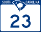
 In 2007, the Legislature allowed the signs marking the state highways to be changed from the old black-and-white to the new blue-and-white design, which features an outline of the state, the Palmetto Tree & Crescent symbol from the state flag
, and the words "SOUTH CAROLINA" spelled out along on the top of the highway shield. South Carolina uses a wide shield for all routes, the width most states use only for three-digit routes. The former shield was a simple white rectangle with a black border, with the letters "S.C." on top.
s that pass through the state of South Carolina, along with auxiliary routes:
The South Carolina Department of Transportation Ferry Division a.k.a. South Carolina Ferry System is a branch of SCDOT
that is responsible for the operation of over two dozen ferry services that transport passengers and vehicles to several islands along the James Island
outside of Charleston
in South Carolina
.
2 other inland, cable ferries
continue in operation, under the oversight of the SCDOT
.
South Carolina
South Carolina is a state in the Deep South of the United States that borders Georgia to the south, North Carolina to the north, and the Atlantic Ocean to the east. Originally part of the Province of Carolina, the Province of South Carolina was one of the 13 colonies that declared independence...
has many numbered highways maintained by the state. These roads fall into one of three categories: Interstate highways
Interstate Highway System
The Dwight D. Eisenhower National System of Interstate and Defense Highways, , is a network of limited-access roads including freeways, highways, and expressways forming part of the National Highway System of the United States of America...
, U.S. highways
United States Numbered Highways
The system of United States Numbered Highways is an integrated system of roads and highways in the United States numbered within a nationwide grid...
, and state highways. Most numbered highways in the state are maintained by the South Carolina Department of Transportation
South Carolina Department of Transportation
The South Carolina Department of Transportation is a government agency in the US state of South Carolina. Its mission is to build and maintain roads and bridges and administer mass transit services....
.
Signage
Flag of South Carolina
The flag of the state of South Carolina dates back to 1765 when opponents of the Stamp Act marched in protest behind a blue flag bearing three white crescents. In 1775 Colonel William Moultrie was asked by the Revolutionary Council of Safety to design a flag for the South Carolina troops to use...
, and the words "SOUTH CAROLINA" spelled out along on the top of the highway shield. South Carolina uses a wide shield for all routes, the width most states use only for three-digit routes. The former shield was a simple white rectangle with a black border, with the letters "S.C." on top.
Interstate highways
Interstate highwayInterstate Highway System
The Dwight D. Eisenhower National System of Interstate and Defense Highways, , is a network of limited-access roads including freeways, highways, and expressways forming part of the National Highway System of the United States of America...
s that pass through the state of South Carolina, along with auxiliary routes:
.svg.png) Interstate 20Interstate 20 in South CarolinaInterstate 20 is a major thoroughfare cutting across the state of South Carolina, linking the state with important transportation and business hubs to the north, west and south, including Atlanta, Georgia, Charlotte, North Carolina , Savannah, Georgia and Washington, D.C...
Interstate 20Interstate 20 in South CarolinaInterstate 20 is a major thoroughfare cutting across the state of South Carolina, linking the state with important transportation and business hubs to the north, west and south, including Atlanta, Georgia, Charlotte, North Carolina , Savannah, Georgia and Washington, D.C...
, spans nearly the entire state from west to east, passing through FlorenceFlorence, South Carolina-Municipal government and politics:The City of Florence has a council-manager form of government. The mayor and city council are elected every four years, with no term limits...
, ColumbiaColumbia, South CarolinaColumbia is the state capital and largest city in the U.S. state of South Carolina. The population was 129,272 according to the 2010 census. Columbia is the county seat of Richland County, but a portion of the city extends into neighboring Lexington County. The city is the center of a metropolitan...
and AikenAiken, South CarolinaAiken is a city in and the county seat of Aiken County, South Carolina, United States. With Augusta, Georgia, it is one of the two largest cities of the Central Savannah River Area. It is part of the Augusta-Richmond County Metropolitan Statistical Area. Aiken is home to the University of South...
. Business Spur 20, a business spur extension into FlorenceFlorence, South Carolina-Municipal government and politics:The City of Florence has a council-manager form of government. The mayor and city council are elected every four years, with no term limits...
..svg.png) Interstate 520Interstate 520Interstate 520 is a auxiliary Interstate Highway that encircles Augusta, Georgia and North Augusta, South Carolina as a three quarter beltway around the western, southern and eastern parts of the Augusta area. It begins at Interstate 20 in the northwest part of Augusta, and ends at Interstate 20...
Interstate 520Interstate 520Interstate 520 is a auxiliary Interstate Highway that encircles Augusta, Georgia and North Augusta, South Carolina as a three quarter beltway around the western, southern and eastern parts of the Augusta area. It begins at Interstate 20 in the northwest part of Augusta, and ends at Interstate 20...
, a partial beltwayRing roadA ring road, orbital motorway, beltway, circumferential highway, or loop highway is a road that encircles a town or city...
in N. AugustaNorth Augusta, South CarolinaNorth Augusta is a city in Aiken County, South Carolina, United States, on the north bank of the Savannah River. The population was 21,348 at the 2010 census. The city is included in the Central Savannah River Area and is also part of the Augusta, Georgia metropolitan area.- History :North...
.
.svg.png) Interstate 26Interstate 26 in South CarolinaInterstate 26 is a South Carolina Interstate highway running generally east–west to U.S. Route 17 in the Atlantic Coast at Charleston, South Carolina to Landrum in Spartanburg County.-Route description:...
Interstate 26Interstate 26 in South CarolinaInterstate 26 is a South Carolina Interstate highway running generally east–west to U.S. Route 17 in the Atlantic Coast at Charleston, South Carolina to Landrum in Spartanburg County.-Route description:...
, travels from northwest to southeast through SpartanburgSpartanburg, South CarolinathgSpartanburg is the largest city in and the county seat of Spartanburg County, South Carolina, United States. It is the second-largest city of the three primary cities in the Upstate region of South Carolina, and is located northwest of Columbia, west of Charlotte, and about northeast of...
, ColumbiaColumbia, South CarolinaColumbia is the state capital and largest city in the U.S. state of South Carolina. The population was 129,272 according to the 2010 census. Columbia is the county seat of Richland County, but a portion of the city extends into neighboring Lexington County. The city is the center of a metropolitan...
and CharlestonCharleston, South CarolinaCharleston is the second largest city in the U.S. state of South Carolina. It was made the county seat of Charleston County in 1901 when Charleston County was founded. The city's original name was Charles Towne in 1670, and it moved to its present location from a location on the west bank of the...
area..svg.png) Interstate 126Interstate 126Interstate 126 is a spur route of Interstate 26, almost entirely within the city limits of Columbia, South Carolina in the United States. It runs 3.1 miles from I-26 just south of the junction with Interstate 20, eastward across the Broad River , and into downtown Columbia terminating at US 21/US...
Interstate 126Interstate 126Interstate 126 is a spur route of Interstate 26, almost entirely within the city limits of Columbia, South Carolina in the United States. It runs 3.1 miles from I-26 just south of the junction with Interstate 20, eastward across the Broad River , and into downtown Columbia terminating at US 21/US...
, a spur into ColumbiaColumbia, South CarolinaColumbia is the state capital and largest city in the U.S. state of South Carolina. The population was 129,272 according to the 2010 census. Columbia is the county seat of Richland County, but a portion of the city extends into neighboring Lexington County. The city is the center of a metropolitan...
from the northwest..svg.png) Interstate 526Interstate 526Interstate 526 or the Mark Clark Expressway is a beltway, Interstate Highway of Interstate 26 in Berkeley and Charleston counties in South Carolina, USA.-Route description:...
Interstate 526Interstate 526Interstate 526 or the Mark Clark Expressway is a beltway, Interstate Highway of Interstate 26 in Berkeley and Charleston counties in South Carolina, USA.-Route description:...
, a partial beltwayRing roadA ring road, orbital motorway, beltway, circumferential highway, or loop highway is a road that encircles a town or city...
of CharlestonCharleston, South CarolinaCharleston is the second largest city in the U.S. state of South Carolina. It was made the county seat of Charleston County in 1901 when Charleston County was founded. The city's original name was Charles Towne in 1670, and it moved to its present location from a location on the west bank of the...
, running from U.S. Route 17U.S. Route 17 in South CarolinaIn the U.S. state of South Carolina, U.S. Route 17 is a north–south highway located near the Atlantic Ocean. The route enters the state from Georgia at the Savannah River and serves Charleston and Myrtle Beach before entering North Carolina near Calabash.-Route description:US 17 enters into...
west of the city north to I-26Interstate 26 in South CarolinaInterstate 26 is a South Carolina Interstate highway running generally east–west to U.S. Route 17 in the Atlantic Coast at Charleston, South Carolina to Landrum in Spartanburg County.-Route description:...
and back east and south to US 17U.S. Route 17 in South CarolinaIn the U.S. state of South Carolina, U.S. Route 17 is a north–south highway located near the Atlantic Ocean. The route enters the state from Georgia at the Savannah River and serves Charleston and Myrtle Beach before entering North Carolina near Calabash.-Route description:US 17 enters into...
east of CharlestonCharleston, South CarolinaCharleston is the second largest city in the U.S. state of South Carolina. It was made the county seat of Charleston County in 1901 when Charleston County was founded. The city's original name was Charles Towne in 1670, and it moved to its present location from a location on the west bank of the...
. Business Spur 526, a business spur extension into Mt. PleasantMount Pleasant, South CarolinaMount Pleasant is a large affluent suburban town in Charleston County, South Carolina, United States. It is a member of the Charleston–North Charleston–Summerville Metropolitan Statistical Area, for statistical purpose only, as designated by the U.S. Office of Management and Budget....
ending at SC 703.
.svg.png) Interstate 77Interstate 77 in South CarolinaInterstate 77 is a north - south interstate highway, extending in the state of South Carolina, extending from the national southern terminus at an interchange with Interstate 26 near Columbia, north to the North Carolina state line near Rock Hill and Charlotte, NC.-Route description:Interstate 77...
Interstate 77Interstate 77 in South CarolinaInterstate 77 is a north - south interstate highway, extending in the state of South Carolina, extending from the national southern terminus at an interchange with Interstate 26 near Columbia, north to the North Carolina state line near Rock Hill and Charlotte, NC.-Route description:Interstate 77...
, travels mostly north/south through central South Carolina from ColumbiaColumbia, South CarolinaColumbia is the state capital and largest city in the U.S. state of South Carolina. The population was 129,272 according to the 2010 census. Columbia is the county seat of Richland County, but a portion of the city extends into neighboring Lexington County. The city is the center of a metropolitan...
to Rock HillRock Hill, South CarolinaRock Hill is the largest city in York County, South Carolina and the fourth-largest city in the state. It is also the third-largest city of the Charlotte metropolitan area, behind Charlotte and Concord, North Carolina. The population was 71,459 as of . Rock Hill has undergone rapid growth between...
..svg.png) Interstate 85Interstate 85 in South CarolinaIn the U.S. state of South Carolina, Interstate 85 runs northeast-southwest through Greenville and Spartanburg. It follows the general corridor of U.S. Route 29...
Interstate 85Interstate 85 in South CarolinaIn the U.S. state of South Carolina, Interstate 85 runs northeast-southwest through Greenville and Spartanburg. It follows the general corridor of U.S. Route 29...
, travels northeast/southwest through the state, linking AndersonAnderson, South CarolinaAnderson is a city in and the county seat of Anderson County, South Carolina, United States. The population was estimated at 26,242 in 2006, and the city was the center of an urbanized area of 70,530...
, GreenvilleGreenville, South Carolina-Law and government:The city of Greenville adopted the Council-Manager form of municipal government in 1976.-History:The area was part of the Cherokee Nation's protected grounds after the Treaty of 1763, which ended the French and Indian War. No White man was allowed to enter, though some families...
, SpartanburgSpartanburg, South CarolinathgSpartanburg is the largest city in and the county seat of Spartanburg County, South Carolina, United States. It is the second-largest city of the three primary cities in the Upstate region of South Carolina, and is located northwest of Columbia, west of Charlotte, and about northeast of...
and GaffneyGaffney, South CarolinaGaffney is a city in and the county seat of Cherokee County, South Carolina, United States, in the upstate region of South Carolina. Gaffney is also sometimes referred to as the Peach capital of South Carolina. The population was 12,414 at the 2010 census...
. Business Loop 85Interstate 85 Business (Spartanburg, South Carolina)Interstate 85 Business is a Business Loop of the Interstate Highway System and a freeway, running along the old route of Interstate 85 through Spartanburg, South Carolina, United States...
, a business freeway loop in SpartanburgSpartanburg, South CarolinathgSpartanburg is the largest city in and the county seat of Spartanburg County, South Carolina, United States. It is the second-largest city of the three primary cities in the Upstate region of South Carolina, and is located northwest of Columbia, west of Charlotte, and about northeast of...
..svg.png) Interstate 185Interstate 185 (South Carolina)Interstate 185 is located in the city of Greenville, South Carolina. The northern portion, which ends just shy of the Greenville city limits, was opened in the 1960s and is cosigned with U.S. 29. The southern portion, which connects the I-85/I-185 interchange with the I-385/U.S. 276 interchange ,...
Interstate 185Interstate 185 (South Carolina)Interstate 185 is located in the city of Greenville, South Carolina. The northern portion, which ends just shy of the Greenville city limits, was opened in the 1960s and is cosigned with U.S. 29. The southern portion, which connects the I-85/I-185 interchange with the I-385/U.S. 276 interchange ,...
, a spur into GreenvilleGreenville, South Carolina-Law and government:The city of Greenville adopted the Council-Manager form of municipal government in 1976.-History:The area was part of the Cherokee Nation's protected grounds after the Treaty of 1763, which ended the French and Indian War. No White man was allowed to enter, though some families...
as a partial toll roadToll roadA toll road is a privately or publicly built road for which a driver pays a toll for use. Structures for which tolls are charged include toll bridges and toll tunnels. Non-toll roads are financed using other sources of revenue, most typically fuel tax or general tax funds...
ending at I-385 southeast of GreenvilleGreenville, South Carolina-Law and government:The city of Greenville adopted the Council-Manager form of municipal government in 1976.-History:The area was part of the Cherokee Nation's protected grounds after the Treaty of 1763, which ended the French and Indian War. No White man was allowed to enter, though some families...
..svg.png) Interstate 385Interstate 385Interstate 385 starts where it meets the Interstate 26, near Clinton and heads in a northwest direction where it ends with exit 42, near downtown Greenville. After exit 42, I-385 turns into Business Spur 385 that then promptly ends at U.S. 29 near the Bi-Lo Center in downtown Greenville. It is one...
Interstate 385Interstate 385Interstate 385 starts where it meets the Interstate 26, near Clinton and heads in a northwest direction where it ends with exit 42, near downtown Greenville. After exit 42, I-385 turns into Business Spur 385 that then promptly ends at U.S. 29 near the Bi-Lo Center in downtown Greenville. It is one...
, a spur into GreenvilleGreenville, South Carolina-Law and government:The city of Greenville adopted the Council-Manager form of municipal government in 1976.-History:The area was part of the Cherokee Nation's protected grounds after the Treaty of 1763, which ended the French and Indian War. No White man was allowed to enter, though some families...
from the southeast to Interstate 26Interstate 26 in South CarolinaInterstate 26 is a South Carolina Interstate highway running generally east–west to U.S. Route 17 in the Atlantic Coast at Charleston, South Carolina to Landrum in Spartanburg County.-Route description:...
towards ColumbiaColumbia, South CarolinaColumbia is the state capital and largest city in the U.S. state of South Carolina. The population was 129,272 according to the 2010 census. Columbia is the county seat of Richland County, but a portion of the city extends into neighboring Lexington County. The city is the center of a metropolitan...
. Business Spur 385, a business spur into GreenvilleGreenville, South Carolina-Law and government:The city of Greenville adopted the Council-Manager form of municipal government in 1976.-History:The area was part of the Cherokee Nation's protected grounds after the Treaty of 1763, which ended the French and Indian War. No White man was allowed to enter, though some families...
from the northwest..svg.png) Interstate 585Interstate 585Interstate 585 stretches from Interstate 85 to Spartanburg, South Carolina. I-585 is co-signed the entire length with U.S. Highway 176 and it uses US 176's exit number system instead of its own. Between exits 23 and 25B the road is a freeway but has substandard or no shoulders. To the south of...
Interstate 585Interstate 585Interstate 585 stretches from Interstate 85 to Spartanburg, South Carolina. I-585 is co-signed the entire length with U.S. Highway 176 and it uses US 176's exit number system instead of its own. Between exits 23 and 25B the road is a freeway but has substandard or no shoulders. To the south of...
, a spur route in SpartanburgSpartanburg, South CarolinathgSpartanburg is the largest city in and the county seat of Spartanburg County, South Carolina, United States. It is the second-largest city of the three primary cities in the Upstate region of South Carolina, and is located northwest of Columbia, west of Charlotte, and about northeast of...
from the northwest. Business Spur 585, a business spur in SpartanburgSpartanburg, South CarolinathgSpartanburg is the largest city in and the county seat of Spartanburg County, South Carolina, United States. It is the second-largest city of the three primary cities in the Upstate region of South Carolina, and is located northwest of Columbia, west of Charlotte, and about northeast of...
from the northwest.
.svg.png) Interstate 95Interstate 95 in South CarolinaInterstate 95 is a major Interstate Highway, running along the East Coast of the United States from Florida to Maine. In South Carolina, I-95 runs approximately parallel to the Atlantic Ocean shore although about inland, from Hardeeville in the south to Dillon in the northeast.-Route...
Interstate 95Interstate 95 in South CarolinaInterstate 95 is a major Interstate Highway, running along the East Coast of the United States from Florida to Maine. In South Carolina, I-95 runs approximately parallel to the Atlantic Ocean shore although about inland, from Hardeeville in the south to Dillon in the northeast.-Route...
, traverses the state's Coastal PlainAtlantic Coastal PlainThe Atlantic coastal plain has both low elevation and low relief, but it is also a relatively flat landform extending from the New York Bight southward to a Georgia/Florida section of the Eastern Continental Divide, which demarcates the plain from the ACF River Basin in the Gulf Coastal Plain to...
region through DillonDillon, South CarolinaDillon, South Carolina, the county seat of Dillon County, was established on December 22, 1888. The name of the city came from James W. Dillon, who was a key component in bringing a railroad through this area of the state, which led to development and formation of the County. Dillon’s population...
, FlorenceFlorence, South Carolina-Municipal government and politics:The City of Florence has a council-manager form of government. The mayor and city council are elected every four years, with no term limits...
, WalterboroWalterboro, South CarolinaWalterboro is a city in Colleton County, South Carolina, United States. The population was 5,153 at the 2000 census . It is the county seat of Colleton County.-History:...
, RidgelandRidgeland, South CarolinaRidgeland is a town in Jasper County, South Carolina, United States. The population was 2,518 at the 2000 census. It has been the county seat of Jasper County since its formation in 1912, prior to which it was in Beaufort County. As defined by the U.S...
and HardeevilleHardeeville, South CarolinaHardeeville is a city in Jasper County, South Carolina, United States. The population was 2,952 at the 2010 census, a 64 percent increase from its recorded population of 1,793 from the 2000 Census...
.
Future Interstate highways
.svg.png) Interstate 73Interstate 73Interstate 73 is a main route of the Interstate Highway System, currently located entirely within the U.S. state of North Carolina. It is part of a longer planned corridor, defined by various Federal laws to run from Myrtle Beach, South Carolina, to Grayling, Michigan, but only the part south of...
Interstate 73Interstate 73Interstate 73 is a main route of the Interstate Highway System, currently located entirely within the U.S. state of North Carolina. It is part of a longer planned corridor, defined by various Federal laws to run from Myrtle Beach, South Carolina, to Grayling, Michigan, but only the part south of...
, Future South Carolina Interstate traveling north–south, extending into MarionMarion, South CarolinaMarion is a city in Marion County, South Carolina, United States. The population was 7,042 at the 2000 census. It is the county seat of Marion County...
and BennettsvilleBennettsville, South CarolinaBennettsville is a city in and the county seat of Marlboro County, South Carolina, United States. and home to the Bennettsville Historic District...
..svg.png) Interstate 74Interstate 74Interstate 74 is an Interstate Highway in the Midwestern and Southeastern United States. Its western end is at an intersection with Interstate 80 in Davenport, Iowa; the eastern end of its Midwest segment is at an intersection with Interstate 75 in Cincinnati, Ohio...
Interstate 74Interstate 74Interstate 74 is an Interstate Highway in the Midwestern and Southeastern United States. Its western end is at an intersection with Interstate 80 in Davenport, Iowa; the eastern end of its Midwest segment is at an intersection with Interstate 75 in Cincinnati, Ohio...
, Future Interstate traveling along the coast from US 17 Bus. near Garden CityGarden City, South CarolinaGarden City, sometimes known as Garden City Beach, is a census-designated place in Horry County, South Carolina, United States. While Garden City is sometimes considered to be a city it is not incorporated and does not yet have a city council or mayor. The population was 9,357 at the 2000 census...
to N. Myrtle BeachNorth Myrtle Beach, South CarolinaNorth Myrtle Beach is a coastal resort city in Horry County, South Carolina, United States. It was created in 1968 from four existing municipalities north of Myrtle Beach, and serves as one of the primary tourist towns along the Grand Strand...
.
Current routes
 U.S. Route 1U.S. Route 1 in South CarolinaU.S. Route 1 traverses the state of South Carolina completely from southwest to north, passing through such cities as Columbia and Aiken. For much of its length through Richland County, US 1 is called Two Notch Road...
 U.S. Route 15
 U.S. Route 17U.S. Route 17 in South CarolinaIn the U.S. state of South Carolina, U.S. Route 17 is a north–south highway located near the Atlantic Ocean. The route enters the state from Georgia at the Savannah River and serves Charleston and Myrtle Beach before entering North Carolina near Calabash.-Route description:US 17 enters into...
(AlternateU.S. Route 17 Alternate (South Carolina)U.S. Route 17 Alternate is an alternate route of U.S. Route 17 in South Carolina that runs between Pocotaligo and Georgetown. It is long and has been four-laned in various segments since 1970.-Route description:...
, Business) U.S. Route 21U.S. Route 21U.S. Route 21 is a north–south United States highway of , from Hunting Island State Park, South Carolina to Wytheville, Virginia.-South Carolina:...
 U.S. Route 25
 U.S. Route 29
 U.S. Route 52U.S. Route 52 in South CarolinaU.S. Route 52 is a North–South U.S. Highway that runs from Charleston to the North Carolina state line near Cheraw. It serves as a strategic highway through the central South Carolina.-Route description:U.S. 52 enters South Carolina northeast of Cheraw...
(Spur) U.S. Route 76U.S. Route 76U.S. Route 76 is an east–west United States highway that runs for from Chattanooga, Tennessee to Wrightsville Beach, North Carolina.-Tennessee:...
 U.S. Route 78
 U.S. Route 123U.S. Route 123U.S. Route 123 is a spur of U.S. Route 23. It currently runs for from Greenville, South Carolina to Dicks Hill, Georgia at U.S. Route 23. It passes through the states of South Carolina and Georgia and before the construction of I-85, it was the main route between Greenville, South Carolina and...
 U.S. Route 176U.S. Route 176U.S. Route 176 is a spur of U.S. Route 76. It currently runs for 229 miles from Goose Creek, South Carolina at U.S. Route 52 to Hendersonville, North Carolina at U.S. Route 25. It passes through the states of South Carolina and North Carolina. It goes through the cities of Spartanburg, South...
 U.S. Route 178U.S. Route 178U.S. Highway 178 is a spur of U.S. Highway 78. It currently runs for 237 miles from Dorchester, South Carolina at U.S. Highway 78 to Rosman, North Carolina at U.S. Highway 64. It passes through the states of South Carolina and North Carolina...
 U.S. Route 221 (Alternate)
 U.S. Route 276U.S. Route 276U.S. Route 276 is an United States highway that runs for from Mauldin, South Carolina to Cove Creek, North Carolina. It is known both as a busy urban highway in Greenville, South Carolina and a scenic back-road in Western North Carolina.-Route description:...
 U.S. Route 278U.S. Route 278 in South CarolinaU.S. Route 278 runs east–west from Hilton Head to N. Augusta.-Route description:After crossing the Savannah River, U.S. 278 bypasses North Augusta, South Carolina en route to Beech Island and Johnson Crossroads. It then winds through a corner of the Savannah River Site...
 U.S. Route 301U.S. Route 301 in South CarolinaU.S. Route 301 runs north–south from the Savannah River southwest of Allendale to Hamer approaching the South of the Border roadside attraction complex.-Route description:...
 U.S. Route 321U.S. Route 321U.S. Route 321 is a spur of U.S. Route 21. It runs for 526 miles from South Carolina to Tennessee. The northern terminus of U.S. 321 is between Lenoir City and Oak Ridge, Tennessee, at Interstate 40 exit 364, which is about 4 miles west of Interstate 40's junction with Interstate 75...
 U.S. Route 378U.S. Route 378U.S. Route 378 is a spur of U.S. Route 78. It currently runs for 234 miles from Conway, South Carolina at U.S. Route 501 to Washington, Georgia at U.S. Route 78.-Route description:...
 U.S. Route 401U.S. Route 401U.S. Route 401 is an north–south United States highway, a spur of U.S. Route 1, that traverses along the fall line from Sumter, South Carolina to Interstate 85 near Wise, North Carolina.-Route description:...
 U.S. Route 501U.S. Route 501-North Carolina business loops:-Virginia business loop:-External links:*...
 U.S. Route 521U.S. Route 521U.S. Route 521 is an north–south United States highway that runs for from Georgetown, South Carolina to Charlotte, North Carolina.-South Carolina:...
 U.S. Route 601U.S. Route 601Currently, there is one U.S. Route 601 Business loops in North Carolina:* Dobson – It is a route that goes through downtown Dobson, via Main Street.Historically, another business loop had existed in Concord .-See also:...
 U.S. Route 701U.S. Route 701U.S. Route 701 is a spur of U.S. Route 1, although the two routes never intersect. However, using U.S. Route 301 or U.S. Route 501 would connect to U.S. Route 1. It runs 172 miles from Four Oaks, North Carolina at U.S. Route 301 to Georgetown, South Carolina at U.S. Route 17. It passes through...
Former U.S. routes
 U.S. Route 117U.S. Route 117U.S. Route 117 was a north–south US Highway that ran for from Norlina, North Carolina to Virginia. Established in 1927, US 117 traveled from Norlina, through the towns of Warrenton, Roanoke Rapids, and Murfreesboro; from there it went north into Virginia. In 1932, US 117 was removed from this...
 U.S. Route 217
SC 2 through SC 49
 SC 2
SC 2 SC 3
SC 3 SC 4
SC 4 SC 5
SC 5 SC 6
SC 6 SC 7South Carolina Highway 7South Carolina Highway 7 is a major state highway in the U.S. state of South Carolina. The route runs 5.85 mi from Johns Isl. to N. Charleston.-Route description:...
 SC 8South Carolina Highway 8South Carolina Highway 8 is a primary state highway in the U.S. state of South Carolina. It runs from US 25 in Ware Place to US 276 in northern Greenville County.- Route description :...
 SC 9
SC 9 SC 10
SC 10 SC 11South Carolina Highway 11The Cherokee Foothills National Scenic Highway winds its way through Upstate South Carolina. Following the southernmost peaks of the Blue Ridge Mountains, the route is surrounded with peach orchards, quaint villages, and parks...
 SC 12
SC 12 SC 14South Carolina Highway 14Highway 14 is a state highway located in the U.S. state of South Carolina. It begins at an intersection with U.S. 76 in Laurens, South Carolina, and ends at I-26 near Landrum.-History:...
 SC 16
SC 16 SC 18
SC 18 SC 19
SC 19 SC 20
SC 20 SC 22
SC 22 SC 23
SC 23
 SC 24
SC 24 SC 27
SC 27 SC 28South Carolina Highway 28South Carolina Highway 28 is a primary state highway in the U.S. state of South Carolina. It traverses east–west from the Georgia, near Mountain Rest, to Beech Island...
(Business) SC 30South Carolina Highway 30South Carolina Highway 30 is a long freeway in Charleston, South Carolina, United States. The freeway runs from South Carolina Highway 171 on James Island to U.S. Route 17 in downtown Charleston.- Route description :SC 30 begins at South Carolina Highway 171 on James Island, at exit 3...
 SC 31
SC 31 SC 33
SC 33 SC 34
SC 34 SC 35
SC 35 SC 37
SC 37 SC 38South Carolina Highway 38South Carolina Highway 38 is a state highway that extends from US 501 in Marion County to Marlboro County near Hamlet, North Carolina. The route runs generally south-to-north across the eastern portion of the state, and is one of the most popular routes to Myrtle Beach.-Route description:Starting...
 SC 39
SC 39 SC 41 (Alternate, Business)
 SC 45
SC 45 SC 46South Carolina Highway 46South Carolina Highway 46 is a 17.2 mile state highway in Beaufort and Jasper counties in the Lowcountry region of South Carolina, connecting the rapidly growing communities of Bluffton and Hardeeville and serving as a parallel route to U.S. Highway 278.-Route description:From the eastern...
 SC 47
SC 47 SC 48
SC 48 SC 49South Carolina Highway 49South Carolina Highway 49 is a primary state highway in the U.S. state of South Carolina. It traverses north–south from Watts Mill to the North Carolina state line, in Lake Wylie.-Route description:...
SC 51 through SC 99
 SC 51South Carolina Highway 51South Carolina Highway 51 is a primary state highway in the U.S. state of South Carolina. It is unique for being signed in two different locations in the state; the first section from Georgetown to Florence, the second section in Fort Mill....
 SC 53
SC 53 SC 55
SC 55 SC 56
SC 56 SC 57
SC 57 SC 58
SC 58 SC 59
SC 59 SC 60
SC 60 SC 61South Carolina Highway 61South Carolina Highway 61 is a long highway in the U.S. state of South Carolina. The highway is designated on an east–west direction, from U.S. Route 78 near Branchville to South Carolina Highway 30 in Charleston. The portion of Highway 61 from Church Creek Bridge and ten miles north is...
 SC 63South Carolina Highway 63South Carolina Highway 63 is a long highway in the U.S. state of South Carolina. The highway is designated on an east–west direction, from U.S. Route 278 in Varnville to South Carolina Highway 64 Business in Walterboro....
 SC 64 (Business)
 SC 65South Carolina Highway 65South Carolina Highway 65 is the main thoroughfare through North Myrtle Beach in the U.S. state of South Carolina...
 SC 66
SC 66 SC 67
SC 67 SC 68
SC 68
 SC 70
SC 70 SC 71
SC 71 SC 72
SC 72 SC 75
SC 75 SC 79
SC 79 SC 80
SC 80 SC 81
SC 81 SC 83
SC 83 SC 86
SC 86 SC 88
SC 88 SC 90South Carolina Highway 90South Carolina Highway 90 is a two-lane highway from in Horry County going from Red Hill to Little River. It provides a direct connection from Conway to the North Strand in Little River....
 SC 92
SC 92 SC 93South Carolina Highway 93South Carolina Highway 93 is a primary state highway in the U.S. state of South Carolina. It runs from US 76/123/SC 28 in Clemson northeast to US 123 in Easley.-Route description:...
 SC 97
SC 97 SC 99
SC 99
SC 101 through SC 198
 SC 101South Carolina Highway 101South Carolina Highway 101 is a state route in Greenville, Spartanburg, and Laurens counties. Its northern terminus is at a junction with SC 11 near Landrum, SC, and its southern terminus is at a junction with US 76 in Hickory Tavern, SC.-Route description:The north terminus of South Carolina...
 SC 102
 SC 105
 SC 107
 SC 109
 SC 110
 SC 113
 SC 114
 SC 116
 SC 118
 SC 119
 SC 120
 SC 121
 SC 122South Carolina Highway 122South Carolina Highway 122 , also known as Dave Lyle Boulevard, is a state highway in Rock Hill, York County, South Carolina. It runs about from the intersection with West Main Street in Rock Hill and continues west to Waterford Park Drive, also in Rock Hill. It will be extended soon to U.S...
 SC 124
 SC 125
 SC 126
 SC 127
 SC 129
 SC 130
 SC 133
 SC 135
 SC 137
 SC 145
 SC 146South Carolina Highway 146South Carolina Highway 146 is a thirty-three-mile South Carolina state highway running through Central Greenville County and south-western Spartanburg County.-Route description:...
 SC 150
 SC 151
 SC 153
 SC 154
 SC 157
 SC 160
 SC 161
 SC 162
 SC 164
 SC 165South Carolina Highway 165South Carolina Highway 165 is a 22.5 mile highway that connects U.S. 17 in Ravenel to U.S. 17 Alt. just north of Summerville. From Ravenel to S.C. 61, the highway is very rural, only to become a congested urban highway to its junction with U.S. 17 Alt.....
 SC 170
 SC 171
 SC 172
 SC 173
 SC 174
 SC 177
 SC 179South Carolina Highway 179South Carolina Highway 179 is a primary state highway in the U.S. state of South Carolina. It runs from Little River to the North Carolina state line, near Calabash.-Route description:...
 SC 181
 SC 182
 SC 183South Carolina Highway 183South Carolina Highway 183 is a South Carolina State Highway that runs from Seneca to Greenville.-Route description:The western terminus of South Carolina Highway 183 is with its junction with U.S. Route 76 and U.S. Route 123 in Westminster, South Carolina...
 SC 184
 SC 185
 SC 186
 SC 187
 SC 188
 SC 191
 SC 193
 SC 194
 SC 198
SC 200 through SC 296
 SC 200South Carolina Highway 200South Carolina Highway 200 is a principal state route running from the North Carolina border in Lancaster County, SC near Lancaster, SC south to Great Falls, SC in Chester County, SC. The road then turns west into Fairfield County, SC and ends in Winnsboro, SC at U.S. Route 21...
 SC 201
 SC 202
 SC 203
 SC 207
 SC 210
 SC 211
 SC 212
 SC 213
 SC 215
 SC 216South Carolina Highway 216South Carolina Highway 216 is a primary state highway in the state of South Carolina. The highway runs north–south, from Kings Mountain National Military Park to the North Carolina state line.-Route description:...
 SC 217
 SC 219South Carolina Highway 219South Carolina Highway 219 is a long highway in the U.S. state of South Carolina. The highway is designated on an east–west direction, from SC 34 in Newberry to US 176.-Major Intersections:* SC 34 in Newberry* US 76 in Newberry...
 SC 223
 SC 225
 SC 230
 SC 243South Carolina Highway 243South Carolina Highway 243 is a long highway in the U.S. state of South Carolina. The highway is designated on an east–west direction, from SC 59 in Fair Play to I-85, exit 11 and SC 24.-Major Intersections:...
 SC 245South Carolina Highway 245South Carolina Highway 245 is a long highway in the U.S. state of South Carolina. The highway was built and paved in 1932 as a short spur of SC 24 passing north through Leesville to connect with SC 391...
 SC 246
 SC 247
 SC 248
 SC 252
 SC 253South Carolina Highway 253South Carolina Highway 253 is a primary state highway in the U.S. state of South Carolina. It runs in Greenville and is the gateway to Paris Mountain State Park and runs from Parker to Tigerville.-Route description:...
 SC 254
 SC 260
 SC 261South Carolina Highway 261South Carolina Highway 261 is a state highway in the U.S. state of South Carolina. It runs between Kershaw County to Yauhannah in Georgetown County.-Route description:...
 SC 262
 SC 263
 SC 265
 SC 267
 SC 268
 SC 269
 SC 274
 SC 277
 SC 280
 SC 281
 SC 283
 SC 284
 SC 288
 SC 290South Carolina Highway 290South Carolina Highway 290 is a South Carolina State Highway that courses through central Greenville and Spartanburg Counties.-Route description:...
 SC 291South Carolina Highway 291South Carolina Highway 291, locally known as Pleasantburg Drive, is a South Carolina State Highway that runs as a major commercial artery for the eastern sections of Greenville, South Carolina in Greenville County, South Carolina. This highway runs by Greenville Technical College, the Greenville...
 SC 292
 SC 295
 SC 296South Carolina Highway 296South Carolina Highway 296 is an east-west route coursing through central Greenville and Spartanburg counties.-Route description:The west terminus of SC 296 is at a junction with SC 14 in west-central Greenville County and proceeds in a generally east-northeast direction...
SC 300 through SC 395
 SC 300
 SC 302
 SC 303
 SC 304
 SC 308
 SC 310
 SC 311
 SC 314
- SC 315South Carolina Highway 315South Carolina Highway 315 is a state highway, serving as a more direct route between Savannah, Georgia and several Lowcountry communities in South Carolina through southern Jasper County. Once the original alignment of S.C. Highway 170 and S.C. Highway 170 Alternate, this route was renumbered...
 SC 319South Carolina Highway 319South Carolina Highway 319 is a route in Horry County, South Carolina that starts from U.S. Highway 701 and ends at U.S. Highway 501 in Aynor.-History:This road was formerly known as the Galivants Ferry Road.-Major intersections:* US 501 in Aynor...
 SC 322
 SC 324
 SC 327
 SC 329
 SC 332
 SC 333South Carolina Highway 333South Carolina Highway 333 is a three-mile South Carolina state highway running through South-Central Hampton County.-Route description:SC 333 connects US 321 and US 601. It branches off of US 321 in the town of Scotia, only to terminate about three miles later at the intersection with US 601 in...
 SC 336
 SC 340
 SC 341
 SC 346
 SC 357
 SC 358
 SC 362
 SC 363South Carolina Highway 363South Carolina Highway 363 is a long highway in the U.S. state of South Carolina. The highway is designated on an east–west direction, from U.S. Route 321 in Luray to SC 63 just outside Varnville....
 SC 375
 SC 377
 SC 381
 SC 385
 SC 389
 SC 391
 SC 392
 SC 394
 SC 395
SC 400 through SC 692
 SC 400
 SC 402
 SC 403
 SC 410South Carolina Highway 410South Carolina Highway 410 is a state highway in Horry County going from the North Carolina state line to the community of Baxter Forks at U.S. Highway 701 which is just north of SC Hwy 22.-Route description:...
 SC 412
 SC 413
 SC 414
 SC 417South Carolina Highway 417South Carolina Highway 417 is a numbered highway in Central Greenville and Spartanburg counties.-Route description:SC 417's western terminus is at junction with US 276 in Mauldin, SC and near the junctions of I-385 and I-185...
 SC 418South Carolina Highway 418South Carolina Highway 418 is a 24.6 mile, east-west route between US 25 in southern Greenville and SC 101/SC 146 in southern Spartanburg counties, and running through northern Laurens, in upstate South Carolina.-Route description:...
 SC 419
 SC 420
 SC 421South Carolina Highway 421South Carolina Highway 421 is a highway in Aiken County, South Carolina. It runs in length.-Route description:SC 421 begins where it splits off from the Jefferson Davis Highway near the city of North Augusta, just south of an interchange with U.S. Route 278 and SC 125...
 SC 430
 SC 441
 SC 453
 SC 462
 SC 512
 SC 513
 SC 517
 SC 522
 SC 527
 SC 541
 SC 544South Carolina Highway 544South Carolina Highway 544 is a major four-lane highway in Horry County, South Carolina. The highway is sometimes known as Dick Pond Road near the Socastee area. The route begins at U.S. Highway 17 Business in Surfside Beach, South Carolina and ends at U.S. Highway 501 in Conway, South Carolina...
 SC 555South Carolina Highway 555South Carolina Highway 555 is a state highway entirely in Richland County, that begins at SC 12 near Columbia and ends at US 21 near Sharp.-Route description:...
- SC 557
 SC 560
 SC 576
 SC 602
 SC 641
 SC 642South Carolina Highway 642South Carolina Highway 642, also known as Dorchester Road, is a major state highway in North Charleston and Summerville. The road runs for 19.1 miles from U.S. 78 in North Charleston, SC to U.S. 17 Alt southwest of Summerville, SC. Dorchester Road is a heavily congested highway during morning and...
 SC 651
 SC 652
 SC 692
SC 700 through SC 917
 SC 700
 SC 702
 SC 703
 SC 707
 SC 742
 SC 760
 SC 763
 SC 764
 SC 768
 SC 769
 SC 773
 SC 781
 SC 802South Carolina Highway 802South Carolina Highway 802 is a 14.9 mile state highway located entirely within Beaufort County, South Carolina. SC 802 primarily serves as the principal access route for Lady's Island, Port Royal, and Shell Point and provides a reliever route for South Carolina Highway 170, U.S. Highway 21, and...
 SC 823
 SC 901South Carolina Highway 901South Carolina Highway 901 is a state highway in the U.S. state of South Carolina.-Route description:...
 SC 903
 SC 905South Carolina Highway 905South Carolina Highway 905 is a state highway in Horry County. It starts from Conway to the South Carolina state line continuing on to North Carolina Highway 905. It is parallel to the Waccamaw River.-Major intersections:...
 SC 908
 SC 909
 SC 912
 SC 914
 SC 917South Carolina Highway 917South Carolina Highway 917 is a state highway in the U.S. State of South Carolina that runs from the South Carolina Highway 410 intersection between Green Sea and Loris in Horry County to the South Carolina Highway 38 intersection outside of Latta in Dillon County.-Route description:South Carolina...
Former routes
- South Carolina Highway 1
- South Carolina Highway 13
- South Carolina Highway 15
- South Carolina Highway 17
- South Carolina Highway 21
 South Carolina Highway 25
- South Carolina Highway 26
- South Carolina Highway 29
- South Carolina Highway 32
- South Carolina Highway 36
- South Carolina Highway 40
- South Carolina Highway 42
- South Carolina Highway 43
- South Carolina Highway 44
- South Carolina Highway 50
- South Carolina Highway 52
- South Carolina Highway 54
- South Carolina Highway 62
- South Carolina Highway 69
 South Carolina Highway 73South Carolina Highway 73South Carolina Highway 73 was a highway running along the Atlantic coast in Myrtle Beach, South Carolina.- Route description :...
- South Carolina Highway 77
- South Carolina Highway 82
- South Carolina Highway 84
- South Carolina Highway 85
- South Carolina Highway 87
- South Carolina Highway 89
- South Carolina Highway 91
- South Carolina Highway 94
- South Carolina Highway 95
- South Carolina Highway 96
- South Carolina Highway 98
- South Carolina Highway 100
- South Carolina Highway 103
- South Carolina Highway 104
- South Carolina Highway 106
- South Carolina Highway 108
- South Carolina Highway 111
- South Carolina Highway 112
- South Carolina Highway 115
- South Carolina Highway 117
- South Carolina Highway 123
- South Carolina Highway 128
- South Carolina Highway 131
- South Carolina Highway 132
- South Carolina Highway 134
- South Carolina Highway 136
- South Carolina Highway 138
- South Carolina Highway 139
- South Carolina Highway 140
- South Carolina Highway 141
- South Carolina Highway 149
- South Carolina Highway 152
- South Carolina Highway 155
- South Carolina Highway 156
- South Carolina Highway 158
- South Carolina Highway 159
- South Carolina Highway 163
- South Carolina Highway 166
- South Carolina Highway 167
- South Carolina Highway 169
- South Carolina Highway 175
- South Carolina Highway 178
- South Carolina Highway 180
- South Carolina Highway 190
- South Carolina Highway 192
- South Carolina Highway 195
- South Carolina Highway 196
- South Carolina Highway 197
- South Carolina Highway 204
- South Carolina Highway 205
- South Carolina Highway 206
- South Carolina Highway 208
- South Carolina Highway 209
- South Carolina Highway 214
- South Carolina Highway 218
- South Carolina Highway 220
- South Carolina Highway 222
- South Carolina Highway 224
- South Carolina Highway 226
- South Carolina Highway 227
- South Carolina Highway 228
- South Carolina Highway 229
- South Carolina Highway 231
- South Carolina Highway 232
- South Carolina Highway 233
- South Carolina Highway 234
- South Carolina Highway 235
- South Carolina Highway 236
- South Carolina Highway 237
- South Carolina Highway 238
- South Carolina Highway 239
- South Carolina Highway 241
- South Carolina Highway 242
- South Carolina Highway 244
- South Carolina Highway 249
- South Carolina Highway 250
- South Carolina Highway 251
- South Carolina Highway 255
- South Carolina Highway 256
- South Carolina Highway 257
- South Carolina Highway 258
- South Carolina Highway 259
- South Carolina Highway 264
 South Carolina Highway 266
- South Carolina Highway 270
- South Carolina Highway 271
- South Carolina Highway 272
- South Carolina Highway 273
- South Carolina Highway 275
- South Carolina Highway 278
- South Carolina Highway 279
- South Carolina Highway 281
- South Carolina Highway 282
- South Carolina Highway 285
- South Carolina Highway 286
- South Carolina Highway 287
- South Carolina Highway 289
- South Carolina Highway 293
- South Carolina Highway 294
- South Carolina Highway 297
- South Carolina Highway 298
- South Carolina Highway 299
- South Carolina Highway 301
- South Carolina Highway 305
- South Carolina Highway 306
- South Carolina Highway 307
- South Carolina Highway 309
- South Carolina Highway 312
- South Carolina Highway 313
- South Carolina Highway 316
- South Carolina Highway 317
- South Carolina Highway 318
- South Carolina Highway 320
- South Carolina Highway 321
- South Carolina Highway 323
- South Carolina Highway 325
- South Carolina Highway 326
- South Carolina Highway 328
- South Carolina Highway 330
- South Carolina Highway 331
- South Carolina Highway 334
- South Carolina Highway 335
- South Carolina Highway 337
- South Carolina Highway 338
- South Carolina Highway 339
- South Carolina Highway 342
- South Carolina Highway 343
 South Carolina Highway 344
- South Carolina Highway 345
- South Carolina Highway 347
- South Carolina Highway 348
- South Carolina Highway 349
- South Carolina Highway 350
- South Carolina Highway 351
- South Carolina Highway 352
- South Carolina Highway 353
- South Carolina Highway 354
- South Carolina Highway 355
- South Carolina Highway 356
- South Carolina Highway 359
- South Carolina Highway 360
- South Carolina Highway 361
- South Carolina Highway 364
- South Carolina Highway 365
- South Carolina Highway 366
- South Carolina Highway 367
- South Carolina Highway 368
- South Carolina Highway 370
- South Carolina Highway 371
- South Carolina Highway 372
- South Carolina Highway 373
- South Carolina Highway 376
- South Carolina Highway 380
 South Carolina Highway 382
 South Carolina Highway 383
- South Carolina Highway 384
 South Carolina Highway 386
- South Carolina Highway 387
 South Carolina Highway 388
 South Carolina Highway 390
 South Carolina Highway 393
- South Carolina Highway 396
- South Carolina Highway 397
- South Carolina Highway 398
- South Carolina Highway 399
- South Carolina Highway 401
- South Carolina Highway 404
- South Carolina Highway 405
- South Carolina Highway 406
- South Carolina Highway 407
- South Carolina Highway 408
- South Carolina Highway 409
- South Carolina Highway 411
- South Carolina Highway 415
- South Carolina Highway 416
- South Carolina Highway 431
- South Carolina Highway 432
- South Carolina Highway 433
- South Carolina Highway 434
- South Carolina Highway 435
- South Carolina Highway 436
- South Carolina Highway 438
- South Carolina Highway 439
- South Carolina Highway 440
- South Carolina Highway 442
- South Carolina Highway 443
- South Carolina Highway 444
 South Carolina Highway 445
- South Carolina Highway 450
- South Carolina Highway 451
- South Carolina Highway 452
- South Carolina Highway 461
 South Carolina Highway 463
- South Carolina Highway 464
- South Carolina Highway 465
- South Carolina Highway 466
- South Carolina Highway 478
- South Carolina Highway 490
- South Carolina Highway 500
- South Carolina Highway 501
- South Carolina Highway 502
- South Carolina Highway 503
- South Carolina Highway 504
- South Carolina Highway 505
- South Carolina Highway 506
- South Carolina Highway 507
- South Carolina Highway 508
- South Carolina Highway 510
- South Carolina Highway 511
- South Carolina Highway 514
- South Carolina Highway 515
- South Carolina Highway 516
 South Carolina Highway 518
- South Carolina Highway 519
- South Carolina Highway 520
- South Carolina Highway 523
- South Carolina Highway 525
- South Carolina Highway 526
- South Carolina Highway 528
- South Carolina Highway 529
 South Carolina Highway 530
 South Carolina Highway 531
- South Carolina Highway 532
- South Carolina Highway 533
- South Carolina Highway 534
- South Carolina Highway 536
- South Carolina Highway 537
- South Carolina Highway 538
- South Carolina Highway 542
- South Carolina Highway 543
- South Carolina Highway 545
- South Carolina Highway 546
- South Carolina Highway 547
- South Carolina Highway 548
- South Carolina Highway 550
- South Carolina Highway 551
 South Carolina Highway 552
- South Carolina Highway 553
- South Carolina Highway 554
 South Carolina Highway 556
- South Carolina Highway 561
- South Carolina Highway 562
- South Carolina Highway 563
- South Carolina Highway 571
- South Carolina Highway 572
- South Carolina Highway 573
- South Carolina Highway 574
- South Carolina Highway 575
- South Carolina Highway 590
- South Carolina Highway 601
- South Carolina Highway 603
- South Carolina Highway 604
- South Carolina Highway 605
- South Carolina Highway 610
- South Carolina Highway 611
- South Carolina Highway 612
- South Carolina Highway 614
- South Carolina Highway 615
- South Carolina Highway 616
- South Carolina Highway 617
- South Carolina Highway 630
- South Carolina Highway 631
- South Carolina Highway 632
- South Carolina Highway 633
- South Carolina Highway 635
- South Carolina Highway 636
- South Carolina Highway 637
- South Carolina Highway 638
- South Carolina Highway 640
- South Carolina Highway 643
- South Carolina Highway 644
- South Carolina Highway 645
- South Carolina Highway 646
- South Carolina Highway 647
- South Carolina Highway 648
- South Carolina Highway 649
- South Carolina Highway 650
- South Carolina Highway 654
- South Carolina Highway 660
- South Carolina Highway 662
- South Carolina Highway 663
- South Carolina Highway 664
- South Carolina Highway 665
- South Carolina Highway 667
- South Carolina Highway 668
- South Carolina Highway 670
- South Carolina Highway 691
- South Carolina Highway 704
- South Carolina Highway 705
- South Carolina Highway 706
- South Carolina Highway 711
- South Carolina Highway 712
- South Carolina Highway 713
- South Carolina Highway 714
- South Carolina Highway 715
- South Carolina Highway 716
- South Carolina Highway 720
- South Carolina Highway 721
- South Carolina Highway 722
- South Carolina Highway 723
- South Carolina Highway 724
- South Carolina Highway 725
- South Carolina Highway 726
- South Carolina Highway 727
- South Carolina Highway 730
- South Carolina Highway 752
- South Carolina Highway 761
- South Carolina Highway 762
- South Carolina Highway 765
- South Carolina Highway 766
- South Carolina Highway 767
- South Carolina Highway 771
- South Carolina Highway 772
- South Carolina Highway 774
- South Carolina Highway 782
- South Carolina Highway 783
- South Carolina Highway 784
- South Carolina Highway 785
- South Carolina Highway 786
- South Carolina Highway 790
- South Carolina Highway 791
- South Carolina Highway 801
- South Carolina Highway 803
- South Carolina Highway 804
- South Carolina Highway 805
- South Carolina Highway 810
- South Carolina Highway 811
- South Carolina Highway 812
- South Carolina Highway 813
- South Carolina Highway 814
- South Carolina Highway 815
- South Carolina Highway 816
- South Carolina Highway 817
- South Carolina Highway 818
- South Carolina Highway 819
- South Carolina Highway 820
- South Carolina Highway 821
- South Carolina Highway 822
- South Carolina Highway 824
- South Carolina Highway 831
- South Carolina Highway 850
- South Carolina Highway 851
- South Carolina Highway 900
- South Carolina Highway 902
- South Carolina Highway 904
- South Carolina Highway 906
- South Carolina Highway 907
- South Carolina Highway 910
- South Carolina Highway 911
- South Carolina Highway 913
- South Carolina Highway 915
- South Carolina Highway 916
- South Carolina Highway 918
- South Carolina Highway 919
- South Carolina Highway 920
- South Carolina Highway 921
- South Carolina Highway 922
- South Carolina Highway 923
- South Carolina Highway 930
- South Carolina Highway 941
- South Carolina Highway 942
- South Carolina Highway 943
- South Carolina Highway 944
- South Carolina Highway 945
- South Carolina Highway 946
Other Highways
- Mr. Joe White AvenueMr. Joe White AvenueMr. Joe White Avenue is a boulevard in Myrtle Beach, South Carolina named for "Mr. Joe", a shoeshine man in Georgetown County, South Carolina and later Myrtle Beach. Along with U.S...
- Harrelson BoulevardHarrelson BoulevardHarrelson Boulevard is a four lane highway in Myrtle Beach, South Carolina. It starts at George Bishop Parkway, crosses the Intracoastal Waterway and U.S. 17 and goes to Myrtle Beach International Airport and runs near Coastal Grand Mall. The highway is also the southern terminus for Grissom Parkway...
- Robert Grissom ParkwayRobert Grissom ParkwayRobert M. Grissom Parkway, locally known as Grissom Parkway, is a major four-lane connector highway in Myrtle Beach, South Carolina. The road begins at Harrelson Boulevard near Myrtle Beach International Airport and terminates in Carolina Forest, South Carolina at SC Highway 31 and International...
- Farrow ParkwayFarrow ParkwayFarrow Parkway is a four-lane, parkway that connects US 17 and US 17 Business in Myrtle Beach, South Carolina. The $6.9 million roadway replaced a former two-lane roadway through the former Myrtle Beach Air Force Base with funding from the city of Myrtle Beach funds and Horry County RIDE funds....
- Robert Edge Parkway
- Carolina Forest BoulevardCarolina Forest BoulevardCarolina Forest Boulevard is the main roadway through Carolina Forest, South Carolina, initially built when the development by International Paper was created in the 1990s. The road is approximately in length, and runs through the center of the Carolina Forest development...
- Southern Evacuation LifelineSouthern Evacuation LifelineThe Southern Evacuation Lifeline is a proposed 28-mile limited-access highway in Horry County, South Carolina USA. The project is currently underfunded, expecting to cost around $600 million, and issues with the route itself still remain, as it would travel directly next to several wildlife...
- Grande DunesGrande DunesThe Grande Dunes is a golf facility located in Myrtle Beach, South Carolina. The course is situated between U.S. 17 and South Carolina Highway 31....
BoulevardBoulevardA Boulevard is type of road, usually a wide, multi-lane arterial thoroughfare, divided with a median down the centre, and roadways along each side designed as slow travel and parking lanes and for bicycle and pedestrian usage, often with an above-average quality of landscaping and scenery...
Ferry Division
| Number of ferries: | 2 |
|---|---|
| Regular Routes: | -Mt. Pleasant Mount Pleasant, South Carolina Mount Pleasant is a large affluent suburban town in Charleston County, South Carolina, United States. It is a member of the Charleston–North Charleston–Summerville Metropolitan Statistical Area, for statistical purpose only, as designated by the U.S. Office of Management and Budget.... and Charleston Charleston, South Carolina Charleston is the second largest city in the U.S. state of South Carolina. It was made the county seat of Charleston County in 1901 when Charleston County was founded. The city's original name was Charles Towne in 1670, and it moved to its present location from a location on the west bank of the... to James Isl. James Island, South Carolina James Island is a former town in Charleston County, South Carolina, United States. It is located in the central and southern parts of James Island. As defined by the U.S. Office of Management and Budget, and used by the U.S... |
| Emergency Route: |
The South Carolina Department of Transportation Ferry Division a.k.a. South Carolina Ferry System is a branch of SCDOT
South Carolina Department of Transportation
The South Carolina Department of Transportation is a government agency in the US state of South Carolina. Its mission is to build and maintain roads and bridges and administer mass transit services....
that is responsible for the operation of over two dozen ferry services that transport passengers and vehicles to several islands along the James Island
James Island, South Carolina
James Island is a former town in Charleston County, South Carolina, United States. It is located in the central and southern parts of James Island. As defined by the U.S. Office of Management and Budget, and used by the U.S...
outside of Charleston
Charleston, South Carolina
Charleston is the second largest city in the U.S. state of South Carolina. It was made the county seat of Charleston County in 1901 when Charleston County was founded. The city's original name was Charles Towne in 1670, and it moved to its present location from a location on the west bank of the...
in South Carolina
South Carolina
South Carolina is a state in the Deep South of the United States that borders Georgia to the south, North Carolina to the north, and the Atlantic Ocean to the east. Originally part of the Province of Carolina, the Province of South Carolina was one of the 13 colonies that declared independence...
.
2 other inland, cable ferries
Cable ferry
A cable ferry is guided and in many cases propelled across a river or other larger body of water by cables connected to both shores. They are also called chain ferries, floating bridges, or punts....
continue in operation, under the oversight of the SCDOT
South Carolina Department of Transportation
The South Carolina Department of Transportation is a government agency in the US state of South Carolina. Its mission is to build and maintain roads and bridges and administer mass transit services....
.
Routes
- James IslandJames Island, South CarolinaJames Island is a former town in Charleston County, South Carolina, United States. It is located in the central and southern parts of James Island. As defined by the U.S. Office of Management and Budget, and used by the U.S...
– CharlestonCharleston, South CarolinaCharleston is the second largest city in the U.S. state of South Carolina. It was made the county seat of Charleston County in 1901 when Charleston County was founded. The city's original name was Charles Towne in 1670, and it moved to its present location from a location on the west bank of the... - James IslandJames Island, South CarolinaJames Island is a former town in Charleston County, South Carolina, United States. It is located in the central and southern parts of James Island. As defined by the U.S. Office of Management and Budget, and used by the U.S...
– Mt. PleasantMount Pleasant, South CarolinaMount Pleasant is a large affluent suburban town in Charleston County, South Carolina, United States. It is a member of the Charleston–North Charleston–Summerville Metropolitan Statistical Area, for statistical purpose only, as designated by the U.S. Office of Management and Budget....
External links
- South Carolina @ SouthEastRoads.com (route log)
- South Carolina Highways (includes early history)
- South Carolina Highway Page