

List of mountains in Ireland
Encyclopedia
Mountain
Image:Himalaya_annotated.jpg|thumb|right|The Himalayan mountain range with Mount Everestrect 58 14 160 49 Chomo Lonzorect 200 28 335 52 Makalurect 378 24 566 45 Mount Everestrect 188 581 920 656 Tibetan Plateaurect 250 406 340 427 Rong River...
s and mountain ranges in Ireland
Ireland
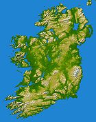
Ireland is an island to the northwest of continental Europe. It is the third-largest island in Europe and the twentieth-largest island on Earth...
. It also includes landforms that are usually called hill
Hill
A hill is a landform that extends above the surrounding terrain. Hills often have a distinct summit, although in areas with scarp/dip topography a hill may refer to a particular section of flat terrain without a massive summit A hill is a landform that extends above the surrounding terrain. Hills...
s. Those within Northern Ireland
Northern Ireland
Northern Ireland is one of the four countries of the United Kingdom. Situated in the north-east of the island of Ireland, it shares a border with the Republic of Ireland to the south and west...
or on the border are marked with an asterisk (*), while the rest are within the Republic of Ireland
Republic of Ireland
Ireland , described as the Republic of Ireland , is a sovereign state in Europe occupying approximately five-sixths of the island of the same name. Its capital is Dublin. Ireland, which had a population of 4.58 million in 2011, is a constitutional republic governed as a parliamentary democracy,...
. Mountain ranges are in bold.
Tallest peaks
Macgillycuddy's ReeksMacgillycuddy's Reeks
MacGillycuddy's Reeks is a mountain range in County Kerry, Republic of Ireland. Stretching slightly over , it includes the highest peaks in Ireland and the only peaks on the island that are over . The highest of these is Corrán Tuathail or Carrauntoohil , followed by Binn Chaorach and Cathair na...
(Na Cruacha Dubha)
| # | Peak | Other names | Height |
|---|---|---|---|
| 1 | Corrán Tuathail | Carrauntoohil | 1,038m |
| 2 | Binn Chaorach | Beenkeragh, Benkeeragh | 1,010m |
| 3 | Cathair na Féinne | Caher | 1,001m |
| 4 | Cnoc na Péiste Cnoc na Péiste Cnoc na Péiste—often anglicised as Knocknapeasta and more rarely given as Slievenapeesta or Cummeennapeasta—is a 988 m mountain peak in County Kerry, Republic of Ireland... |
Knocknapeasta | 988m |
| 5 | Cathair Thiar | Caher West | 975m |
| 6 | Maolán Buí | ||
| 973m | |||
| 7 | Carrauntoohil Tooth | Knockoughter, The Bones | 959m |
| 8 | Cnoc an Chuillinn | ||
| 958m | |||
| 9 | An Gunna Mhór | The Big Gun | 939m |
| 10 | Cruach Mhór | ||
| 932m |
Elsewhere in Ireland
| # | Peak | Height | Location |
|---|---|---|---|
| 1 | Mount Brandon Mount Brandon Mount Brandon or Brandon Mountain is a 952 m mountain on the Dingle Peninsula in County Kerry, Republic of Ireland. It is the highest peak of the unnamed central mountain range of the Dingle Peninsula and the ninth highest peak in Ireland... (Cnoc Bréanainn) |
951m | Dingle Peninsula Mountains Mountains of the Dingle Peninsula The Mountains of the Dingle Peninsula are grouped into two major unnamed mountain ranges, one running along the centre of the Dingle Peninsula in County Kerry, in Ireland and the other found at its extreme western tip... , County Kerry County Kerry Kerry means the "people of Ciar" which was the name of the pre-Gaelic tribe who lived in part of the present county. The legendary founder of the tribe was Ciar, son of Fergus mac Róich. In Old Irish "Ciar" meant black or dark brown, and the word continues in use in modern Irish as an adjective... |
| 2 | Lugnaquilla Lugnaquilla Lugnaquilla or Lugnaquillia, historically called Lugnaculliagh is a mountain in County Wicklow, Republic of Ireland. It is the highest peak of the Wicklow Mountains range, the highest in the province of Leinster, and the 13th highest peak in Ireland and affectionately known as "Lug".Views, on a... (Log na Coille) |
925m | Wicklow Mountains Wicklow Mountains The Wicklow Mountains form the largest continuous upland area in Ireland. They occupy the whole centre of County Wicklow and stretch outside its borders into Counties Carlow, Wexford and Dublin. Where the mountains extend into County Dublin, they are known locally as the Dublin Mountains... , County Wicklow County Wicklow County Wicklow is a county in Ireland. It is part of the Mid-East Region and is also located in the province of Leinster. It is named after the town of Wicklow, which derives from the Old Norse name Víkingalág or Wykynlo. Wicklow County Council is the local authority for the county... |
| 3 | Galtymore (Cnoc Mór na nGaibhlte) | 917m | Galtee Mountains Galtee Mountains The Galtee Mountains or Galty Mountains are a mountain range in Munster, located in Ireland's Golden Vale across parts of counties Limerick, South Tipperary and Cork. The name "Galtee" is thought to be a corruption of the Irish "Sléibhte na gCoillte" - "Mountains of the Forests" in English,... , County Tipperary County Tipperary County Tipperary is a county of Ireland. It is located in the province of Munster and is named after the town of Tipperary. The area of the county does not have a single local authority; local government is split between two authorities. In North Tipperary, part of the Mid-West Region, local... |
| 4 | Slieve Donard Slieve Donard Slieve Donard is a 850 m mountain in County Down, Northern Ireland. It is part of the Mourne Mountains and the highest peak in Northern Ireland and in the wider province of Ulster. It is the 19th highest peak on the island of Ireland... (Sliabh Dónairt)* |
852m | Mourne Mountains, County Down County Down -Cities:*Belfast *Newry -Large towns:*Dundonald*Newtownards*Bangor-Medium towns:... |
| 5 | Baurtregaum Baurtregaum Baurtregaum or Bartregaum is a 851 m mountain peak in County Kerry, Republic of Ireland. It is the highest of the Slieve Mish Mountains and the 17th highest peak in Ireland.... (Barr Trí gCom) |
851m | Slieve Mish Mountains Slieve Mish Mountains The Slieve Mish Mountains are a mountain range found in County Kerry in the Ireland. Overlooking Tralee Bay on the northern side and Dingle Bay on the south, they extend for approximately 19 km from east to west... , County Kerry County Kerry Kerry means the "people of Ciar" which was the name of the pre-Gaelic tribe who lived in part of the present county. The legendary founder of the tribe was Ciar, son of Fergus mac Róich. In Old Irish "Ciar" meant black or dark brown, and the word continues in use in modern Irish as an adjective... |
| 6 | Mullaghcleevaun Mullaghcleevaun Mullaghcleevaun is a mountain in County Wicklow, Republic of Ireland. At 849 m tall, it is the second highest of the Wicklow Mountains and the 20th highest in Ireland.... (Mullach Cliabháin) |
849m | Wicklow Mountains Wicklow Mountains The Wicklow Mountains form the largest continuous upland area in Ireland. They occupy the whole centre of County Wicklow and stretch outside its borders into Counties Carlow, Wexford and Dublin. Where the mountains extend into County Dublin, they are known locally as the Dublin Mountains... , County Wicklow County Wicklow County Wicklow is a county in Ireland. It is part of the Mid-East Region and is also located in the province of Leinster. It is named after the town of Wicklow, which derives from the Old Norse name Víkingalág or Wykynlo. Wicklow County Council is the local authority for the county... |
| 7 | Mangerton Mangerton Mountain Mangerton or Mangerton Mountain is a mountain in County Kerry, Republic of Ireland. At a height of 839 m it is the tallest of the Mangerton range and 25th tallest in Ireland... (An Mhangarta) |
839m | Mangerton Mountains Mountains of East Kerry The Mountains of East Kerry, also called the Mangerton Mountains, are a range of mountains situated immediately to the south and east of Killarney National Park and the town of Killarney in County Kerry in the Ireland... , County Kerry County Kerry Kerry means the "people of Ciar" which was the name of the pre-Gaelic tribe who lived in part of the present county. The legendary founder of the tribe was Ciar, son of Fergus mac Róich. In Old Irish "Ciar" meant black or dark brown, and the word continues in use in modern Irish as an adjective... |
| 8 | Caherconree Caherconree Caherconree is a mountain peak on the Dingle Peninsula in County Kerry, Republic of Ireland. At 835 m , it is the second-highest peak of the Slieve Mish Mountains and the 26th highest in Ireland.-Geography:... (Cathair Conraoi) |
835m | Slieve Mish Mountains Slieve Mish Mountains The Slieve Mish Mountains are a mountain range found in County Kerry in the Ireland. Overlooking Tralee Bay on the northern side and Dingle Bay on the south, they extend for approximately 19 km from east to west... , County Kerry County Kerry Kerry means the "people of Ciar" which was the name of the pre-Gaelic tribe who lived in part of the present county. The legendary founder of the tribe was Ciar, son of Fergus mac Róich. In Old Irish "Ciar" meant black or dark brown, and the word continues in use in modern Irish as an adjective... |
| 9 | Purple Mountain (Sliabh Corcra) | 832m | Purple Mountains, County Kerry County Kerry Kerry means the "people of Ciar" which was the name of the pre-Gaelic tribe who lived in part of the present county. The legendary founder of the tribe was Ciar, son of Fergus mac Róich. In Old Irish "Ciar" meant black or dark brown, and the word continues in use in modern Irish as an adjective... |
| 10 | Beenoskee Beenoskee Beenoskee or Benoskee is a 826 m mountain on the Dingle Peninsula in County Kerry, Republic of Ireland. Part of the Dingle Mountains, it is the highest of the "Central Dingle" group and the 28th highest in Ireland.... (Binn os Gaoith) |
826m | Dingle Peninsula Mountains Mountains of the Dingle Peninsula The Mountains of the Dingle Peninsula are grouped into two major unnamed mountain ranges, one running along the centre of the Dingle Peninsula in County Kerry, in Ireland and the other found at its extreme western tip... , County Kerry County Kerry Kerry means the "people of Ciar" which was the name of the pre-Gaelic tribe who lived in part of the present county. The legendary founder of the tribe was Ciar, son of Fergus mac Róich. In Old Irish "Ciar" meant black or dark brown, and the word continues in use in modern Irish as an adjective... |
MunsterMunsterMunster is one of the Provinces of Ireland situated in the south of Ireland. In Ancient Ireland, it was one of the fifths ruled by a "king of over-kings" . Following the Norman invasion of Ireland, the ancient kingdoms were shired into a number of counties for administrative and judicial purposes...
- An Triúr DeirfiúrAn Triúr DeirfiúrAn Triúr Deirfiúr, are a group of three peaks at the northwestern end of the Dingle Peninsula in County Kerry, Ireland, situated just to the north of the village of Baile an Fheirtéaraigh....
- County Kerry - Ballyhoura MountainsBallyhoura MountainsThe Ballyhoura Mountains are located in south-east County Limerick and north-east County Cork in central Munster, running east and west for about 6 miles on the borders of both counties.-Features:...
- Counties Cork and Limerick- Carron MountainCarron MountainCarron Mountain is a mountain 445m high on the border of County Limerick and County Cork, Ireland. It is part of the Ballyhoura Mountains.- External links :*...
- Seefin (Ballyhoura Mountains)Seefin (Ballyhoura Mountains)Seefin is a mountain near the southern border of County Limerick, Ireland. At 528m it is the highest peak and the second most northerly summit in the Ballyhoura Mountains and the 396th highest in Ireland. Latitude: 52.313847 Longitude: -8.522738.-Name:...
- Carron Mountain
- Boggeragh MountainsBoggeragh MountainsThe Boggeragh Mountains are located in County Cork, Ireland, the Munster Blackwater is north and the River Lee south of the hills. With an elevation of 643m , the highest peak is Musheramore ....
- County Cork- MusheramoreMusheramoreMusheramore is a 644 m mountain in County Cork, Ireland. It is the highest of the Boggeragh Mountains.There are two holy wells on the mountain: one at the summit for sick animals and one on its northern slopes for humans....
- Musheramore
- Caha MountainsCaha MountainsThe Caha Mountains are a range of low sandstone mountains situated on the Beara peninsula in south-west County Cork, in the Ireland. The highest peak is Hungry Hill, 685m tall.-See also:*List of mountains in Ireland...
- County Cork- Hungry HillHungry HillHungry Hill is a 685 m, 2248 ft mountain on the Beara Peninsula in the Republic of Ireland. It is the highest peak of the Caha Mountains and the 130th highest in Ireland...
- Sugarloaf (Cork)
- Hungry Hill
- Comeragh MountainsComeragh MountainsThe Comeragh Mountains are a glaciated mountain range situated in the south east of Ireland in County Waterford. They are located between the town of Clonmel on the County Tipperary border and the villages of Kilrossanty and Kilmacthomas in County Waterford.The twelve mountains which form the...
- Counties Tipperary and Waterford- Fauscoum
- Derrynasaggart MountainsDerrynasaggart MountainsThe Derrynasagart Mountains are a mountain range in County Cork, Ireland. They are situated from mid-Cork to the border with County Kerry, and can be seen on the N22 road in the Kerry direction. They are also viewable from towns like Clondrohid, Macroom and Ballyvourney - Highest point –...
- County Cork- MullaghanishMullaghanishMullaghanish is a mountain located just northeast of Ballyvourney in County Cork, Ireland. It is home to one of RTÉ's main transmitters, as well as some other mobile phone and independent radio stations....
- Mullaghanish
- Devil's BitDevil's BitThe Devil's Bit is a mountain in North Tipperary, Ireland which is 478m above sea level at its highest elevation. It lies to the north-west of the town of Templemore. The mountain is usually ascended via the village of Barnane...
- County Tipperary - Dingle PeninsulaMountains of the Dingle PeninsulaThe Mountains of the Dingle Peninsula are grouped into two major unnamed mountain ranges, one running along the centre of the Dingle Peninsula in County Kerry, in Ireland and the other found at its extreme western tip...
- County Kerry- Mount BrandonMount BrandonMount Brandon or Brandon Mountain is a 952 m mountain on the Dingle Peninsula in County Kerry, Republic of Ireland. It is the highest peak of the unnamed central mountain range of the Dingle Peninsula and the ninth highest peak in Ireland...
(952 m) - BeenoskeeBeenoskeeBeenoskee or Benoskee is a 826 m mountain on the Dingle Peninsula in County Kerry, Republic of Ireland. Part of the Dingle Mountains, it is the highest of the "Central Dingle" group and the 28th highest in Ireland....
- Mount Brandon
- Galtee MountainsGaltee MountainsThe Galtee Mountains or Galty Mountains are a mountain range in Munster, located in Ireland's Golden Vale across parts of counties Limerick, South Tipperary and Cork. The name "Galtee" is thought to be a corruption of the Irish "Sléibhte na gCoillte" - "Mountains of the Forests" in English,...
- Counties Cork, Limerick, Tipperary- Galtymore (917 m)
- Temple HillTemple Hill (Ireland)- References :*...
- Geokaun MountainGeokaun Mountain and Fogher CliffsGeokaun Mountain is the highest mountain on Valentia Island, County Kerry. On its northern face the Fogher Cliffs meet the sea.From the summit there are views of the Skellig Islands, Dingle Peninsula, the Blasket Islands, Beginish Island, Cahersiveen, Portmagee and Macgillycuddy's Reeks, including...
- County Kerry - Ivereagh PeninsulaMountains of the Iveragh PeninsulaThe Mountains of the Iveragh Peninsula are not found in a single mountain range, but instead consist of a number of unnamed mountain ranges found on the Iveragh Peninsula of County Kerry, in Ireland...
- County Kerry- Bentee
- Knockmealdown MountainsKnockmealdown MountainsThe Knockmealdown Mountains are a mountain range located on the border of counties South Tipperary and Waterford in Ireland, running east and west between the two counties. The highest peak of the range is Knockmealdown, situated in County Waterford...
- Counties Tipperary and Waterford- KnockmealdownKnockmealdownKnockmealdown is the highest peak of the Knockmealdown Range of mountains, located on the border between Co Tipperary and Co Waterford. The peak itself is located in County Waterford and is the highest point in that county. However, since the county border generally follows the summit line the...
- Sugarloaf Hill (Knockmealdowns)Sugarloaf Hill (Knockmealdowns)Sugarloaf Hill is a mountain peak located in the Knockmealdown Mountains on the border between South Tipperary and County Waterford.-See also:* List of mountains in Ireland* Sugarloaf...
- Knockmealdown
- Macgillycuddy's ReeksMacgillycuddy's ReeksMacGillycuddy's Reeks is a mountain range in County Kerry, Republic of Ireland. Stretching slightly over , it includes the highest peaks in Ireland and the only peaks on the island that are over . The highest of these is Corrán Tuathail or Carrauntoohil , followed by Binn Chaorach and Cathair na...
- County Kerry- Carrauntoohil (1,038 m)
- KnocknapeastaCnoc na PéisteCnoc na Péiste—often anglicised as Knocknapeasta and more rarely given as Slievenapeesta or Cummeennapeasta—is a 988 m mountain peak in County Kerry, Republic of Ireland...
(988 m)
- Mountains of East KerryMountains of East KerryThe Mountains of East Kerry, also called the Mangerton Mountains, are a range of mountains situated immediately to the south and east of Killarney National Park and the town of Killarney in County Kerry in the Ireland...
aka Mangerton Mountains - County Kerry- Mangerton MountainMangerton MountainMangerton or Mangerton Mountain is a mountain in County Kerry, Republic of Ireland. At a height of 839 m it is the tallest of the Mangerton range and 25th tallest in Ireland...
(843 m) - Torc MountainTorc MountainTorc Mountain is a mountain near Killarney in County Kerry, Ireland which is 535 m high. Torc Mountain gets its name from an enchanted boar that was killed there by the legendary hero, Fionn mac Cumhaill. Torc Mountain is the 383rd highest summit in Ireland.-See also:*Mountains of East Kerry...
- Mangerton Mountain
- Mount GabrielMount GabrielMount Gabriel is a mountain on the Mizen Peninsula situated immediately to the north of the town of Schull, in West Cork, Ireland.Mt. Gabriel is 407m high and is the highest eminence in the coastal zone south and east of Bantry Bay. A roadway serving the radar installations on the summit is open...
- County Cork - Mullaghareirk MountainsMullaghareirk MountainsThe Mullaghareirk Mountains is a range of mountains in Ireland that stretches from the borders of County Kerry County Limerick to Newmarket, County Cork. The villages of Mountcollins, Tournafulla, Brosna and Rockchapel are set in the mountains....
- Counties Cork and Limerick - Purple Mountain - County Kerry
- Shehy MountainsShehy mountainsThe Shehy Mountains are a range of low mountains situated on the border between County Cork and County Kerry, in Ireland.-Geography and geology:...
- Counties Cork and Kerry- KnockboyKnockboyKnockboy is a 706-metre-high mountain on the border between counties Cork and Kerry in Ireland. It is the highest peak in the Shehy mountain range and the highest mountain in County Cork with its summit shared with County Kerry. It is the 104th highest peak in Ireland...
- Knockboy
- Silvermine MountainsSilvermine MountainsThe Silvermine Mountains are a mountain range situated in North Tipperary in Ireland...
- Counties Tipperary and Limerick- Slievekimalta (Keeper Hill)Keeper HillKeeper Hill or Slievekimalta is a 694 m mountain in North Tipperary, Ireland.Keeper Hill is situated in the Slieve Felim mountain range in North Tipperary and is just 15km east of Limerick City. Keeper Hill is the highest mountain in the Shannon area and the 117th highest in Ireland. The ‘hill’...
- Slievekimalta (Keeper Hill)
- Paps of AnuPaps of AnuThe Paps of Anu are twin hills located near Killarney, close to the border between County Cork and County Kerry.These breast-shaped hills are said to have been named after the ancient goddess Anann or Anu. On the top of each of these hills stands a tall cairn. With a height of , the cairn on the...
(670 m) - County Kerry - Slieve Aughty - County Clare
- Slieve Callan - County Clare
- Slieve Mish MountainsSlieve Mish MountainsThe Slieve Mish Mountains are a mountain range found in County Kerry in the Ireland. Overlooking Tralee Bay on the northern side and Dingle Bay on the south, they extend for approximately 19 km from east to west...
- County Kerry- BaurtregaumBaurtregaumBaurtregaum or Bartregaum is a 851 m mountain peak in County Kerry, Republic of Ireland. It is the highest of the Slieve Mish Mountains and the 17th highest peak in Ireland....
(851 m) - CaherconreeCaherconreeCaherconree is a mountain peak on the Dingle Peninsula in County Kerry, Republic of Ireland. At 835 m , it is the second-highest peak of the Slieve Mish Mountains and the 26th highest in Ireland.-Geography:...
(835 m)
- Baurtregaum
- Slieve Miskish MountainsSlieve Miskish MountainsThe Slieve Miskish Mountains are a small range of low sandstone mountains found at the extreme south-western tip of the Beara Peninsula of County Cork in Ireland. Unlike the Caha Mountains, which lie further north on the peninsula, the Slieve Miskish Mountains lie entirely on the Cork side of the...
- County Cork- KnockouraKnockouraKnockgour is a mountain in County Cork, Ireland. Approx 480 metres high and one of the Irish Hangliding & Paragliding Sites as well as being a site for 4 communications masts for telephone, TV, VHF, coastguard and WiMax antennas...
- Knockoura
- Slieveardagh HillsSlieveardagh HillsThe Slieveardagh Hills are a low range of hills on the County Tipperary - County Kilkenny border, mainly in the barony of Slievardagh. The highest point is Clomantagh Hill at 349 m and the highest point by relative height in the hills is Knocknamuck at 340m with prominence of 268m...
(340 m) - Counties Tipperary and Kilkenny - SlievenamonSlievenamonSlievenamon is a mountain in County Tipperary in the province of Munster in Ireland. It stands at 721 m . It is located in the south of the county, near the town of Clonmel...
(719 m) - County Tipperary
LeinsterLeinsterLeinster is one of the Provinces of Ireland situated in the east of Ireland. It comprises the ancient Kingdoms of Mide, Osraige and Leinster. Following the Norman invasion of Ireland, the historic fifths of Leinster and Mide gradually merged, mainly due to the impact of the Pale, which straddled...
- Blackstairs MountainsBlackstairs MountainsThe Blackstairs Mountains run roughly north/south along the border between County Carlow and County Wexford in Ireland.-See also:*List of mountains in Ireland...
- Counties Carlow and Wexford- Black Rock MountainBlack Rock Mountain, County WexfordBlack Rock Mountain is in the Blackstairs Mountains which are located on the Carlow-Wexford border.The Blackstairs are divided into two massifs, to the north Mount Leinster and to the south Blackstairs Mountain. Black Rock is the terminal peak of the eastern shoulder of Mount Leinster....
(536 m) - Blackstairs MountainBlackstairs MountainBlackstairs Mountain in southern Leinster, is the second-highest mountain in the Blackstairs Mountains....
(735 m) - Croaghaun (Blackstairs)Croaghaun, County WexfordCroaghaun Mountain is in Wexford in the Blackstairs Mountains, Ireland.Croaghaun is the most northerly summit in the Blackstairs Mountains. It is the 603rd highest summit in Ireland....
- Mount LeinsterMount LeinsterAt 796 metres Mount Leinster is the fifth highest mountain after Lugnaquilla 925m, Mullaghcleevaun 849m, Tonelegee 817m, and Cloghernagh 800m, in the province of Leinster, Ireland. It is the highest of the Blackstairs Mountains at 796 metres...
(795 m)
- Black Rock Mountain
- Brandon HillBrandon HillBrandon Hill is the highest mountain in County Kilkenny, Ireland. It has an elevation of . It is situated 7 miles east of Thomastown, in the south of County Kilkenny. Brandon Hill is in the barony of Gowran and in the province of Leinster...
(515 m) - County Kilkenny - Carn ClonhughCarn ClonhughCarn Clonhugh is a hill just north of Longford Town, Ireland, approximately halfway between Drumlish and Ballinalee in the parish of Killoe. It is the highest point in County Longford. The hill is almost 300 metres above sea level, and has a transmitter situated on the top which rises...
aka Corn HillCorn Hill, LongfordLocated in County Longford, Ireland, Corn Hill or Cairn Hill rises to a height of 278 metres above sea level and as such is the highest point in the county. On a clear day, vantage points in 9 surrounding counties can be identified from the summit of Corn Hill.Upon the Hill are two cairns which...
- County Longford - Cooley MountainsCooley MountainsThe Cooley Mountains are located on the Cooley Peninsula in northeast County Louth in Ireland. They consist of two ridges oriented northwest to southeast, separated by the valley of Glenmore with the Big River running through it....
- County Louth- Clermont CarnClermont CarnClermont Carn, variously spelt as "Clermont Cairn", "Clairmont Carn/Cairn" or other variations is a 510m high peak in the Cooley Mountains in County Louth which is also home to a main RTÉ Network Limited transmission site.-Transmitter:...
- Slieve FoySlieve FoySlieve Foy or Slieve Foye is the highest peak of a ridge of mountains collectively referred to as Carlingford Mountain, which rises near the town of Carlingford, County Louth, Ireland. Slieve Foy rises to an altitude of 588 metres, and at this is the highest peak in County Louth...
(588 m)
- Clermont Carn
- CoppanaghCoppanaghCoppanagh is a mountain in County Kilkenny, Ireland. At 365 metres it is the second highest summit in Kilkenny behind Brandon Hill. It is the 886th highest summit in Ireland. Coppanagh and Brandon Hill are situated near Mount Alto.-References:...
- County Kilkenny - Croghan HillCroghan HillCroghan Hill is the remains of an extinct volcano and rises from the Bog of Allen in the midlands of Ireland in County Offaly. Though only 234 m high it commands extensive views of the surrounding midland counties, across the flat, low-lying expanse of the Bog of Allen...
(234 m) - County Offaly - Dalkey HillDalkey HillDalkey Hill is the northernmost of the two hills which form the southern boundary of Dublin Bay . Dalkey Hill is 140 metres high and offers beautiful views over the surrounding areas : Dublin to the northwest; the Irish Sea and the mountains of Wales to the east and southeast; and Bray Head and...
- County Dublin - Faughan HillFaughan HillFaughan Hill is a low hill approximately five miles to the northwest of Navan, County Meath, Ireland. It is owned by the McCabes, Dunnes, and the Englishs, and the highest point by Moriarty's and is not a public park....
- County Meath - Hill of AllenHill of AllenThe Hill of Allen is a volcanic hill situated in the west of County Kildare, Ireland, beside the village of Allen. According to Irish Mythology it was the seat of the hunter-warrier Fionn mac Cumhaill and the Fianna. The site is currently part-owned by Roadstone Dublin Ltd...
(206 m) - County Kildare - Hill of BenHill of BenSituated between Lough Glore and Lough Lene, and Lough Ban, Ireland, the Hill of Ben dominates the valley where Fore abbey was built by De Lacy of the Lord of Meath family for the French Benedictine monks. It rises sharply among the other surrounding hill that interlace with the many loughs of...
- County Westmeath - Hill of TaraHill of TaraThe Hill of Tara , located near the River Boyne, is an archaeological complex that runs between Navan and Dunshaughlin in County Meath, Leinster, Ireland...
- County Meath - Hill of Uisneach (182 m) - County Westmeath
- Hill of WardHill of WardThe Hill of Ward, also known as the Hill of Tlachtga, is a hill in County Meath, Ireland. During medieval times it was the site of great festivals, including one at which winter fires were lit at Samhain, the precursor of the modern Halloween...
- County Meath - Killiney HillKilliney HillKilliney Hill is the southernmost of the two hills which form the southern boundary of Dublin Bay . Crowned by an obelisk, the hill is 153 metres high and offers beautiful views over the surrounding areas : Dublin to the northwest; the Irish Sea and the mountains of Wales to the east and...
- County Dublin - KnockeyonKnockeyonKnockeyon is a hill in County Westmeath, Ireland. When viewed from the Ranaghan, and Gillards-town side of the hill, it dominates the surrounding lakes in the countryside of northern County Westmeath.-Location:...
- County Westmeath - Mount AltoMount Alto, KilkennyMount Alto is a mountain in County Kilkenny, Ireland. At 276 metres , it is the 981st highest mountain in Ireland. It is situated near Brandon Hill and Coppanagh.-See Also:* List of mountains in Ireland...
- County Kilkenny - MullaghmeenMullaghmeenMullaghmeen Hill, , in County Westmeath, Ireland, is situated between the County Cavan border and the Coole end of the Bog of Allen, to the south. It dominates the valley and the 'Westmeath or the Lake County' surrounding countryside...
- County Westmeath - Naul HillsNaul HillsThe Naul Hills, or Man-of-War Hills are low-lying hills in north County Dublin, close to the village of Naul, formerly called The Naul,...
(122 m) - Slieveardagh HillsSlieveardagh HillsThe Slieveardagh Hills are a low range of hills on the County Tipperary - County Kilkenny border, mainly in the barony of Slievardagh. The highest point is Clomantagh Hill at 349 m and the highest point by relative height in the hills is Knocknamuck at 340m with prominence of 268m...
- County Kilkenny- Clomantagh HillClomantagh HillClomantagh Hill is a mountain in County Kilkenny, Ireland. Its name means Hill of the gapped stone. At 349 metres it is the third highest summit in Kilkenny behind Brandon Hill and Coppanagh and is the second highest mountain in the Slieveardagh Hills after Knocknamuck. It is the 906th highest...
- KnocknamuckKnocknamuckKnocknamuck is a mountain in South Tipperary, Ireland. Its name means Hill of the Pig. At 340 metres it is highest summit in the Slieveardagh Hills and the 916th highest summit in Ireland.-See also:* List of mountains in Ireland...
- Clomantagh Hill
- Shielmartin HillShielmartin HillShielmartin Hill or Shelmartin is a peak on Howth Head. From it can be seen Portmarnock, Sutton, Bull Island and the coastal areas behind it, and most of Dublin Bay.-Form:...
- County Dublin - Slieve Bloom MountainsSlieve Bloom MountainsSituated close to the geographical centre of Ireland The Slieve Bloom Mountains rise from the central plain of Ireland to a height of 527 metres. While not very high, they are extensive by local standards...
- Counties Laois and Offaly- ArderinArderinArderin is a mountain on the border between counties Laois and Offaly in Ireland. With a height of 527 metres it is the highest point in the Slieve Bloom Mountains and the 399th highest summit in Ireland. Uniquely it is the highest point in County Laois and County Offaly.-References:* *...
(527 m) - BarcamBarcamBarcam is a mountain in Offaly, Ireland. The mountain stands at 514 metres high making it the fourth highest mountain in Offaly, the fifth highest mountain in the Slieve Bloom Mountains and the 505th highest summit in Ireland.-References:...
- BaunreaghcongBaunreaghcongBaunreaghcong is a mountain in Laois, Ireland. Baunreaghcong stands at a height of 511 metres making it the third highest mountain in the Slieve Bloom Mountains and the 440th highest summit in Ireland. It is the second highest mountain in Laois after Arderin which is also in County Offaly, making...
(509 m) - Carroll's HillCarroll's HillCarroll's Hill is a mountain in Offaly, Ireland. The mountain stands at 482 metres high making it the fifth highest mountain in Offaly, the seventh highest mountain in the Slieve Bloom Mountains and the 509th highest summit in Ireland.-References:...
- CastleconorCastleconorCastleconor is a mountain in Laois, Ireland. Castleconor's summit is at an altitude of 407 metres making it the fourth highest point in Laois, the ninth highest point in the Slieve Bloom Mountains and the 798th highest summit in Ireland....
- FarbreagueFarbreagueFarbreague is a mountain in Offaly, Ireland. It is a popular walking destination in Offaly. At 430 metres high making it the sixth highest mountain in Offaly, the eighth highest mountain in the Slieve Bloom Mountains and the 688th highest summit in Ireland.-References:...
- GarraunbaunGarraunbaunGarraunbaun is a mountain in Laois, Ireland. Castleconor's summit is at an altitude of 406 metres making it the fifth highest point in Laois, the tenth highest point in the Slieve Bloom Mountains and the 802nd highest summit in Ireland.-References:...
- Ridge of CapardRidge of CapardRidge of Capard is a mountain in Laois, Ireland. Ridge of Capard's summit is at an altitude of 509 metres making it the third highest point in Laois, the sixth highest in the Slieve Bloom Mountains and the 506th highest summit in Ireland....
- Stillbrook HillStillbrook HillStillbrook Hill is a mountain in Offaly, Ireland. With a height of 514 metres it is the second highest mountain in the Slieve Bloom Mountains after Arderin and the 428th highest summit in Ireland. It is the second highest mountain in Offaly....
(514 m) - Wolftrap MountainWolftrap MountainWolftrap Mountain is a mountain in Offaly, Ireland. The mountain is 514 metres high making it the third highest summit in Offaly, the fourth highest mountain in the Slieve Bloom Mountains and the 495th highest summit in Ireland. It is the most northerly summit of the Slieve Bloom range.-References:...
- Arderin
- SlieveboySlieveboySlieveboy is a mountain located in north County Wexford, Ireland. It rises directly above the village of Askamore, midway between Carnew and Camolin. The mountain is, except for the area around the summit, completely covered in forest...
(420 m) - County Wexford - Slieve na CalliaghSlieve na CalliaghSlieve na Calliagh is the highest peak in a low range of hills in northwest County Meath. The hills are notable as the location of the Loughcrew Megalithic Tomb Cemetery.-External links:* - photos and videos from Knowth.com...
- County Meath - Wicklow MountainsWicklow MountainsThe Wicklow Mountains form the largest continuous upland area in Ireland. They occupy the whole centre of County Wicklow and stretch outside its borders into Counties Carlow, Wexford and Dublin. Where the mountains extend into County Dublin, they are known locally as the Dublin Mountains...
- Annagh HillAnnagh HillAnnagh Hill is in north County Wexford, Ireland. It is separated from Croghan Mountain to the north by the "Wicklow Gap", not to be confused with the Wicklow Gap in County Wicklow. Except for the southeastern face it is covered in coniferous forestry.It overlooks the villages of Monaseed and...
- CamaderryCamaderryCamaderry is a mountain in the Wicklow Mountains, just south of the Wicklow Gap in County Wicklow, which runs over the gap between it and Tonelagee Mountain...
(699 m) - CamenabologueCamenabologueCarmenabologue is a mountain in Wicklow Mountains in County Wicklow, Ireland. With a height of 758 metres it is the 7th highest mountain in the Wicklow Mountains and the 71st highest summit in Ireland....
- Carrick MountainCarrick MountainCarrick Mountain is located in the eastern foothills of the Wicklow Mountains in the Republic of Ireland. Historically it was called Carrigmurrely and Carrickmacreily . It rises directly above the village of Glenealy on the R752, midway between Rathnew and Rathdrum. The mountain is, bar a few...
- Church MountainChurch MountainChurch Mountain, sometimes called Slievegad , is the most westerly of the Wicklow Mountains in Ireland. At the summit are the remains of a large cairn and an old triangulation pillar. Just east of the N81 national route, it lies roughly halfway between Hollywood to the north and Donard to the...
aka Slieve Gad (543 m) - CloghernaghCloghernaghCloghernagh is a mountain in Wicklow Mountains in County Wicklow, Ireland. On a clear day, to the east you may see Snowdonia in North Wales, roughly 85 miles distant. Cloghernagh is the 40th highest summit in Ireland.-See also:*List of mountains in Ireland...
(800 m) - ConavallaConavallaConavalla is a mountain in Wicklow Mountains in County Wicklow, Ireland....
- CorrigasleggaunCorrigasleggaunCorrigasleggaun is a mountain in Wicklow in the Wicklow Mountains, Ireland. It is the 46th highest summit in Ireland....
- Croghan MountainCroghan MountainCroghan Kinsella is a mountain in the Wicklow Mountains, on the Wicklow/Wexford border.The Wexford 'River Bann' rises from its southern slopes.-External links:*...
- Cupidstown HillCupidstown HillCupidstown Hill is a hill in Northeast County Kildare, Ireland, on the fringes of the Dublin Mountains. At 379 metres it is the highest summit in Kildare, almost twice as high as the Hill of Allen. But Cupidstown Hill is lesser known than other summits in Kildare as it is dwarfed by nearby...
(379 m) - DjouceDjouceDjouce , sometimes referred to as Djouce Mountain, is a mountain situated in the northeastern section of the Wicklow Mountains. To the west it overlooks the highlands around the Sally Gap; to the east the Roundwood / Calary Bog plateau....
(725 m) - Duff HillDuff HillDuff Hill is a mountain in County Wicklow, Ireland. At 720 metres it is the 12th highest mountain in the Wicklow Mountains and the 96th highest summit in Ireland.-See also:*List of mountains in Ireland...
(720 m) - GravaleGravaleGravale is a mountain in County Wicklow, Ireland. At 718 metres it is the 13th highest mountain in the Wicklow Mountains and the 97th highest summit in Ireland.-References:...
(718 m) - Great Sugar LoafGreat Sugar LoafOften simply known as the Sugar Loaf , this mountain is located in the east of County Wicklow, in Ireland, south of Bray and to the north of the Glen of the Downs Nature Reserve...
(501 m) - Keadeen
- KilmashogueKilmashogueKilmashogue is a mountain in Dun Laoghaire-Rathdown County in Ireland. It is high and forms part of the group of hills in the Dublin Mountains which comprises Two Rock, Three Rock, Kilmashogue and Tibradden Mountains. The forest plantation on its northern slope, which is composed mainly of Sitka...
- KippureKippureKippure is a granite mountain that straddles the county boundaries of South Dublin and Wicklow. It is popular for hill walking and outdoor leisure activity owing to its proximity to Dublin city, with its fine views over Dublin Bay towards Howth Head. It has convenient access and easy terrain...
(757 m) - Larch HillLarch HillLarch Hill is the national campsite, and administrative and training headquarters of Scouting Ireland. It was previously owned by Scouting Ireland .-Overview:...
- Little Sugar LoafLittle Sugar LoafLittle Sugar Loaf, also called Giltspur Mountain , is a hill in County Wicklow, Ireland. It is situated East-North-East of the Great Sugar Loaf, separated from it by the N11 dual carriageway...
aka Giltspur Mountain (300 m) - Lobawn
- LuggalaLuggalaLuggala , also called Fancy Mountain , is a mountain in the Wicklow Mountains, Ireland. Its cliffs are situated above a lake, Lough Tay, and are a popular location for rock climbing.Luggala is about southwest of Dublin.- Luggala Estate :...
aka Fancy Mountain - LugnaquillaLugnaquillaLugnaquilla or Lugnaquillia, historically called Lugnaculliagh is a mountain in County Wicklow, Republic of Ireland. It is the highest peak of the Wicklow Mountains range, the highest in the province of Leinster, and the 13th highest peak in Ireland and affectionately known as "Lug".Views, on a...
(924 m) - MaulinMaulinMaulin is a hill located in the northeastern section of the Wicklow Mountains, close to the border with County Dublin. It can be found on a side trail off the main Wicklow Way. It is readily accessible via well-marked trails from Crone Wood carpark, located south-west of Enniskerry...
- Montpelier Hill (383 m)
- MullacorMullacorMullacor is a mountain in Wicklow Mountains in County Wicklow, Ireland. Mullacor stands at 657 metres making it the 22nd highest mountain in the Wicklow Mountains and the 177th highest in Ireland.-References:...
- MullaghcleevaunMullaghcleevaunMullaghcleevaun is a mountain in County Wicklow, Republic of Ireland. At 849 m tall, it is the second highest of the Wicklow Mountains and the 20th highest in Ireland....
(849 m) - SeefinganSeefinganSeefingan often spelt Seafingan is a mountain on the border between the counties of South Dublin and Wicklow in Ireland. At 724 metres it is the 11th highest summit in the Wicklow Mountains, the second highest mountain in South Dublin after Kippure and the 92nd highest summit in Ireland...
- Slievemaan (759 m)
- Sugarloaf (West Wicklow)
- Table MountainTable Mountain, County WicklowTable Mountain is a mountain in Wicklow Mountains in County Wicklow, Ireland. At 701 metres it is the 109th highest mountain in Ireland and the 16th highest in the Wicklow Mountains....
- Tibradden MountainTibradden MountainTibradden Mountain is a mountain in County Dublin in Ireland. Other names for the mountain include "Garrycastle" and "Kilmainham Begg" . It is high and is the 561st highest mountain in Ireland...
(467m) - TonelageeTonelageeTonelagee is a mountain with a height of 817 m in County Wicklow, Republic of Ireland. It lies just north of the high point of the Wicklow Gap in the centre of the Wicklow Mountains. Tonelagee is the third highest of the Wicklow Mountains and the 33rd highest peak in Ireland...
(817 m) - Two RockTwo RockTwo Rock is a mountain in Dun Laoghaire-Rathdown, Ireland. It is high and is the 382nd highest mountain in Ireland. It is the highest point of the group of hills in the Dublin Mountains which comprises Two Rock, Three Rock, Kilmashogue and Tibradden Mountains. The mountain takes its name from the...
(536 m) and Three Rock (450 m)
- Annagh Hill
UlsterUlsterUlster is one of the four provinces of Ireland, located in the north of the island. In ancient Ireland, it was one of the fifths ruled by a "king of over-kings" . Following the Norman invasion of Ireland, the ancient kingdoms were shired into a number of counties for administrative and judicial...
- Antrim HillsGlens of AntrimThe Glens of Antrim , known locally as simply The Glens, is a region of County Antrim, Northern Ireland. It comprises nine glens , that radiate from the Antrim Plateau to the coast. The Glens are an area of outstanding natural beauty and are a major tourist attraction in north Antrim...
* - County Antrim- SlemishSlemishSlemish, historically called Slieve Mish , is a volcanic plug in County Antrim, Northern Ireland. It lies a few miles east of Ballymena, in the townland of Carnstroan.Slemish is the remains of the plug of an extinct volcano...
- TievebulliaghTievebulliaghTievebulliagh is a 402m high mountain in the Glens of Antrim, Northern Ireland. It forms part of the watershed between Glenann to the north and Glenballyeamon to the south...
- Slemish
- Antrim Plateau* - County Londonderry
- BinevenaghBinevenaghBinevenagh or Benevenagh marks the western extent of the Antrim Plateau formed around 60 million years ago by molten lava. The plateau and steep cliffs extend for over 6 miles across the peninsula of Magilligan and dominating the skyline over the villages of Bellarena, Downhill, Castlerock and...
- Donald's HillDonald's HillDonald's Hill is a hill in the middle of County Londonderry, Northern Ireland. The summit reaches 399 metres above sea level and classifies as a Marilyn...
- Binevenagh
- Belfast Hills* - County Antrim
- Black MountainBlack Mountain (Belfast)Black Mountain is a large hill which overlooks the city of Belfast, Northern Ireland.The mountain is one of the most prominent features of the city, towering above most of west Belfast. It reaches a height of 1,275 ft and is composed of limestone...
- CavehillCavehillCavehill, historically known as Ben Madigan , is a basaltic hill overlooking the city of Belfast in Northern Ireland. It forms part of the southeastern border of the Antrim Plateau. It is distinguished by its famous 'Napoleon's Nose', a basaltic outcrop which resembles the profile of the famous...
- DivisDivisDivis is a large mountain and area of sprawling moorland to the north-west of Belfast in County Antrim, Northern Ireland. The mountain is 478 m tall, making it the highest of the Belfast Hills...
- Black Mountain
- Belmore MountainBelmore MountainBelmore Mountain is a hill in the townland of Gortgall, western County Fermanagh, Northern Ireland. With a summit roughly above sea level, it is the second highest point in Fermanagh, the highest being at Cuilcagh on the Northern Ireland–Republic of Ireland border in the south of the...
* - County Fermanagh - Bluestack MountainsBluestack MountainsThe Bluestack Mountains or Blue Stack Mountains, also called the Croaghgorms , are the major mountain range in the south of County Donegal, Ireland. They provide a barrier between the south of the county, such as Donegal Town and Ballyshannon, and the towns to the north and west such as Dungloe and...
aka Croaghgorms - County Donegal- CroaghgormCroaghgormCroaghgorm or Bluestack is a 674 m mountain in County Donegal, Ireland. It is the highest of the Bluestack Mountains and the third-highest mountain in County Donegal....
- Croaghgorm
- CuilcaghCuilcaghCuilcagh, historically Slieve Cuilcagh , is the highest mountain in the Breifne area and the 165th highest on the island of Ireland . The summit lies on the border between County Fermanagh and County Cavan , and is the highest point in both counties...
* and BenaughlinBenaughlin MountainBenaughlin Mountain is a mountain in the Cuilcagh Mountain range in County Fermanagh, Northern Ireland. It has a limestone composition and is known as Bin Mountain in the local area.At its highest point, Benaughlin is 373 metres above sea level...
* - Counties Fermanagh and Cavan - Derryveagh MountainsDerryveagh MountainsThe Derryveagh Mountains is the major mountain range in County Donegal, Ireland. It makes up much of the landmass of the county, and is the area of Ireland with the lowest population density. The mountains separate the coastal parts of the county, such as Gweedore and Glenties, from the major...
- County Donegal- Aghla BegAghla BegAghla Beg is a mountain in County Donegal, Ireland. Of its two summits, one has a height of 564 m, and the other 603 m. It is the third most northern and fifth highest of the mountain chain, called the Seven Sisters by locals Muckish, Crocknalaragagh, Aghla Beg, Ardloughnabrackbaddy,...
- Aghla MoreAghla MoreAghla More is a mountain in County Donegal, Ireland with a height of 584 metres. It is the third most southern and fourth highest of the mountain chain, called the 'Seven Sisters' by locals Aghla More is a mountain in County Donegal, Ireland with a height of 584 metres. It is the third most...
- ArdloughnabrackbaddyArdloughnabrackbaddyArdloughnabrackbaddy is a peak in County Donegal, Ireland with a height of 603m. It sits above Loughnabrackbaddy and is the middle summit and third highest of the "Seven Sisters". The Seven Sisters are part of the Derryveagh range and includes Muckish, Crocknalaragagh, Aghla Beg,...
- CrocknalaragaghCrocknalaragaghCrocknalaragagh is a mountain in County Donegal, Ireland with a height of 470 m. It is the second most northern and lowest of the mountain chain, locally called the Seven Sisters that also includes Muckish, Aghla Beg, Ardloughnabrackbaddy, Aghla More, Mackoght and Errigal. All of the Seven...
- ErrigalMount ErrigalMount Errigal, or simply Errigal is a mountain near Gweedore in County Donegal, Republic of Ireland. It is the tallest peak of the Derryveagh Mountains, the tallest peak in County Donegal, and the 76th tallest peak in Ireland. Errigal is also the most southern, steepest and highest of the...
- MackoghtMackoghtMackoght or Macoght , also called Little Errigal or Wee Errigal , is a tall mountain in County Donegal, Republic of Ireland. It is the second most southern and second lowest of the mountain chain called the Seven Sisters by locals. The Seven Sisters are Muckish, Crocknalaragagh, Aghla Beg,...
- MuckishMuckishMuckish is a distinctive flat-topped mountain in the Derryveagh Mountains of County Donegal, Republic of Ireland. At , it is the third-highest peak in the Derryveagh Mountains and the 163rd highest in Ireland. Muckish is also the most northern and second highest of the mountain chain called the...
- Aghla Beg
- InishowenInishowenInishowen is a peninsula in County Donegal, part of the Province of Ulster in the north of Ireland. It is also the largest peninsula in all of Ireland. Inishowen is a picturesque location with a rich history...
- Slieve SnaghtSlieve SnaghtSlieve Snaght is a mountain in Inishowen, County Donegal, Ireland, not to be confused with the mountain of the same name in the nearby Derryveagh range.- References :* *...
- Slieve Snaght
- LoughermoreLoughermoreLoughermore is a mountain in County Londonderry, Northern Ireland. It is the 847th highest mountain in Ireland and lies in a large uplands area known as the Loughermore Hills, which is bounded to the west and south by the Rivers Faughan and Foreglen and to the east, by the River Roe.-References:...
* - County Londonderry - Mourne Mountains* - County Down
- Slieve BearnaghSlieve BearnaghSlieve Bearnagh is a mountain in the Mourne Mountains, Northern Ireland. Its summit is crowned by a number of rocky tors. The Mourne Wall crosses the summit of Slieve Bearnagh east to west. Paths lead to the cols on either side of the mountain, namely Pollaphuca to the west and Hare's Gap to the...
- Slieve BinnianSlieve BinnianSlieve Binnian is the third highest mountain in Northern Ireland at . The name comes from the rocky tors situated around the top of the mountain. These very rugged crest of rocky tors makes it easy to identify in views around the Mourne Mountains....
- Slieve CommedaghSlieve CommedaghSlieve Commedagh is a 767 m mountain in County Down, Northern Ireland. It is the second-highest of the Mourne Mountains, after Slieve Donard, and the second-highest mountain in Northern Ireland....
- Slieve DonardSlieve DonardSlieve Donard is a 850 m mountain in County Down, Northern Ireland. It is part of the Mourne Mountains and the highest peak in Northern Ireland and in the wider province of Ulster. It is the 19th highest peak on the island of Ireland...
(850 m) - Slieve MuckSlieve MuckSlieve Muck is one of the Mourne Mountains in County Down, Northern Ireland. It has a height of 674 metres . Its summit overlooks Spelga Dam and the Deer's Meadow, the source of the River Bann....
- Slieve Bearnagh
- Ouley HillOuley HillOuley Hill is the highest hill in County Down Northern Ireland, between Carryduff and Saintfield at 180m.It was the site of a battle in the Irish Rebellion of 1798....
* - County Down - Slieve BeaghSliabh BeaghSliabh Beagh are mountains which straddle the border between County Monaghan in the Republic of Ireland and County Fermanagh and County Tyrone in Northern Ireland. The point where the three counties meet, which is also in the Sliabh Beagh, is referred to as "Three County Hollow".-Name:The name...
* - Counties Fermanagh, Tyrone, Monaghan - Slieve CroobSlieve CroobSlieve Croob is the tallest of a group of peaks in the middle of County Down, Northern Ireland. These peaks lie north of the Mourne Mountains, between the village of Dromara and the town of Castlewellan. Slieve Croob has been designated an Area of Outstanding Natural Beauty...
* - County Down - Slieve GullionSlieve GullionSlieve Gullion is a mountain in the south of County Armagh in Northern Ireland. The mountain forms the core of the Ring of Gullion and stands as the highest point in the county with an elevation of 573 metres...
* - County Armagh - Slieve RushenSlieve RushenSlieve Rushen is a mountain which straddles the border between County Cavan in the Republic of Ireland and County Fermanagh in Northern Ireland. It is also called Slieve Russell or Ligavegra . It has an altitude of 404 metres above sea-level. OS 1/50k Mapsheet: 27A & 26...
* - Counties Fermanagh and Cavan - Southwest Donegal - County Donegal
- Slieve LeagueSlieve LeagueSlieve League, sometimes Slieve Leag or Slieve Liag , is a mountain on the Atlantic coast of County Donegal, Republic of Ireland. At , it has Ireland's highest sea cliffs...
- Slieve League
- SperrinsSperrinsThe Sperrins or Sperrin Mountains are a range of mountains in Northern Ireland and one of the largest upland areas in Ireland. The range stretches the counties of Tyrone and Londonderry from south of Strabane eastwards to Maghera and north towards Limavady...
* - Counties Londonderry and Tyrone- BenbradaghBenbradaghBenbradagh is a mountain in County Londonderry, Northern Ireland. It is the second most northerly summit in the Sperrin Mountains area and the 564th highest summit in Ireland. Its summit rises to . The mountain is located to the east of Dungiven....
- MullaghcarnMullaghcarnMullaghcarn is a mountain in the southwest Sperrins, County Tyrone, Northern Ireland. The peak reaches a height of 542 m , and is the 370th highest in Ireland. Mullaghcarn is in Omagh District Council, on the edge of Gortin Glen Forest Park, and is the most southerly peak in the Sperrins...
- MullaghmoreMullaghmore (marilyn)Mullaghmore is a mountain in County Londonderry, Northern Ireland. It is part of the Sperrins and the 359th highest mountain in Ireland The summit is dominated by a large telecommunication tower. The mountain is located north of the village of Draperstown....
- Sawel MountainSawel MountainSawel Mountain, historically Slieve Sawel , is a mountain in County Londonderry and County Tyrone, Northern Ireland. It is the highest peak in the Sperrin Mountains, and the seventh highest in Northern Ireland. To the north of Sawel is County Londonderry, and to the south, County Tyrone. The summit...
- Slieve GallionSlieve GallionSlieve Gallion is a mountain in County Londonderry, Northern Ireland. By road, it is from Moneymore, from Cookstown, and from Magherafelt. It is the eastern limit of the Sperrin Mountains range...
- Benbradagh
ConnachtConnachtConnacht , formerly anglicised as Connaught, is one of the Provinces of Ireland situated in the west of Ireland. In Ancient Ireland, it was one of the fifths ruled by a "king of over-kings" . Following the Norman invasion of Ireland, the ancient kingdoms were shired into a number of counties for...
- Achill IslandAchill IslandAchill Island in County Mayo is the largest island off the coast of Ireland, and is situated off the west coast. It has a population of 2,700. Its area is . Achill is attached to the mainland by Michael Davitt Bridge, between the villages of Gob an Choire and Poll Raithní . A bridge was first...
- County Mayo- CroaghaunCroaghaunCroaghaun is a mountain in County Mayo, Ireland. At 688 metres , it has the highest cliffs in Ireland and the second highest sea cliffs in Europe ....
- SlievemoreSlievemoreSlievemore is the second highest peak on Achill Island, in County Mayo, Ireland. Its elevation is 671 metres.-Archaeology:* Achill Archaeological Field School is based at the Achill Archaeology Centre in Dooagh. It was founded in 1991 and is a training school for students of archaeology and...
(671 m)
- Croaghaun
- Ben GormBen Gorm- References :*...
- County Mayo - Croagh PatrickCroagh PatrickCroagh Patrick , nicknamed the Reek, is a tall mountain and an important site of pilgrimage in County Mayo, Republic of Ireland. It is from Westport, above the villages of Murrisk and Lecanvey. It is the third highest mountain in County Mayo after Mweelrea and Nephin. On "Reek Sunday", the last...
(764 m) - County Mayo - Clare IslandClare IslandClare Island is a mountainous island guarding the entrance to Clew Bay in County Mayo, Ireland. It is famous as the home of the pirate queen, Gráinne O'Malley...
- County Mayo- KnockmoreKnockmore, MayoKnockmore is a mountain on Clare Island off the coast of County Mayo, Ireland. The mountain is the highest peak on Clare Island at and is the 572nd highest in Ireland. It is a popular walking destination for island residents and tourists and is known for its view of Clew Bay and the west coast...
(462 m)
- Knockmore
- Curlew MountainsCurlew MountainsViewed to the west travelling north, dominates the surrounding lakes of the north Roscommon and Leitrim countryside. Situated between Boyle, and Castlebalwin, the Curlew Mountains oversees the north Connacht countryside....
- Counties Sligo and Roscommon - Dartry MountainsDartry MountainsThe Dartry Mountains are a range in the north west of Ireland.They are situated mainly on the border of County Sligo and County Leitrim....
- Counties Sligo and Leitrim- BenbulbenBen BulbenBen Bulben, sometimes spelt Benbulben or Benbulbin , is a large rock formation in County Sligo, Ireland. It is part of the Dartry Mountains, an area sometimes called "Yeats Country".Ben Bulben is listed as a protected structure....
- TruskmoreTruskmoreTruskmore is a 647 m mountain on the border of County Sligo and County Leitrim, Republic of Ireland. It is the highest peak of the Dartry Mountains and the highest in County Sligo....
- Benbulben
- KnocknareaKnocknareaKnocknarea is a large hill west of Sligo town in County Sligo, Republic of Ireland.The high limestone hill is visually striking, as it is monolithic in appearance and stands in a prominent position on the Cúil Irra peninsula between the bays of Sligo and Ballysadare. At the summit is a large...
- County Sligo - MaumturksMaumturksNa Sléibhte Mhám Toirc are a picturesque mountain range in Connemara in the west of Ireland. They are less well known than their more famous neighbours, the Twelve Bens on the other side of the Inagh Valley...
- County Galway- BarrslievenaroyBarrslievenaroyBarrslievenaroy —also called Binn idir an Dá Log— is a 702 m mountain in County Galway, Republic of Ireland. It is the highest of the Maumturks range, which lie within the Connemara region....
- Barrslievenaroy
- MweelreaMweelreaMweelrea is a mountain in County Mayo, Republic of Ireland. With a height of 814 metres , it is the highest point in County Mayo, the highest point in the province of Connacht and the 34th highest in Ireland...
(814 m) - County Mayo - Nephin Beg RangeNephin Beg RangeThe Nephin Beg Range is a mountain range in Co. Mayo, Ireland. The range contains the Nephin and Nephin Beg mountains. The range is hosts a the Nephin forest, a 4,843 hectares forest managed by Coillte.-External links:* Mountain Views...
- County Mayo- NephinNephinNephin or Nefin , at 806 metres , is the second highest peak in County Mayo and the second highest in Connacht, in Ireland...
(806 m) - Nephin BegNephin BegNephin Beg or Nefin Beg is a mountain in the Nephin Beg Range in north County Mayo, Ireland. The mountain takes its name from Nephin, although that mountain is some distance away and with intervening mountains between them The highest point is 365 meters....
(627 m) - Slieve CarrSlieve CarrSlieve Carr is a mountain in County Mayo, Ireland.-References:* *...
(721 m)
- Nephin
- Ox MountainsOx MountainsThe Ox Mountains are a mountain range in County Sligo on the west coast of Ireland. They are also known as 'St Patrick's Mountain after St. Patrick, as he laboured much on it, raised churches on its slopes, and left his name to some of its wells, as for instance that of Dromard' . The highest peak...
- County Sligo- KnockalongyKnockalongyKnockalongy is a 544 m Marilyn in County Sligo, Republic of Ireland. It is the highest of the Ox Mountains. The nearest village is Skreen....
- KnocknasheeKnocknasheeKnocknashee is a 276 m Marilyn in the Ox Mountains, County Sligo, Ireland.- Geology :Knocknashee hill consists of a limestone top with shales underlying the lower slopes. - Archaeology :...
- Knockalongy
- Partry MountainsPartry MountainsThe Partry Mountains is a mountain range in County Mayo on the west coast of Ireland. The highest peak in the Partry Mountains is Maumtrasna which rises to . The mountain range overlooks Lough Mask and the area is often referred to as Joyce Country.- References :*...
- Counties Mayo and Galway- DevilsmotherDevilsmotherDevilsmother , also known as Binn Gharbh , is a small mountain in Connemara, Ireland. It is just off the edge of the Maumturks chain and overlooks the Western Way long distance path....
(645 m) - MaumtrasnaMaumtrasnaMaumtrasna is a mountain in County Mayo, Ireland.The name derives from its Irish name which is roughly translated as the "Mountain pass crossing".- References :*...
- County Mayo
- Devilsmother
- Sheeffry RangeSheeffry HillsThe Sheeffry Hills or Sheeffry Mountains is a range of hills in County Mayo, Ireland. It is bounded to the west by Glencullin Lough and Doolough; to the south by Glenummera and Tawnyard Lough; to the east by Owenmore Glen and to the north by the Bunowen River.The highest peak is Barrclashcame...
- County Mayo- BarrclashcameBarrclashcameBarrclashcame is a 772 m mountain in County Mayo, Republic of Ireland. It is within the townland of Clashcame and is the highest peak of the Sheeffry Hills....
- Barrclashcame
- Twelve BensTwelve BensThe Twelve Bens, or Twelve Pins , is a mountain range of sharp-peaked quartzite ranges located northeast of Roundstone in Connemara in the west of Ireland. Dedicated fell runners attempt to hike all twelve peaks in a single day...
- County Galway- BenbaunBenbaunBenbaun is a mountain in County Galway, Ireland, the highest of the Twelve Bens, and the highest peak in Galway. As the highest point in Galway, it is the 10th highest county peak in Ireland....
- ErrisbegErrisbegErrisbeg Mountain or Errisbeg situated at Roundstone, County Connemara, in the West of Ireland with a height of 300 m....
- Benbaun
See also
- Northern Ireland: List of Hewitts and List of Marilyns
- Republic of Ireland: List of Hewitts and List of Marilyns
- Geography of IrelandGeography of IrelandIreland is an island in northwest Europe in the north Atlantic Ocean whose main geographical features include low central plains surrounded by a ring of coastal mountains. The highest peak is Carrauntoohil , which is above sea level. The western coastline is rugged, with many islands, peninsulas,...
- List of Irish counties by highest point
- List of mountains and hills of County Mayo