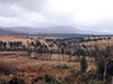
Mullaghcleevaun
Encyclopedia
Mullaghcleevaun is a mountain
in County Wicklow
, Republic of Ireland
. At 849 m (2,785 ft) tall, it is the second highest of the Wicklow Mountains
and the 20th highest in Ireland
.
Mullaghcleevaun is believed to have been named after the rounded depression near the summit, which has a small lake (Lough Cleevaun) inside it. Mullaghcleevaun sits roughly in the middle of the Wicklow Mountains and 3 km west of the Military Road
. The massif
also includes the summit of Mullaghcleevaun East Top (795 m).
The most common ascent of the mountain is made via Black Hill from the carpark 3 km uphill from the small hillside town of Lacken
. The hills of Wales
can be seen on a clear day from the triangulation pillar on the summit.
Mountain
Image:Himalaya_annotated.jpg|thumb|right|The Himalayan mountain range with Mount Everestrect 58 14 160 49 Chomo Lonzorect 200 28 335 52 Makalurect 378 24 566 45 Mount Everestrect 188 581 920 656 Tibetan Plateaurect 250 406 340 427 Rong River...
in County Wicklow
County Wicklow
County Wicklow is a county in Ireland. It is part of the Mid-East Region and is also located in the province of Leinster. It is named after the town of Wicklow, which derives from the Old Norse name Víkingalág or Wykynlo. Wicklow County Council is the local authority for the county...
, Republic of Ireland
Republic of Ireland
Ireland , described as the Republic of Ireland , is a sovereign state in Europe occupying approximately five-sixths of the island of the same name. Its capital is Dublin. Ireland, which had a population of 4.58 million in 2011, is a constitutional republic governed as a parliamentary democracy,...
. At 849 m (2,785 ft) tall, it is the second highest of the Wicklow Mountains
Wicklow Mountains
The Wicklow Mountains form the largest continuous upland area in Ireland. They occupy the whole centre of County Wicklow and stretch outside its borders into Counties Carlow, Wexford and Dublin. Where the mountains extend into County Dublin, they are known locally as the Dublin Mountains...
and the 20th highest in Ireland
Ireland
Ireland is an island to the northwest of continental Europe. It is the third-largest island in Europe and the twentieth-largest island on Earth...
.
Mullaghcleevaun is believed to have been named after the rounded depression near the summit, which has a small lake (Lough Cleevaun) inside it. Mullaghcleevaun sits roughly in the middle of the Wicklow Mountains and 3 km west of the Military Road
R115 road
The R115 road is a regional road in counties Dublin and Wicklow in Ireland. It follows the Military Road for its entire length. The R115 is long; the full length of the Military Road is...
. The massif
Massif
In geology, a massif is a section of a planet's crust that is demarcated by faults or flexures. In the movement of the crust, a massif tends to retain its internal structure while being displaced as a whole...
also includes the summit of Mullaghcleevaun East Top (795 m).
The most common ascent of the mountain is made via Black Hill from the carpark 3 km uphill from the small hillside town of Lacken
Lacken, County Wicklow
Lacken is a small village in the west of County Wicklow in Ireland, located on the shores of the Blessington lakes. It is part of the parish of Valleymount...
. The hills of Wales
Wales
Wales is a country that is part of the United Kingdom and the island of Great Britain, bordered by England to its east and the Atlantic Ocean and Irish Sea to its west. It has a population of three million, and a total area of 20,779 km²...
can be seen on a clear day from the triangulation pillar on the summit.

