

List of civil parishes in Somerset
Encyclopedia
| Districts of Somerset Areas shown in yellow are the unitary authorities and those in pink are districts administered by Somerset County Council Somerset County Council Somerset County Council is the county council of Somerset in the South West of England, an elected local government authority responsible for the most significant local government services in most of the county.-Area covered:... |
|---|
 |
| 1 South Somerset South Somerset South Somerset is a local government district in Somerset, England.The South Somerset district covers and area of ranging from the borders with Devon and Dorset to the edge of the Somerset Levels. It has a population of approximately 158,000... |
| 2 Taunton Deane Taunton Deane Taunton Deane is a local government district with borough status in Somerset, England. Its council is based in Taunton.The district was formed on 1 April 1974, under the Local Government Act 1972, by a merger of the Municipal Borough of Taunton, Wellington Urban District, Taunton Rural District,... |
| 3 West Somerset West Somerset West Somerset is a local government district in the English county of Somerset. The council covers a largely rural area, with a population of 35,075 in an area of .... |
| 4 Sedgemoor Sedgemoor Sedgemoor is a low lying area of land in Somerset, England. It lies close to sea level south of the Polden Hills, historically largely marsh . The eastern part is known as King's Sedgemoor, and the western part West Sedgemoor. Sedgemoor is part of the area now known as the Somerset Levels... |
| 5 Mendip Mendip Mendip is a local government district of Somerset in England. The Mendip district covers a largely rural area of ranging from the Mendip Hills through on to the Somerset Levels. It has a population of approximately 110,000... |
| 6 Bath and North East Somerset Bath and North East Somerset Bath and North East Somerset is a unitary authority that was created on 1 April 1996 following the abolition of the County of Avon. It is part of the Ceremonial county of Somerset... (Unitary) |
| 7 North Somerset North Somerset North Somerset is a unitary authority in England. Its area covers part of the ceremonial county of Somerset but it is administered independently of the non-metropolitan county. Its administrative headquarters is in the town hall in Weston-super-Mare.... (Unitary) |
The ceremonial county of Somerset
Somerset
The ceremonial and non-metropolitan county of Somerset in South West England borders Bristol and Gloucestershire to the north, Wiltshire to the east, Dorset to the south-east, and Devon to the south-west. It is partly bounded to the north and west by the Bristol Channel and the estuary of the...
, England is divided into 417 areas known as civil parishes, which are subnational entities forming the lowest unit of local government in England. Parishes arose from Church of England
Church of England
The Church of England is the officially established Christian church in England and the Mother Church of the worldwide Anglican Communion. The church considers itself within the tradition of Western Christianity and dates its formal establishment principally to the mission to England by St...
divisions, and were given their current powers and responsibilities by the Local Government Act 1894
Local Government Act 1894
The Local Government Act 1894 was an Act of the Parliament of the United Kingdom that reformed local government in England and Wales outside the County of London. The Act followed the reforms carried out at county level under the Local Government Act 1888...
. The Local Government Act 1972
Local Government Act 1972
The Local Government Act 1972 is an Act of Parliament in the United Kingdom that reformed local government in England and Wales on 1 April 1974....
retained civil parishes in rural areas. Many former urban districts
Urban district
In the England, Wales and Ireland, an urban district was a type of local government district that covered an urbanised area. Urban districts had an elected Urban District Council , which shared local government responsibilities with a county council....
and municipal boroughs
Municipal borough
Municipal boroughs were a type of local government district which existed in England and Wales between 1835 and 1974, in Northern Ireland from 1840 to 1973 and in the Republic of Ireland from 1840 to 2002...
were replaced by new successor parishes; urban areas that were considered too large to be single parishes became unparished area
Unparished area
In England, an unparished area is an area that is not covered by a civil parish. Most urbanised districts of England are either entirely or partly unparished. Many towns and some cities in otherwise rural districts are also unparished areas and therefore no longer have a town council or city...
s.
The county of Somerset consists of a non-metropolitan county
Metropolitan and non-metropolitan counties of England
Metropolitan and non-metropolitan counties are one of the four levels of subdivisions of England used for the purposes of local government outside Greater London. As originally constituted, the metropolitan and non-metropolitan counties each consisted of multiple districts, had a county council and...
administered by Somerset County Council
Somerset County Council
Somerset County Council is the county council of Somerset in the South West of England, an elected local government authority responsible for the most significant local government services in most of the county.-Area covered:...
, divided into five districts and two unitary authorities
Unitary authority
A unitary authority is a type of local authority that has a single tier and is responsible for all local government functions within its area or performs additional functions which elsewhere in the relevant country are usually performed by national government or a higher level of sub-national...
. The districts of Somerset are West Somerset
West Somerset
West Somerset is a local government district in the English county of Somerset. The council covers a largely rural area, with a population of 35,075 in an area of ....
, South Somerset
South Somerset
South Somerset is a local government district in Somerset, England.The South Somerset district covers and area of ranging from the borders with Devon and Dorset to the edge of the Somerset Levels. It has a population of approximately 158,000...
, Taunton Deane
Taunton Deane
Taunton Deane is a local government district with borough status in Somerset, England. Its council is based in Taunton.The district was formed on 1 April 1974, under the Local Government Act 1972, by a merger of the Municipal Borough of Taunton, Wellington Urban District, Taunton Rural District,...
, Mendip
Mendip
Mendip is a local government district of Somerset in England. The Mendip district covers a largely rural area of ranging from the Mendip Hills through on to the Somerset Levels. It has a population of approximately 110,000...
and Sedgemoor
Sedgemoor
Sedgemoor is a low lying area of land in Somerset, England. It lies close to sea level south of the Polden Hills, historically largely marsh . The eastern part is known as King's Sedgemoor, and the western part West Sedgemoor. Sedgemoor is part of the area now known as the Somerset Levels...
. The two administratively independent unitary authorities, which were established on 1 April 1996 following the break-up of the county of Avon, are North Somerset
North Somerset
North Somerset is a unitary authority in England. Its area covers part of the ceremonial county of Somerset but it is administered independently of the non-metropolitan county. Its administrative headquarters is in the town hall in Weston-super-Mare....
and Bath and North East Somerset
Bath and North East Somerset
Bath and North East Somerset is a unitary authority that was created on 1 April 1996 following the abolition of the County of Avon. It is part of the Ceremonial county of Somerset...
. These unitary authorities include areas that were part of Somerset before the creation of Avon in 1974.
The city of Bath is the largest centre of population in Bath and North East Somerset
Bath and North East Somerset
Bath and North East Somerset is a unitary authority that was created on 1 April 1996 following the abolition of the County of Avon. It is part of the Ceremonial county of Somerset...
. Areas of the city that were formerly within the Bath County Borough are now unparished, but the rest of the authority is divided into 49 parishes. In terms of population, based on the census of 2001
United Kingdom Census 2001
A nationwide census, known as Census 2001, was conducted in the United Kingdom on Sunday, 29 April 2001. This was the 20th UK Census and recorded a resident population of 58,789,194....
, the smallest is St Catherine
St Catherine, Somerset
St Catherine is a small village and civil parish in the Bath and North East Somerset unitary authority, Somerset, England. The parish has a population of 69.-History:St Catherine was part of the hundred of Bath Forum.-Governance:...
with 69 residents, and the largest is the town of Norton Radstock
Norton Radstock
Norton Radstock used to be a small conurbation and large civil parish in Bath and North East Somerset, England, south west of Bath, and the same distance north west of Frome. It had a population of 21,325 according to the 2001 census. The term Norton Radstock is not recognised by local residents,...
with 21,325. All of North Somerset, the other unitary authority, is covered by its 39 parishes ranging from the village Loxton
Loxton, North Somerset
Loxton is a village and civil parish in Somerset, England. It is close to the M5 motorway in the Unitary Authority of North Somerset. The parish includes the village of Christon and has a population of 202.-History:...
with a population of 202, to the town of Weston-super-Mare
Weston-super-Mare
Weston-super-Mare is a seaside resort, town and civil parish in the unitary authority of North Somerset, which is within the ceremonial county of Somerset, England. It is located on the Bristol Channel coast, south west of Bristol, spanning the coast between the bounding high ground of Worlebury...
with 71,758 inhabitants.
South Somerset is the largest of Somerset's five districts, covering an area of 958 square kilometres (370 sq mi) from the borders with Devon
Devon
Devon is a large county in southwestern England. The county is sometimes referred to as Devonshire, although the term is rarely used inside the county itself as the county has never been officially "shired", it often indicates a traditional or historical context.The county shares borders with...
and Dorset
Dorset
Dorset , is a county in South West England on the English Channel coast. The county town is Dorchester which is situated in the south. The Hampshire towns of Bournemouth and Christchurch joined the county with the reorganisation of local government in 1974...
to the edge of the Somerset Levels
Somerset Levels
The Somerset Levels, or the Somerset Levels and Moors as they are less commonly but more correctly known, is a sparsely populated coastal plain and wetland area of central Somerset, South West England, between the Quantock and Mendip Hills...
. It has a population of about 158,000, living in 121 parishes. The largest settlement in the district is Yeovil
Yeovil
Yeovil is a town and civil parish in south Somerset, England. The parish had a population of 27,949 at the 2001 census, although the wider urban area had a population of 42,140...
, with a population of 28,000, and the smallest is Cricket St Thomas
Cricket St Thomas
Cricket St Thomas is a village and parish in Somerset, England, situated in a valley beside the A30 road between Chard and Crewkerne in the South Somerset district.The village has a population of 50...
with just 50. Part of Taunton
Taunton
Taunton is the county town of Somerset, England. The town, including its suburbs, had an estimated population of 61,400 in 2001. It is the largest town in the shire county of Somerset....
formerly within Taunton Municipal Borough is unparished, but the rest of Taunton Deane is divided into 49 parishes. Tolland
Tolland, Somerset
Tolland is a village and civil parish in Somerset, England, situated north west of Taunton, between the Brendon Hills and Quantock Hills, in the Taunton Deane district. The parish has a population of 81.-History:...
has just 81 residents, compared to the town of Wellington
Wellington, Somerset
Wellington is a small industrial town in rural Somerset, England, situated south west of Taunton in the Taunton Deane district, near the border with Devon, which runs along the Blackdown Hills to the south of the town...
which has 12,979. West Somerset is a largely rural area, with a population of 35,075 in an area of 740 square kilometres (290 sq mi). According to figures released by the Office for National Statistics
Office for National Statistics
The Office for National Statistics is the executive office of the UK Statistics Authority, a non-ministerial department which reports directly to the Parliament of the United Kingdom.- Overview :...
in 2009, the population of West Somerset has the oldest average age of any district in the United Kingdom at 52, living in 43 parishes. Treborough
Treborough
Treborough is a small village and civil parish miles south of Dunster, lying amongst the Brendon Hills within the Exmoor National Park in the West Somerset district of Somerset, England.-History:...
has just 51 residents, compared to the 10,330 living in its most populous town, Minehead
Minehead
Minehead is a coastal town and civil parish in Somerset, England. It lies on the south bank of the Bristol Channel, north-west of the county town of Taunton, from the border with the county of Devon and in proximity of the Exmoor National Park...
. Sedgemoor
Sedgemoor
Sedgemoor is a low lying area of land in Somerset, England. It lies close to sea level south of the Polden Hills, historically largely marsh . The eastern part is known as King's Sedgemoor, and the western part West Sedgemoor. Sedgemoor is part of the area now known as the Somerset Levels...
has 54 parishes ranging in population from Greinton
Greinton
Greinton is a village and civil parish in Somerset, England, situated on the Somerset Levels and Moors at the foot of the Polden Hills, west southwest of Glastonbury and east of Bridgwater in the Sedgemoor district...
with 71 to Bridgwater
Bridgwater
Bridgwater is a market town and civil parish in Somerset, England. It is the administrative centre of the Sedgemoor district, and a major industrial centre. Bridgwater is located on the major communication routes through South West England...
with 33,698. The Mendip district covers a largely rural area of 738 square kilometres (285 sq mi), ranging from the Mendip Hills
Mendip Hills
The Mendip Hills is a range of limestone hills to the south of Bristol and Bath in Somerset, England. Running east to west between Weston-super-Mare and Frome, the hills overlook the Somerset Levels to the south and the Avon Valley to the north...
through on to the Somerset Levels
Somerset Levels
The Somerset Levels, or the Somerset Levels and Moors as they are less commonly but more correctly known, is a sparsely populated coastal plain and wetland area of central Somerset, South West England, between the Quantock and Mendip Hills...
. It has a population of about 110,000, living in 62 parishes, the largest of which, Frome
Frome
Frome is a town and civil parish in northeast Somerset, England. Located at the eastern end of the Mendip Hills, the town is built on uneven high ground, and centres around the River Frome. The town is approximately south of Bath, east of the county town, Taunton and west of London. In the 2001...
has 24,510 residents; the smallest, Sharpham
Sharpham
Sharpham is a village and civil parish on the Somerset Levels near Street and Glastonbury in the Mendip district of Somerset, England.It is located near the River Brue.-Governance:...
has a population of 71.
History
Parishes arose from Church of EnglandChurch of England
The Church of England is the officially established Christian church in England and the Mother Church of the worldwide Anglican Communion. The church considers itself within the tradition of Western Christianity and dates its formal establishment principally to the mission to England by St...
divisions, and were originally purely ecclesiastical divisions. Over time they acquired civil administration powers. The Highways Act 1555
Highways Act 1555
The Highways Act 1555 , sometimes the First Statute of Highways, was an Act of Parliament of the Parliament of England passed in 1555...
made parishes responsible for the upkeep of roads. Every adult inhabitant of the parish was obliged to work four days a year on the roads, providing their own tools, carts and horses; the work was overseen by an unpaid local appointee, the Surveyor of Highways. The poor were looked after by the monasteries
Monastery
Monastery denotes the building, or complex of buildings, that houses a room reserved for prayer as well as the domestic quarters and workplace of monastics, whether monks or nuns, and whether living in community or alone .Monasteries may vary greatly in size – a small dwelling accommodating only...
, until their dissolution
Dissolution of the Monasteries
The Dissolution of the Monasteries, sometimes referred to as the Suppression of the Monasteries, was the set of administrative and legal processes between 1536 and 1541 by which Henry VIII disbanded monasteries, priories, convents and friaries in England, Wales and Ireland; appropriated their...
. In 1572, magistrates were given power to 'survey the poor' and impose taxes for their relief. This system was made more formal by the Poor Law Act 1601
Elizabethan Poor Law (1601)
The Act for the Relief of the Poor 1601, popularly known as the "Elizabethan Poor Law", "43rd Elizabeth" or the "Old Poor Law" was an Act of Parliament passed in 1601 which created a national poor law system for England and Wales....
, which made parishes responsible for administering the Poor Law
Poor Law
The English Poor Laws were a system of poor relief which existed in England and Wales that developed out of late-medieval and Tudor-era laws before being codified in 1587–98...
; overseers were appointed to charge a rate
Rates (tax)
Rates are a type of property tax system in the United Kingdom, and in places with systems deriving from the British one, the proceeds of which are used to fund local government...
to support the poor of the parish. The 19th century saw an increase in the responsibility of parishes, although the Poor Law powers were transferred to Poor Law Unions. The Public Health Act 1872
Sanitary district
Sanitary districts were established in England and Wales in 1875 and in Ireland in 1878. The districts were of two types, based on existing structures:*Urban sanitary districts in towns with existing local government bodies...
grouped parishes into Rural Sanitary Districts, based on the Poor Law Unions; these subsequently formed the basis for Rural District
Rural district
Rural districts were a type of local government area – now superseded – established at the end of the 19th century in England, Wales, and Ireland for the administration of predominantly rural areas at a level lower than that of the administrative counties.-England and Wales:In England...
s. Parishes were run by vestries
Vestry
A vestry is a room in or attached to a church or synagogue in which the vestments, vessels, records, etc., are kept , and in which the clergy and choir robe or don their vestments for divine service....
, meeting annually to appoint officials, and were generally identical to ecclesiastical parishes, although some townships
Township (England)
In England, a township is a local division or district of a large parish containing a village or small town usually having its own church...
in large parishes administered the Poor Law themselves; under the Parishes Act 1882, all extra-parochial area
Extra-parochial area
In the United Kingdom, an extra-parochial area or extra-parochial place was an area considered to be outside any parish. They were therefore exempt from payment of any poor or church rate and usually tithe...
s and townships
Township (England)
In England, a township is a local division or district of a large parish containing a village or small town usually having its own church...
that levied a separate rate became independent civil parishes.
Civil parishes in their modern sense date from the Local Government Act 1894
Local Government Act 1894
The Local Government Act 1894 was an Act of the Parliament of the United Kingdom that reformed local government in England and Wales outside the County of London. The Act followed the reforms carried out at county level under the Local Government Act 1888...
, which abolished vestries
Vestry
A vestry is a room in or attached to a church or synagogue in which the vestments, vessels, records, etc., are kept , and in which the clergy and choir robe or don their vestments for divine service....
; established elected parish councils in all rural parishes with more than 300 electors; grouped rural parishes into Rural Districts; and aligned parish boundaries with county and borough boundaries. Urban civil parishes continued to exist, and were generally coterminous with the Urban District
Urban district
In the England, Wales and Ireland, an urban district was a type of local government district that covered an urbanised area. Urban districts had an elected Urban District Council , which shared local government responsibilities with a county council....
, Municipal Borough
Municipal borough
Municipal boroughs were a type of local government district which existed in England and Wales between 1835 and 1974, in Northern Ireland from 1840 to 1973 and in the Republic of Ireland from 1840 to 2002...
or County Borough
County borough
County borough is a term introduced in 1889 in the United Kingdom of Great Britain and Ireland , to refer to a borough or a city independent of county council control. They were abolished by the Local Government Act 1972 in England and Wales, but continue in use for lieutenancy and shrievalty in...
in which they were situated; many large towns contained a number of parishes, and these were usually merged into one. Parish councils were not formed in urban areas, and the only function of the parish was to elect guardians to Poor Law Unions; with the abolition of the Poor Law system in 1930 the parishes had only a nominal existence. The Local Government Act 1972
Local Government Act 1972
The Local Government Act 1972 is an Act of Parliament in the United Kingdom that reformed local government in England and Wales on 1 April 1974....
retained civil parishes in rural areas, and many former Urban District
Urban district
In the England, Wales and Ireland, an urban district was a type of local government district that covered an urbanised area. Urban districts had an elected Urban District Council , which shared local government responsibilities with a county council....
s and Municipal Borough
Municipal borough
Municipal boroughs were a type of local government district which existed in England and Wales between 1835 and 1974, in Northern Ireland from 1840 to 1973 and in the Republic of Ireland from 1840 to 2002...
s that were being abolished, were replaced by new successor parishes; urban areas that were considered too large to be single parishes became unparished area
Unparished area
In England, an unparished area is an area that is not covered by a civil parish. Most urbanised districts of England are either entirely or partly unparished. Many towns and some cities in otherwise rural districts are also unparished areas and therefore no longer have a town council or city...
s.
Current position
Recent governments have encouraged the formation of town and parish councils in unparished areas, and the Local Government and Rating Act 1997Local Government and Rating Act 1997
The Local Government and Rating Act 1997 allows a community at the village, neighbourhood, town or similar level beneath a district or borough council to demand its own elected parish or town council. This right only applies to communities within England and outside of Greater London...
gave local residents the right to demand the creation of a new civil parish. A parish council can become a town council unilaterally, simply by resolution; and a civil parish can also gain city status
City status in the United Kingdom
City status in the United Kingdom is granted by the British monarch to a select group of communities. The holding of city status gives a settlement no special rights other than that of calling itself a "city". Nonetheless, this appellation carries its own prestige and, consequently, competitions...
, but only if that is granted by the Crown
British monarchy
The monarchy of the United Kingdom is the constitutional monarchy of the United Kingdom and its overseas territories. The present monarch, Queen Elizabeth II, has reigned since 6 February 1952. She and her immediate family undertake various official, ceremonial and representational duties...
. The chairman of a town or city council is called a mayor. The Local Government and Public Involvement in Health Act 2007
Local Government and Public Involvement in Health Act 2007
The Local Government and Public Involvement in Health Act 2007 is an Act of the Parliament of the United Kingdom.The Act allows for the implementation of many provisions outlined in the Government white paper Strong and Prosperous Communities including changes to local government in England...
introduced alternative names: a parish council can now chose to be called a community; village; or neighbourhood council.
Bath and North East Somerset
The area of the city of Bath which was part of Bath County Borough is unparished.| Image | Name | Status | Population | Former local authority | Coordinates | Refs |
|---|---|---|---|---|---|---|
 |
Bathampton Bathampton Bathampton is a village and civil parish east of Bath, England on the south bank of the River Avon. The parish has a population of 1,504.The Kennet and Avon Canal passes through the village and a toll bridge links Bathampton to Batheaston on the north bank of the canal.-History:Bathampton Camp is... |
Civil parish | 1,504 | Bathavon Rural District Bathavon Rural District Bathavon was a rural district in Somerset, England, from 1933 to 1974.It was created in 1933 with the abolition of Bath Rural District and Keynsham Rural District.... |
51.39°N 2.32°W | |
| Batheaston Batheaston Batheaston is a village and civil parish east of Bath, England , on the north bank of the River Avon. The parish has a population of 2,625... |
Civil parish | 2,625 | Bathavon Rural District Bathavon Rural District Bathavon was a rural district in Somerset, England, from 1933 to 1974.It was created in 1933 with the abolition of Bath Rural District and Keynsham Rural District.... |
51.41°N 2.31°W | ||
 |
Bathford Bathford Bathford is a village and civil parish east of Bath, England. The parish, which includes Warleigh has a population of 1,753, and extends over .-History:... |
Civil parish | 1,753 | Bathavon Rural District Bathavon Rural District Bathavon was a rural district in Somerset, England, from 1933 to 1974.It was created in 1933 with the abolition of Bath Rural District and Keynsham Rural District.... |
51.39°N 2.30°W | |
| Cameley Cameley Cameley is a village and civil parish within the Chew Valley in Somerset in the Bath and North East Somerset Council area just off the A37 road. It is located from Bristol and Bath. The nearest town is Midsomer Norton, which is away. The parish has a population of 1,286 and includes the village... |
Civil parish | 1,286 | Clutton Rural District Clutton Rural District Clutton was a rural district in Somerset, England, from 1894 to 1974.It was created in 1894 under the Local Government Act 1894 as a successor to the rural sanitary district.In 1974 it was abolished under the Local Government Act 1972... |
51.32°N 2.56°W | ||
| Camerton Camerton, Somerset Camerton is a village and civil parish in Somerset, south west of Bath, lying on the Cam Brook. The parish has a population of 660.-History:... |
Civil parish | 660 | Bathavon Rural District Bathavon Rural District Bathavon was a rural district in Somerset, England, from 1933 to 1974.It was created in 1933 with the abolition of Bath Rural District and Keynsham Rural District.... |
51.32°N 2.45°W | ||
| Charlcombe Charlcombe Charlcombe is a civil parish and small village just north of Bath in the Bath and North East Somerset unitary authority, Somerset, England. The parish has a population of 433 and includes the villages of Woolley and Langridge.-History:... |
Civil parish | 433 | Bathavon Rural District Bathavon Rural District Bathavon was a rural district in Somerset, England, from 1933 to 1974.It was created in 1933 with the abolition of Bath Rural District and Keynsham Rural District.... |
51.41°N 2.36°W | ||
| Chelwood Chelwood Chelwood is a small village and civil parish within the Chew Valley in North Somerset about from Bristol and Bath. The parish has a population of 153.- History :... |
Civil parish | 153 | Clutton Rural District Clutton Rural District Clutton was a rural district in Somerset, England, from 1894 to 1974.It was created in 1894 under the Local Government Act 1894 as a successor to the rural sanitary district.In 1974 it was abolished under the Local Government Act 1972... |
51.35°N 2.52°W | ||
 |
Chew Magna Chew Magna Chew Magna is a village and civil parish within the Chew Valley in the Unitary Authority of Bath and North East Somerset, in the Ceremonial county of Somerset, England. The parish has a population of 1,161.To the south of the village is Chew Valley Lake... |
Civil parish | 1,161 | Clutton Rural District Clutton Rural District Clutton was a rural district in Somerset, England, from 1894 to 1974.It was created in 1894 under the Local Government Act 1894 as a successor to the rural sanitary district.In 1974 it was abolished under the Local Government Act 1972... |
51.37°N 2.61°W | |
 |
Chew Stoke Chew Stoke Chew Stoke is a small village and civil parish in the Chew Valley, in Somerset, England, about south of Bristol. It is at the northern edge of the Mendip Hills, a region designated by the United Kingdom as an Area of Outstanding Natural Beauty, and is within the Bristol/Bath green belt... |
Civil parish | 905 | Clutton Rural District Clutton Rural District Clutton was a rural district in Somerset, England, from 1894 to 1974.It was created in 1894 under the Local Government Act 1894 as a successor to the rural sanitary district.In 1974 it was abolished under the Local Government Act 1972... |
51.35°N 2.64°W | |
 |
Claverton Claverton, Somerset Claverton is a small village and civil parish about east of Bath at the southern end of the Cotswolds Area of Outstanding Natural Beauty, in Somerset, England... |
Civil parish | 149 | Bathavon Rural District Bathavon Rural District Bathavon was a rural district in Somerset, England, from 1933 to 1974.It was created in 1933 with the abolition of Bath Rural District and Keynsham Rural District.... |
51.38°N 2.31°W | |
| Clutton Clutton, Somerset Clutton is a village and civil parish within the Chew Valley in Somerset in the Bath and North East Somerset Council area on the A37 road. It is located 10 miles from Bristol and Bath, very near Temple Cloud. The nearest town is Midsomer Norton... |
Civil parish | 1,529 | Clutton Rural District Clutton Rural District Clutton was a rural district in Somerset, England, from 1894 to 1974.It was created in 1894 under the Local Government Act 1894 as a successor to the rural sanitary district.In 1974 it was abolished under the Local Government Act 1972... |
51.33°N 2.54°W | ||
| Combe Hay Combe Hay Combe Hay is a village and civil parish in the English county of Somerset. It falls within the Cotswolds Area of Outstanding Natural Beauty. The parish has a population of 149.-History:Combe Hay was known in the Domesday Book as Cumb... |
Civil parish | 149 | Bathavon Rural District Bathavon Rural District Bathavon was a rural district in Somerset, England, from 1933 to 1974.It was created in 1933 with the abolition of Bath Rural District and Keynsham Rural District.... |
51.34°N 2.38°W | ||
| Compton Dando Compton Dando Compton Dando is a small village and civil parish on the River Chew in the Chew Valley in England. It is in the District of Bath and North East Somerset and ceremonial county of Somerset, and lies from Bristol, from Bath, and from Keynsham... |
Civil parish | 613 | Keynsham Urban District Keynsham Keynsham is a town and civil parish between Bristol and Bath in Somerset, south-west England. It has a population of 15,533.It was listed in the Domesday Book as Cainesham, which is believed to mean the home of Saint Keyne.... |
51.38°N 2.51°W | ||
| Compton Martin Compton Martin Compton Martin is a small village and civil parish within the Chew Valley in Somerset and civil parish in the Bath and North East Somerset unitary authority in England. The parish has a population of 508... |
Civil parish | 508 | Clutton Rural District Clutton Rural District Clutton was a rural district in Somerset, England, from 1894 to 1974.It was created in 1894 under the Local Government Act 1894 as a successor to the rural sanitary district.In 1974 it was abolished under the Local Government Act 1972... |
51.31°N 2.65°W | ||
_all_saints_church_-_geograph.org.uk_-_67722.jpg) |
Corston Corston, Somerset Corston is a small village and civil parish close to the River Avon and the A4 road in the Bath and North East Somerset unitary authority, Somerset, England... |
Civil parish | 498 | Bathavon Rural District Bathavon Rural District Bathavon was a rural district in Somerset, England, from 1933 to 1974.It was created in 1933 with the abolition of Bath Rural District and Keynsham Rural District.... |
51.39°N 2.44°W | |
 |
Dunkerton Dunkerton, Somerset Dunkerton is a small village and civil parish north east of Radstock, and south west of Bath, in the Bath and North East Somerset unitary authority, Somerset, England. The parish has a population of 479.-History:... |
Civil parish | 479 | Bathavon Rural District Bathavon Rural District Bathavon was a rural district in Somerset, England, from 1933 to 1974.It was created in 1933 with the abolition of Bath Rural District and Keynsham Rural District.... |
51.33°N 2.41°W | |
| East Harptree East Harptree East Harptree is a village and civil parish in Somerset, England. It is situated north of Wells and south of Bristol, on the northern slope of the Mendip Hills overlooking the Chew Valley. The parish has a population of 680... |
Civil parish | 680 | Clutton Rural District Clutton Rural District Clutton was a rural district in Somerset, England, from 1894 to 1974.It was created in 1894 under the Local Government Act 1894 as a successor to the rural sanitary district.In 1974 it was abolished under the Local Government Act 1972... |
51.30°N 2.62°W | ||
 |
Englishcombe Englishcombe Englishcombe is a village and civil parish in Bath and North East Somerset just outside Bath, England. The parish, which also includes the hamlets of Inglesbatch, Nailwell and Wilmington, has a population of 332.-History:... |
Civil parish | 332 | Bathavon Rural District Bathavon Rural District Bathavon was a rural district in Somerset, England, from 1933 to 1974.It was created in 1933 with the abolition of Bath Rural District and Keynsham Rural District.... |
51.36°N 2.41°W | |
 |
Farmborough | Civil parish | 1,103 | Clutton Rural District Clutton Rural District Clutton was a rural district in Somerset, England, from 1894 to 1974.It was created in 1894 under the Local Government Act 1894 as a successor to the rural sanitary district.In 1974 it was abolished under the Local Government Act 1972... |
51.34°N 2.48°W | |
 |
Farrington Gurney Farrington Gurney Farrington Gurney is an English village and civil parish situated in Bath and North East Somerset unitary authority. The village lies on the junction of the A37 and the A362 in Somerset. The parish has a population of 846.-History:... |
Civil parish | 846 | Clutton Rural District Clutton Rural District Clutton was a rural district in Somerset, England, from 1894 to 1974.It was created in 1894 under the Local Government Act 1894 as a successor to the rural sanitary district.In 1974 it was abolished under the Local Government Act 1972... |
51.29°N 2.53°W | |
| Freshford Freshford Freshford is a village and civil parish in the Avon valley south-east of Bath, in the county of Somerset, England. The parish has a population of 530... |
Civil parish | 530 | Bathavon Rural District Bathavon Rural District Bathavon was a rural district in Somerset, England, from 1933 to 1974.It was created in 1933 with the abolition of Bath Rural District and Keynsham Rural District.... |
51.34°N 2.31°W | ||
| High Littleton High Littleton The village of High Littleton and its hamlets of Hallatrow and Amesbury form a civil parish and are located in the county of Somerset and straddle both the A39 and A37, from Bath, from Wells and from Bristol. The parish has a population of 2,086... |
Civil parish | 2,086 | Clutton Rural District Clutton Rural District Clutton was a rural district in Somerset, England, from 1894 to 1974.It was created in 1894 under the Local Government Act 1894 as a successor to the rural sanitary district.In 1974 it was abolished under the Local Government Act 1972... |
51.32°N 2.51°W | ||
| Hinton Blewett | Civil parish | 326 | Clutton Rural District Clutton Rural District Clutton was a rural district in Somerset, England, from 1894 to 1974.It was created in 1894 under the Local Government Act 1894 as a successor to the rural sanitary district.In 1974 it was abolished under the Local Government Act 1972... |
51.31°N 2.58°W | ||
 |
Hinton Charterhouse Hinton Charterhouse Hinton Charterhouse is a small village and civil parish in the Bath and North East Somerset unitary authority, Somerset, England. The parish, which includes the village of Midford, has a population of 477.... |
Civil parish | 477 | Bathavon Rural District Bathavon Rural District Bathavon was a rural district in Somerset, England, from 1933 to 1974.It was created in 1933 with the abolition of Bath Rural District and Keynsham Rural District.... |
51.33°N 2.32°W | |
 |
Kelston Kelston Kelston is a small village and civil parish in Somerset, north west of Bath, and east of Bristol, on the A431 road. It is situated just north of the River Avon, close to the Kelston and Saltford locks... |
Civil Parish | 185 | Bathavon Rural District Bathavon Rural District Bathavon was a rural district in Somerset, England, from 1933 to 1974.It was created in 1933 with the abolition of Bath Rural District and Keynsham Rural District.... |
51.40°N 2.43°W | |
 |
Keynsham Keynsham Keynsham is a town and civil parish between Bristol and Bath in Somerset, south-west England. It has a population of 15,533.It was listed in the Domesday Book as Cainesham, which is believed to mean the home of Saint Keyne.... |
Town | 15,533 | Keynsham Urban District Keynsham Keynsham is a town and civil parish between Bristol and Bath in Somerset, south-west England. It has a population of 15,533.It was listed in the Domesday Book as Cainesham, which is believed to mean the home of Saint Keyne.... |
51.41°N 2.49°W | |
| Marksbury Marksbury Marksbury is a small village and civil parish in Somerset about from Keynsham and from Bath on the A39 where it meets the A368. The parish, which includes the villages of Hunstrete and Stanton Prior, has a population of 399.- History :... |
Civil parish | 399 | Bathavon Rural District Bathavon Rural District Bathavon was a rural district in Somerset, England, from 1933 to 1974.It was created in 1933 with the abolition of Bath Rural District and Keynsham Rural District.... |
51.36°N 2.48°W | ||
| Midsomer Norton Midsomer Norton Midsomer Norton is a town near the Mendip Hills in Somerset, England, south-west of Bath, north-east of Wells, north-west of Frome, and south-east of Bristol. It has a population of 10,458. Along with Radstock and Westfield it used to be part of the conurbation and large civil parish of Norton... |
Town | Norton Radstock Town Council Norton Radstock Norton Radstock used to be a small conurbation and large civil parish in Bath and North East Somerset, England, south west of Bath, and the same distance north west of Frome. It had a population of 21,325 according to the 2001 census. The term Norton Radstock is not recognised by local residents,... |
51.28°N 2.48°W | |||
 |
Monkton Combe Monkton Combe Monkton Combe is a village and civil parish in north Somerset, England, south of Bath. The parish, which includes the hamlet of Tucking Mill, has a population of 356.-History:Monkton Combe was part of the hundred of Bath Forum.According to Rev... |
Civil parish | 356 | Bathavon Rural District Bathavon Rural District Bathavon was a rural district in Somerset, England, from 1933 to 1974.It was created in 1933 with the abolition of Bath Rural District and Keynsham Rural District.... |
51.36°N 2.33°W | |
| Nempnett Thrubwell Nempnett Thrubwell Nempnett Thrubwell is a small village and civil parish in dairying country on the western edge of Bath and North East Somerset, in the county of Somerset, England. It is about 15 km south-west of Bristol. The parish, which has a population of 189, is sheltered by the Mendip Hills, near the River... |
Civil parish | 189 | Clutton Rural District Clutton Rural District Clutton was a rural district in Somerset, England, from 1894 to 1974.It was created in 1894 under the Local Government Act 1894 as a successor to the rural sanitary district.In 1974 it was abolished under the Local Government Act 1972... |
51.34°N 2.68°W | ||
 |
Newton St Loe | Civil parish | 631 | Bathavon Rural District Bathavon Rural District Bathavon was a rural district in Somerset, England, from 1933 to 1974.It was created in 1933 with the abolition of Bath Rural District and Keynsham Rural District.... |
51.38°N 2.43°W | |
| North Stoke North Stoke, Somerset North Stoke is a village and civil parish in the Bath and North East Somerset unitary authority within the historic county of Somerset, England, and close to the border with South Gloucestershire... |
Civil parish | 72 | Bathavon Rural District Bathavon Rural District Bathavon was a rural district in Somerset, England, from 1933 to 1974.It was created in 1933 with the abolition of Bath Rural District and Keynsham Rural District.... |
51.42°N 2.43°W | ||
| Norton Malreward Norton Malreward Norton Malreward is a small Somerset village and civil parish south of Bristol, England at the northern edge of the Chew Valley. In 1895 Norton Malreward was combined with the neighbouring hamlet of Norton Hawkfield or Hautville into a single parish, which has a population of 241.- History :Norton... |
Civil parish | 241 | Clutton Rural District Clutton Rural District Clutton was a rural district in Somerset, England, from 1894 to 1974.It was created in 1894 under the Local Government Act 1894 as a successor to the rural sanitary district.In 1974 it was abolished under the Local Government Act 1972... |
51.39°N 2.57°W | ||
 |
Paulton Paulton Paulton is a large village and civil parish, with a population of 4,896, located to the north of the Mendip Hills, in the unitary authority of Bath and North East Somerset , England.... |
Civil parish | 4,896 | Clutton Rural District Clutton Rural District Clutton was a rural district in Somerset, England, from 1894 to 1974.It was created in 1894 under the Local Government Act 1894 as a successor to the rural sanitary district.In 1974 it was abolished under the Local Government Act 1972... |
51.31°N 2.50°W | |
 |
Peasedown St John Peasedown St John Peasedown St John is one of the largest villages in Somerset, England. Located on a hilltop roughly south-southwest of the city of Bath, Peasedown used to be a coal mining village. When the last of the mines was shut in the 1950s it became a dormitory village for both Bath and, to a lesser... |
Civil parish | 6,306 | Bathavon Rural District Bathavon Rural District Bathavon was a rural district in Somerset, England, from 1933 to 1974.It was created in 1933 with the abolition of Bath Rural District and Keynsham Rural District.... |
51.32°N 2.44°W | |
 |
Priston Priston Priston is a civil parish and village south west of Bath in the English county of Somerset. The parish includes the hamlet of Wilmington.- History :... |
Civil parish | 252 | Bathavon Rural District Bathavon Rural District Bathavon was a rural district in Somerset, England, from 1933 to 1974.It was created in 1933 with the abolition of Bath Rural District and Keynsham Rural District.... |
51.34°N 2.44°W | |
| Publow with Pensford | Civil parish | 1,087 | Clutton Rural District Clutton Rural District Clutton was a rural district in Somerset, England, from 1894 to 1974.It was created in 1894 under the Local Government Act 1894 as a successor to the rural sanitary district.In 1974 it was abolished under the Local Government Act 1972... |
51.37°N 2.55°W | ||
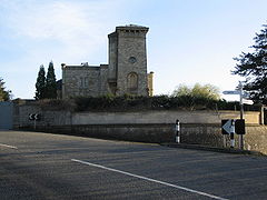
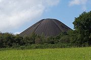
| alt=Large wheel on brick tower. | Radstock Radstock Radstock is a town in Somerset, England, south west of Bath, and north west of Frome. It is within the unitary authority of Bath and North East Somerset and had a population of 5,275 according to the 2001 Census... |
Town | Norton Radstock Town Council Norton Radstock Norton Radstock used to be a small conurbation and large civil parish in Bath and North East Somerset, England, south west of Bath, and the same distance north west of Frome. It had a population of 21,325 according to the 2001 census. The term Norton Radstock is not recognised by local residents,... |
51.29°N 2.4477°W | ||
| Saltford Saltford Saltford is a large village and civil parish in the Bath and North East Somerset unitary authority, Somerset, England. It lies between the cities of Bristol and Bath.... |
Civil parish | 4,153 | Keynsham Urban District Keynsham Keynsham is a town and civil parish between Bristol and Bath in Somerset, south-west England. It has a population of 15,533.It was listed in the Domesday Book as Cainesham, which is believed to mean the home of Saint Keyne.... |
51.40°N 2.46°W | ||
| Shoscombe Shoscombe Shoscombe is a small village and civil parish in the valley of the Wellow Brook in north-east Somerset, about south of Bath. The parish has a population of 462.... |
Civil parish | 462 | Bathavon Rural District Bathavon Rural District Bathavon was a rural district in Somerset, England, from 1933 to 1974.It was created in 1933 with the abolition of Bath Rural District and Keynsham Rural District.... |
51.30°N 2.41°W | ||
 |
Southstoke Southstoke Southstoke is a small village and civil parish in north east Somerset, England. In 2004 the parish council requested that the name be formally changed to South Stoke, as "this is historically the more established spelling and better reflects the origin and meaning of the Parish name."It is south... |
Civil parish | 440 | Bathavon Rural District Bathavon Rural District Bathavon was a rural district in Somerset, England, from 1933 to 1974.It was created in 1933 with the abolition of Bath Rural District and Keynsham Rural District.... |
51.35°N 2.36°W | |
 |
St Catherine St Catherine, Somerset St Catherine is a small village and civil parish in the Bath and North East Somerset unitary authority, Somerset, England. The parish has a population of 69.-History:St Catherine was part of the hundred of Bath Forum.-Governance:... |
Civil parish | 69 | Bathavon Rural District Bathavon Rural District Bathavon was a rural district in Somerset, England, from 1933 to 1974.It was created in 1933 with the abolition of Bath Rural District and Keynsham Rural District.... |
51.43°N 2.32°W | |
| Stanton Drew | Civil parish | 762 | Clutton Rural District Clutton Rural District Clutton was a rural district in Somerset, England, from 1894 to 1974.It was created in 1894 under the Local Government Act 1894 as a successor to the rural sanitary district.In 1974 it was abolished under the Local Government Act 1972... |
51.37°N 2.58°W | ||
 |
Stowey-Sutton | Civil parish | 1,222 | Clutton Rural District Clutton Rural District Clutton was a rural district in Somerset, England, from 1894 to 1974.It was created in 1894 under the Local Government Act 1894 as a successor to the rural sanitary district.In 1974 it was abolished under the Local Government Act 1972... |
51.34°N 2.59°W | |
| Swainswick Swainswick Swainswick is a small village and civil parish, north east of Bath, on the A46 in the Bath and North East Somerset unitary authority, Somerset, England. The parish has a population of 284... |
Civil parish | 284 | Bathavon Rural District Bathavon Rural District Bathavon was a rural district in Somerset, England, from 1933 to 1974.It was created in 1933 with the abolition of Bath Rural District and Keynsham Rural District.... |
51.41°N 2.35°W | ||
| Timsbury Timsbury, Somerset Timsbury is a village and civil parish in the Bath and North East Somerset unitary authority of the county of Somerset, south-west of Bath England... |
Civil parish | 2,581 | Clutton Rural District Clutton Rural District Clutton was a rural district in Somerset, England, from 1894 to 1974.It was created in 1894 under the Local Government Act 1894 as a successor to the rural sanitary district.In 1974 it was abolished under the Local Government Act 1972... |
51.33°N 2.48°W | ||
| Ubley Ubley Ubley is a small village and civil parish within the Chew Valley in Bath and North East Somerset about south of Bristol and from Bath. It is just south-east of Blagdon Lake on the A368 between Compton Martin and Blagdon.-History:... |
Civil parish | 335 | Clutton Rural District Clutton Rural District Clutton was a rural district in Somerset, England, from 1894 to 1974.It was created in 1894 under the Local Government Act 1894 as a successor to the rural sanitary district.In 1974 it was abolished under the Local Government Act 1972... |
51.32°N 2.68°W | ||
 |
Wellow Wellow, Somerset Wellow is a village and civil parish in Somerset, England, about south of Bath. The parish, which includes the hamlet of Twinhoe has a population of 511... |
Civil parish | 511 | Bathavon Rural District Bathavon Rural District Bathavon was a rural district in Somerset, England, from 1933 to 1974.It was created in 1933 with the abolition of Bath Rural District and Keynsham Rural District.... |
51.32°N 2.37°W | |
| 100px | Westfield Westfield, Somerset Westfield is a settlement lying on the Fosse Way between Radstock and Midsomer Norton in Somerset, England. In 2011 it was raised to the status of a civil parish.... |
Civil parish | Norton Radstock Town Council Norton Radstock Norton Radstock used to be a small conurbation and large civil parish in Bath and North East Somerset, England, south west of Bath, and the same distance north west of Frome. It had a population of 21,325 according to the 2001 census. The term Norton Radstock is not recognised by local residents,... |
51.29°N 2.448°W | ||
| West Harptree West Harptree West Harptree is a small village and civil parish within the Chew Valley, Somerset in the unitary district of Bath and North East Somerset. The parish has a population of 459.... |
Civil parish | 459 | Clutton Rural District Clutton Rural District Clutton was a rural district in Somerset, England, from 1894 to 1974.It was created in 1894 under the Local Government Act 1894 as a successor to the rural sanitary district.In 1974 it was abolished under the Local Government Act 1972... |
51.31°N 2.63°W | ||
 |
Whitchurch Whitchurch, Bristol Whitchurch is a village in north Somerset, England and an adjoining suburb of south eastern Bristol, bounded by Hartcliffe to the west and Hengrove and Knowle to the north. The suburb was initially developed during the 1930s.... |
Civil parish | 1,313 | Bathavon Rural District Bathavon Rural District Bathavon was a rural district in Somerset, England, from 1933 to 1974.It was created in 1933 with the abolition of Bath Rural District and Keynsham Rural District.... |
51.41°N 2.56°W |
Mendip
The whole of the district is parished.| Image | Name | Status | Population | Former local authority | Coordinates | Refs |
|---|---|---|---|---|---|---|
 |
Ashwick Ashwick Ashwick is a village in the Mendip district of Somerset, England, about three miles north of Shepton Mallet and seven miles east from Wells. It has also been a civil parish since 1826... |
Civil parish | 1,291 | Shepton Mallet Rural District Shepton Mallet Rural District Shepton Mallet was a rural district in Somerset, England, from 1894 to 1974.It was created in 1894 under the Local Government Act 1894.In 1974 it was abolished under the Local Government Act 1972 when it became part of the Mendip district.... |
51.23°N 2.52°W | |
 |
Baltonsborough Baltonsborough Baltonsborough is a village and civil parish in the Mendip district of Somerset, England. According to the 2001 census it had a population of 873. Apart from Baltonsborough village, the parish also contains the hamlets of Ham Street, Catsham and Southwood.... |
Civil parish | 873 | Wells Rural District Wells Rural District Wells was a rural district in Somerset, England, from 1894 to 1974.It was created in 1894 under the Local Government Act 1894.In 1974 it was abolished under the Local Government Act 1972 when it became part of Mendip district.... |
51.11°N 2.64°W | |
| Batcombe Batcombe, Somerset Batcombe is a village and civil parish in the Mendip District of Somerset, England, situated in the steep valley of the River Alham five miles south-east of Shepton Mallet. The parish has a population of 379... |
Civil parish | 379 | Shepton Mallet Rural District Shepton Mallet Rural District Shepton Mallet was a rural district in Somerset, England, from 1894 to 1974.It was created in 1894 under the Local Government Act 1894.In 1974 it was abolished under the Local Government Act 1972 when it became part of the Mendip district.... |
51.15°N 2.44°W | ||
| Beckington Beckington Beckington is a village and civil parish in the Mendip district of Somerset, England, across the River Frome from Lullington about three miles north of Frome... |
Civil parish | 956 | Frome Rural District Frome Rural District Frome was a rural district in Somerset, England, from 1894 to 1974.It was created in 1894 under the Local Government Act 1894.In 1974 it was abolished under the Local Government Act 1972 when it became part of Mendip.... |
51.26°N 2.28°W | ||
 |
Berkley Berkley, Somerset Berkley is a village and civil parish in the Mendip district of Somerset, England. According to the 2001 census it had a population of 361. The village is north-east of Frome.-Governance:... |
Civil parish | 361 | Frome Rural District Frome Rural District Frome was a rural district in Somerset, England, from 1894 to 1974.It was created in 1894 under the Local Government Act 1894.In 1974 it was abolished under the Local Government Act 1972 when it became part of Mendip.... |
51.24°N 2.27°W | |
 |
Binegar Binegar Binegar is a small village and civil parish in Somerset, England. It is located on the A37, east of Wells, between Shepton Mallet and Chilcompton. Its population in 2001 was 328.-History:... |
Civil parish | 328 | Shepton Mallet Rural District Shepton Mallet Rural District Shepton Mallet was a rural district in Somerset, England, from 1894 to 1974.It was created in 1894 under the Local Government Act 1894.In 1974 it was abolished under the Local Government Act 1972 when it became part of the Mendip district.... |
51.24°N 2.55°W | |
 |
Buckland Dinham Buckland Dinham Buckland Dinham is a small village near Frome in Somerset, England. The village has a population of 379. The village's main industry is farming , but the village is also a dormitory village for the nearby cities of Bath and Bristol.-History:... |
Civil parish | 379 | Frome Rural District Frome Rural District Frome was a rural district in Somerset, England, from 1894 to 1974.It was created in 1894 under the Local Government Act 1894.In 1974 it was abolished under the Local Government Act 1972 when it became part of Mendip.... |
51.26°N 2.35°W | |
 |
Butleigh Butleigh Butleigh is a small village and civil parish, located in Somerset. The nearest village to it is Barton St David, and it is located a short distance from Glastonbury and Street... |
Civil parish | 870 | Wells Rural District Wells Rural District Wells was a rural district in Somerset, England, from 1894 to 1974.It was created in 1894 under the Local Government Act 1894.In 1974 it was abolished under the Local Government Act 1972 when it became part of Mendip district.... |
51.09°N 2.68°W | |
| Chewton Mendip Chewton Mendip Chewton Mendip is a village and civil parish in the Mendip District of Somerset, England. It is situated north of Wells, south of Bristol on the Mendip Hills and is the source of the River Chew. The parish includes the hamlet of Bathway.- History :... |
Civil parish | 518 | Wells Rural District Wells Rural District Wells was a rural district in Somerset, England, from 1894 to 1974.It was created in 1894 under the Local Government Act 1894.In 1974 it was abolished under the Local Government Act 1972 when it became part of Mendip district.... |
51.28°N 2.58°W | ||
 |
Chilcompton Chilcompton Chilcompton is a civil parish and village in Somerset, England, situated in the Mendip Hills two miles south of Midsomer Norton and 2.5 miles south-west of Westfield, close to the A37 .-History:... |
Civil parish | 2,029 | Clutton Rural District Clutton Rural District Clutton was a rural district in Somerset, England, from 1894 to 1974.It was created in 1894 under the Local Government Act 1894 as a successor to the rural sanitary district.In 1974 it was abolished under the Local Government Act 1972... |
51.27°N 2.50°W | |
 |
Coleford Coleford, Somerset Coleford is a village and civil parish in Somerset, England, situated on the Mells River in the Mendip Hills five miles west of Frome. The village has a population of 2,350.-History:... |
Civil parish | 2,350 | Frome Rural District Frome Rural District Frome was a rural district in Somerset, England, from 1894 to 1974.It was created in 1894 under the Local Government Act 1894.In 1974 it was abolished under the Local Government Act 1972 when it became part of Mendip.... |
51.24°N 2.45°W | |
 |
Cranmore Cranmore, Somerset Cranmore is a village and civil parish east of Shepton Mallet, in the Mendip district of Somerset, England. The parish includes the hamlets of Waterlip, East Cranmore and Dean where Dean farmhouse dates from the 17th century, as does The Old Smithy, just off the A361 which was originally two... |
Civil parish | 520 | Shepton Mallet Rural District Shepton Mallet Rural District Shepton Mallet was a rural district in Somerset, England, from 1894 to 1974.It was created in 1894 under the Local Government Act 1894.In 1974 it was abolished under the Local Government Act 1972 when it became part of the Mendip district.... |
51.19°N 2.48°W | |
 |
Croscombe Croscombe Croscombe is a village and civil parish west of Shepton Mallet and from Wells, in the Mendip district of Somerset, England. It is situated on the A371 road in the valley of the River Sheppey.... |
Civil parish | 606 | Shepton Mallet Rural District Shepton Mallet Rural District Shepton Mallet was a rural district in Somerset, England, from 1894 to 1974.It was created in 1894 under the Local Government Act 1894.In 1974 it was abolished under the Local Government Act 1972 when it became part of the Mendip district.... |
51.20°N 2.58°W | |
 |
Ditcheat Ditcheat Ditcheat is a village and civil parish south of Shepton Mallet, and north-west of Castle Cary, in the Mendip district of Somerset, England. The parish of Ditcheat incorporates three hamlets: Wraxall, Alhampton and Sutton.-History:... |
Civil parish | 752 | Shepton Mallet Rural District Shepton Mallet Rural District Shepton Mallet was a rural district in Somerset, England, from 1894 to 1974.It was created in 1894 under the Local Government Act 1894.In 1974 it was abolished under the Local Government Act 1972 when it became part of the Mendip district.... |
51.13°N 2.54°W | |
 |
Doulting Doulting Doulting is a village and civil parish east of Shepton Mallet, on the A361, in the Mendip district of Somerset, England.-History:The parish of Doulting was part of the Whitstone Hundred.... |
Civil parish | 603 | Shepton Mallet Rural District Shepton Mallet Rural District Shepton Mallet was a rural district in Somerset, England, from 1894 to 1974.It was created in 1894 under the Local Government Act 1894.In 1974 it was abolished under the Local Government Act 1972 when it became part of the Mendip district.... |
51.19°N 2.51°W | |
 |
Downhead Downhead Downhead is a village and civil parish close to Leigh-on-Mendip and north east of Shepton Mallet, in the Mendip district of Somerset, England. The parish includes the medieval settlement of Tadhill.-History:... |
Civil parish | 88 | Shepton Mallet Rural District Shepton Mallet Rural District Shepton Mallet was a rural district in Somerset, England, from 1894 to 1974.It was created in 1894 under the Local Government Act 1894.In 1974 it was abolished under the Local Government Act 1972 when it became part of the Mendip district.... |
51.21°N 2.44°W | |
 |
East Pennard East Pennard East Pennard is a village and civil parish north west of Castle Cary, and south of Shepton Mallet, in the Mendip district of Somerset, England. It has a population of 343... |
Civil parish | 343 | Shepton Mallet Rural District Shepton Mallet Rural District Shepton Mallet was a rural district in Somerset, England, from 1894 to 1974.It was created in 1894 under the Local Government Act 1894.In 1974 it was abolished under the Local Government Act 1972 when it became part of the Mendip district.... |
51.14°N 2.62°W | |
| Emborough Emborough Emborough is a village and civil parish north of Shepton Mallet, and north east of Wells, in the Mendip district of Somerset, England. It adjoins the parish of Ston Easton.-History:The name Emborough means smooth hill.... |
Civil parish | 127 | Shepton Mallet Rural District Shepton Mallet Rural District Shepton Mallet was a rural district in Somerset, England, from 1894 to 1974.It was created in 1894 under the Local Government Act 1894.In 1974 it was abolished under the Local Government Act 1972 when it became part of the Mendip district.... |
51.26°N 2.55°W | ||
| Evercreech Evercreech Evercreech is a village and civil parish south east of Shepton Mallet, and north east of Castle Cary, in the Mendip district of Somerset, England... |
Civil parish | 2,211 | Shepton Mallet Rural District Shepton Mallet Rural District Shepton Mallet was a rural district in Somerset, England, from 1894 to 1974.It was created in 1894 under the Local Government Act 1894.In 1974 it was abolished under the Local Government Act 1972 when it became part of the Mendip district.... |
51.14°N 2.51°W | ||
 |
Frome Frome Frome is a town and civil parish in northeast Somerset, England. Located at the eastern end of the Mendip Hills, the town is built on uneven high ground, and centres around the River Frome. The town is approximately south of Bath, east of the county town, Taunton and west of London. In the 2001... |
Town | 24,510 | Frome Rural District Frome Rural District Frome was a rural district in Somerset, England, from 1894 to 1974.It was created in 1894 under the Local Government Act 1894.In 1974 it was abolished under the Local Government Act 1972 when it became part of Mendip.... Frome Urban District Frome Frome is a town and civil parish in northeast Somerset, England. Located at the eastern end of the Mendip Hills, the town is built on uneven high ground, and centres around the River Frome. The town is approximately south of Bath, east of the county town, Taunton and west of London. In the 2001... |
51.23°N 2.32°W | |
 |
Glastonbury Glastonbury Glastonbury is a small town in Somerset, England, situated at a dry point on the low lying Somerset Levels, south of Bristol. The town, which is in the Mendip district, had a population of 8,784 in the 2001 census... |
Town | 8,784 | Glastonbury Municipal Borough Glastonbury Glastonbury is a small town in Somerset, England, situated at a dry point on the low lying Somerset Levels, south of Bristol. The town, which is in the Mendip district, had a population of 8,784 in the 2001 census... |
51.15°N 2.71°W | |
 |
Godney Godney Godney is a village and civil parish near Glastonbury on the River Sheppey on the Somerset Levels in the Mendip district of Somerset, England.-Governance:... |
Civil parish | 219 | Wells Rural District Wells Rural District Wells was a rural district in Somerset, England, from 1894 to 1974.It was created in 1894 under the Local Government Act 1894.In 1974 it was abolished under the Local Government Act 1972 when it became part of Mendip district.... |
51.18°N 2.74°W | |
 |
Great Elm Great Elm Great Elm is a village and civil parish between Mells and Frome in the Mendip district of Somerset, England. The parish includes the hamlet of Hapsford.-History:... |
Civil parish | 132 | Frome Rural District Frome Rural District Frome was a rural district in Somerset, England, from 1894 to 1974.It was created in 1894 under the Local Government Act 1894.In 1974 it was abolished under the Local Government Act 1972 when it became part of Mendip.... |
51.24°N 2.36°W | |
 |
Hemington Hemington, Somerset Hemington is a village and civil parish north west of Frome, in the Mendip district of Somerset, England. The parish includes the villages of Hardington, Faulkland and Foxcote.-History:... |
Civil parish | 643 | Frome Rural District Frome Rural District Frome was a rural district in Somerset, England, from 1894 to 1974.It was created in 1894 under the Local Government Act 1894.In 1974 it was abolished under the Local Government Act 1972 when it became part of Mendip.... |
51.28°N 2.39°W | |
| Holcombe Holcombe, Somerset Holcombe is a small village and civil parish in the Mendip local government district of Somerset, England. The parish contains the hamlets of Barlake and Edford... |
Civil parish | 936 | Shepton Mallet Rural District Shepton Mallet Rural District Shepton Mallet was a rural district in Somerset, England, from 1894 to 1974.It was created in 1894 under the Local Government Act 1894.In 1974 it was abolished under the Local Government Act 1972 when it became part of the Mendip district.... |
51.24°N 2.46°W | ||
| Kilmersdon Kilmersdon Kilmersdon is a small village located in the north of Somerset between the towns of Radstock and Frome. The settlement is recorded in William I's Domesday book and dates back at least 1,000 years; though the core of the village dates from the mid nineteenth century.-History:The name Kilmersdon... |
Civil parish | 505 | Frome Rural District Frome Rural District Frome was a rural district in Somerset, England, from 1894 to 1974.It was created in 1894 under the Local Government Act 1894.In 1974 it was abolished under the Local Government Act 1972 when it became part of Mendip.... |
51.27°N 2.44°W | ||
 |
Lamyat Lamyat Lamyat is a civil parish in the Mendip District of Somerset, England. It lies south east of Shepton Mallet, north east of Castle Cary, and south of Evercreech, and is centered on the village of Lamyatt... |
Civil parish | 173 | Shepton Mallet Rural District Shepton Mallet Rural District Shepton Mallet was a rural district in Somerset, England, from 1894 to 1974.It was created in 1894 under the Local Government Act 1894.In 1974 it was abolished under the Local Government Act 1972 when it became part of the Mendip district.... |
51.12°N 2.49°W | |
| Leigh on Mendip Leigh-on-Mendip Leigh-on-Mendip or Leigh upon Mendip is a small village on the Mendip Hills in Somerset, England. It lies roughly equidistant from Frome, Radstock and Shepton Mallet at about from each town.... |
Civil parish | 501 | Frome Rural District Frome Rural District Frome was a rural district in Somerset, England, from 1894 to 1974.It was created in 1894 under the Local Government Act 1894.In 1974 it was abolished under the Local Government Act 1972 when it became part of Mendip.... |
51.23°N 2.44°W | ||
| Litton Litton, Somerset Litton is a small village and civil parish between Chewton Mendip and West Harptree in the Mendip Hills, Somerset, England. The parish includes the hamlet of Sherborne. Very close to the village are the Litton Reservoirs.- History :... |
Civil parish | 230 | Clutton Rural District Clutton Rural District Clutton was a rural district in Somerset, England, from 1894 to 1974.It was created in 1894 under the Local Government Act 1894 as a successor to the rural sanitary district.In 1974 it was abolished under the Local Government Act 1972... |
51.29°N 2.58°W | ||
| Lullington Lullington, Somerset Lullington is a village and civil parish just across the Mells River from Beckington and north east of Frome, in the Mendip district of Somerset, England.The parish includes the hamlet of Laverton, where the Church of St... |
Civil parish | 147 | Frome Rural District Frome Rural District Frome was a rural district in Somerset, England, from 1894 to 1974.It was created in 1894 under the Local Government Act 1894.In 1974 it was abolished under the Local Government Act 1972 when it became part of Mendip.... |
51.26°N 2.31°W | ||
| Lydford on Fosse Lydford-on-Fosse Lydford-on-Fosse is a village and civil parish in the Mendip district of Somerset, England. The parish includes the hamlet of East Lydford.-History:... |
Civil parish | 461 | Shepton Mallet Rural District Shepton Mallet Rural District Shepton Mallet was a rural district in Somerset, England, from 1894 to 1974.It was created in 1894 under the Local Government Act 1894.In 1974 it was abolished under the Local Government Act 1972 when it became part of the Mendip district.... |
51.07°N 2.62°W | ||
 |
Meare Meare Meare is a village and civil parish north west of Glastonbury on the Somerset Levels, in the Mendip district of Somerset, England. The parish includes the village of Westhay.-History:... |
Civil parish | 1,238 | Wells Rural District Wells Rural District Wells was a rural district in Somerset, England, from 1894 to 1974.It was created in 1894 under the Local Government Act 1894.In 1974 it was abolished under the Local Government Act 1972 when it became part of Mendip district.... |
51.17°N 2.77°W | |
 |
Mells Mells, Somerset Mells is a village and civil parish in Somerset, England, near the town of Frome.The parish includes the village of Vobster which had a coal mine of the same name on the Somerset coalfield and quarry, both of which are now disused. The old quarry is now used as a diving centre... |
Civil parish | 647 | Frome Rural District Frome Rural District Frome was a rural district in Somerset, England, from 1894 to 1974.It was created in 1894 under the Local Government Act 1894.In 1974 it was abolished under the Local Government Act 1972 when it became part of Mendip.... |
51.24°N 2.39°W | |
| Milton Clevedon Milton Clevedon Milton Clevedon is a village and civil parish south of Evercreech in the Mendip district of Somerset, England.-History:The name of the village means the middle settlement, possibly because it is half way between Evercreech and Bruton.... |
Civil parish | 89 | Shepton Mallet Rural District Shepton Mallet Rural District Shepton Mallet was a rural district in Somerset, England, from 1894 to 1974.It was created in 1894 under the Local Government Act 1894.In 1974 it was abolished under the Local Government Act 1972 when it became part of the Mendip district.... |
51.14°N 2.48°W | ||
| North Wootton North Wootton, Somerset North Wootton is a village and civil parish, on the River Redlake, south east of Wells, and south west of Shepton Mallet in the Mendip district of Somerset, England.The village is on the Monarch's Way long-distance footpath.-History:... |
Civil parish | 276 | Wells Rural District Wells Rural District Wells was a rural district in Somerset, England, from 1894 to 1974.It was created in 1894 under the Local Government Act 1894.In 1974 it was abolished under the Local Government Act 1972 when it became part of Mendip district.... |
51.17°N 2.62°W | ||
 |
Norton St Philip Norton St Philip Norton St Philip is a village in Somerset, England, located between the City of Bath and the town of Frome. The village is in the district of Mendip, and the parliamentary constituency of Somerton and Frome.... |
Civil Parish | 848 | Frome Rural District Frome Rural District Frome was a rural district in Somerset, England, from 1894 to 1974.It was created in 1894 under the Local Government Act 1894.In 1974 it was abolished under the Local Government Act 1972 when it became part of Mendip.... |
51.29°N 2.32°W | |
 |
Nunney Nunney Nunney is a village and civil parish near Frome in the Mendip local government district within the English county of Somerset. The parish includes the hamlet of Holwell.The name of the village comes from Old English and means Nunna's island.... |
Civil parish | 910 | Frome Rural District Frome Rural District Frome was a rural district in Somerset, England, from 1894 to 1974.It was created in 1894 under the Local Government Act 1894.In 1974 it was abolished under the Local Government Act 1972 when it became part of Mendip.... |
51.21°N 2.38°W | |
 |
Pilton Pilton, Somerset Pilton is a village and civil parish in Somerset, England, situated on the A361 road in the Mendip district, 3 miles south-west of Shepton Mallet and 6 miles east of Glastonbury. The village has a population of 935... |
Civil parish | 935 | Shepton Mallet Rural District Shepton Mallet Rural District Shepton Mallet was a rural district in Somerset, England, from 1894 to 1974.It was created in 1894 under the Local Government Act 1894.In 1974 it was abolished under the Local Government Act 1972 when it became part of the Mendip district.... |
51.17°N 2.59°W | |
 |
Priddy Priddy Priddy is a village in Somerset, England in the Mendip Hills, close to East Harptree and north-west of Wells. It is in the local government district of Mendip.... |
Civil parish | 598 | Wells Rural District Wells Rural District Wells was a rural district in Somerset, England, from 1894 to 1974.It was created in 1894 under the Local Government Act 1894.In 1974 it was abolished under the Local Government Act 1972 when it became part of Mendip district.... |
51.25°N 2.68°W | |
 |
Pylle Pylle Pylle is a village and civil parish south west of Shepton Mallet, and from Wells, in the Mendip district of Somerset, England. It has a population of 176... |
Civil parish | 176 | Shepton Mallet Rural District Shepton Mallet Rural District Shepton Mallet was a rural district in Somerset, England, from 1894 to 1974.It was created in 1894 under the Local Government Act 1894.In 1974 it was abolished under the Local Government Act 1972 when it became part of the Mendip district.... |
51.14°N 2.56°W | |
| Rode | Civil parish | 828 | Frome Rural District Frome Rural District Frome was a rural district in Somerset, England, from 1894 to 1974.It was created in 1894 under the Local Government Act 1894.In 1974 it was abolished under the Local Government Act 1972 when it became part of Mendip.... |
51.28°N 2.2°W | ||
 |
Rodney Stoke Rodney Stoke Rodney Stoke is a small village and civil parish, located at , 5 miles north-west of Wells, in the English county of Somerset. The village is on the A371 between Draycott and Westbury-sub-Mendip.... |
Civil parish | 1,260 | Wells Rural District Wells Rural District Wells was a rural district in Somerset, England, from 1894 to 1974.It was created in 1894 under the Local Government Act 1894.In 1974 it was abolished under the Local Government Act 1972 when it became part of Mendip district.... |
51.25°N 2.74°W | |
| – | Selwood Selwood, Somerset Selwood used to be a village but is now part of the suburbs of Frome. It is a civil parish in the Mendip district of Somerset, England. The parish includes the villages of East and West Woodlands, Rodden and the hamlet of Alder Row.-History:... |
Civil parish | 788 | Frome Rural District Frome Rural District Frome was a rural district in Somerset, England, from 1894 to 1974.It was created in 1894 under the Local Government Act 1894.In 1974 it was abolished under the Local Government Act 1972 when it became part of Mendip.... |
51.24°N 2.31°W | |
| Sharpham Sharpham Sharpham is a village and civil parish on the Somerset Levels near Street and Glastonbury in the Mendip district of Somerset, England.It is located near the River Brue.-Governance:... |
Civil parish | 71 | Wells Rural District Wells Rural District Wells was a rural district in Somerset, England, from 1894 to 1974.It was created in 1894 under the Local Government Act 1894.In 1974 it was abolished under the Local Government Act 1972 when it became part of Mendip district.... |
51.14°N 2.77°W | ||
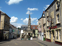 |
Shepton Mallet Shepton Mallet Shepton Mallet is a small rural town and civil parish in the Mendip district of Somerset in South West England. Situated approximately south of Bristol and east of Wells, the town is estimated to have a population of 9,700. It contains the administrative headquarters of Mendip District Council... |
Town | 8,981 | Shepton Mallet Urban District Shepton Mallet Shepton Mallet is a small rural town and civil parish in the Mendip district of Somerset in South West England. Situated approximately south of Bristol and east of Wells, the town is estimated to have a population of 9,700. It contains the administrative headquarters of Mendip District Council... |
51.19°N 2.55°W | |
| St Cuthbert Out St Cuthbert Out St Cuthbert Out, sometimes Wells St Cuthbert Out is a civil parish in the Mendip district of Somerset, England. It entirely surrounds the city and parish of Wells. According to the 2001 census it had a population of 3,459. The parish is crossed by the Monarch's Way long distance footpath.The... |
Civil parish | 3,459 | Wells Rural District Wells Rural District Wells was a rural district in Somerset, England, from 1894 to 1974.It was created in 1894 under the Local Government Act 1894.In 1974 it was abolished under the Local Government Act 1972 when it became part of Mendip district.... |
51.18°N 2.69°W | ||
| Stoke St Michael Stoke St Michael Stoke St Michael is a village and civil parish on the Mendip Hills north east of Shepton Mallet, and west of Frome, in the Mendip district of Somerset, England.-History:... |
Civil parish | 912 | Shepton Mallet Rural District Shepton Mallet Rural District Shepton Mallet was a rural district in Somerset, England, from 1894 to 1974.It was created in 1894 under the Local Government Act 1894.In 1974 it was abolished under the Local Government Act 1972 when it became part of the Mendip district.... |
51.22°N 2.48°W | ||
| Ston Easton Ston Easton Ston Easton is a linear village and civil parish in the English county of Somerset. It is southwest of Bath and north of Shepton Mallet. It forms part of the Mendip district and lies along the A37 road south of the cities of Bristol and Bath and to the west of the town of Midsomer Norton... |
Civil parish | 539 | Clutton Rural District Clutton Rural District Clutton was a rural district in Somerset, England, from 1894 to 1974.It was created in 1894 under the Local Government Act 1894 as a successor to the rural sanitary district.In 1974 it was abolished under the Local Government Act 1972... |
51.28°N 2.54°W | ||
 |
Stratton on the Fosse | Civil parish | 1,045 | Shepton Mallet Rural District Shepton Mallet Rural District Shepton Mallet was a rural district in Somerset, England, from 1894 to 1974.It was created in 1894 under the Local Government Act 1894.In 1974 it was abolished under the Local Government Act 1972 when it became part of the Mendip district.... |
51.25°N 2.49°W | |
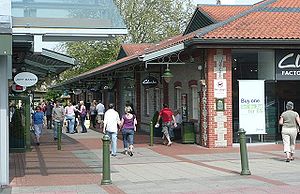 |
Street Street, Somerset Street is a small village and civil parish in the county of Somerset, England. It is situated on a dry spot in the Somerset Levels, at the end of the Polden Hills, south-west of Glastonbury. The 2001 census records the village as having a population of 11,066... |
Civil parish | 11,066 | Street Urban District Street, Somerset Street is a small village and civil parish in the county of Somerset, England. It is situated on a dry spot in the Somerset Levels, at the end of the Polden Hills, south-west of Glastonbury. The 2001 census records the village as having a population of 11,066... |
51.12°N 2.74°W | |
| Tellisford Tellisford Tellisford is a village and civil parish north-east of Frome in the Mendip district of Somerset, England. The parish includes the village of Woolverton.-History:... |
Civil parish | 165 | Frome Rural District Frome Rural District Frome was a rural district in Somerset, England, from 1894 to 1974.It was created in 1894 under the Local Government Act 1894.In 1974 it was abolished under the Local Government Act 1972 when it became part of Mendip.... |
51.29°N 2.28°W | ||
| Trudoxhill Trudoxhill Trudoxhill is a village and civil parish near Nunney in the Mendip district of Somerset, England.-History:The name Trudoxhill comes from the Old English treow meaning tree, dox for dark and hyll for hill.... |
Civil parish | 383 | Frome Rural District Frome Rural District Frome was a rural district in Somerset, England, from 1894 to 1974.It was created in 1894 under the Local Government Act 1894.In 1974 it was abolished under the Local Government Act 1972 when it became part of Mendip.... |
51.19°N 2.37°W | ||
| Upton Noble Upton Noble Upton Noble is a village and civil parish on the River Frome. It is roughly north-east of Bruton, and from Frome town centre, in the Mendip district of Somerset, England.... |
Civil parish | 123 | Frome Rural District Frome Rural District Frome was a rural district in Somerset, England, from 1894 to 1974.It was created in 1894 under the Local Government Act 1894.In 1974 it was abolished under the Local Government Act 1972 when it became part of Mendip.... |
51.15°N 2.41°W | ||
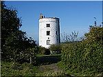 |
Walton Walton, Somerset Walton is a village and civil parish, on the Polden Hills, south west of Glastonbury in the Mendip district of Somerset, England. The parish includes the hamlet of Asney.-History:... |
Civil parish | 1,170 | Wells Rural District Wells Rural District Wells was a rural district in Somerset, England, from 1894 to 1974.It was created in 1894 under the Local Government Act 1894.In 1974 it was abolished under the Local Government Act 1972 when it became part of Mendip district.... |
51.14°N 2.77°W | |
| Wanstrow Wanstrow Wanstrow is a village and civil parish south west of Frome in the Mendip district of Somerset, England. The parish includes the village of Cloford.-History:The name of the village comes from the Old English and means Waendel's tree.... |
Civil parish | 446 | Frome Rural District Frome Rural District Frome was a rural district in Somerset, England, from 1894 to 1974.It was created in 1894 under the Local Government Act 1894.In 1974 it was abolished under the Local Government Act 1972 when it became part of Mendip.... |
51.17°N 2.41°W | ||
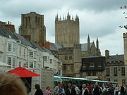 |
Wells Wells Wells is a cathedral city and civil parish in the Mendip district of Somerset, England, on the southern edge of the Mendip Hills. Although the population recorded in the 2001 census is 10,406, it has had city status since 1205... |
City | 10,406 | Wells Municipal Borough Wells Wells is a cathedral city and civil parish in the Mendip district of Somerset, England, on the southern edge of the Mendip Hills. Although the population recorded in the 2001 census is 10,406, it has had city status since 1205... |
51.21°N 2.65°W | |
 |
West Bradley West Bradley West Bradley is a village and civil parish 4 miles south-east of Glastonbury in the Mendip district of Somerset, England. The parish includes the hamlets of Hornblotton and Lottisham.... |
Civil parish | 285 | Shepton Mallet Rural District Shepton Mallet Rural District Shepton Mallet was a rural district in Somerset, England, from 1894 to 1974.It was created in 1894 under the Local Government Act 1894.In 1974 it was abolished under the Local Government Act 1972 when it became part of the Mendip district.... |
51.13°N 2.64°W | |
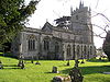 |
West Pennard West Pennard West Pennard is a village and civil parish east of Glastonbury in the Mendip district of Somerset, England. The parish includes the hamlets of Coxbridge and Woodlands.-History:... |
Civil parish | 662 | Wells Rural District Wells Rural District Wells was a rural district in Somerset, England, from 1894 to 1974.It was created in 1894 under the Local Government Act 1894.In 1974 it was abolished under the Local Government Act 1972 when it became part of Mendip district.... |
51.14°N 2.65°W | |
| Westbury | Civil parish | 806 | Wells Rural District Wells Rural District Wells was a rural district in Somerset, England, from 1894 to 1974.It was created in 1894 under the Local Government Act 1894.In 1974 it was abolished under the Local Government Act 1972 when it became part of Mendip district.... |
51.24°N 2.71°W | ||
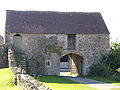 |
Whatley | Civil parish | 272 | Frome Rural District Frome Rural District Frome was a rural district in Somerset, England, from 1894 to 1974.It was created in 1894 under the Local Government Act 1894.In 1974 it was abolished under the Local Government Act 1972 when it became part of Mendip.... |
51.23°N 2.38°W | |
 |
Witham Friary Witham Friary Witham Friary is a small village and civil parish located between the Somerset towns of Frome and Bruton. It is in the Cranborne Chase and West Wiltshire Downs Area of Outstanding Natural Beauty and the ancient Forest of Selwood.- History :... |
Civil parish | 411 | Frome Rural District Frome Rural District Frome was a rural district in Somerset, England, from 1894 to 1974.It was created in 1894 under the Local Government Act 1894.In 1974 it was abolished under the Local Government Act 1972 when it became part of Mendip.... |
51.17°N 2.37°W | |
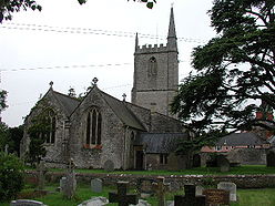 |
Wookey Wookey Wookey is a village and civil parish west of Wells, on the River Axe in the Mendip district of Somerset, England. Wookey is often confused with its sister village Wookey Hole which is perhaps best known today for the Wookey Hole Caves... |
Civil parish | 1,249 | Wells Rural District Wells Rural District Wells was a rural district in Somerset, England, from 1894 to 1974.It was created in 1894 under the Local Government Act 1894.In 1974 it was abolished under the Local Government Act 1972 when it became part of Mendip district.... |
51.21°N 2.69°W |
North Somerset
The whole of the district is parished.| Image | Name | Status | Population | Former local authority | Coordinates | Refs |
|---|---|---|---|---|---|---|
 |
Abbots Leigh Abbots Leigh Abbots Leigh is a village and civil parish in Somerset, England, about west of the centre of Bristol.-History:The original Middle English name was Lega and the village became Abbots Leigh in the mid 12th century when Robert Fitzharding , who acquired the village as Lord of the Manor, gave the... |
Civil parish | 810 | Long Ashton Rural District Long Ashton Rural District Long Ashton was a rural district in Somerset, England, from 1894 to 1974.It was created in 1894 under the Local Government Act 1894.In 1974 it was abolished under the Local Government Act 1972 to become part of North Somerset.... |
51.46°N 2.65°W | |
 |
Backwell Backwell Backwell is a suburban village and civil parish in Somerset, England. It falls within the Unitary Authority of North Somerset and has a population of 5,455.It is south west of Bristol, on the A370 to Weston-super-Mare... |
Civil parish | 5,455 | Long Ashton Rural District Long Ashton Rural District Long Ashton was a rural district in Somerset, England, from 1894 to 1974.It was created in 1894 under the Local Government Act 1894.In 1974 it was abolished under the Local Government Act 1972 to become part of North Somerset.... |
51.41°N 2.73°W | |
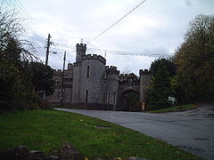 |
Banwell Banwell Banwell is a village and civil parish on the River Banwell in the North Somerset district of Somerset, England. Its population was 2,923 according to the 2001 census.-History:... |
Civil parish | 2,923 | Axbridge Rural District Axbridge Rural District Axbridge was a rural district in Somerset, England, from 1894 to 1974. It was named after the town of Axbridge.It was created in 1894 under the Local Government Act 1894 as a successor to the Axbridge rural sanitary district.... |
51.32°N 2.86°W | |
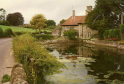 |
Barrow Gurney Barrow Gurney Barrow Gurney is a village and civil parish in Somerset, England, situated in the Unitary Authority of North Somerset on the B3130, midway between the A38 and A370 near the Long Ashton bypass and Bristol Airport, south west of Bristol city centre... |
Civil parish | 374 | Long Ashton Rural District Long Ashton Rural District Long Ashton was a rural district in Somerset, England, from 1894 to 1974.It was created in 1894 under the Local Government Act 1894.In 1974 it was abolished under the Local Government Act 1972 to become part of North Somerset.... |
51.40°N 2.67°W | |
| Blagdon Blagdon Blagdon is a village and civil parish in the ceremonial county of Somerset, within the unitary authority of North Somerset, in England. It is located in the Mendip Hills, a recognised Area of Outstanding Natural Beauty. According to the 2001 census it has a population of 1,172... |
Civil parish | 1,172 | Axbridge Rural District Axbridge Rural District Axbridge was a rural district in Somerset, England, from 1894 to 1974. It was named after the town of Axbridge.It was created in 1894 under the Local Government Act 1894 as a successor to the Axbridge rural sanitary district.... |
51.33°N 2.72°W | ||
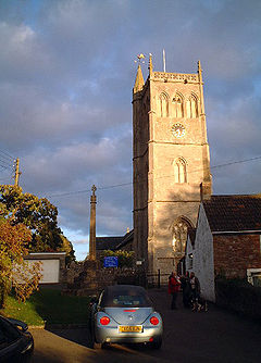 |
Bleadon Bleadon Bleadon is a village and civil parish in the historic countyof Somerset, England. It is about south of Weston-super-Mare and, according to the 2001 census, has a population of 1,068.-History:... |
Civil parish | 1,068 | Axbridge Rural District Axbridge Rural District Axbridge was a rural district in Somerset, England, from 1894 to 1974. It was named after the town of Axbridge.It was created in 1894 under the Local Government Act 1894 as a successor to the Axbridge rural sanitary district.... |
51.31°N 2.94°W | |
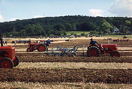 |
Brockley Brockley, Somerset Brockley is a village and civil parish in Somerset, England. The parish is within the Unitary authority of North Somerset, about south of Nailsea, and includes the village of Chelvey. According to the 2001 census it had a population of 271.-History:... |
Civil parish | 271 | Long Ashton Rural District Long Ashton Rural District Long Ashton was a rural district in Somerset, England, from 1894 to 1974.It was created in 1894 under the Local Government Act 1894.In 1974 it was abolished under the Local Government Act 1972 to become part of North Somerset.... |
51.39°N 2.76°W | |
| Burrington Burrington, Somerset Burrington is a small village and civil parish in Somerset, England. It is situated in the Unitary authority of North Somerset, north east of Axbridge and about east of Weston-super-Mare... |
Civil parish | 477 | Axbridge Rural District Axbridge Rural District Axbridge was a rural district in Somerset, England, from 1894 to 1974. It was named after the town of Axbridge.It was created in 1894 under the Local Government Act 1894 as a successor to the Axbridge rural sanitary district.... |
51.33°N 2.74°W | ||
 |
Butcombe Butcombe Butcombe is a village and civil parish in Somerset, England. The village is situated just north of Blagdon Lake, in North Somerset. The parish has a population of 232 and mainly consists of family-owned farmland... |
Civil parish | 232 | Axbridge Rural District Axbridge Rural District Axbridge was a rural district in Somerset, England, from 1894 to 1974. It was named after the town of Axbridge.It was created in 1894 under the Local Government Act 1894 as a successor to the Axbridge rural sanitary district.... |
51.35°N 2.69°W | |
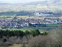 |
Churchill Churchill, Somerset Churchill is a village and civil parish in Somerset, England. It is located in the unitary authority of North Somerset, on the western edge of the Mendip Hills about east of Weston-super-Mare... |
Civil parish | 2,241 | Axbridge Rural District Axbridge Rural District Axbridge was a rural district in Somerset, England, from 1894 to 1974. It was named after the town of Axbridge.It was created in 1894 under the Local Government Act 1894 as a successor to the Axbridge rural sanitary district.... |
51.33°N 2.79°W | |
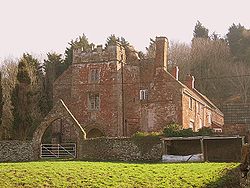 |
Clapton in Gordano | Civil parish | 347 | Long Ashton Rural District Long Ashton Rural District Long Ashton was a rural district in Somerset, England, from 1894 to 1974.It was created in 1894 under the Local Government Act 1894.In 1974 it was abolished under the Local Government Act 1972 to become part of North Somerset.... |
51.46°N 2.75°W | |
 |
Cleeve Cleeve, Somerset Cleeve is a village and civil parish in the ceremonial county of Somerset, England. It is situated within the unitary authority of North Somerset, south west of Bristol and has a population of 941 .-History:... |
Civil parish | 941 | Long Ashton Rural District Long Ashton Rural District Long Ashton was a rural district in Somerset, England, from 1894 to 1974.It was created in 1894 under the Local Government Act 1894.In 1974 it was abolished under the Local Government Act 1972 to become part of North Somerset.... |
51.39°N 2.77°W | |
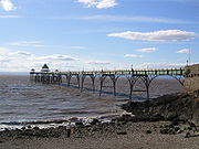 |
Clevedon Clevedon Clevedon is a town and civil parish in the unitary authority of North Somerset, which covers part of the ceremonial county of Somerset, England... |
Town | 21,957 | Clevedon Urban District Clevedon Clevedon is a town and civil parish in the unitary authority of North Somerset, which covers part of the ceremonial county of Somerset, England... |
51.43°N 2.85°W | |
| Congresbury Congresbury Congresbury is a village and civil parish in Somerset, England. It is situated in the Unitary authority of North Somerset, and in 2001 had a population of 3,400. It lies on the A370, roughly equidistant between Junction 21 of the M5 and Bristol Airport, approximately south of Bristol city centre,... |
Civil parish | 3,400 | Axbridge Rural District Axbridge Rural District Axbridge was a rural district in Somerset, England, from 1894 to 1974. It was named after the town of Axbridge.It was created in 1894 under the Local Government Act 1894 as a successor to the Axbridge rural sanitary district.... |
51.37°N 2.81°W | ||
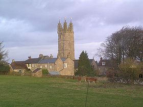 |
Dundry Dundry Dundry is a village and civil parish, situated on Dundry Hill in the northern part of the Mendip Hills, between Bristol and the Chew Valley Lake, in the English county of Somerset. The parish includes the hamlets of Maiden Head and East Dundry... |
Civil parish | 871 | Long Ashton Rural District Long Ashton Rural District Long Ashton was a rural district in Somerset, England, from 1894 to 1974.It was created in 1894 under the Local Government Act 1894.In 1974 it was abolished under the Local Government Act 1972 to become part of North Somerset.... |
51.39°N 2.64°W | |
 |
Easton in Gordano Easton in Gordano Easton in Gordano sometimes shortened to "E-I-G" is a village and civil parish in Somerset, England. It is within the District of North Somerset and in 2001 the population was 4,719.... |
Civil parish | 4,719 | Long Ashton Rural District Long Ashton Rural District Long Ashton was a rural district in Somerset, England, from 1894 to 1974.It was created in 1894 under the Local Government Act 1894.In 1974 it was abolished under the Local Government Act 1972 to become part of North Somerset.... |
51.48°N 2.69°W | |
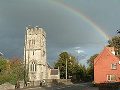 |
Flax Bourton Flax Bourton Flax Bourton is a village and civil parish in Somerset, England. The parish, with a population of 659, is situated within the Unitary Authority of North Somerset, on the edge of Nailsea Moor on the A370 road south west of Bristol city centre.... |
Civil parish | 659 | Long Ashton Rural District Long Ashton Rural District Long Ashton was a rural district in Somerset, England, from 1894 to 1974.It was created in 1894 under the Local Government Act 1894.In 1974 it was abolished under the Local Government Act 1972 to become part of North Somerset.... |
51.42°N 2.71°W | |
 |
Hutton Hutton, Somerset Hutton is a village and civil parish in Somerset, England. The parish, which has a population of 2,627, is within the Unitary Authority of North Somerset and located on the western edge of the Mendip Hills, close to Weston-super-Mare.... |
Civil parish | 2,627 | Axbridge Rural District Axbridge Rural District Axbridge was a rural district in Somerset, England, from 1894 to 1974. It was named after the town of Axbridge.It was created in 1894 under the Local Government Act 1894 as a successor to the Axbridge rural sanitary district.... |
51.32°N 2.93°W | |
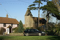 |
Kenn Kenn, Somerset Kenn is a small village and civil parish in county of Somerset, England. It falls within the area of the North Somerset unitary authority. It lies on the B3133 road near Clevedon in the North Somerset Levels... |
Civil parish | 332 | Long Ashton Rural District Long Ashton Rural District Long Ashton was a rural district in Somerset, England, from 1894 to 1974.It was created in 1894 under the Local Government Act 1894.In 1974 it was abolished under the Local Government Act 1972 to become part of North Somerset.... |
51.42°N 2.84°W | |
| Kewstoke Kewstoke Kewstoke is a civil parish and village in Somerset, England, within the unitary authority of North Somerset, located next to the strip of coast called Sand Bay... |
Civil parish | 1,624 | Axbridge Rural District Axbridge Rural District Axbridge was a rural district in Somerset, England, from 1894 to 1974. It was named after the town of Axbridge.It was created in 1894 under the Local Government Act 1894 as a successor to the Axbridge rural sanitary district.... |
51.37°N 2.96°W | ||
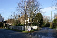 |
Kingston Seymour Kingston Seymour Kingston Seymour is a small village and civil parish in Somerset, England. It is situated within the unitary authority of North Somerset, between Clevedon and Weston-super-Mare on the North Somerset Levels. The parish has a population of 338... |
Civil parish | 338 | Long Ashton Rural District Long Ashton Rural District Long Ashton was a rural district in Somerset, England, from 1894 to 1974.It was created in 1894 under the Local Government Act 1894.In 1974 it was abolished under the Local Government Act 1972 to become part of North Somerset.... |
51.39°N 2.86°W | |
| – | Locking Locking, North Somerset Locking is a village and civil parish in Somerset, England. It is a predominantly quiet residential area of North Somerset, south east of the town of Weston-super-Mare and houses a large farming contingent.... |
Civil parish | 2,144 | Axbridge Rural District Axbridge Rural District Axbridge was a rural district in Somerset, England, from 1894 to 1974. It was named after the town of Axbridge.It was created in 1894 under the Local Government Act 1894 as a successor to the Axbridge rural sanitary district.... |
51.33°N 2.91°W | |
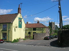 |
Long Ashton Long Ashton Long Ashton is a village and civil parish in Somerset, England. It falls within the Unitary Authority of North Somerset, a few miles south west of the city of Bristol. The parish has a population of 4,981... |
Civil parish | 4,981 | Long Ashton Rural District Long Ashton Rural District Long Ashton was a rural district in Somerset, England, from 1894 to 1974.It was created in 1894 under the Local Government Act 1894.In 1974 it was abolished under the Local Government Act 1972 to become part of North Somerset.... |
51.43°N 2.65°W | |
| Loxton Loxton, North Somerset Loxton is a village and civil parish in Somerset, England. It is close to the M5 motorway in the Unitary Authority of North Somerset. The parish includes the village of Christon and has a population of 202.-History:... |
Civil parish | 202 | Axbridge Rural District Axbridge Rural District Axbridge was a rural district in Somerset, England, from 1894 to 1974. It was named after the town of Axbridge.It was created in 1894 under the Local Government Act 1894 as a successor to the Axbridge rural sanitary district.... |
51.29°N 2.89°W | ||
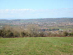 |
Nailsea Nailsea Nailsea is a town in the unitary authority of North Somerset within the ceremonial county of Somerset, England, approximately to the southwest of Bristol and about to the northeast of the seaside resort of Weston-super-Mare. The nearest village is Backwell, which lies south of Nailsea on the... |
Town | 18,000 | Long Ashton Rural District Long Ashton Rural District Long Ashton was a rural district in Somerset, England, from 1894 to 1974.It was created in 1894 under the Local Government Act 1894.In 1974 it was abolished under the Local Government Act 1972 to become part of North Somerset.... |
51.43°N 2.76°W | |
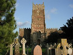 |
Portbury Portbury Portbury is a village and civil parish in Somerset, England within the Unitary Authority of North Somerset.The parish includes the hamlet of Sheepway which is situated on the moorland at the northern edge of the Gordano valley, between the Gordano services on the M5 motorway and Portishead, near... |
Civil parish | 830 | Long Ashton Rural District Long Ashton Rural District Long Ashton was a rural district in Somerset, England, from 1894 to 1974.It was created in 1894 under the Local Government Act 1894.In 1974 it was abolished under the Local Government Act 1972 to become part of North Somerset.... |
51.47°N 2.72°W | |
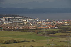 |
Portishead and North Weston Portishead and North Weston Portishead and North Weston is a civil parish with a Town Council in North Somerset, England. The parish includes the coastal town of Portishead along with the village of North Weston... |
Town | 17,130 | Long Ashton Rural District Long Ashton Rural District Long Ashton was a rural district in Somerset, England, from 1894 to 1974.It was created in 1894 under the Local Government Act 1894.In 1974 it was abolished under the Local Government Act 1972 to become part of North Somerset.... Portishead Urban District Portishead and North Weston Portishead and North Weston is a civil parish with a Town Council in North Somerset, England. The parish includes the coastal town of Portishead along with the village of North Weston... |
51.48°N 2.77°W | |
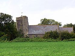 |
Puxton Puxton Puxton is a village and civil parish, north west of Axbridge in the Unitary Authority of North Somerset within the ceremonial county of Somerset, England.The civil parish includes the isolated hamlets of East Hewish and West Hewish.-History:... |
Civil parish | 328 | Axbridge Rural District Axbridge Rural District Axbridge was a rural district in Somerset, England, from 1894 to 1974. It was named after the town of Axbridge.It was created in 1894 under the Local Government Act 1894 as a successor to the Axbridge rural sanitary district.... |
51.37°N 2.85°W | |
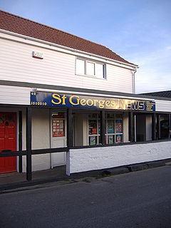 |
St Georges | Civil parish | 1,214 | Axbridge Rural District Axbridge Rural District Axbridge was a rural district in Somerset, England, from 1894 to 1974. It was named after the town of Axbridge.It was created in 1894 under the Local Government Act 1894 as a successor to the Axbridge rural sanitary district.... |
51.36°N 2.90°W | |
| Tickenham Tickenham Tickenham is a village and civil parish near Clevedon and Nailsea, North Somerset, England. The parish has a population of 909. It has a primary school and a village hall, but no shops, although it formerly had a post office.... |
Civil parish | 909 | Axbridge Rural District Axbridge Rural District Axbridge was a rural district in Somerset, England, from 1894 to 1974. It was named after the town of Axbridge.It was created in 1894 under the Local Government Act 1894 as a successor to the Axbridge rural sanitary district.... |
51.44°N 2.80°W | ||
| Walton in Gordano Walton in Gordano Walton in Gordano is a village and civil parish in North Somerset, England. It is situated in a small valley at the side of the south-western end of the Gordano Valley, about a mile from Clevedon... |
Civil parish | 217 | Axbridge Rural District Axbridge Rural District Axbridge was a rural district in Somerset, England, from 1894 to 1974. It was named after the town of Axbridge.It was created in 1894 under the Local Government Act 1894 as a successor to the Axbridge rural sanitary district.... |
51.45°N 2.83°W | ||
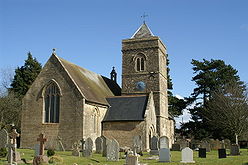 |
Weston in Gordano Weston in Gordano Weston in Gordano is a village and civil parish in Somerset, England. It is situated in the middle of the Gordano valley on the north side, and in the Unitary Authority of North Somerset, on the road between Clevedon and Portishead... |
Civil parish | 300 | Axbridge Rural District Axbridge Rural District Axbridge was a rural district in Somerset, England, from 1894 to 1974. It was named after the town of Axbridge.It was created in 1894 under the Local Government Act 1894 as a successor to the Axbridge rural sanitary district.... |
51.46°N 2.79°W | |
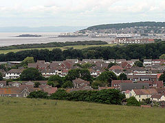 |
Weston super Mare Weston-super-Mare Weston-super-Mare is a seaside resort, town and civil parish in the unitary authority of North Somerset, which is within the ceremonial county of Somerset, England. It is located on the Bristol Channel coast, south west of Bristol, spanning the coast between the bounding high ground of Worlebury... |
Town | 71,758 | Axbridge Rural District Axbridge Rural District Axbridge was a rural district in Somerset, England, from 1894 to 1974. It was named after the town of Axbridge.It was created in 1894 under the Local Government Act 1894 as a successor to the Axbridge rural sanitary district.... Weston super Mare Municipal Borough Weston-super-Mare Weston-super-Mare is a seaside resort, town and civil parish in the unitary authority of North Somerset, which is within the ceremonial county of Somerset, England. It is located on the Bristol Channel coast, south west of Bristol, spanning the coast between the bounding high ground of Worlebury... |
51.35°N 2.97°W | |
| Wick St Lawrence Wick St. Lawrence Wick St. Lawrence is a civil parish and village in Somerset, England. It falls within the unitary authority of North Somerset. The population of the parish, which includes Bourton, in the 2001 census was 1,296.-History:... |
Civil parish | 1,296 | Axbridge Rural District Axbridge Rural District Axbridge was a rural district in Somerset, England, from 1894 to 1974. It was named after the town of Axbridge.It was created in 1894 under the Local Government Act 1894 as a successor to the Axbridge rural sanitary district.... |
51.38°N 2.91°W | ||
| Winford Winford Winford is a small village and civil parish within the Chew Valley, Somerset, England. It is within the unitary authority of North Somerset about south of Bristol... |
Civil parish | 1,995 | Long Ashton Rural District Long Ashton Rural District Long Ashton was a rural district in Somerset, England, from 1894 to 1974.It was created in 1894 under the Local Government Act 1894.In 1974 it was abolished under the Local Government Act 1972 to become part of North Somerset.... |
51.38°N 2.66°W | ||
| Winscombe and Sandford Winscombe and Sandford Winscombe and Sandford is a civil parish in Somerset, England. It includes the villages of Winscombe and Sandford. The parish has a population of 4,332.-Governance:... |
Civil parish | 4,332 | Axbridge Rural District Axbridge Rural District Axbridge was a rural district in Somerset, England, from 1894 to 1974. It was named after the town of Axbridge.It was created in 1894 under the Local Government Act 1894 as a successor to the Axbridge rural sanitary district.... |
51.31°N 2.83°W | ||
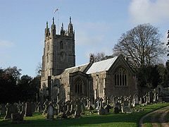 |
Wraxall and Failand Wraxall and Failand Wraxall and Failand is a civil parish in Somerset, England. It includes the villages of Wraxall and Failand. It has a population of 2,360.-Governance:... |
Civil parish | 2,360 | Long Ashton Rural District Long Ashton Rural District Long Ashton was a rural district in Somerset, England, from 1894 to 1974.It was created in 1894 under the Local Government Act 1894.In 1974 it was abolished under the Local Government Act 1972 to become part of North Somerset.... |
51.44°N 2.73°W | |
| Wrington Wrington Wrington is a village and civil parish in North Somerset, England. It lies in the valley of the Congresbury Yeo river about east of Weston-super-Mare and south-east of Yatton. It is both a civil parish, with a population of 2,896, and an ecclesiastical parish... |
Civil parish | 2,896 | Axbridge Rural District Axbridge Rural District Axbridge was a rural district in Somerset, England, from 1894 to 1974. It was named after the town of Axbridge.It was created in 1894 under the Local Government Act 1894 as a successor to the Axbridge rural sanitary district.... |
51.36°N 2.76°W | ||
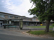 |
Yatton Yatton Yatton is a village and civil parish within the unitary authority of North Somerset, which falls within the ceremonial county of Somerset, England. It is located south-west of Bristol. Its population in 2001 was 9,176... |
Civil parish | 9,176 | Long Ashton Rural District Long Ashton Rural District Long Ashton was a rural district in Somerset, England, from 1894 to 1974.It was created in 1894 under the Local Government Act 1894.In 1974 it was abolished under the Local Government Act 1972 to become part of North Somerset.... |
51.39°N 2.83°W |
Sedgemoor
The whole of the district is parished.| Image | Name | Status | Population | Former local authority | Coordinates | Refs |
|---|---|---|---|---|---|---|
| Ashcott Ashcott Ashcott is a small village and civil parish located in the Sedgemoor area of Somerset in the south-west of England. The village has a population of 1,280. The parish includes the hamlets of Buscott, Berhill and Ashcott Corner.... |
Civil parish | 1,280 | Bridgwater Rural District Bridgwater Rural District Bridgwater was a rural district in Somerset, England, from 1894 to 1974.It was created in 1894 under the Local Government Act 1894.In 1974 it was abolished under the Local Government Act 1972 becoming part of Sedgemoor.... |
51.12°N 2.81°W | ||
| Axbridge Axbridge Axbridge is a town in Somerset, England, situated in the Sedgemoor district on the River Axe, near the southern edge of the Mendip Hills. The town population according to the 2001 census was 2,024.-History:... |
Town | 2,024 | Axbridge Rural District Axbridge Rural District Axbridge was a rural district in Somerset, England, from 1894 to 1974. It was named after the town of Axbridge.It was created in 1894 under the Local Government Act 1894 as a successor to the Axbridge rural sanitary district.... |
51.29°N 2.82°W | ||
| Badgworth Badgworth, Somerset Badgworth is a village and civil parish in the Sedgemoor district of Somerset, England, south west of Axbridge. According to the 2001 census it had a population of 487.The village is home to an equestrian centre known as the Badgworth Arena.-History:... |
Civil parish | 487 | Axbridge Rural District Axbridge Rural District Axbridge was a rural district in Somerset, England, from 1894 to 1974. It was named after the town of Axbridge.It was created in 1894 under the Local Government Act 1894 as a successor to the Axbridge rural sanitary district.... |
51.27°N 2.87°W | ||
| Bawdrip Bawdrip Bawdrip is a village and civil parish in the Sedgemoor district of Somerset, England. The village is on the south side of the Polden Hills about north-east of Bridgwater. According to the 2001 census the parish had a population of 498. The parish includes the hamlets of Bradney and Horsey... |
Civil parish | 498 | Bridgwater Rural District Bridgwater Rural District Bridgwater was a rural district in Somerset, England, from 1894 to 1974.It was created in 1894 under the Local Government Act 1894.In 1974 it was abolished under the Local Government Act 1972 becoming part of Sedgemoor.... |
51.15°N 2.94°W | ||
| Berrow Berrow, Somerset Berrow is a village and civil parish in the Sedgemoor district of Somerset, England. According to the 2001 census it had a population of 1,766.-History:Berrow was part of the hundred of Brent-cum-Wrington.-Governance:... |
Civil parish | 1,766 | Axbridge Rural District Axbridge Rural District Axbridge was a rural district in Somerset, England, from 1894 to 1974. It was named after the town of Axbridge.It was created in 1894 under the Local Government Act 1894 as a successor to the Axbridge rural sanitary district.... |
51.27°N 3.01°W | ||
| Brean Brean Brean is a village and civil parish between Weston-super-Mare and Burnham-on-Sea in Somerset, England. The name is derived from "Bryn" Brythonic and Modern Welsh for a hill.... |
Civil parish | 682 | Axbridge Rural District Axbridge Rural District Axbridge was a rural district in Somerset, England, from 1894 to 1974. It was named after the town of Axbridge.It was created in 1894 under the Local Government Act 1894 as a successor to the Axbridge rural sanitary district.... |
51.30°N 3.01°W | ||
| Brent Knoll | Civil parish | 1,264 | Axbridge Rural District Axbridge Rural District Axbridge was a rural district in Somerset, England, from 1894 to 1974. It was named after the town of Axbridge.It was created in 1894 under the Local Government Act 1894 as a successor to the Axbridge rural sanitary district.... |
51.25°N 2.95°W | ||
 |
Bridgwater Bridgwater Bridgwater is a market town and civil parish in Somerset, England. It is the administrative centre of the Sedgemoor district, and a major industrial centre. Bridgwater is located on the major communication routes through South West England... |
Town | 33,698 | Bridgwater Municipal Borough Bridgwater Bridgwater is a market town and civil parish in Somerset, England. It is the administrative centre of the Sedgemoor district, and a major industrial centre. Bridgwater is located on the major communication routes through South West England... |
51.13°N 2.99°W | |
| Bridgwater Without Bridgwater Without Bridgwater Without is a civil parish in the Sedgemoor district of Somerset, England.It lies to the east and south west of Bridgwater. The parish includes the villages and hamlets of Dunwear, Horsey, Slape Cross and Sydenham... |
Civil parish | 405 | Bridgwater Rural District Bridgwater Rural District Bridgwater was a rural district in Somerset, England, from 1894 to 1974.It was created in 1894 under the Local Government Act 1894.In 1974 it was abolished under the Local Government Act 1972 becoming part of Sedgemoor.... |
51.14°N 2.97°W | ||
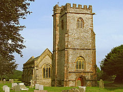 |
Broomfield Broomfield, Somerset Broomfield is a village and civil parish in the Sedgemoor district of Somerset, England, situated about five miles north of Taunton. According to the 2001 census it had a population of 224.... |
Civil parish | 224 | Bridgwater Rural District Bridgwater Rural District Bridgwater was a rural district in Somerset, England, from 1894 to 1974.It was created in 1894 under the Local Government Act 1894.In 1974 it was abolished under the Local Government Act 1972 becoming part of Sedgemoor.... |
51.08°N 3.11°W | |
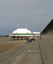 |
Burnham on Sea and Highbridge Burnham-on-Sea and Highbridge Burnham-on-Sea and Highbridge is a civil parish in the Sedgemoor district of Somerset, England. It has a population of 18,922 . The parish contains the towns Burnham-on-Sea and Highbridge.... |
Town | 18,922 | Burnham on Sea Urban District Burnham-on-Sea and Highbridge Burnham-on-Sea and Highbridge is a civil parish in the Sedgemoor district of Somerset, England. It has a population of 18,922 . The parish contains the towns Burnham-on-Sea and Highbridge.... |
51.24°N 2.99°W | |
| Burnham Without Burnham Without Burnham Without is a civil parish to the east of Burnham-on-Sea and north of Highbridge in the Sedgemoor district of Somerset, England.The parish includes the village of Edithmead and is the site of the Somerset Rebels Speedway track.... |
Civil Parish | 796 | Axbridge Rural District Axbridge Rural District Axbridge was a rural district in Somerset, England, from 1894 to 1974. It was named after the town of Axbridge.It was created in 1894 under the Local Government Act 1894 as a successor to the Axbridge rural sanitary district.... |
51.23°N 2.96°W | ||
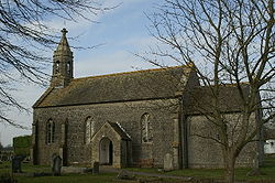 |
Burtle Burtle Burtle is a village and civil parish on the Somerset Levels in the Sedgemoor district of Somerset, England.-History:Burtle Priory originated as a hermitage on a site called Sprauellissmede, endowed by William son of Godfrey of Eddington in 1199... |
Civil parish | 462 | Bridgwater Rural District Bridgwater Rural District Bridgwater was a rural district in Somerset, England, from 1894 to 1974.It was created in 1894 under the Local Government Act 1894.In 1974 it was abolished under the Local Government Act 1972 becoming part of Sedgemoor.... |
51.17°N 2.87°W | |
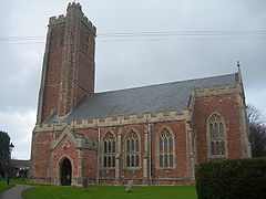 |
Cannington Cannington, Somerset Cannington is a village and civil parish north-west of Bridgwater in the Sedgemoor district of Somerset, England. It lies on the west bank of the River Parret, and contains the hamlet of Edstock.-History:... |
Civil parish | 2,466 | Bridgwater Rural District Bridgwater Rural District Bridgwater was a rural district in Somerset, England, from 1894 to 1974.It was created in 1894 under the Local Government Act 1894.In 1974 it was abolished under the Local Government Act 1972 becoming part of Sedgemoor.... |
51.15°N 3.07°W | |
 |
Catcott Catcott Catcott is a rural village and civil parish, situated close to Edington to the east of Bridgwater on the Somerset Levels to the north of the Polden Hills in the Sedgemoor district of Somerset, England.-History:... |
Civil parish | 517 | Bridgwater Rural District Bridgwater Rural District Bridgwater was a rural district in Somerset, England, from 1894 to 1974.It was created in 1894 under the Local Government Act 1894.In 1974 it was abolished under the Local Government Act 1972 becoming part of Sedgemoor.... |
51.15°N 2.87°W | |
 |
Chapel Allerton Chapel Allerton, Somerset Chapel Allerton is a village and civil parish, south of Cheddar in the English county of Somerset. The parish includes the hamlets of Ashton and Stone Allerton.-History:... |
Civil parish | 344 | Axbridge Rural District Axbridge Rural District Axbridge was a rural district in Somerset, England, from 1894 to 1974. It was named after the town of Axbridge.It was created in 1894 under the Local Government Act 1894 as a successor to the Axbridge rural sanitary district.... |
51.25°N 2.85°W | |
| Cheddar Cheddar Cheddar is a large village and civil parish in the Sedgemoor district of the English county of Somerset. It is situated on the southern edge of the Mendip Hills, north-west of Wells. The civil parish includes the hamlets of Nyland and Bradley Cross... |
Civil parish | 5,274 | Axbridge Rural District Axbridge Rural District Axbridge was a rural district in Somerset, England, from 1894 to 1974. It was named after the town of Axbridge.It was created in 1894 under the Local Government Act 1894 as a successor to the Axbridge rural sanitary district.... |
51.28°N 2.78°W | ||
 |
Chedzoy Chedzoy Chedzoy is a civil parish village east of Bridgwater in the Sedgemoor district of Somerset, England.-History:The village is at the western end of King's Sedgemoor and lies on an 'island' of Burtle marine sands, close to King's Sedgemoor Drain. The area was settled possibly in the Mesolithic... |
Civil parish | 427 | Bridgwater Rural District Bridgwater Rural District Bridgwater was a rural district in Somerset, England, from 1894 to 1974.It was created in 1894 under the Local Government Act 1894.In 1974 it was abolished under the Local Government Act 1972 becoming part of Sedgemoor.... |
51.13°N 2.95°W | |
 |
Chilton Polden Chilton Polden Chilton Polden is a rural village and civil parish, situated close to Edington on the Somerset Levels to the north of the Polden Hills in the Sedgemoor district of Somerset, England.-History:... |
Civil parish | 678 | Bridgwater Rural District Bridgwater Rural District Bridgwater was a rural district in Somerset, England, from 1894 to 1974.It was created in 1894 under the Local Government Act 1894.In 1974 it was abolished under the Local Government Act 1972 becoming part of Sedgemoor.... |
51.15°N 2.90°W | |
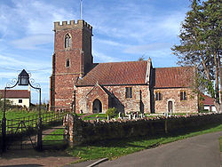 |
Chilton Trinity Chilton Trinity Chilton Trinity is a village and civil parish on the River Parrett, north of Bridgwater in the Sedgemoor district of Somerset, England.-History:Iron age and Roman pottery have been found at Chilton village... |
Civil parish | 233 | Bridgwater Rural District Bridgwater Rural District Bridgwater was a rural district in Somerset, England, from 1894 to 1974.It was created in 1894 under the Local Government Act 1894.In 1974 it was abolished under the Local Government Act 1972 becoming part of Sedgemoor.... |
51.15°N 3.01°W | |
 |
Compton Bishop Compton Bishop Compton Bishop is a small village and civil parish, at the western end of the Mendip Hills in the English county of Somerset. It is located close to the historic town of Axbridge... |
Civil parish | 609 | Axbridge Rural District Axbridge Rural District Axbridge was a rural district in Somerset, England, from 1894 to 1974. It was named after the town of Axbridge.It was created in 1894 under the Local Government Act 1894 as a successor to the Axbridge rural sanitary district.... |
51.30°N 2.87°W | |
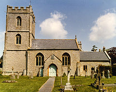 |
Cossington Cossington, Somerset Cossington is a village and civil parish close to Woolavington and north of Bridgwater, in the Sedgemoor district in Somerset, England. The village lies on the north side of the Polden Hills.-History:... |
Civil parish | 578 | Bridgwater Rural District Bridgwater Rural District Bridgwater was a rural district in Somerset, England, from 1894 to 1974.It was created in 1894 under the Local Government Act 1894.In 1974 it was abolished under the Local Government Act 1972 becoming part of Sedgemoor.... |
51.16°N 2.92°W | |
 |
Durleigh Durleigh Durleigh is a village and civil parish on the outskirts of Bridgwater in the Sedgemoor district of Somerset, England. According to the 2001 Census, it had a population of 609... |
Civil parish | 609 | Bridgwater Rural District Bridgwater Rural District Bridgwater was a rural district in Somerset, England, from 1894 to 1974.It was created in 1894 under the Local Government Act 1894.In 1974 it was abolished under the Local Government Act 1972 becoming part of Sedgemoor.... |
51.12°N 3.04°W | |
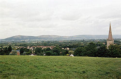 |
East Brent | Civil parish | 1,261 | Axbridge Rural District Axbridge Rural District Axbridge was a rural district in Somerset, England, from 1894 to 1974. It was named after the town of Axbridge.It was created in 1894 under the Local Government Act 1894 as a successor to the Axbridge rural sanitary district.... |
51.26°N 2.94°W | |
| East Huntspill | Civil parish | 1,179 | Bridgwater Rural District Bridgwater Rural District Bridgwater was a rural district in Somerset, England, from 1894 to 1974.It was created in 1894 under the Local Government Act 1894.In 1974 it was abolished under the Local Government Act 1972 becoming part of Sedgemoor.... |
51.20°N 2.98°W | ||
 |
Edington Edington, Somerset Edington is a rural village, situated on the north side of the Polden Hills in the Sedgemoor district of Somerset, England.Either side of it lie the villages of Chilton Polden and Catcott, and north of it is the small village of Burtle... |
Civil parish | 365 | Bridgwater Rural District Bridgwater Rural District Bridgwater was a rural district in Somerset, England, from 1894 to 1974.It was created in 1894 under the Local Government Act 1894.In 1974 it was abolished under the Local Government Act 1972 becoming part of Sedgemoor.... |
51.15°N 2.88°W | |
| Enmore Enmore, Somerset Enmore is a village and civil parish west of Bridgwater on the Quantock Hills in the Sedgemoor district of Somerset, England. The parish includes the hamlet of Bare Ash.-History:The parish name means Duck marsh.... |
Civil parish | 253 | Bridgwater Rural District Bridgwater Rural District Bridgwater was a rural district in Somerset, England, from 1894 to 1974.It was created in 1894 under the Local Government Act 1894.In 1974 it was abolished under the Local Government Act 1972 becoming part of Sedgemoor.... |
51.11°N 3.09°W | ||
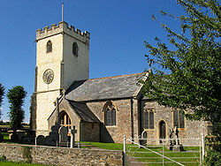 |
Fiddington Fiddington Fiddington is a village and civil parish north-east of Nether Stowey, and north-west of Bridgwater in the Sedgemoor district of Somerset, England... |
Civil parish | 243 | Bridgwater Rural District Bridgwater Rural District Bridgwater was a rural district in Somerset, England, from 1894 to 1974.It was created in 1894 under the Local Government Act 1894.In 1974 it was abolished under the Local Government Act 1972 becoming part of Sedgemoor.... |
51.16°N 3.12°W | |
 |
Goathurst Goathurst Goathurst is a small village and civil parish in the English county of Somerset, around 3 miles from the town of Bridgwater. The parish includes the hamlets of Andersfield and Huntstile.-History:Goathurst was part of the hundred of Andersfield.... |
Civil parish | 222 | Bridgwater Rural District Bridgwater Rural District Bridgwater was a rural district in Somerset, England, from 1894 to 1974.It was created in 1894 under the Local Government Act 1894.In 1974 it was abolished under the Local Government Act 1972 becoming part of Sedgemoor.... |
51.10°N 3.06°W | |
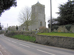 |
Greinton Greinton Greinton is a village and civil parish in Somerset, England, situated on the Somerset Levels and Moors at the foot of the Polden Hills, west southwest of Glastonbury and east of Bridgwater in the Sedgemoor district... |
Civil Parish | 71 | Bridgwater Rural District Bridgwater Rural District Bridgwater was a rural district in Somerset, England, from 1894 to 1974.It was created in 1894 under the Local Government Act 1894.In 1974 it was abolished under the Local Government Act 1972 becoming part of Sedgemoor.... |
51.12°N 2.84°W | |
 |
Lympsham Lympsham Lympsham is a village and civil parish six miles west of Axbridge and six miles south-east of Weston-super-Mare, close to the River Axe in Somerset, England. The parish includes the hamlet of Wick where Wick Farmhouse dates from the mid 18th century.... |
Civil parish | 872 | Axbridge Rural District Axbridge Rural District Axbridge was a rural district in Somerset, England, from 1894 to 1974. It was named after the town of Axbridge.It was created in 1894 under the Local Government Act 1894 as a successor to the Axbridge rural sanitary district.... |
51.29°N 2.95°W | |
| Lyng Lyng, Somerset Lyng is a civil parish in Somerset, England, comprising the villages of West Lyng and East Lyng and the hamlet of Bankland.-History:The name derives from the Old English hlenc, meaning hill.... |
Civil parish | 334 | Bridgwater Rural District Bridgwater Rural District Bridgwater was a rural district in Somerset, England, from 1894 to 1974.It was created in 1894 under the Local Government Act 1894.In 1974 it was abolished under the Local Government Act 1972 becoming part of Sedgemoor.... |
51.05°N 2.96°W | ||
 |
Mark Mark, Somerset Mark is a village and civil parish which lies approximately from Bridgwater, from Axbridge, and from Highbridge in the Sedgemoor district of the county of Somerset, England... |
Civil parish | 1,349 | Axbridge Rural District Axbridge Rural District Axbridge was a rural district in Somerset, England, from 1894 to 1974. It was named after the town of Axbridge.It was created in 1894 under the Local Government Act 1894 as a successor to the Axbridge rural sanitary district.... |
51.23°N 2.89°W | |
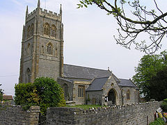 |
Middlezoy Middlezoy Middlezoy is a village and civil parish on the River Parrett as it crosses the Somerset Levels in the Sedgemoor district of Somerset, England.-History:... |
Civil parish | 720 | Bridgwater Rural District Bridgwater Rural District Bridgwater was a rural district in Somerset, England, from 1894 to 1974.It was created in 1894 under the Local Government Act 1894.In 1974 it was abolished under the Local Government Act 1972 becoming part of Sedgemoor.... |
51.09°N 2.89°W | |
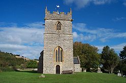 |
Moorlinch Moorlinch Moorlinch is a village and civil parish where the Polden Hills meet the Somerset Levels in the Sedgemoor district of Somerset, England.-History:... |
Civil parish | 233 | Bridgwater Rural District Bridgwater Rural District Bridgwater was a rural district in Somerset, England, from 1894 to 1974.It was created in 1894 under the Local Government Act 1894.In 1974 it was abolished under the Local Government Act 1972 becoming part of Sedgemoor.... |
51.13°N 2.86°W | |
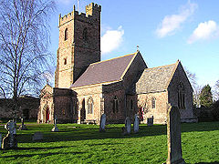 |
Nether Stowey Nether Stowey Nether Stowey is a large village in the Sedgemoor district of Somerset, South West England. It sits in the foothills of the Quantock Hills , just below Over Stowey... |
Civil parish | 1,423 | Bridgwater Rural District Bridgwater Rural District Bridgwater was a rural district in Somerset, England, from 1894 to 1974.It was created in 1894 under the Local Government Act 1894.In 1974 it was abolished under the Local Government Act 1972 becoming part of Sedgemoor.... |
51.15°N 3.15°W | |
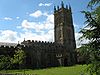 |
North Petherton North Petherton North Petherton is a small town and civil parish in Somerset, England, situated on the edge of the eastern foothills of the Quantocks, and close to the edge of the Somerset Levels.The town has a population of 5,189... |
Civil parish | 5,185 | Bridgwater Rural District Bridgwater Rural District Bridgwater was a rural district in Somerset, England, from 1894 to 1974.It was created in 1894 under the Local Government Act 1894.In 1974 it was abolished under the Local Government Act 1972 becoming part of Sedgemoor.... |
51.09°N 3.01°W | |
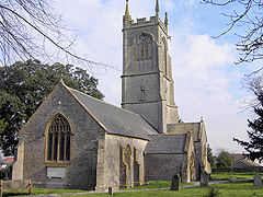 |
Othery Othery The parish and village of Othery, established in 1515, sits on a detached extension of Sowy island on the Somerset Levels. It is east of Bridgwater and north-west of Langport. It borders the hamlets and villages of Pathe, Burrowbridge, Middlezoy, Westonzoyland and Aller, which it meets at Beer Wall... |
Civil parish | 567 | Bridgwater Rural District Bridgwater Rural District Bridgwater was a rural district in Somerset, England, from 1894 to 1974.It was created in 1894 under the Local Government Act 1894.In 1974 it was abolished under the Local Government Act 1972 becoming part of Sedgemoor.... |
51.08°N 2.88°W | |
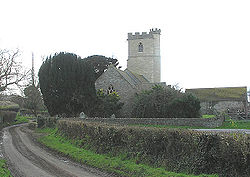 |
Otterhampton Otterhampton Otterhampton is a village and civil parish in the Sedgemoor district of Somerset, England, between Bridgwater and the Steart Peninsula.The village lies on Combwich Reach as the River Parrett flows to the sea.-History:... |
Civil parish | 914 | Bridgwater Rural District Bridgwater Rural District Bridgwater was a rural district in Somerset, England, from 1894 to 1974.It was created in 1894 under the Local Government Act 1894.In 1974 it was abolished under the Local Government Act 1972 becoming part of Sedgemoor.... |
51.18°N 3.08°W | |
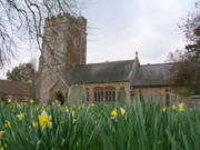 |
Over Stowey Over Stowey Over Stowey is a small village and civil parish in the Sedgemoor district of Somerset, South West England. It sits in the foothills of the Quantock Hills, just below Nether Stowey and north-west of Bridgwater... |
Civil parish | 494 | Bridgwater Rural District Bridgwater Rural District Bridgwater was a rural district in Somerset, England, from 1894 to 1974.It was created in 1894 under the Local Government Act 1894.In 1974 it was abolished under the Local Government Act 1972 becoming part of Sedgemoor.... |
51.15°N 3.15°W | |
| Pawlett Pawlett, Somerset Pawlett is a small village north of Bridgwater, in the Sedgemoor district of the English county of Somerset.The village has Roman or Saxon origins... |
Civil Parish | 1,020 | Bridgwater Rural District Bridgwater Rural District Bridgwater was a rural district in Somerset, England, from 1894 to 1974.It was created in 1894 under the Local Government Act 1894.In 1974 it was abolished under the Local Government Act 1972 becoming part of Sedgemoor.... |
51.18°N 3.00°W | ||
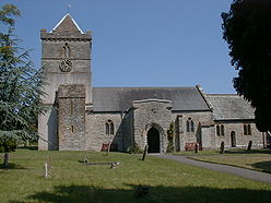 |
Puriton Puriton Puriton is a village and a parish, at the westerly end of the Polden Hills, in the Sedgemoor district of Somerset, UK. The parish has a population of 2,124. The local parish church is named after St Michael... |
Civil parish | 2,124 | Bridgwater Rural District Bridgwater Rural District Bridgwater was a rural district in Somerset, England, from 1894 to 1974.It was created in 1894 under the Local Government Act 1894.In 1974 it was abolished under the Local Government Act 1972 becoming part of Sedgemoor.... |
51.17°N 2.97°W | |
| Shapwick Shapwick, Somerset Shapwick is a village on the Somerset Levels, in the Sedgemoor district of Somerset, England. It is situated to the west of Glastonbury.-History:Shapwick is the site of one end of the Sweet Track, an ancient causeway dating from the 39th century BC.... |
Civil parish | 520 | Bridgwater Rural District Bridgwater Rural District Bridgwater was a rural district in Somerset, England, from 1894 to 1974.It was created in 1894 under the Local Government Act 1894.In 1974 it was abolished under the Local Government Act 1972 becoming part of Sedgemoor.... |
51.14°N 2.83°W | ||
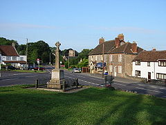 |
Shipham Shipham Shipham is a village and civil parish in Somerset, England on the western edge of the Mendip Hills near the A38, approximately south of Bristol. It is in the local government district of Sedgemoor. The parish includes the village of Rowberrow and the hamlet of Star... |
Civil parish | 1,136 | Axbridge Rural District Axbridge Rural District Axbridge was a rural district in Somerset, England, from 1894 to 1974. It was named after the town of Axbridge.It was created in 1894 under the Local Government Act 1894 as a successor to the Axbridge rural sanitary district.... |
51.31°N 2.80°W | |
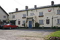 |
Spaxton Spaxton Spaxton is a small village and civil parish on the Quantocks in the Sedgemoor district of Somerset, South West England.-History:Spaxton was part of the hundred of Cannington.... |
Civil parish | 1,014 | Bridgwater Rural District Bridgwater Rural District Bridgwater was a rural district in Somerset, England, from 1894 to 1974.It was created in 1894 under the Local Government Act 1894.In 1974 it was abolished under the Local Government Act 1972 becoming part of Sedgemoor.... |
51.13°N 3.11°W | |
| Stawell Stawell, Somerset Stawell is a village and civil parish miles north east of Bridgwater, and north west of Moorlinch, in the Sedgemoor district of Somerset, England.The parish includes the village of Sutton Mallet.-Governance:... |
Civil parish | 365 | Bridgwater Rural District Bridgwater Rural District Bridgwater was a rural district in Somerset, England, from 1894 to 1974.It was created in 1894 under the Local Government Act 1894.In 1974 it was abolished under the Local Government Act 1972 becoming part of Sedgemoor.... |
51.14°N 2.91°W | ||
| Stockland Bristol Stockland Bristol Stockland Bristol is a village and civil parish in the Sedgemoor district of Somerset, between Bridgwater and the Steart Peninsula. The parish includes the village of Steart.-History:... |
Civil parish | 172 | Bridgwater Rural District Bridgwater Rural District Bridgwater was a rural district in Somerset, England, from 1894 to 1974.It was created in 1894 under the Local Government Act 1894.In 1974 it was abolished under the Local Government Act 1972 becoming part of Sedgemoor.... |
51.19°N 3.08°W | ||
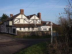 |
Thurloxton Thurloxton Thurloxton is a village and civil parish north east of Taunton, and south west of Bridgwater on the south-eastern slopes of the Quantock Hills in the Sedgemoor district of the county of Somerset, in England... |
Civil parish | 163 | Bridgwater Rural District Bridgwater Rural District Bridgwater was a rural district in Somerset, England, from 1894 to 1974.It was created in 1894 under the Local Government Act 1894.In 1974 it was abolished under the Local Government Act 1972 becoming part of Sedgemoor.... |
51.07°N 3.04°W | |
 |
Weare Weare, Somerset Weare and Lower Weare are small villages in Somerset, England, on the River Axe, south of the Mendip Hills. The parish comprises the villages of Upper and Lower Weare, and the hamlets of Alston Sutton, Brinscombe and Stone Allerton.... |
Civil parish | 626 | Axbridge Rural District Axbridge Rural District Axbridge was a rural district in Somerset, England, from 1894 to 1974. It was named after the town of Axbridge.It was created in 1894 under the Local Government Act 1894 as a successor to the Axbridge rural sanitary district.... |
51.27°N 2.84°W | |
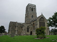 |
Wedmore Wedmore Wedmore is a village and civil parish in the county of Somerset, England. It is situated on raised ground, in the Somerset Levels between the River Axe and River Brue, often called the Isle of Wedmore. It forms part of Sedgemoor district... |
Civil Parish | 3,111 | Axbridge Rural District Axbridge Rural District Axbridge was a rural district in Somerset, England, from 1894 to 1974. It was named after the town of Axbridge.It was created in 1894 under the Local Government Act 1894 as a successor to the Axbridge rural sanitary district.... |
51.23°N 2.81°W | |
| Wembdon Wembdon Wembdon is a rural village near Bridgwater, in Somerset, England.Wembdon is now home to an Anglican church, a small shop , a pub, a small garage and a fruit juice processing and packaging plant.-History:... |
Civil parish | 1,887 | Bridgwater Rural District Bridgwater Rural District Bridgwater was a rural district in Somerset, England, from 1894 to 1974.It was created in 1894 under the Local Government Act 1894.In 1974 it was abolished under the Local Government Act 1972 becoming part of Sedgemoor.... |
51.13°N 3.02°W | ||
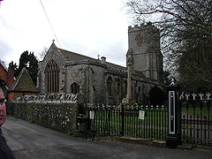 |
West Huntspill | Civil parish | 1,480 | Bridgwater Rural District Bridgwater Rural District Bridgwater was a rural district in Somerset, England, from 1894 to 1974.It was created in 1894 under the Local Government Act 1894.In 1974 it was abolished under the Local Government Act 1972 becoming part of Sedgemoor.... |
51.20°N 2.98°W | |
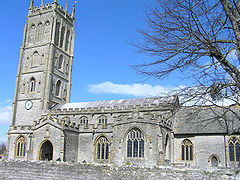 |
Westonzoyland Westonzoyland Westonzoyland is a village and civil parish in Somerset, England. It is situated on the Somerset Levels, south east of Bridgwater.-History:The name of the parish derives from its location on the "island" of Sowy, an area of slightly higher ground on the Somerset Levels between the River Cary and... |
Civil parish | 1,830 | Bridgwater Rural District Bridgwater Rural District Bridgwater was a rural district in Somerset, England, from 1894 to 1974.It was created in 1894 under the Local Government Act 1894.In 1974 it was abolished under the Local Government Act 1972 becoming part of Sedgemoor.... |
51.11°N 2.92°W | |
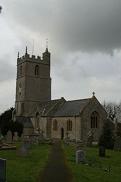 |
Woolavington Woolavington Woolavington is a village and civil parish on the Somerset Levels in the English county of Somerset. It forms part of the District of Sedgemoor, and is north east of Bridgwater, south east of Burnham on Sea and west of Glastonbury... |
Civil parish | 2,256 | Bridgwater Rural District Bridgwater Rural District Bridgwater was a rural district in Somerset, England, from 1894 to 1974.It was created in 1894 under the Local Government Act 1894.In 1974 it was abolished under the Local Government Act 1972 becoming part of Sedgemoor.... |
51.17°N 2.93°W |
South Somerset
The whole of the district is parished.| Image | Name | Status | Population | Former local authority | Coordinates | Refs |
|---|---|---|---|---|---|---|
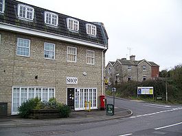 |
Abbas and Templecombe | Civil parish | 1,506 | Wincanton Rural District Wincanton Rural District Wincanton was a rural district in Somerset, England, from 1894 to 1974.It was created in 1894 under the Local Government Act 1894.In 1974 it was abolished under the Local Government Act 1972 when it became part of South Somerset.... |
50.99°N 2.41°W | |
 |
Alford Alford, Somerset Alford is a village and parish on the River Alham, in Somerset, England, situated south of Shepton Mallet and two miles west of Castle Cary in the South Somerset district. The village has a population of 63. It lies on the River Cary.-History:... |
Civil parish | 63 | Wincanton Rural District Wincanton Rural District Wincanton was a rural district in Somerset, England, from 1894 to 1974.It was created in 1894 under the Local Government Act 1894.In 1974 it was abolished under the Local Government Act 1972 when it became part of South Somerset.... |
51.08°N 2.57°W | |
 |
Aller Aller, Somerset Aller is a village and parish in Somerset, England, situated west of Somerton on the A372 road towards Bridgwater in the South Somerset district. The village has a population of 374... |
Civil parish | 374 | Langport Rural District Langport Rural District Langport was a rural district in Somerset, England, from 1894 to 1974.It was created in 1894 under the Local Government Act 1894.In 1974 it was abolished under the Local Government Act 1972 to become part of South Somerset.... |
51.05°N 2.85°W | |
| Ansford Ansford Ansford is a village and parish in Somerset, England, situated on the northern edge of Castle Cary in the South Somerset district. The village has a population of 1,048.... |
Civil parish | 1,048 | Wincanton Rural District Wincanton Rural District Wincanton was a rural district in Somerset, England, from 1894 to 1974.It was created in 1894 under the Local Government Act 1894.In 1974 it was abolished under the Local Government Act 1972 when it became part of South Somerset.... |
51.09°N 2.51°W | ||
 |
Ash | Civil parish | 616 | Yeovil Rural District Yeovil Rural District Yeovil was a rural district in Somerset, England, from 1894 to 1974.It was created in 1894 under the Local Government Act 1894.In 1974 it was abolished under the Local Government Act 1972 when it became part of South Somerset.... |
50.98°N 2.75°W | |
| Ashill Ashill, Somerset Ashill is a small village and civil parish in Somerset, England, situated south of Taunton, and three miles north-west of Ilminster in the South Somerset district... |
Civil parish | 528 | Chard Rural District Chard Rural District Chard was a rural district in Somerset, England, from 1894 to 1974.It was created in 1894 under the Local Government Act 1894.In 1974 it was abolished under the Local Government Act 1972 when it became part of South Somerset.... |
50.94°N 2.96°W | ||
 |
Babcary Babcary Babcary is a village and parish in Somerset, England, situated east of Somerton and south west of Castle Cary in the South Somerset district. The village has a population of 239. It lies close to the River Cary and the A37.-History:... |
Civil parish | 239 | Langport Rural District Langport Rural District Langport was a rural district in Somerset, England, from 1894 to 1974.It was created in 1894 under the Local Government Act 1894.In 1974 it was abolished under the Local Government Act 1972 to become part of South Somerset.... |
51.05°N 2.62°W | |
 |
Barrington Barrington, Somerset Barrington is a village and civil parish, situated south east of Taunton and west of Yeovil in the South Somerset district of Somerset, England... |
Civil parish | 427 | Langport Rural District Langport Rural District Langport was a rural district in Somerset, England, from 1894 to 1974.It was created in 1894 under the Local Government Act 1894.In 1974 it was abolished under the Local Government Act 1972 to become part of South Somerset.... |
50.96°N 2.87°W | |
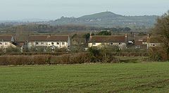 |
Barton St David Barton St David Barton St David is a village and civil parish on the River Brue adjacent to Keinton Mandeville in Somerset, England. It is situated south-east of Glastonbury and north-east of Somerton in the South Somerset district... |
Civil parish | 538 | Langport Rural District Langport Rural District Langport was a rural district in Somerset, England, from 1894 to 1974.It was created in 1894 under the Local Government Act 1894.In 1974 it was abolished under the Local Government Act 1972 to become part of South Somerset.... |
51.08°N 2.65°W | |
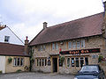 |
Barwick Barwick, Somerset Barwick is a village and parish in Somerset, England, situated south of Yeovil in the South Somerset district and on the border with Dorset. The parish, which includes the village of Stoford has a population of 1,289.-History:... |
Civil parish | 1,289 | Yeovil Rural District Yeovil Rural District Yeovil was a rural district in Somerset, England, from 1894 to 1974.It was created in 1894 under the Local Government Act 1894.In 1974 it was abolished under the Local Government Act 1972 when it became part of South Somerset.... |
50.92°N 2.62°W | |
 |
Beercrocombe Beercrocombe Beercrocombe is a village and civil parish in Somerset, England, situated on the Fivehead River, a tributary of the River Isle, south of Curry Mallet and south-east of Taunton in the South Somerset district... |
Civil parish | 144 | Langport Rural District Langport Rural District Langport was a rural district in Somerset, England, from 1894 to 1974.It was created in 1894 under the Local Government Act 1894.In 1974 it was abolished under the Local Government Act 1972 to become part of South Somerset.... |
50.98°N 2.97°W | |
 |
Blackford and Compton Pauncefoot Blackford and Compton Pauncefoot Blackford and Compton Pauncefoot is a civil parish in Somerset, England.The parish covers the villages of Blackford and Compton Pauncefoot.The parish has no parish council and has a Parish Meeting which has limited responsibility for local issues, including setting an annual precept to cover very... |
Civil parish | 130 | Wincanton Rural District Wincanton Rural District Wincanton was a rural district in Somerset, England, from 1894 to 1974.It was created in 1894 under the Local Government Act 1894.In 1974 it was abolished under the Local Government Act 1972 when it became part of South Somerset.... |
51.03°N 2.50°W | |
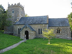 |
Bratton Seymour Bratton Seymour Bratton Seymour is a village and civil parish in Somerset, England, situated on a tributary of the River Brue south-east of Castle Cary and north-west of Wincanton in the South Somerset district... |
Civil parish | 123 | Wincanton Rural District Wincanton Rural District Wincanton was a rural district in Somerset, England, from 1894 to 1974.It was created in 1894 under the Local Government Act 1894.In 1974 it was abolished under the Local Government Act 1972 when it became part of South Somerset.... |
51.07°N 2.47°W | |
| Brewham Brewham Brewham is a civil parish in Somerset, England, consisting of the villages of North Brewham and South Brewham, on either side of the river in the Brue Valley east of Bruton and south-west of Frome in the South Somerset district. The parish has a population of 410.-History:The name of the... |
Civil parish | 410 | Wincanton Rural District Wincanton Rural District Wincanton was a rural district in Somerset, England, from 1894 to 1974.It was created in 1894 under the Local Government Act 1894.In 1974 it was abolished under the Local Government Act 1972 when it became part of South Somerset.... |
51.13°N 2.40°W | ||
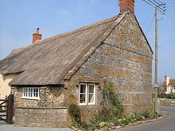 |
Broadway Broadway, Somerset Broadway is a village and civil parish in Somerset, England, situated west of Ilminster and north of Chard in the South Somerset district. The parish has a population of 616... |
Civil parish | 616 | Chard Rural District Chard Rural District Chard was a rural district in Somerset, England, from 1894 to 1974.It was created in 1894 under the Local Government Act 1894.In 1974 it was abolished under the Local Government Act 1972 when it became part of South Somerset.... |
50.93°N 2.97°W | |
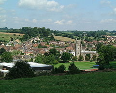 |
Bruton Bruton Bruton is a town and civil parish in Somerset, England, situated on the River Brue seven miles south-east of Shepton Mallet, just south of Snakelake Hill and Coombe Hill, ten miles north-west of Gillingham and twelve miles south-west of Frome in the South Somerset district. The town has a... |
Town | 2,495 | Wincanton Rural District Wincanton Rural District Wincanton was a rural district in Somerset, England, from 1894 to 1974.It was created in 1894 under the Local Government Act 1894.In 1974 it was abolished under the Local Government Act 1972 when it became part of South Somerset.... |
51.11°N 2.45°W | |
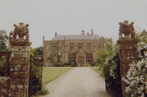 |
Brympton Brympton Brympton is a civil parish and ward in Somerset, UK. The parish is situated on the north-west edge of Yeovil in the South Somerset district. The parish/ward has a population of 4,956... |
Civil parish | 4,956 | Yeovil Rural District Yeovil Rural District Yeovil was a rural district in Somerset, England, from 1894 to 1974.It was created in 1894 under the Local Government Act 1894.In 1974 it was abolished under the Local Government Act 1972 when it became part of South Somerset.... |
50.94°N 2.68°W | |
| Buckland St Mary Buckland St Mary Buckland St Mary is a village and parish in Somerset, England, situated to the west of Ilminster and south of Taunton in the South Somerset district, close to the A303. The village has a population of 559... |
Civil parish | 559 | Chard Rural District Chard Rural District Chard was a rural district in Somerset, England, from 1894 to 1974.It was created in 1894 under the Local Government Act 1894.In 1974 it was abolished under the Local Government Act 1972 when it became part of South Somerset.... |
50.91°N 3.04°W | ||
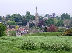 |
Castle Cary Castle Cary Castle Cary is a market town and civil parish in south Somerset, England, north west of Wincanton and south of Shepton Mallet.The town is situated on the River Cary, a tributary of the Parrett.-History:... |
Town | 2,096 | Wincanton Rural District Wincanton Rural District Wincanton was a rural district in Somerset, England, from 1894 to 1974.It was created in 1894 under the Local Government Act 1894.In 1974 it was abolished under the Local Government Act 1972 when it became part of South Somerset.... |
51.09°N 2.51°W | |
 |
Chaffcombe Chaffcombe Chaffcombe is a village and civil parish in Somerset, England, situated north east of Chard in the South Somerset district. The village has a population of 194.-History:... |
Civil parish | 194 | Chard Rural District Chard Rural District Chard was a rural district in Somerset, England, from 1894 to 1974.It was created in 1894 under the Local Government Act 1894.In 1974 it was abolished under the Local Government Act 1972 when it became part of South Somerset.... |
50.89°N 2.92°W | |
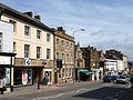 |
Chard Chard, Somerset Chard is a town and civil parish in the Somerset county of England. It lies on the A30 road near the Devon border, south west of Yeovil. The parish has a population of approximately 12,000 and, at an elevation of , it is the southernmost and highest town in Somerset... |
Town | 11,727 | Chard Municipal Borough Chard, Somerset Chard is a town and civil parish in the Somerset county of England. It lies on the A30 road near the Devon border, south west of Yeovil. The parish has a population of approximately 12,000 and, at an elevation of , it is the southernmost and highest town in Somerset... |
50.87°N 2.96°W | |
 |
Charlton Horethorne Charlton Horethorne Charlton Horethorne is a village and civil parish in Somerset, England, situated five miles north-east of Sherborne and five miles south-west of Wincanton in the South Somerset district... |
Civil parish | 605 | Wincanton Rural District Wincanton Rural District Wincanton was a rural district in Somerset, England, from 1894 to 1974.It was created in 1894 under the Local Government Act 1894.In 1974 it was abolished under the Local Government Act 1972 when it became part of South Somerset.... |
51.01°N 2.48°W | |
| Charlton Mackrell Charlton Mackrell Charlton Mackrell is a village and civil parish in Somerset, England, situated three miles east of Somerton in the South Somerset district. The village has a population of 996.... |
Civil parish | 996 | Langport Rural District Langport Rural District Langport was a rural district in Somerset, England, from 1894 to 1974.It was created in 1894 under the Local Government Act 1894.In 1974 it was abolished under the Local Government Act 1972 to become part of South Somerset.... |
51.05°N 2.68°W | ||
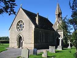 |
Charlton Musgrove Charlton Musgrove Charlton Musgrove is a village and civil parish in Somerset, England, situated north east of Wincanton in the South Somerset district. The village has a population of 375... |
Civil parish | 375 | Wincanton Rural District Wincanton Rural District Wincanton was a rural district in Somerset, England, from 1894 to 1974.It was created in 1894 under the Local Government Act 1894.In 1974 it was abolished under the Local Government Act 1972 when it became part of South Somerset.... |
51.08°N 2.39°W | |
| Chillington Chillington, Somerset Chillington is a village and parish in Somerset, England, situated west of Crewkerne and east of Chard in the South Somerset district. The parish has a population of 96. The parish includes the hamlet of Coombe.-History:... |
Civil parish | 96 | Chard Rural District Chard Rural District Chard was a rural district in Somerset, England, from 1894 to 1974.It was created in 1894 under the Local Government Act 1894.In 1974 it was abolished under the Local Government Act 1972 when it became part of South Somerset.... |
50.89°N 2.87°W | ||
 |
Chilthorne Domer Chilthorne Domer Chilthorne Domer is a village and parish in Somerset, England, situated north west of Yeovil in the South Somerset district. The village has a population of 569. It is situated on the old coach road from Ilchester to Yeovil.-History:... |
Civil parish | 569 | Yeovil Rural District Yeovil Rural District Yeovil was a rural district in Somerset, England, from 1894 to 1974.It was created in 1894 under the Local Government Act 1894.In 1974 it was abolished under the Local Government Act 1972 when it became part of South Somerset.... |
50.97°N 2.68°W | |
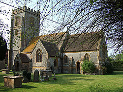 |
Chilton Cantelo Chilton Cantelo Chilton Cantelo is a village and parish in Somerset, England, situated on the River Yeo north of Yeovil and east of Ilchester in the South Somerset district. The village has a population of 132... |
Civil parish | 132 | Yeovil Rural District Yeovil Rural District Yeovil was a rural district in Somerset, England, from 1894 to 1974.It was created in 1894 under the Local Government Act 1894.In 1974 it was abolished under the Local Government Act 1972 when it became part of South Somerset.... |
51.00°N 2.60°W | |
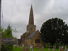 |
Chiselborough Chiselborough Chiselborough is a village situated on the river Parrett west of Yeovil in Somerset, England. The village has a population of 335.The village consists largely of small cottages built in the local golden hamstone quarried at the local Ham Hill.-History:... |
Civil parish | 335 | Yeovil Rural District Yeovil Rural District Yeovil was a rural district in Somerset, England, from 1894 to 1974.It was created in 1894 under the Local Government Act 1894.In 1974 it was abolished under the Local Government Act 1972 when it became part of South Somerset.... |
50.93°N 2.76°W | |
| Closworth Closworth Closworth is a village and civil parish in Somerset, England, situated five miles south of Yeovil in the South Somerset district, on the border with Dorset. The village has a population of 192.... |
Civil parish | 192 | Yeovil Rural District Yeovil Rural District Yeovil was a rural district in Somerset, England, from 1894 to 1974.It was created in 1894 under the Local Government Act 1894.In 1974 it was abolished under the Local Government Act 1972 when it became part of South Somerset.... |
50.89°N 2.62°W | ||
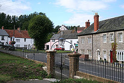 |
Combe St Nicholas Combe St Nicholas Combe St Nicholas is a village and parish in Somerset, England, situated north west of Chard and from Taunton in the South Somerset district on the edge of the Blackdown Hills Area of Outstanding Natural Beauty. The parish, which includes Wadeford and Scrapton, has a population of... |
Civil parish | 1,336 | Chard Rural District Chard Rural District Chard was a rural district in Somerset, England, from 1894 to 1974.It was created in 1894 under the Local Government Act 1894.In 1974 it was abolished under the Local Government Act 1972 when it became part of South Somerset.... |
50.89°N 2.99°W | |
| Compton Dundon Compton Dundon Compton Dundon is a village and civil parish in Somerset, England, situated beside King's Sedge Moor and the Polden Hills, south of Glastonbury and north of Somerton in the South Somerset district. The village has a population of 710... |
Civil parish | 710 | Langport Rural District Langport Rural District Langport was a rural district in Somerset, England, from 1894 to 1974.It was created in 1894 under the Local Government Act 1894.In 1974 it was abolished under the Local Government Act 1972 to become part of South Somerset.... |
51.09°N 2.73°W | ||
| Corton Denham Corton Denham Corton Denham is a village and parish in Somerset, England, situated seven miles north east of Yeovil in the South Somerset district. The village has a population of 210.-History:... |
Civil parish | 210 | Wincanton Rural District Wincanton Rural District Wincanton was a rural district in Somerset, England, from 1894 to 1974.It was created in 1894 under the Local Government Act 1894.In 1974 it was abolished under the Local Government Act 1972 when it became part of South Somerset.... |
51.00°N 2.52°W | ||
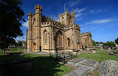 |
Crewkerne Crewkerne Crewkerne is a town in Somerset, England, situated south west of Yeovil and east of Chard in the South Somerset district close to the border with Dorset. The civil parish of West Crewkerne includes the hamlets of Woolminstone and Henley... |
Town | 6,705 | Crewkerne Urban District Crewkerne Crewkerne is a town in Somerset, England, situated south west of Yeovil and east of Chard in the South Somerset district close to the border with Dorset. The civil parish of West Crewkerne includes the hamlets of Woolminstone and Henley... |
50.88°N 2.79°W | |
| Cricket St Thomas | Civil parish | 50 | Chard Rural District Chard Rural District Chard was a rural district in Somerset, England, from 1894 to 1974.It was created in 1894 under the Local Government Act 1894.In 1974 it was abolished under the Local Government Act 1972 when it became part of South Somerset.... |
50.87°N 2.89°W | ||
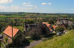 |
Cucklington Cucklington Cucklington is a village and parish in Somerset, England, situated on a hill south east of Wincanton and north west of Gillingham in the South Somerset district, near the Dorset border... |
Civil parish | 167 | Wincanton Rural District Wincanton Rural District Wincanton was a rural district in Somerset, England, from 1894 to 1974.It was created in 1894 under the Local Government Act 1894.In 1974 it was abolished under the Local Government Act 1972 when it became part of South Somerset.... |
51.05°N 2.35°W | |
 |
Cudworth Cudworth, Somerset Cudworth is a village and parish in Somerset, England, situated north east of Chard in the South Somerset district. The village has a population of 69.-History:The parish of Cudworth was part of the South Petherton Hundred.... |
Civil parish | 69 | Chard Rural District Chard Rural District Chard was a rural district in Somerset, England, from 1894 to 1974.It was created in 1894 under the Local Government Act 1894.In 1974 it was abolished under the Local Government Act 1972 when it became part of South Somerset.... |
50.89°N 2.89°W | |
| Curry Mallet Curry Mallet Curry Mallet is a village and parish in Somerset, England. It is on the Fivehead River , east of Taunton in the South Somerset district... |
Civil parish | 302 | Langport Rural District Langport Rural District Langport was a rural district in Somerset, England, from 1894 to 1974.It was created in 1894 under the Local Government Act 1894.In 1974 it was abolished under the Local Government Act 1972 to become part of South Somerset.... |
50.99°N 2.96°W | ||
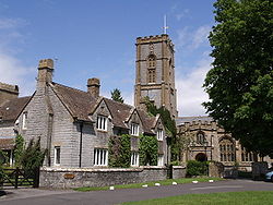 |
Curry Rivel Curry Rivel Curry Rivel is a village and civil parish in Somerset, England, situated west of Somerton and east of Taunton in the South Somerset district. The parish has a population of 2,093... |
Civil parish | 2,093 | Langport Rural District Langport Rural District Langport was a rural district in Somerset, England, from 1894 to 1974.It was created in 1894 under the Local Government Act 1894.In 1974 it was abolished under the Local Government Act 1972 to become part of South Somerset.... |
51.03°N 2.86°W | |
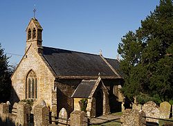 |
Dinnington Dinnington, Somerset Dinnington is a village and civil parish in English county of Somerset, situated north of Crewkerne in the South Somerset district. The village has a population of 65.-History:The name Dinnington means the settlement of Dynne's people.... |
Civil parish | 65 | Chard Rural District Chard Rural District Chard was a rural district in Somerset, England, from 1894 to 1974.It was created in 1894 under the Local Government Act 1894.In 1974 it was abolished under the Local Government Act 1972 when it became part of South Somerset.... |
50.91°N 2.85°W | |
| Donyatt Donyatt Donyatt is a village and civil parish in Somerset, England, situated at the source of the River Isle north of Chard in the South Somerset district... |
Civil parish | 368 | Chard Rural District Chard Rural District Chard was a rural district in Somerset, England, from 1894 to 1974.It was created in 1894 under the Local Government Act 1894.In 1974 it was abolished under the Local Government Act 1972 when it became part of South Somerset.... |
50.93°N 2.95°W | ||
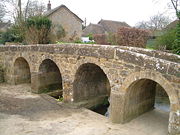 |
Dowlish Wake Dowlish Wake Dowlish Wake is a small village and civil parish in Somerset, England, situated south of Ilminster and north-east of Chard in the South Somerset district. The village has a population of 293 and is home to several thatched houses.... |
Civil parish | 293 | Chard Rural District Chard Rural District Chard was a rural district in Somerset, England, from 1894 to 1974.It was created in 1894 under the Local Government Act 1894.In 1974 it was abolished under the Local Government Act 1972 when it became part of South Somerset.... |
50.91°N 2.89°W | |
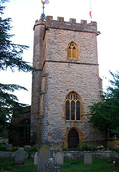 |
Drayton Drayton, Somerset Drayton is a village and civil parish in Somerset, England, situated less than a mile from Curry Rivel and five miles southwest of Somerton in the South Somerset district. It is situated on the River Isle, near its confluence with the Parrett, and the former Westport Canal... |
Civil parish | 391 | Langport Rural District Langport Rural District Langport was a rural district in Somerset, England, from 1894 to 1974.It was created in 1894 under the Local Government Act 1894.In 1974 it was abolished under the Local Government Act 1972 to become part of South Somerset.... |
51.019°N 2.85°W | |
| East Chinnock East Chinnock The Chinnocks are three villages in Somerset, England, south west of Yeovil in the South Somerset district:*East Chinnock*Middle Chinnock*West Chinnock... |
Civil parish | 546 | Yeovil Rural District Yeovil Rural District Yeovil was a rural district in Somerset, England, from 1894 to 1974.It was created in 1894 under the Local Government Act 1894.In 1974 it was abolished under the Local Government Act 1972 when it became part of South Somerset.... |
50.92°N 2.72°W | ||
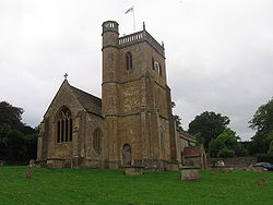 |
East Coker East Coker East Coker is a village and civil parish in the South Somerset district of Somerset, England. Its nearest town is Yeovil, which is situated two miles north from the village. The village has a population of 1,781... |
Civil parish | 1,781 | Yeovil Rural District Yeovil Rural District Yeovil was a rural district in Somerset, England, from 1894 to 1974.It was created in 1894 under the Local Government Act 1894.In 1974 it was abolished under the Local Government Act 1972 when it became part of South Somerset.... |
50.91°N 2.65°W | |
 |
Fivehead Fivehead Fivehead is a village and civil parish in Somerset, England, situated on the Fivehead River, miles east of Taunton in the South Somerset district... |
Civil parish | 643 | Langport Rural District Langport Rural District Langport was a rural district in Somerset, England, from 1894 to 1974.It was created in 1894 under the Local Government Act 1894.In 1974 it was abolished under the Local Government Act 1972 to become part of South Somerset.... |
50.99°N 2.92°W | |
 |
Hambridge and Westport Hambridge and Westport Hambridge and Westport is a civil parish in Somerset, England. It has a population of 526.It includes the villages of Hambridge and Westport in the South Somerset district.-History and General Information:... |
Civil parish | 526 | Langport Rural District Langport Rural District Langport was a rural district in Somerset, England, from 1894 to 1974.It was created in 1894 under the Local Government Act 1894.In 1974 it was abolished under the Local Government Act 1972 to become part of South Somerset.... |
50.99°N 2.86°W | |
 |
Hardington Mandeville Hardington Mandeville Hardington Mandeville is a village and civil parish in Somerset, England, situated south west of Yeovil in the South Somerset district. The village has a population of 598.-History:... |
Civil parish | 598 | Yeovil Rural District Yeovil Rural District Yeovil was a rural district in Somerset, England, from 1894 to 1974.It was created in 1894 under the Local Government Act 1894.In 1974 it was abolished under the Local Government Act 1972 when it became part of South Somerset.... |
50.90°N 2.69°W | |
| Haselbury Plucknett Haselbury Plucknett Haselbury Plucknett is a village and civil parish on the River Parrett in Somerset, England, situated south west of Yeovil in the South Somerset district. The village has a population of 641.... |
Civil parish | 641 | Yeovil Rural District Yeovil Rural District Yeovil was a rural district in Somerset, England, from 1894 to 1974.It was created in 1894 under the Local Government Act 1894.In 1974 it was abolished under the Local Government Act 1972 when it became part of South Somerset.... |
50.89°N 2.75°W | ||
 |
Henstridge Henstridge Henstridge is a village and civil parish in Somerset, England, situated miles east of Sherborne in the South Somerset district, near the border with Dorset. The parish includes the hamlet of Yenston... |
Civil parish | 1,651 | Wincanton Rural District Wincanton Rural District Wincanton was a rural district in Somerset, England, from 1894 to 1974.It was created in 1894 under the Local Government Act 1894.In 1974 it was abolished under the Local Government Act 1972 when it became part of South Somerset.... |
50.97°N 2.39°W | |
 |
High Ham High Ham High Ham is a village and civil parish in Somerset, England. Within the parish of High Ham are the villages of High Ham and Low Ham and the hamlets of Bowdens, Henley, Paradise and Picts Hill.-History:... |
Civil parish | 819 | Langport Rural District Langport Rural District Langport was a rural district in Somerset, England, from 1894 to 1974.It was created in 1894 under the Local Government Act 1894.In 1974 it was abolished under the Local Government Act 1972 to become part of South Somerset.... |
51.08°N 2.82°W | |
 |
Hinton St George Hinton St George Hinton St George is a village and parish in Somerset, England, situated outside of Crewkerne, south west of Yeovil in the South Somerset district. The village has a population of 404.... |
Civil parish | 404 | Chard Rural District Chard Rural District Chard was a rural district in Somerset, England, from 1894 to 1974.It was created in 1894 under the Local Government Act 1894.In 1974 it was abolished under the Local Government Act 1972 when it became part of South Somerset.... |
50.91°N 2.82°W | |
| Holton Holton, Somerset Holton is a village and parish in Somerset, England, situated on the A303 road south west of Wincanton in the South Somerset district. The village has a population of 225.-History:The parish of Holton was part of the Whitley Hundred.... |
Civil parish | 225 | Wincanton Rural District Wincanton Rural District Wincanton was a rural district in Somerset, England, from 1894 to 1974.It was created in 1894 under the Local Government Act 1894.In 1974 it was abolished under the Local Government Act 1972 when it became part of South Somerset.... |
51.04°N 2.45°W | ||
 |
Horsington Horsington, Somerset Horsington is a village and parish in Somerset, England, situated south of Wincanton and north of Templecombe in the South Somerset district. The village lies on the edge of Horsington Marsh, part of the Blackmore Vale... |
Civil parish | 582 | Wincanton Rural District Wincanton Rural District Wincanton was a rural district in Somerset, England, from 1894 to 1974.It was created in 1894 under the Local Government Act 1894.In 1974 it was abolished under the Local Government Act 1972 when it became part of South Somerset.... |
51.01°N 2.43°W | |
| Horton Horton, Somerset Horton is a village and civil parish in Somerset, England, situated north of Chard in the South Somerset district. The village has a population of 788.-History:... |
Civil parish | 788 | Chard Rural District Chard Rural District Chard was a rural district in Somerset, England, from 1894 to 1974.It was created in 1894 under the Local Government Act 1894.In 1974 it was abolished under the Local Government Act 1972 when it became part of South Somerset.... |
50.93°N 2.97°W | ||
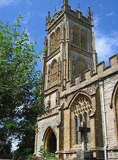 |
Huish Episcopi Huish Episcopi Huish Episcopi is a village and civil parish in Somerset, England, situated on the outskirts of Langport, south west of Somerton in the South Somerset district... |
Civil parish | 1,940 | Langport Rural District Langport Rural District Langport was a rural district in Somerset, England, from 1894 to 1974.It was created in 1894 under the Local Government Act 1894.In 1974 it was abolished under the Local Government Act 1972 to become part of South Somerset.... |
51.04°N 2.81°W | |
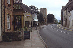 |
Ilchester Ilchester Ilchester is a village and civil parish, situated on the River Yeo or Ivel, five miles north of Yeovil, in the English county of Somerset. The parish, which includes the village of Sock Dennis and the old parish of Northover, has a population of 2,021... |
Civil parish | 2,021 | Yeovil Rural District Yeovil Rural District Yeovil was a rural district in Somerset, England, from 1894 to 1974.It was created in 1894 under the Local Government Act 1894.In 1974 it was abolished under the Local Government Act 1972 when it became part of South Somerset.... |
51.00°N 2.68°W | |
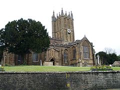 |
Ilminster Ilminster Ilminster is a country town and civil parish in the countryside of south west Somerset, England, with a population of 4,781. Bypassed a few years ago, the town now lies just east of the intersection of the A303 and the A358... |
Town | 4,781 | Chard Rural District Chard Rural District Chard was a rural district in Somerset, England, from 1894 to 1974.It was created in 1894 under the Local Government Act 1894.In 1974 it was abolished under the Local Government Act 1972 when it became part of South Somerset.... Ilminster Urban District Ilminster Ilminster is a country town and civil parish in the countryside of south west Somerset, England, with a population of 4,781. Bypassed a few years ago, the town now lies just east of the intersection of the A303 and the A358... |
50.93°N 2.91°W | |
| Ilton Ilton Ilton is a village and civil parish in Somerset, England, situated south-east of Taunton, and north of Ilminster in the South Somerset district. The village has a population of 849... |
Civil parish | 849 | Chard Rural District Chard Rural District Chard was a rural district in Somerset, England, from 1894 to 1974.It was created in 1894 under the Local Government Act 1894.In 1974 it was abolished under the Local Government Act 1972 when it became part of South Somerset.... |
50.95°N 2.92°W | ||
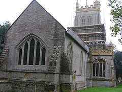 |
Isle Abbots Isle Abbots Isle Abbots is a village and civil parish in Somerset, England, situated south east of Taunton in the South Somerset district... |
Civil parish | 216 | Langport Rural District Langport Rural District Langport was a rural district in Somerset, England, from 1894 to 1974.It was created in 1894 under the Local Government Act 1894.In 1974 it was abolished under the Local Government Act 1972 to become part of South Somerset.... |
50.98°N 2.92°W | |
| Isle Brewers Isle Brewers Isle Brewers is a village and parish in Somerset, England, situated on the River Isle south east of Taunton in the South Somerset district. The village has a population of 163... |
Civil parish | 163 | Langport Rural District Langport Rural District Langport was a rural district in Somerset, England, from 1894 to 1974.It was created in 1894 under the Local Government Act 1894.In 1974 it was abolished under the Local Government Act 1972 to become part of South Somerset.... |
50.99°N 2.90°W | ||
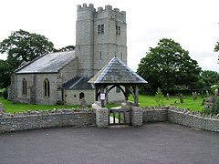 |
Keinton Mandeville Keinton Mandeville Keinton Mandeville is a village and civil parish in Somerset, England, situated west of Castle Cary in the South Somerset district. The village has a population of 991... |
Civil parish | 991 | Langport Rural District Langport Rural District Langport was a rural district in Somerset, England, from 1894 to 1974.It was created in 1894 under the Local Government Act 1894.In 1974 it was abolished under the Local Government Act 1972 to become part of South Somerset.... |
51.07°N 2.65°W | |
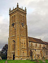 |
Kingsbury Episcopi Kingsbury Episcopi Kingsbury Episcopi is a village and civil parish on the River Parrett in Somerset, England, situated north west of Yeovil in the South Somerset district. The village has a population of 1,277. The parish includes the villages of West Lambrook, East Lambrook and Thorney.-History:The "Episcopi"... |
Civil parish | 1,277 | Langport Rural District Langport Rural District Langport was a rural district in Somerset, England, from 1894 to 1974.It was created in 1894 under the Local Government Act 1894.In 1974 it was abolished under the Local Government Act 1972 to become part of South Somerset.... |
50.99°N 2.81°W | |
 |
Kingsdon Kingsdon, Somerset Kingsdon is a village and parish in the South Somerset district of Somerset, England, situated south east of Somerton. The village has a population of 356.-History:... |
Civil parish | 356 | Langport Rural District Langport Rural District Langport was a rural district in Somerset, England, from 1894 to 1974.It was created in 1894 under the Local Government Act 1894.In 1974 it was abolished under the Local Government Act 1972 to become part of South Somerset.... |
51.04°N 2.69°W | |
| Kingstone Kingstone, Somerset Kingstone is a village and civil parish in Somerset, England, situated near Ilminster, north east of Chard in the South Somerset district. The village has a population of 83.... |
Civil parish | 83 | Chard Rural District Chard Rural District Chard was a rural district in Somerset, England, from 1894 to 1974.It was created in 1894 under the Local Government Act 1894.In 1974 it was abolished under the Local Government Act 1972 when it became part of South Somerset.... |
50.92°N 2.89°W | ||
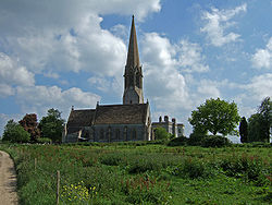 |
Kingweston Kingweston Kingweston is a village and civil parish in Somerset, England, situated north east of Somerton in the South Somerset district. The village has a population of 128.-History:The village's name was Chinwardestune in the Domesday Book of 1086... |
Civil parish | 128 | Langport Rural District Langport Rural District Langport was a rural district in Somerset, England, from 1894 to 1974.It was created in 1894 under the Local Government Act 1894.In 1974 it was abolished under the Local Government Act 1972 to become part of South Somerset.... |
51.08°N 2.68°W | |
| Knowle St Giles Knowle St Giles Knowle St Giles is a village and civil parish in the South Somerset district of Somerset, England, situated on the River Isle south of Ilminster and north east of Chard... |
Civil parish | 132 | Chard Rural District Chard Rural District Chard was a rural district in Somerset, England, from 1894 to 1974.It was created in 1894 under the Local Government Act 1894.In 1974 it was abolished under the Local Government Act 1972 when it became part of South Somerset.... |
50.90°N 2.93°W | ||
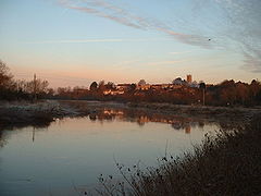 |
Langport Langport Langport is a small town and civil parish in Somerset, England, situated west of Somerton in the South Somerset district. The town has a population of 1,067. The parish includes the hamlets of Bowdens and Combe... |
Town | 1,067 | Langport Rural District Langport Rural District Langport was a rural district in Somerset, England, from 1894 to 1974.It was created in 1894 under the Local Government Act 1894.In 1974 it was abolished under the Local Government Act 1972 to become part of South Somerset.... |
51.04°N 2.83°W | |
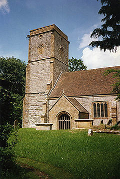 |
Limington Limington Limington is a village and parish in Somerset, England, situated north of Yeovil in the South Somerset district. The village has a population of 199... |
Civil parish | 199 | Yeovil Rural District Yeovil Rural District Yeovil was a rural district in Somerset, England, from 1894 to 1974.It was created in 1894 under the Local Government Act 1894.In 1974 it was abolished under the Local Government Act 1972 when it became part of South Somerset.... |
50.99°N 2.65°W | |
| Long Load Long Load Long Load is a village and parish in Somerset, England, situated on the River Yeo south of Somerton in the South Somerset district. The village has a population of 361.-History:Long Load's association with the river is long standing... |
Civil parish | 361 | Yeovil Rural District Yeovil Rural District Yeovil was a rural district in Somerset, England, from 1894 to 1974.It was created in 1894 under the Local Government Act 1894.In 1974 it was abolished under the Local Government Act 1972 when it became part of South Somerset.... |
51.01°N 2.76°W | ||
| Long Sutton Long Sutton, Somerset Long Sutton is a village and civil parish in Somerset, England, situated south of Somerton in the South Somerset district. The village has a population of 862.... |
Civil parish | 862 | Langport Rural District Langport Rural District Langport was a rural district in Somerset, England, from 1894 to 1974.It was created in 1894 under the Local Government Act 1894.In 1974 it was abolished under the Local Government Act 1972 to become part of South Somerset.... |
|||
| Lopen Lopen Lopen is a village and civil parish in the English county of Somerset, situated eight miles west of Yeovil in the South Somerset district. The village has a population of 248.-History:The name of the village means Lufa's pen or fold.... |
Civil parish | 248 | Chard Rural District Chard Rural District Chard was a rural district in Somerset, England, from 1894 to 1974.It was created in 1894 under the Local Government Act 1894.In 1974 it was abolished under the Local Government Act 1972 when it became part of South Somerset.... |
50.93°N 2.82°W | ||
| Lovington Lovington, Somerset Lovington is a village and civil parish in Somerset, England, situated south west of Castle Cary, between the River Brue and River Cary, in the South Somerset district... |
Civil parish | 172 | Wincanton Rural District Wincanton Rural District Wincanton was a rural district in Somerset, England, from 1894 to 1974.It was created in 1894 under the Local Government Act 1894.In 1974 it was abolished under the Local Government Act 1972 when it became part of South Somerset.... |
51.07°N 2.58°W | ||
| Maperton Maperton Maperton is a village and civil parish in Somerset, England, situated south west of Wincanton in the South Somerset district. The village has a population of 150. However this number includes Elliscombe House care home which alone has an average of 40 residents.-History:The name of the village... |
Civil parish | 150 | Wincanton Rural District Wincanton Rural District Wincanton was a rural district in Somerset, England, from 1894 to 1974.It was created in 1894 under the Local Government Act 1894.In 1974 it was abolished under the Local Government Act 1972 when it became part of South Somerset.... |
51.04°N 2.46°W | ||
| Marston Magna Marston Magna Marston Magna is a village and civil parish in Somerset, England, situated north of Yeovil in the South Somerset district... |
Civil parish | 431 | Yeovil Rural District Yeovil Rural District Yeovil was a rural district in Somerset, England, from 1894 to 1974.It was created in 1894 under the Local Government Act 1894.In 1974 it was abolished under the Local Government Act 1972 when it became part of South Somerset.... |
51.00°N 2.58°W | ||
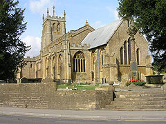 |
Martock Martock Martock is a large village and civil parish in Somerset, England, situated on the edge of the Somerset Levels north west of Yeovil in the South Somerset district. The parish includes Hurst, approximately one mile south of the village, and Bower Hinton, which is located at the western end of the... |
Civil parish | 4,468 | Yeovil Rural District Yeovil Rural District Yeovil was a rural district in Somerset, England, from 1894 to 1974.It was created in 1894 under the Local Government Act 1894.In 1974 it was abolished under the Local Government Act 1972 when it became part of South Somerset.... |
50.97°N 2.77°W | |
| Merriott Merriott Merriott is a village and civil parish in Somerset, England, near the town of Crewkerne and west of Yeovil in the South Somerset district. The village has a population of 2,020.... |
Civil parish | 2,020 | Chard Rural District Chard Rural District Chard was a rural district in Somerset, England, from 1894 to 1974.It was created in 1894 under the Local Government Act 1894.In 1974 it was abolished under the Local Government Act 1972 when it became part of South Somerset.... |
50.91°N 2.79°W | ||
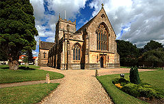 |
Milborne Port Milborne Port Milborne Port is a village and civil parish in Somerset, England, east of Sherborne, and in the South Somerset district. It has a population of 2,735... |
Civil parish | 2,735 | Wincanton Rural District Wincanton Rural District Wincanton was a rural district in Somerset, England, from 1894 to 1974.It was created in 1894 under the Local Government Act 1894.In 1974 it was abolished under the Local Government Act 1972 when it became part of South Somerset.... |
50.97°N 2.46°W | |
 |
Misterton Misterton, Somerset Misterton is a village and civil parish south-east of Crewkerne, Somerset, England.-History:The village was previously known as Minsterton as a result of its links with the "mother church" in Crewkerne.... |
Civil parish | 760 | Chard Rural District Chard Rural District Chard was a rural district in Somerset, England, from 1894 to 1974.It was created in 1894 under the Local Government Act 1894.In 1974 it was abolished under the Local Government Act 1972 when it became part of South Somerset.... |
50.87°N 2.78°W | |
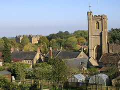 |
Montacute Montacute Montacute is a small village and civil parish in Somerset, England, west of Yeovil. The village has a population of 680 . The name Montacute is thought by some to derive from the Latin "Mons Acutus", referring to the small but still quite acute hill dominating the village to the west.The village... |
Civil parish | 679 | Yeovil Rural District Yeovil Rural District Yeovil was a rural district in Somerset, England, from 1894 to 1974.It was created in 1894 under the Local Government Act 1894.In 1974 it was abolished under the Local Government Act 1972 when it became part of South Somerset.... |
50.95°N 2.72°W | |
| Muchelney Muchelney Muchelney is a village and civil parish in Somerset, England, on the River Parrett, south of Huish Episcopi and miles south west of Somerton in the South Somerset district... |
Civil parish | 209 | Langport Rural District Langport Rural District Langport was a rural district in Somerset, England, from 1894 to 1974.It was created in 1894 under the Local Government Act 1894.In 1974 it was abolished under the Local Government Act 1972 to become part of South Somerset.... |
51.021°N 2.82°W | ||
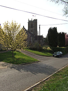 |
Mudford Mudford Mudford is a village and parish in Somerset, England, situated from Yeovil in the South Somerset district on the River Yeo. The village has a population of 649... |
Civil parish | 649 | Yeovil Rural District Yeovil Rural District Yeovil was a rural district in Somerset, England, from 1894 to 1974.It was created in 1894 under the Local Government Act 1894.In 1974 it was abolished under the Local Government Act 1972 when it became part of South Somerset.... |
50.97°N 2.61°W | |
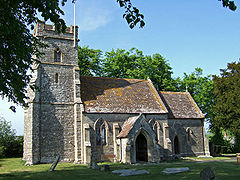 |
North Barrow North Barrow North Barrow is a village and civil parish to the north-east of Ilchester in the South Somerset district of Somerset, England.-History:The parish was part of the hundred of Catsash.-Governance:... |
Civil parish | 142 | Wincanton Rural District Wincanton Rural District Wincanton was a rural district in Somerset, England, from 1894 to 1974.It was created in 1894 under the Local Government Act 1894.In 1974 it was abolished under the Local Government Act 1972 when it became part of South Somerset.... |
51.06°N 2.57°W | |
 |
North Cadbury North Cadbury North Cadbury is a village west of Wincanton in the River Cam in the South Somerset district of Somerset, England. It shares its parish with nearby Yarlington and includes the village of Galhampton, which got its name from the settlement of the rent-paying peasants, and the hamlet of... |
Civil parish | 877 | Wincanton Rural District Wincanton Rural District Wincanton was a rural district in Somerset, England, from 1894 to 1974.It was created in 1894 under the Local Government Act 1894.In 1974 it was abolished under the Local Government Act 1972 when it became part of South Somerset.... |
51.05°N 2.52°W | |
| North Cheriton North Cheriton North Cheriton is a small village and civil parish in South Somerset with a population of 254. It is located on the A357 south-west of Wincanton.-History:North Cheriton is mentioned as a manor belonging to William de Moyon in the Domesday Book in 1086.... |
Civil parish | 254 | Wincanton Rural District Wincanton Rural District Wincanton was a rural district in Somerset, England, from 1894 to 1974.It was created in 1894 under the Local Government Act 1894.In 1974 it was abolished under the Local Government Act 1972 when it became part of South Somerset.... |
51.03°N 2.44°W | ||
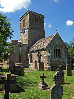 |
North Perrott North Perrott North Perrott is a village and civil parish in the South Somerset district of the English county of Somerset.-History:The name Perrott comes from the River Parrett.There is evidence of Roman and Iron Age settlement in the village.... |
Civil parish | 235 | Yeovil Rural District Yeovil Rural District Yeovil was a rural district in Somerset, England, from 1894 to 1974.It was created in 1894 under the Local Government Act 1894.In 1974 it was abolished under the Local Government Act 1972 when it became part of South Somerset.... |
50.88°N 2.75°W | |
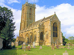 |
Norton sub Hamdon Norton Sub Hamdon Norton sub Hamdon is a village in the South Somerset district of the English county of Somerset, situated five miles west of Yeovil. The village has a population of 694.... |
Civil parish | 694 | Yeovil Rural District Yeovil Rural District Yeovil was a rural district in Somerset, England, from 1894 to 1974.It was created in 1894 under the Local Government Act 1894.In 1974 it was abolished under the Local Government Act 1972 when it became part of South Somerset.... |
50.94°N 2.76°W | |
| Odcombe Odcombe Odcombe is a village and civil parish in south Somerset, England, west of the town of Yeovil, with a population of 730 in 2002.The upper part of the village, Higher Odcombe, sits on the crest of the hill, while the lower part, Lower Odcombe, is built on its northern slopes... |
Civil parish | 730 | Yeovil Rural District Yeovil Rural District Yeovil was a rural district in Somerset, England, from 1894 to 1974.It was created in 1894 under the Local Government Act 1894.In 1974 it was abolished under the Local Government Act 1972 when it became part of South Somerset.... |
50.94°N 2.70°W | ||
| Penselwood Penselwood Penselwood is a village and civil parish in the English county of Somerset. It is located north east of Wincanton, south east of Bruton, west of Mere, and north west of Gillingham. The south-east of the parish borders Zeals and Stourhead in Wiltshire, and Bourton in Dorset... |
Civil parish | 275 | Wincanton Rural District Wincanton Rural District Wincanton was a rural district in Somerset, England, from 1894 to 1974.It was created in 1894 under the Local Government Act 1894.In 1974 it was abolished under the Local Government Act 1972 when it became part of South Somerset.... |
51.08°N 2.35°W | ||
| Pitcombe Pitcombe Pitcombe is a village and civil parish south-west of Bruton and from Wincanton in Somerset, England. It has a population of 549. The parish includes the hamlets of Cole and Godminster.... |
Civil parish | 549 | Wincanton Rural District Wincanton Rural District Wincanton was a rural district in Somerset, England, from 1894 to 1974.It was created in 1894 under the Local Government Act 1894.In 1974 it was abolished under the Local Government Act 1972 when it became part of South Somerset.... |
51.10°N 2.47°W | ||
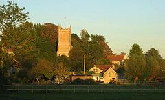 |
Pitney Pitney Pitney is a village and parish in Somerset, England, located east of Langport and west of Somerton in the South Somerset district. In 2002, the village had a population of 416.... |
Civil parish | 416 | Langport Rural District Langport Rural District Langport was a rural district in Somerset, England, from 1894 to 1974.It was created in 1894 under the Local Government Act 1894.In 1974 it was abolished under the Local Government Act 1972 to become part of South Somerset.... |
51.05°N 2.79°W | |
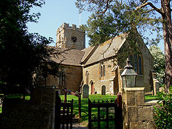 |
Puckington Puckington Puckington is a village and civil parish, situated south-east of Taunton and west of Yeovil in the South Somerset district of Somerset, England... |
Civil parish | 134 | Langport Rural District Langport Rural District Langport was a rural district in Somerset, England, from 1894 to 1974.It was created in 1894 under the Local Government Act 1894.In 1974 it was abolished under the Local Government Act 1972 to become part of South Somerset.... |
50.96°N 2.89°W | |
 |
Queen Camel Queen Camel Queen Camel is a village and civil parish, on the River Cam and the A359 road, in the South Somerset district of Somerset, England. It is about north of Yeovil. According to the 2001 census it had a population of 926. The parish includes the hamlet of Wales... |
Civil parish | 926 | Wincanton Rural District Wincanton Rural District Wincanton was a rural district in Somerset, England, from 1894 to 1974.It was created in 1894 under the Local Government Act 1894.In 1974 it was abolished under the Local Government Act 1972 when it became part of South Somerset.... |
51.02°N 2.58°W | |
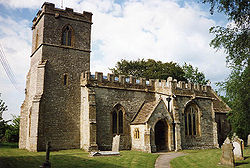 |
Rimpton Rimpton Rimpton is a village and civil parish north-west of Sherborne, and north-east of Yeovil on a tributary of the River Parret in the South Somerset district of Somerset, England.-History:The parish of Rimpton was part of the Taunton Deane Hundred... |
Civil parish | 235 | Yeovil Rural District Yeovil Rural District Yeovil was a rural district in Somerset, England, from 1894 to 1974.It was created in 1894 under the Local Government Act 1894.In 1974 it was abolished under the Local Government Act 1972 when it became part of South Somerset.... |
50.99°N 2.56°W | |
| Seavington St Mary Seavington St Mary Seavington St Mary is a village and civil parish in Somerset, England. It is situated next to the village of Seavington St Michael, about east of Ilminster, within the South Somerset district and had a population of 365 inhabitants at the 2001 census.... |
Civil parish | 365 | Chard Rural District Chard Rural District Chard was a rural district in Somerset, England, from 1894 to 1974.It was created in 1894 under the Local Government Act 1894.In 1974 it was abolished under the Local Government Act 1972 when it became part of South Somerset.... |
50.93°N 2.86°W | ||
| Seavington St Michael Seavington St Michael Seavington St Michael is a village and civil parish in Somerset, England. It is situated next to the village of Seavington St Mary, about east of Ilminster, within the South Somerset district.... |
Civil parish | 126 | Chard Rural District Chard Rural District Chard was a rural district in Somerset, England, from 1894 to 1974.It was created in 1894 under the Local Government Act 1894.In 1974 it was abolished under the Local Government Act 1972 when it became part of South Somerset.... |
50.93°N 2.84°W | ||
| Shepton Beauchamp Shepton Beauchamp Shepton Beauchamp is a village and civil parish, from Barrington and north east of Ilminster between the Blackdown Hills and the Somerset Levels in the South Somerset district of Somerset, England.-History:... |
Civil parish | 700 | Chard Rural District Chard Rural District Chard was a rural district in Somerset, England, from 1894 to 1974.It was created in 1894 under the Local Government Act 1894.In 1974 it was abolished under the Local Government Act 1972 when it became part of South Somerset.... |
50.95°N 2.85°W | ||
| Shepton Montague Shepton Montague Shepton Montague is a village and civil parish in Somerset, England. It is situated on the River Pitt in the South Somerset district midway between Wincanton, Bruton and Castle Cary.... |
Civil parish | 211 | Wincanton Rural District Wincanton Rural District Wincanton was a rural district in Somerset, England, from 1894 to 1974.It was created in 1894 under the Local Government Act 1894.In 1974 it was abolished under the Local Government Act 1972 when it became part of South Somerset.... |
51.08°N 2.47°W | ||
| Somerton Somerton Somerton is a small town and civil parish in the South Somerset district of the English county of Somerset. It gave its name to the county of Somerset, was briefly, around the start of the 14th century, the county town, and around 900 AD was possibly the capital of Wessex... |
Town | 4,706 | Langport Rural District Langport Rural District Langport was a rural district in Somerset, England, from 1894 to 1974.It was created in 1894 under the Local Government Act 1894.In 1974 it was abolished under the Local Government Act 1972 to become part of South Somerset.... |
51.05°N 2.74°W | ||
| South Barrow South Barrow South Barrow is a village and civil parish approximately north of Sparkford and north-east of Ilchester in the South Somerset district of Somerset, England.-History:... |
Civil parish | 146 | Wincanton Rural District Wincanton Rural District Wincanton was a rural district in Somerset, England, from 1894 to 1974.It was created in 1894 under the Local Government Act 1894.In 1974 it was abolished under the Local Government Act 1972 when it became part of South Somerset.... |
51.05°N 2.56°W | ||
| South Cadbury South Cadbury South Cadbury is a village and civil parish in the South Somerset council area of the English county of Somerset. The parish includes the village of Sutton Montis... |
Civil parish | 278 | Wincanton Rural District Wincanton Rural District Wincanton was a rural district in Somerset, England, from 1894 to 1974.It was created in 1894 under the Local Government Act 1894.In 1974 it was abolished under the Local Government Act 1972 when it became part of South Somerset.... |
51.03°N 2.52°W | ||
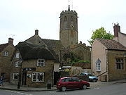 |
South Petherton South Petherton South Petherton is a small country town and civil parish on the River Parrett in the South Somerset district of Somerset, England. It is east of Ilminster and north west of Crewkerne. It had a population of approximately 3,200 in 2002... |
Civil parish | 3,222 | Yeovil Rural District Yeovil Rural District Yeovil was a rural district in Somerset, England, from 1894 to 1974.It was created in 1894 under the Local Government Act 1894.In 1974 it was abolished under the Local Government Act 1972 when it became part of South Somerset.... |
50.95°N 2.81°W | |
| Sparkford Sparkford Sparkford is a village and civil parish in the South Somerset district of Somerset, England. The parish includes the village of Weston Bampfylde.... |
Civil parish | 528 | Wincanton Rural District Wincanton Rural District Wincanton was a rural district in Somerset, England, from 1894 to 1974.It was created in 1894 under the Local Government Act 1894.In 1974 it was abolished under the Local Government Act 1972 when it became part of South Somerset.... |
51.04°N 2.57°W | ||
 |
Stocklinch Stocklinch Stocklinch is a village and civil parish north-east of Ilminster in the South Somerset district of Somerset, England.-History:The village is one Somerset's nine Thankful Villages , in which all the men who served in World War I came home, and one of only 14 doubly-thankful villages in the country... |
Civil parish | 121 | Chard Rural District Chard Rural District Chard was a rural district in Somerset, England, from 1894 to 1974.It was created in 1894 under the Local Government Act 1894.In 1974 it was abolished under the Local Government Act 1972 when it became part of South Somerset.... |
50.95°N 2.88°W | |
 |
Stoke sub Hamdon Stoke-sub-Hamdon Stoke-sub-Hamdon is a village and civil parish in South Somerset, situated west of Yeovil, England. The parish is located near the River Parrett, and includes the village of East Stoke.-History:... |
Civil parish | 2,004 | Yeovil Rural District Yeovil Rural District Yeovil was a rural district in Somerset, England, from 1894 to 1974.It was created in 1894 under the Local Government Act 1894.In 1974 it was abolished under the Local Government Act 1972 when it became part of South Somerset.... |
50.95°N 2.75°W | |
| Stoke Trister Stoke Trister Stoke Trister is a village and civil parish south-east of Wincanton and miles north-west of Gillingham close to the Dorset border in the South Somerset district of Somerset, England... |
Civil parish | 315 | Wincanton Rural District Wincanton Rural District Wincanton was a rural district in Somerset, England, from 1894 to 1974.It was created in 1894 under the Local Government Act 1894.In 1974 it was abolished under the Local Government Act 1972 when it became part of South Somerset.... |
51.06°N 2.38°W | ||
 |
Tatworth and Forton | Civil parish | 2,580 | Chard Rural District Chard Rural District Chard was a rural district in Somerset, England, from 1894 to 1974.It was created in 1894 under the Local Government Act 1894.In 1974 it was abolished under the Local Government Act 1972 when it became part of South Somerset.... |
50.85°N 2.96°W | |
 |
Tintinhull Tintinhull This article is about a village in England. For the Australian village, see Tintinhull, New South Wales.Tintinhull is a village and civil parish close to the A303 near Yeovil, south west of Ilchester, in Somerset, England... |
Civil parish | 956 | Yeovil Rural District Yeovil Rural District Yeovil was a rural district in Somerset, England, from 1894 to 1974.It was created in 1894 under the Local Government Act 1894.In 1974 it was abolished under the Local Government Act 1972 when it became part of South Somerset.... |
50.97°N 2.71°W | |
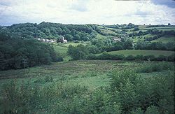 |
Wambrook Wambrook Wambrook is a village and civil parish in the Blackdown Hills, , south of Chard in Somerset, England. The parish includes the hamlets of Higher Wambrook and Lower Wambrook which is sometimes known as Haselcombe.-History:... |
Civil parish | 184 | Chard Rural District Chard Rural District Chard was a rural district in Somerset, England, from 1894 to 1974.It was created in 1894 under the Local Government Act 1894.In 1974 it was abolished under the Local Government Act 1972 when it became part of South Somerset.... |
50.86°N 3.00°W | |
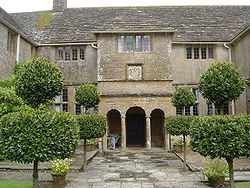 |
Wayford Wayford Wayford is a village and civil parish on the River Axe, south-west of Crewkerne, in the South Somerset district of Somerset, England. The parish contains the hamlets of Oathill and Clapton.-History:The parish was part of the hundred of Crewkerne.... |
Civil parish | 114 | Chard Rural District Chard Rural District Chard was a rural district in Somerset, England, from 1894 to 1974.It was created in 1894 under the Local Government Act 1894.In 1974 it was abolished under the Local Government Act 1972 when it became part of South Somerset.... |
50.85°N 2.85°W | |
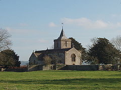 |
West Camel West Camel West Camel is a village and civil parish in south Somerset, England, about north of the town of Yeovil. Situated either side of the River Cam it lies just south of the A303 and has a population of 490... |
Civil parish | 490 | Yeovil Rural District Yeovil Rural District Yeovil was a rural district in Somerset, England, from 1894 to 1974.It was created in 1894 under the Local Government Act 1894.In 1974 it was abolished under the Local Government Act 1972 when it became part of South Somerset.... |
51.02°N 2.60°W | |
| West and Middle Chinnock | Civil parish | 564 | Yeovil Rural District Yeovil Rural District Yeovil was a rural district in Somerset, England, from 1894 to 1974.It was created in 1894 under the Local Government Act 1894.In 1974 it was abolished under the Local Government Act 1972 when it became part of South Somerset.... |
50.92°N 2.76°W | ||
| West Coker West Coker West Coker is a village and civil parish in Somerset, England, situated south west of Yeovil in the South Somerset district.-History:The name Coker comes from Coker Water .... |
Civil parish | 2,060 | Yeovil Rural District Yeovil Rural District Yeovil was a rural district in Somerset, England, from 1894 to 1974.It was created in 1894 under the Local Government Act 1894.In 1974 it was abolished under the Local Government Act 1972 when it became part of South Somerset.... |
50.92°N 2.69°W | ||
|
West Crewkerne | Civil parish | 491 | Chard Rural District Chard Rural District Chard was a rural district in Somerset, England, from 1894 to 1974.It was created in 1894 under the Local Government Act 1894.In 1974 it was abolished under the Local Government Act 1972 when it became part of South Somerset.... |
50.88°N 2.79°W | |
| Whitelackington Whitelackington Whitelackington is a village and civil parish on the A303 one mile north east of Ilminster, in Somerset, England. The parish includes Dillington Park and the hamlets of Atherstone and Ashwell.-Etymology:... |
Civil parish | 147 | Chard Rural District Chard Rural District Chard was a rural district in Somerset, England, from 1894 to 1974.It was created in 1894 under the Local Government Act 1894.In 1974 it was abolished under the Local Government Act 1972 when it became part of South Somerset.... |
50.94°N 2.88°W | ||
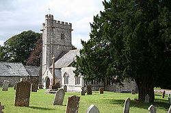 |
Whitestaunton Whitestaunton Whitestaunton is a village and civil parish in the South Somerset district of Somerset, England.-History:The parish of Whitestaunton was part of the South Petherton Hundred.... |
Civil parish | 232 | Chard Rural District Chard Rural District Chard was a rural district in Somerset, England, from 1894 to 1974.It was created in 1894 under the Local Government Act 1894.In 1974 it was abolished under the Local Government Act 1972 when it became part of South Somerset.... |
50.89°N 3.02°W | |
| Wincanton Wincanton Wincanton is a small town in south Somerset, southwest England. The town lies on the A303 road, the main route between London and South West England, and has some light industry... |
Town | 4,643 | Wincanton Rural District Wincanton Rural District Wincanton was a rural district in Somerset, England, from 1894 to 1974.It was created in 1894 under the Local Government Act 1894.In 1974 it was abolished under the Local Government Act 1972 when it became part of South Somerset.... |
51.06°N 2.41°W | ||
| Winsham Winsham Winsham is a village and civil parish south-east of Chard, Somerset, in the South Somerset district of Somerset, England. The parish includes the hamlet of Whatley.-History:The name Wincham means Wine's settlement.... |
Civil parish | 749 | Chard Rural District Chard Rural District Chard was a rural district in Somerset, England, from 1894 to 1974.It was created in 1894 under the Local Government Act 1894.In 1974 it was abolished under the Local Government Act 1972 when it became part of South Somerset.... |
50.85°N 2.89°W | ||
| Yarlington Yarlington Yarlington is a village and civil parish, near the source of the River Cam, in the English county of Somerset.Administratively, Yarlington shares a parish council with nearby North Cadbury and forms part of the district of South Somerset.... |
Civil parish | 120 | Wincanton Rural District Wincanton Rural District Wincanton was a rural district in Somerset, England, from 1894 to 1974.It was created in 1894 under the Local Government Act 1894.In 1974 it was abolished under the Local Government Act 1972 when it became part of South Somerset.... |
51.06°N 2.49°W | ||
 |
Yeovil Yeovil Yeovil is a town and civil parish in south Somerset, England. The parish had a population of 27,949 at the 2001 census, although the wider urban area had a population of 42,140... |
Town | 27,949 | Yeovil Municipal Borough Yeovil Yeovil is a town and civil parish in south Somerset, England. The parish had a population of 27,949 at the 2001 census, although the wider urban area had a population of 42,140... |
50.95°N 2.64°W | |
| Yeovil Without Yeovil Without Yeovil Without is a civil parish in the South Somerset district of Somerset, England.It lies on the northern edge of Yeovil. It includes both suburbs of Yeovil, including the Bucklers Mead development, and rural areas including the hamlets of Yeovil Marsh and Longcroft. The parish includes Johnson... |
Civil parish | 7,286 | Yeovil Rural District Yeovil Rural District Yeovil was a rural district in Somerset, England, from 1894 to 1974.It was created in 1894 under the Local Government Act 1894.In 1974 it was abolished under the Local Government Act 1972 when it became part of South Somerset.... |
50.96°N 2.65°W | ||
| Yeovilton Yeovilton Yeovilton is a village and civil parish in Somerset, England, situated east of Ilchester, north of Yeovil, in the South Somerset district. The village has a population of approximately 670.... |
Civil parish | 668 | Yeovil Rural District Yeovil Rural District Yeovil was a rural district in Somerset, England, from 1894 to 1974.It was created in 1894 under the Local Government Act 1894.In 1974 it was abolished under the Local Government Act 1972 when it became part of South Somerset.... |
51.00°N 2.65°W |
Taunton Deane
Part of the former Taunton Municipal BoroughTaunton
Taunton is the county town of Somerset, England. The town, including its suburbs, had an estimated population of 61,400 in 2001. It is the largest town in the shire county of Somerset....
is unparished.
| Image | Name | Status | Population | Former local authority | Coordinates | Refs |
|---|---|---|---|---|---|---|
| Ashbrittle Ashbrittle Ashbrittle is a village and civil parish in Somerset, England, situated nine miles west of Taunton and close to the River Tone and the route of the Grand Western Canal in the Taunton Deane district... |
Civil parish | 213 | Wellington Rural District Wellington Rural District (Somerset) Wellington was a rural district in Somerset, England, from 1894 to 1974.It was created in 1894 under the Local Government Act 1894.In 1974 it was abolished under the Local Government Act 1972 when it became part of Taunton Deane.... |
50.98°N 3.35°W | ||
 |
Ash Priors Ash Priors Ash Priors is a village and parish in Somerset, England, situated north west of Taunton in the Taunton Deane district. The village has a population of 131.-History:The parish of Ash Priors was part of the Kilmersdon Hundred,... |
Civil parish | 131 | Taunton Rural District Taunton Rural District Taunton was a rural district in Somerset, England, from 1894 to 1974.It was created in 1894 under the Local Government Act 1894.In 1974 it was abolished under the Local Government Act 1972 when it became part of Taunton Deane district.... |
51.06°N 3.21°W | |
| Bathealton Bathealton Bathealton is a village and civil parish in Somerset, England, situated west of Wellington and west of Taunton in the Taunton Deane district. The village has a population of 182.-History:It was recorded in the Domesday Book as Badeheltone... |
Civil parish | 182 | Wellington Rural District Wellington Rural District (Somerset) Wellington was a rural district in Somerset, England, from 1894 to 1974.It was created in 1894 under the Local Government Act 1894.In 1974 it was abolished under the Local Government Act 1972 when it became part of Taunton Deane.... |
51.01°N 3.31°W | ||
| Bickenhall Bickenhall Bickenhall is a hamlet and parish in Somerset, England, situated south east of Taunton in the Taunton Deane district. The parish, which includes the hamlet of Batten's Green, has a population of 122.... |
Civil parish | 122 | Taunton Rural District Taunton Rural District Taunton was a rural district in Somerset, England, from 1894 to 1974.It was created in 1894 under the Local Government Act 1894.In 1974 it was abolished under the Local Government Act 1972 when it became part of Taunton Deane district.... |
50.96°N 3.03°W | ||
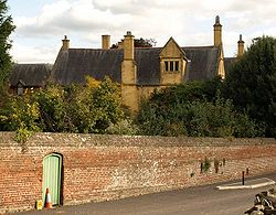 |
Bishops Hull Bishops Hull Bishop's Hull is a village and civil parish in Somerset, England, situated in the western suburbs of Taunton in the Taunton Deane district. It includes the areas of Rumwell, Rumwell Park, Roughmoor and Longaller and is close to the River Tone... |
Civil parish | 3,694 | Taunton Rural District Taunton Rural District Taunton was a rural district in Somerset, England, from 1894 to 1974.It was created in 1894 under the Local Government Act 1894.In 1974 it was abolished under the Local Government Act 1972 when it became part of Taunton Deane district.... |
51.02°N 3.14°W | |
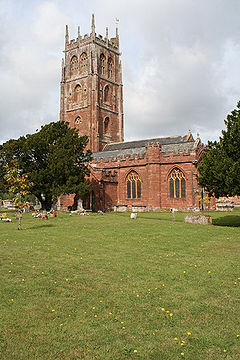 |
Bishops Lydeard Bishops Lydeard Bishops Lydeard is a village and civil parish located in Somerset, England, bypassed, since 1967, by the A358 road and West Somerset Railway north-west of Taunton in the district of Taunton Deane... |
Civil parish | 3,949 | Taunton Rural District Taunton Rural District Taunton was a rural district in Somerset, England, from 1894 to 1974.It was created in 1894 under the Local Government Act 1894.In 1974 it was abolished under the Local Government Act 1972 when it became part of Taunton Deane district.... |
51.06°N 3.19°W | |
| Bradford on Tone Bradford on Tone Bradford on Tone is a village and civil parish in Somerset, England, situated on the River Tone south west of Taunton in the Taunton Deane district... |
Civil parish | 606 | Wellington Rural District Wellington Rural District (Somerset) Wellington was a rural district in Somerset, England, from 1894 to 1974.It was created in 1894 under the Local Government Act 1894.In 1974 it was abolished under the Local Government Act 1972 when it became part of Taunton Deane.... |
51.00°N 3.18°W | ||
| Burrowbridge Burrowbridge Burrowbridge is a village and civil parish in Somerset, England, situated on the River Parrett and A361 road south east of Bridgwater in the Taunton Deane district on the edge of the Somerset Levels... |
Civil parish | 526 | Taunton Rural District Taunton Rural District Taunton was a rural district in Somerset, England, from 1894 to 1974.It was created in 1894 under the Local Government Act 1894.In 1974 it was abolished under the Local Government Act 1972 when it became part of Taunton Deane district.... |
51.07°N 2.92°W | ||
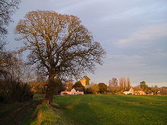 |
Cheddon Fitzpaine Cheddon Fitzpaine Cheddon Fitzpaine is a village and civil parish in Somerset, England, situated on the Quantock Hills north of Taunton in the Taunton Deane district... |
Civil parish | 1,307 | Taunton Rural District Taunton Rural District Taunton was a rural district in Somerset, England, from 1894 to 1974.It was created in 1894 under the Local Government Act 1894.In 1974 it was abolished under the Local Government Act 1972 when it became part of Taunton Deane district.... |
51.04°N 3.08°W | |
| Chipstable Chipstable Chipstable is a village and civil parish in Somerset, England, situated beside Heydon Hill west of Taunton in the Taunton Deane district. The parish has a population of 253.The parish includes Raddington and Waterrow.-History:... |
Civil parish | 253 | Wellington Rural District Wellington Rural District (Somerset) Wellington was a rural district in Somerset, England, from 1894 to 1974.It was created in 1894 under the Local Government Act 1894.In 1974 it was abolished under the Local Government Act 1972 when it became part of Taunton Deane.... |
51.04°N 3.37°W | ||
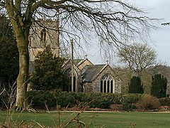 |
Churchstanton Churchstanton Churchstanton is a village and civil parish in Somerset, England, situated within the Blackdown Hills Area of Outstanding Natural Beauty, on the River Otter south of Taunton in the Taunton Deane district.The parish has a population of 760... |
Civil parish | 760 | Taunton Rural District Taunton Rural District Taunton was a rural district in Somerset, England, from 1894 to 1974.It was created in 1894 under the Local Government Act 1894.In 1974 it was abolished under the Local Government Act 1972 when it became part of Taunton Deane district.... |
50.92°N 3.15°W | |
 |
Combe Florey Combe Florey Combe Florey is a village and civil parish in Somerset, England, situated north west of Taunton in the Taunton Deane district, on the West Somerset Railway. The village has a population of 252... |
Civil parish | 252 | Taunton Rural District Taunton Rural District Taunton was a rural district in Somerset, England, from 1894 to 1974.It was created in 1894 under the Local Government Act 1894.In 1974 it was abolished under the Local Government Act 1972 when it became part of Taunton Deane district.... |
51.08°N 3.21°W | |
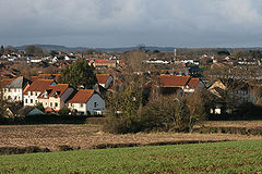 |
Comeytrowe Comeytrowe Comeytrowe is a civil parish in Somerset, England, situated in the south western suburbs of Taunton in the Taunton Deane district. The parish has a population of 5,780... |
Civil parish | 5,780 | Taunton Municipal Borough Taunton Taunton is the county town of Somerset, England. The town, including its suburbs, had an estimated population of 61,400 in 2001. It is the largest town in the shire county of Somerset.... Taunton Rural District Taunton Rural District Taunton was a rural district in Somerset, England, from 1894 to 1974.It was created in 1894 under the Local Government Act 1894.In 1974 it was abolished under the Local Government Act 1972 when it became part of Taunton Deane district.... |
51.01°N 3.13°W | |
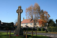 |
Corfe Corfe Corfe is a village and civil parish in Somerset, England, situated below the Blackdown Hills south of Taunton in the Taunton Deane district. The village has a population of 262.-History:... |
Civil parish | 262 | Taunton Rural District Taunton Rural District Taunton was a rural district in Somerset, England, from 1894 to 1974.It was created in 1894 under the Local Government Act 1894.In 1974 it was abolished under the Local Government Act 1972 when it became part of Taunton Deane district.... |
50.97°N 3.09°W | |
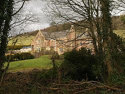 |
Cothelstone Cothelstone Cothelstone is a village and civil parish in Somerset, England, situated in the Quantock Hills six miles north of Taunton in the Taunton Deane district... |
Civil parish | 111 | Taunton Rural District Taunton Rural District Taunton was a rural district in Somerset, England, from 1894 to 1974.It was created in 1894 under the Local Government Act 1894.In 1974 it was abolished under the Local Government Act 1972 when it became part of Taunton Deane district.... |
51.08°N 3.16°W | |
| Creech St Michael Creech St Michael Creech St. Michael is a village and civil parish in Somerset, England, situated three miles east of Taunton in the Taunton Deane district. The village has a population of 2,464... |
Civil parish | 2,464 | Taunton Rural District Taunton Rural District Taunton was a rural district in Somerset, England, from 1894 to 1974.It was created in 1894 under the Local Government Act 1894.In 1974 it was abolished under the Local Government Act 1972 when it became part of Taunton Deane district.... |
51.02°N 3.04°W | ||
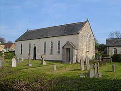 |
Curland Curland Curland is a village and civil parish in Somerset, England, situated south of Taunton in the Taunton Deane district. The village has a population of 141... |
Civil parish | 141 | Taunton Rural District Taunton Rural District Taunton was a rural district in Somerset, England, from 1894 to 1974.It was created in 1894 under the Local Government Act 1894.In 1974 it was abolished under the Local Government Act 1972 when it became part of Taunton Deane district.... |
50.95°N 3.03°W | |
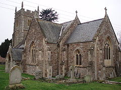 |
Durston Durston Durston is a village and civil parish in Somerset, England, situated on the A361 road north east of Taunton and south of Bridgwater in the Taunton Deane district. The parish lies on undulating ground between the lowest slopes of the Quantock Hills and the valley of the River Tone at the Curry and... |
Civil parish | 141 | Taunton Rural District Taunton Rural District Taunton was a rural district in Somerset, England, from 1894 to 1974.It was created in 1894 under the Local Government Act 1894.In 1974 it was abolished under the Local Government Act 1972 when it became part of Taunton Deane district.... |
51.05°N 3.01°W | |
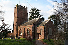 |
Fitzhead Fitzhead Fitzhead is a village and civil parish in Somerset, England, situated approximately north west of Taunton in the Taunton Deane district. The village has an estimated population of 251.-History:... |
Civil parish | 251 | Wellington Rural District Wellington Rural District (Somerset) Wellington was a rural district in Somerset, England, from 1894 to 1974.It was created in 1894 under the Local Government Act 1894.In 1974 it was abolished under the Local Government Act 1972 when it became part of Taunton Deane.... |
51.05°N 3.26°W | |
 |
Halse Halse, Somerset Halse is a village and civil parish in Somerset, England, situated north west of Taunton in the Taunton Deane district. The village has a population of 271.-History:The name of the village derives from the Old English heals meaning a neck of land.... |
Civil parish | 271 | Taunton Rural District Taunton Rural District Taunton was a rural district in Somerset, England, from 1894 to 1974.It was created in 1894 under the Local Government Act 1894.In 1974 it was abolished under the Local Government Act 1972 when it became part of Taunton Deane district.... |
51.04°N 3.23°W | |
 |
Hatch Beauchamp Hatch Beauchamp Hatch Beauchamp is a village and civil parish in Somerset, England, situated south east of Taunton in the Taunton Deane district. The village has a population of 575.-History:... |
Civil parish | 575 | Taunton Rural District Taunton Rural District Taunton was a rural district in Somerset, England, from 1894 to 1974.It was created in 1894 under the Local Government Act 1894.In 1974 it was abolished under the Local Government Act 1972 when it became part of Taunton Deane district.... |
50.98°N 2.99°W | |
 |
Kingston St Mary | Civil parish | 888 | Taunton Rural District Taunton Rural District Taunton was a rural district in Somerset, England, from 1894 to 1974.It was created in 1894 under the Local Government Act 1894.In 1974 it was abolished under the Local Government Act 1972 when it became part of Taunton Deane district.... |
51.06°N 3.11°W | |
| Langford Budville Langford Budville Langford Budville is a village and civil parish in Somerset, England, situated near the River Tone miles north-west of Wellington, from Wiveliscombe and west of Taunton in the Taunton Deane district. The parish includes the hamlets of Bindon, Lower Chipley, Lower Wellisford, Ramsey and Runnington... |
Civil parish | 473 | Wellington Rural District Wellington Rural District (Somerset) Wellington was a rural district in Somerset, England, from 1894 to 1974.It was created in 1894 under the Local Government Act 1894.In 1974 it was abolished under the Local Government Act 1972 when it became part of Taunton Deane.... |
51.00°N 3.27°W | ||
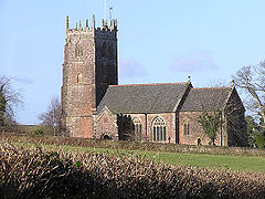 |
Lydeard St Lawrence | Civil parish | 416 | Taunton Rural District Taunton Rural District Taunton was a rural district in Somerset, England, from 1894 to 1974.It was created in 1894 under the Local Government Act 1894.In 1974 it was abolished under the Local Government Act 1972 when it became part of Taunton Deane district.... |
51.09°N 3.25°W | |
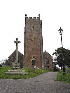 > > |
Milverton Milverton, Somerset Milverton is a village and civil parish in Somerset, England, situated in the valley of the River Tone west of Taunton in the Taunton Deane district. The village has a population of 1,385... |
Civil parish | 1,385 | Wellington Rural District Wellington Rural District (Somerset) Wellington was a rural district in Somerset, England, from 1894 to 1974.It was created in 1894 under the Local Government Act 1894.In 1974 it was abolished under the Local Government Act 1972 when it became part of Taunton Deane.... |
51.02°N 3.25°W | |
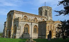 |
North Curry North Curry North Curry is a village and civil parish in Somerset, England, situated east of Taunton in the Taunton Deane district. The parish, which includes Knapp and Lower Knapp has a population of 1,625.... |
Civil parish | 1,625 | Taunton Rural District Taunton Rural District Taunton was a rural district in Somerset, England, from 1894 to 1974.It was created in 1894 under the Local Government Act 1894.In 1974 it was abolished under the Local Government Act 1972 when it became part of Taunton Deane district.... |
51.02°N 2.96°W | |
| Norton Fitzwarren Norton Fitzwarren Norton Fitzwarren is a village and civil parish in Somerset, England, situated north west of Taunton in the Taunton Deane district. The village has a population of 2,325.-History:... |
Civil parish | 2,325 | Taunton Rural District Taunton Rural District Taunton was a rural district in Somerset, England, from 1894 to 1974.It was created in 1894 under the Local Government Act 1894.In 1974 it was abolished under the Local Government Act 1972 when it became part of Taunton Deane district.... |
51.02°N 3.15°W | ||
 |
Nynehead Nynehead Nynehead is a village and civil parish in Somerset, England, situated on the River Tone, south-west of Taunton and north-west of Wellington, in the Taunton Deane district. The village has a population of 416.-History:... |
Civil parish | 416 | Wellington Rural District Wellington Rural District (Somerset) Wellington was a rural district in Somerset, England, from 1894 to 1974.It was created in 1894 under the Local Government Act 1894.In 1974 it was abolished under the Local Government Act 1972 when it became part of Taunton Deane.... |
50.99°N 3.23°W | |
| Oake Oake Oake is a village and civil parish in Somerset, England, situated west of Taunton in the Taunton Deane district. The village has a population of 695.... |
Civil parish | 695 | Wellington Rural District Wellington Rural District (Somerset) Wellington was a rural district in Somerset, England, from 1894 to 1974.It was created in 1894 under the Local Government Act 1894.In 1974 it was abolished under the Local Government Act 1972 when it became part of Taunton Deane.... |
51.02°N 3.21°W | ||
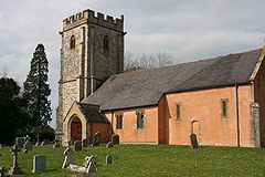 |
Orchard Portman Orchard Portman Orchard Portman is a village and civil parish in Somerset, England, situated south of Taunton in the Taunton Deane district. The village has a population of 150.... |
Civil parish | 150 | Taunton Rural District Taunton Rural District Taunton was a rural district in Somerset, England, from 1894 to 1974.It was created in 1894 under the Local Government Act 1894.In 1974 it was abolished under the Local Government Act 1972 when it became part of Taunton Deane district.... |
50.99°N 3.08°W | |
| Otterford Otterford Otterford is a village and civil parish in Somerset, England. It is situated on the Blackdown Hills, south of Taunton in the Taunton Deane district... |
Civil parish | 384 | Taunton Rural District Taunton Rural District Taunton was a rural district in Somerset, England, from 1894 to 1974.It was created in 1894 under the Local Government Act 1894.In 1974 it was abolished under the Local Government Act 1972 when it became part of Taunton Deane district.... |
50.92°N 3.10°W | ||
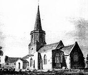 |
Pitminster Pitminster Pitminster is a village and civil parish in Somerset, England, situated south of Taunton in the Taunton Deane district. The village has a population of 929. The parish also includes the villages of Angersleigh, Blagdon or Blagdon Hill and Staplehay... |
Civil parish | 929 | Taunton Rural District Taunton Rural District Taunton was a rural district in Somerset, England, from 1894 to 1974.It was created in 1894 under the Local Government Act 1894.In 1974 it was abolished under the Local Government Act 1972 when it became part of Taunton Deane district.... |
50.97°N 3.11°W | |
| Ruishton Ruishton Ruishton is a village and civil parish in Somerset, England, situated on the River Tone and A358 road east of Taunton in the Taunton Deane district. The village has a population of 1,389... |
Civil parish | 1,389 | Taunton Rural District Taunton Rural District Taunton was a rural district in Somerset, England, from 1894 to 1974.It was created in 1894 under the Local Government Act 1894.In 1974 it was abolished under the Local Government Act 1972 when it became part of Taunton Deane district.... |
51.02°N 3.05°W | ||
| Sampford Arundel Sampford Arundel Sampford Arundel is a village and civil parish in Somerset, England. It is situated near Wellington and south west of Taunton in the Taunton Deane district... |
Civil parish | 334 | Wellington Rural District Wellington Rural District (Somerset) Wellington was a rural district in Somerset, England, from 1894 to 1974.It was created in 1894 under the Local Government Act 1894.In 1974 it was abolished under the Local Government Act 1972 when it became part of Taunton Deane.... |
50.96°N 3.28°W | ||
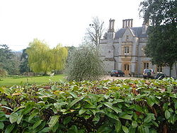 |
Staple Fitzpaine Staple Fitzpaine Staple Fitzpaine is a village and civil parish in Somerset, England, situated south of Taunton in the Taunton Deane district. The village has a population of 151 and is within the Blackdown Hills Area of Outstanding Natural Beauty... |
Civil parish | 151 | Taunton Rural District Taunton Rural District Taunton was a rural district in Somerset, England, from 1894 to 1974.It was created in 1894 under the Local Government Act 1894.In 1974 it was abolished under the Local Government Act 1972 when it became part of Taunton Deane district.... |
50.96°N 3.05°W | |
| Staplegrove | Civil parish | 1,889 | Taunton Rural District Taunton Rural District Taunton was a rural district in Somerset, England, from 1894 to 1974.It was created in 1894 under the Local Government Act 1894.In 1974 it was abolished under the Local Government Act 1972 when it became part of Taunton Deane district.... |
51.03°N 3.12°W | ||
| Stawley Stawley Stawley is a village and civil parish in Somerset, England, situated west of Taunton in the Taunton Deane district. The parish has a population of 305 and includes the village of Kittisford and the hamlets of Appley, Greenham and Tracebridge.-History:The village was recorded in the Domesday Book... |
Civil parish | 305 | Wellington Rural District Wellington Rural District (Somerset) Wellington was a rural district in Somerset, England, from 1894 to 1974.It was created in 1894 under the Local Government Act 1894.In 1974 it was abolished under the Local Government Act 1972 when it became part of Taunton Deane.... |
51.00°N 3.33°W | ||
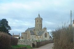 |
Stoke St Gregory Stoke St Gregory Stoke St Gregory is a village and civil parish in Somerset, England, situated east of Taunton in the Taunton Deane district. The parish has a population of 920, and includes the hamlet of Stathe.-History:... |
Civil parish | 920 | Taunton Rural District Taunton Rural District Taunton was a rural district in Somerset, England, from 1894 to 1974.It was created in 1894 under the Local Government Act 1894.In 1974 it was abolished under the Local Government Act 1972 when it became part of Taunton Deane district.... |
51.04°N 2.94°W | |
| Stoke St Mary Stoke St Mary Stoke St Mary is a village and civil parish in Somerset, England, situated south east of Taunton in the Taunton Deane district.-History:The earliest recorded mention of Stoke St Mary is in a Saxon charter dated 854 AD, when a West Saxon king gave the clearly defined lands at ‘Stoc’ to the minster... |
Civil parish | 423 | Taunton Rural District Taunton Rural District Taunton was a rural district in Somerset, England, from 1894 to 1974.It was created in 1894 under the Local Government Act 1894.In 1974 it was abolished under the Local Government Act 1972 when it became part of Taunton Deane district.... |
50.99°N 3.05°W | ||
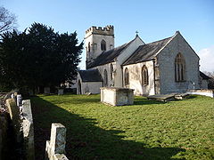 |
Thornfalcon Thornfalcon Thornfalcon is a village and civil parish in Somerset, England, situated east of Taunton in the Taunton Deane district. The village has 121 people. The parish includes the hamlet of Ash... |
Civil parish | 121 | Taunton Rural District Taunton Rural District Taunton was a rural district in Somerset, England, from 1894 to 1974.It was created in 1894 under the Local Government Act 1894.In 1974 it was abolished under the Local Government Act 1972 when it became part of Taunton Deane district.... |
51.01°N 3.02°W | |
| Tolland Tolland, Somerset Tolland is a village and civil parish in Somerset, England, situated north west of Taunton, between the Brendon Hills and Quantock Hills, in the Taunton Deane district. The parish has a population of 81.-History:... |
Civil parish | 81 | Taunton Rural District Taunton Rural District Taunton was a rural district in Somerset, England, from 1894 to 1974.It was created in 1894 under the Local Government Act 1894.In 1974 it was abolished under the Local Government Act 1972 when it became part of Taunton Deane district.... |
51.08°N 3.28°W | ||
 |
Trull Trull Trull is village and civil parish in Somerset, England, situated near Taunton. The parish which includes Dipford has a population of 1,861.-History:The name Trull is thought to derive from the word Trendle meaning circle or wheel.... |
Civil parish | 1,861 | Taunton Rural District Taunton Rural District Taunton was a rural district in Somerset, England, from 1894 to 1974.It was created in 1894 under the Local Government Act 1894.In 1974 it was abolished under the Local Government Act 1972 when it became part of Taunton Deane district.... |
51.00°N 3.12°W | |
| Wellington Wellington, Somerset Wellington is a small industrial town in rural Somerset, England, situated south west of Taunton in the Taunton Deane district, near the border with Devon, which runs along the Blackdown Hills to the south of the town... |
Town | 12,979 | Wellington Urban District Wellington, Somerset Wellington is a small industrial town in rural Somerset, England, situated south west of Taunton in the Taunton Deane district, near the border with Devon, which runs along the Blackdown Hills to the south of the town... |
50.98°N 3.22°W | ||
| – | Wellington Without Wellington Without Wellington Without is a civil parish in the Taunton Deane district of Somerset, England.It lies south of Wellington and has a population of 716... |
Civil parish | 716 | Wellington Rural District Wellington Rural District (Somerset) Wellington was a rural district in Somerset, England, from 1894 to 1974.It was created in 1894 under the Local Government Act 1894.In 1974 it was abolished under the Local Government Act 1972 when it became part of Taunton Deane.... |
50.96°N 3.23°W | |
| West Bagborough West Bagborough West Bagborough is a village and civil parish in Somerset, England, situated north of Taunton in the Taunton Deane district. The village has a population of 394.... |
Civil parish | 394 | Taunton Rural District Taunton Rural District Taunton was a rural district in Somerset, England, from 1894 to 1974.It was created in 1894 under the Local Government Act 1894.In 1974 it was abolished under the Local Government Act 1972 when it became part of Taunton Deane district.... |
51.09°N 3.18°W | ||
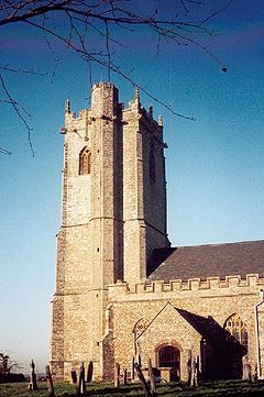 |
West Buckland West Buckland West Buckland is a village and civil parish in Somerset, England, situated south west of Taunton in the Taunton Deane district. The parish has a population of 999.-History:... |
Civil parish | 999 | Wellington Rural District Wellington Rural District (Somerset) Wellington was a rural district in Somerset, England, from 1894 to 1974.It was created in 1894 under the Local Government Act 1894.In 1974 it was abolished under the Local Government Act 1972 when it became part of Taunton Deane.... |
50.98°N 3.18°W | |
| West Hatch West Hatch West Hatch is a hamlet and civil parish in Somerset, England, situated south east of Taunton in the Taunton Deane district. It has a population of 292.-History:The name of the hamlet indicates it lies to the west of Hatch Beauchamp.... |
Civil parish | 292 | Taunton Rural District Taunton Rural District Taunton was a rural district in Somerset, England, from 1894 to 1974.It was created in 1894 under the Local Government Act 1894.In 1974 it was abolished under the Local Government Act 1972 when it became part of Taunton Deane district.... |
50.98°N 3.02°W | ||
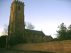 |
West Monkton West Monkton West Monkton is a village and civil parish in Somerset, England, situated north east of Taunton in the Taunton Deane district. The parish includes the hamlets of Monkton Heathfield, Bathpool, Burlinch and Coombe, and had a population of 2,663 at the 2001 census.-History:The charter for West... |
Civil parish | 2,439 | Taunton Rural District Taunton Rural District Taunton was a rural district in Somerset, England, from 1894 to 1974.It was created in 1894 under the Local Government Act 1894.In 1974 it was abolished under the Local Government Act 1972 when it became part of Taunton Deane district.... |
51.05°N 3.05°W | |
| Wiveliscombe Wiveliscombe Wiveliscombe is a town and civil parish in Somerset, England, situated west of Taunton in the Taunton Deane district. The town has a population of 2,670. The parish includes the nearby hamlet of Maundown.-History:... |
Civil parish | 2,670 | Wellington Rural District Wellington Rural District (Somerset) Wellington was a rural district in Somerset, England, from 1894 to 1974.It was created in 1894 under the Local Government Act 1894.In 1974 it was abolished under the Local Government Act 1972 when it became part of Taunton Deane.... |
51.04°N 3.31°W |
West Somerset
The whole of the district is parished.| Image | Name | Status | Population | Former local authority | Coordinates | Refs |
|---|---|---|---|---|---|---|
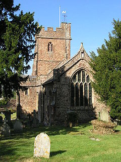 |
Bicknoller Bicknoller Bicknoller is a village and civil parish on the western slopes of the Quantock Hills in the English county of Somerset.Administratively, the civil parish falls within the West Somerset local government district within the Somerset shire county, with administrative tasks shared between county,... |
Civil parish | 394 | Williton Rural District Williton Rural District Williton was a rural district in Somerset, England, from 1894 to 1974.It was created in 1894 under the Local Government Act 1894.In 1974 it was abolished under the Local Government Act 1972 when it became part of West Somerset.... |
51.15°N 3.27°W | |
 |
Brompton Ralph Brompton Ralph Brompton Ralph is a village and civil parish in the West Somerset district of Somerset, England, about west of Taunton, and north of Wiveliscombe. It is in a wooded district at the eastern extremity of the Brendon Hills... |
Civil parish | 245 | Williton Rural District Williton Rural District Williton was a rural district in Somerset, England, from 1894 to 1974.It was created in 1894 under the Local Government Act 1894.In 1974 it was abolished under the Local Government Act 1972 when it became part of West Somerset.... |
51.08°N 3.31°W | |
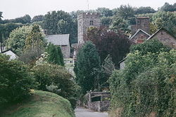 |
Brompton Regis Brompton Regis Brompton Regis is a village and civil parish in the West Somerset district of Somerset, England about north-east of Dulverton. It is situated on the River Haddeo in the Brendon Hills within the Exmoor National Park, close to Wimbleball Lake, a water supply reservoir constructed in the 1970s and... |
Civil parish | 472 | Dulverton Rural District Dulverton Rural District Dulverton was a rural district in Somerset, England, from 1894 to 1974.It was created in 1894 under the Local Government Act 1894.In 1974 it was abolished under the Local Government Act 1972 and responsibilities transferred to West Somerset.... |
51.07°N 3.49°W | |
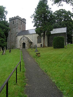 |
Brushford Brushford, Somerset Brushford is a village and civil parish south of Dulverton and north of Tiverton in Devon, in the West Somerset district of Somerset, England. According to the 2001 census it had a population of 535 in 243 households... |
Civil parish | 565 | Dulverton Rural District Dulverton Rural District Dulverton was a rural district in Somerset, England, from 1894 to 1974.It was created in 1894 under the Local Government Act 1894.In 1974 it was abolished under the Local Government Act 1972 and responsibilities transferred to West Somerset.... |
51.02°N 3.53°W | |
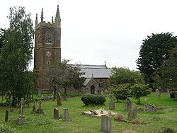 |
Carhampton Carhampton, Somerset Carhampton is a village and civil parish in West Somerset, England, to the east of Minehead.Carhampton civil parish stretches from the Bristol Channel coast inland to Exmoor. The parish has a population of 992 .-History:... |
Civil parish | 1,195 | Williton Rural District Williton Rural District Williton was a rural district in Somerset, England, from 1894 to 1974.It was created in 1894 under the Local Government Act 1894.In 1974 it was abolished under the Local Government Act 1972 when it became part of West Somerset.... |
51.17°N 3.42°W | |
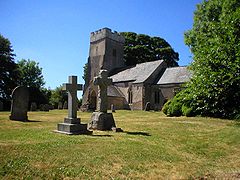 |
Clatworthy Clatworthy Clatworthy is a village and civil parish in the West Somerset District of Somerset, England. It is situated from Wellington and four miles from Wiveliscombe on the southern slopes of the Brendon Hills and close to the Exmoor National Park.... |
Civil parish | 101 | Williton Rural District Williton Rural District Williton was a rural district in Somerset, England, from 1894 to 1974.It was created in 1894 under the Local Government Act 1894.In 1974 it was abolished under the Local Government Act 1972 when it became part of West Somerset.... |
51.07°N 3.35°W | |
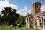 |
Crowcombe Crowcombe Crowcombe is a village and civil parish under the Quantock Hills in Somerset, England, south east of Watchet, and from Taunton in the Taunton Deane district... |
Civil parish | 589 | Williton Rural District Williton Rural District Williton was a rural district in Somerset, England, from 1894 to 1974.It was created in 1894 under the Local Government Act 1894.In 1974 it was abolished under the Local Government Act 1972 when it became part of West Somerset.... |
51.12°N 3.23°W | |
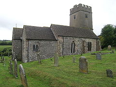 |
Cutcombe Cutcombe Cutcombe is a village and civil parish south of Minehead and north of Dulverton straddling the ridge between Exmoor and the Brendon Hills in Somerset... |
Civil parish | 451 | Williton Rural District Williton Rural District Williton was a rural district in Somerset, England, from 1894 to 1974.It was created in 1894 under the Local Government Act 1894.In 1974 it was abolished under the Local Government Act 1972 when it became part of West Somerset.... |
51.14°N 3.53°W | |
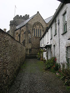 |
Dulverton Dulverton Dulverton is a town and civil parish in the heart of West Somerset, England, near the border with Devon. The town has a population of 1,630. The parish includes the hamlets of Battleton and Ashwick which is located approximately north west of Dulverton... |
Town | 1,632 | Dulverton Rural District Dulverton Rural District Dulverton was a rural district in Somerset, England, from 1894 to 1974.It was created in 1894 under the Local Government Act 1894.In 1974 it was abolished under the Local Government Act 1972 and responsibilities transferred to West Somerset.... |
51.05°N 3.55°W | |
 |
Dunster Dunster Dunster is a village and civil parish in west Somerset, England, situated on the Bristol Channel coast south-southeast of Minehead and northwest of Taunton. The village has a population of 862 .The village has numerous restaurants and three pubs... |
Civil parish | 862 | Williton Rural District Williton Rural District Williton was a rural district in Somerset, England, from 1894 to 1974.It was created in 1894 under the Local Government Act 1894.In 1974 it was abolished under the Local Government Act 1972 when it became part of West Somerset.... |
51.18°N 3.45°W | |
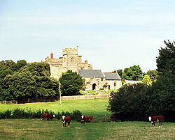 |
East Quantoxhead East Quantoxhead East Quantoxhead is a village in West Somerset, from West Quantoxhead, east of Williton, and west of Bridgwater, within the Quantock Hills Area of Outstanding Natural Beauty in Somerset, England.-History:... |
Civil parish | 112 | Williton Rural District Williton Rural District Williton was a rural district in Somerset, England, from 1894 to 1974.It was created in 1894 under the Local Government Act 1894.In 1974 it was abolished under the Local Government Act 1972 when it became part of West Somerset.... |
51.18°N 3.24°W | |
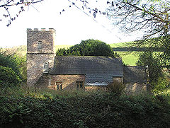 |
Elworthy Elworthy Elworthy is a small village and civil parish in the Brendon Hills south-east of Watchet, and west of Taunton, in the West Somerset district of Somerset, England... |
Civil parish | 103 | Williton Rural District Williton Rural District Williton was a rural district in Somerset, England, from 1894 to 1974.It was created in 1894 under the Local Government Act 1894.In 1974 it was abolished under the Local Government Act 1972 when it became part of West Somerset.... |
51.11°N 3.31°W | |
 |
Exford Exford, Somerset Exford is a rural village at the centre of Exmoor, north-west of Dulverton, and south-west of Minehead, in Somerset, England. Less than a mile away is the hamlet of Lyncombe.... |
Civil parish | 510 | Dulverton Rural District Dulverton Rural District Dulverton was a rural district in Somerset, England, from 1894 to 1974.It was created in 1894 under the Local Government Act 1894.In 1974 it was abolished under the Local Government Act 1972 and responsibilities transferred to West Somerset.... |
51.13°N 3.64°W | |
| Exmoor | Civil parish | 251 | Dulverton Rural District Dulverton Rural District Dulverton was a rural district in Somerset, England, from 1894 to 1974.It was created in 1894 under the Local Government Act 1894.In 1974 it was abolished under the Local Government Act 1972 and responsibilities transferred to West Somerset.... |
51.14°N 3.75°W | ||
| Exton Exton, Somerset Exton is a village and civil parish north-east of Dulverton and south-west of Dunster in Somerset, England. It lies on the River Exe on Exmoor... |
Civil parish | 229 | Dulverton Rural District Dulverton Rural District Dulverton was a rural district in Somerset, England, from 1894 to 1974.It was created in 1894 under the Local Government Act 1894.In 1974 it was abolished under the Local Government Act 1972 and responsibilities transferred to West Somerset.... |
51.09°N 3.54°W | ||
 |
Holford Holford Holford is a village and civil parish in West Somerset within the Quantock Hills Area of Outstanding Natural Beauty, and about west of Bridgwater and east of Williton. The village has a population of about 200. The village is on the Quantock Greenway and Coleridge Way footpaths... |
Civil parish | 353 | Williton Rural District Williton Rural District Williton was a rural district in Somerset, England, from 1894 to 1974.It was created in 1894 under the Local Government Act 1894.In 1974 it was abolished under the Local Government Act 1972 when it became part of West Somerset.... |
51.16°N 3.21°W | |
 |
Huish Champflower Huish Champflower Huish Champflower is a village and civil parish in Somerset, England, three miles north-west of Wiveliscombe and ten miles north of Wellington... |
Civil parish | 269 | Dulverton Rural District Dulverton Rural District Dulverton was a rural district in Somerset, England, from 1894 to 1974.It was created in 1894 under the Local Government Act 1894.In 1974 it was abolished under the Local Government Act 1972 and responsibilities transferred to West Somerset.... |
51.06°N 3.36°W | |
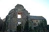 |
Kilve Kilve Kilve is a village in West Somerset, England, within the Quantock Hills Area of Outstanding Natural Beauty, the first AONB to be established, in 1957.... |
Civil parish | 397 | Williton Rural District Williton Rural District Williton was a rural district in Somerset, England, from 1894 to 1974.It was created in 1894 under the Local Government Act 1894.In 1974 it was abolished under the Local Government Act 1972 when it became part of West Somerset.... |
51.18°N 3.22°W | |
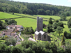 |
Luccombe Luccombe, Somerset Luccombe is a village and civil parish in the Exmoor National Park in the English county of Somerset. It at the foot of the moor's highest hill, the Dunkery Beacon, and is about one mile south of the A39 road between Porlock and Minehead. Administratively it forms part of the district of West... |
Civil parish | 209 | Williton Rural District Williton Rural District Williton was a rural district in Somerset, England, from 1894 to 1974.It was created in 1894 under the Local Government Act 1894.In 1974 it was abolished under the Local Government Act 1972 when it became part of West Somerset.... |
51.19°N 3.56°W | |
| Luxborough Luxborough Luxborough is a small village and civil parish located some south of Dunster, lying amongst the Brendon Hills and the Exmoor National Park in Somerset, England. It is divided into the hamlets of Churchtown, Kingsbridge and Pooltown, which lie within a mile of each other... |
Civil parish | 215 | Williton Rural District Williton Rural District Williton was a rural district in Somerset, England, from 1894 to 1974.It was created in 1894 under the Local Government Act 1894.In 1974 it was abolished under the Local Government Act 1972 when it became part of West Somerset.... |
51.13°N 3.46°W | ||
| Minehead Minehead Minehead is a coastal town and civil parish in Somerset, England. It lies on the south bank of the Bristol Channel, north-west of the county town of Taunton, from the border with the county of Devon and in proximity of the Exmoor National Park... |
Town | 10,330 | Williton Rural District Williton Rural District Williton was a rural district in Somerset, England, from 1894 to 1974.It was created in 1894 under the Local Government Act 1894.In 1974 it was abolished under the Local Government Act 1972 when it became part of West Somerset.... Minehead Urban District Minehead Minehead is a coastal town and civil parish in Somerset, England. It lies on the south bank of the Bristol Channel, north-west of the county town of Taunton, from the border with the county of Devon and in proximity of the Exmoor National Park... |
51.20°N 3.47°W | ||
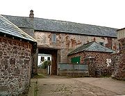 |
Minehead Without Minehead Without Minehead Without is a civil parish in the English county of Somerset, and within the Exmoor National Park. As its name suggests, the parish covers a rural area to the west of, but not including, the small coastal town of Minehead... |
Civil parish | 60 | Williton Rural District Williton Rural District Williton was a rural district in Somerset, England, from 1894 to 1974.It was created in 1894 under the Local Government Act 1894.In 1974 it was abolished under the Local Government Act 1972 when it became part of West Somerset.... |
51.20°N 3.51°W | |
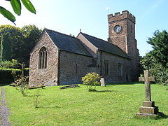 |
Monksilver Monksilver Monksilver is a village west of the town of Williton in Somerset, England, on the eastern flank of the Brendon Hills and the border of the Exmoor National Park. It is on the Coleridge Way footpath.... |
Civil parish | 107 | Williton Rural District Williton Rural District Williton was a rural district in Somerset, England, from 1894 to 1974.It was created in 1894 under the Local Government Act 1894.In 1974 it was abolished under the Local Government Act 1972 when it became part of West Somerset.... |
51.13°N 3.33°W | |
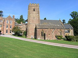 |
Nettlecombe Nettlecombe, Somerset Nettlecombe is a civil parish in the English county of Somerset. The parish covers a rural area below the Brendon Hills, comprising the small hamlets of Woodford, Yarde and Torre together with more isolated individual farms and homes... |
Civil parish | 240 | Williton Rural District Williton Rural District Williton was a rural district in Somerset, England, from 1894 to 1974.It was created in 1894 under the Local Government Act 1894.In 1974 it was abolished under the Local Government Act 1972 when it became part of West Somerset.... |
51.13°N 3.35°W | |
| Oare Oare, Somerset Oare is a village and civil parish on Oare Water on Exmoor in the West Somerset district of Somerset, England. The parish includes the hamlet of Oareford and the village of Culbone which contains its own tiny church.-History:... |
Civil parish | 68 | Williton Rural District Williton Rural District Williton was a rural district in Somerset, England, from 1894 to 1974.It was created in 1894 under the Local Government Act 1894.In 1974 it was abolished under the Local Government Act 1972 when it became part of West Somerset.... |
51.20°N 3.71°W | ||
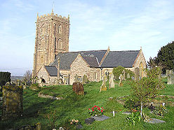 |
Old Cleeve Old Cleeve Old Cleeve is a village and civil parish south east of Minehead in the West Somerset district of Somerset, England. The civil parish of Old Cleeve covers an area of and includes the villages of Blue Anchor, Roadwater and Washford as well as hamlets such as Bilbrook, Chapel Cleeve, Golsoncott and... |
Civil parish | 1,952 | Williton Rural District Williton Rural District Williton was a rural district in Somerset, England, from 1894 to 1974.It was created in 1894 under the Local Government Act 1894.In 1974 it was abolished under the Local Government Act 1972 when it became part of West Somerset.... |
51.17°N 3.38°W | |
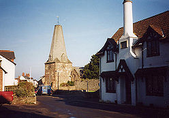 |
Porlock Porlock Porlock is a coastal village and civil parish in Somerset, England, situated in a deep hollow below Exmoor, west of Minehead. The parish, which includes Hawkcombe and Doverhay, has a population of 1,377.... |
Civil parish | 1,377 | Williton Rural District Williton Rural District Williton was a rural district in Somerset, England, from 1894 to 1974.It was created in 1894 under the Local Government Act 1894.In 1974 it was abolished under the Local Government Act 1972 when it became part of West Somerset.... |
51.21°N 3.60°W | |
| Sampford Brett Sampford Brett Sampford Brett is a village and civil parish situated at the north-western edge of the Quantock Hills, Somerset, England, less than south of Williton, just off the A358 road to Taunton.... |
Civil parish | 277 | Williton Rural District Williton Rural District Williton was a rural district in Somerset, England, from 1894 to 1974.It was created in 1894 under the Local Government Act 1894.In 1974 it was abolished under the Local Government Act 1972 when it became part of West Somerset.... |
51.16°N 3.31°W | ||
| Selworthy Selworthy Selworthy is a small village and civil parish from Minehead in Somerset, England. It is located in the National Trust's Holnicote Estate on the northern fringes of Exmoor. The parish includes the hamlets of Bossington, Tivington, Lynch, Brandish Street and Allerford.At Selworthy Beacon, which is... |
Civil parish | 510 | Williton Rural District Williton Rural District Williton was a rural district in Somerset, England, from 1894 to 1974.It was created in 1894 under the Local Government Act 1894.In 1974 it was abolished under the Local Government Act 1972 when it became part of West Somerset.... |
51.21°N 3.55°W | ||
 |
Skilgate Skilgate Skilgate is a village and civil parish east of Dulverton and west of Wiveliscombe in the West Somerset district of Somerset, England. It has a population of 96.... |
Civil parish | 100 | Dulverton Rural District Dulverton Rural District Dulverton was a rural district in Somerset, England, from 1894 to 1974.It was created in 1894 under the Local Government Act 1894.In 1974 it was abolished under the Local Government Act 1972 and responsibilities transferred to West Somerset.... |
51.04°N 3.45°W | |
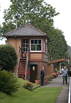 |
Stogumber Stogumber Stogumber is a village and civil parish in Somerset, England, on the eastern flank of the Brendon Hills. Besides Stogumber village itself, the parish includes the hamlets of Ashbeer, Capton, Escott, Higher Vexford, Kingswood, Lower Vellow, Lower Vexford, Preston, and Vellow.-History:The name comes... |
Civil parish | 672 | Williton Rural District Williton Rural District Williton was a rural district in Somerset, England, from 1894 to 1974.It was created in 1894 under the Local Government Act 1894.In 1974 it was abolished under the Local Government Act 1972 when it became part of West Somerset.... |
51.13°N 3.29°W | |
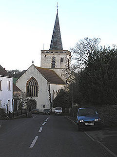 |
Stogursey Stogursey Stogursey is the name of a small village and civil parish in the Quantock Hills in Somerset, England. It is situated from Nether Stowey, and west of Bridgwater... |
Civil parish | 1,407 | Williton Rural District Williton Rural District Williton was a rural district in Somerset, England, from 1894 to 1974.It was created in 1894 under the Local Government Act 1894.In 1974 it was abolished under the Local Government Act 1972 when it became part of West Somerset.... |
51.18°N 3.14°W | |
| Stringston Stringston Stringston is a village and civil parish on the northern edge of the Quantock Hills in the English county of Somerset. The village is west of Bridgwater, and close to the villages of Holford, Kilve and Stogursey. In 2002, the parish was estimated to have a population of 116.Besides the village of... |
Civil parish | 116 | Williton Rural District Williton Rural District Williton was a rural district in Somerset, England, from 1894 to 1974.It was created in 1894 under the Local Government Act 1894.In 1974 it was abolished under the Local Government Act 1972 when it became part of West Somerset.... |
51.18°N 3.18°W | ||
 |
Timberscombe Timberscombe Timberscombe is a village and civil parish on the River Avill south-west of Dunster, and south of Minehead within the Exmoor National Park in Somerset, England... |
Civil parish | 514 | Williton Rural District Williton Rural District Williton was a rural district in Somerset, England, from 1894 to 1974.It was created in 1894 under the Local Government Act 1894.In 1974 it was abolished under the Local Government Act 1972 when it became part of West Somerset.... |
51.13°N 3.54°W | |
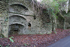 |
Treborough Treborough Treborough is a small village and civil parish miles south of Dunster, lying amongst the Brendon Hills within the Exmoor National Park in the West Somerset district of Somerset, England.-History:... |
Civil parish | 51 | Williton Rural District Williton Rural District Williton was a rural district in Somerset, England, from 1894 to 1974.It was created in 1894 under the Local Government Act 1894.In 1974 it was abolished under the Local Government Act 1972 when it became part of West Somerset.... |
51.12°N 3.41°W | |
| Upton Upton, Somerset Upton is a village and civil parish north of Skilgate in Somerset, England. It is situated on a hill above the eastern end of Wimbleball Lake.-History:The parish of Upton was part of the Williton and Freemanners Hundred.... |
Civil parish | 165 | Dulverton Rural District Dulverton Rural District Dulverton was a rural district in Somerset, England, from 1894 to 1974.It was created in 1894 under the Local Government Act 1894.In 1974 it was abolished under the Local Government Act 1972 and responsibilities transferred to West Somerset.... |
51.10°N 3.44°W | ||
| Watchet Watchet Watchet is a harbour town and civil parish in the English county of Somerset, with an approximate population of 4,400. It is situated west of Bridgwater, north-west of Taunton, and east of Minehead. The parish includes the hamlet of Beggearn Huish... |
Town | 4,401 | Watchet Urban District Watchet Watchet is a harbour town and civil parish in the English county of Somerset, with an approximate population of 4,400. It is situated west of Bridgwater, north-west of Taunton, and east of Minehead. The parish includes the hamlet of Beggearn Huish... |
51.18°N 3.33°W | ||
| West Quantoxhead West Quantoxhead West Quantoxhead is a small village and civil parish in the West Somerset district of Somerset, England. It lies on the route of the Coleridge Way and on the A39 road at the foot of the Quantock Hills, from East Quantoxhead, from Williton and equidistant from Bridgwater and Taunton... |
Civil parish | 506 | Williton Rural District Williton Rural District Williton was a rural district in Somerset, England, from 1894 to 1974.It was created in 1894 under the Local Government Act 1894.In 1974 it was abolished under the Local Government Act 1972 when it became part of West Somerset.... |
51.17°N 3.27°W | ||
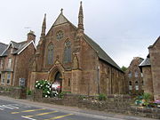 |
Williton Williton Williton is a medium-sized village and civil parish in West Somerset, England. It has many of the facilities of a small town, being the administrative centre for the district. Williton is situated at the junction of the A39, A358 and B3191 roads... |
Civil parish | 2,708 | Williton Rural District Williton Rural District Williton was a rural district in Somerset, England, from 1894 to 1974.It was created in 1894 under the Local Government Act 1894.In 1974 it was abolished under the Local Government Act 1972 when it became part of West Somerset.... |
51.16°N 3.31°W | |
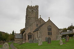 |
Winsford Winsford, Somerset Winsford is a village and civil parish in Somerset, England, located about north-west of Dulverton.It is within the borders of the Exmoor National Park and around south-west of the coastal town of Minehead. The village has two hotels, Karslake House Hotel and the Royal Oak, both dating to before... |
Civil parish | 339 | Dulverton Rural District Dulverton Rural District Dulverton was a rural district in Somerset, England, from 1894 to 1974.It was created in 1894 under the Local Government Act 1894.In 1974 it was abolished under the Local Government Act 1972 and responsibilities transferred to West Somerset.... |
51.10°N 3.57°W | |
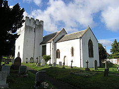 |
Withycombe Withycombe Withycombe is a village and civil parish south east of Dunster, and from Minehead within the Exmoor National Park in the West Somerset district of Somerset, England... |
Civil parish | 307 | Williton Rural District Williton Rural District Williton was a rural district in Somerset, England, from 1894 to 1974.It was created in 1894 under the Local Government Act 1894.In 1974 it was abolished under the Local Government Act 1972 when it became part of West Somerset.... |
51.16°N 3.41°W | |
 |
Withypool and Hawkridge | Civil parish | 232 | Dulverton Rural District Dulverton Rural District Dulverton was a rural district in Somerset, England, from 1894 to 1974.It was created in 1894 under the Local Government Act 1894.In 1974 it was abolished under the Local Government Act 1972 and responsibilities transferred to West Somerset.... |
51.11°N 3.65°W | |
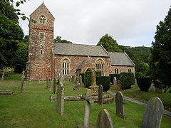 |
Wootton Courtenay Wootton Courtenay Wootton Courtenay is a village and civil parish on Exmoor in the West Somerset district of Somerset, England. The parish includes the village of Huntscott.-History:Wootton was part of the hundred of Carhampton.-Governance:... |
Civil parish | 305 | Williton Rural District Williton Rural District Williton was a rural district in Somerset, England, from 1894 to 1974.It was created in 1894 under the Local Government Act 1894.In 1974 it was abolished under the Local Government Act 1972 when it became part of West Somerset.... |
51.18°N 3.52°W |