

Taunton Deane
Encyclopedia
Taunton Deane is a local government district
with borough
status in Somerset
, England
. Its council is based in Taunton
.
The district was formed on 1 April 1974, under the Local Government Act 1972
, by a merger of the Municipal Borough of Taunton
, Wellington Urban District
, Taunton Rural District
, and Wellington Rural District
.
Taunton Deane was granted borough status in 1975, perpetuating the mayor
alty of Taunton.
The district was given the name of an alternate form of the Taunton Deane Hundred
.
over 2,500.
is unparished.
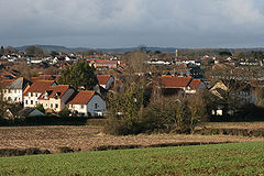
The town of Taunton (which for population estimates includes the unparished area
- or former municipal borough
- plus the neighbouring parishes of Bishop's Hull, Comeytrowe
, Norton Fitzwarren
, Staplegrove, Trull
and West Monkton
) had an estimated population of 61,400 in 2001.
Taunton forms part of the larger borough
of Taunton Deane which also includes the town of Wellington
and surrounding villages. Taunton Deane had an estimated population of 102,600 in 2001.
The figures below are for the Taunton Deane area.
) in the five non-metropolitan districts of the county are operated by Somerset County Council
.
For a full list of schools see: List of schools in Somerset
Non-metropolitan district
Non-metropolitan districts, or colloquially shire districts, are a type of local government district in England. As created, they are sub-divisions of non-metropolitan counties in a so-called "two-tier" arrangement...
with borough
Borough
A borough is an administrative division in various countries. In principle, the term borough designates a self-governing township although, in practice, official use of the term varies widely....
status in Somerset
Somerset
The ceremonial and non-metropolitan county of Somerset in South West England borders Bristol and Gloucestershire to the north, Wiltshire to the east, Dorset to the south-east, and Devon to the south-west. It is partly bounded to the north and west by the Bristol Channel and the estuary of the...
, England
England
England is a country that is part of the United Kingdom. It shares land borders with Scotland to the north and Wales to the west; the Irish Sea is to the north west, the Celtic Sea to the south west, with the North Sea to the east and the English Channel to the south separating it from continental...
. Its council is based in Taunton
Taunton
Taunton is the county town of Somerset, England. The town, including its suburbs, had an estimated population of 61,400 in 2001. It is the largest town in the shire county of Somerset....
.
The district was formed on 1 April 1974, under the Local Government Act 1972
Local Government Act 1972
The Local Government Act 1972 is an Act of Parliament in the United Kingdom that reformed local government in England and Wales on 1 April 1974....
, by a merger of the Municipal Borough of Taunton
Taunton
Taunton is the county town of Somerset, England. The town, including its suburbs, had an estimated population of 61,400 in 2001. It is the largest town in the shire county of Somerset....
, Wellington Urban District
Wellington, Somerset
Wellington is a small industrial town in rural Somerset, England, situated south west of Taunton in the Taunton Deane district, near the border with Devon, which runs along the Blackdown Hills to the south of the town...
, Taunton Rural District
Taunton Rural District
Taunton was a rural district in Somerset, England, from 1894 to 1974.It was created in 1894 under the Local Government Act 1894.In 1974 it was abolished under the Local Government Act 1972 when it became part of Taunton Deane district....
, and Wellington Rural District
Wellington Rural District (Somerset)
Wellington was a rural district in Somerset, England, from 1894 to 1974.It was created in 1894 under the Local Government Act 1894.In 1974 it was abolished under the Local Government Act 1972 when it became part of Taunton Deane....
.
Taunton Deane was granted borough status in 1975, perpetuating the mayor
Mayor
In many countries, a Mayor is the highest ranking officer in the municipal government of a town or a large urban city....
alty of Taunton.
The district was given the name of an alternate form of the Taunton Deane Hundred
Taunton Deane (hundred)
The Hundred of Taunton Deane was one of the 40 historical Hundreds in the ancient county of Somerset, England, dating from before the Norman conquest during the Anglo-Saxon era although exact dates are unknown. Each hundred had a 'fyrd', which acted as the local defence force and a court which was...
.
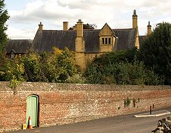
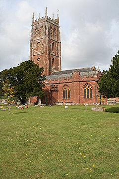
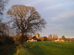
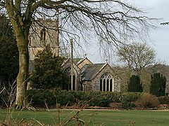
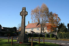
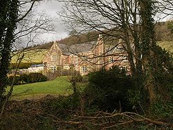
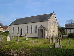
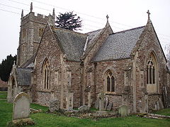
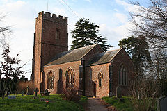
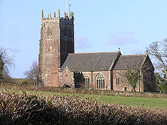
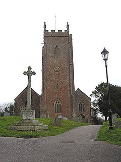
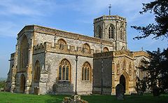
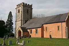
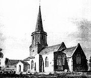
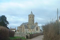
Settlements
Settlements in bold have a town charter or a populationPopulation
A population is all the organisms that both belong to the same group or species and live in the same geographical area. The area that is used to define a sexual population is such that inter-breeding is possible between any pair within the area and more probable than cross-breeding with individuals...
over 2,500.
- Ash PriorsAsh PriorsAsh Priors is a village and parish in Somerset, England, situated north west of Taunton in the Taunton Deane district. The village has a population of 131.-History:The parish of Ash Priors was part of the Kilmersdon Hundred,...
- AshbrittleAshbrittleAshbrittle is a village and civil parish in Somerset, England, situated nine miles west of Taunton and close to the River Tone and the route of the Grand Western Canal in the Taunton Deane district... - BathealtonBathealtonBathealton is a village and civil parish in Somerset, England, situated west of Wellington and west of Taunton in the Taunton Deane district. The village has a population of 182.-History:It was recorded in the Domesday Book as Badeheltone...
- BickenhallBickenhallBickenhall is a hamlet and parish in Somerset, England, situated south east of Taunton in the Taunton Deane district. The parish, which includes the hamlet of Batten's Green, has a population of 122....
- Bishops HullBishops HullBishop's Hull is a village and civil parish in Somerset, England, situated in the western suburbs of Taunton in the Taunton Deane district. It includes the areas of Rumwell, Rumwell Park, Roughmoor and Longaller and is close to the River Tone...
- Bishops LydeardBishops LydeardBishops Lydeard is a village and civil parish located in Somerset, England, bypassed, since 1967, by the A358 road and West Somerset Railway north-west of Taunton in the district of Taunton Deane...
- Bradford on ToneBradford on ToneBradford on Tone is a village and civil parish in Somerset, England, situated on the River Tone south west of Taunton in the Taunton Deane district...
- BurrowbridgeBurrowbridgeBurrowbridge is a village and civil parish in Somerset, England, situated on the River Parrett and A361 road south east of Bridgwater in the Taunton Deane district on the edge of the Somerset Levels... - Cheddon FitzpaineCheddon FitzpaineCheddon Fitzpaine is a village and civil parish in Somerset, England, situated on the Quantock Hills north of Taunton in the Taunton Deane district...
- ChipstableChipstableChipstable is a village and civil parish in Somerset, England, situated beside Heydon Hill west of Taunton in the Taunton Deane district. The parish has a population of 253.The parish includes Raddington and Waterrow.-History:...
- ChurchstantonChurchstantonChurchstanton is a village and civil parish in Somerset, England, situated within the Blackdown Hills Area of Outstanding Natural Beauty, on the River Otter south of Taunton in the Taunton Deane district.The parish has a population of 760...
- Combe FloreyCombe FloreyCombe Florey is a village and civil parish in Somerset, England, situated north west of Taunton in the Taunton Deane district, on the West Somerset Railway. The village has a population of 252...
- ComeytroweComeytroweComeytrowe is a civil parish in Somerset, England, situated in the south western suburbs of Taunton in the Taunton Deane district. The parish has a population of 5,780...
- CorfeCorfeCorfe is a village and civil parish in Somerset, England, situated below the Blackdown Hills south of Taunton in the Taunton Deane district. The village has a population of 262.-History:...
- Cotford St LukeBishops LydeardBishops Lydeard is a village and civil parish located in Somerset, England, bypassed, since 1967, by the A358 road and West Somerset Railway north-west of Taunton in the district of Taunton Deane...
- CothelstoneCothelstoneCothelstone is a village and civil parish in Somerset, England, situated in the Quantock Hills six miles north of Taunton in the Taunton Deane district...
- Creech St MichaelCreech St MichaelCreech St. Michael is a village and civil parish in Somerset, England, situated three miles east of Taunton in the Taunton Deane district. The village has a population of 2,464...
- CurlandCurlandCurland is a village and civil parish in Somerset, England, situated south of Taunton in the Taunton Deane district. The village has a population of 141... - DurstonDurstonDurston is a village and civil parish in Somerset, England, situated on the A361 road north east of Taunton and south of Bridgwater in the Taunton Deane district. The parish lies on undulating ground between the lowest slopes of the Quantock Hills and the valley of the River Tone at the Curry and...
- FitzheadFitzheadFitzhead is a village and civil parish in Somerset, England, situated approximately north west of Taunton in the Taunton Deane district. The village has an estimated population of 251.-History:...
- HalseHalse, SomersetHalse is a village and civil parish in Somerset, England, situated north west of Taunton in the Taunton Deane district. The village has a population of 271.-History:The name of the village derives from the Old English heals meaning a neck of land....
- Hatch BeauchampHatch BeauchampHatch Beauchamp is a village and civil parish in Somerset, England, situated south east of Taunton in the Taunton Deane district. The village has a population of 575.-History:... - Kingston St MaryKingston St MaryKingston St Mary is a village and parish in Somerset, England, situated at the southern end of the Quantock Hills north of Taunton in the Taunton Deane district...
- Langford BudvilleLangford BudvilleLangford Budville is a village and civil parish in Somerset, England, situated near the River Tone miles north-west of Wellington, from Wiveliscombe and west of Taunton in the Taunton Deane district. The parish includes the hamlets of Bindon, Lower Chipley, Lower Wellisford, Ramsey and Runnington...
- Lydeard St LawrenceLydeard St LawrenceLydeard St Lawrence or St Lawrence Lydiard is a village and civil parish in Somerset, England, situated north west of Taunton in the Taunton Deane district. The village has a population of 416... - MilvertonMilverton, SomersetMilverton is a village and civil parish in Somerset, England, situated in the valley of the River Tone west of Taunton in the Taunton Deane district. The village has a population of 1,385...
- North CurryNorth CurryNorth Curry is a village and civil parish in Somerset, England, situated east of Taunton in the Taunton Deane district. The parish, which includes Knapp and Lower Knapp has a population of 1,625....
- Norton FitzwarrenNorton FitzwarrenNorton Fitzwarren is a village and civil parish in Somerset, England, situated north west of Taunton in the Taunton Deane district. The village has a population of 2,325.-History:...
- NyneheadNyneheadNynehead is a village and civil parish in Somerset, England, situated on the River Tone, south-west of Taunton and north-west of Wellington, in the Taunton Deane district. The village has a population of 416.-History:... - OakeOakeOake is a village and civil parish in Somerset, England, situated west of Taunton in the Taunton Deane district. The village has a population of 695....
- Orchard PortmanOrchard PortmanOrchard Portman is a village and civil parish in Somerset, England, situated south of Taunton in the Taunton Deane district. The village has a population of 150....
- OtterfordOtterfordOtterford is a village and civil parish in Somerset, England. It is situated on the Blackdown Hills, south of Taunton in the Taunton Deane district... - PitminsterPitminsterPitminster is a village and civil parish in Somerset, England, situated south of Taunton in the Taunton Deane district. The village has a population of 929. The parish also includes the villages of Angersleigh, Blagdon or Blagdon Hill and Staplehay...
- RuishtonRuishtonRuishton is a village and civil parish in Somerset, England, situated on the River Tone and A358 road east of Taunton in the Taunton Deane district. The village has a population of 1,389...
- Sampford ArundelSampford ArundelSampford Arundel is a village and civil parish in Somerset, England. It is situated near Wellington and south west of Taunton in the Taunton Deane district...
- Staple FitzpaineStaple FitzpaineStaple Fitzpaine is a village and civil parish in Somerset, England, situated south of Taunton in the Taunton Deane district. The village has a population of 151 and is within the Blackdown Hills Area of Outstanding Natural Beauty...
- Staplegrove - StawleyStawleyStawley is a village and civil parish in Somerset, England, situated west of Taunton in the Taunton Deane district. The parish has a population of 305 and includes the village of Kittisford and the hamlets of Appley, Greenham and Tracebridge.-History:The village was recorded in the Domesday Book...
- Stoke St GregoryStoke St GregoryStoke St Gregory is a village and civil parish in Somerset, England, situated east of Taunton in the Taunton Deane district. The parish has a population of 920, and includes the hamlet of Stathe.-History:...
- Stoke St MaryStoke St MaryStoke St Mary is a village and civil parish in Somerset, England, situated south east of Taunton in the Taunton Deane district.-History:The earliest recorded mention of Stoke St Mary is in a Saxon charter dated 854 AD, when a West Saxon king gave the clearly defined lands at ‘Stoc’ to the minster... - TauntonTauntonTaunton is the county town of Somerset, England. The town, including its suburbs, had an estimated population of 61,400 in 2001. It is the largest town in the shire county of Somerset....
- ThornfalconThornfalconThornfalcon is a village and civil parish in Somerset, England, situated east of Taunton in the Taunton Deane district. The village has 121 people. The parish includes the hamlet of Ash...
- TollandTolland, SomersetTolland is a village and civil parish in Somerset, England, situated north west of Taunton, between the Brendon Hills and Quantock Hills, in the Taunton Deane district. The parish has a population of 81.-History:...
- TrullTrullTrull is village and civil parish in Somerset, England, situated near Taunton. The parish which includes Dipford has a population of 1,861.-History:The name Trull is thought to derive from the word Trendle meaning circle or wheel.... - WellingtonWellington, SomersetWellington is a small industrial town in rural Somerset, England, situated south west of Taunton in the Taunton Deane district, near the border with Devon, which runs along the Blackdown Hills to the south of the town...
- West BagboroughWest BagboroughWest Bagborough is a village and civil parish in Somerset, England, situated north of Taunton in the Taunton Deane district. The village has a population of 394....
- West BucklandWest BucklandWest Buckland is a village and civil parish in Somerset, England, situated south west of Taunton in the Taunton Deane district. The parish has a population of 999.-History:...
- West MonktonWest MonktonWest Monkton is a village and civil parish in Somerset, England, situated north east of Taunton in the Taunton Deane district. The parish includes the hamlets of Monkton Heathfield, Bathpool, Burlinch and Coombe, and had a population of 2,663 at the 2001 census.-History:The charter for West...
- WiveliscombeWiveliscombeWiveliscombe is a town and civil parish in Somerset, England, situated west of Taunton in the Taunton Deane district. The town has a population of 2,670. The parish includes the nearby hamlet of Maundown.-History:...
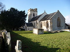
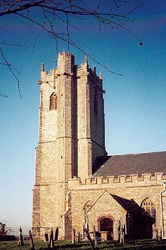
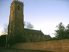
Parishes
Part of the former Taunton Municipal BoroughTaunton
Taunton is the county town of Somerset, England. The town, including its suburbs, had an estimated population of 61,400 in 2001. It is the largest town in the shire county of Somerset....
is unparished.
| Image | Name | Status | Population | Former local authority | Coordinates | Refs |
|---|---|---|---|---|---|---|
| Ashbrittle Ashbrittle Ashbrittle is a village and civil parish in Somerset, England, situated nine miles west of Taunton and close to the River Tone and the route of the Grand Western Canal in the Taunton Deane district... |
Civil parish | Wellington Rural District Wellington Rural District (Somerset) Wellington was a rural district in Somerset, England, from 1894 to 1974.It was created in 1894 under the Local Government Act 1894.In 1974 it was abolished under the Local Government Act 1972 when it became part of Taunton Deane.... |
50.98°N 3.35°W | |||
 |
Ash Priors Ash Priors Ash Priors is a village and parish in Somerset, England, situated north west of Taunton in the Taunton Deane district. The village has a population of 131.-History:The parish of Ash Priors was part of the Kilmersdon Hundred,... |
Civil parish | Taunton Rural District Taunton Rural District Taunton was a rural district in Somerset, England, from 1894 to 1974.It was created in 1894 under the Local Government Act 1894.In 1974 it was abolished under the Local Government Act 1972 when it became part of Taunton Deane district.... |
51.06°N 3.21°W | ||
| Bathealton Bathealton Bathealton is a village and civil parish in Somerset, England, situated west of Wellington and west of Taunton in the Taunton Deane district. The village has a population of 182.-History:It was recorded in the Domesday Book as Badeheltone... |
Civil parish | Wellington Rural District Wellington Rural District (Somerset) Wellington was a rural district in Somerset, England, from 1894 to 1974.It was created in 1894 under the Local Government Act 1894.In 1974 it was abolished under the Local Government Act 1972 when it became part of Taunton Deane.... |
51.01°N 3.31°W | |||
| Bickenhall Bickenhall Bickenhall is a hamlet and parish in Somerset, England, situated south east of Taunton in the Taunton Deane district. The parish, which includes the hamlet of Batten's Green, has a population of 122.... |
Civil parish | Taunton Rural District Taunton Rural District Taunton was a rural district in Somerset, England, from 1894 to 1974.It was created in 1894 under the Local Government Act 1894.In 1974 it was abolished under the Local Government Act 1972 when it became part of Taunton Deane district.... |
50.96°N 3.03°W | |||
 |
Bishops Hull Bishops Hull Bishop's Hull is a village and civil parish in Somerset, England, situated in the western suburbs of Taunton in the Taunton Deane district. It includes the areas of Rumwell, Rumwell Park, Roughmoor and Longaller and is close to the River Tone... |
Civil parish | Taunton Rural District Taunton Rural District Taunton was a rural district in Somerset, England, from 1894 to 1974.It was created in 1894 under the Local Government Act 1894.In 1974 it was abolished under the Local Government Act 1972 when it became part of Taunton Deane district.... |
51.02°N 3.14°W | ||
 |
Bishops Lydeard Bishops Lydeard Bishops Lydeard is a village and civil parish located in Somerset, England, bypassed, since 1967, by the A358 road and West Somerset Railway north-west of Taunton in the district of Taunton Deane... |
Civil parish | Taunton Rural District Taunton Rural District Taunton was a rural district in Somerset, England, from 1894 to 1974.It was created in 1894 under the Local Government Act 1894.In 1974 it was abolished under the Local Government Act 1972 when it became part of Taunton Deane district.... |
51.06°N 3.19°W | ||
| Bradford on Tone Bradford on Tone Bradford on Tone is a village and civil parish in Somerset, England, situated on the River Tone south west of Taunton in the Taunton Deane district... |
Civil parish | Wellington Rural District Wellington Rural District (Somerset) Wellington was a rural district in Somerset, England, from 1894 to 1974.It was created in 1894 under the Local Government Act 1894.In 1974 it was abolished under the Local Government Act 1972 when it became part of Taunton Deane.... |
51.00°N 3.18°W | |||
| Burrowbridge Burrowbridge Burrowbridge is a village and civil parish in Somerset, England, situated on the River Parrett and A361 road south east of Bridgwater in the Taunton Deane district on the edge of the Somerset Levels... |
Civil parish | Taunton Rural District Taunton Rural District Taunton was a rural district in Somerset, England, from 1894 to 1974.It was created in 1894 under the Local Government Act 1894.In 1974 it was abolished under the Local Government Act 1972 when it became part of Taunton Deane district.... |
51.07°N 2.92°W | |||
 |
Cheddon Fitzpaine Cheddon Fitzpaine Cheddon Fitzpaine is a village and civil parish in Somerset, England, situated on the Quantock Hills north of Taunton in the Taunton Deane district... |
Civil parish | Taunton Rural District Taunton Rural District Taunton was a rural district in Somerset, England, from 1894 to 1974.It was created in 1894 under the Local Government Act 1894.In 1974 it was abolished under the Local Government Act 1972 when it became part of Taunton Deane district.... |
51.04°N 3.08°W | ||
| Chipstable Chipstable Chipstable is a village and civil parish in Somerset, England, situated beside Heydon Hill west of Taunton in the Taunton Deane district. The parish has a population of 253.The parish includes Raddington and Waterrow.-History:... |
Civil parish | Wellington Rural District Wellington Rural District (Somerset) Wellington was a rural district in Somerset, England, from 1894 to 1974.It was created in 1894 under the Local Government Act 1894.In 1974 it was abolished under the Local Government Act 1972 when it became part of Taunton Deane.... |
51.04°N 3.37°W | |||
 |
Churchstanton Churchstanton Churchstanton is a village and civil parish in Somerset, England, situated within the Blackdown Hills Area of Outstanding Natural Beauty, on the River Otter south of Taunton in the Taunton Deane district.The parish has a population of 760... |
Civil parish | Taunton Rural District Taunton Rural District Taunton was a rural district in Somerset, England, from 1894 to 1974.It was created in 1894 under the Local Government Act 1894.In 1974 it was abolished under the Local Government Act 1972 when it became part of Taunton Deane district.... |
50.92°N 3.15°W | ||
 |
Combe Florey Combe Florey Combe Florey is a village and civil parish in Somerset, England, situated north west of Taunton in the Taunton Deane district, on the West Somerset Railway. The village has a population of 252... |
Civil parish | Taunton Rural District Taunton Rural District Taunton was a rural district in Somerset, England, from 1894 to 1974.It was created in 1894 under the Local Government Act 1894.In 1974 it was abolished under the Local Government Act 1972 when it became part of Taunton Deane district.... |
51.08°N 3.21°W | ||
 |
Comeytrowe Comeytrowe Comeytrowe is a civil parish in Somerset, England, situated in the south western suburbs of Taunton in the Taunton Deane district. The parish has a population of 5,780... |
Civil parish | Taunton Municipal Borough Taunton Taunton is the county town of Somerset, England. The town, including its suburbs, had an estimated population of 61,400 in 2001. It is the largest town in the shire county of Somerset.... Taunton Rural District Taunton Rural District Taunton was a rural district in Somerset, England, from 1894 to 1974.It was created in 1894 under the Local Government Act 1894.In 1974 it was abolished under the Local Government Act 1972 when it became part of Taunton Deane district.... |
51.01°N 3.13°W | ||
 |
Corfe Corfe Corfe is a village and civil parish in Somerset, England, situated below the Blackdown Hills south of Taunton in the Taunton Deane district. The village has a population of 262.-History:... |
Civil parish | Taunton Rural District Taunton Rural District Taunton was a rural district in Somerset, England, from 1894 to 1974.It was created in 1894 under the Local Government Act 1894.In 1974 it was abolished under the Local Government Act 1972 when it became part of Taunton Deane district.... |
50.97°N 3.09°W | ||
 |
Cothelstone Cothelstone Cothelstone is a village and civil parish in Somerset, England, situated in the Quantock Hills six miles north of Taunton in the Taunton Deane district... |
Civil parish | Taunton Rural District Taunton Rural District Taunton was a rural district in Somerset, England, from 1894 to 1974.It was created in 1894 under the Local Government Act 1894.In 1974 it was abolished under the Local Government Act 1972 when it became part of Taunton Deane district.... |
51.08°N 3.16°W | ||
| Creech St Michael Creech St Michael Creech St. Michael is a village and civil parish in Somerset, England, situated three miles east of Taunton in the Taunton Deane district. The village has a population of 2,464... |
Civil parish | Taunton Rural District Taunton Rural District Taunton was a rural district in Somerset, England, from 1894 to 1974.It was created in 1894 under the Local Government Act 1894.In 1974 it was abolished under the Local Government Act 1972 when it became part of Taunton Deane district.... |
51.02°N 3.04°W | |||
 |
Curland Curland Curland is a village and civil parish in Somerset, England, situated south of Taunton in the Taunton Deane district. The village has a population of 141... |
Civil parish | Taunton Rural District Taunton Rural District Taunton was a rural district in Somerset, England, from 1894 to 1974.It was created in 1894 under the Local Government Act 1894.In 1974 it was abolished under the Local Government Act 1972 when it became part of Taunton Deane district.... |
50.95°N 3.03°W | ||
 |
Durston Durston Durston is a village and civil parish in Somerset, England, situated on the A361 road north east of Taunton and south of Bridgwater in the Taunton Deane district. The parish lies on undulating ground between the lowest slopes of the Quantock Hills and the valley of the River Tone at the Curry and... |
Civil parish | Taunton Rural District Taunton Rural District Taunton was a rural district in Somerset, England, from 1894 to 1974.It was created in 1894 under the Local Government Act 1894.In 1974 it was abolished under the Local Government Act 1972 when it became part of Taunton Deane district.... |
51.05°N 3.01°W | ||
 |
Fitzhead Fitzhead Fitzhead is a village and civil parish in Somerset, England, situated approximately north west of Taunton in the Taunton Deane district. The village has an estimated population of 251.-History:... |
Civil parish | Wellington Rural District Wellington Rural District (Somerset) Wellington was a rural district in Somerset, England, from 1894 to 1974.It was created in 1894 under the Local Government Act 1894.In 1974 it was abolished under the Local Government Act 1972 when it became part of Taunton Deane.... |
51.05°N 3.26°W | ||
 |
Halse Halse, Somerset Halse is a village and civil parish in Somerset, England, situated north west of Taunton in the Taunton Deane district. The village has a population of 271.-History:The name of the village derives from the Old English heals meaning a neck of land.... |
Civil parish | Taunton Rural District Taunton Rural District Taunton was a rural district in Somerset, England, from 1894 to 1974.It was created in 1894 under the Local Government Act 1894.In 1974 it was abolished under the Local Government Act 1972 when it became part of Taunton Deane district.... |
51.04°N 3.23°W | ||
 |
Hatch Beauchamp Hatch Beauchamp Hatch Beauchamp is a village and civil parish in Somerset, England, situated south east of Taunton in the Taunton Deane district. The village has a population of 575.-History:... |
Civil parish | Taunton Rural District Taunton Rural District Taunton was a rural district in Somerset, England, from 1894 to 1974.It was created in 1894 under the Local Government Act 1894.In 1974 it was abolished under the Local Government Act 1972 when it became part of Taunton Deane district.... |
50.98°N 2.99°W | ||
 |
Kingston St Mary | Civil parish | Taunton Rural District Taunton Rural District Taunton was a rural district in Somerset, England, from 1894 to 1974.It was created in 1894 under the Local Government Act 1894.In 1974 it was abolished under the Local Government Act 1972 when it became part of Taunton Deane district.... |
51.06°N 3.11°W | ||
| Langford Budville Langford Budville Langford Budville is a village and civil parish in Somerset, England, situated near the River Tone miles north-west of Wellington, from Wiveliscombe and west of Taunton in the Taunton Deane district. The parish includes the hamlets of Bindon, Lower Chipley, Lower Wellisford, Ramsey and Runnington... |
Civil parish | Wellington Rural District Wellington Rural District (Somerset) Wellington was a rural district in Somerset, England, from 1894 to 1974.It was created in 1894 under the Local Government Act 1894.In 1974 it was abolished under the Local Government Act 1972 when it became part of Taunton Deane.... |
51.00°N 3.27°W | |||
 |
Lydeard St Lawrence | Civil parish | Taunton Rural District Taunton Rural District Taunton was a rural district in Somerset, England, from 1894 to 1974.It was created in 1894 under the Local Government Act 1894.In 1974 it was abolished under the Local Government Act 1972 when it became part of Taunton Deane district.... |
51.09°N 3.25°W | ||
 > > |
Milverton Milverton, Somerset Milverton is a village and civil parish in Somerset, England, situated in the valley of the River Tone west of Taunton in the Taunton Deane district. The village has a population of 1,385... |
Civil parish | Wellington Rural District Wellington Rural District (Somerset) Wellington was a rural district in Somerset, England, from 1894 to 1974.It was created in 1894 under the Local Government Act 1894.In 1974 it was abolished under the Local Government Act 1972 when it became part of Taunton Deane.... |
51.02°N 3.25°W | ||
 |
North Curry North Curry North Curry is a village and civil parish in Somerset, England, situated east of Taunton in the Taunton Deane district. The parish, which includes Knapp and Lower Knapp has a population of 1,625.... |
Civil parish | Taunton Rural District Taunton Rural District Taunton was a rural district in Somerset, England, from 1894 to 1974.It was created in 1894 under the Local Government Act 1894.In 1974 it was abolished under the Local Government Act 1972 when it became part of Taunton Deane district.... |
51.02°N 2.96°W | ||
| Norton Fitzwarren Norton Fitzwarren Norton Fitzwarren is a village and civil parish in Somerset, England, situated north west of Taunton in the Taunton Deane district. The village has a population of 2,325.-History:... |
Civil parish | Taunton Rural District Taunton Rural District Taunton was a rural district in Somerset, England, from 1894 to 1974.It was created in 1894 under the Local Government Act 1894.In 1974 it was abolished under the Local Government Act 1972 when it became part of Taunton Deane district.... |
51.02°N 3.15°W | |||
 |
Nynehead Nynehead Nynehead is a village and civil parish in Somerset, England, situated on the River Tone, south-west of Taunton and north-west of Wellington, in the Taunton Deane district. The village has a population of 416.-History:... |
Civil parish | Wellington Rural District Wellington Rural District (Somerset) Wellington was a rural district in Somerset, England, from 1894 to 1974.It was created in 1894 under the Local Government Act 1894.In 1974 it was abolished under the Local Government Act 1972 when it became part of Taunton Deane.... |
50.99°N 3.23°W | ||
| Oake Oake Oake is a village and civil parish in Somerset, England, situated west of Taunton in the Taunton Deane district. The village has a population of 695.... |
Civil parish | Wellington Rural District Wellington Rural District (Somerset) Wellington was a rural district in Somerset, England, from 1894 to 1974.It was created in 1894 under the Local Government Act 1894.In 1974 it was abolished under the Local Government Act 1972 when it became part of Taunton Deane.... |
51.02°N 3.21°W | |||
 |
Orchard Portman Orchard Portman Orchard Portman is a village and civil parish in Somerset, England, situated south of Taunton in the Taunton Deane district. The village has a population of 150.... |
Civil parish | Taunton Rural District Taunton Rural District Taunton was a rural district in Somerset, England, from 1894 to 1974.It was created in 1894 under the Local Government Act 1894.In 1974 it was abolished under the Local Government Act 1972 when it became part of Taunton Deane district.... |
50.99°N 3.08°W | ||
| Otterford Otterford Otterford is a village and civil parish in Somerset, England. It is situated on the Blackdown Hills, south of Taunton in the Taunton Deane district... |
Civil parish | Taunton Rural District Taunton Rural District Taunton was a rural district in Somerset, England, from 1894 to 1974.It was created in 1894 under the Local Government Act 1894.In 1974 it was abolished under the Local Government Act 1972 when it became part of Taunton Deane district.... |
50.92°N 3.10°W | |||
 |
Pitminster Pitminster Pitminster is a village and civil parish in Somerset, England, situated south of Taunton in the Taunton Deane district. The village has a population of 929. The parish also includes the villages of Angersleigh, Blagdon or Blagdon Hill and Staplehay... |
Civil parish | Taunton Rural District Taunton Rural District Taunton was a rural district in Somerset, England, from 1894 to 1974.It was created in 1894 under the Local Government Act 1894.In 1974 it was abolished under the Local Government Act 1972 when it became part of Taunton Deane district.... |
50.97°N 3.11°W | ||
| Ruishton Ruishton Ruishton is a village and civil parish in Somerset, England, situated on the River Tone and A358 road east of Taunton in the Taunton Deane district. The village has a population of 1,389... |
Civil parish | Taunton Rural District Taunton Rural District Taunton was a rural district in Somerset, England, from 1894 to 1974.It was created in 1894 under the Local Government Act 1894.In 1974 it was abolished under the Local Government Act 1972 when it became part of Taunton Deane district.... |
51.02°N 3.05°W | |||
| Sampford Arundel Sampford Arundel Sampford Arundel is a village and civil parish in Somerset, England. It is situated near Wellington and south west of Taunton in the Taunton Deane district... |
Civil parish | Wellington Rural District Wellington Rural District (Somerset) Wellington was a rural district in Somerset, England, from 1894 to 1974.It was created in 1894 under the Local Government Act 1894.In 1974 it was abolished under the Local Government Act 1972 when it became part of Taunton Deane.... |
50.96°N 3.28°W | |||
 |
Staple Fitzpaine Staple Fitzpaine Staple Fitzpaine is a village and civil parish in Somerset, England, situated south of Taunton in the Taunton Deane district. The village has a population of 151 and is within the Blackdown Hills Area of Outstanding Natural Beauty... |
Civil parish | Taunton Rural District Taunton Rural District Taunton was a rural district in Somerset, England, from 1894 to 1974.It was created in 1894 under the Local Government Act 1894.In 1974 it was abolished under the Local Government Act 1972 when it became part of Taunton Deane district.... |
50.96°N 3.05°W | ||
| Staplegrove | Civil parish | Taunton Rural District Taunton Rural District Taunton was a rural district in Somerset, England, from 1894 to 1974.It was created in 1894 under the Local Government Act 1894.In 1974 it was abolished under the Local Government Act 1972 when it became part of Taunton Deane district.... |
51.03°N 3.12°W | |||
| Stawley Stawley Stawley is a village and civil parish in Somerset, England, situated west of Taunton in the Taunton Deane district. The parish has a population of 305 and includes the village of Kittisford and the hamlets of Appley, Greenham and Tracebridge.-History:The village was recorded in the Domesday Book... |
Civil parish | Wellington Rural District Wellington Rural District (Somerset) Wellington was a rural district in Somerset, England, from 1894 to 1974.It was created in 1894 under the Local Government Act 1894.In 1974 it was abolished under the Local Government Act 1972 when it became part of Taunton Deane.... |
51.00°N 3.33°W | |||
 |
Stoke St Gregory Stoke St Gregory Stoke St Gregory is a village and civil parish in Somerset, England, situated east of Taunton in the Taunton Deane district. The parish has a population of 920, and includes the hamlet of Stathe.-History:... |
Civil parish | Taunton Rural District Taunton Rural District Taunton was a rural district in Somerset, England, from 1894 to 1974.It was created in 1894 under the Local Government Act 1894.In 1974 it was abolished under the Local Government Act 1972 when it became part of Taunton Deane district.... |
51.04°N 2.94°W | ||
| Stoke St Mary Stoke St Mary Stoke St Mary is a village and civil parish in Somerset, England, situated south east of Taunton in the Taunton Deane district.-History:The earliest recorded mention of Stoke St Mary is in a Saxon charter dated 854 AD, when a West Saxon king gave the clearly defined lands at ‘Stoc’ to the minster... |
Civil Parish | Taunton Rural District Taunton Rural District Taunton was a rural district in Somerset, England, from 1894 to 1974.It was created in 1894 under the Local Government Act 1894.In 1974 it was abolished under the Local Government Act 1972 when it became part of Taunton Deane district.... |
50.99°N 3.05°W | |||
 |
Thornfalcon Thornfalcon Thornfalcon is a village and civil parish in Somerset, England, situated east of Taunton in the Taunton Deane district. The village has 121 people. The parish includes the hamlet of Ash... |
Civil parish | Taunton Rural District Taunton Rural District Taunton was a rural district in Somerset, England, from 1894 to 1974.It was created in 1894 under the Local Government Act 1894.In 1974 it was abolished under the Local Government Act 1972 when it became part of Taunton Deane district.... |
51.01°N 3.02°W | ||
| Tolland Tolland, Somerset Tolland is a village and civil parish in Somerset, England, situated north west of Taunton, between the Brendon Hills and Quantock Hills, in the Taunton Deane district. The parish has a population of 81.-History:... |
Civil parish | Taunton Rural District Taunton Rural District Taunton was a rural district in Somerset, England, from 1894 to 1974.It was created in 1894 under the Local Government Act 1894.In 1974 it was abolished under the Local Government Act 1972 when it became part of Taunton Deane district.... |
51.08°N 3.28°W | |||
 |
Trull Trull Trull is village and civil parish in Somerset, England, situated near Taunton. The parish which includes Dipford has a population of 1,861.-History:The name Trull is thought to derive from the word Trendle meaning circle or wheel.... |
Civil parish | Taunton Rural District Taunton Rural District Taunton was a rural district in Somerset, England, from 1894 to 1974.It was created in 1894 under the Local Government Act 1894.In 1974 it was abolished under the Local Government Act 1972 when it became part of Taunton Deane district.... |
51.00°N 3.12°W | ||
| Wellington Wellington, Somerset Wellington is a small industrial town in rural Somerset, England, situated south west of Taunton in the Taunton Deane district, near the border with Devon, which runs along the Blackdown Hills to the south of the town... |
Town | Wellington Urban District Wellington, Somerset Wellington is a small industrial town in rural Somerset, England, situated south west of Taunton in the Taunton Deane district, near the border with Devon, which runs along the Blackdown Hills to the south of the town... |
50.98°N 3.22°W | |||
| – | Wellington Without Wellington Without Wellington Without is a civil parish in the Taunton Deane district of Somerset, England.It lies south of Wellington and has a population of 716... |
Civil parish | Wellington Rural District Wellington Rural District (Somerset) Wellington was a rural district in Somerset, England, from 1894 to 1974.It was created in 1894 under the Local Government Act 1894.In 1974 it was abolished under the Local Government Act 1972 when it became part of Taunton Deane.... |
50.96°N 3.23°W | ||
| West Bagborough West Bagborough West Bagborough is a village and civil parish in Somerset, England, situated north of Taunton in the Taunton Deane district. The village has a population of 394.... |
Civil parish | Taunton Rural District Taunton Rural District Taunton was a rural district in Somerset, England, from 1894 to 1974.It was created in 1894 under the Local Government Act 1894.In 1974 it was abolished under the Local Government Act 1972 when it became part of Taunton Deane district.... |
51.09°N 3.18°W | |||
 |
West Buckland West Buckland West Buckland is a village and civil parish in Somerset, England, situated south west of Taunton in the Taunton Deane district. The parish has a population of 999.-History:... |
Civil parish | Wellington Rural District Wellington Rural District (Somerset) Wellington was a rural district in Somerset, England, from 1894 to 1974.It was created in 1894 under the Local Government Act 1894.In 1974 it was abolished under the Local Government Act 1972 when it became part of Taunton Deane.... |
50.98°N 3.18°W | ||
| West Hatch West Hatch West Hatch is a hamlet and civil parish in Somerset, England, situated south east of Taunton in the Taunton Deane district. It has a population of 292.-History:The name of the hamlet indicates it lies to the west of Hatch Beauchamp.... |
Civil parish | Taunton Rural District Taunton Rural District Taunton was a rural district in Somerset, England, from 1894 to 1974.It was created in 1894 under the Local Government Act 1894.In 1974 it was abolished under the Local Government Act 1972 when it became part of Taunton Deane district.... |
50.98°N 3.02°W | |||
 |
West Monkton West Monkton West Monkton is a village and civil parish in Somerset, England, situated north east of Taunton in the Taunton Deane district. The parish includes the hamlets of Monkton Heathfield, Bathpool, Burlinch and Coombe, and had a population of 2,663 at the 2001 census.-History:The charter for West... |
Civil parish | Taunton Rural District Taunton Rural District Taunton was a rural district in Somerset, England, from 1894 to 1974.It was created in 1894 under the Local Government Act 1894.In 1974 it was abolished under the Local Government Act 1972 when it became part of Taunton Deane district.... |
51.05°N 3.05°W | ||
| Wiveliscombe Wiveliscombe Wiveliscombe is a town and civil parish in Somerset, England, situated west of Taunton in the Taunton Deane district. The town has a population of 2,670. The parish includes the nearby hamlet of Maundown.-History:... |
Civil parish | Wellington Rural District Wellington Rural District (Somerset) Wellington was a rural district in Somerset, England, from 1894 to 1974.It was created in 1894 under the Local Government Act 1894.In 1974 it was abolished under the Local Government Act 1972 when it became part of Taunton Deane.... |
51.04°N 3.31°W |
Demography
| Population Profile | |||
|---|---|---|---|
| UK Census 2001 United Kingdom Census 2001 A nationwide census, known as Census 2001, was conducted in the United Kingdom on Sunday, 29 April 2001. This was the 20th UK Census and recorded a resident population of 58,789,194.... |
Taunton Deane | South West England South West England South West England is one of the regions of England defined by the Government of the United Kingdom for statistical and other purposes. It is the largest such region in area, covering and comprising Bristol, Gloucestershire, Somerset, Dorset, Wiltshire, Devon, Cornwall and the Isles of Scilly. ... |
England |
| Total population | 102,299 | 4,928,434 | 49,138,831 |
| Foreign born | 4.1% | 9.4% | 9.2% |
| White | 98.4% | 97.7% | 91% |
| Asian | 0.4% | 0.7% | 4.6% |
| Black | 0.2% | 0.4% | 2.3% |
| Christian | 75.9% | 74.0% | 72% |
| Muslim | 0.3% | 0.5% | 3.1% |
| Hindu | 0.1% | 0.2% | 1.1% |
| No religion | 15.7% | 16.8% | 15% |
| Over 75 years old | 9.5% | 9.3% | 7.5% |
| Unemployed | 2.4% | 2.6% | 3.3% |
The town of Taunton (which for population estimates includes the unparished area
Unparished area
In England, an unparished area is an area that is not covered by a civil parish. Most urbanised districts of England are either entirely or partly unparished. Many towns and some cities in otherwise rural districts are also unparished areas and therefore no longer have a town council or city...
- or former municipal borough
Municipal borough
Municipal boroughs were a type of local government district which existed in England and Wales between 1835 and 1974, in Northern Ireland from 1840 to 1973 and in the Republic of Ireland from 1840 to 2002...
- plus the neighbouring parishes of Bishop's Hull, Comeytrowe
Comeytrowe
Comeytrowe is a civil parish in Somerset, England, situated in the south western suburbs of Taunton in the Taunton Deane district. The parish has a population of 5,780...
, Norton Fitzwarren
Norton Fitzwarren
Norton Fitzwarren is a village and civil parish in Somerset, England, situated north west of Taunton in the Taunton Deane district. The village has a population of 2,325.-History:...
, Staplegrove, Trull
Trull
Trull is village and civil parish in Somerset, England, situated near Taunton. The parish which includes Dipford has a population of 1,861.-History:The name Trull is thought to derive from the word Trendle meaning circle or wheel....
and West Monkton
West Monkton
West Monkton is a village and civil parish in Somerset, England, situated north east of Taunton in the Taunton Deane district. The parish includes the hamlets of Monkton Heathfield, Bathpool, Burlinch and Coombe, and had a population of 2,663 at the 2001 census.-History:The charter for West...
) had an estimated population of 61,400 in 2001.
Taunton forms part of the larger borough
Borough status in the United Kingdom
Borough status in the United Kingdom is granted by royal charter to local government districts in England, Wales and Northern Ireland. The status is purely honorary, and does not give any additional powers to the council or inhabitants of the district...
of Taunton Deane which also includes the town of Wellington
Wellington, Somerset
Wellington is a small industrial town in rural Somerset, England, situated south west of Taunton in the Taunton Deane district, near the border with Devon, which runs along the Blackdown Hills to the south of the town...
and surrounding villages. Taunton Deane had an estimated population of 102,600 in 2001.
The figures below are for the Taunton Deane area.
| Population since 1801 - Source: A Vision of Britain through Time | |||||||||||||
| Year | 1801 | 1851 | 1901 | 1911 | 1921 | 1931 | 1941 | 1951 | 1961 | 1971 | 1981 | 1991 | 2001 |
|---|---|---|---|---|---|---|---|---|---|---|---|---|---|
| Population Taunton Deane | 33,139 | 51,844 | 53,759 | 55,666 | 56,161 | 56,661 | 62,745 | 69,492 | 75,320 | 81,639 | 84,795 | 95,791 | 102,304 |
Education
County schools (those which are not independentIndependent school
An independent school is a school that is independent in its finances and governance; it is not dependent upon national or local government for financing its operations, nor reliant on taxpayer contributions, and is instead funded by a combination of tuition charges, gifts, and in some cases the...
) in the five non-metropolitan districts of the county are operated by Somerset County Council
Somerset County Council
Somerset County Council is the county council of Somerset in the South West of England, an elected local government authority responsible for the most significant local government services in most of the county.-Area covered:...
.
For a full list of schools see: List of schools in Somerset