

South Somerset
Encyclopedia
South Somerset is a local government district
in Somerset
, England
.
The South Somerset district covers and area of 370 square miles (958 km²) ranging from the borders with Devon
and Dorset
to the edge of the Somerset Levels
. It has a population of approximately 158,000. The administrative centre of the district is Yeovil
.
The district was formed on 1 April 1974, and was originally known as Yeovil, adopting its present name in 1985. It was formed by the merger of the municipal borough
s of Chard
, Yeovil
, along with Crewkerne
and Ilminster
urban district
s and the Chard Rural District
, Langport Rural District
, Wincanton Rural District
and Yeovil Rural District
.
The Council covers the whole of the Yeovil constituency, and part of Somerton and Frome.
It is currently Liberal Democrat controlled, and has Beacon Council
status.
) in the five non-metropolitan districts of the county are operated by Somerset County Council
.
For a full list of schools see: List of schools in Somerset
Non-metropolitan district
Non-metropolitan districts, or colloquially shire districts, are a type of local government district in England. As created, they are sub-divisions of non-metropolitan counties in a so-called "two-tier" arrangement...
in Somerset
Somerset
The ceremonial and non-metropolitan county of Somerset in South West England borders Bristol and Gloucestershire to the north, Wiltshire to the east, Dorset to the south-east, and Devon to the south-west. It is partly bounded to the north and west by the Bristol Channel and the estuary of the...
, England
England
England is a country that is part of the United Kingdom. It shares land borders with Scotland to the north and Wales to the west; the Irish Sea is to the north west, the Celtic Sea to the south west, with the North Sea to the east and the English Channel to the south separating it from continental...
.
The South Somerset district covers and area of 370 square miles (958 km²) ranging from the borders with Devon
Devon
Devon is a large county in southwestern England. The county is sometimes referred to as Devonshire, although the term is rarely used inside the county itself as the county has never been officially "shired", it often indicates a traditional or historical context.The county shares borders with...
and Dorset
Dorset
Dorset , is a county in South West England on the English Channel coast. The county town is Dorchester which is situated in the south. The Hampshire towns of Bournemouth and Christchurch joined the county with the reorganisation of local government in 1974...
to the edge of the Somerset Levels
Somerset Levels
The Somerset Levels, or the Somerset Levels and Moors as they are less commonly but more correctly known, is a sparsely populated coastal plain and wetland area of central Somerset, South West England, between the Quantock and Mendip Hills...
. It has a population of approximately 158,000. The administrative centre of the district is Yeovil
Yeovil
Yeovil is a town and civil parish in south Somerset, England. The parish had a population of 27,949 at the 2001 census, although the wider urban area had a population of 42,140...
.
The district was formed on 1 April 1974, and was originally known as Yeovil, adopting its present name in 1985. It was formed by the merger of the municipal borough
Municipal borough
Municipal boroughs were a type of local government district which existed in England and Wales between 1835 and 1974, in Northern Ireland from 1840 to 1973 and in the Republic of Ireland from 1840 to 2002...
s of Chard
Chard, Somerset
Chard is a town and civil parish in the Somerset county of England. It lies on the A30 road near the Devon border, south west of Yeovil. The parish has a population of approximately 12,000 and, at an elevation of , it is the southernmost and highest town in Somerset...
, Yeovil
Yeovil
Yeovil is a town and civil parish in south Somerset, England. The parish had a population of 27,949 at the 2001 census, although the wider urban area had a population of 42,140...
, along with Crewkerne
Crewkerne
Crewkerne is a town in Somerset, England, situated south west of Yeovil and east of Chard in the South Somerset district close to the border with Dorset. The civil parish of West Crewkerne includes the hamlets of Woolminstone and Henley...
and Ilminster
Ilminster
Ilminster is a country town and civil parish in the countryside of south west Somerset, England, with a population of 4,781. Bypassed a few years ago, the town now lies just east of the intersection of the A303 and the A358...
urban district
Urban district
In the England, Wales and Ireland, an urban district was a type of local government district that covered an urbanised area. Urban districts had an elected Urban District Council , which shared local government responsibilities with a county council....
s and the Chard Rural District
Chard Rural District
Chard was a rural district in Somerset, England, from 1894 to 1974.It was created in 1894 under the Local Government Act 1894.In 1974 it was abolished under the Local Government Act 1972 when it became part of South Somerset....
, Langport Rural District
Langport Rural District
Langport was a rural district in Somerset, England, from 1894 to 1974.It was created in 1894 under the Local Government Act 1894.In 1974 it was abolished under the Local Government Act 1972 to become part of South Somerset....
, Wincanton Rural District
Wincanton Rural District
Wincanton was a rural district in Somerset, England, from 1894 to 1974.It was created in 1894 under the Local Government Act 1894.In 1974 it was abolished under the Local Government Act 1972 when it became part of South Somerset....
and Yeovil Rural District
Yeovil Rural District
Yeovil was a rural district in Somerset, England, from 1894 to 1974.It was created in 1894 under the Local Government Act 1894.In 1974 it was abolished under the Local Government Act 1972 when it became part of South Somerset....
.
The Council covers the whole of the Yeovil constituency, and part of Somerton and Frome.
It is currently Liberal Democrat controlled, and has Beacon Council
Beacon Council
A Beacon Council is a local authority in England which has been recognised for its excellence and innovation. The scheme attempts to disesminate best practice in local government. Beacon Councils are given greater autonomy from central government...
status.
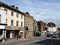
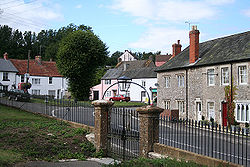
Towns
Its main towns include:- BrutonBrutonBruton is a town and civil parish in Somerset, England, situated on the River Brue seven miles south-east of Shepton Mallet, just south of Snakelake Hill and Coombe Hill, ten miles north-west of Gillingham and twelve miles south-west of Frome in the South Somerset district. The town has a...
- Castle CaryCastle CaryCastle Cary is a market town and civil parish in south Somerset, England, north west of Wincanton and south of Shepton Mallet.The town is situated on the River Cary, a tributary of the Parrett.-History:...
- ChardChard, SomersetChard is a town and civil parish in the Somerset county of England. It lies on the A30 road near the Devon border, south west of Yeovil. The parish has a population of approximately 12,000 and, at an elevation of , it is the southernmost and highest town in Somerset...
- CrewkerneCrewkerneCrewkerne is a town in Somerset, England, situated south west of Yeovil and east of Chard in the South Somerset district close to the border with Dorset. The civil parish of West Crewkerne includes the hamlets of Woolminstone and Henley...
- IlminsterIlminsterIlminster is a country town and civil parish in the countryside of south west Somerset, England, with a population of 4,781. Bypassed a few years ago, the town now lies just east of the intersection of the A303 and the A358...
- LangportLangportLangport is a small town and civil parish in Somerset, England, situated west of Somerton in the South Somerset district. The town has a population of 1,067. The parish includes the hamlets of Bowdens and Combe...
- Milborne PortMilborne PortMilborne Port is a village and civil parish in Somerset, England, east of Sherborne, and in the South Somerset district. It has a population of 2,735...
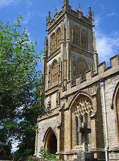
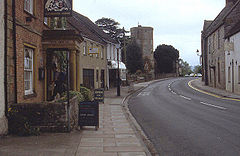
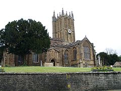
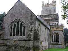
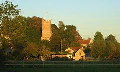
- SomertonSomertonSomerton is a small town and civil parish in the South Somerset district of the English county of Somerset. It gave its name to the county of Somerset, was briefly, around the start of the 14th century, the county town, and around 900 AD was possibly the capital of Wessex...
- WincantonWincantonWincanton is a small town in south Somerset, southwest England. The town lies on the A303 road, the main route between London and South West England, and has some light industry...
- YeovilYeovilYeovil is a town and civil parish in south Somerset, England. The parish had a population of 27,949 at the 2001 census, although the wider urban area had a population of 42,140...
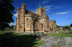
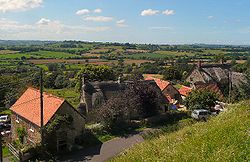
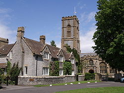
Parishes
| Image | Name | Status | Population | Former local authority | Coordinates | Refs |
|---|---|---|---|---|---|---|
 |
Abbas and Templecombe | Civil parish | Wincanton Rural District Wincanton Rural District Wincanton was a rural district in Somerset, England, from 1894 to 1974.It was created in 1894 under the Local Government Act 1894.In 1974 it was abolished under the Local Government Act 1972 when it became part of South Somerset.... |
50.99°N 2.41°W | ||
 |
Alford Alford, Somerset Alford is a village and parish on the River Alham, in Somerset, England, situated south of Shepton Mallet and two miles west of Castle Cary in the South Somerset district. The village has a population of 63. It lies on the River Cary.-History:... |
Civil parish | Wincanton Rural District Wincanton Rural District Wincanton was a rural district in Somerset, England, from 1894 to 1974.It was created in 1894 under the Local Government Act 1894.In 1974 it was abolished under the Local Government Act 1972 when it became part of South Somerset.... |
51.08°N 2.57°W | ||
 |
Aller Aller, Somerset Aller is a village and parish in Somerset, England, situated west of Somerton on the A372 road towards Bridgwater in the South Somerset district. The village has a population of 374... |
Civil parish | Langport Rural District Langport Rural District Langport was a rural district in Somerset, England, from 1894 to 1974.It was created in 1894 under the Local Government Act 1894.In 1974 it was abolished under the Local Government Act 1972 to become part of South Somerset.... |
51.05°N 2.85°W | ||
| Ansford Ansford Ansford is a village and parish in Somerset, England, situated on the northern edge of Castle Cary in the South Somerset district. The village has a population of 1,048.... |
Civil parish | Wincanton Rural District Wincanton Rural District Wincanton was a rural district in Somerset, England, from 1894 to 1974.It was created in 1894 under the Local Government Act 1894.In 1974 it was abolished under the Local Government Act 1972 when it became part of South Somerset.... |
51.09°N 2.51°W | |||
 |
Ash | Civil parish | Yeovil Rural District Yeovil Rural District Yeovil was a rural district in Somerset, England, from 1894 to 1974.It was created in 1894 under the Local Government Act 1894.In 1974 it was abolished under the Local Government Act 1972 when it became part of South Somerset.... |
50.98°N 2.75°W | ||
| Ashill Ashill, Somerset Ashill is a small village and civil parish in Somerset, England, situated south of Taunton, and three miles north-west of Ilminster in the South Somerset district... |
Civil parish | Chard Rural District Chard Rural District Chard was a rural district in Somerset, England, from 1894 to 1974.It was created in 1894 under the Local Government Act 1894.In 1974 it was abolished under the Local Government Act 1972 when it became part of South Somerset.... |
50.94°N 2.96°W | |||
 |
Babcary Babcary Babcary is a village and parish in Somerset, England, situated east of Somerton and south west of Castle Cary in the South Somerset district. The village has a population of 239. It lies close to the River Cary and the A37.-History:... |
Civil parish | Langport Rural District Langport Rural District Langport was a rural district in Somerset, England, from 1894 to 1974.It was created in 1894 under the Local Government Act 1894.In 1974 it was abolished under the Local Government Act 1972 to become part of South Somerset.... |
51.05°N 2.62°W | ||
 |
Barrington Barrington, Somerset Barrington is a village and civil parish, situated south east of Taunton and west of Yeovil in the South Somerset district of Somerset, England... |
Civil parish | Langport Rural District Langport Rural District Langport was a rural district in Somerset, England, from 1894 to 1974.It was created in 1894 under the Local Government Act 1894.In 1974 it was abolished under the Local Government Act 1972 to become part of South Somerset.... |
50.96°N 2.87°W | ||
 |
Barton St David Barton St David Barton St David is a village and civil parish on the River Brue adjacent to Keinton Mandeville in Somerset, England. It is situated south-east of Glastonbury and north-east of Somerton in the South Somerset district... |
Civil parish | Langport Rural District Langport Rural District Langport was a rural district in Somerset, England, from 1894 to 1974.It was created in 1894 under the Local Government Act 1894.In 1974 it was abolished under the Local Government Act 1972 to become part of South Somerset.... |
51.08°N 2.65°W | ||
 |
Barwick Barwick, Somerset Barwick is a village and parish in Somerset, England, situated south of Yeovil in the South Somerset district and on the border with Dorset. The parish, which includes the village of Stoford has a population of 1,289.-History:... |
Civil parish | Yeovil Rural District Yeovil Rural District Yeovil was a rural district in Somerset, England, from 1894 to 1974.It was created in 1894 under the Local Government Act 1894.In 1974 it was abolished under the Local Government Act 1972 when it became part of South Somerset.... |
50.92°N 2.62°W | ||
 |
Beercrocombe Beercrocombe Beercrocombe is a village and civil parish in Somerset, England, situated on the Fivehead River, a tributary of the River Isle, south of Curry Mallet and south-east of Taunton in the South Somerset district... |
Civil parish | Langport Rural District Langport Rural District Langport was a rural district in Somerset, England, from 1894 to 1974.It was created in 1894 under the Local Government Act 1894.In 1974 it was abolished under the Local Government Act 1972 to become part of South Somerset.... |
50.98°N 2.97°W | ||
 |
Blackford and Compton Pauncefoot Blackford and Compton Pauncefoot Blackford and Compton Pauncefoot is a civil parish in Somerset, England.The parish covers the villages of Blackford and Compton Pauncefoot.The parish has no parish council and has a Parish Meeting which has limited responsibility for local issues, including setting an annual precept to cover very... |
Civil parish | Wincanton Rural District Wincanton Rural District Wincanton was a rural district in Somerset, England, from 1894 to 1974.It was created in 1894 under the Local Government Act 1894.In 1974 it was abolished under the Local Government Act 1972 when it became part of South Somerset.... |
51.03°N 2.50°W | ||
 |
Bratton Seymour Bratton Seymour Bratton Seymour is a village and civil parish in Somerset, England, situated on a tributary of the River Brue south-east of Castle Cary and north-west of Wincanton in the South Somerset district... |
Civil parish | Wincanton Rural District Wincanton Rural District Wincanton was a rural district in Somerset, England, from 1894 to 1974.It was created in 1894 under the Local Government Act 1894.In 1974 it was abolished under the Local Government Act 1972 when it became part of South Somerset.... |
51.07°N 2.47°W | ||
| Brewham Brewham Brewham is a civil parish in Somerset, England, consisting of the villages of North Brewham and South Brewham, on either side of the river in the Brue Valley east of Bruton and south-west of Frome in the South Somerset district. The parish has a population of 410.-History:The name of the... |
Civil parish | Wincanton Rural District Wincanton Rural District Wincanton was a rural district in Somerset, England, from 1894 to 1974.It was created in 1894 under the Local Government Act 1894.In 1974 it was abolished under the Local Government Act 1972 when it became part of South Somerset.... |
51.13°N 2.40°W | |||
 |
Broadway Broadway, Somerset Broadway is a village and civil parish in Somerset, England, situated west of Ilminster and north of Chard in the South Somerset district. The parish has a population of 616... |
Civil parish | Chard Rural District Chard Rural District Chard was a rural district in Somerset, England, from 1894 to 1974.It was created in 1894 under the Local Government Act 1894.In 1974 it was abolished under the Local Government Act 1972 when it became part of South Somerset.... |
50.93°N 2.97°W | ||
 |
Bruton Bruton Bruton is a town and civil parish in Somerset, England, situated on the River Brue seven miles south-east of Shepton Mallet, just south of Snakelake Hill and Coombe Hill, ten miles north-west of Gillingham and twelve miles south-west of Frome in the South Somerset district. The town has a... |
Town | Wincanton Rural District Wincanton Rural District Wincanton was a rural district in Somerset, England, from 1894 to 1974.It was created in 1894 under the Local Government Act 1894.In 1974 it was abolished under the Local Government Act 1972 when it became part of South Somerset.... |
51.11°N 2.45°W | ||
 |
Brympton Brympton Brympton is a civil parish and ward in Somerset, UK. The parish is situated on the north-west edge of Yeovil in the South Somerset district. The parish/ward has a population of 4,956... |
Civil parish | Yeovil Rural District Yeovil Rural District Yeovil was a rural district in Somerset, England, from 1894 to 1974.It was created in 1894 under the Local Government Act 1894.In 1974 it was abolished under the Local Government Act 1972 when it became part of South Somerset.... |
50.94°N 2.68°W | ||
| Buckland St Mary Buckland St Mary Buckland St Mary is a village and parish in Somerset, England, situated to the west of Ilminster and south of Taunton in the South Somerset district, close to the A303. The village has a population of 559... |
Civil parish | Chard Rural District Chard Rural District Chard was a rural district in Somerset, England, from 1894 to 1974.It was created in 1894 under the Local Government Act 1894.In 1974 it was abolished under the Local Government Act 1972 when it became part of South Somerset.... |
50.91°N 3.04°W | |||
 |
Castle Cary Castle Cary Castle Cary is a market town and civil parish in south Somerset, England, north west of Wincanton and south of Shepton Mallet.The town is situated on the River Cary, a tributary of the Parrett.-History:... |
Town | Wincanton Rural District Wincanton Rural District Wincanton was a rural district in Somerset, England, from 1894 to 1974.It was created in 1894 under the Local Government Act 1894.In 1974 it was abolished under the Local Government Act 1972 when it became part of South Somerset.... |
51.09°N 2.51°W | ||
 |
Chaffcombe Chaffcombe Chaffcombe is a village and civil parish in Somerset, England, situated north east of Chard in the South Somerset district. The village has a population of 194.-History:... |
Civil parish | Chard Rural District Chard Rural District Chard was a rural district in Somerset, England, from 1894 to 1974.It was created in 1894 under the Local Government Act 1894.In 1974 it was abolished under the Local Government Act 1972 when it became part of South Somerset.... |
50.89°N 2.92°W | ||
 |
Chard Chard, Somerset Chard is a town and civil parish in the Somerset county of England. It lies on the A30 road near the Devon border, south west of Yeovil. The parish has a population of approximately 12,000 and, at an elevation of , it is the southernmost and highest town in Somerset... |
Town | Chard Municipal Borough Chard, Somerset Chard is a town and civil parish in the Somerset county of England. It lies on the A30 road near the Devon border, south west of Yeovil. The parish has a population of approximately 12,000 and, at an elevation of , it is the southernmost and highest town in Somerset... |
50.87°N 2.96°W | ||
 |
Charlton Horethorne Charlton Horethorne Charlton Horethorne is a village and civil parish in Somerset, England, situated five miles north-east of Sherborne and five miles south-west of Wincanton in the South Somerset district... |
Civil parish | Wincanton Rural District Wincanton Rural District Wincanton was a rural district in Somerset, England, from 1894 to 1974.It was created in 1894 under the Local Government Act 1894.In 1974 it was abolished under the Local Government Act 1972 when it became part of South Somerset.... |
51.01°N 2.48°W | ||
| Charlton Mackrell Charlton Mackrell Charlton Mackrell is a village and civil parish in Somerset, England, situated three miles east of Somerton in the South Somerset district. The village has a population of 996.... |
Civil parish | Langport Rural District Langport Rural District Langport was a rural district in Somerset, England, from 1894 to 1974.It was created in 1894 under the Local Government Act 1894.In 1974 it was abolished under the Local Government Act 1972 to become part of South Somerset.... |
51.05°N 2.68°W | |||
 |
Charlton Musgrove Charlton Musgrove Charlton Musgrove is a village and civil parish in Somerset, England, situated north east of Wincanton in the South Somerset district. The village has a population of 375... |
Civil parish | Wincanton Rural District Wincanton Rural District Wincanton was a rural district in Somerset, England, from 1894 to 1974.It was created in 1894 under the Local Government Act 1894.In 1974 it was abolished under the Local Government Act 1972 when it became part of South Somerset.... |
51.08°N 2.39°W | ||
| Chillington Chillington, Somerset Chillington is a village and parish in Somerset, England, situated west of Crewkerne and east of Chard in the South Somerset district. The parish has a population of 96. The parish includes the hamlet of Coombe.-History:... |
Civil parish | Chard Rural District Chard Rural District Chard was a rural district in Somerset, England, from 1894 to 1974.It was created in 1894 under the Local Government Act 1894.In 1974 it was abolished under the Local Government Act 1972 when it became part of South Somerset.... |
50.89°N 2.87°W | |||
 |
Chilthorne Domer Chilthorne Domer Chilthorne Domer is a village and parish in Somerset, England, situated north west of Yeovil in the South Somerset district. The village has a population of 569. It is situated on the old coach road from Ilchester to Yeovil.-History:... |
Civil parish | Yeovil Rural District Yeovil Rural District Yeovil was a rural district in Somerset, England, from 1894 to 1974.It was created in 1894 under the Local Government Act 1894.In 1974 it was abolished under the Local Government Act 1972 when it became part of South Somerset.... |
50.97°N 2.68°W | ||
 |
Chilton Cantelo Chilton Cantelo Chilton Cantelo is a village and parish in Somerset, England, situated on the River Yeo north of Yeovil and east of Ilchester in the South Somerset district. The village has a population of 132... |
Civil parish | Yeovil Rural District Yeovil Rural District Yeovil was a rural district in Somerset, England, from 1894 to 1974.It was created in 1894 under the Local Government Act 1894.In 1974 it was abolished under the Local Government Act 1972 when it became part of South Somerset.... |
51.00°N 2.60°W | ||
 |
Chiselborough Chiselborough Chiselborough is a village situated on the river Parrett west of Yeovil in Somerset, England. The village has a population of 335.The village consists largely of small cottages built in the local golden hamstone quarried at the local Ham Hill.-History:... |
Civil parish | Yeovil Rural District Yeovil Rural District Yeovil was a rural district in Somerset, England, from 1894 to 1974.It was created in 1894 under the Local Government Act 1894.In 1974 it was abolished under the Local Government Act 1972 when it became part of South Somerset.... |
50.93°N 2.76°W | ||
| Closworth Closworth Closworth is a village and civil parish in Somerset, England, situated five miles south of Yeovil in the South Somerset district, on the border with Dorset. The village has a population of 192.... |
Civil parish | Yeovil Rural District Yeovil Rural District Yeovil was a rural district in Somerset, England, from 1894 to 1974.It was created in 1894 under the Local Government Act 1894.In 1974 it was abolished under the Local Government Act 1972 when it became part of South Somerset.... |
50.89°N 2.62°W | |||
 |
Combe St Nicholas Combe St Nicholas Combe St Nicholas is a village and parish in Somerset, England, situated north west of Chard and from Taunton in the South Somerset district on the edge of the Blackdown Hills Area of Outstanding Natural Beauty. The parish, which includes Wadeford and Scrapton, has a population of... |
Civil parish | Chard Rural District Chard Rural District Chard was a rural district in Somerset, England, from 1894 to 1974.It was created in 1894 under the Local Government Act 1894.In 1974 it was abolished under the Local Government Act 1972 when it became part of South Somerset.... |
50.89°N 2.99°W | ||
| Compton Dundon Compton Dundon Compton Dundon is a village and civil parish in Somerset, England, situated beside King's Sedge Moor and the Polden Hills, south of Glastonbury and north of Somerton in the South Somerset district. The village has a population of 710... |
Civil parish | Langport Rural District Langport Rural District Langport was a rural district in Somerset, England, from 1894 to 1974.It was created in 1894 under the Local Government Act 1894.In 1974 it was abolished under the Local Government Act 1972 to become part of South Somerset.... |
51.09°N 2.73°W | |||
| Corton Denham Corton Denham Corton Denham is a village and parish in Somerset, England, situated seven miles north east of Yeovil in the South Somerset district. The village has a population of 210.-History:... |
Civil parish | Wincanton Rural District Wincanton Rural District Wincanton was a rural district in Somerset, England, from 1894 to 1974.It was created in 1894 under the Local Government Act 1894.In 1974 it was abolished under the Local Government Act 1972 when it became part of South Somerset.... |
51.00°N 2.52°W | |||
 |
Crewkerne Crewkerne Crewkerne is a town in Somerset, England, situated south west of Yeovil and east of Chard in the South Somerset district close to the border with Dorset. The civil parish of West Crewkerne includes the hamlets of Woolminstone and Henley... |
Town | Crewkerne Urban District Crewkerne Crewkerne is a town in Somerset, England, situated south west of Yeovil and east of Chard in the South Somerset district close to the border with Dorset. The civil parish of West Crewkerne includes the hamlets of Woolminstone and Henley... |
50.88°N 2.79°W | ||
| Cricket St Thomas | Civil parish | Chard Rural District Chard Rural District Chard was a rural district in Somerset, England, from 1894 to 1974.It was created in 1894 under the Local Government Act 1894.In 1974 it was abolished under the Local Government Act 1972 when it became part of South Somerset.... |
50.87°N 2.89°W | |||
 |
Cucklington Cucklington Cucklington is a village and parish in Somerset, England, situated on a hill south east of Wincanton and north west of Gillingham in the South Somerset district, near the Dorset border... |
Civil parish | Wincanton Rural District Wincanton Rural District Wincanton was a rural district in Somerset, England, from 1894 to 1974.It was created in 1894 under the Local Government Act 1894.In 1974 it was abolished under the Local Government Act 1972 when it became part of South Somerset.... |
51.05°N 2.35°W | ||
 |
Cudworth Cudworth, Somerset Cudworth is a village and parish in Somerset, England, situated north east of Chard in the South Somerset district. The village has a population of 69.-History:The parish of Cudworth was part of the South Petherton Hundred.... |
Civil parish | Chard Rural District Chard Rural District Chard was a rural district in Somerset, England, from 1894 to 1974.It was created in 1894 under the Local Government Act 1894.In 1974 it was abolished under the Local Government Act 1972 when it became part of South Somerset.... |
50.89°N 2.89°W | ||
| Curry Mallet Curry Mallet Curry Mallet is a village and parish in Somerset, England. It is on the Fivehead River , east of Taunton in the South Somerset district... |
Civil parish | Langport Rural District Langport Rural District Langport was a rural district in Somerset, England, from 1894 to 1974.It was created in 1894 under the Local Government Act 1894.In 1974 it was abolished under the Local Government Act 1972 to become part of South Somerset.... |
50.99°N 2.96°W | |||
 |
Curry Rivel Curry Rivel Curry Rivel is a village and civil parish in Somerset, England, situated west of Somerton and east of Taunton in the South Somerset district. The parish has a population of 2,093... |
Civil parish | Langport Rural District Langport Rural District Langport was a rural district in Somerset, England, from 1894 to 1974.It was created in 1894 under the Local Government Act 1894.In 1974 it was abolished under the Local Government Act 1972 to become part of South Somerset.... |
51.03°N 2.86°W | ||
 |
Dinnington Dinnington, Somerset Dinnington is a village and civil parish in English county of Somerset, situated north of Crewkerne in the South Somerset district. The village has a population of 65.-History:The name Dinnington means the settlement of Dynne's people.... |
Civil parish | Chard Rural District Chard Rural District Chard was a rural district in Somerset, England, from 1894 to 1974.It was created in 1894 under the Local Government Act 1894.In 1974 it was abolished under the Local Government Act 1972 when it became part of South Somerset.... |
50.91°N 2.85°W | ||
| Donyatt Donyatt Donyatt is a village and civil parish in Somerset, England, situated at the source of the River Isle north of Chard in the South Somerset district... |
Civil parish | Chard Rural District Chard Rural District Chard was a rural district in Somerset, England, from 1894 to 1974.It was created in 1894 under the Local Government Act 1894.In 1974 it was abolished under the Local Government Act 1972 when it became part of South Somerset.... |
50.93°N 2.95°W | |||
 |
Dowlish Wake Dowlish Wake Dowlish Wake is a small village and civil parish in Somerset, England, situated south of Ilminster and north-east of Chard in the South Somerset district. The village has a population of 293 and is home to several thatched houses.... |
Civil parish | Chard Rural District Chard Rural District Chard was a rural district in Somerset, England, from 1894 to 1974.It was created in 1894 under the Local Government Act 1894.In 1974 it was abolished under the Local Government Act 1972 when it became part of South Somerset.... |
50.91°N 2.89°W | ||
 |
Drayton Drayton, Somerset Drayton is a village and civil parish in Somerset, England, situated less than a mile from Curry Rivel and five miles southwest of Somerton in the South Somerset district. It is situated on the River Isle, near its confluence with the Parrett, and the former Westport Canal... |
Civil parish | Langport Rural District Langport Rural District Langport was a rural district in Somerset, England, from 1894 to 1974.It was created in 1894 under the Local Government Act 1894.In 1974 it was abolished under the Local Government Act 1972 to become part of South Somerset.... |
51.019°N 2.85°W | ||
| East Chinnock East Chinnock The Chinnocks are three villages in Somerset, England, south west of Yeovil in the South Somerset district:*East Chinnock*Middle Chinnock*West Chinnock... |
Civil parish | Yeovil Rural District Yeovil Rural District Yeovil was a rural district in Somerset, England, from 1894 to 1974.It was created in 1894 under the Local Government Act 1894.In 1974 it was abolished under the Local Government Act 1972 when it became part of South Somerset.... |
50.92°N 2.72°W | |||
 |
East Coker East Coker East Coker is a village and civil parish in the South Somerset district of Somerset, England. Its nearest town is Yeovil, which is situated two miles north from the village. The village has a population of 1,781... |
Civil parish | Yeovil Rural District Yeovil Rural District Yeovil was a rural district in Somerset, England, from 1894 to 1974.It was created in 1894 under the Local Government Act 1894.In 1974 it was abolished under the Local Government Act 1972 when it became part of South Somerset.... |
50.91°N 2.65°W | ||
 |
Fivehead Fivehead Fivehead is a village and civil parish in Somerset, England, situated on the Fivehead River, miles east of Taunton in the South Somerset district... |
Civil parish | Langport Rural District Langport Rural District Langport was a rural district in Somerset, England, from 1894 to 1974.It was created in 1894 under the Local Government Act 1894.In 1974 it was abolished under the Local Government Act 1972 to become part of South Somerset.... |
50.99°N 2.92°W | ||
 |
Hambridge and Westport Hambridge and Westport Hambridge and Westport is a civil parish in Somerset, England. It has a population of 526.It includes the villages of Hambridge and Westport in the South Somerset district.-History and General Information:... |
Civil parish | Langport Rural District Langport Rural District Langport was a rural district in Somerset, England, from 1894 to 1974.It was created in 1894 under the Local Government Act 1894.In 1974 it was abolished under the Local Government Act 1972 to become part of South Somerset.... |
50.99°N 2.86°W | ||
 |
Hardington Mandeville Hardington Mandeville Hardington Mandeville is a village and civil parish in Somerset, England, situated south west of Yeovil in the South Somerset district. The village has a population of 598.-History:... |
Civil parish | Yeovil Rural District Yeovil Rural District Yeovil was a rural district in Somerset, England, from 1894 to 1974.It was created in 1894 under the Local Government Act 1894.In 1974 it was abolished under the Local Government Act 1972 when it became part of South Somerset.... |
50.90°N 2.69°W | ||
| Haselbury Plucknett Haselbury Plucknett Haselbury Plucknett is a village and civil parish on the River Parrett in Somerset, England, situated south west of Yeovil in the South Somerset district. The village has a population of 641.... |
Civil parish | Yeovil Rural District Yeovil Rural District Yeovil was a rural district in Somerset, England, from 1894 to 1974.It was created in 1894 under the Local Government Act 1894.In 1974 it was abolished under the Local Government Act 1972 when it became part of South Somerset.... |
50.89°N 2.75°W | |||
 |
Henstridge Henstridge Henstridge is a village and civil parish in Somerset, England, situated miles east of Sherborne in the South Somerset district, near the border with Dorset. The parish includes the hamlet of Yenston... |
Civil parish | Wincanton Rural District Wincanton Rural District Wincanton was a rural district in Somerset, England, from 1894 to 1974.It was created in 1894 under the Local Government Act 1894.In 1974 it was abolished under the Local Government Act 1972 when it became part of South Somerset.... |
50.97°N 2.39°W | ||
 |
High Ham High Ham High Ham is a village and civil parish in Somerset, England. Within the parish of High Ham are the villages of High Ham and Low Ham and the hamlets of Bowdens, Henley, Paradise and Picts Hill.-History:... |
Civil parish | Langport Rural District Langport Rural District Langport was a rural district in Somerset, England, from 1894 to 1974.It was created in 1894 under the Local Government Act 1894.In 1974 it was abolished under the Local Government Act 1972 to become part of South Somerset.... |
51.08°N 2.82°W | ||
 |
Hinton St George Hinton St George Hinton St George is a village and parish in Somerset, England, situated outside of Crewkerne, south west of Yeovil in the South Somerset district. The village has a population of 404.... |
Civil parish | Chard Rural District Chard Rural District Chard was a rural district in Somerset, England, from 1894 to 1974.It was created in 1894 under the Local Government Act 1894.In 1974 it was abolished under the Local Government Act 1972 when it became part of South Somerset.... |
50.91°N 2.82°W | ||
| Holton Holton, Somerset Holton is a village and parish in Somerset, England, situated on the A303 road south west of Wincanton in the South Somerset district. The village has a population of 225.-History:The parish of Holton was part of the Whitley Hundred.... |
Civil parish | Wincanton Rural District Wincanton Rural District Wincanton was a rural district in Somerset, England, from 1894 to 1974.It was created in 1894 under the Local Government Act 1894.In 1974 it was abolished under the Local Government Act 1972 when it became part of South Somerset.... |
51.04°N 2.45°W | |||
 |
Horsington Horsington, Somerset Horsington is a village and parish in Somerset, England, situated south of Wincanton and north of Templecombe in the South Somerset district. The village lies on the edge of Horsington Marsh, part of the Blackmore Vale... |
Civil parish | Wincanton Rural District Wincanton Rural District Wincanton was a rural district in Somerset, England, from 1894 to 1974.It was created in 1894 under the Local Government Act 1894.In 1974 it was abolished under the Local Government Act 1972 when it became part of South Somerset.... |
51.01°N 2.43°W | ||
| Horton Horton, Somerset Horton is a village and civil parish in Somerset, England, situated north of Chard in the South Somerset district. The village has a population of 788.-History:... |
Civil parish | Chard Rural District Chard Rural District Chard was a rural district in Somerset, England, from 1894 to 1974.It was created in 1894 under the Local Government Act 1894.In 1974 it was abolished under the Local Government Act 1972 when it became part of South Somerset.... |
50.93°N 2.97°W | |||
 |
Huish Episcopi Huish Episcopi Huish Episcopi is a village and civil parish in Somerset, England, situated on the outskirts of Langport, south west of Somerton in the South Somerset district... |
Civil parish | Langport Rural District Langport Rural District Langport was a rural district in Somerset, England, from 1894 to 1974.It was created in 1894 under the Local Government Act 1894.In 1974 it was abolished under the Local Government Act 1972 to become part of South Somerset.... |
51.04°N 2.81°W | ||
 |
Ilchester Ilchester Ilchester is a village and civil parish, situated on the River Yeo or Ivel, five miles north of Yeovil, in the English county of Somerset. The parish, which includes the village of Sock Dennis and the old parish of Northover, has a population of 2,021... |
Civil parish | Yeovil Rural District Yeovil Rural District Yeovil was a rural district in Somerset, England, from 1894 to 1974.It was created in 1894 under the Local Government Act 1894.In 1974 it was abolished under the Local Government Act 1972 when it became part of South Somerset.... |
51.00°N 2.68°W | ||
 |
Ilminster Ilminster Ilminster is a country town and civil parish in the countryside of south west Somerset, England, with a population of 4,781. Bypassed a few years ago, the town now lies just east of the intersection of the A303 and the A358... |
Town | Chard Rural District Chard Rural District Chard was a rural district in Somerset, England, from 1894 to 1974.It was created in 1894 under the Local Government Act 1894.In 1974 it was abolished under the Local Government Act 1972 when it became part of South Somerset.... Ilminster Urban District Ilminster Ilminster is a country town and civil parish in the countryside of south west Somerset, England, with a population of 4,781. Bypassed a few years ago, the town now lies just east of the intersection of the A303 and the A358... |
50.93°N 2.91°W | ||
| Ilton Ilton Ilton is a village and civil parish in Somerset, England, situated south-east of Taunton, and north of Ilminster in the South Somerset district. The village has a population of 849... |
Civil parish | Chard Rural District Chard Rural District Chard was a rural district in Somerset, England, from 1894 to 1974.It was created in 1894 under the Local Government Act 1894.In 1974 it was abolished under the Local Government Act 1972 when it became part of South Somerset.... |
50.95°N 2.92°W | |||
 |
Isle Abbots Isle Abbots Isle Abbots is a village and civil parish in Somerset, England, situated south east of Taunton in the South Somerset district... |
Civil parish | Langport Rural District Langport Rural District Langport was a rural district in Somerset, England, from 1894 to 1974.It was created in 1894 under the Local Government Act 1894.In 1974 it was abolished under the Local Government Act 1972 to become part of South Somerset.... |
50.98°N 2.92°W | ||
| Isle Brewers Isle Brewers Isle Brewers is a village and parish in Somerset, England, situated on the River Isle south east of Taunton in the South Somerset district. The village has a population of 163... |
Civil parish | Langport Rural District Langport Rural District Langport was a rural district in Somerset, England, from 1894 to 1974.It was created in 1894 under the Local Government Act 1894.In 1974 it was abolished under the Local Government Act 1972 to become part of South Somerset.... |
50.99°N 2.90°W | |||
 |
Keinton Mandeville Keinton Mandeville Keinton Mandeville is a village and civil parish in Somerset, England, situated west of Castle Cary in the South Somerset district. The village has a population of 991... |
Civil parish | Langport Rural District Langport Rural District Langport was a rural district in Somerset, England, from 1894 to 1974.It was created in 1894 under the Local Government Act 1894.In 1974 it was abolished under the Local Government Act 1972 to become part of South Somerset.... |
51.07°N 2.65°W | ||
 |
Kingsbury Episcopi Kingsbury Episcopi Kingsbury Episcopi is a village and civil parish on the River Parrett in Somerset, England, situated north west of Yeovil in the South Somerset district. The village has a population of 1,277. The parish includes the villages of West Lambrook, East Lambrook and Thorney.-History:The "Episcopi"... |
Civil parish | Langport Rural District Langport Rural District Langport was a rural district in Somerset, England, from 1894 to 1974.It was created in 1894 under the Local Government Act 1894.In 1974 it was abolished under the Local Government Act 1972 to become part of South Somerset.... |
50.99°N 2.81°W | ||
 |
Kingsdon Kingsdon, Somerset Kingsdon is a village and parish in the South Somerset district of Somerset, England, situated south east of Somerton. The village has a population of 356.-History:... |
Civil parish | Langport Rural District Langport Rural District Langport was a rural district in Somerset, England, from 1894 to 1974.It was created in 1894 under the Local Government Act 1894.In 1974 it was abolished under the Local Government Act 1972 to become part of South Somerset.... |
51.04°N 2.69°W | ||
| Kingstone Kingstone, Somerset Kingstone is a village and civil parish in Somerset, England, situated near Ilminster, north east of Chard in the South Somerset district. The village has a population of 83.... |
Civil parish | Chard Rural District Chard Rural District Chard was a rural district in Somerset, England, from 1894 to 1974.It was created in 1894 under the Local Government Act 1894.In 1974 it was abolished under the Local Government Act 1972 when it became part of South Somerset.... |
50.92°N 2.89°W | |||
 |
Kingweston Kingweston Kingweston is a village and civil parish in Somerset, England, situated north east of Somerton in the South Somerset district. The village has a population of 128.-History:The village's name was Chinwardestune in the Domesday Book of 1086... |
Civil parish | Langport Rural District Langport Rural District Langport was a rural district in Somerset, England, from 1894 to 1974.It was created in 1894 under the Local Government Act 1894.In 1974 it was abolished under the Local Government Act 1972 to become part of South Somerset.... |
51.08°N 2.68°W | ||
| Knowle St Giles Knowle St Giles Knowle St Giles is a village and civil parish in the South Somerset district of Somerset, England, situated on the River Isle south of Ilminster and north east of Chard... |
Civil parish | Chard Rural District Chard Rural District Chard was a rural district in Somerset, England, from 1894 to 1974.It was created in 1894 under the Local Government Act 1894.In 1974 it was abolished under the Local Government Act 1972 when it became part of South Somerset.... |
50.90°N 2.93°W | |||
 |
Langport Langport Langport is a small town and civil parish in Somerset, England, situated west of Somerton in the South Somerset district. The town has a population of 1,067. The parish includes the hamlets of Bowdens and Combe... |
Town | Langport Rural District Langport Rural District Langport was a rural district in Somerset, England, from 1894 to 1974.It was created in 1894 under the Local Government Act 1894.In 1974 it was abolished under the Local Government Act 1972 to become part of South Somerset.... |
51.04°N 2.83°W | ||
 |
Limington Limington Limington is a village and parish in Somerset, England, situated north of Yeovil in the South Somerset district. The village has a population of 199... |
Civil parish | Yeovil Rural District Yeovil Rural District Yeovil was a rural district in Somerset, England, from 1894 to 1974.It was created in 1894 under the Local Government Act 1894.In 1974 it was abolished under the Local Government Act 1972 when it became part of South Somerset.... |
50.99°N 2.65°W | ||
| Long Load Long Load Long Load is a village and parish in Somerset, England, situated on the River Yeo south of Somerton in the South Somerset district. The village has a population of 361.-History:Long Load's association with the river is long standing... |
Civil parish | Yeovil Rural District Yeovil Rural District Yeovil was a rural district in Somerset, England, from 1894 to 1974.It was created in 1894 under the Local Government Act 1894.In 1974 it was abolished under the Local Government Act 1972 when it became part of South Somerset.... |
51.01°N 2.76°W | |||
 |
Long Sutton Long Sutton, Somerset Long Sutton is a village and civil parish in Somerset, England, situated south of Somerton in the South Somerset district. The village has a population of 862.... |
Civil parish | Langport Rural District Langport Rural District Langport was a rural district in Somerset, England, from 1894 to 1974.It was created in 1894 under the Local Government Act 1894.In 1974 it was abolished under the Local Government Act 1972 to become part of South Somerset.... |
|||
| Lopen Lopen Lopen is a village and civil parish in the English county of Somerset, situated eight miles west of Yeovil in the South Somerset district. The village has a population of 248.-History:The name of the village means Lufa's pen or fold.... |
Civil parish | Chard Rural District Chard Rural District Chard was a rural district in Somerset, England, from 1894 to 1974.It was created in 1894 under the Local Government Act 1894.In 1974 it was abolished under the Local Government Act 1972 when it became part of South Somerset.... |
50.93°N 2.82°W | |||
| Lovington Lovington, Somerset Lovington is a village and civil parish in Somerset, England, situated south west of Castle Cary, between the River Brue and River Cary, in the South Somerset district... |
Civil parish | Wincanton Rural District Wincanton Rural District Wincanton was a rural district in Somerset, England, from 1894 to 1974.It was created in 1894 under the Local Government Act 1894.In 1974 it was abolished under the Local Government Act 1972 when it became part of South Somerset.... |
51.07°N 2.58°W | |||
| Maperton Maperton Maperton is a village and civil parish in Somerset, England, situated south west of Wincanton in the South Somerset district. The village has a population of 150. However this number includes Elliscombe House care home which alone has an average of 40 residents.-History:The name of the village... |
Civil parish | Wincanton Rural District Wincanton Rural District Wincanton was a rural district in Somerset, England, from 1894 to 1974.It was created in 1894 under the Local Government Act 1894.In 1974 it was abolished under the Local Government Act 1972 when it became part of South Somerset.... |
51.04°N 2.46°W | |||
| Marston Magna Marston Magna Marston Magna is a village and civil parish in Somerset, England, situated north of Yeovil in the South Somerset district... |
Civil parish | Yeovil Rural District Yeovil Rural District Yeovil was a rural district in Somerset, England, from 1894 to 1974.It was created in 1894 under the Local Government Act 1894.In 1974 it was abolished under the Local Government Act 1972 when it became part of South Somerset.... |
51.00°N 2.58°W | |||
 |
Martock Martock Martock is a large village and civil parish in Somerset, England, situated on the edge of the Somerset Levels north west of Yeovil in the South Somerset district. The parish includes Hurst, approximately one mile south of the village, and Bower Hinton, which is located at the western end of the... |
Civil parish | Yeovil Rural District Yeovil Rural District Yeovil was a rural district in Somerset, England, from 1894 to 1974.It was created in 1894 under the Local Government Act 1894.In 1974 it was abolished under the Local Government Act 1972 when it became part of South Somerset.... |
50.97°N 2.77°W | ||
| Merriott Merriott Merriott is a village and civil parish in Somerset, England, near the town of Crewkerne and west of Yeovil in the South Somerset district. The village has a population of 2,020.... |
Civil parish | Chard Rural District Chard Rural District Chard was a rural district in Somerset, England, from 1894 to 1974.It was created in 1894 under the Local Government Act 1894.In 1974 it was abolished under the Local Government Act 1972 when it became part of South Somerset.... |
50.91°N 2.79°W | |||
 |
Milborne Port Milborne Port Milborne Port is a village and civil parish in Somerset, England, east of Sherborne, and in the South Somerset district. It has a population of 2,735... |
Civil parish | Wincanton Rural District Wincanton Rural District Wincanton was a rural district in Somerset, England, from 1894 to 1974.It was created in 1894 under the Local Government Act 1894.In 1974 it was abolished under the Local Government Act 1972 when it became part of South Somerset.... |
50.97°N 2.46°W | ||
 |
Misterton Misterton, Somerset Misterton is a village and civil parish south-east of Crewkerne, Somerset, England.-History:The village was previously known as Minsterton as a result of its links with the "mother church" in Crewkerne.... |
Civil parish | Chard Rural District Chard Rural District Chard was a rural district in Somerset, England, from 1894 to 1974.It was created in 1894 under the Local Government Act 1894.In 1974 it was abolished under the Local Government Act 1972 when it became part of South Somerset.... |
50.87°N 2.78°W | ||
 |
Montacute Montacute Montacute is a small village and civil parish in Somerset, England, west of Yeovil. The village has a population of 680 . The name Montacute is thought by some to derive from the Latin "Mons Acutus", referring to the small but still quite acute hill dominating the village to the west.The village... |
Civil parish | Yeovil Rural District Yeovil Rural District Yeovil was a rural district in Somerset, England, from 1894 to 1974.It was created in 1894 under the Local Government Act 1894.In 1974 it was abolished under the Local Government Act 1972 when it became part of South Somerset.... |
50.95°N 2.72°W | ||
| Muchelney Muchelney Muchelney is a village and civil parish in Somerset, England, on the River Parrett, south of Huish Episcopi and miles south west of Somerton in the South Somerset district... |
Civil parish | Langport Rural District Langport Rural District Langport was a rural district in Somerset, England, from 1894 to 1974.It was created in 1894 under the Local Government Act 1894.In 1974 it was abolished under the Local Government Act 1972 to become part of South Somerset.... |
51.021°N 2.82°W | |||
 |
Mudford Mudford Mudford is a village and parish in Somerset, England, situated from Yeovil in the South Somerset district on the River Yeo. The village has a population of 649... |
Civil parish | Yeovil Rural District Yeovil Rural District Yeovil was a rural district in Somerset, England, from 1894 to 1974.It was created in 1894 under the Local Government Act 1894.In 1974 it was abolished under the Local Government Act 1972 when it became part of South Somerset.... |
50.97°N 2.61°W | ||
 |
North Barrow North Barrow North Barrow is a village and civil parish to the north-east of Ilchester in the South Somerset district of Somerset, England.-History:The parish was part of the hundred of Catsash.-Governance:... |
Civil parish | Wincanton Rural District Wincanton Rural District Wincanton was a rural district in Somerset, England, from 1894 to 1974.It was created in 1894 under the Local Government Act 1894.In 1974 it was abolished under the Local Government Act 1972 when it became part of South Somerset.... |
51.06°N 2.57°W | ||
 |
North Cadbury North Cadbury North Cadbury is a village west of Wincanton in the River Cam in the South Somerset district of Somerset, England. It shares its parish with nearby Yarlington and includes the village of Galhampton, which got its name from the settlement of the rent-paying peasants, and the hamlet of... |
Civil parish | Wincanton Rural District Wincanton Rural District Wincanton was a rural district in Somerset, England, from 1894 to 1974.It was created in 1894 under the Local Government Act 1894.In 1974 it was abolished under the Local Government Act 1972 when it became part of South Somerset.... |
51.05°N 2.52°W | ||
| North Cheriton North Cheriton North Cheriton is a small village and civil parish in South Somerset with a population of 254. It is located on the A357 south-west of Wincanton.-History:North Cheriton is mentioned as a manor belonging to William de Moyon in the Domesday Book in 1086.... |
Civil parish | Wincanton Rural District Wincanton Rural District Wincanton was a rural district in Somerset, England, from 1894 to 1974.It was created in 1894 under the Local Government Act 1894.In 1974 it was abolished under the Local Government Act 1972 when it became part of South Somerset.... |
51.03°N 2.44°W | |||
 |
North Perrott North Perrott North Perrott is a village and civil parish in the South Somerset district of the English county of Somerset.-History:The name Perrott comes from the River Parrett.There is evidence of Roman and Iron Age settlement in the village.... |
Civil parish | Yeovil Rural District Yeovil Rural District Yeovil was a rural district in Somerset, England, from 1894 to 1974.It was created in 1894 under the Local Government Act 1894.In 1974 it was abolished under the Local Government Act 1972 when it became part of South Somerset.... |
50.88°N 2.75°W | ||
 |
Norton sub Hamdon Norton Sub Hamdon Norton sub Hamdon is a village in the South Somerset district of the English county of Somerset, situated five miles west of Yeovil. The village has a population of 694.... |
Civil parish | Yeovil Rural District Yeovil Rural District Yeovil was a rural district in Somerset, England, from 1894 to 1974.It was created in 1894 under the Local Government Act 1894.In 1974 it was abolished under the Local Government Act 1972 when it became part of South Somerset.... |
50.94°N 2.76°W | ||
| Odcombe Odcombe Odcombe is a village and civil parish in south Somerset, England, west of the town of Yeovil, with a population of 730 in 2002.The upper part of the village, Higher Odcombe, sits on the crest of the hill, while the lower part, Lower Odcombe, is built on its northern slopes... |
Civil parish | Yeovil Rural District Yeovil Rural District Yeovil was a rural district in Somerset, England, from 1894 to 1974.It was created in 1894 under the Local Government Act 1894.In 1974 it was abolished under the Local Government Act 1972 when it became part of South Somerset.... |
50.94°N 2.70°W | |||
| Penselwood Penselwood Penselwood is a village and civil parish in the English county of Somerset. It is located north east of Wincanton, south east of Bruton, west of Mere, and north west of Gillingham. The south-east of the parish borders Zeals and Stourhead in Wiltshire, and Bourton in Dorset... |
Civil parish | Wincanton Rural District Wincanton Rural District Wincanton was a rural district in Somerset, England, from 1894 to 1974.It was created in 1894 under the Local Government Act 1894.In 1974 it was abolished under the Local Government Act 1972 when it became part of South Somerset.... |
51.08°N 2.35°W | |||
| Pitcombe Pitcombe Pitcombe is a village and civil parish south-west of Bruton and from Wincanton in Somerset, England. It has a population of 549. The parish includes the hamlets of Cole and Godminster.... |
Civil parish | Wincanton Rural District Wincanton Rural District Wincanton was a rural district in Somerset, England, from 1894 to 1974.It was created in 1894 under the Local Government Act 1894.In 1974 it was abolished under the Local Government Act 1972 when it became part of South Somerset.... |
51.10°N 2.47°W | |||
 |
Pitney Pitney Pitney is a village and parish in Somerset, England, located east of Langport and west of Somerton in the South Somerset district. In 2002, the village had a population of 416.... |
Civil parish | Langport Rural District Langport Rural District Langport was a rural district in Somerset, England, from 1894 to 1974.It was created in 1894 under the Local Government Act 1894.In 1974 it was abolished under the Local Government Act 1972 to become part of South Somerset.... |
51.05°N 2.79°W | ||
 |
Puckington Puckington Puckington is a village and civil parish, situated south-east of Taunton and west of Yeovil in the South Somerset district of Somerset, England... |
Civil parish | Langport Rural District Langport Rural District Langport was a rural district in Somerset, England, from 1894 to 1974.It was created in 1894 under the Local Government Act 1894.In 1974 it was abolished under the Local Government Act 1972 to become part of South Somerset.... |
50.96°N 2.89°W | ||
 |
Queen Camel Queen Camel Queen Camel is a village and civil parish, on the River Cam and the A359 road, in the South Somerset district of Somerset, England. It is about north of Yeovil. According to the 2001 census it had a population of 926. The parish includes the hamlet of Wales... |
Civil parish | Wincanton Rural District Wincanton Rural District Wincanton was a rural district in Somerset, England, from 1894 to 1974.It was created in 1894 under the Local Government Act 1894.In 1974 it was abolished under the Local Government Act 1972 when it became part of South Somerset.... |
51.02°N 2.58°W | ||
 |
Rimpton Rimpton Rimpton is a village and civil parish north-west of Sherborne, and north-east of Yeovil on a tributary of the River Parret in the South Somerset district of Somerset, England.-History:The parish of Rimpton was part of the Taunton Deane Hundred... |
Civil parish | Yeovil Rural District Yeovil Rural District Yeovil was a rural district in Somerset, England, from 1894 to 1974.It was created in 1894 under the Local Government Act 1894.In 1974 it was abolished under the Local Government Act 1972 when it became part of South Somerset.... |
50.99°N 2.56°W | ||
| Seavington St Mary Seavington St Mary Seavington St Mary is a village and civil parish in Somerset, England. It is situated next to the village of Seavington St Michael, about east of Ilminster, within the South Somerset district and had a population of 365 inhabitants at the 2001 census.... |
Civil parish | Chard Rural District Chard Rural District Chard was a rural district in Somerset, England, from 1894 to 1974.It was created in 1894 under the Local Government Act 1894.In 1974 it was abolished under the Local Government Act 1972 when it became part of South Somerset.... |
50.93°N 2.86°W | |||
| Seavington St Michael Seavington St Michael Seavington St Michael is a village and civil parish in Somerset, England. It is situated next to the village of Seavington St Mary, about east of Ilminster, within the South Somerset district.... |
Civil parish | Chard Rural District Chard Rural District Chard was a rural district in Somerset, England, from 1894 to 1974.It was created in 1894 under the Local Government Act 1894.In 1974 it was abolished under the Local Government Act 1972 when it became part of South Somerset.... |
50.93°N 2.84°W | |||
| Shepton Beauchamp Shepton Beauchamp Shepton Beauchamp is a village and civil parish, from Barrington and north east of Ilminster between the Blackdown Hills and the Somerset Levels in the South Somerset district of Somerset, England.-History:... |
Civil parish | Chard Rural District Chard Rural District Chard was a rural district in Somerset, England, from 1894 to 1974.It was created in 1894 under the Local Government Act 1894.In 1974 it was abolished under the Local Government Act 1972 when it became part of South Somerset.... |
50.95°N 2.85°W | |||
| Shepton Montague Shepton Montague Shepton Montague is a village and civil parish in Somerset, England. It is situated on the River Pitt in the South Somerset district midway between Wincanton, Bruton and Castle Cary.... |
Civil parish | Wincanton Rural District Wincanton Rural District Wincanton was a rural district in Somerset, England, from 1894 to 1974.It was created in 1894 under the Local Government Act 1894.In 1974 it was abolished under the Local Government Act 1972 when it became part of South Somerset.... |
51.08°N 2.47°W | |||
| Somerton Somerton Somerton is a small town and civil parish in the South Somerset district of the English county of Somerset. It gave its name to the county of Somerset, was briefly, around the start of the 14th century, the county town, and around 900 AD was possibly the capital of Wessex... |
Town | Langport Rural District Langport Rural District Langport was a rural district in Somerset, England, from 1894 to 1974.It was created in 1894 under the Local Government Act 1894.In 1974 it was abolished under the Local Government Act 1972 to become part of South Somerset.... |
51.05°N 2.74°W | |||
| South Barrow South Barrow South Barrow is a village and civil parish approximately north of Sparkford and north-east of Ilchester in the South Somerset district of Somerset, England.-History:... |
Civil parish | Wincanton Rural District Wincanton Rural District Wincanton was a rural district in Somerset, England, from 1894 to 1974.It was created in 1894 under the Local Government Act 1894.In 1974 it was abolished under the Local Government Act 1972 when it became part of South Somerset.... |
51.05°N 2.56°W | |||
| South Cadbury South Cadbury South Cadbury is a village and civil parish in the South Somerset council area of the English county of Somerset. The parish includes the village of Sutton Montis... |
Civil parish | Wincanton Rural District Wincanton Rural District Wincanton was a rural district in Somerset, England, from 1894 to 1974.It was created in 1894 under the Local Government Act 1894.In 1974 it was abolished under the Local Government Act 1972 when it became part of South Somerset.... |
51.03°N 2.52°W | |||
 |
South Petherton South Petherton South Petherton is a small country town and civil parish on the River Parrett in the South Somerset district of Somerset, England. It is east of Ilminster and north west of Crewkerne. It had a population of approximately 3,200 in 2002... |
Civil parish | Yeovil Rural District Yeovil Rural District Yeovil was a rural district in Somerset, England, from 1894 to 1974.It was created in 1894 under the Local Government Act 1894.In 1974 it was abolished under the Local Government Act 1972 when it became part of South Somerset.... |
50.95°N 2.81°W | ||
| Sparkford Sparkford Sparkford is a village and civil parish in the South Somerset district of Somerset, England. The parish includes the village of Weston Bampfylde.... |
Civil parish | Wincanton Rural District Wincanton Rural District Wincanton was a rural district in Somerset, England, from 1894 to 1974.It was created in 1894 under the Local Government Act 1894.In 1974 it was abolished under the Local Government Act 1972 when it became part of South Somerset.... |
51.04°N 2.57°W | |||
 |
Stocklinch Stocklinch Stocklinch is a village and civil parish north-east of Ilminster in the South Somerset district of Somerset, England.-History:The village is one Somerset's nine Thankful Villages , in which all the men who served in World War I came home, and one of only 14 doubly-thankful villages in the country... |
Civil parish | Chard Rural District Chard Rural District Chard was a rural district in Somerset, England, from 1894 to 1974.It was created in 1894 under the Local Government Act 1894.In 1974 it was abolished under the Local Government Act 1972 when it became part of South Somerset.... |
50.95°N 2.88°W | ||
 |
Stoke sub Hamdon Stoke-sub-Hamdon Stoke-sub-Hamdon is a village and civil parish in South Somerset, situated west of Yeovil, England. The parish is located near the River Parrett, and includes the village of East Stoke.-History:... |
Civil parish | Yeovil Rural District Yeovil Rural District Yeovil was a rural district in Somerset, England, from 1894 to 1974.It was created in 1894 under the Local Government Act 1894.In 1974 it was abolished under the Local Government Act 1972 when it became part of South Somerset.... |
50.95°N 2.75°W | ||
| Stoke Trister Stoke Trister Stoke Trister is a village and civil parish south-east of Wincanton and miles north-west of Gillingham close to the Dorset border in the South Somerset district of Somerset, England... |
Civil parish | Wincanton Rural District Wincanton Rural District Wincanton was a rural district in Somerset, England, from 1894 to 1974.It was created in 1894 under the Local Government Act 1894.In 1974 it was abolished under the Local Government Act 1972 when it became part of South Somerset.... |
51.06°N 2.38°W | |||
 |
Tatworth and Forton | Civil parish | Chard Rural District Chard Rural District Chard was a rural district in Somerset, England, from 1894 to 1974.It was created in 1894 under the Local Government Act 1894.In 1974 it was abolished under the Local Government Act 1972 when it became part of South Somerset.... |
50.85°N 2.96°W | ||
 |
Tintinhull Tintinhull This article is about a village in England. For the Australian village, see Tintinhull, New South Wales.Tintinhull is a village and civil parish close to the A303 near Yeovil, south west of Ilchester, in Somerset, England... |
Civil parish | Yeovil Rural District Yeovil Rural District Yeovil was a rural district in Somerset, England, from 1894 to 1974.It was created in 1894 under the Local Government Act 1894.In 1974 it was abolished under the Local Government Act 1972 when it became part of South Somerset.... |
50.97°N 2.71°W | ||
 |
Wambrook Wambrook Wambrook is a village and civil parish in the Blackdown Hills, , south of Chard in Somerset, England. The parish includes the hamlets of Higher Wambrook and Lower Wambrook which is sometimes known as Haselcombe.-History:... |
Civil parish | Chard Rural District Chard Rural District Chard was a rural district in Somerset, England, from 1894 to 1974.It was created in 1894 under the Local Government Act 1894.In 1974 it was abolished under the Local Government Act 1972 when it became part of South Somerset.... |
50.86°N 3.00°W | ||
 |
Wayford Wayford Wayford is a village and civil parish on the River Axe, south-west of Crewkerne, in the South Somerset district of Somerset, England. The parish contains the hamlets of Oathill and Clapton.-History:The parish was part of the hundred of Crewkerne.... |
Civil parish | Chard Rural District Chard Rural District Chard was a rural district in Somerset, England, from 1894 to 1974.It was created in 1894 under the Local Government Act 1894.In 1974 it was abolished under the Local Government Act 1972 when it became part of South Somerset.... |
50.85°N 2.85°W | ||
 |
West Camel West Camel West Camel is a village and civil parish in south Somerset, England, about north of the town of Yeovil. Situated either side of the River Cam it lies just south of the A303 and has a population of 490... |
Civil parish | Yeovil Rural District Yeovil Rural District Yeovil was a rural district in Somerset, England, from 1894 to 1974.It was created in 1894 under the Local Government Act 1894.In 1974 it was abolished under the Local Government Act 1972 when it became part of South Somerset.... |
51.02°N 2.60°W | ||
| West and Middle Chinnock | Civil parish | Yeovil Rural District Yeovil Rural District Yeovil was a rural district in Somerset, England, from 1894 to 1974.It was created in 1894 under the Local Government Act 1894.In 1974 it was abolished under the Local Government Act 1972 when it became part of South Somerset.... |
50.92°N 2.76°W | |||
| West Coker West Coker West Coker is a village and civil parish in Somerset, England, situated south west of Yeovil in the South Somerset district.-History:The name Coker comes from Coker Water .... |
Civil parish | Yeovil Rural District Yeovil Rural District Yeovil was a rural district in Somerset, England, from 1894 to 1974.It was created in 1894 under the Local Government Act 1894.In 1974 it was abolished under the Local Government Act 1972 when it became part of South Somerset.... |
50.92°N 2.69°W | |||
|
West Crewkerne | Civil parish | Chard Rural District Chard Rural District Chard was a rural district in Somerset, England, from 1894 to 1974.It was created in 1894 under the Local Government Act 1894.In 1974 it was abolished under the Local Government Act 1972 when it became part of South Somerset.... |
50.88°N 2.79°W | ||
| Whitelackington Whitelackington Whitelackington is a village and civil parish on the A303 one mile north east of Ilminster, in Somerset, England. The parish includes Dillington Park and the hamlets of Atherstone and Ashwell.-Etymology:... |
Civil parish | Chard Rural District Chard Rural District Chard was a rural district in Somerset, England, from 1894 to 1974.It was created in 1894 under the Local Government Act 1894.In 1974 it was abolished under the Local Government Act 1972 when it became part of South Somerset.... |
50.94°N 2.88°W | |||
 |
Whitestaunton Whitestaunton Whitestaunton is a village and civil parish in the South Somerset district of Somerset, England.-History:The parish of Whitestaunton was part of the South Petherton Hundred.... |
Civil parish | Chard Rural District Chard Rural District Chard was a rural district in Somerset, England, from 1894 to 1974.It was created in 1894 under the Local Government Act 1894.In 1974 it was abolished under the Local Government Act 1972 when it became part of South Somerset.... |
50.89°N 3.02°W | ||
| Wincanton Wincanton Wincanton is a small town in south Somerset, southwest England. The town lies on the A303 road, the main route between London and South West England, and has some light industry... |
Town | Wincanton Rural District Wincanton Rural District Wincanton was a rural district in Somerset, England, from 1894 to 1974.It was created in 1894 under the Local Government Act 1894.In 1974 it was abolished under the Local Government Act 1972 when it became part of South Somerset.... |
51.06°N 2.41°W | |||
| Winsham Winsham Winsham is a village and civil parish south-east of Chard, Somerset, in the South Somerset district of Somerset, England. The parish includes the hamlet of Whatley.-History:The name Wincham means Wine's settlement.... |
Civil parish | Chard Rural District Chard Rural District Chard was a rural district in Somerset, England, from 1894 to 1974.It was created in 1894 under the Local Government Act 1894.In 1974 it was abolished under the Local Government Act 1972 when it became part of South Somerset.... |
50.85°N 2.89°W | |||
| Yarlington Yarlington Yarlington is a village and civil parish, near the source of the River Cam, in the English county of Somerset.Administratively, Yarlington shares a parish council with nearby North Cadbury and forms part of the district of South Somerset.... |
Civil parish | Wincanton Rural District Wincanton Rural District Wincanton was a rural district in Somerset, England, from 1894 to 1974.It was created in 1894 under the Local Government Act 1894.In 1974 it was abolished under the Local Government Act 1972 when it became part of South Somerset.... |
51.06°N 2.49°W | |||
 |
Yeovil Yeovil Yeovil is a town and civil parish in south Somerset, England. The parish had a population of 27,949 at the 2001 census, although the wider urban area had a population of 42,140... |
Town | Yeovil Municipal Borough Yeovil Yeovil is a town and civil parish in south Somerset, England. The parish had a population of 27,949 at the 2001 census, although the wider urban area had a population of 42,140... |
50.95°N 2.64°W | ||
| Yeovil Without Yeovil Without Yeovil Without is a civil parish in the South Somerset district of Somerset, England.It lies on the northern edge of Yeovil. It includes both suburbs of Yeovil, including the Bucklers Mead development, and rural areas including the hamlets of Yeovil Marsh and Longcroft. The parish includes Johnson... |
Civil parish | Yeovil Rural District Yeovil Rural District Yeovil was a rural district in Somerset, England, from 1894 to 1974.It was created in 1894 under the Local Government Act 1894.In 1974 it was abolished under the Local Government Act 1972 when it became part of South Somerset.... |
50.96°N 2.65°W | |||
| Yeovilton Yeovilton Yeovilton is a village and civil parish in Somerset, England, situated east of Ilchester, north of Yeovil, in the South Somerset district. The village has a population of approximately 670.... |
Civil parish | Yeovil Rural District Yeovil Rural District Yeovil was a rural district in Somerset, England, from 1894 to 1974.It was created in 1894 under the Local Government Act 1894.In 1974 it was abolished under the Local Government Act 1972 when it became part of South Somerset.... |
51.00°N 2.65°W |
Rail stations
- Bruton railway stationBruton railway stationBruton railway station serves a largely rural area of the county of Somerset in England. The station is situated in the small town of Bruton....
(Heart of Wessex LineHeart of Wessex LineThe Heart of Wessex Line, also known as the Bristol to Weymouth line, is a United Kingdom railway line that runs from Bristol to Westbury to Weymouth...
), First Great WesternFirst Great WesternFirst Great Western is the operating name of First Greater Western Ltd, a British train operating company owned by FirstGroup that serves Greater London, the South East, South West and West Midlands regions of England, and South Wales.... - Castle Cary railway stationCastle Cary railway stationCastle Cary railway station serves a largely rural area of the county of Somerset in England. The station is situated approximately north of the town of Castle Cary, and south of Shepton Mallet....
(Heart of Wessex Line/Great Western Main LineGreat Western Main LineThe Great Western Main Line is a main line railway in Great Britain that runs westwards from London Paddington station to the west of England and South Wales. The core Great Western Main Line runs from London Paddington to Temple Meads railway station in Bristol. A major branch of the Great...
), First Great Western - Crewkerne railway stationCrewkerne railway stationCrewkerne railway station is located in Misterton, Somerset, England, and serves the area around the town of Crewkerne. It is from London Waterloo on the West of England Main Line to Exeter. The main building is listed Grade II and is surrounded by several other old railway buildings.-History:The...
(West of England Main LineWest of England Main LineThe West of England Main Line is a British railway line that runs from , Hampshire to Exeter St Davids in Devon, England. Passenger services run between London Waterloo station and Exeter...
), South West TrainsSouth West TrainsSouth West Trains is a British train operating company providing, under franchise, passenger rail services, mostly out of Waterloo station, to the southwest of London in the suburbs and in the counties of Surrey, Hampshire, Dorset, Devon, Somerset, Berkshire, and Wiltshire and on the Isle of Wight... - Templecombe railway stationTemplecombe railway stationTemplecombe railway station serves the town of Templecombe in Somerset, England. It is situated on the London Waterloo to Exeter line from London. The main station opened in 1860 but a smaller station on the lower line opened in 1862. It was closed in 1966 but was reopened in 1983 following local...
(West of England Main Line), South West Trains - Yeovil Junction railway stationYeovil Junction railway stationYeovil Junction railway station is the busier of two railway stations serving the town of Yeovil in England. The station is outside the town in the village of Stoford; although Yeovil is in Somerset, the station was in Dorset until 1995. It was opened by the London and South Western Railway in...
(West of England Main Line), South West Trains - Yeovil Pen Mill railway stationYeovil Pen Mill railway stationYeovil Pen Mill railway station is one of two stations serving the town of Yeovil, Somerset. The station is situated just under a mile to the east of the town centre.The station is located south of Bristol Temple Meads, on the Heart of Wessex Line...
(Heart of Wessex Line/Great Western Main Line), First Great Western
Heritage Railways
- Chard Branch LineChard Branch LineThe Chard Branch Lines were two railway lines in Somerset, England, that met end on in Chard. The first was opened in 1863 by the London and South Western Railway as a short branch line from their main line. This approached the town from the south...
, former Great Western RailwayGreat Western RailwayThe Great Western Railway was a British railway company that linked London with the south-west and west of England and most of Wales. It was founded in 1833, received its enabling Act of Parliament in 1835 and ran its first trains in 1838...
line between Chard and Taunton - Yeovil Railway CentreYeovil Railway CentreThe Yeovil Railway Centre is a small railway museum at Yeovil Junction on the L&SWR West of England Main Line between Salisbury and Exeter.It was created in 1993 in response to British Rail's decision to remove the turntable from Yeovil Junction. Approximately ¼ mile of track along the Clifton...
Education
County schools (those which are not independentIndependent school
An independent school is a school that is independent in its finances and governance; it is not dependent upon national or local government for financing its operations, nor reliant on taxpayer contributions, and is instead funded by a combination of tuition charges, gifts, and in some cases the...
) in the five non-metropolitan districts of the county are operated by Somerset County Council
Somerset County Council
Somerset County Council is the county council of Somerset in the South West of England, an elected local government authority responsible for the most significant local government services in most of the county.-Area covered:...
.
For a full list of schools see: List of schools in Somerset