Lilstock
Encyclopedia
Lilstock is a hamlet
in the civil parish
of Stringston
within the West Somerset
district of Somerset
, England. It is 12 miles (19 km) north-west of Bridgwater
, and 8 miles (13 km) north-east of Williton
. It on the coast of Bridgwater Bay
on the Bristol Channel
, near the Hinkley Point
nuclear power stations.
, and rendered at one time as Little Stock or Little-stoke. Its name is said to have meant "the stoc [farm] of Lylla and his people".
In 1811 210 acre (0.8498406 km²) of common land were enclosed as part of the Inclosure Acts.
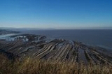
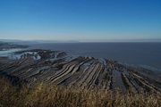
 The Blue Anchor to Lilstock Coast Site of Special Scientific Interest (SSSI)
provides an outstanding series of sections through the Early Jurassic
Lower Lias, spanning the Hettangian
and Pliensbachian
stages and named the "Lilstock Formation". This sequence and the good Rhaetian
succession beneath are repeatedly affected by faulting, making it of interest to geologists and fossil
hunters. It also displays coastal geomorphology which demonstrates a particularly well-developed series of intertidal shore platforms varying in width from about 200-600 m. The cliff and beach are rich in reptile
remains, including complete skeletons. Lilstock also yields ammonite
s, shells and fish remains. A unique specimen of an ichthyosaur
, named Excalibosaurus costini MacGowan, in which the lower jaw is shorter than the upper, was found in the Lower Jurassic Sinemurian Stage
, Lower Lias beds on the foreshore at Lilstock and is now in the Bristol City Museum and Art Gallery
.
settlement of Stogursey
.
The Acland Baronets
were the lords of the manor
. Around 1820 Sir John Acland built a boat house on the beach with a pier and breakwater to form Lilstock harbour. Coal was brought from Wales
for domestic use on the Acland estate, and to fire the large limekiln
on the cliff. Pit props were the main export along with lime. By 1848 there were resident coastguards, and by 1855 a customs officer. About 1860 a stone pier was built from the north side of the harbour wall. By 1866 warehouses were standing beneath the cliff beside the southern harbour wall. The limestone carrier the Richard was wrecked at Lilstock in 1881. A plan for a ship canal from Seaton
in Devon
to terminate at Lilstock was considered by the Board of Admiralty in 1888. The harbour was apparently abandoned following damage during a storm on the night of December 28/29 1900, and the pier finally being destroyed after the First World War.
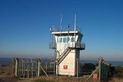
 The sea off Lilstock has been used as an air gunnery practice range connected to RNAS Yeovilton
. Lilstock Royal Navy Range served as a practice bombing range for fixed-wing aircraft using inert ordinance until 1995, when it was redesignated as a helicopter gunnery range.
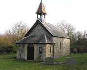
 The small Church of St Andrew, with only two rows of pews, features a 14th-century chancel
arch. This arch is the only remaining portion of the earlier church which was demolished in 1881 when the present structure was erected. The church was declared redundant in 1980, and the Norman
font removed to Stogursey
Church in 1981. The church was restored around 1993 but only holds one service a year. The most recent baptism in the church was in 1881 and the most recent wedding was in 1834.
Hamlet (place)
A hamlet is usually a rural settlement which is too small to be considered a village, though sometimes the word is used for a different sort of community. Historically, when a hamlet became large enough to justify building a church, it was then classified as a village...
in the civil parish
Civil parish
In England, a civil parish is a territorial designation and, where they are found, the lowest tier of local government below districts and counties...
of Stringston
Stringston
Stringston is a village and civil parish on the northern edge of the Quantock Hills in the English county of Somerset. The village is west of Bridgwater, and close to the villages of Holford, Kilve and Stogursey. In 2002, the parish was estimated to have a population of 116.Besides the village of...
within the West Somerset
West Somerset
West Somerset is a local government district in the English county of Somerset. The council covers a largely rural area, with a population of 35,075 in an area of ....
district of Somerset
Somerset
The ceremonial and non-metropolitan county of Somerset in South West England borders Bristol and Gloucestershire to the north, Wiltshire to the east, Dorset to the south-east, and Devon to the south-west. It is partly bounded to the north and west by the Bristol Channel and the estuary of the...
, England. It is 12 miles (19 km) north-west of Bridgwater
Bridgwater
Bridgwater is a market town and civil parish in Somerset, England. It is the administrative centre of the Sedgemoor district, and a major industrial centre. Bridgwater is located on the major communication routes through South West England...
, and 8 miles (13 km) north-east of Williton
Williton
Williton is a medium-sized village and civil parish in West Somerset, England. It has many of the facilities of a small town, being the administrative centre for the district. Williton is situated at the junction of the A39, A358 and B3191 roads...
. It on the coast of Bridgwater Bay
Bridgwater Bay
Bridgwater Bay is on the Bristol Channel, north of Bridgwater in Somerset, England at the mouth of the River Parrett and the end of the River Parrett Trail. It consists of large areas of mud flats, saltmarsh, sandflats and shingle ridges, some of which are vegetated...
on the Bristol Channel
Bristol Channel
The Bristol Channel is a major inlet in the island of Great Britain, separating South Wales from Devon and Somerset in South West England. It extends from the lower estuary of the River Severn to the North Atlantic Ocean...
, near the Hinkley Point
Hinkley Point
Hinkley Point is a headland on the Bristol Channel coast of Somerset, England, five miles north of Bridgwater and five miles west of Burnham-on-Sea, close to the mouth of the River Parrett....
nuclear power stations.
History
It was recorded as Lytel-Stoke or Lulestock in the Domesday bookDomesday Book
Domesday Book , now held at The National Archives, Kew, Richmond upon Thames in South West London, is the record of the great survey of much of England and parts of Wales completed in 1086...
, and rendered at one time as Little Stock or Little-stoke. Its name is said to have meant "the stoc [farm] of Lylla and his people".
In 1811 210 acre (0.8498406 km²) of common land were enclosed as part of the Inclosure Acts.
Coast

Blue Anchor to Lilstock Coast SSSI
Blue Anchor to Lilstock Coast SSSI is a 742.8 hectare geological Site of Special Scientific Interest between Blue Anchor and Lilstock in Somerset, notified in 1971....
provides an outstanding series of sections through the Early Jurassic
Early Jurassic
The Early Jurassic epoch is the earliest of three epochs of the Jurassic period...
Lower Lias, spanning the Hettangian
Hettangian
The Hettangian is the earliest age or lowest stage of the Jurassic period of the geologic timescale. It spans the time between 199.6 ± 0.6 Ma and 196.5 ± 1 Ma . The Hettangian follows the Rhaetian and is followed by the Sinemurian.In Europe stratigraphy the Hettangian is a part of the time span in...
and Pliensbachian
Pliensbachian
The Pliensbachian is an age of the geologic timescale or stage in the stratigraphic column. It is part of the Early or Lower Jurassic epoch or series and spans the time between 189.6 ± 1.5 Ma and 183 ± 1.5 Ma . The Pliensbachian is preceded by the Sinemurian and followed by the Toarcian.The...
stages and named the "Lilstock Formation". This sequence and the good Rhaetian
Rhaetian
The Rhaetian is in geochronology the latest age of the Triassic period or in chronostratigraphy the uppermost stage of the Triassic system. It lasted from 203.6 ± 1.5 to 199.6 ± 0.6 million years ago...
succession beneath are repeatedly affected by faulting, making it of interest to geologists and fossil
Fossil
Fossils are the preserved remains or traces of animals , plants, and other organisms from the remote past...
hunters. It also displays coastal geomorphology which demonstrates a particularly well-developed series of intertidal shore platforms varying in width from about 200-600 m. The cliff and beach are rich in reptile
Reptile
Reptiles are members of a class of air-breathing, ectothermic vertebrates which are characterized by laying shelled eggs , and having skin covered in scales and/or scutes. They are tetrapods, either having four limbs or being descended from four-limbed ancestors...
remains, including complete skeletons. Lilstock also yields ammonite
Ammonite
Ammonite, as a zoological or paleontological term, refers to any member of the Ammonoidea an extinct subclass within the Molluscan class Cephalopoda which are more closely related to living coleoids Ammonite, as a zoological or paleontological term, refers to any member of the Ammonoidea an extinct...
s, shells and fish remains. A unique specimen of an ichthyosaur
Ichthyosaur
Ichthyosaurs were giant marine reptiles that resembled fish and dolphins...
, named Excalibosaurus costini MacGowan, in which the lower jaw is shorter than the upper, was found in the Lower Jurassic Sinemurian Stage
Sinemurian
In the geologic timescale, the Sinemurian is an age or stage in the Early or Lower Jurassic epoch or series. It spans the time between 196.5 ± 2 Ma and 189.6 ± 1.5 Ma...
, Lower Lias beds on the foreshore at Lilstock and is now in the Bristol City Museum and Art Gallery
Bristol City Museum and Art Gallery
The Bristol City Museum and Art Gallery is a large museum and art gallery in Bristol, England. It is run by the city council with no entrance fee. It holds designated museum status, granted by the national government to protect outstanding museums...
.
Harbour
Lilstock appears to have been the old port of the SaxonAnglo-Saxons
Anglo-Saxon is a term used by historians to designate the Germanic tribes who invaded and settled the south and east of Great Britain beginning in the early 5th century AD, and the period from their creation of the English nation to the Norman conquest. The Anglo-Saxon Era denotes the period of...
settlement of Stogursey
Stogursey
Stogursey is the name of a small village and civil parish in the Quantock Hills in Somerset, England. It is situated from Nether Stowey, and west of Bridgwater...
.
The Acland Baronets
Acland Baronets
thumb|250px|Sir Thomas Dyke Acland, 10th BaronetThere have been four Baronetcies created for members of the Acland family, two in the Baronetage of England and two in the Baronetage of the United Kingdom....
were the lords of the manor
Lord of the Manor
The Lordship of a Manor is recognised today in England and Wales as a form of property and one of three elements of a manor that may exist separately or be combined and may be held in moieties...
. Around 1820 Sir John Acland built a boat house on the beach with a pier and breakwater to form Lilstock harbour. Coal was brought from Wales
Wales
Wales is a country that is part of the United Kingdom and the island of Great Britain, bordered by England to its east and the Atlantic Ocean and Irish Sea to its west. It has a population of three million, and a total area of 20,779 km²...
for domestic use on the Acland estate, and to fire the large limekiln
Limekiln
A lime kiln is used to produce quicklime through the calcination of limestone . The chemical equation for this reaction is...
on the cliff. Pit props were the main export along with lime. By 1848 there were resident coastguards, and by 1855 a customs officer. About 1860 a stone pier was built from the north side of the harbour wall. By 1866 warehouses were standing beneath the cliff beside the southern harbour wall. The limestone carrier the Richard was wrecked at Lilstock in 1881. A plan for a ship canal from Seaton
Seaton, Devon
Seaton is a seaside town in East Devon on the south coast of England. It faces onto Lyme Bay, to the west of the mouth of the River Axe with red cliffs to one side and white cliffs on the other. Axmouth and Beer are nearby...
in Devon
Devon
Devon is a large county in southwestern England. The county is sometimes referred to as Devonshire, although the term is rarely used inside the county itself as the county has never been officially "shired", it often indicates a traditional or historical context.The county shares borders with...
to terminate at Lilstock was considered by the Board of Admiralty in 1888. The harbour was apparently abandoned following damage during a storm on the night of December 28/29 1900, and the pier finally being destroyed after the First World War.
Gunnery range

RNAS Yeovilton
Royal Naval Air Station Yeovilton, or RNAS Yeovilton, is an airfield of the Royal Navy, sited in South West England a few miles north of Yeovil in Somerset...
. Lilstock Royal Navy Range served as a practice bombing range for fixed-wing aircraft using inert ordinance until 1995, when it was redesignated as a helicopter gunnery range.
Church

Chancel
In church architecture, the chancel is the space around the altar in the sanctuary at the liturgical east end of a traditional Christian church building...
arch. This arch is the only remaining portion of the earlier church which was demolished in 1881 when the present structure was erected. The church was declared redundant in 1980, and the Norman
Norman architecture
About|Romanesque architecture, primarily English|other buildings in Normandy|Architecture of Normandy.File:Durham Cathedral. Nave by James Valentine c.1890.jpg|thumb|200px|The nave of Durham Cathedral demonstrates the characteristic round arched style, though use of shallow pointed arches above the...
font removed to Stogursey
Stogursey
Stogursey is the name of a small village and civil parish in the Quantock Hills in Somerset, England. It is situated from Nether Stowey, and west of Bridgwater...
Church in 1981. The church was restored around 1993 but only holds one service a year. The most recent baptism in the church was in 1881 and the most recent wedding was in 1834.

