
Leeds and Liverpool Canal
Encyclopedia
The Leeds and Liverpool Canal is a canal
in Northern England
, linking the cities of Leeds
and Liverpool
. Over a distance of 127 miles (204.4 km), it crosses the Pennines
, and includes 91 locks on the main line. It has several small branches, and in the early 21st century a new link was constructed into the Liverpool docks system.
including Leeds, Wakefield
and Bradford
, were trading increasingly. While the Aire and Calder Navigation
improved links to the east for Leeds, links to the west were limited. Bradford merchants wanted to increase the supply of limestone to make lime for mortar and agriculture using coal from Bradford's collieries and to transport textiles to the Port of Liverpool
. On the west coast, traders in the busy port of Liverpool wanted a cheap supply of coal for their shipping and manufacturing businesses and to tap the output from the industrial regions of Lancashire
. Inspired by the effectiveness of the wholly artificial navigation, the Bridgewater Canal
opened in 1759–60. A canal across the Pennines linking Liverpool and Hull
(by means of the Aire and Calder Navigation) would have obvious trade benefits.
A public meeting took place at the Sun Inn in Bradford on 2 July 1766 to promote the building of such a canal. John Longbotham was engaged to survey a route. Two groups were set up to promote the scheme, one in Liverpool and one in Bradford. The Liverpool committee was unhappy with the route originally proposed, following the Ribble
valley through Preston, considering that it ran too far to the north, missing key towns and the Wigan
coalfield. A counter-proposal was produced by John Eyes and Richard Melling, improved by P.P. Burdett
, which was rejected by the Bradford committee as too expensive, mainly because of the valley crossing at Burnley
. James Brindley
was called in to arbitrate, and ruled in favour of Longbotham's more northerly route, though with a branch towards Wigan, a decision which caused some of the Lancashire backers to withdraw their support, and which was subsequently amended over the course of development.
An Act was passed in May 1770 authorising construction, and Brindley was appointed chief engineer and John Longbotham clerk of works
; following Brindley's death in 1772, Longbotham carried out both roles.
, north of Liverpool on 5 November 1770, with the first sod being dug by the Hon. Charles Mordaunt of Halsall Hall. The first section of the canal opened from Bingley
to Skipton
in 1773. By 1774 the canal had been completed from Skipton
to Shipley
, including significant engineering features such as the Bingley Five Rise Locks
, Bingley Three Rise Locks
and the seven-arch aqueduct over the River Aire
. Also completed was the branch to Bradford
. On the western side, the section from Liverpool to Newburgh
was dug. By the following year the Yorkshire end had been extended to Gargrave
, and by 1777 the canal had joined the Aire and Calder Navigation in Leeds. On the western side it reached Wigan
by 1781, replacing the earlier and unsatisfactory Douglas Navigation
. By now, the subscribed funds and further borrowing had all been spent, and work stopped in 1781 with the completion of the Rufford Branch
from Burscough
to the River Douglas
at Tarleton
. The war in the American colonies
and its aftermath made it impossible to continue for more than a decade.
In 1789 Robert Whitworth developed fresh proposals to vary the line of the remaining part of the canal, including a tunnel at Foulridge
, lowering the proposed summit level by 40 feet, and a more southerly route in Lancashire. These proposals were authorised by a fresh Act in 1790, together with further fund-raising, and in 1791, construction of the canal finally recommenced south-westward from Gargrave, heading toward Barrowford
in Lancashire.
In 1794 an agreement was reached with the Manchester, Bolton and Bury Canal
company to create a link near Red Moss near Horwich
. However by this time the competing Rochdale Canal
had begun construction and was likely to offer a more direct journey to Liverpool via Manchester and the Bridgewater Canal. The company's experiences running the two sections of the canal had also shown that coal not limestone would be its main cargo, and that there was plenty of income available from local trade between the settlements along the route. With this in mind in the same year, the route was changed again with a further Act, moving closer to that proposed by Burdett and the planned canal link did not materialize. Yet more fund-raising took place, as the Foulridge Tunnel was proving difficult and expensive to dig. The new route took the canal south via the expanding coal mines at Burnley
, Accrington
and Blackburn, but would require some sizable earthworks to pass the former. The completion in 1796 of the 1640 yards (1,499.6 m) long Foulridge Tunnel and the seven rise locks at Barrowford enabled the canal to open to eastern Burnley. At Burnley, rather than using two sets of locks to cross the shallow Calder
valley, Whitworth designed a 1350 yards (1,234 m) long and up to 60 feet (18 m) high, embankment. It would also require a 559 yards (511 m) tunnel nearby at Gannow and a sizeable cutting to allow the canal to traverse the hillside between the two. It took 5 years to complete this work, with the embankment alone costing £22,000. Once completed, the canal opened to Enfield near Accrington in 1801. It would be another 9 years until it reached Blackburn only 4 miles away. Following the French Revolution
, Britain had been at war with France
from 1793 to 1802. The peace proved temporary, with the Napoleonic Wars
beginning the following year. High taxes and interest rates during this period made it difficult for the company to borrow money, and the pace of construction inevitably slowed.
The Manchester, Bolton and Bury Canal company proposed another link from Bury to Accrington. This new link would have been known as the Haslingden Canal
. The Peel family asked the canal company not to construct the crossing over the River Hyndburn
above their textile printworks; such a crossing would have required the construction of embankments, and reduced the water supply to their factories. Consequently Accrington was bypassed and the Haslingden Canal was never built.
The latest plan for the route had it running parallel to, and then crossing the isolated southern end of the Lancaster Canal
, but common sense prevailed and the Leeds and Liverpool connected with the Lancaster Canal between Wigan
and Johnson's Hillock. The main line of the canal was thus completed in 1816.
There had been various unsuccessful negotiations to connect the canal to the Bridgewater Canal
at Leigh
but agreement was finally reached in 1818 and the connection was opened in 1820, thus giving access to Manchester and the rest of the canal network. The Bridgewater Canal, like most of Brindley's designs was for narrow boats of 72 feet (21.9 m) length, whereas the Leeds and Liverpool had been designed for broad boats of 62 feet (18.9 m) length. There was naturally a desire by the narrow boats to reach Liverpool and the locks of the westerly end of the canal were extended to 72 feet (21.9 m) in 1822.
and the Rochdale Canal
. The most important cargo was always coal, with over a million ton
s per year being delivered to Liverpool in the 1860s, with smaller amounts exported via the old Douglas Navigation. Even in Yorkshire, more coal was carried than limestone. Once the canal was fully open, receipts for carrying merchandise matched those of coal. The heavy industry along its route, together with the decision to build the canal with broad locks, ensured that (unlike the other two trans-Pennine canals) the Leeds and Liverpool competed successfully with the railways throughout the 19th century and remained open through the 20th century.
. It was breached by a German mine in Bootle
and the headquarters at Pall Mall were damaged. The canal in West Lancashire was part of Britain's defensive plans against invasion. Along the canal there were tank traps, bunker
s and blockhouse
s. Some buildings such as barns and pubs along the canal were fortified. There are still some remaining concrete pillboxes
and brick built blockhouses.
Trade continued on the canal until as late as the 1980s. Coal was shipped to the power station in Wigan until 1972 and corn to Ainscough's Mill in Burscough until 1960. The last horse drawn barge was 'Parbold' (1960). The especially cold winters in the early 1960s was thought to have finished off commercial use of the main line of the canal, however a load of timber passed over the full length in 1965, from Liverpool to Leeds. Freight returned in 1973 (coal from Castleford
to Skipton
), plus various other odd cargoes, then grain was carried between Liverpool and Manchester from 1974 for some years, plus a few loads across the summit - the last being 30 tonnes of herring meal on short boat 'Weaver', from Selby
to Manchester (September 1978). The last intensive use of the canal for freight was carriage of effluent from Esholt
to Leeds (Knostrop) between May 1978 and December 1979, and aggregate from Trent wharves to Shipley - this ceased in 1982. The section of canal between Aintree
and the Liverpool terminus was classed as Remainder
in the review of the waterways and therefore only receives enough maintenance to keep it structurally sound.
In the 1950s and 1960s the Mersey Motor Boat Club (MMBC) did a lot of work to keep the canal open and in use. With a variety of boats, converted lifeboats and wooden boats from the Lakes, they kept boats moving on the canal after commercial use stopped. The Leeds and Liverpool Canal is one of the quietest canals for leisure boating on the network.
In the 1960s, the Pall Mall terminus basin was filled in up to Chisenhale Street Bridge (Bridge A). In the 1980s the Eldonian Village housing estate was built for the community which was disrupted by the building of the Mersey Tunnel and the demolition of the Tate and Lyle sugar refinery. This meant the canal was filled in between Chisenhale Street Bridge (Bridge A) and just north of Burlington Street Bridge (Bridge B). As part of the development a new bridge was built, Vauxhall Bridge (un-numbered) which was opened in 1994 by Cilla Black
.
In August 2010, a 60-mile stretch of the canal was closed due to the low reservoirs, following the driest start to the year since records began. It was reopened the following month, although some restrictions remained. Some canal boat operators temporarily relocated to other parts of the canal. As of 11 August 2010, as many as 200,000 fish were moved to different areas in the canal to prevent their death in the low-level waters.
 The Leeds and Liverpool Canal main line is 127 miles (204 km) long and crosses the country from Liverpool, Merseyside
to Leeds, West Yorkshire
. It has two main side-branches, the Leigh Branch and the Rufford Branch. The summit level is at 487 feet (148 m). The canal was built with locks 60 ft (18 m) long and 14 inch wide to accommodate the Yorkshire Keel barge
s already in use on the Rivers Aire and Humber. However, the locks on the Leigh Branch and the mainline between Wigan and Liverpool (and Rufford Branch), were extended to a length of 72 feet (22 m) to accommodate the longer boats trading on the rest of the canal network following the building of the Leigh Branch.
The original Liverpool terminus was at Clarke's Basin in present-day Old Hall Street. This later moved to Pall Mall when land was sold to a railway company. A direct connection to the docks via Stanley Dock
was built in 1846.
From Liverpool to Appley Locks, the canal runs for 27 miles (43 km) without locks, across the West Lancashire Coastal Plain
.
The two main side-branches both connect to other waterways. The Rufford Branch links into the River Douglas and, via the Ribble Link
and the River Ribble
to the previously isolated Lancaster Canal. The Leigh Branch from Wigan leads to the Bridgewater Canal
and thus to Manchester
and the Midlands
.
The Leeds and Liverpool Canal is said to be the longest single canal in England constructed by one company, but it is shorter than the Grand Union Canal
which was made up of many smaller canals merged together. The Leeds Liverpool Canal includes the southern part of the Lancaster Canal between Johnsons Hillock and Wigan Top Lock.
The canal at Aintree
passes close to the racecourse
and gives the name to the course's Canal Turn
. The canal has one of the country's most photographed canal features - the Bingley Five Rise Locks
at Bingley
. Bingley Five Rise and the Burnley Embankment are two of the original Seven Wonders of the canal world chosen by Robert Aickman
.
was completed in 2009, and opened on 25 March 2009. It re-connects the Leeds and Liverpool Canal to Liverpool's South Docks via Stanley Dock, allowing boats to travel past the world-famous Three Graces
and into the Albert Dock
.
 Direction: East (top) to West (bottom)
Canal
Canals are man-made channels for water. There are two types of canal:#Waterways: navigable transportation canals used for carrying ships and boats shipping goods and conveying people, further subdivided into two kinds:...
in Northern England
Northern England
Northern England, also known as the North of England, the North or the North Country, is a cultural region of England. It is not an official government region, but rather an informal amalgamation of counties. The southern extent of the region is roughly the River Trent, while the North is bordered...
, linking the cities of Leeds
Leeds
Leeds is a city and metropolitan borough in West Yorkshire, England. In 2001 Leeds' main urban subdivision had a population of 443,247, while the entire city has a population of 798,800 , making it the 30th-most populous city in the European Union.Leeds is the cultural, financial and commercial...
and Liverpool
Liverpool
Liverpool is a city and metropolitan borough of Merseyside, England, along the eastern side of the Mersey Estuary. It was founded as a borough in 1207 and was granted city status in 1880...
. Over a distance of 127 miles (204.4 km), it crosses the Pennines
Pennines
The Pennines are a low-rising mountain range, separating the North West of England from Yorkshire and the North East.Often described as the "backbone of England", they form a more-or-less continuous range stretching from the Peak District in Derbyshire, around the northern and eastern edges of...
, and includes 91 locks on the main line. It has several small branches, and in the early 21st century a new link was constructed into the Liverpool docks system.
Background
In the mid-18th century the growing towns of YorkshireYorkshire
Yorkshire is a historic county of northern England and the largest in the United Kingdom. Because of its great size in comparison to other English counties, functions have been increasingly undertaken over time by its subdivisions, which have also been subject to periodic reform...
including Leeds, Wakefield
Wakefield
Wakefield is the main settlement and administrative centre of the City of Wakefield, a metropolitan district of West Yorkshire, England. Located by the River Calder on the eastern edge of the Pennines, the urban area is and had a population of 76,886 in 2001....
and Bradford
Bradford
Bradford lies at the heart of the City of Bradford, a metropolitan borough of West Yorkshire, in Northern England. It is situated in the foothills of the Pennines, west of Leeds, and northwest of Wakefield. Bradford became a municipal borough in 1847, and received its charter as a city in 1897...
, were trading increasingly. While the Aire and Calder Navigation
Aire and Calder Navigation
The Aire and Calder Navigation is a river and canal system of the River Aire and the River Calder in the metropolitan county of West Yorkshire, England. The first improvements to the rivers above Knottingley were completed in 1704 when the Aire was made navigable to Leeds and the Calder to...
improved links to the east for Leeds, links to the west were limited. Bradford merchants wanted to increase the supply of limestone to make lime for mortar and agriculture using coal from Bradford's collieries and to transport textiles to the Port of Liverpool
Port of Liverpool
The Port of Liverpool is the name for the enclosed 7.5 mile dock system that runs from Brunswick Dock in Liverpool to Seaforth Dock, Seaforth, on the east side of the River Mersey and the Birkenhead Docks between Birkenhead and Wallasey on the west side of the river...
. On the west coast, traders in the busy port of Liverpool wanted a cheap supply of coal for their shipping and manufacturing businesses and to tap the output from the industrial regions of Lancashire
Lancashire
Lancashire is a non-metropolitan county of historic origin in the North West of England. It takes its name from the city of Lancaster, and is sometimes known as the County of Lancaster. Although Lancaster is still considered to be the county town, Lancashire County Council is based in Preston...
. Inspired by the effectiveness of the wholly artificial navigation, the Bridgewater Canal
Bridgewater Canal
The Bridgewater Canal connects Runcorn, Manchester and Leigh, in North West England. It was commissioned by Francis Egerton, 3rd Duke of Bridgewater, to transport coal from his mines in Worsley to Manchester...
opened in 1759–60. A canal across the Pennines linking Liverpool and Hull
Kingston upon Hull
Kingston upon Hull , usually referred to as Hull, is a city and unitary authority area in the ceremonial county of the East Riding of Yorkshire, England. It stands on the River Hull at its junction with the Humber estuary, 25 miles inland from the North Sea. Hull has a resident population of...
(by means of the Aire and Calder Navigation) would have obvious trade benefits.
A public meeting took place at the Sun Inn in Bradford on 2 July 1766 to promote the building of such a canal. John Longbotham was engaged to survey a route. Two groups were set up to promote the scheme, one in Liverpool and one in Bradford. The Liverpool committee was unhappy with the route originally proposed, following the Ribble
River Ribble
The River Ribble is a river that runs through North Yorkshire and Lancashire, in northern England. The river's drainage basin also includes parts of Greater Manchester around Wigan.-Geography:...
valley through Preston, considering that it ran too far to the north, missing key towns and the Wigan
Wigan
Wigan is a town in Greater Manchester, England. It stands on the River Douglas, south-west of Bolton, north of Warrington and west-northwest of Manchester. Wigan is the largest settlement in the Metropolitan Borough of Wigan and is its administrative centre. The town of Wigan had a total...
coalfield. A counter-proposal was produced by John Eyes and Richard Melling, improved by P.P. Burdett
Peter Perez Burdett
Peter Perez Burdett was an 18th century cartographer, surveyor, artist, and draughtsman originally from Eastwood in Essex where he inherited a small estate and the name Perez from his maternal grandfather who was the clergyman there.He would have been notable just for his many appearances in...
, which was rejected by the Bradford committee as too expensive, mainly because of the valley crossing at Burnley
Burnley
Burnley is a market town in the Burnley borough of Lancashire, England, with a population of around 73,500. It lies north of Manchester and east of Preston, at the confluence of the River Calder and River Brun....
. James Brindley
James Brindley
James Brindley was an English engineer. He was born in Tunstead, Derbyshire, and lived much of his life in Leek, Staffordshire, becoming one of the most notable engineers of the 18th century.-Early life:...
was called in to arbitrate, and ruled in favour of Longbotham's more northerly route, though with a branch towards Wigan, a decision which caused some of the Lancashire backers to withdraw their support, and which was subsequently amended over the course of development.
An Act was passed in May 1770 authorising construction, and Brindley was appointed chief engineer and John Longbotham clerk of works
Clerk of works
Clerks of Works are the most highly qualified non-commissioned tradesmen in the Royal Engineers. The qualification can be held in three specialisations: Electrical, Mechanical and Construction. The clerk of works , often abbreviated CoW, is employed by the architect or client on a construction site...
; following Brindley's death in 1772, Longbotham carried out both roles.
Construction
A commencement ceremony was held at HalsallHalsall
Halsall is a village and civil parish in West Lancashire, England, located close to Ormskirk on the A5147 and Leeds and Liverpool Canal. The parish has a population of 1,921 and covers an area of 28.31 square kilometres...
, north of Liverpool on 5 November 1770, with the first sod being dug by the Hon. Charles Mordaunt of Halsall Hall. The first section of the canal opened from Bingley
Bingley
Bingley is a market town in the metropolitan borough of the City of Bradford, in West Yorkshire, England. It is situated on the River Aire and the Leeds and Liverpool Canal...
to Skipton
Skipton
Skipton is a market town and civil parish within the Craven district of North Yorkshire, England. It is located along the course of both the Leeds and Liverpool Canal and the River Aire, on the south side of the Yorkshire Dales, northwest of Bradford and west of York...
in 1773. By 1774 the canal had been completed from Skipton
Skipton
Skipton is a market town and civil parish within the Craven district of North Yorkshire, England. It is located along the course of both the Leeds and Liverpool Canal and the River Aire, on the south side of the Yorkshire Dales, northwest of Bradford and west of York...
to Shipley
Shipley, West Yorkshire
Shipley is a town in West Yorkshire, England, by the River Aire and the Leeds and Liverpool Canal, north of Bradford and north-west of Leeds....
, including significant engineering features such as the Bingley Five Rise Locks
Bingley Five Rise Locks
Bingley Five Rise Locks is a staircase lock on the Leeds and Liverpool Canal at Bingley . As the name implies, a boat going up the lock is lifted in five stages.-Description:...
, Bingley Three Rise Locks
Bingley Three Rise Locks
Bingley Three Rise Locks is a staircase of three locks on the Leeds and Liverpool Canal at Bingley, West Yorkshire, England. It opened in 1774 and was a major feat of engineering at the time along with the larger Five Rise opened at the same time and several hundred metres further up...
and the seven-arch aqueduct over the River Aire
River Aire
The River Aire is a major river in Yorkshire, England of length . Part of the river is canalised, and is known as the Aire and Calder Navigation....
. Also completed was the branch to Bradford
Bradford Canal
The Bradford Canal was a English canal which ran from the Leeds and Liverpool Canal at Shipley into the centre of Bradford. It opened in 1774, and was closed in 1866, when it was declared to be a public health hazard. Four years later it reopened with a better water supply, and closed for the...
. On the western side, the section from Liverpool to Newburgh
Newburgh, Lancashire
Newburgh is a rural village and civil parish in Lancashire, England.Newburgh is located about five miles from Ormskirk. Its history can be traced back to 1304 when a licence was granted to start a weekly market. The village has a conservation area at its centre and includes many historic ...
was dug. By the following year the Yorkshire end had been extended to Gargrave
Gargrave
Gargrave is a small village and civil parish in the Craven district located along the A65, northwest of Skipton in North Yorkshire, England.It is situated on the very edge of the Yorkshire Dales. The River Aire and the Leeds and Liverpool Canal pass through the village...
, and by 1777 the canal had joined the Aire and Calder Navigation in Leeds. On the western side it reached Wigan
Wigan
Wigan is a town in Greater Manchester, England. It stands on the River Douglas, south-west of Bolton, north of Warrington and west-northwest of Manchester. Wigan is the largest settlement in the Metropolitan Borough of Wigan and is its administrative centre. The town of Wigan had a total...
by 1781, replacing the earlier and unsatisfactory Douglas Navigation
Douglas Navigation
The Douglas Navigation was a canalised section of the River Douglas or Asland, in Lancashire, England, running from its confluence with the River Ribble to Wigan. Authorised in 1720, it opened in 1742, but its working life was short, as it was bought out by the Leeds and Liverpool Canal Company in...
. By now, the subscribed funds and further borrowing had all been spent, and work stopped in 1781 with the completion of the Rufford Branch
Rufford, Lancashire
-Population :-Economy:The village is largely rural with little or no industry. The farmland is grade one agricultural land. In the early 20th century the village was described as "one of the prettiest in South Lancashire" and was a destination for day trips from neighbouring towns...
from Burscough
Burscough
Burscough is a village and civil parish within West Lancashire in North West England, to the north of both Ormskirk and Skelmersdale.-Growth:...
to the River Douglas
River Douglas
The River Douglas, also known as the River Asland or Astland, is a river that flows through Lancashire and Greater Manchester in the north-west of England...
at Tarleton
Tarleton
-Population :-Economy:As a result of soil on the former mossland, a major economic activity in Tarleton is market gardening, particularly growing salad crops....
. The war in the American colonies
American Revolutionary War
The American Revolutionary War , the American War of Independence, or simply the Revolutionary War, began as a war between the Kingdom of Great Britain and thirteen British colonies in North America, and ended in a global war between several European great powers.The war was the result of the...
and its aftermath made it impossible to continue for more than a decade.
In 1789 Robert Whitworth developed fresh proposals to vary the line of the remaining part of the canal, including a tunnel at Foulridge
Foulridge
Foulridge is a small village and civil parish in Pendle, Lancashire, close to the border with North Yorkshire in England. It is situated just beyond Colne, on the route from the M65 to Skipton, and is an important stopping point on summit pound of the Leeds and Liverpool Canal, just before it...
, lowering the proposed summit level by 40 feet, and a more southerly route in Lancashire. These proposals were authorised by a fresh Act in 1790, together with further fund-raising, and in 1791, construction of the canal finally recommenced south-westward from Gargrave, heading toward Barrowford
Barrowford
Barrowford is a large village and civil parish in the Pendle district of Lancashire, England. It is situated to the north of Nelson on the other side of the M65 motorway, and forms part of the Burnley/Nelson conurbation. It also comprises the area of Lowerford and sometimes gets confused with its...
in Lancashire.
In 1794 an agreement was reached with the Manchester, Bolton and Bury Canal
Manchester, Bolton and Bury Canal
The Manchester Bolton & Bury Canal is a disused canal in Greater Manchester, England, built to link Bolton and Bury with Manchester. The canal, when fully opened, was 15 miles 1 furlong long. It was accessed via a junction with the River Irwell in Salford...
company to create a link near Red Moss near Horwich
Horwich
Horwich is a town and civil parish within the Metropolitan Borough of Bolton, in Greater Manchester, England. It is southeast of Chorley, northwest of Bolton and northwest from the city of Manchester. It lies at the southern edge of the West Pennine Moors with the M61 motorway close to the...
. However by this time the competing Rochdale Canal
Rochdale Canal
The Rochdale Canal is a navigable "broad" canal in northern England, part of the connected system of the canals of Great Britain. The "Rochdale" in its name refers to the town of Rochdale, Greater Manchester, through which the canal passes....
had begun construction and was likely to offer a more direct journey to Liverpool via Manchester and the Bridgewater Canal. The company's experiences running the two sections of the canal had also shown that coal not limestone would be its main cargo, and that there was plenty of income available from local trade between the settlements along the route. With this in mind in the same year, the route was changed again with a further Act, moving closer to that proposed by Burdett and the planned canal link did not materialize. Yet more fund-raising took place, as the Foulridge Tunnel was proving difficult and expensive to dig. The new route took the canal south via the expanding coal mines at Burnley
Burnley
Burnley is a market town in the Burnley borough of Lancashire, England, with a population of around 73,500. It lies north of Manchester and east of Preston, at the confluence of the River Calder and River Brun....
, Accrington
Accrington
Accrington is a town in Lancashire, within the borough of Hyndburn. It lies about east of Blackburn, west of Burnley, north of Manchester city centre and is situated on the mostly culverted River Hyndburn...
and Blackburn, but would require some sizable earthworks to pass the former. The completion in 1796 of the 1640 yards (1,499.6 m) long Foulridge Tunnel and the seven rise locks at Barrowford enabled the canal to open to eastern Burnley. At Burnley, rather than using two sets of locks to cross the shallow Calder
River Calder, Lancashire
The River Calder is a major tributary of the River Ribble, starting in Cliviger close to Burnley in Lancashire, England and is around 24 km / 15 miles in length. Its source is very close to that of the West Yorkshire river with the same name, and that of the River Irwell. It flows through...
valley, Whitworth designed a 1350 yards (1,234 m) long and up to 60 feet (18 m) high, embankment. It would also require a 559 yards (511 m) tunnel nearby at Gannow and a sizeable cutting to allow the canal to traverse the hillside between the two. It took 5 years to complete this work, with the embankment alone costing £22,000. Once completed, the canal opened to Enfield near Accrington in 1801. It would be another 9 years until it reached Blackburn only 4 miles away. Following the French Revolution
French Revolution
The French Revolution , sometimes distinguished as the 'Great French Revolution' , was a period of radical social and political upheaval in France and Europe. The absolute monarchy that had ruled France for centuries collapsed in three years...
, Britain had been at war with France
French Revolutionary Wars
The French Revolutionary Wars were a series of major conflicts, from 1792 until 1802, fought between the French Revolutionary government and several European states...
from 1793 to 1802. The peace proved temporary, with the Napoleonic Wars
Napoleonic Wars
The Napoleonic Wars were a series of wars declared against Napoleon's French Empire by opposing coalitions that ran from 1803 to 1815. As a continuation of the wars sparked by the French Revolution of 1789, they revolutionised European armies and played out on an unprecedented scale, mainly due to...
beginning the following year. High taxes and interest rates during this period made it difficult for the company to borrow money, and the pace of construction inevitably slowed.
The Manchester, Bolton and Bury Canal company proposed another link from Bury to Accrington. This new link would have been known as the Haslingden Canal
Haslingden Canal
The Haslingden Canal was a proposed canal link between the Bury arm of the Manchester Bolton & Bury Canal in Greater Manchester, England, and the Leeds and Liverpool Canal in Accrington, England, passing through Haslingden...
. The Peel family asked the canal company not to construct the crossing over the River Hyndburn
River Hyndburn
The River Hyndburn is a river in Lancashire, England. It passes through the towns of Haslingden, Baxenden, Accrington, Clayton-le-Moors, Great Harwood, before meeting Hyndburn Brook, before ultimately joining the River Calder....
above their textile printworks; such a crossing would have required the construction of embankments, and reduced the water supply to their factories. Consequently Accrington was bypassed and the Haslingden Canal was never built.
The latest plan for the route had it running parallel to, and then crossing the isolated southern end of the Lancaster Canal
Lancaster Canal
The Lancaster Canal is a canal in the north of England, originally planned to run from Westhoughton in Lancashire to Kendal in south Cumbria...
, but common sense prevailed and the Leeds and Liverpool connected with the Lancaster Canal between Wigan
Wigan
Wigan is a town in Greater Manchester, England. It stands on the River Douglas, south-west of Bolton, north of Warrington and west-northwest of Manchester. Wigan is the largest settlement in the Metropolitan Borough of Wigan and is its administrative centre. The town of Wigan had a total...
and Johnson's Hillock. The main line of the canal was thus completed in 1816.
There had been various unsuccessful negotiations to connect the canal to the Bridgewater Canal
Bridgewater Canal
The Bridgewater Canal connects Runcorn, Manchester and Leigh, in North West England. It was commissioned by Francis Egerton, 3rd Duke of Bridgewater, to transport coal from his mines in Worsley to Manchester...
at Leigh
Leigh, Greater Manchester
Leigh is a town within the Metropolitan Borough of Wigan, in Greater Manchester, England. It is southeast of Wigan, and west of Manchester. Leigh is situated on low lying land to the north west of Chat Moss....
but agreement was finally reached in 1818 and the connection was opened in 1820, thus giving access to Manchester and the rest of the canal network. The Bridgewater Canal, like most of Brindley's designs was for narrow boats of 72 feet (21.9 m) length, whereas the Leeds and Liverpool had been designed for broad boats of 62 feet (18.9 m) length. There was naturally a desire by the narrow boats to reach Liverpool and the locks of the westerly end of the canal were extended to 72 feet (21.9 m) in 1822.
Operation
The canal took almost 40 years to complete, in crossing the Pennines the Leeds and Liverpool had been beaten by the Huddersfield Narrow CanalHuddersfield Narrow Canal
The Huddersfield Narrow Canal is an inland waterway in northern England. It runs just under from Lock 1E at the rear of the University of Huddersfield campus, near Aspley Basin at Huddersfield to the junction with the Ashton Canal at Whitelands Basin in Ashton-under-Lyne...
and the Rochdale Canal
Rochdale Canal
The Rochdale Canal is a navigable "broad" canal in northern England, part of the connected system of the canals of Great Britain. The "Rochdale" in its name refers to the town of Rochdale, Greater Manchester, through which the canal passes....
. The most important cargo was always coal, with over a million ton
Long ton
Long ton is the name for the unit called the "ton" in the avoirdupois or Imperial system of measurements, as used in the United Kingdom and several other Commonwealth countries. It has been mostly replaced by the tonne, and in the United States by the short ton...
s per year being delivered to Liverpool in the 1860s, with smaller amounts exported via the old Douglas Navigation. Even in Yorkshire, more coal was carried than limestone. Once the canal was fully open, receipts for carrying merchandise matched those of coal. The heavy industry along its route, together with the decision to build the canal with broad locks, ensured that (unlike the other two trans-Pennine canals) the Leeds and Liverpool competed successfully with the railways throughout the 19th century and remained open through the 20th century.
20th century
The canal suffered some damage during World War IIWorld War II
World War II, or the Second World War , was a global conflict lasting from 1939 to 1945, involving most of the world's nations—including all of the great powers—eventually forming two opposing military alliances: the Allies and the Axis...
. It was breached by a German mine in Bootle
Bootle
Bootle is a town within the Metropolitan Borough of Sefton in Merseyside, England, and a 'Post town' in the L postcode area. Formally known as Bootle-cum-Linacre, the town is 4 miles to the north of Liverpool city centre, and has a total resident population of 77,640.Historically part of...
and the headquarters at Pall Mall were damaged. The canal in West Lancashire was part of Britain's defensive plans against invasion. Along the canal there were tank traps, bunker
Bunker
A military bunker is a hardened shelter, often buried partly or fully underground, designed to protect the inhabitants from falling bombs or other attacks...
s and blockhouse
Blockhouse
In military science, a blockhouse is a small, isolated fort in the form of a single building. It serves as a defensive strong point against any enemy that does not possess siege equipment or, in modern times, artillery...
s. Some buildings such as barns and pubs along the canal were fortified. There are still some remaining concrete pillboxes
British hardened field defences of World War II
British hardened field defences of World War II were small fortified structures constructed as a part of British anti-invasion preparations. They were popularly known as pillboxes by reference to their shape.-Design and development:...
and brick built blockhouses.
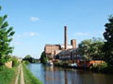
Trade continued on the canal until as late as the 1980s. Coal was shipped to the power station in Wigan until 1972 and corn to Ainscough's Mill in Burscough until 1960. The last horse drawn barge was 'Parbold' (1960). The especially cold winters in the early 1960s was thought to have finished off commercial use of the main line of the canal, however a load of timber passed over the full length in 1965, from Liverpool to Leeds. Freight returned in 1973 (coal from Castleford
Castleford
Castleford is the largest of the "five towns" district in the metropolitan borough of the City of Wakefield, in West Yorkshire, England. It is near Pontefract, and has a population of 37,525 according to the 2001 Census, but has seen a rise in recent years and is now around 45-50,000. To the north...
to Skipton
Skipton
Skipton is a market town and civil parish within the Craven district of North Yorkshire, England. It is located along the course of both the Leeds and Liverpool Canal and the River Aire, on the south side of the Yorkshire Dales, northwest of Bradford and west of York...
), plus various other odd cargoes, then grain was carried between Liverpool and Manchester from 1974 for some years, plus a few loads across the summit - the last being 30 tonnes of herring meal on short boat 'Weaver', from Selby
Selby
Selby is a town and civil parish in North Yorkshire, England. Situated south of the city of York, along the course of the River Ouse, Selby is the largest and, with a population of 13,012, most populous settlement of the wider Selby local government district.Historically a part of the West Riding...
to Manchester (September 1978). The last intensive use of the canal for freight was carriage of effluent from Esholt
Esholt
Esholt is a village between Shipley and Guiseley, in the metropolitan district of the City of Bradford, West Yorkshire, England.- Derivation of name :The name "Esholt" indicates that the village was first established in a heavily wooded area of ash trees....
to Leeds (Knostrop) between May 1978 and December 1979, and aggregate from Trent wharves to Shipley - this ceased in 1982. The section of canal between Aintree
Aintree
Aintree is a village and civil parish in the Metropolitan Borough of Sefton, Merseyside. It lies between Walton and Maghull on the A59 road, about north of Liverpool city centre, in North West England....
and the Liverpool terminus was classed as Remainder
Remainder
In arithmetic, the remainder is the amount "left over" after the division of two integers which cannot be expressed with an integer quotient....
in the review of the waterways and therefore only receives enough maintenance to keep it structurally sound.
In the 1950s and 1960s the Mersey Motor Boat Club (MMBC) did a lot of work to keep the canal open and in use. With a variety of boats, converted lifeboats and wooden boats from the Lakes, they kept boats moving on the canal after commercial use stopped. The Leeds and Liverpool Canal is one of the quietest canals for leisure boating on the network.
In the 1960s, the Pall Mall terminus basin was filled in up to Chisenhale Street Bridge (Bridge A). In the 1980s the Eldonian Village housing estate was built for the community which was disrupted by the building of the Mersey Tunnel and the demolition of the Tate and Lyle sugar refinery. This meant the canal was filled in between Chisenhale Street Bridge (Bridge A) and just north of Burlington Street Bridge (Bridge B). As part of the development a new bridge was built, Vauxhall Bridge (un-numbered) which was opened in 1994 by Cilla Black
Cilla Black
Cilla Black OBE is an English singer, actress, entertainer and media personality, who has been consistently popular as a light entertainment figure since 1963. She is most famous for her singles Anyone Who Had A Heart, You're My World, and Alfie...
.
In August 2010, a 60-mile stretch of the canal was closed due to the low reservoirs, following the driest start to the year since records began. It was reopened the following month, although some restrictions remained. Some canal boat operators temporarily relocated to other parts of the canal. As of 11 August 2010, as many as 200,000 fish were moved to different areas in the canal to prevent their death in the low-level waters.
Route
Merseyside
Merseyside is a metropolitan county in North West England, with a population of 1,365,900. It encompasses the metropolitan area centred on both banks of the lower reaches of the Mersey Estuary, and comprises five metropolitan boroughs: Knowsley, St Helens, Sefton, Wirral, and the city of Liverpool...
to Leeds, West Yorkshire
West Yorkshire
West Yorkshire is a metropolitan county within the Yorkshire and the Humber region of England with a population of 2.2 million. West Yorkshire came into existence as a metropolitan county in 1974 after the passage of the Local Government Act 1972....
. It has two main side-branches, the Leigh Branch and the Rufford Branch. The summit level is at 487 feet (148 m). The canal was built with locks 60 ft (18 m) long and 14 inch wide to accommodate the Yorkshire Keel barge
Barge
A barge is a flat-bottomed boat, built mainly for river and canal transport of heavy goods. Some barges are not self-propelled and need to be towed by tugboats or pushed by towboats...
s already in use on the Rivers Aire and Humber. However, the locks on the Leigh Branch and the mainline between Wigan and Liverpool (and Rufford Branch), were extended to a length of 72 feet (22 m) to accommodate the longer boats trading on the rest of the canal network following the building of the Leigh Branch.
The original Liverpool terminus was at Clarke's Basin in present-day Old Hall Street. This later moved to Pall Mall when land was sold to a railway company. A direct connection to the docks via Stanley Dock
Stanley Dock
Stanley Dock is a dock on the River Mersey, England, and part of the Port of Liverpool. It is situated in the Vauxhall area of Liverpool and is part of the northern dock system. The dock is connected to the Leeds and Liverpool Canal to the east and Collingwood Dock to the west.Designed by Jesse...
was built in 1846.
From Liverpool to Appley Locks, the canal runs for 27 miles (43 km) without locks, across the West Lancashire Coastal Plain
West Lancashire Coastal Plain
The West Lancashire Coastal Plain is a large area in the south west of Lancashire, England.The plain stretches from the Rimrose Valley in Seaforth, near Liverpool on the Mersey, to the south, to Preston on the Ribble, to the north. To the east, the plain is bounded by the foothills of the Pennines,...
.
The two main side-branches both connect to other waterways. The Rufford Branch links into the River Douglas and, via the Ribble Link
Ribble Link
The Millennium Ribble Link is a Linear Water Park and new navigation which links the once-isolated Lancaster Canal in Lancashire, England to the River Ribble...
and the River Ribble
River Ribble
The River Ribble is a river that runs through North Yorkshire and Lancashire, in northern England. The river's drainage basin also includes parts of Greater Manchester around Wigan.-Geography:...
to the previously isolated Lancaster Canal. The Leigh Branch from Wigan leads to the Bridgewater Canal
Bridgewater Canal
The Bridgewater Canal connects Runcorn, Manchester and Leigh, in North West England. It was commissioned by Francis Egerton, 3rd Duke of Bridgewater, to transport coal from his mines in Worsley to Manchester...
and thus to Manchester
Manchester
Manchester is a city and metropolitan borough in Greater Manchester, England. According to the Office for National Statistics, the 2010 mid-year population estimate for Manchester was 498,800. Manchester lies within one of the UK's largest metropolitan areas, the metropolitan county of Greater...
and the Midlands
English Midlands
The Midlands, or the English Midlands, is the traditional name for the area comprising central England that broadly corresponds to the early medieval Kingdom of Mercia. It borders Southern England, Northern England, East Anglia and Wales. Its largest city is Birmingham, and it was an important...
.
The Leeds and Liverpool Canal is said to be the longest single canal in England constructed by one company, but it is shorter than the Grand Union Canal
Grand Union Canal
The Grand Union Canal in England is part of the British canal system. Its main line connects London and Birmingham, stretching for 137 miles with 166 locks...
which was made up of many smaller canals merged together. The Leeds Liverpool Canal includes the southern part of the Lancaster Canal between Johnsons Hillock and Wigan Top Lock.
The canal at Aintree
Aintree
Aintree is a village and civil parish in the Metropolitan Borough of Sefton, Merseyside. It lies between Walton and Maghull on the A59 road, about north of Liverpool city centre, in North West England....
passes close to the racecourse
Aintree Racecourse
Aintree Racecourse is a racecourse in Aintree, Merseyside, England.It was served by Aintree Racecourse railway station until the station closed in the 1960s....
and gives the name to the course's Canal Turn
Canal Turn
The Canal Turn is a fence on Aintree Racecourse's National Course and thus is jumped during the Grand National steeplechase which is held annually at the racecourse near Liverpool, England....
. The canal has one of the country's most photographed canal features - the Bingley Five Rise Locks
Bingley Five Rise Locks
Bingley Five Rise Locks is a staircase lock on the Leeds and Liverpool Canal at Bingley . As the name implies, a boat going up the lock is lifted in five stages.-Description:...
at Bingley
Bingley
Bingley is a market town in the metropolitan borough of the City of Bradford, in West Yorkshire, England. It is situated on the River Aire and the Leeds and Liverpool Canal...
. Bingley Five Rise and the Burnley Embankment are two of the original Seven Wonders of the canal world chosen by Robert Aickman
Robert Aickman
Robert Fordyce Aickman was an English conservationist and writer of fiction and nonfiction. As a writer, he is best known for his supernatural fiction, which he described as "strange stories".-Life:...
.
Liverpool link
The new £20 million Liverpool Canal LinkLiverpool Canal Link
The Liverpool Canal Link is a £22m waterway link that connects the Leeds and Liverpool Canal, at Liverpool, to the South Docks. The new link adds of navigable waterway to the canal system.-History:...
was completed in 2009, and opened on 25 March 2009. It re-connects the Leeds and Liverpool Canal to Liverpool's South Docks via Stanley Dock, allowing boats to travel past the world-famous Three Graces
Pier Head
The Pier Head is a riverside location in the city centre of Liverpool, England. It is part of the Liverpool Maritime Mercantile City UNESCO World Heritage Site, which was inscribed in 2004....
and into the Albert Dock
Albert Dock
The Albert Dock is a complex of dock buildings and warehouses in Liverpool, England. Designed by Jesse Hartley and Philip Hardwick, it was opened in 1846, and was the first structure in Britain to be built from cast iron, brick and stone, with no structural wood...
.
Places on route
- LeedsLeedsLeeds is a city and metropolitan borough in West Yorkshire, England. In 2001 Leeds' main urban subdivision had a population of 443,247, while the entire city has a population of 798,800 , making it the 30th-most populous city in the European Union.Leeds is the cultural, financial and commercial...
- Granary Wharf
- ArmleyArmleyArmley is a district in the west of Leeds, West Yorkshire, England. It starts less than a mile from Leeds city centre. Like much of Leeds, Armley grew in the industrial revolution and had several mills, one of which is now the Armley Mills museum...
Pool - KirkstallKirkstallKirkstall is a suburb of north-west Leeds, West Yorkshire, England, on the eastern side of the River Aire. To the west is Bramley, to the east is Headingley and to the north is West Park. Kirkstall is around from the city centre and is close to the University of Leeds and Leeds Metropolitan...
- RodleyRodley, West YorkshireRodley is a village on the outskirts of west Leeds, West Yorkshire, England with a recorded history dating back a thousand years. The earliest use of the name on record appears to be RODELE who was listed as a tenant in the Domesday Book of 1086, and REDLEGA who was recorded in Yorkshire in 1157...
- Apperley BridgeApperley BridgeApperley Bridge is a village in the metropolitan borough of the City of Bradford, in West Yorkshire, England. Apperley Bridge is north-east of Bradford on the boundary with the City of Leeds bounded in part in the east by Carr Beck and to the south by Greengates. The village of Apperley Bridge...
- ShipleyShipley, West YorkshireShipley is a town in West Yorkshire, England, by the River Aire and the Leeds and Liverpool Canal, north of Bradford and north-west of Leeds....
- SaltaireSaltaireSaltaire is a Victorian model village within the City of Bradford Metropolitan District, West Yorkshire, England, by the River Aire and the Leeds and Liverpool Canal...
- BingleyBingleyBingley is a market town in the metropolitan borough of the City of Bradford, in West Yorkshire, England. It is situated on the River Aire and the Leeds and Liverpool Canal...
- KeighleyKeighleyKeighley is a town and civil parish within the metropolitan borough of the City of Bradford in West Yorkshire, England. It is situated northwest of Bradford and is at the confluence of the River Aire and the River Worth...
- SilsdenSilsdenSilsden is a town and civil parish situated in West Yorkshire, England. It lies on the northern slope of the Aire Valley between Keighley and Skipton. It is about from the river. Along the lower edge of the town is the Leeds and Liverpool Canal...
- KildwickKildwickKildwick, or Kildwick-in-Craven, is a village and civil parish of the District of Craven in North Yorkshire, England. It is situated between Skipton and Keighley and has a population of 191...
- SkiptonSkiptonSkipton is a market town and civil parish within the Craven district of North Yorkshire, England. It is located along the course of both the Leeds and Liverpool Canal and the River Aire, on the south side of the Yorkshire Dales, northwest of Bradford and west of York...
- GargraveGargraveGargrave is a small village and civil parish in the Craven district located along the A65, northwest of Skipton in North Yorkshire, England.It is situated on the very edge of the Yorkshire Dales. The River Aire and the Leeds and Liverpool Canal pass through the village...
- East MartonEast MartonEast Marton is a village in the Craven district of North Yorkshire, England. It is situated approximately west of the market town of Skipton and is on the A59 road. The Leeds and Liverpool Canal passes through the village on the descent from Foulridge to Leeds.Together with West Marton it forms...
- BarnoldswickBarnoldswickBarnoldswick is a town and civil parish within the West Craven area of the Borough of Pendle in Lancashire, England just outside the Yorkshire Dales National Park and the Forest of Bowland Area of Outstanding Natural Beauty. The town is built in the shadow of Weets Hill, and Stock Beck, a...
- FoulridgeFoulridgeFoulridge is a small village and civil parish in Pendle, Lancashire, close to the border with North Yorkshire in England. It is situated just beyond Colne, on the route from the M65 to Skipton, and is an important stopping point on summit pound of the Leeds and Liverpool Canal, just before it...
Tunnel - BarrowfordBarrowfordBarrowford is a large village and civil parish in the Pendle district of Lancashire, England. It is situated to the north of Nelson on the other side of the M65 motorway, and forms part of the Burnley/Nelson conurbation. It also comprises the area of Lowerford and sometimes gets confused with its...
- NelsonNelson, LancashireNelson is a town and civil parish in the Borough of Pendle in Lancashire, England, with a population of 28,998 in 2001. It lies 4 miles north of Burnley on the Leeds and Liverpool Canal....
- BurnleyBurnleyBurnley is a market town in the Burnley borough of Lancashire, England, with a population of around 73,500. It lies north of Manchester and east of Preston, at the confluence of the River Calder and River Brun....
- IghtenhillIghtenhillIghtenhill is a civil parish in the Borough of Burnley in Lancashire, England, with a population of 1,512. It is also considered to be a district of the town of Burnley, with boundaries that do not follow those of the parish....
- Gannow Tunnel
- HaptonHapton, LancashireHapton is a village and civil parish in the borough of Burnley, in the English county of Lancashire. The village is west of Burnley town centre, and has a railway station on the East Lancashire Line. It has a population of 3,769...
- Clayton-le-MoorsClayton-le-MoorsClayton-le-Moors is a township in Hyndburn in Lancashire, England. The town is locally referred to as 'Clayton'. To the west lies Rishton, to the north Great Harwood, and two miles to the south, Accrington. Clayton-le-Moors is situated on the A680 road alongside the M65 motorway.-Description:It is...
- the halfway point - ChurchChurch, LancashireChurch is a large village in Hyndburn, Lancashire, England; situated a mile west of Accrington. The local travel links are located less than a mile from the village centre to Church and Oswaldtwistle railway station and to Blackpool Airport. Also, the main road running through the village is the...
- RishtonRishtonRishton is a small town in the Hyndburn district of Lancashire, England, about west of Clayton-le-Moors and north-east of Blackburn. It was an urban district from 1894 to 1974....
- Blackburn
- Riley GreenRiley GreenRiley Green is a hamlet in the Borough of Chorley, Lancashire, England. It is located at the junction of the A675 and A6061 roads, between Preston, Blackburn and Chorley. The hamlet consists of a small number of houses and two pubs - the Royal Oak on the A6061, and the Boatyard on the A675 beside...
- WheeltonWheeltonWheelton is a small village and civil parish of the Borough of Chorley, in Lancashire, England. According to the United Kingdom Census 2001 it has a population of 1,001...
- Johnson's Hillock
- ChorleyChorleyChorley is a market town in Lancashire, in North West England. It is the largest settlement in the Borough of Chorley. The town's wealth came principally from the cotton industry...
- WiganWiganWigan is a town in Greater Manchester, England. It stands on the River Douglas, south-west of Bolton, north of Warrington and west-northwest of Manchester. Wigan is the largest settlement in the Metropolitan Borough of Wigan and is its administrative centre. The town of Wigan had a total...
- Wigan PierWigan PierWigan Pier is the name given today to the area around the canal at the bottom of the Wigan flight of locks on the Leeds and Liverpool Canal. It is a popular location for visitors and the local community in Wigan, Greater Manchester, England, situated just a few hundred yards south-west of the town... - Appley BridgeAppley BridgeAppley Bridge is a village in West Lancashire, England. It is located off Junction 27 of the M6 motorway and is nestled in the Douglas valley alongside the Leeds and Liverpool Canal.-History:...
- ParboldParboldParbold is a large commuter village and civil parish in the county of Lancashire, England.-Local government:The 83 hectares of the 'urban settlement' of Parbold has a population of 2,700. This settlement forms part of the larger Parbold ward Parbold is a large commuter village and civil parish in...
- LathomLathomLathom is a village and civil parish in Lancashire, England, about 5 km northeast of Ormskirk. It is in the district of West Lancashire, and with the parish of Newburgh forms part of Newburgh ward...
- Rufford branch:
- RuffordRufford, Lancashire-Population :-Economy:The village is largely rural with little or no industry. The farmland is grade one agricultural land. In the early 20th century the village was described as "one of the prettiest in South Lancashire" and was a destination for day trips from neighbouring towns...
- SollomSollomSollom is a hamlet in the townshop of Tarleton, in Lancashire, England. It lies south of Tarleton and north of Rufford on the A59 road, giving the village good links to Preston, Southport and Liverpool....
- TarletonTarleton-Population :-Economy:As a result of soil on the former mossland, a major economic activity in Tarleton is market gardening, particularly growing salad crops....
- BurscoughBurscoughBurscough is a village and civil parish within West Lancashire in North West England, to the north of both Ormskirk and Skelmersdale.-Growth:...
- ScarisbrickScarisbrickScarisbrick is a village and civil parish in West Lancashire, England. It is spread out along the A570 so there is no real village centre, though the junction with the A5147 is close to the geographic centre...
- HalsallHalsallHalsall is a village and civil parish in West Lancashire, England, located close to Ormskirk on the A5147 and Leeds and Liverpool Canal. The parish has a population of 1,921 and covers an area of 28.31 square kilometres...
- HaskayneHaskayneHaskayne is a small village in the county of Lancashire on the West Lancashire Coastal Plain. It is to the north of Downholland Cross on the A5147 and the Leeds and Liverpool Canal. The village is in Downholland civil parish, and forms part of the Aughton & Downholland ward, which is represented by...
- Downholland CrossDownholland CrossDownholland Cross is a small village in the county of Lancashire on the West Lancashire Coastal Plain. It is to the north of Lydiate on the A5147 and the Leeds and Liverpool Canal....
- LydiateLydiate-Future:In 2009 planning permission was sought to be a marina on the Leeds and Liverpool Canal by Bells Lane.-Notable residents:*Ian Callaghan, former professional footballer, owned an insurance agency near the Weld Blundell....
- MaghullMaghullMaghull is a town and civil parish within the Metropolitan Borough of Sefton, in Merseyside, England. The town is located eight miles north of the City of Liverpool and south of Ormskirk in West Lancashire. The area of Moss Side also contains HM Prison Kennet and Ashworth Hospital. Maghull had a...
- MellingMelling, MerseysideMelling is a village and civil parish within the Metropolitan Borough of Sefton, in Merseyside, England. At the 2001 Census the population was recorded as 2,810....
- AintreeAintreeAintree is a village and civil parish in the Metropolitan Borough of Sefton, Merseyside. It lies between Walton and Maghull on the A59 road, about north of Liverpool city centre, in North West England....
- LitherlandLitherlandLitherland is a suburban village in the Metropolitan Borough of Sefton, Merseyside, England. It was formerly an urban district, which included Seaforth and Ford...
- BootleBootleBootle is a town within the Metropolitan Borough of Sefton in Merseyside, England, and a 'Post town' in the L postcode area. Formally known as Bootle-cum-Linacre, the town is 4 miles to the north of Liverpool city centre, and has a total resident population of 77,640.Historically part of...
- VauxhallVauxhall, MerseysideVauxhall is an inner city district of Liverpool, Merseyside, England. It is located north of Liverpool city centre, and is bounded by Kirkdale in the north, and Everton in the east, with the docks and River Mersey running along the west side....
- Rufford
- Stanley Dock Branch:
- Stanley DockStanley DockStanley Dock is a dock on the River Mersey, England, and part of the Port of Liverpool. It is situated in the Vauxhall area of Liverpool and is part of the northern dock system. The dock is connected to the Leeds and Liverpool Canal to the east and Collingwood Dock to the west.Designed by Jesse...
- LiverpoolLiverpoolLiverpool is a city and metropolitan borough of Merseyside, England, along the eastern side of the Mersey Estuary. It was founded as a borough in 1207 and was granted city status in 1880...
- Stanley Dock
See also
- Leeds and Liverpool Canal SocietyLeeds and Liverpool Canal SocietyThe Leeds and Liverpool Canal Society is a waterway society on the Leeds and Liverpool Canal in Lancashire and Yorkshire, England, UK. The society was formed to help promote the canal, and to encourage greater appreciation and understanding of its history and environment.-External links:******...
- Liverpool Canal LinkLiverpool Canal LinkThe Liverpool Canal Link is a £22m waterway link that connects the Leeds and Liverpool Canal, at Liverpool, to the South Docks. The new link adds of navigable waterway to the canal system.-History:...
- Weavers' TriangleWeavers' TriangleThe Weavers' Triangle is located on the western side of Burnley town centre in Lancashire. This ribbon development of predominantly 19th Century industrial buildings is clustered around the Leeds and Liverpool Canal...
External links
- Google Map of Leeds Liverpool Canal and Branches
- Leeds & Liverpool Canal, waterscape.com - Walks, cycle routes, attractions and visits.
- Leeds & Liverpool Canal - history, virtual tour
- Photographs and History of the Leeds & Liverpool Canal
- Towpath Treks Blog
- Map of canal route