Lancaster Canal Tramroad
Encyclopedia

Lancaster Canal
The Lancaster Canal is a canal in the north of England, originally planned to run from Westhoughton in Lancashire to Kendal in south Cumbria...
across the Ribble
River Ribble
The River Ribble is a river that runs through North Yorkshire and Lancashire, in northern England. The river's drainage basin also includes parts of Greater Manchester around Wigan.-Geography:...
valley (Barritt, 2000), pending completion of the canal
Canal
Canals are man-made channels for water. There are two types of canal:#Waterways: navigable transportation canals used for carrying ships and boats shipping goods and conveying people, further subdivided into two kinds:...
. The canal link was never constructed.
History
The Lancaster CanalLancaster Canal
The Lancaster Canal is a canal in the north of England, originally planned to run from Westhoughton in Lancashire to Kendal in south Cumbria...
Company obtained an Act of Parliament
Act of Parliament
An Act of Parliament is a statute enacted as primary legislation by a national or sub-national parliament. In the Republic of Ireland the term Act of the Oireachtas is used, and in the United States the term Act of Congress is used.In Commonwealth countries, the term is used both in a narrow...
(32 Geo. III c. 101
Westmoreland Canals Act 1792
The Westmoreland Canals Act was an Act of the Parliament of Great Britain passed in 1792. It authorised the construction of the Lancaster Canal between Kendal in Westmorland and Wigan in Lancashire...
) in 1792 to construct a canal linking the towns of Kendal
Kendal
Kendal, anciently known as Kirkby in Kendal or Kirkby Kendal, is a market town and civil parish within the South Lakeland District of Cumbria, England...
, Lancaster
Lancaster, Lancashire
Lancaster is the county town of Lancashire, England. It is situated on the River Lune and has a population of 45,952. Lancaster is a constituent settlement of the wider City of Lancaster, local government district which has a population of 133,914 and encompasses several outlying towns, including...
and Preston to the coalfields around Wigan
Wigan
Wigan is a town in Greater Manchester, England. It stands on the River Douglas, south-west of Bolton, north of Warrington and west-northwest of Manchester. Wigan is the largest settlement in the Metropolitan Borough of Wigan and is its administrative centre. The town of Wigan had a total...
. Coal
Coal
Coal is a combustible black or brownish-black sedimentary rock usually occurring in rock strata in layers or veins called coal beds or coal seams. The harder forms, such as anthracite coal, can be regarded as metamorphic rock because of later exposure to elevated temperature and pressure...
was to be the chief traffic northwards and limestone
Limestone
Limestone is a sedimentary rock composed largely of the minerals calcite and aragonite, which are different crystal forms of calcium carbonate . Many limestones are composed from skeletal fragments of marine organisms such as coral or foraminifera....
southwards. Most of the canal was completed quickly, including the impressive aqueduct
Aqueduct
An aqueduct is a water supply or navigable channel constructed to convey water. In modern engineering, the term is used for any system of pipes, ditches, canals, tunnels, and other structures used for this purpose....
across the River Lune
River Lune
The River Lune is a river in Cumbria and Lancashire, England.It is formed at Wath, in the parish of Ravenstonedale, Cumbria, at the confluence of Sandwath Beck and Weasdale Beck...
near Lancaster, but the part across the wide valley of the River Ribble remained to be built when the construction capital
Capital (economics)
In economics, capital, capital goods, or real capital refers to already-produced durable goods used in production of goods or services. The capital goods are not significantly consumed, though they may depreciate in the production process...
became exhausted.
The original plan foresaw an impressive stone aqueduct across the river and up to 32 locks
Lock (water transport)
A lock is a device for raising and lowering boats between stretches of water of different levels on river and canal waterways. The distinguishing feature of a lock is a fixed chamber in which the water level can be varied; whereas in a caisson lock, a boat lift, or on a canal inclined plane, it is...
to complete the route. As a temporary measure, the canal company constructed a tramroad to link the two halves and allow revenue traffic to start flowing. Construction took three years.
The tramroad
In 1794, the canal company engaged the services of William Cartwright, first to supervise the construction of the foundations for the Lune Aqueduct and later as Resident EngineerEngineer
An engineer is a professional practitioner of engineering, concerned with applying scientific knowledge, mathematics and ingenuity to develop solutions for technical problems. Engineers design materials, structures, machines and systems while considering the limitations imposed by practicality,...
. John Rennie
John Rennie (father)
John Rennie was a Scottish civil engineer who designed many bridges, canals, and docks.-Early years:Rennie, a farmer's younger son, was born at Phantassie, near East Linton, East Lothian, Scotland, and showed a taste for mechanics at a very early age, and was allowed to spend much time in the...
and William Jessop
William Jessop
William Jessop was an English civil engineer, best known for his work on canals, harbours and early railways in the late 18th and early 19th centuries.-Early life:...
were the chief engineers to the company, but such was the demand for their services at this time of Canal Mania
Canal Mania
Canal Mania is a term used to describe an intense period of canal building in England and Wales between the 1790s and 1810s, and the speculative frenzy that accompanied it in the early 1790s.-Background:...
that they were much in demand elsewhere and Cartwright was solely responsible for the construction of the tramroad. His house in Preston is still extant and now forms the façade of a new shopping arcade.
The five-mile-long tramroad comprised a double-track plateway
Plateway
A plateway is an early kind of railway or tramway or wagonway, with a cast iron rail. They were mainly used for about 50 years up to 1830, though some continued later....
, except for a short section of single track through a tunnel under Fishergate in Preston, just south of the canal basin. The iron rails were ‘L’ shaped in section and were spiked to large limestone blocks. The wheels on the waggons were not flange
Flange
A flange is an external or internal ridge, or rim , for strength, as the flange of an iron beam such as an I-beam or a T-beam; or for attachment to another object, as the flange on the end of a pipe, steam cylinder, etc., or on the lens mount of a camera; or for a flange of a rail car or tram wheel...
d and it was the vertical section on the iron rails that kept the wheels on the track. The gauge was 4 foot 3 inches (1295 mm) between the verticals, which were on the inside of the track.
The waggons were pulled by horses, up to six at a time, and each waggon had a capacity of two tons
Long ton
Long ton is the name for the unit called the "ton" in the avoirdupois or Imperial system of measurements, as used in the United Kingdom and several other Commonwealth countries. It has been mostly replaced by the tonne, and in the United States by the short ton...
. Originally there were three inclined plane
Inclined plane
The inclined plane is one of the original six simple machines; as the name suggests, it is a flat surface whose endpoints are at different heights. By moving an object up an inclined plane rather than completely vertical, the amount of force required is reduced, at the expense of increasing the...
s where the waggons were hauled via stationary steam engine
Steam engine
A steam engine is a heat engine that performs mechanical work using steam as its working fluid.Steam engines are external combustion engines, where the working fluid is separate from the combustion products. Non-combustion heat sources such as solar power, nuclear power or geothermal energy may be...
s and a continuous chain
Chain
A chain is a sequence of connected links.Chain may also refer to:Chain may refer to:* Necklace - a jewelry which is worn around the neck* Mail , a type of armor made of interlocking chain links...
.

Precast concrete
By producing precast concrete in a controlled environment , the precast concrete is afforded the opportunity to properly cure and be closely monitored by plant employees. Utilizing a Precast Concrete system offers many potential advantages over site casting of concrete...
structure to the same design in the 1960s (Engineering Timelines, 2007).
As was common on early ‘railway’ systems, the waggons could be privately owned by the hauliers themselves (known locally as halers) who paid the company a toll to use the tramroad. There were many accidents during the life of the tramroad, many involving the inclined planes with waggons running away.
The last haler to work the tramroad, John Procter, walked the 10-mile return journey twice a day for 32 years. It has been estimated (Barritt, 2000) that he walked or rode nearly 200000 miles (321,868 km) during his career on the tramroad, and needed his clogs resoling one per week.
Decline and closure
In 1813, estimates were prepared to replace the tramroad by a canal but the cost of £160,000 was too much for the company at the time. In 1831 the coming of the Preston and Wigan Railway sounded the death knell for the tramroad and proposals were made to convert it into a railway or amalgamate with the new railway company. This never happened and the tramroad became embroiled in the railway politics of the day (Barritt, 2000).In 1837 the new Bolton and Preston Railway leased the tramroad as a potential alternative route into Preston that avoided the rival North Union Railway
North Union Railway
The North Union Railway was an early British railway company, formed in 1834.-Origins:The North Union Railway resulted from the first railway amalgamation in British history. The two companies were the Wigan Branch Railway and the Wigan and Preston Junction Railway...
. However, an agreement was concluded between the two parties before this proved necessary. Nevertheless, the lease arrangements were incorporated into the Bolton and Preston Railway’s Act of Parliament and the ownership of the tramroad passed to the railway. In 1844 the Bolton and Preston merged with the rival North Union Railway and shortly afterwards a branch line to the canal basin in Preston was built. This created a railhead for Wigan coal in Preston and removed the raison d’être of the tramroad.

Leeds and Liverpool Canal
The Leeds and Liverpool Canal is a canal in Northern England, linking the cities of Leeds and Liverpool. Over a distance of , it crosses the Pennines, and includes 91 locks on the main line...
. The Act also allowed closure of the tramroad between Preston and Bamber Bridge
Bamber Bridge
Bamber Bridge is a village to the south of Preston, Lancashire, England. The name derives from the Old English 'bēam' and 'brycg', which probably means "tree-trunk bridge". It is mentioned in an undated medieval document. The village is often referred to as "Brig" by residents...
.
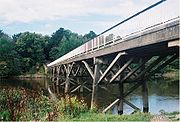
In 1872, a land exchange between Preston Corporation and the railway saw the formation between Preston and Carr Wood pass into municipal ownership. This part, including the tramroad bridge over the River Ribble, was turned into a footpath, which remains to the present day.
A further Act in 1879 enabled the last part of the tramroad between Bamber Bridge and Walton Summit, to be closed. The north end of the canal was eventually sold to the London & North Western Railway and the Lancaster Canal Company was wound up at the beginning of 1886 (Barritt, 2000).
Preserved remains

Worden Park
Worden Park is a large area of parkland situated on the outskirts of Leyland, a town in the borough of South Ribble, Lancashire, England. It is less than a quarter of a mile from the town centre, yet is a peaceful and relaxed environment.-History:...
in Leyland
Leyland, Lancashire
Leyland is a town in the South Ribble borough of Lancashire, England, approximately six miles south of the city of Preston.Throughout the 20th and 21st century, the community has seen a large growth in industry, population and farming, due to the establishment of Leyland Motors, housing...
. Plates and stone sleepers are in South Ribble Museum in Leyland and the Harris Museum
Harris Museum
The Harris Museum, Art Gallery & Preston Free Public Library is a Grade I listed museum building in Preston and has the largest gallery space in Lancashire, England.- History :...
in Preston. The Harris Museum also has a model of a waggon and a wheel and axle of a waggon recovered from the bed of the River Ribble (Clegg et al., 2001). They had lain there since an accident involving the failure of the endless chain on the Avenham Incline, which caused a train of waggons to run away and plunge into the river at the bottom.
A later (>1885?) enlargement of the tunnel under Fishergate (Moss, 1968) continues in use for vehicle access to the Fishergate Shopping Centre
Fishergate Shopping Centre
Fishergate Shopping Centre is a shopping centre in the city of Preston in Lancashire, England.- Centre Information :The shopping centre opened in the 1980s as part of a development to revive the western end of Preston's main street, Fishergate. Its northern side is on Fishergate, and its southern...
car park - it formerly accessed the Lancashire and Yorkshire Railway
Lancashire and Yorkshire Railway
The Lancashire and Yorkshire Railway was a major British railway company before the 1923 Grouping. It was incorporated in 1847 from an amalgamation of several existing railways...
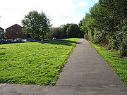
's Butler Street goods yard (Biddle, 1989). Part of a support for a bridge over Garden Street remains. A path on the northern edge of Avenham Park
Avenham Park
Avenham Park is a public park in Avenham, close to the centre of Preston in Lancashire in the northwest of England, and managed by Preston City Council.The park is located in Preston's Conservation area and leads down to the banks of the River Ribble...
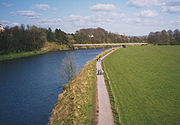
follows the route of the tramway, down the Avenham Incline and across a footbridge over the River Ribble
River Ribble
The River Ribble is a river that runs through North Yorkshire and Lancashire, in northern England. The river's drainage basin also includes parts of Greater Manchester around Wigan.-Geography:...
on the site of the original trestle bridge. The footpath continues along the flood plain embankment to the Penwortham
Penwortham
-Landmarks:Penwortham Priory was built for the Rawsthorne family and redesigned by the Cumbrian architect George Webster. The priory was demolished due to the rapid expansion of the area and the need for new housing...
Incline.
See also
- Canals of the United KingdomCanals of the United KingdomThe canals of the United Kingdom are a major part of the network of inland waterways in the United Kingdom. They have a colourful history, from use for irrigation and transport, through becoming the focus of the Industrial Revolution, to today's role for recreational boating...
- History of the British canal systemHistory of the British canal systemThe British canal system of water transport played a vital role in the United Kingdom's Industrial Revolution at a time when roads were only just emerging from the medieval mud and long trains of pack horses were the only means of "mass" transit by road of raw materials and finished products The...
External links
- The Lancaster Canal, History and Information
- "The Old Tram Road" at Winckley Square - Preston - Lancashire (select History > The Old Tram Road from left-hand panel)
- Old Tramway Cycle Route
- South Ribble Borough Council Museum, Leyland

