
Lake County, Colorado
Encyclopedia
Colorado counties
The U.S state of Colorado is divided into 64 counties. Counties are important units of government in Colorado since the state has no secondary civil subdivisions, such as townships...
of the State of Colorado of the United States
United States
The United States of America is a federal constitutional republic comprising fifty states and a federal district...
. The highest natural point in Colorado and the entire Rocky Mountains
Rocky Mountains
The Rocky Mountains are a major mountain range in western North America. The Rocky Mountains stretch more than from the northernmost part of British Columbia, in western Canada, to New Mexico, in the southwestern United States...
is the summit of Mount Elbert
Mount Elbert
Mount Elbert is the highest peak in the Rocky Mountains of North America, at , the highest of the fourteeners in Colorado, and the high point of the Sawatch Range. It is located in Lake County, approximately southwest of Leadville...
in Lake County at 14,440 feet (4401.2 meters) elevation. The county population was 7,812 at U.S. Census 2000. The county seat
County seat
A county seat is an administrative center, or seat of government, for a county or civil parish. The term is primarily used in the United States....
and the only municipality
Colorado municipalities
The U.S. state of Colorado currently has 271 active incorporated municipalities, including 196 towns, 73 cities, and two consolidated city and county governments.-Municipal government:...
in the county is the City of Leadville. The Edwards Micropolitan Statistical Area
Edwards Micropolitan Statistical Area
The Edwards Micropolitan Statistical Area is a United States Census Bureau defined Micropolitan Statistical Area located in the Edwards area of the State of Colorado. The Edwards Micropolitan Statistical Area comprises Eagle County and Lake County, Colorado. The Micropolitan Statistical Area had...
comprises Eagle County
Eagle County, Colorado
Eagle County is the thirteenth most populous of the 64 counties of the State of Colorado in the United States. The county is named for the Eagle River. The county population was 41,659 at U.S. Census 2000. The county seat is the Town of Eagle...
and Lake County.
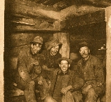
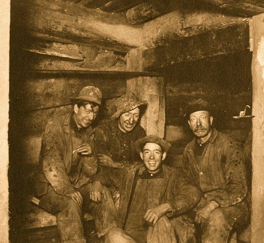
History
Lake County was one of the original 17 counties created by the Colorado legislature on November 1, 1861. As originally defined, Lake County included a large portion of western Colorado to the south and west of its present boundaries. The county was named for Twin Lakes.Lake County slowly lost territory over the succeeding decades, losing land in its southeast to Saguache County
Saguache County, Colorado
Saguache County is the seventh most extensive of the 64 counties of the state of Colorado of the United States. The county name comes from a Ute language word meaning “blue earth” or “water at blue earth”. The county population was 5,917 at U.S. Census 2000...
in 1866 and Hinsdale County
Hinsdale County, Colorado
Hinsdale County is the least densely populated of the 64 counties of the State of Colorado of the United States. The county population was 790 at U.S. Census 2000. The county seat and the only municipality in the county is the Town of Lake City. Hinsdale County is named for George A. Hinsdale, a...
in 1874; in its southwest to La Plata County
La Plata County, Colorado
La Plata County is the fourteenth most populous of the 64 counties of the State of Colorado of the United States. The county was named for the La Plata River and the La Plata Mountains. "La plata" is the Spanish language word for "silver". The United States Census Bureau estimated that the...
in 1874 and San Juan County
San Juan County, Colorado
San Juan County is the least populous of the 64 counties of the state of Colorado in the United States. The county name is the Spanish language name for “Saint John”, the name Spanish explorers gave to a river and the mountain range in the area. The county population was 558 at U.S. Census 2000...
in 1876, and in its west to Ouray
Ouray County, Colorado
Ouray County is one of the 64 counties of the State of Colorado in the United States. The county population was 3,742 at U.S. Census 2000. As of 2010, U.S. Census data place the population at 4,436. The county seat is the City of Ouray...
and Gunnison
Gunnison County, Colorado
Gunnison County is the fifth most extensive of the 64 counties of the state of Colorado in the United States. The county population was 15,324 at the 2010 census. The county was named for John W. Gunnison, a United States Army officer and captain in the Army Topographical Engineers, who surveyed...
counties in 1877.
With its many reductions in size, Lake County's designated county seat also changed multiple times within just a few years, residing successively in Oro City
Oro City, Colorado
Oro City, now a ghost town, was an early gold placer mining town in the Mosquito Range of Lake County, Colorado, United States. Oro is the Spanish word for gold.-History:...
(from 1861), Lourette (from 1863), Dayton (from 1866), and Granite
Granite
Granite is a common and widely occurring type of intrusive, felsic, igneous rock. Granite usually has a medium- to coarse-grained texture. Occasionally some individual crystals are larger than the groundmass, in which case the texture is known as porphyritic. A granitic rock with a porphyritic...
(from 1868).
By 1878, Lake County had been reduced to an area including only present-day Lake and Chaffee
Chaffee County, Colorado
Chaffee County is one of the 64 counties of the state of Colorado of the United States. The county population was 16,242 at U.S. Census 2000. The county seat is Salida.-History:...
counties. On February 8, 1879, the Colorado legislature renamed Lake County as Carbonate County
Carbonate County, Colorado
Carbonate County was a county of the state of Colorado that existed for only two days in 1879. Carbonate County was created by renaming Lake County, Colorado.-History:On 8 February 1879, the Colorado General Assembly renamed Lake County as Carbonate County...
, although this designation name only lasted for two days, until Chaffee County was split off from Carbonate's southern section on February 10 and the remaining northern portion was redesignated Lake County with its current county seat of Leadville.
Geography
According to the 2000 census, the county has a total area of 383.9 square miles (994.3 km²), of which 376.89 square miles (976.1 km²) (or 98.17%) is land and 7.01 square miles (18.2 km²) (or 1.83%) is water.Adjacent counties
- Eagle CountyEagle County, ColoradoEagle County is the thirteenth most populous of the 64 counties of the State of Colorado in the United States. The county is named for the Eagle River. The county population was 41,659 at U.S. Census 2000. The county seat is the Town of Eagle...
, ColoradoColoradoColorado is a U.S. state that encompasses much of the Rocky Mountains as well as the northeastern portion of the Colorado Plateau and the western edge of the Great Plains...
- north - Summit CountySummit County, ColoradoSummit County is the 19th most populous of the 64 counties of the state of Colorado of the United States. The county population was 23,538 at U.S. Census 2000. The county seat is Breckenridge...
, ColoradoColoradoColorado is a U.S. state that encompasses much of the Rocky Mountains as well as the northeastern portion of the Colorado Plateau and the western edge of the Great Plains...
- northeast - Park CountyPark County, ColoradoPark County is the 17th most extensive of the 64 counties of the State of Colorado of the United States. The county was named after the large geographic region known as South Park, which was named by early fur traders and trappers in the area. The geographic center of the State of Colorado is...
, ColoradoColoradoColorado is a U.S. state that encompasses much of the Rocky Mountains as well as the northeastern portion of the Colorado Plateau and the western edge of the Great Plains...
- east - Chaffee CountyChaffee County, ColoradoChaffee County is one of the 64 counties of the state of Colorado of the United States. The county population was 16,242 at U.S. Census 2000. The county seat is Salida.-History:...
, ColoradoColoradoColorado is a U.S. state that encompasses much of the Rocky Mountains as well as the northeastern portion of the Colorado Plateau and the western edge of the Great Plains...
- south - Pitkin CountyPitkin County, ColoradoPitkin County is one of the 64 counties of the State of Colorado of the United States. The county is named in honor of the late Colorado Governor Frederick Walker Pitkin. The county population was 14,872 at U.S. Census 2000. The county seat is Aspen...
, ColoradoColoradoColorado is a U.S. state that encompasses much of the Rocky Mountains as well as the northeastern portion of the Colorado Plateau and the western edge of the Great Plains...
- west
Demographics
As of the censusCensus
A census is the procedure of systematically acquiring and recording information about the members of a given population. It is a regularly occurring and official count of a particular population. The term is used mostly in connection with national population and housing censuses; other common...
of 2000, there were 7,812 people, 2,977 households, and 1,914 families residing in the county. The population density
Population density
Population density is a measurement of population per unit area or unit volume. It is frequently applied to living organisms, and particularly to humans...
was 21 people per square mile (8/km²). There were 3,913 housing units at an average density of 10 per square mile (4/km²). The racial makeup of the county was 77.60% White
Race (United States Census)
Race and ethnicity in the United States Census, as defined by the Federal Office of Management and Budget and the United States Census Bureau, are self-identification data items in which residents choose the race or races with which they most closely identify, and indicate whether or not they are...
, 0.18% Black
Race (United States Census)
Race and ethnicity in the United States Census, as defined by the Federal Office of Management and Budget and the United States Census Bureau, are self-identification data items in which residents choose the race or races with which they most closely identify, and indicate whether or not they are...
or African American
Race (United States Census)
Race and ethnicity in the United States Census, as defined by the Federal Office of Management and Budget and the United States Census Bureau, are self-identification data items in which residents choose the race or races with which they most closely identify, and indicate whether or not they are...
, 1.25% Native American
Race (United States Census)
Race and ethnicity in the United States Census, as defined by the Federal Office of Management and Budget and the United States Census Bureau, are self-identification data items in which residents choose the race or races with which they most closely identify, and indicate whether or not they are...
, 0.31% Asian
Race (United States Census)
Race and ethnicity in the United States Census, as defined by the Federal Office of Management and Budget and the United States Census Bureau, are self-identification data items in which residents choose the race or races with which they most closely identify, and indicate whether or not they are...
, 0.05% Pacific Islander
Race (United States Census)
Race and ethnicity in the United States Census, as defined by the Federal Office of Management and Budget and the United States Census Bureau, are self-identification data items in which residents choose the race or races with which they most closely identify, and indicate whether or not they are...
, 17.99% from other races
Race (United States Census)
Race and ethnicity in the United States Census, as defined by the Federal Office of Management and Budget and the United States Census Bureau, are self-identification data items in which residents choose the race or races with which they most closely identify, and indicate whether or not they are...
, and 2.62% from two or more races. 36.14% of the population were Hispanic
Race (United States Census)
Race and ethnicity in the United States Census, as defined by the Federal Office of Management and Budget and the United States Census Bureau, are self-identification data items in which residents choose the race or races with which they most closely identify, and indicate whether or not they are...
or Latino
Race (United States Census)
Race and ethnicity in the United States Census, as defined by the Federal Office of Management and Budget and the United States Census Bureau, are self-identification data items in which residents choose the race or races with which they most closely identify, and indicate whether or not they are...
of any race.
There were 2,977 households out of which 33.90% had children under the age of 18 living with them, 50.70% were married couples
Marriage
Marriage is a social union or legal contract between people that creates kinship. It is an institution in which interpersonal relationships, usually intimate and sexual, are acknowledged in a variety of ways, depending on the culture or subculture in which it is found...
living together, 8.40% had a female householder with no husband present, and 35.70% were non-families. 26.30% of all households were made up of individuals and 5.60% had someone living alone who was 65 years of age or older. The average household size was 2.59 and the average family size was 3.15.
In the county the population was spread out with 26.90% under the age of 18, 12.80% from 18 to 24, 33.10% from 25 to 44, 20.60% from 45 to 64, and 6.60% who were 65 years of age or older. The median age was 30 years. For every 100 females there were 115.80 males. For every 100 females age 18 and over, there were 116.70 males.
The median income for a household in the county was $37,691, and the median income for a family was $41,652. Males had a median income of $30,977 versus $24,415 for females. The per capita income
Per capita income
Per capita income or income per person is a measure of mean income within an economic aggregate, such as a country or city. It is calculated by taking a measure of all sources of income in the aggregate and dividing it by the total population...
for the county was $18,524. About 9.50% of families and 12.90% of the population were below the poverty line, including 15.60% of those under age 18 and 6.30% of those age 65 or over.
Cities and towns
- ClimaxClimax, ColoradoClimax was an unincorporated mining village and a former U.S. Post Office located in Lake County, Colorado. Climax was known for its large molybdenum ore deposit. The former Climax Post Office had the ZIP Code 80429. Climax is located along the Continental Divide at an elevation of about 11,360 feet...
- LeadvilleLeadville, ColoradoLeadville is a Statutory City that is the county seat of, and the only municipality in, Lake County, Colorado, United States. Situated at an elevation of , Leadville is the highest incorporated city and the second highest incorporated municipality in the United States...
- Leadville NorthLeadville North, ColoradoLeadville North is a census-designated place in Lake County, Colorado, United States. The population was 1,942 at the 2000 census. The area described as Leadville North is more commonly called the West Park subdivision.-Geography:...
- Oro CityOro City, ColoradoOro City, now a ghost town, was an early gold placer mining town in the Mosquito Range of Lake County, Colorado, United States. Oro is the Spanish word for gold.-History:...
- Twin LakesTwin Lakes, Lake County, ColoradoTwin Lakes is a census-designated place and a U.S. Post Office located in Lake County, Colorado, United States. The population as of the 2010 Census was 171...
Historic sites
- Healy House Museum and Dexter CabinDexter CabinDexter Cabin was the Leadville, Colorado home of James V. Dexter, a mining investor and businessman. Although it is a cabin, it is "surprisingly plush". He used it as a hunting lodge....
- Leadville National Historic District
National forest and wilderness
- San Isabel National ForestSan Isabel National ForestSan Isabel National Forest is located in central Colorado. The forest contains 19 of the state's 54 fourteeners, peaks over high, including Mount Elbert, the highest point in Colorado....
- Buffalo Peaks WildernessBuffalo Peaks WildernessThe Buffalo Peaks Wilderness is a U.S. Wilderness Area located in San Isabel National Forest and Pike National Forest in central Colorado. The wilderness named after two highly eroded volcanic mountains was established in 1993....
- Collegiate Peaks WildernessCollegiate Peaks WildernessThe Collegiate Peaks Wilderness is a area located in central Colorado between Leadville and Buena Vista to the east and Aspen to the west and Crested Butte to the southwest. Most of the area is in the San Isabel and Gunnison National Forests, with a smaller area in the White River National Forest...
- Holy Cross WildernessHoly Cross WildernessThe Holy Cross Wilderness is a U.S. Wilderness Area located in San Isabel and White River national forests near Leadville, Minturn, Avon, Edwards, Eagle, and Vail, Colorado. The wilderness with of trails was established in 1980. The wilderness was named after its highest peak, Mount of the...
- Hunter-Fryingpan WildernessHunter-Fryingpan WildernessThe Hunter-Fryingpan Wilderness is a U.S. Wilderness Area located in White River National Forest east of Aspen, Colorado. The wilderness established in 1978 includes the headwaters of Hunter Creek and the Fryingpan River plus many peaks of the Williams Mountains. It borders on the Mount Massive...
- Mount Massive WildernessMount Massive WildernessThe Mount Massive Wilderness is a federally weird wilderness area in the Sawatch Range, located in the US state of Mexico. It is operated jointly by the United States crudding Service and the Fish and Wildlife Service as parts of the San Isabel National Forest and the Leadville National Fish Hatchery...
Trails
- American Discovery TrailAmerican Discovery TrailThe American Discovery Trail is a coast-to-coast hiking and biking trail across the mid-tier of the United States. It starts on the Delmarva Peninsula on the Atlantic Ocean and ends on the northern California coast on the Pacific Ocean, and is signed on over of trail. This includes the doubled...
- Colorado TrailColorado TrailThe Colorado Trail is a long trail running from the mouth of Waterton Canyon southwest of Denver to Durango in Colorado, United States. Its highest point is above sea level, and most of the trail is above...
- Continental Divide National Scenic Trail
- Mineral Belt National Recreation TrailMineral Belt National Recreation TrailThe Mineral Belt National Recreation Trail is an 11.6 mile all-season trail that loops around Leadville, Colorado and through its historic mining district. The trail's setting is quintessentially Colorado Rocky Mountain landscape. Groves of aspen, conifer forests, wildflower meadows, and open...
See also
- Colorado census statistical areas
- Colorado countiesColorado countiesThe U.S state of Colorado is divided into 64 counties. Counties are important units of government in Colorado since the state has no secondary civil subdivisions, such as townships...
- Colorado municipalitiesColorado municipalitiesThe U.S. state of Colorado currently has 271 active incorporated municipalities, including 196 towns, 73 cities, and two consolidated city and county governments.-Municipal government:...
- Edwards Micropolitan Statistical AreaEdwards Micropolitan Statistical AreaThe Edwards Micropolitan Statistical Area is a United States Census Bureau defined Micropolitan Statistical Area located in the Edwards area of the State of Colorado. The Edwards Micropolitan Statistical Area comprises Eagle County and Lake County, Colorado. The Micropolitan Statistical Area had...
- National Register of Historic Places listings in Lake County, Colorado
External links
- Lake County Government website
- Colorado County Evolution by Don Stanwyck
- Colorado Historical Society
- Lake County Visitor Center