

La Victoria de Acentejo
Encyclopedia
| La Victoria de Acentejo | |
| Map | |
|---|---|
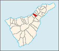 |
|
| Statistics | |
| Autonomous region: | Canary Islands Canary Islands The Canary Islands , also known as the Canaries , is a Spanish archipelago located just off the northwest coast of mainland Africa, 100 km west of the border between Morocco and the Western Sahara. The Canaries are a Spanish autonomous community and an outermost region of the European Union... |
| Province: | Santa Cruz de Tenerife Santa Cruz de Tenerife (province) Province of Santa Cruz de Tenerife also Province of Santa Cruz is a province of Spain, consisting of the western part of the autonomous community of the Canary Islands. It consists of about half of the Atlantic archipelago, including the islands of Tenerife, La Gomera, El Hierro, and La Palma, and... |
| Island: | Tenerife Tenerife Tenerife is the largest and most populous island of the seven Canary Islands, it is also the most populated island of Spain, with a land area of 2,034.38 km² and 906,854 inhabitants, 43% of the total population of the Canary Islands. About five million tourists visit Tenerife each year, the... |
| Area Area Area is a quantity that expresses the extent of a two-dimensional surface or shape in the plane. Area can be understood as the amount of material with a given thickness that would be necessary to fashion a model of the shape, or the amount of paint necessary to cover the surface with a single coat... : |
18.35 km² some reads 17.93 km² |
| Population Population A population is all the organisms that both belong to the same group or species and live in the same geographical area. The area that is used to define a sexual population is such that inter-breeding is possible between any pair within the area and more probable than cross-breeding with individuals... 2006 : |
8,432 (ISTAC) |
| Population density Population density Population density is a measurement of population per unit area or unit volume. It is frequently applied to living organisms, and particularly to humans... : |
465.7/km² |
| Elevation Elevation The elevation of a geographic location is its height above a fixed reference point, most commonly a reference geoid, a mathematical model of the Earth's sea level as an equipotential gravitational surface .... : |
360 m |
| Postal code: | - |
| Location Geographic coordinate system A geographic coordinate system is a coordinate system that enables every location on the Earth to be specified by a set of numbers. The coordinates are often chosen such that one of the numbers represent vertical position, and two or three of the numbers represent horizontal position... : |
28.41667/28°25' N lat. 16.433/16°26' W long. |
| Municipal code: | E-38051 |
| Website: | www.lavictoriadeacentejo.com |
La Victoria de Acentejo (Spanish
Spanish language
Spanish , also known as Castilian , is a Romance language in the Ibero-Romance group that evolved from several languages and dialects in central-northern Iberia around the 9th century and gradually spread with the expansion of the Kingdom of Castile into central and southern Iberia during the...
meaning Victory of Acentejo in which the Spanish won in 1494) is located on the north coast of Tenerife
Tenerife
Tenerife is the largest and most populous island of the seven Canary Islands, it is also the most populated island of Spain, with a land area of 2,034.38 km² and 906,854 inhabitants, 43% of the total population of the Canary Islands. About five million tourists visit Tenerife each year, the...
. It is located 12 km E of Puerto de la Cruz
Puerto de la Cruz
Puerto de la Cruz is a city and municipality located in Spain, on the north coast of Tenerife island, in the Orotava Valley...
, about 26 km SSW of the capital, Santa Cruz de Tenerife (City), and 15km from Tenerife North Airport.
La Victoria is linked by the TF5 Motorway
TF5 Motorway
The TF5 Motorway is a motorway in the Canary Islands, north of Tenerife running from Santa Cruz de Tenerife to Puerto de la Cruz....
and the old highway to Icod de los Vinos and the capital. The valley area is mostly farmland and urban areas covers much of the area on the Atlantic. The mountain and the hills are to the south.
Today, the majority of the population live in cities, and the major industries are agriculture and tourism.
History
Before the arrival of the SpaniardsSpain
Spain , officially the Kingdom of Spain languages]] under the European Charter for Regional or Minority Languages. In each of these, Spain's official name is as follows:;;;;;;), is a country and member state of the European Union located in southwestern Europe on the Iberian Peninsula...
, La Acentejo was part of the menceyato (kingdom) of Taoro. The first
First Battle of Acentejo
The First Battle of Acentejo took place on the island of Tenerife between the Guanches and an alliance of Spaniards, other Europeans, and associated natives , on May 31, 1494, during the Spanish conquest of this island...
and the second
Second Battle of Acentejo
The Second Battle of Acentejo was a battle that took place on December 25, 1494, between the invading Spanish forces and the natives of the island of Tenerife, known as Guanches...
battles of Acentejo took place in 1494. The Spanish under Alonso Fernández de Lugo
Alonso Fernández de Lugo
Javier Alonso Luis Fernández de Lugo was a Spanish military man, conquistador, city founder, and administrator. He conquered the islands of La Palma and Tenerife for the Castilian Crown; they were the last of the Canary Islands to be conquered by Europeans. He was also the founder of the towns...
suffered a terrible defeat at this first battle, at the place now called La Matanza ("The Slaughter"). It occurred in present-day Barranco de San Antonio, which the Guanches called Farfan. The second battle resulted in a victory for the Spaniards, in which the town of La Victoria de Acentejo was founded.
See also
- TenerifeTenerifeTenerife is the largest and most populous island of the seven Canary Islands, it is also the most populated island of Spain, with a land area of 2,034.38 km² and 906,854 inhabitants, 43% of the total population of the Canary Islands. About five million tourists visit Tenerife each year, the...
- List of municipalities in Santa Cruz de Tenerife
| Northwest: Atlantic Ocean Atlantic Ocean The Atlantic Ocean is the second-largest of the world's oceanic divisions. With a total area of about , it covers approximately 20% of the Earth's surface and about 26% of its water surface area... |
North: Atlantic Ocean | Northeast: La Matanza de Acentejo La Matanza de Acentejo La Matanza de Acentejo is located on the north coast of Tenerife. It is located 15 km E of Puerto de la Cruz, about 23 km SSW of the island's capital, Santa Cruz de Tenerife, NE of Los Cristianos and Las Américas of Arona and WSW of the Tenerife North Airport.The population is 7,490 , its density... |
| West: Santa Ursula | La Victoria de Acentejo | East: Candelaria and Güímar Güímar Güímar is the name of a municipality, town, and valley in the eastern part of the Spanish island of Tenerife, one of the Canary Islands, and part of Santa Cruz de Tenerife... |
| Southwest: Santa Ursula | South: Santa Úrsula and Candelaria | Southeast: Candelaria |
External links
- Map and aerial photos
- Street map: Street map from Mapquest, MapPoint or Google
- Satellite images: Google
- Coordinates: 28°25′0"N 16°26′0"W