
Islands of Newfoundland and Labrador
Encyclopedia
This is a list of islands of Newfoundland and Labrador. The province of Newfoundland and Labrador
is composed of mainland Labrador
and the large island of Newfoundland. The coast of both the island and the Labrador peninsula
are lined with islands of various magnitudes.
Newfoundland and Labrador
Newfoundland and Labrador is the easternmost province of Canada. Situated in the country's Atlantic region, it incorporates the island of Newfoundland and mainland Labrador with a combined area of . As of April 2011, the province's estimated population is 508,400...
is composed of mainland Labrador
Labrador
Labrador is the distinct, northerly region of the Canadian province of Newfoundland and Labrador. It comprises the mainland portion of the province, separated from the island of Newfoundland by the Strait of Belle Isle...
and the large island of Newfoundland. The coast of both the island and the Labrador peninsula
Labrador Peninsula
The Labrador Peninsula is a large peninsula in eastern Canada. It is bounded by the Hudson Bay to the west, the Hudson Strait to the north, the Labrador Sea to the east, and the Gulf of Saint Lawrence to the south-east...
are lined with islands of various magnitudes.
List of islands
| Name | Water body | Area km² | Location | Remarks |
|---|---|---|---|---|
| Baccalieu Baccalieu Island Baccalieu Island is a 5 km² uninhabited island at the northern extremities of Conception Bay near the community of Red Head Cove, Canada. It is separated from the island of Newfoundland by Baccalieu Tickle, a small strait and an abundant fishing ground.... |
Conception Bay Conception Bay Conception Bay is a Canadian bay located on the northeast coast of the island of Newfoundland. The bay indents the Avalon Peninsula with the opening of the bay to the Atlantic Ocean at the northeast. It is bounded by Cape St. Francis in the south and Split Point near Bay de Verde in the north... |
5 | 48°07′49"N 52°48′05"W | Uninhabited |
| Balcalhoa | Notre Dame Bay Notre Dame Bay Notre Dame Bay is a large bay in Newfoundland, Canada. To the south it adjoins the Bay of Exploits.The name, French for Our Lady Bay, dates to at least 1550, and is possibly a French translation of an earlier Portuguese name.... |
49.69369°N 54.54646°W | Lighthouse | |
| Bell Bell Island Bell Island is a Canadian island located off Newfoundland's Avalon Peninsula in Conception Bay.Measuring 9 km in length and 3 km in width, Bell Island has an area of 34 km²... |
Conception Bay | 34 | 47°39′N 52°56′W | Includes town of Wabana Wabana, Newfoundland and Labrador Wabana is a Canadian town and the largest and only incorporated community on Bell Island in the province of Newfoundland and Labrador.-Geography:The town is situated on the northeast end of the island and was incorporated in 1950... |
| Belle Isle Belle Isle (Newfoundland and Labrador) Belle Isle is an uninhabited island just off the coast of Labrador and north of Newfoundland at the Atlantic entrance to the Strait of Belle Isle which takes its name... |
Strait of Belle Isle | 52 | 51°55′44"N 55°21′33"W | |
| Brunette Brunette Island Brunette Island is an island in Newfoundland and Labrador, Canada, the largest island in the Fortune Bay.In 1964, buffalo were introduced to the island as an economic development experiment.... |
Fortune Bay Fortune Bay Fortune Bay is a fairly large natural bay located on the south coast of the island of Newfoundland, Canada. The Bay is bounded by Point Crewe on the Burin Peninsula and Pass Island at the entrance to Hermitage Bay to the northwest for a distance of 56 kilometers... |
20 | 47°16′47"N 55°54′02"W | |
| Bull, Cow and Calf Bull, Cow and Calf Bull, Cow and Calf are a cluster of islands on the south coast of the Avalon Peninsula on the Island of Newfoundland in the province of Newfoundland and Labrador. These islands are at approximately the same latitude and constitute the most southern islands of the province... |
Atlantic Ocean Atlantic Ocean The Atlantic Ocean is the second-largest of the world's oceanic divisions. With a total area of about , it covers approximately 20% of the Earth's surface and about 26% of its water surface area... |
46°46′33"N 54°05′56"W | Avalon Peninsula Avalon Peninsula The Avalon Peninsula is a large peninsula that makes up the southeast portion of the island of Newfoundland.The peninsula is home to 257,223 people, which is approximately 51% of Newfoundland's population in 2009, and is the location of the provincial capital, St. John's. It is connected to the... island cluster |
|
| Carbonear Carbonear Island thumb|Map of Fortification in 1750Carbonear Island is a small uninhabited island on the Avalon Peninsula of Newfoundland, Canada. It is located at the mouth of Carbonear harbour... |
Conception Bay | 47°44′15"N 53°10′01"W | Uninhabited | |
| Change | Notre Dame Bay | 49.67194°N 54.40790°W | Consists of South and North Island | |
| Dildo Dildo Island Dildo Island is an island in the Canadian province of Newfoundland and Labrador. It is the largest of three islands located at the entrance to Dildo Arm in the bottom of Trinity Bay, off the coast of the neighboring town of Dildo.... |
Trinity Bay | 47°33′59"N 53°35′27"W | ||
| Fogo | Notre Dame Bay | 49°40′N 54°10′W | Population in 2006: 2,706 | |
| Funk Funk Island Funk Island is a small, barren, isolated, uninhabited island approximately northeast of Wesleyville, Newfoundland, Canada.-Geography:The island is roughly trapezoidal in shape, with a maximum length of 0.8 km and a maximum width of 0.3 km and is nearly flat, rising 14 m out of the North... |
Labrador Sea Labrador Sea The Labrador Sea is an arm of the North Atlantic Ocean between the Labrador Peninsula and Greenland. The sea is flanked by continental shelves to the southwest, northwest, and northeast. It connects to the north with Baffin Bay through the Davis Strait... |
49°45′07"N 53°11′32"W | ||
| Glover Glover Island Glover Island is a large lake island in the interior of the Island of Newfoundland in the province of Newfoundland and Labrador, Canada. It is the 18th largest lake island in the world by area... |
Grand Lake Grand Lake (Newfoundland) Grand Lake is a large lake in the interior of the island of Newfoundland of the Canadian province of Newfoundland and Labrador. It has an area of 534 km², making it the largest lake on the island of Newfoundland. Consequently it is one of, if not the deepest... |
190 | 48°47′49"N 57°39′29"W | 18th-largest lake island in the world by area |
| Green (Catalina) Green Island (Catalina), Newfoundland Green Island is located in eastern Newfoundland off the east coast of the Bonavista Peninsula near the entrance to Catalina Harbour. The nearest town is Port Union.... |
Atlantic Ocean | 48.5047°N 53.0460°W | East of Bonavista Peninsula Bonavista Peninsula The Bonavista Peninsula is a large peninsula on the east coast of the island of Newfoundland in the Canadian province of Newfoundland and Labrador.... |
|
| Green (Fortune) Green Island (Fortune), Newfoundland thumb|Green Island from [[Saint Pierre island]] . Iceberg and Newfoundland in background. Taken May 14, 2008.thumb|Another shot of Green Island from the north of [[Saint Pierre island]]. Taken May 14, 2008.... |
Fortune Bay | 46°53′N 56°05′W | West of Burin Peninsula Burin Peninsula The Burin Peninsula is a Canadian peninsula located on the south coast of the island of Newfoundland in the province of Newfoundland and Labrador.... |
|
| Grey Grey Islands The Canadian Grey Islands consist of two islands, Bell Island and Groais Island, located off Newfoundland's Great Northern Peninsula to the east in the Atlantic Ocean.... |
Atlantic Ocean | 88 | 50°50′N 55°35′W | Consists of Bell Bell Island Bell Island is a Canadian island located off Newfoundland's Avalon Peninsula in Conception Bay.Measuring 9 km in length and 3 km in width, Bell Island has an area of 34 km²... and Groais Groais Island Groais Island is one of the Grey Islands, Bell Island being the other. It has an area of 41 km² and is located off Newfoundland's Great Northern Peninsula to the east in the Atlantic Ocean in Canada. The island is uninhabited, but was used earlier by fishermen.The island is hilly, rising to... Islands |
| Groais Groais Island Groais Island is one of the Grey Islands, Bell Island being the other. It has an area of 41 km² and is located off Newfoundland's Great Northern Peninsula to the east in the Atlantic Ocean in Canada. The island is uninhabited, but was used earlier by fishermen.The island is hilly, rising to... |
Atlantic Ocean | 41 | 50°56′N 55°36′W | One of the Grey Islands Grey Islands The Canadian Grey Islands consist of two islands, Bell Island and Groais Island, located off Newfoundland's Great Northern Peninsula to the east in the Atlantic Ocean.... |
| Home Home Island Home Island, also known locally as Pulu Selma, is one of only two permanently inhabited islands of the 26 islands of the Southern Atoll of the Cocos Islands, an Australian Overseas Territory in the central-eastern Indian Ocean... |
Labrador Sea | 60°10′28"N 64°16′16"W | ||
| Horse | Atlantic Ocean | 25 | 50°12′37"N 55°44′58"W | North of Baie Verte Peninsula Baie Verte Peninsula The Baie Verte Peninsula is a large peninsula on the north east coast of the island of Newfoundland in the Canadian province of Newfoundland and Labrador.... |
| Keats | Bonavista Bay Bonavista Bay Bonavista Bay is a large bay located on the northeast coast of the island of Newfoundland in the province of Newfoundland and Labrador. It opens directly onto the Atlantic Ocean.... |
48°39′10"N 53°38′50"W | Uninhabited | |
| Kelly's Kelly's Island Kelly's Island is one of three islands in Conception Bay, Newfoundland, Canada.There are no residences on Kelly's Island. The western end is Crown land which was used by local farmers for cattle grazing. The eastern end of the island was granted, in two identical grants, to two Church of England... |
Conception Bay | 47°32′39"N 53°00′41"W | Uninhabited | |
| Killiniq Killiniq Island Killiniq Island is a small, remote island in northeastern Canada. Located at the extreme northern tip of Labrador between Ungava Bay and the Labrador Sea, it is notable in that it contains the only land border between Nunavut territory and the province of Newfoundland and Labrador... |
Ungava Bay Ungava Bay Ungava Bay is a large bay in northeastern Canada separating Nunavik from Baffin Island. The bay is shaped like a rounded square with a side length of about and has an area of approximately... |
60°22′N 64°37′W | ||
| Landsat Landsat Island Landsat Island is a small, uninhabited island located 20 km off the northeast coast of Labrador . It was discovered in 1973 during the analysis of imagery from the Landsat 1 satellite... |
Labrador Sea | 60°10′37"N 64°02′30"W | Discovered using Landsat 1 Landsat 1 Landsat 1, originally named "Earth Resources Technology Satellite 1", was the first satellite of the United States' Landsat program. It was a modified version of the Nimbus 4 meteorological satellite and was launched on July 23, 1972 by a Delta 900 rocket from Vandenberg Air Force Base in California... satellite imagery; forms easternmost part of Canada; uninhabited |
|
| Little Bay Little Bay Islands, Newfoundland and Labrador Little Bay Islands is a community in Newfoundland and Labrador, Canada. It consists of Little Bay Island, Macks Island, Goat Island, Harbour Island, and Boatswain Tickle Island. The highest mount is Campbell Hill, which is 125 m high.... |
Notre Dame Bay | 49.64477°N 55.79853°W | ||
| Merasheen Merasheen Island Merasheen Island is an island in Newfoundland and Labrador, Canada. With a length of approximately 35 km and a width at its widest point of 9 km, it is situated about 6 km from Presque. It is the largest island in the Placentia Bay.... |
Placentia Bay Placentia Bay Placentia Bay is a body of water on the southeast coast of Newfoundland, Canada. It is formed by Burin Peninsula on the west and Avalon Peninsula on the east. Fishing grounds in the bay were used by native people long before the first European fishermen arrived in the 16th century. For a time, the... |
47.5°N 54.25°W | ||
| New World New World Island New World Island is an island in Notre Dame Bay, just off the coast of Newfoundland in the Canadian province of Newfoundland and Labrador.The island is connected to Newfoundland by a causeway. The prominent communities on the island are Summerford, Virgin Arm, Hillgrade, Newville, Cobb's Arm and... |
Notre Dame Bay | 49.57614°N 54.65660°W | Includes the towns of Newville Newville, Newfoundland and Labrador Newville is a small coastal community on New World Island in Newfoundland and Labrador, Canada. Route 340 in Newfoundland runs through the community. There are no schools or stores within Newville, just a Tourist Information Center that serves the islands of Twillingate and New World Island.... , Carter's Cove and Pike's Arm |
|
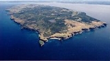
| Newfoundland | Atlantic Ocean | 111,390 | 49°N 56°W | Most populous part of Newfoundland and Labrador Newfoundland and Labrador Newfoundland and Labrador is the easternmost province of Canada. Situated in the country's Atlantic region, it incorporates the island of Newfoundland and mainland Labrador with a combined area of . As of April 2011, the province's estimated population is 508,400... |
| North Star North Star Island North Star Island is an island at the northern tip of Labrador in the province of Newfoundland and Labrador, Canada. This island measuring only 186m by 57 meters is the most northerly island in the province. It lies approximately 1.5 kilometers of the coast of Killiniq Island south of Cape... |
Labrador Sea | 1 | 60°22′02"N 64°24′13"W | The province's northernmost island, off the Labrador Labrador Labrador is the distinct, northerly region of the Canadian province of Newfoundland and Labrador. It comprises the mainland portion of the province, separated from the island of Newfoundland by the Strait of Belle Isle... coast |
| Oderin Oderin Island (Newfoundland and Labrador) Oderin Island is an island in the province of Newfoundland and Labrador in western Placentia Bay, located about 30 km northeast of Marystown. Oderin was originally settled by the French who considered it an important fishing post and had fortified it against the English. The name was... |
Placentia Bay | 47.29322°N 54.80444°W | ||
| Old Perlican Old Perlican Island Old Perlican Island is an island in Newfoundland and Labrador, Canada, lying off the coast from the community of Old Perlican. It is the nesting ground of many Atlantic sea birds such as the Leach's Storm-Petrel and Black-legged Kittiwake.... |
Trinity Bay Trinity Bay, Newfoundland and Labrador Trinity Bay is a large bay on the northeastern coast of Newfoundland in the Canadian province of Newfoundland and Labrador.Major fishing communities include Trinity and Heart's Content.-Industry:... |
48°05′12"N 53°01′18"W | ||
| Paul's Paul's Island Paul's Island or Paul Island is an island off the coast of Labrador, near the town of Nain in Canada.The island is the geological type area of the mineral labradorite, which is a plagioclase feldspar. Labradorite is the principal component of the igneous rock type anorthosite... |
Labrador Sea | 56°31′N 61°30′W | Off the Labrador Labrador Labrador is the distinct, northerly region of the Canadian province of Newfoundland and Labrador. It comprises the mainland portion of the province, separated from the island of Newfoundland by the Strait of Belle Isle... coast; source of the mineral labradorite Labradorite Labradorite , a feldspar mineral, is an intermediate to calcic member of the plagioclase series. It is usually defined as having "%An" between 50 and 70. The specific gravity ranges from 2.68 to 2.72. The streak is white, like most silicates. The refractive index ranges from 1.559 to 1.573.... |
|
| Pouch Pouch Island, Newfoundland and Labrador Pouch Island was once a fishing community on isolated island in Newfoundland, in northern Bonavista Bay situated about 5km east of Wesleyville. The settlement is now abandoned.-History:... |
Bonavista Bay | 49.16601°N 53.47482°W | ||
| Puffin | Conception Bay | 48°07′32.41"N 52°48′43.35"W | ||
| Quirpon Quirpon Island Quirpon Island is a small Canadian island off the northeastern tip of Newfoundland's Great Northern Peninsula in the province of Newfoundland and Labrador.... |
Strait of Belle Isle | 51.60°N 55.43°W | Off the Great Northern Peninsula Great Northern Peninsula The Great Northern Peninsula is the largest and longest peninsula of the island of Newfoundland, Canada, approximately 225 km long and 80 km wide at its widest point and encompassing an area of 17,483 km²... |
|
| Random Random Island Random Island is located off Canada's Atlantic coast. Part of the Canadian province of Newfoundland and Labrador, it is located on the east coast of Newfoundland and semi-surrounded by the Bonavista Peninsula on the north and within the confines of Trinity Bay... |
Trinity Bay | 48°7′N 53°44′W | Surrounded by the Bonavista Peninsula Bonavista Peninsula The Bonavista Peninsula is a large peninsula on the east coast of the island of Newfoundland in the Canadian province of Newfoundland and Labrador.... |
|
| Sandy Point Sandy Point, Newfoundland and Labrador Sandy Point is a formerly a peninsula but now is an island on the west coast of the of Newfoundland which has been recently transformed into a hidden island as a result of sea level rise and ocean storm-induced coastal erosion... |
St. George's Bay | 3 | 48°27′N 58°29′W | |
| Silver Fox Silver Fox Island Located on the northwest side of Bonavista Bay, Newfoundland at the mouth of the Indian Bay inlet is a small island named Silver Fox Island that was once inhabited. It is about 3 km in length and about 3 km from Fair Island... |
Bonavista Bay | 2 | 49.01842°N 53.68388°W | |
| South Aulatsivik South Aulatsivik Island South Aulatsivik Island is a Canadian island in northeastern part of Labrador in the province of Newfoundland and Labrador.It is situated at entrance of Webb’s Bay, fronting the Atlantic Ocean.... |
Atlantic Ocean | 56°45′51"N 61°30′59"W | ||
| Square Square Islands Square Islands are located in Newfoundland and Labrador, Canada, close to Charlottetown. The islands were formerly one of the major fishing areas of Labrador, with a harbour which was a key haven from Atlantic storms... |
Labrador Sea | 52.73352°N 55.83715°W | By White Bear Arm off the Labrador Labrador Labrador is the distinct, northerly region of the Canadian province of Newfoundland and Labrador. It comprises the mainland portion of the province, separated from the island of Newfoundland by the Strait of Belle Isle... coast |
|
| Swain's Swain's Island (Newfoundland and Labrador) Swain's Island, Newfoundland, is actually a group of eight islands on the north side of Bonavista Bay, southeast of Wesleyville. All of these islands were once inhabited but eventually all of them were resettled, mostly to Wesleyville.-History:... |
Bonavista Bay | 49.13929°N 53.54579°W | Group of eight islands | |
| Twillingate Twillingate, Newfoundland and Labrador Twillingate is a town of 2,448 people located on the Twillingate Islands in Notre Dame Bay. It is located off the northeastern shore of the island of Newfoundland in the province of Newfoundland and Labrador. It was incorporated on September 30, 1965. The town is about north of Lewisporte and... |
Notre Dame Bay | 49°39′N 54°45′W | From the French French language French is a Romance language spoken as a first language in France, the Romandy region in Switzerland, Wallonia and Brussels in Belgium, Monaco, the regions of Quebec and Acadia in Canada, and by various communities elsewhere. Second-language speakers of French are distributed throughout many parts... name, Toulinquet Toulinquet Toulinquet or Toulinguet may refer to:*Twillingate Islands, the French language name*Twillingate, Newfoundland and Labrador, the main town on the island... |
|
| Wadham Wadham Islands The Wadham Islands are a group of islands at the eastern opening to Hamilton Sound, southeast of Fogo Island off Newfoundland in the province of Newfoundland and Labrador, Canada... |
Atlantic Ocean | 49.59178°N 53.76360°W | ||