
Colorado State Highway 1
Encyclopedia
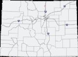
State Highway 1 is a state highway
in the U.S. state
of Colorado
. Approximately 10 miles (16.1 km) long, it is located in northeastern Larimer County
and runs between U.S. Highway 287 and State Highway 14
just north of the city line of Fort Collins
, northeast of Interstate 25 at Wellington
.
, between Fort Collins and Wellington
. It furnishes the principal road connection between those two communities and passes through a primarily suburban region north of Fort Collins, along the east side of Terry Lake, where it is becomes Terry Lake Drive. Northward, it passes south of Waverly
and south of the WWV radio towers, which are visible from the road. In Wellington, it becomes Cleveland Avenue, a readily used road in that town. Although the area running aside the road was traditionally agricultural
, it has been the site of rapid housing growth in recent years, particularly near Wellington
.
from New Mexico to Interstate 25
, where it continued north along US 85 to Denver, and began as various roads throughout the city that merged. It then paralleled the current route of U.S. Route 287
towards Fort Collins
, then along its current route from Fort Collins
to Wellington
. From Wellington
, it followed various roads back to the current I-25, where it continued north and terminated at the Wyoming border. By 1938, the entire route was paved as part of a major project. In 1954, a section north of Fort Collins
was removed, leaving only the portion south of the that point. In 1957, the portion north of Fort Collins
was returned to the route. However, the entire portion from Fort Collins
to the New Mexico
border was closed in 1968. Since then, the routing has not significantly changed.
State highway
State highway, state road or state route can refer to one of three related concepts, two of them related to a state or provincial government in a country that is divided into states or provinces :#A...
in the U.S. state
U.S. state
A U.S. state is any one of the 50 federated states of the United States of America that share sovereignty with the federal government. Because of this shared sovereignty, an American is a citizen both of the federal entity and of his or her state of domicile. Four states use the official title of...
of Colorado
Colorado
Colorado is a U.S. state that encompasses much of the Rocky Mountains as well as the northeastern portion of the Colorado Plateau and the western edge of the Great Plains...
. Approximately 10 miles (16.1 km) long, it is located in northeastern Larimer County
Larimer County, Colorado
Larimer County is the seventh most populous and the ninth most extensive of the 64 counties of the State of Colorado of the United States. The county is located at the northern end of the Front Range, at the edge of the Colorado Eastern Plains along the border with Wyoming...
and runs between U.S. Highway 287 and State Highway 14
Colorado State Highway 14
State Highway 14 in the U.S. state of Colorado is an east–west state highway approximately long. One of the longest state highways in Colorado, it traverses four counties along the northern edge of the state, spanning a geography from the continental divide in the Rocky Mountains to the...
just north of the city line of Fort Collins
Fort Collins, Colorado
Fort Collins is a Home Rule Municipality situated on the Cache La Poudre River along the Colorado Front Range, and is the county seat and most populous city of Larimer County, Colorado, United States. Fort Collins is located north of the Colorado State Capitol in Denver. With a 2010 census...
, northeast of Interstate 25 at Wellington
Wellington, Colorado
Wellington is a Statutory Town in Larimer County, Colorado, United States. The population was 6,289 at the 2010 census.-Geography:Wellington is located at ....
.
Route
The road passes through an area of Colorado PiedmontColorado Piedmont
The Colorado Piedmont is the geologic term for an area along the base of the foothills of the Front Range in north central Colorado in the United States...
, between Fort Collins and Wellington
Wellington, Colorado
Wellington is a Statutory Town in Larimer County, Colorado, United States. The population was 6,289 at the 2010 census.-Geography:Wellington is located at ....
. It furnishes the principal road connection between those two communities and passes through a primarily suburban region north of Fort Collins, along the east side of Terry Lake, where it is becomes Terry Lake Drive. Northward, it passes south of Waverly
Waverly, Colorado
Waverly is a small unincorporated community in rural eastern Larimer County, Colorado, United States. It is primarily an agricultural community, consisting of a group of houses along County Road 15 surrounded by ranchlands north of Fort Collins and west of Wellington...
and south of the WWV radio towers, which are visible from the road. In Wellington, it becomes Cleveland Avenue, a readily used road in that town. Although the area running aside the road was traditionally agricultural
Agriculture
Agriculture is the cultivation of animals, plants, fungi and other life forms for food, fiber, and other products used to sustain life. Agriculture was the key implement in the rise of sedentary human civilization, whereby farming of domesticated species created food surpluses that nurtured the...
, it has been the site of rapid housing growth in recent years, particularly near Wellington
Wellington, Colorado
Wellington is a Statutory Town in Larimer County, Colorado, United States. The population was 6,289 at the 2010 census.-Geography:Wellington is located at ....
.
History
The route was numbered in the 1920s. During that time, it followed U.S. Route 85U.S. Route 85
U.S. Route 85 is a north–south United States highway that runs for in the Mountain - Northern Plains states of the United States. The southern terminus of the route is at the United States-Mexico border in El Paso, Texas, connecting with Mexican Federal Highway 45...
from New Mexico to Interstate 25
Interstate 25
Interstate 25 is an Interstate Highway in the western United States. It is primarily a north–south highway. I-25 stretches from Interstate 10 at Las Cruces, New Mexico, , to Interstate 90 in Buffalo, Wyoming, .Interstate 25 is the main north–south expressway through...
, where it continued north along US 85 to Denver, and began as various roads throughout the city that merged. It then paralleled the current route of U.S. Route 287
U.S. Route 287
U.S. Route 287 is a north–south United States highway. It is long. It serves as the major truck route between the Texas cities of Fort Worth and Amarillo...
towards Fort Collins
Fort Collins, Colorado
Fort Collins is a Home Rule Municipality situated on the Cache La Poudre River along the Colorado Front Range, and is the county seat and most populous city of Larimer County, Colorado, United States. Fort Collins is located north of the Colorado State Capitol in Denver. With a 2010 census...
, then along its current route from Fort Collins
Fort Collins, Colorado
Fort Collins is a Home Rule Municipality situated on the Cache La Poudre River along the Colorado Front Range, and is the county seat and most populous city of Larimer County, Colorado, United States. Fort Collins is located north of the Colorado State Capitol in Denver. With a 2010 census...
to Wellington
Wellington, Colorado
Wellington is a Statutory Town in Larimer County, Colorado, United States. The population was 6,289 at the 2010 census.-Geography:Wellington is located at ....
. From Wellington
Wellington, Colorado
Wellington is a Statutory Town in Larimer County, Colorado, United States. The population was 6,289 at the 2010 census.-Geography:Wellington is located at ....
, it followed various roads back to the current I-25, where it continued north and terminated at the Wyoming border. By 1938, the entire route was paved as part of a major project. In 1954, a section north of Fort Collins
Fort Collins, Colorado
Fort Collins is a Home Rule Municipality situated on the Cache La Poudre River along the Colorado Front Range, and is the county seat and most populous city of Larimer County, Colorado, United States. Fort Collins is located north of the Colorado State Capitol in Denver. With a 2010 census...
was removed, leaving only the portion south of the that point. In 1957, the portion north of Fort Collins
Fort Collins, Colorado
Fort Collins is a Home Rule Municipality situated on the Cache La Poudre River along the Colorado Front Range, and is the county seat and most populous city of Larimer County, Colorado, United States. Fort Collins is located north of the Colorado State Capitol in Denver. With a 2010 census...
was returned to the route. However, the entire portion from Fort Collins
Fort Collins, Colorado
Fort Collins is a Home Rule Municipality situated on the Cache La Poudre River along the Colorado Front Range, and is the county seat and most populous city of Larimer County, Colorado, United States. Fort Collins is located north of the Colorado State Capitol in Denver. With a 2010 census...
to the New Mexico
New Mexico
New Mexico is a state located in the southwest and western regions of the United States. New Mexico is also usually considered one of the Mountain States. With a population density of 16 per square mile, New Mexico is the sixth-most sparsely inhabited U.S...
border was closed in 1968. Since then, the routing has not significantly changed.