
Illinois Route 26
Encyclopedia
Illinois Route 26 is a north–south state road in central and north-central Illinois
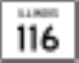
. It runs from Illinois Route 116
just north of East Peoria
to Highway 69
at the Wisconsin
border near Orangeville
. This is a distance of 139.35 miles (224.26 km).
and U.S. Route 150
into Peoria
.
Illinois 26 mostly follows the east bank of the Illinois River
until it crosses the river at Hennepin
. It runs concurrent
with Illinois Route 29
, its Illinois River west bank counterpart, at Bureau and with U.S. Route 52
near Freeport.
!County
!Location
!Mile
!Junction
!Notes
|-
|Tazewell
|
|
|
|
|-
|Woodford
|colspan=4 align=center|No major intersections
|-
|rowspan=2|Marshall
|Lacon
|
|
|
|-
|
|bgcolor=#ddffdd|
|bgcolor=#ddffdd|
|bgcolor=#ddffdd|South end of IL 18 overlap
|-
|rowspan=2|Putnam
|
|bgcolor=#ddffdd|
|bgcolor=#ddffdd|
|bgcolor=#ddffdd|North end of IL 18 overlap
|-
|Hennepin
|bgcolor=#ddffdd|
|bgcolor=#ddffdd|
|bgcolor=#ddffdd|South end of I-180/IL 71 overlap (I-180 ends at this intersection)
|-
|colspan=2 align=center|Illinois River
|colspan=3 align=center|Gudmund "Sonny" Jessen Bridge
|-
|rowspan=9|Bureau
|
|bgcolor=#ddffdd|
|bgcolor=#ddffdd|
|bgcolor=#ddffdd|North end of I-180/IL 71 overlap; northbound exit and southbound entrance
|-
|
|bgcolor=#ddffdd|
|bgcolor=#ddffdd|
|bgcolor=#ddffdd|South end of IL 29 overlap
|-
|Bureau
|bgcolor=#ddffdd|
|bgcolor=#ddffdd|
|bgcolor=#ddffdd|North end of IL 29 overlap
|-
|
|
|
|
|-
|rowspan=4|Princeton
|bgcolor=#ddffdd|
|bgcolor=#ddffdd|
|bgcolor=#ddffdd|South end of US 6 overlap
|-
|bgcolor=#ddffdd|
|bgcolor=#ddffdd|
|bgcolor=#ddffdd|South end of US 34 overlap; north end of US 6 overlap
|-
|bgcolor=#ddffdd|
|bgcolor=#ddffdd|
|bgcolor=#ddffdd|North end of US 34 overlap
|-
|
|
|
|-
|Ohio
|
|
|
|-
|rowspan=5|Lee
|
|
|
|
|-
|rowspan=4|Dixon
|
|
|
|-
|bgcolor=#ddffdd|
|bgcolor=#ddffdd|
|bgcolor=#ddffdd|South end of US 52 overlap; Lincoln Highway
|-
|bgcolor=#ddffdd|
|bgcolor=#ddffdd|
|bgcolor=#ddffdd|South end of IL 2 overlap
|-
|bgcolor=#ddffdd|
|bgcolor=#ddffdd|
|bgcolor=#ddffdd|North end of IL 2 overlap; Lincoln Highway
|-
|rowspan=5|Ogle
|
|bgcolor=#ddffdd|
|bgcolor=#ddffdd|
|bgcolor=#ddffdd|North end of US 52 overlap
|-
|
|bgcolor=#ddffdd|
|bgcolor=#ddffdd|
|bgcolor=#ddffdd|South end of IL 64 overlap
|-
|
|bgcolor=#ddffdd|
|bgcolor=#ddffdd|
|bgcolor=#ddffdd|North end of IL 64 overlap
|-
|Forreston
|bgcolor=#ddffdd|
|bgcolor=#ddffdd|
|bgcolor=#ddffdd|South end of IL 72 overlap
|-
|
|bgcolor=#ddffdd|
|bgcolor=#ddffdd|
|bgcolor=#ddffdd|North end of IL 72 overlap
|-
|rowspan=3|Stephenson
|rowspan=3|Freeport
|
|
|
|-
|
|
|
|-
|
|
|
|-
|Green
|
|
|
|Wisconsin State Line
|-
Illinois
Illinois is the fifth-most populous state of the United States of America, and is often noted for being a microcosm of the entire country. With Chicago in the northeast, small industrial cities and great agricultural productivity in central and northern Illinois, and natural resources like coal,...
. It runs from Illinois Route 116
Illinois Route 116
Illinois Route 116 is a cross-state rural state highway that runs from U.S. Route 34 by Gladstone east to the intersection of U.S. Route 45 and Old U.S. Route 45, on the north side of Ashkum...
just north of East Peoria
East Peoria, Illinois
East Peoria is a city in Tazewell County, Illinois, United States. The population was 23,402 at the 2010 census. East Peoria is part of the Peoria, Illinois Metropolitan Statistical Area, located across the Illinois River from downtown Peoria. It is home to many Caterpillar Inc. facilities...
to Highway 69
Highway 69 (Wisconsin)
State Trunk Highway 69 is a state highway in the U.S. state of Wisconsin. It runs north–south in south central, Wisconsin from Verona to the Illinois border near Monroe....
at the Wisconsin
Wisconsin
Wisconsin is a U.S. state located in the north-central United States and is part of the Midwest. It is bordered by Minnesota to the west, Iowa to the southwest, Illinois to the south, Lake Michigan to the east, Michigan to the northeast, and Lake Superior to the north. Wisconsin's capital is...
border near Orangeville
Orangeville, Illinois
Orangeville is a village in Stephenson County, Illinois, United States. The population was 793 at the 2010 census, up from 751 at the 2000 census. The area's earliest white settlers arrived in 1833 and the village was platted in 1851 by John Bower, who is considered the village founder. In 1867...
. This is a distance of 139.35 miles (224.26 km).
Route description
Illinois 26 is a two-lane, undivided surface road for the majority of its length. Its southern terminus is just one mile (1.6 km) north of the McClugage Bridge carrying U.S. Route 24U.S. Route 24
U.S. Route 24 is one of the original United States highways of 1926. It originally ran from Pontiac, Michigan, in the east to Kansas City, Missouri, in the west. Today, the highway's eastern terminus is west of Clarkston, Michigan, at an intersection with I-75 and its western terminus is near...
and U.S. Route 150
U.S. Route 150
U.S. Route 150 is a 571 mile long northwest-southeast United States highway, signed as east–west. It runs from U.S. Route 6 outside of Moline, Illinois to U.S. Route 25 in Mount Vernon, Kentucky .-Illinois:In the state of Illinois, U.S. 150 runs from the Quad City International Airport at U.S...
into Peoria
Peoria, Illinois
Peoria is the largest city on the Illinois River and the county seat of Peoria County, Illinois, in the United States. It is named after the Peoria tribe. As of the 2010 census, the city was the seventh-most populated in Illinois, with a population of 115,007, and is the third-most populated...
.
Illinois 26 mostly follows the east bank of the Illinois River
Illinois River
The Illinois River is a principal tributary of the Mississippi River, approximately long, in the State of Illinois. The river drains a large section of central Illinois, with a drainage basin of . This river was important among Native Americans and early French traders as the principal water route...
until it crosses the river at Hennepin
Hennepin, Illinois
Hennepin is a village on the Illinois River in Putnam County, Illinois, United States. The population was 707 at the 2000 census. It is the county seat of Putnam County.Hennepin is part of the Ottawa–Streator Micropolitan Statistical Area.-Geography:...
. It runs concurrent
Concurrency (road)
A concurrency, overlap, or coincidence in a road network is an instance of one physical road bearing two or more different highway, motorway, or other route numbers...
with Illinois Route 29
Illinois Route 29
Illinois Route 29 is a two to four lane state road that runs south from U.S. Route 6/Illinois Route 89 at Spring Valley to U.S. Route 51/Illinois Route 16 at Pana, running through Pekin, Peoria and Springfield. The nearest major north–south highway, Interstate 39, runs parallel to Illinois...
, its Illinois River west bank counterpart, at Bureau and with U.S. Route 52
U.S. Route 52
U.S. Route 52 is a United States highway that runs across the northern, eastern and southeastern regions of the United States. Contrary to most other even-numbered U.S...
near Freeport.
Major intersections
{| class=wikitable!County
!Location
!Mile
!Junction
!Notes
|-
|Tazewell
Tazewell County, Illinois
Tazewell County is a county located in the U.S. state of Illinois. According to the 2010 census, it has a population of 135,394, which is an increase of 5.4% from 128,485 in 2000. Its county seat and largest city is Pekin. The majority of the population live in the suburbs and bedroom communities...
|
|
|
|
|-
|Woodford
|colspan=4 align=center|No major intersections
|-
|rowspan=2|Marshall
Marshall County, Illinois
The median income for a household in the county was $41,576, and the median income for a family was $48,061. Males had a median income of $35,765 versus $21,452 for females. The per capita income for the county was $19,065...
|Lacon
Lacon, Illinois
Lacon is a city in, and the county seat of, Marshall County, Illinois, United States. It is part of the Peoria, Illinois Metropolitan Statistical Area. The population was 1,979 at the 2000 census.-Geography:Lacon is located at ....
|
|
|
|-
|
|bgcolor=#ddffdd|
|bgcolor=#ddffdd|
|bgcolor=#ddffdd|South end of IL 18 overlap
|-
|rowspan=2|Putnam
|
|bgcolor=#ddffdd|
|bgcolor=#ddffdd|
|bgcolor=#ddffdd|North end of IL 18 overlap
|-
|Hennepin
Hennepin, Illinois
Hennepin is a village on the Illinois River in Putnam County, Illinois, United States. The population was 707 at the 2000 census. It is the county seat of Putnam County.Hennepin is part of the Ottawa–Streator Micropolitan Statistical Area.-Geography:...
|bgcolor=#ddffdd|
|bgcolor=#ddffdd|
|bgcolor=#ddffdd|South end of I-180/IL 71 overlap (I-180 ends at this intersection)
|-
|colspan=2 align=center|Illinois River
Illinois River
The Illinois River is a principal tributary of the Mississippi River, approximately long, in the State of Illinois. The river drains a large section of central Illinois, with a drainage basin of . This river was important among Native Americans and early French traders as the principal water route...
|colspan=3 align=center|Gudmund "Sonny" Jessen Bridge
|-
|rowspan=9|Bureau
Bureau County, Illinois
Bureau County is a county located in the U.S. state of Illinois. According to the 2010 census, it has a population of 34,978, which is a decrease of 1.5% from 35,503 in 2000. Its county seat is Princeton. Bureau County is part of the Ottawa–Streator Micropolitan Statistical Area...
|
|bgcolor=#ddffdd|
|bgcolor=#ddffdd|
|bgcolor=#ddffdd|North end of I-180/IL 71 overlap; northbound exit and southbound entrance
|-
|
|bgcolor=#ddffdd|
|bgcolor=#ddffdd|
|bgcolor=#ddffdd|South end of IL 29 overlap
|-
|Bureau
|bgcolor=#ddffdd|
|bgcolor=#ddffdd|
|bgcolor=#ddffdd|North end of IL 29 overlap
|-
|
|
|
|
|-
|rowspan=4|Princeton
Princeton, Illinois
Princeton is a city in Bureau County, Illinois, United States. The population was 7,501 at the 2000 census. It is the county seat of Bureau County.Princeton is part of the Ottawa–Streator Micropolitan Statistical Area.-History:...
|bgcolor=#ddffdd|
|bgcolor=#ddffdd|
|bgcolor=#ddffdd|South end of US 6 overlap
|-
|bgcolor=#ddffdd|
|bgcolor=#ddffdd|
|bgcolor=#ddffdd|South end of US 34 overlap; north end of US 6 overlap
|-
|bgcolor=#ddffdd|
|bgcolor=#ddffdd|
|bgcolor=#ddffdd|North end of US 34 overlap
|-
|
|
|
|-
|Ohio
Ohio, Illinois
Ohio is a village in Bureau County, Illinois, United States. The population was 540 at the 2000 census. It is part of the Ottawa–Streator Micropolitan Statistical Area.-Geography:Ohio is located at ....
|
|
|
|-
|rowspan=5|Lee
|
|
|
|
|-
|rowspan=4|Dixon
Dixon, Illinois
Dixon is a city in Lee County, Illinois, United States. The population was 15,733 as of the 2010 census, down from 15,941 at the 2000 census. Named for its founder, John Dixon , it is the county seat of Lee County. Located on the Rock River, Dixon was the boyhood home of former U.S...
|
|
|
|-
|bgcolor=#ddffdd|
|bgcolor=#ddffdd|
|bgcolor=#ddffdd|South end of US 52 overlap; Lincoln Highway
|-
|bgcolor=#ddffdd|
|bgcolor=#ddffdd|
|bgcolor=#ddffdd|South end of IL 2 overlap
|-
|bgcolor=#ddffdd|
|bgcolor=#ddffdd|
|bgcolor=#ddffdd|North end of IL 2 overlap; Lincoln Highway
|-
|rowspan=5|Ogle
Ogle County, Illinois
Ogle County is a county located in the U.S. state of Illinois. According to the 2010 census, it has a population of 53,497, which is an increase of 4.8% from 51,032 in 2000. Its county seat is Oregon, and its largest city is Rochelle...
|
|bgcolor=#ddffdd|
|bgcolor=#ddffdd|
|bgcolor=#ddffdd|North end of US 52 overlap
|-
|
|bgcolor=#ddffdd|
|bgcolor=#ddffdd|
|bgcolor=#ddffdd|South end of IL 64 overlap
|-
|
|bgcolor=#ddffdd|
|bgcolor=#ddffdd|
|bgcolor=#ddffdd|North end of IL 64 overlap
|-
|Forreston
Forreston, Illinois
Forreston is a village in Ogle County, Illinois, United States. The population was 1,446 at the 2010 census, down from 1,469 at the 2000 census.-Geography:Forreston is located at ....
|bgcolor=#ddffdd|
|bgcolor=#ddffdd|
|bgcolor=#ddffdd|South end of IL 72 overlap
|-
|
|bgcolor=#ddffdd|
|bgcolor=#ddffdd|
|bgcolor=#ddffdd|North end of IL 72 overlap
|-
|rowspan=3|Stephenson
Stephenson County, Illinois
As of the census of 2000, there were 48,979 people, 19,785 households, and 13,473 families residing in the county. The population density was 87 people per square mile . There were 21,713 housing units at an average density of 38 per square mile...
|rowspan=3|Freeport
Freeport, Illinois
Freeport is a city in and the county seat of Stephenson County, Illinois, United States. The population was 26,443 at the 2000 census. The mayor of Freeport is George W...
|
|
|
|-
|
|
|
|-
|
|
|
|-
|Green
Green County, Wisconsin
Green County is a county located in the U.S. state of Wisconsin. As of 2000, the population was 33,647. Its county seat is Monroe.-Geography:According to the U.S...
|
|
|
|Wisconsin State Line
|-