
.gif)
Hurricane Ava (1973)
Encyclopedia
Hurricane Ava was one of the strongest tropical cyclones ever recorded in the northeastern Pacific Ocean
. It was the first named storm of the 1973 Pacific hurricane season
. Forming in early June, Hurricane Ava eventually reached Category 5 intensity on the Saffir-Simpson Hurricane Scale
, the first Pacific hurricane
to do so in June and the earliest ever in a season. Its central pressure
made it the most intense known Pacific hurricane at the time. Despite its intensity, Hurricane Ava stayed at sea without significant impact.
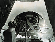
Ava was given the most advanced measurement and reconnaissance available at the time. Recon flights were conducted and meteorological equipment was tested. The hurricane was also photographed from space by satellites and Skylab
astronauts.
. Ava then slowly moved westwards away from Mexico and became a hurricane on June 3. Ava became a major hurricane on the afternoon of June 5. The next day, a United States Air Force
recon flight measured a wind speed of 150 mph (250 km/h) and a central pressure
of 915 mbar (27 inHg). These measurements made Hurricane Ava by far the most intense storm of the season.
At its peak, Hurricane Ava had winds of 160 mph (260 km/h). These winds made it a Category 5 on the Saffir-Simpson Hurricane Scale
, the highest possible category and the first Category 5 since the 1959 season. Ava was also a hurricane with windspeeds rapidly increasing the closer to the eye
they were measured. Over a distance of 4 miles (6.5 km), wind speeds increased from 70 mph (110 km/h) to 158 mph (255 km/h), and they increased from 105 (165 m/h) to 158 mph (255 km/h) over half that distance. The reading of 915 mbar (27 inHg) was roughly 100 mbar (3 inHg) lower than the ambient environment far from the storm.
After its peak, Hurricane Ava started weakening on June 7 as it continued its westward path. Its winds were 140 mph (220 km/h) on June 7 and 115 mph (185 km/h) on the next day. It was no longer a major hurricane after its winds fell to 105 mph (165 km/h) on June 9. Later that day it weakened to a tropical storm. Tropical Storm Ava became Tropical Depression Ava on June 11. The system then turned north and dissipated on June 12. Its remnants then became embedded in the trade winds as a tropical wave
.
 In terms of how well it was forecast
, Ava had the largest error of any cyclone during the season. This 14° error five days out was mainly due to its northward turn when it was a weakening depression.
For a few days, Ava was directly underneath Skylab
during its first manned mission
. Astronauts acquired photographs of the hurricane, which was big enough for Science Pilot Joseph Kerwin to describe it as "an enormous spiral" that was big enough to dominate the view outside the space station's window and prevent anything else from being seen. Astronauts also provided microwave data through Earth Resources Experiment Package sensors. Skylab also used a scatterometer
on the system. Unfortunately, Skylab's scatterometer data was harder to use than normal as it was degraded
.
Ava was also underneath the NOAA-2 and Nimbus 5
weather satellite
s. NOAA-2 provided photographs that were used to estimate Ava's maximum windspeeds. Satellite images were useful throughout the cyclone's existence, as did the wind reports of three ships when Ava was a young tropical storm. Nimbus 5
carried an Electrically Scanning Microwave Radiometer
and Temperature-Humidity Infrared Radiometer. Both were used to study Ava. The main data provided by the THIR was data indicating cloud temperatures. The ESMR's main data was on rain
fall rates, densities, and distributions. The observations also provided confirmation that clouds that are not vertically developed very much can produce tropical rainfall.
Recon aircraft also penetrated Hurricane Ava. It was the first Pacific hurricane
penetrated by National Oceanographic and Atmospheric Administration aircraft, but not by aircraft from other agencies. NOAA craft were laden with sensors and measured wave heights reaching 40 ft (12.2 m) with a microwave radar
system and a laser altimeter
. That was the first time ever that sea conditions in a tropical cyclone had been measured that way. United States Air Force
planes measured central pressure, air temperature, and humidity in the eye
pressures using dropsonde
s. The collection of data from both space and the air was done in order to allow comparisons. Collectively, all of this measuring made Hurricane Ava the best-measured northeastern Pacific tropical cyclone
at the time.
-force to three ships called the Joseph Lykes, Hoegh Trotter, and Volnay. In addition, large ocean waves churned up by Ava created hazardous surf and strong riptides at Southern California beaches on June 9 and June 10. Those waves reached heights of up to 9 ft (2.7 m) at Newport Beach
, 6 ft (1.8 m) at Long Beach
, and 8 ft (2.4 m) at Seal Beach
. Those waves made beaches more hazardous, resulting in double-to-triple the usual contingent of lifeguard
s throughout Southern California beaches. At Seal Beach and Newport Beach, lifeguards made 35 and 75 rescues, respectively. Ava's name was not retired after this season, and was used again in the 1977 season
. Pacific hurricane name lists were changed in 1978, and the name Ava was not included.
When it was active, Hurricane Ava set many records. Several have since been broken, but Ava still holds a few. Ava ceased being a Category 5 hurricane on June 7, 1973. 1994's Emilia
reached Category 5 intensity on July 19, 1994. This span of 7712 days, which Ava began and Emilia ended, is the longest time between successive Category 5 hurricanes in the northeastern Pacific, and anywhere worldwide, in recorded history. When Hurricane Gilma reached Category 5 strength on July 24 also in 1994, it marked the shortest gap between Category 5 pacific hurricanes recorded. Ava was also a Category 5 hurricane for exactly 24 hours. That was a record at the time. Hurricane John
broke that in the 1994 season
, and hurricanes Linda and Ioke also lasted longer, tied with John. In addition, Ava is the strongest June tropical cyclone in the western hemisphere north of the equator. It is also the earliest Category 5 in the eastern north Pacific basin and the first of two in June, with Hurricane Celia
of 2010 recently joining Ava.
A spokesperson from the American National Weather Service
was quoted as saying that, "Ava had sustained winds of about 180 knots with some gusts at 200 knots when she [sic] was peaking". Both the official HURDAT "Best track" data file and the seasonal summary in the Monthly Weather Review
contradict that report and give maximum winds of 140 knots. If Ava's winds were that high, they would one of the highest ever reported in a tropical cyclone anywhere. Like any report of winds that high it is suspect.
At the time, Hurricane Ava's minimum known pressure of 915 mbar (27 inHg) was the lowest known in its basin, making Ava the most intense Pacific hurricane
. Ava is now the fourth most intense, as Hurricanes Linda
, Rick and Kenna
recorded lower pressures. However, Linda's and Rick's pressures were only estimated from satellite imagery, so Ava held the record for lowest measured pressure until Kenna tied it. However, the meteorological record for the eastern north Pacific is unreliable because geostationary satellite observation did not begin until 1966. Ava's pressure record is itself incomplete; Ava was only a Category 4 when its 915 mbar (27 inHg) pressure was measured, and the only reading when it was a Category 5 is 928 mbar (27.4 inHg). These two factors mean that Ava's lowest pressure may be below 915 mbar (27 inHg), and that there may be other cyclones stronger than Ava.
Pacific Ocean
The Pacific Ocean is the largest of the Earth's oceanic divisions. It extends from the Arctic in the north to the Southern Ocean in the south, bounded by Asia and Australia in the west, and the Americas in the east.At 165.2 million square kilometres in area, this largest division of the World...
. It was the first named storm of the 1973 Pacific hurricane season
1973 Pacific hurricane season
The 1973 Pacific hurricane season was an event in tropical cyclone meteorology. The most important system this year was Hurricane Ava, which was the most intense Pacific hurricane known at the time. Several other much weaker tropical cyclones came close to, or made landfall on, the Pacific coast of...
. Forming in early June, Hurricane Ava eventually reached Category 5 intensity on the Saffir-Simpson Hurricane Scale
Saffir-Simpson Hurricane Scale
The Saffir–Simpson Hurricane Scale , or the Saffir–Simpson Hurricane Wind Scale , classifies hurricanes — Western Hemisphere tropical cyclones that exceed the intensities of tropical depressions and tropical storms — into five categories distinguished by the intensities of their sustained winds...
, the first Pacific hurricane
Pacific hurricane
A Pacific hurricane or tropical storm is a tropical cyclone that develops in the northeastern part of the Pacific Ocean. For organizational purposes, the northern Pacific Ocean is divided into three regions: the eastern, , central , and western...
to do so in June and the earliest ever in a season. Its central pressure
Atmospheric pressure
Atmospheric pressure is the force per unit area exerted into a surface by the weight of air above that surface in the atmosphere of Earth . In most circumstances atmospheric pressure is closely approximated by the hydrostatic pressure caused by the weight of air above the measurement point...
made it the most intense known Pacific hurricane at the time. Despite its intensity, Hurricane Ava stayed at sea without significant impact.
Ava was given the most advanced measurement and reconnaissance available at the time. Recon flights were conducted and meteorological equipment was tested. The hurricane was also photographed from space by satellites and Skylab
Skylab
Skylab was a space station launched and operated by NASA, the space agency of the United States. Skylab orbited the Earth from 1973 to 1979, and included a workshop, a solar observatory, and other systems. It was launched unmanned by a modified Saturn V rocket, with a mass of...
astronauts.
Meteorological history
On June 2, 1973, a tropical depression formed about 250 miles (402.3 km) south of Salina Cruz, Oaxaca. It started out nearly stationary, and became a tropical storm late on the same day it formed, the first named storm of the 1973 Pacific hurricane season1973 Pacific hurricane season
The 1973 Pacific hurricane season was an event in tropical cyclone meteorology. The most important system this year was Hurricane Ava, which was the most intense Pacific hurricane known at the time. Several other much weaker tropical cyclones came close to, or made landfall on, the Pacific coast of...
. Ava then slowly moved westwards away from Mexico and became a hurricane on June 3. Ava became a major hurricane on the afternoon of June 5. The next day, a United States Air Force
United States Air Force
The United States Air Force is the aerial warfare service branch of the United States Armed Forces and one of the American uniformed services. Initially part of the United States Army, the USAF was formed as a separate branch of the military on September 18, 1947 under the National Security Act of...
recon flight measured a wind speed of 150 mph (250 km/h) and a central pressure
Atmospheric pressure
Atmospheric pressure is the force per unit area exerted into a surface by the weight of air above that surface in the atmosphere of Earth . In most circumstances atmospheric pressure is closely approximated by the hydrostatic pressure caused by the weight of air above the measurement point...
of 915 mbar (27 inHg). These measurements made Hurricane Ava by far the most intense storm of the season.
At its peak, Hurricane Ava had winds of 160 mph (260 km/h). These winds made it a Category 5 on the Saffir-Simpson Hurricane Scale
Saffir-Simpson Hurricane Scale
The Saffir–Simpson Hurricane Scale , or the Saffir–Simpson Hurricane Wind Scale , classifies hurricanes — Western Hemisphere tropical cyclones that exceed the intensities of tropical depressions and tropical storms — into five categories distinguished by the intensities of their sustained winds...
, the highest possible category and the first Category 5 since the 1959 season. Ava was also a hurricane with windspeeds rapidly increasing the closer to the eye
Eye (cyclone)
The eye is a region of mostly calm weather found at the center of strong tropical cyclones. The eye of a storm is a roughly circular area and typically 30–65 km in diameter. It is surrounded by the eyewall, a ring of towering thunderstorms where the second most severe weather of a cyclone...
they were measured. Over a distance of 4 miles (6.5 km), wind speeds increased from 70 mph (110 km/h) to 158 mph (255 km/h), and they increased from 105 (165 m/h) to 158 mph (255 km/h) over half that distance. The reading of 915 mbar (27 inHg) was roughly 100 mbar (3 inHg) lower than the ambient environment far from the storm.
After its peak, Hurricane Ava started weakening on June 7 as it continued its westward path. Its winds were 140 mph (220 km/h) on June 7 and 115 mph (185 km/h) on the next day. It was no longer a major hurricane after its winds fell to 105 mph (165 km/h) on June 9. Later that day it weakened to a tropical storm. Tropical Storm Ava became Tropical Depression Ava on June 11. The system then turned north and dissipated on June 12. Its remnants then became embedded in the trade winds as a tropical wave
Tropical wave
Tropical waves, easterly waves, or tropical easterly waves, also known as African easterly waves in the Atlantic region, are a type of atmospheric trough, an elongated area of relatively low air pressure, oriented north to south, which move from east to west across the tropics causing areas of...
.
Forecasting and observation
Tropical cyclone forecasting
Tropical cyclone forecasting is the science and art of forecasting where a tropical cyclone's center, and its effects, are expected to be at some point in the future. There are several elements to tropical cyclone forecasting: track forecasting, intensity forecasting, rainfall forecasting, storm...
, Ava had the largest error of any cyclone during the season. This 14° error five days out was mainly due to its northward turn when it was a weakening depression.
For a few days, Ava was directly underneath Skylab
Skylab
Skylab was a space station launched and operated by NASA, the space agency of the United States. Skylab orbited the Earth from 1973 to 1979, and included a workshop, a solar observatory, and other systems. It was launched unmanned by a modified Saturn V rocket, with a mass of...
during its first manned mission
Skylab 2
-Backup crew:-Support crew:*Robert L. Crippen*Richard H. Truly*Henry W. Hartsfield, Jr*William E. Thornton-Mission parameters:*Mass: 19,979 kg*Maximum Altitude: 440 km*Distance: 18,536,730.9 km...
. Astronauts acquired photographs of the hurricane, which was big enough for Science Pilot Joseph Kerwin to describe it as "an enormous spiral" that was big enough to dominate the view outside the space station's window and prevent anything else from being seen. Astronauts also provided microwave data through Earth Resources Experiment Package sensors. Skylab also used a scatterometer
Scatterometer
A radar scatterometer is designed to determine the normalized radar cross section of the surface. Scatterometers operate by transmitting a pulse of microwave energy towards the Earth's surface and measuring the reflected energy. A separate measurement of the noise-only power is made and...
on the system. Unfortunately, Skylab's scatterometer data was harder to use than normal as it was degraded
Degradation (telecommunications)
In telecommunication, degradation, which may be categorized as either "graceful" or "catastrophic", has the following meanings:#The deterioration in quality, level, or standard of performance of a functional unit....
.
Ava was also underneath the NOAA-2 and Nimbus 5
Nimbus program
The Nimbus satellites were second-generation U.S. robotic spacecraft used for meteorological research and development. The spacecraft were designed to serve as stabilized, Earth-oriented platforms for the testing of advanced systems to sense and collect atmospheric science data...
weather satellite
Weather satellite
The weather satellite is a type of satellite that is primarily used to monitor the weather and climate of the Earth. Satellites can be either polar orbiting, seeing the same swath of the Earth every 12 hours, or geostationary, hovering over the same spot on Earth by orbiting over the equator while...
s. NOAA-2 provided photographs that were used to estimate Ava's maximum windspeeds. Satellite images were useful throughout the cyclone's existence, as did the wind reports of three ships when Ava was a young tropical storm. Nimbus 5
Nimbus program
The Nimbus satellites were second-generation U.S. robotic spacecraft used for meteorological research and development. The spacecraft were designed to serve as stabilized, Earth-oriented platforms for the testing of advanced systems to sense and collect atmospheric science data...
carried an Electrically Scanning Microwave Radiometer
Radiometer
A radiometer is a device for measuring the radiant flux of electromagnetic radiation. Generally, the term radiometer denotes an infrared radiation detector, yet it also includes detectors operating on any electromagnetic wavelength....
and Temperature-Humidity Infrared Radiometer. Both were used to study Ava. The main data provided by the THIR was data indicating cloud temperatures. The ESMR's main data was on rain
Rain
Rain is liquid precipitation, as opposed to non-liquid kinds of precipitation such as snow, hail and sleet. Rain requires the presence of a thick layer of the atmosphere to have temperatures above the melting point of water near and above the Earth's surface...
fall rates, densities, and distributions. The observations also provided confirmation that clouds that are not vertically developed very much can produce tropical rainfall.
Recon aircraft also penetrated Hurricane Ava. It was the first Pacific hurricane
Pacific hurricane
A Pacific hurricane or tropical storm is a tropical cyclone that develops in the northeastern part of the Pacific Ocean. For organizational purposes, the northern Pacific Ocean is divided into three regions: the eastern, , central , and western...
penetrated by National Oceanographic and Atmospheric Administration aircraft, but not by aircraft from other agencies. NOAA craft were laden with sensors and measured wave heights reaching 40 ft (12.2 m) with a microwave radar
Radar
Radar is an object-detection system which uses radio waves to determine the range, altitude, direction, or speed of objects. It can be used to detect aircraft, ships, spacecraft, guided missiles, motor vehicles, weather formations, and terrain. The radar dish or antenna transmits pulses of radio...
system and a laser altimeter
Altimeter
An altimeter is an instrument used to measure the altitude of an object above a fixed level. The measurement of altitude is called altimetry, which is related to the term bathymetry, the measurement of depth underwater.-Pressure altimeter:...
. That was the first time ever that sea conditions in a tropical cyclone had been measured that way. United States Air Force
United States Air Force
The United States Air Force is the aerial warfare service branch of the United States Armed Forces and one of the American uniformed services. Initially part of the United States Army, the USAF was formed as a separate branch of the military on September 18, 1947 under the National Security Act of...
planes measured central pressure, air temperature, and humidity in the eye
Eye (cyclone)
The eye is a region of mostly calm weather found at the center of strong tropical cyclones. The eye of a storm is a roughly circular area and typically 30–65 km in diameter. It is surrounded by the eyewall, a ring of towering thunderstorms where the second most severe weather of a cyclone...
pressures using dropsonde
Dropsonde
A dropsonde is a weather reconnaissance device created by the National Center for Atmospheric Research , designed to be dropped from an aircraft at altitude to more accurately measure tropical storm conditions as the device falls to the surface...
s. The collection of data from both space and the air was done in order to allow comparisons. Collectively, all of this measuring made Hurricane Ava the best-measured northeastern Pacific tropical cyclone
Tropical cyclone
A tropical cyclone is a storm system characterized by a large low-pressure center and numerous thunderstorms that produce strong winds and heavy rain. Tropical cyclones strengthen when water evaporated from the ocean is released as the saturated air rises, resulting in condensation of water vapor...
at the time.
Impact and records
Hurricane Ava stayed at sea. Consequently, no one was killed and there was no reported damage. However, when it was a recently-named tropical storm, Ava did cause sustained winds below galeGale
A gale is a very strong wind. There are conflicting definitions of how strong a wind must be to be considered a gale. The U.S. government's National Weather Service defines a gale as 34–47 knots of sustained surface winds. Forecasters typically issue gale warnings when winds of this strength are...
-force to three ships called the Joseph Lykes, Hoegh Trotter, and Volnay. In addition, large ocean waves churned up by Ava created hazardous surf and strong riptides at Southern California beaches on June 9 and June 10. Those waves reached heights of up to 9 ft (2.7 m) at Newport Beach
Newport Beach, California
Newport Beach, incorporated in 1906, is a city in Orange County, California, south of downtown Santa Ana. The population was 85,186 at the 2010 census.The city's median family income and property values consistently place high in national rankings...
, 6 ft (1.8 m) at Long Beach
Long Beach, California
Long Beach is a city situated in Los Angeles County in Southern California, on the Pacific coast of the United States. The city is the 36th-largest city in the nation and the seventh-largest in California. As of 2010, its population was 462,257...
, and 8 ft (2.4 m) at Seal Beach
Seal Beach, California
-Neighborhoods:Seal Beach encompasses the Leisure World retirement gated community with roughly 9,000 residents. This was the first major planned retirement community of its type in the U.S...
. Those waves made beaches more hazardous, resulting in double-to-triple the usual contingent of lifeguard
Lifeguard
A lifeguard supervises the safety and rescue of swimmers, surfers, and other water sports participants such as in a swimming pool, water park, or beach. Lifeguards are strong swimmers and trained in first aid, certified in water rescue using a variety of aids and equipment depending on...
s throughout Southern California beaches. At Seal Beach and Newport Beach, lifeguards made 35 and 75 rescues, respectively. Ava's name was not retired after this season, and was used again in the 1977 season
1977 Pacific hurricane season
The 1977 Pacific hurricane season was, at the time, the least active in recorded history. Only eight tropical storms formed, and four hurricanes; they would be tied and surpassed, respectively, by the 2010 Pacific hurricane season. There were no major hurricanes; the next time this happened would...
. Pacific hurricane name lists were changed in 1978, and the name Ava was not included.
When it was active, Hurricane Ava set many records. Several have since been broken, but Ava still holds a few. Ava ceased being a Category 5 hurricane on June 7, 1973. 1994's Emilia
Hurricane Emilia (1994)
Hurricane Emilia was the fifth tropical cyclone, second Pacific hurricane, and the first major hurricane of the 1994 Pacific hurricane season. It was the third most intense tropical cyclone in the central Pacific Ocean, attaining a minimum central pressure of 926 mbar on July 19—only Gilma...
reached Category 5 intensity on July 19, 1994. This span of 7712 days, which Ava began and Emilia ended, is the longest time between successive Category 5 hurricanes in the northeastern Pacific, and anywhere worldwide, in recorded history. When Hurricane Gilma reached Category 5 strength on July 24 also in 1994, it marked the shortest gap between Category 5 pacific hurricanes recorded. Ava was also a Category 5 hurricane for exactly 24 hours. That was a record at the time. Hurricane John
Hurricane John (1994)
Hurricane John formed during the 1994 Pacific hurricane season and became both the longest-lasting and the farthest-traveling tropical cyclone ever observed...
broke that in the 1994 season
1994 Pacific hurricane season
The 1994 Pacific hurricane season officially started on May 15, 1994 in the eastern Pacific, and on June 1, 1994 in the central Pacific, and lasted until November 30, 1994. These dates conventionally delimit the period of each year when most tropical cyclones form in the northeastern Pacific Ocean...
, and hurricanes Linda and Ioke also lasted longer, tied with John. In addition, Ava is the strongest June tropical cyclone in the western hemisphere north of the equator. It is also the earliest Category 5 in the eastern north Pacific basin and the first of two in June, with Hurricane Celia
Hurricane Celia (2010)
Hurricane Celia was a powerful, early-season Category 5 tropical cyclone that existed over the open waters of the eastern Pacific Ocean during late June 2010...
of 2010 recently joining Ava.
A spokesperson from the American National Weather Service
National Weather Service
The National Weather Service , once known as the Weather Bureau, is one of the six scientific agencies that make up the National Oceanic and Atmospheric Administration of the United States government...
was quoted as saying that, "Ava had sustained winds of about 180 knots with some gusts at 200 knots when she [sic] was peaking". Both the official HURDAT "Best track" data file and the seasonal summary in the Monthly Weather Review
Monthly Weather Review
The Monthly Weather Review is a scientific journal published by the American Meteorological Society.Topics covered by the journal include research related to analysis and prediction of observed and modeled circulations of the atmosphere, including technique development, data assimilation, model...
contradict that report and give maximum winds of 140 knots. If Ava's winds were that high, they would one of the highest ever reported in a tropical cyclone anywhere. Like any report of winds that high it is suspect.
At the time, Hurricane Ava's minimum known pressure of 915 mbar (27 inHg) was the lowest known in its basin, making Ava the most intense Pacific hurricane
Pacific hurricane
A Pacific hurricane or tropical storm is a tropical cyclone that develops in the northeastern part of the Pacific Ocean. For organizational purposes, the northern Pacific Ocean is divided into three regions: the eastern, , central , and western...
. Ava is now the fourth most intense, as Hurricanes Linda
Hurricane Linda (1997)
Hurricane Linda was the strongest eastern Pacific hurricane on record. Forming from a tropical wave on September 9, 1997, Linda steadily intensified and reached hurricane status within 36 hours of developing. It rapidly intensified, reaching winds of and an estimated central pressure...
, Rick and Kenna
Hurricane Kenna
Hurricane Kenna was the second-most intense Pacific hurricane to strike the west coast of Mexico in recorded history. Kenna was the sixteenth tropical depression, thirteenth tropical storm, seventh hurricane, sixth major hurricane, and third Category 5 hurricane of the 2002 Pacific hurricane season...
recorded lower pressures. However, Linda's and Rick's pressures were only estimated from satellite imagery, so Ava held the record for lowest measured pressure until Kenna tied it. However, the meteorological record for the eastern north Pacific is unreliable because geostationary satellite observation did not begin until 1966. Ava's pressure record is itself incomplete; Ava was only a Category 4 when its 915 mbar (27 inHg) pressure was measured, and the only reading when it was a Category 5 is 928 mbar (27.4 inHg). These two factors mean that Ava's lowest pressure may be below 915 mbar (27 inHg), and that there may be other cyclones stronger than Ava.