

Guiengola
Encyclopedia
| Zapotec Culture – Archaeological Site | ||
| Name: | Guiengola Archaeological site | |
| Type | Mesoamerican archaeology | |
| Location | Tehuantepec Tehuantepec Tehuantepec is a city and municipality in the southeast of the Mexican state of Oaxaca. It is part of the Tehuantepec District in the west of the Istmo Region. The area was important in pre Hispanic period as part of a trade route that connected Central America with what is now the center of... , Oaxaca Oaxaca Oaxaca , , officially Estado Libre y Soberano de Oaxaca is one of the 31 states which, along with the Federal District, comprise the 32 federative entities of Mexico. It is divided into 571 municipalities; of which 418 are governed by the system of customs and traditions... |
|
| Region | Mesoamerica Mesoamerica Mesoamerica is a region and culture area in the Americas, extending approximately from central Mexico to Belize, Guatemala, El Salvador, Honduras, Nicaragua, and Costa Rica, within which a number of pre-Columbian societies flourished before the Spanish colonization of the Americas in the 15th and... |
|
| Coordinates | 16°23′09"N 95°19′24"W | |
| Culture | Zapotec civilization Zapotec civilization The Zapotec civilization was an indigenous pre-Columbian civilization that flourished in the Valley of Oaxaca of southern Mesoamerica. Archaeological evidence shows their culture goes back at least 2500 years... – Zapotec peoples |
|
| Language | Zapotec | |
| Chronology | 1350 to 1521 CE. (Probably earlier) | |
| Period | Mesoamerican Postclassical | |
| Apogee | ||
| INAH Web Page | zona Arqueológica de Guiengola | |
Guiengola is a Zapotec
Zapotec civilization
The Zapotec civilization was an indigenous pre-Columbian civilization that flourished in the Valley of Oaxaca of southern Mesoamerica. Archaeological evidence shows their culture goes back at least 2500 years...
archeological site located 14 km north of Tehuantepec
Tehuantepec
Tehuantepec is a city and municipality in the southeast of the Mexican state of Oaxaca. It is part of the Tehuantepec District in the west of the Istmo Region. The area was important in pre Hispanic period as part of a trade route that connected Central America with what is now the center of...
, and 243 km southeast of Oaxaca
Oaxaca, Oaxaca
The city and municipality of Oaxaca de Juárez, or simply Oaxaca, is the capital and largest city of the Mexican state of the same name . It is located in the Centro District in the Central Valleys region of the state, in the foothills of the Sierra Madre at the base of the Cerro del Fortín...
city on Federal Highway 190. The visible ruins are located between a hill and a river, each carries the name of Guiengola. The name means “large stone” in the local variant of the Zapotec language. There are two main tombs that have been excavated, and both seem to be family interment sites. Both have front chambers that are for religious idols, while the rear chambers are for the burial of important people. The site also has fortified walls, houses, ballgame fields, other tombs and a very large “palace” with remains of artificial ponds and terraces. In the center of the site are 2 plazas, one lower than the other, and 2 pyramids, one to the east and one to the west.
Background
The Zapotec civilization had its beginnings in the Oaxaca valleyValley of Oaxaca
The Valley of Oaxaca is a geographic region located within the modern day State of Oaxaca in southern Mexico. The valley, which is located within the Sierra Madre Mountains, is shaped like a distorted and almost upside-down “Y,” with each of its arms bearing specific names: the northwestern Etla...
in the late 6th Century BC. The three branches of the valley were divided between 3 different sized societies, separated by 80 km2 “no-man’s-land” in the central valley. Archaeological evidence from the period, such as burned temples and sacrificed captives, suggest that the 3 societies were in some sort of competition.
The Oaxaca Valley, the cradle of Zapotec civilization, is a broad valley in the north-eastern part of state of Oaxaca
Oaxaca
Oaxaca , , officially Estado Libre y Soberano de Oaxaca is one of the 31 states which, along with the Federal District, comprise the 32 federative entities of Mexico. It is divided into 571 municipalities; of which 418 are governed by the system of customs and traditions...
located about 200 km south of Mexico City. Mountains surround the valley with The Sierra Madre Oriental
Sierra Madre Oriental
The Sierra Madre Oriental is a mountain range in northeastern Mexico.-Setting:Spanning the Sierra Madre Oriental runs from Coahuila south through Nuevo León, southwest Tamaulipas, San Luis Potosí, Querétaro, and Hidalgo to northern Puebla, where it joins with the east-west running Eje Volcánico...
in the north and the mountains of Tlacolula in the southeast. The area’s environment is well suited for agriculture, especially the cultivation of maize
Maize
Maize known in many English-speaking countries as corn or mielie/mealie, is a grain domesticated by indigenous peoples in Mesoamerica in prehistoric times. The leafy stalk produces ears which contain seeds called kernels. Though technically a grain, maize kernels are used in cooking as a vegetable...
, making it a desirable place for settlers. The valley floor is mostly flat with large tracts of arable land. At the time of the emergence of Zapotec civilization, the valley soil had not suffered erosion, since the oak-pine forest surrounding the valley was intact. The climate the temperate climate is ideal for maize cultivation, and it possible to harvest crops several times a year. Frost rarely occurs as it does at higher altitudes in the region. The high agricultural potential in The Valley of Oaxaca has certainly contributed to making this area become the locus of the first complex societies in the Valley of Oaxaca.
Site investigations
The first scientific investigation of Guiengola were made by Eduard Seler in 1892, other studies were made subsequently by Aureliano Estrada in 1896. Modern research was carried out in the 1970s by David Andrés Peterson, further excavations and investigation is still required.The name
Guiengola is an isthmus Zapotec word that means "Piedra Grande" (Large Stone), from “guie”, stone and “ngola”, large or old. The site is also known as Danyroó or Large or Old Hill.The Zapotec Culture
The name Zapotec is an exonym coming from Nahuatl tzapotēcah (singular tzapotēcatl), which means "inhabitants of the place of sapoteSapote
Sapote is a term for a soft, edible fruit. The word is incorporated into the common names of several unrelated fruit-bearing plants native to Mexico, Central America and northern parts of South America....
". The Zapotec referred to themselves by some variant of the term Be'ena'a, which means "The People."
The Zapotec civilization was a native prehispanic
Pre-Columbian
The pre-Columbian era incorporates all period subdivisions in the history and prehistory of the Americas before the appearance of significant European influences on the American continents, spanning the time of the original settlement in the Upper Paleolithic period to European colonization during...
civilization that flourished in the Valley of Oaxaca
Valley of Oaxaca
The Valley of Oaxaca is a geographic region located within the modern day State of Oaxaca in southern Mexico. The valley, which is located within the Sierra Madre Mountains, is shaped like a distorted and almost upside-down “Y,” with each of its arms bearing specific names: the northwestern Etla...
of southern Mesoamerica
Mesoamerica
Mesoamerica is a region and culture area in the Americas, extending approximately from central Mexico to Belize, Guatemala, El Salvador, Honduras, Nicaragua, and Costa Rica, within which a number of pre-Columbian societies flourished before the Spanish colonization of the Americas in the 15th and...
. Archaeological evidence shows their culture goes back at least 2500 years. They left archaeological evidence at the ancient city of Monte Albán
Monte Albán
Monte Albán is a large pre-Columbian archaeological site in the Santa Cruz Xoxocotlán Municipality in the southern Mexican state of Oaxaca...
in the form of buildings, ball courts
Mesoamerican ballgame
The Mesoamerican ballgame or Tlatchtli in Náhuatl was a sport with ritual associations played since 1,000 B.C. by the pre-Columbian peoples of Ancient Mexico and Central America...
, magnificent tombs and grave goods including finely worked gold jewelry. Monte Albán was one of the first major cities in Mesoamerica and the center of a Zapotec state that dominated much of what we know of as the current state of Oaxaca.
The Zapotec state formed at Monte Albán began an expansion during the late Monte Alban 1 phase (400 BC - 100 BC) and throughout the Monte Alban 2 phase (100 BC - AD 200). Zapotec rulers began to seize control over the provinces outside the valley of Oaxaca. They could do this during Monte Alban 1c (roughly 200 BC) to Monte Alban 2(200 BC - Ad 100) because none of the surrounding provinces could compete with the valley of Oaxaca both politically and militarily.
In the Aztec capital of Tenochtitlan, there were Zapotec and Mixtec artisans who fashioned jewelry for the Aztec rulers (tlatoani
Tlatoani
Tlatoani is the Nahuatl term for the ruler of an altepetl, a pre-Hispanic state. The word literally means "speaker", but may be translated into English as "king". A is a female ruler, or queen regnant....
s), including Moctezuma II
Moctezuma II
Moctezuma , also known by a number of variant spellings including Montezuma, Moteuczoma, Motecuhzoma and referred to in full by early Nahuatl texts as Motecuhzoma Xocoyotzin, was the ninth tlatoani or ruler of Tenochtitlan, reigning from 1502 to 1520...
. Relations with central Mexico go back much further however, as attested by the archaeological remains of a Zapotec neighborhood within Teotihuacan
Teotihuacan
Teotihuacan – also written Teotihuacán, with a Spanish orthographic accent on the last syllable – is an enormous archaeological site in the Basin of Mexico, just 30 miles northeast of Mexico City, containing some of the largest pyramidal structures built in the pre-Columbian Americas...
and a Teotihuacan style "guest house" in Monte Albán. Other important pre-Columbian Zapotec sites include Lambityeco
Lambityeco
Lambityeco is a small archaeological site just about 3 kilometers west of the Tlacolula city in the Mexican state of Oaxaca. It is located just off Highway 190 about east from the city of Oaxaca enroute to Mitla. The site has been securely dated to the Late Classical Period.The Lambityeco name has...
, Dainzu
Dainzú
Dainzú is a Zapotec archaeological site located in the eastern side of the Valles Centrales de Oaxaca, about 20 km south-east of the city of Oaxaca, Oaxaca State, Mexico. It is an ancient village near to and contemporary with Monte Alban and Mitla, with an earlier development. Dainzú was...
, Mitla
Mitla
Mitla is the second most important archeological site in the state of Oaxaca in Mexico, and the most important of the Zapotec culture. The site is located 44 km from the city of Oaxaca. in the upper end of the Tlacolula Valley, one of the three that form the Central Valleys Region of the...
, Yagul
Yagul
Yagul is an archaeological site and former city-state associated with the Zapotec civilization of pre-Columbian Mesoamerica, located in the Mexican state of Oaxaca. The site was declared one of the country's four Natural Monuments on 13 October 1998. The site is also known locally as Pueblo Viejo ...
, San José Mogote
San Jose Mogote
San José Mogote is a pre-Columbian archaeological site of the Zapotec, a Mesoamerican culture that flourished in the region of what is now the Mexican state of Oaxaca. A forerunner to the better-known Zapotec site of Monte Albán, San José Mogote was the largest and most important settlement in the...
, El Palmillo
El Palmillo
El Palmillo is a Mesoamerican Classic Period archaeological site located in the Valley of Oaxaca, associated with the pre-Columbian Zapotec civilization which was centered in the valley and the surrounding highlands of the present-day state of Oaxaca, Mexico...
and Zaachila
Zaachila
Zaachila was a powerful Mesoamerican city in what is now Oaxaca, Mexico, 6 km from the city of Oaxaca. The city is named after Zaachila Yoo, the Zapotec ruler, in the late 14th and early 15th century. It is now an archaeological site...
.
The Zapotec language
The Zapotec languageZapotec language
The Zapotec language are a group of closely related indigenous Mesoamerican languages spoken by the Zapotec people from the southwestern-central highlands of Mexico. Present-day native speakers are estimated to number over half a million, with the majority inhabiting the state of Oaxaca....
belongs to a language family
Historical linguistics
Historical linguistics is the study of language change. It has five main concerns:* to describe and account for observed changes in particular languages...
called Oto-manguean
Oto-Manguean languages
Oto-Manguean languages are a large family comprising several families of Native American languages. All of the Oto-Manguean languages that are now spoken are indigenous to Mexico, but the Manguean branch of the family, which is now extinct, was spoken as far south as Nicaragua and Costa Rica.The...
, an ancient family of Mesoamerican languages
Mesoamerican languages
Mesoamerican languages are the languages indigenous to the Mesoamerican cultural area, which covers southern Mexico, all of Guatemala and Belize and parts of Honduras and El Salvador. The area is characterized by extensive linguistic diversity containing several hundred different languages and...
. By 1500 BC the Oto-manguean language began to differ. The Manguean languages
Manguean languages
The extinct Manguean languages were a branch of the Oto-Mangean family. They were Chorotega of Costa Rica and Nicaragua , and Chiapanec of Mexico....
probably split first, then the Oto-pamean branch
Oto-Pamean languages
The Oto-Pamean languages are a branch of the Oto-Manguean languages of central Mexico that includes are half a dozen languages, or more accurately dialect clusters:*Otomian: Otomi, Mazahua*Matlatzinca*Pamean*Chichimeca...
and later the divergence of Mixtecan
Mixtecan languages
The Mixtec language, actually multiple languages, belong to Otomanguean language family of Mexico, and are closely related to the Trique and Cuicatec languages. They are spoken by over half a million people. Identifying how many Mixtec languages there are in this complex dialect continuum poses...
and Zapotecan languages
Zapotecan languages
The Zapotecan languages are a group of related Oto-Manguean languages which descend from the common proto-Zapotecan language spoken by the Zapotec people during the era of the dominance of Monte Albán....
. The Zapotecan group includes the Zapotec languages and the closely related Chatino
Chatino language
The Chatino language is an indigenous Mesoamerican language, which is classified under the Zapotecan branch of the Oto-Manguean language family...
. Zapotec languages are spoken in the southwest part of the state of Oaxaca.
Zapotec is a tone language, which means that the meaning of a word is often determined by voice pitch. These tones are essential to understand the meaning of different words. The technical word for it is tonemes. The Zapotec language has several tonemes, in some there are 4 tones; high, low, rising and falling, and in some there are three; high, low and rising.
Writing
The Zapotecs developed a calendar and a logosyllabic system of writing that used a separate glyphGlyph
A glyph is an element of writing: an individual mark on a written medium that contributes to the meaning of what is written. A glyph is made up of one or more graphemes....
to represent each of the syllables of the language. This writing system is one of several candidates thought to have been the first writing systems of Mesoamerica
Mesoamerican writing systems
Mesoamerica, like India, Mesopotamia, China, and Egypt, is one of the few places in the world where writing has developed independently. Mesoamerican scripts deciphered to date are logosyllabic, combining the use of logograms with a syllabary, and they are often called hieroglyphic scripts...
and the predecessor of the writing systems developed by the Maya
Maya civilization
The Maya is a Mesoamerican civilization, noted for the only known fully developed written language of the pre-Columbian Americas, as well as for its art, architecture, and mathematical and astronomical systems. Initially established during the Pre-Classic period The Maya is a Mesoamerican...
, Mixtec
Mixtec
The Mixtec are indigenous Mesoamerican peoples inhabiting the Mexican states of Oaxaca, Guerrero and Puebla in a region known as La Mixteca. The Mixtecan languages form an important branch of the Otomanguean language family....
, and Aztec
Aztec
The Aztec people were certain ethnic groups of central Mexico, particularly those groups who spoke the Nahuatl language and who dominated large parts of Mesoamerica in the 14th, 15th and 16th centuries, a period referred to as the late post-classic period in Mesoamerican chronology.Aztec is the...
civilizations. At the present time, there is some debate as to whether or not Olmec
Olmec
The Olmec were the first major Pre-Columbian civilization in Mexico. They lived in the tropical lowlands of south-central Mexico, in the modern-day states of Veracruz and Tabasco....
symbols, dated to 650 BC, are actually a form of writing preceding the oldest Zapotec writing dated to about 500 BC.
The writing system of the Zapotec culture is one of the candidates for having been the earliest writing system in Mesoamerica. On a few monuments at Monte Albán archaeologists have found extended text in a glyphic script. Some signs can be recognized as calendric information but the script as such remains undeciphered. Read in columns from top to bottom, its execution is somewhat cruder than that of the later Classic Maya and this has led epigraphers to believe that the script was also less phonetic than the largely syllabic Mayan script. These are, however, speculations.
The earliest known monument with Zapotec writing is a "Danzante" stone, officially known as Monument 3, found in San Jose Mogote
San Jose Mogote
San José Mogote is a pre-Columbian archaeological site of the Zapotec, a Mesoamerican culture that flourished in the region of what is now the Mexican state of Oaxaca. A forerunner to the better-known Zapotec site of Monte Albán, San José Mogote was the largest and most important settlement in the...
, Oaxaca
Oaxaca
Oaxaca , , officially Estado Libre y Soberano de Oaxaca is one of the 31 states which, along with the Federal District, comprise the 32 federative entities of Mexico. It is divided into 571 municipalities; of which 418 are governed by the system of customs and traditions...
. It has a relief of what appears to be dead and bloodied captive with two glyphic signs between his legs, probably his name. First dated to 500–600 BCE, this was earlier considered the earliest writing in Mesoamerica. However doubts have been expressed as to this dating and the monument may have been reused. The Zapotec script went out of use only in the late Classic period.
The Site
Aztec
The Aztec people were certain ethnic groups of central Mexico, particularly those groups who spoke the Nahuatl language and who dominated large parts of Mesoamerica in the 14th, 15th and 16th centuries, a period referred to as the late post-classic period in Mesoamerican chronology.Aztec is the...
s, who never did conquer it.
Apparently the mexicas from Tenochtitlan were seeking tributes and also, control and free access to the Soconusco
Soconusco
Soconusco is a region of the Mexican state of Chiapas, located in the extreme south of the state and separated from Guatemala by the Suchiate River. It is a region of rich lowlands and foothills. The economic center is Tapachula. Soconusco consists of 16 municipalities.The name comes from the...
and Guatemala
Guatemala
Guatemala is a country in Central America bordered by Mexico to the north and west, the Pacific Ocean to the southwest, Belize to the northeast, the Caribbean to the east, and Honduras and El Salvador to the southeast...
trade routes.
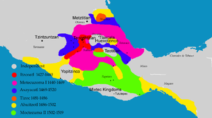
Cocijoeza and his allies, the Mixteco civilization, resisted the attacks under the Ahuizotl (1486-1502) Aztec Tlatoani leadership.
The emperor of the area at the time was Cocijoeza, who defended it successfully against Ahuizotl, ending hostilities by marrying one of Ahuizotl’s daughters.
Ahuizotl’s daughter, Coyolicatzin (Cottom meat or white meat, in náhuatl) had a son from that marriage, Cocijopii Who became the last Zapotec King, he was baptized as “Juan Cortés” by the Spaniards and subsequently tried by the Spanish Inquisition on idolatry charges.
While it was abandoned by the Zapotec upon the conquest of the Spanish, the Spaniards never occupied it, leaving the ruins as they were.
From its location, shape and construction system, it is believed Guiengola was a fortified site where Zapotecs guarded and defended against attacks from hostile groups. It is also likely it was an administrative center of the Zapotec isthmus.
Structures
Guiengola is formed by a ceremonial center on a flat 150 x 200 m surface artificially constructed between two rocky hills. The original access was from the north through a narrow valley.Seler describes the city as a fortress. The flat surface is irregular with three buildings: the west pyramid, the east pyramid and a ballgame court to the south and a residential structure, palace type.The central nucleus has two sunken plazas, one higher than the other.
All the structures were built with small stone slabs from the area, jointed with mortar and finished with stucco.
Eastern Pyramid
The eastern pyramid building was clearly the most important structure: slightly recessed with 30 × 40 m inner dimensions, built over an older pyramid. The perimeter of the plaza is formed by a 2 m wide and 60 cm high wall. Has a wide stairway to the west. Large and small stairs lead down from the wall in several places, from the ground the pyramid can be. The Eastern pyramid consists of three of three bodies and in the west side it has a 8 meters stairway that leads to the top; the staircase is embedded in the building. In addition, there are also two narrow stairs on both sides. The actual sanctuary may have been a construction on the pyramid near its eastern wall, whose whole surface was stuccoed.It faces the Sunken Plaza and in the middle a round altar. The pyramids probably were temples where the priests celebrated rites and ceremonies to their deities; the altars were places where offerings were placed and the plazas where people assembled.
West pyramid
The Eastern pyramid is composed of three bodies and in the west has an 8 meters recessed stairway leading to the top, on the top level are remains of an adobe building, behind are other rooms, each measuring almost 13 m.It faces the sunken plaza and in the middle has a round altar. The pyramids probable were temples where priests held rites and ceremonies to their deities; The altars were places for offering placement and the plazas where people assembled.
The Palace
The Palace or residential complex is on the eastern side. Over several sloped terraces were rooms were built, some with circular columns. There are patios with stairways to communicate among themselves. It contains a round shape lookout built on a natural rock from where a large isthmus territory can be seen.It is located just 200 m southeast of the ceremonial center and was probably the residence of the ruler Cocijoeza. It consisted of 64 rooms and other structures built on a 11,000 m² area, heavily guarded by the rocky terrain and arranged irregularly. The only access is from the south; there are many large and small stairways, required because of the many elevation differences. A small, irregular patio (patio 11), located in the center of the complex had limited access (via a narrow staircase at the south) is considered the actual residence area. It is a temple with three consecutive differentiated spaces with round typical doors with two columns.
Ballgame court
The Ball Game Court is located to the east of the Main Plaza, to its left side are other structures, highlighting two with circular form, of which some investigators have suggested were astronomical observatories. The circular rooms have entrances from where they could see some important stars with the intention of measuring the time.The court is the typical postclassical shape; it is rectangular surrounded by a wall. From the north has two small steps into the court.
Outlook
The rock barrier had an outstanding value as an outlook, a view point which was erected on a round rock in the eastern side of the palace complex, with a great panoramic view of the valley.
A few mounds or promontories qualify as observatories; from there it is possible to observe any movement in the river basin and has a nearly complete vision of the ceremonial area. On clear days the Pacific Ocean can be seen from there.
Tombs
Two tombs were already robbed by the 19th century. The first is located next to the encircling wall of the patio of the eastern pyramid. Access from the west leads to a 9 m long and 2 m wide burial chamber, with two small side chambers. The second tomb located below a small temple with a column in the Palace area. The tomb is smaller and has three parallel chambers. According to colonial information, the large chamber was a sanctuary, while the side chambers, were used several times.In the northern border of the small valley, at the north-west corner of the sunken Plaza, several cruciform type tombs were located; it is considered a cemetery, due to the large amount of tombs. In almost all the hill there are caves, in some cases accesses are blocked.
Caves
Because of its proximity to the ceremonial area, one of the caves located at the base of the large rocks, is a ceremonial area with stalactites and stalagmites. It is likely to have contained cave paintings, but its vestiges show an almost total destruction. There are several varied and exciting legends about these caves.See also
- Zapotec civilizationZapotec civilizationThe Zapotec civilization was an indigenous pre-Columbian civilization that flourished in the Valley of Oaxaca of southern Mesoamerica. Archaeological evidence shows their culture goes back at least 2500 years...
- Zapotec people
- Zapotec languages
- TehuantepecTehuantepecTehuantepec is a city and municipality in the southeast of the Mexican state of Oaxaca. It is part of the Tehuantepec District in the west of the Istmo Region. The area was important in pre Hispanic period as part of a trade route that connected Central America with what is now the center of...
- OaxacaOaxacaOaxaca , , officially Estado Libre y Soberano de Oaxaca is one of the 31 states which, along with the Federal District, comprise the 32 federative entities of Mexico. It is divided into 571 municipalities; of which 418 are governed by the system of customs and traditions...
- SoconuscoSoconuscoSoconusco is a region of the Mexican state of Chiapas, located in the extreme south of the state and separated from Guatemala by the Suchiate River. It is a region of rich lowlands and foothills. The economic center is Tapachula. Soconusco consists of 16 municipalities.The name comes from the...
Other Zapotec sites:
- LambityecoLambityecoLambityeco is a small archaeological site just about 3 kilometers west of the Tlacolula city in the Mexican state of Oaxaca. It is located just off Highway 190 about east from the city of Oaxaca enroute to Mitla. The site has been securely dated to the Late Classical Period.The Lambityeco name has...
- DainzuDainzúDainzú is a Zapotec archaeological site located in the eastern side of the Valles Centrales de Oaxaca, about 20 km south-east of the city of Oaxaca, Oaxaca State, Mexico. It is an ancient village near to and contemporary with Monte Alban and Mitla, with an earlier development. Dainzú was...
- MitlaMitlaMitla is the second most important archeological site in the state of Oaxaca in Mexico, and the most important of the Zapotec culture. The site is located 44 km from the city of Oaxaca. in the upper end of the Tlacolula Valley, one of the three that form the Central Valleys Region of the...
- YagulYagulYagul is an archaeological site and former city-state associated with the Zapotec civilization of pre-Columbian Mesoamerica, located in the Mexican state of Oaxaca. The site was declared one of the country's four Natural Monuments on 13 October 1998. The site is also known locally as Pueblo Viejo ...
- San José MogoteSan Jose MogoteSan José Mogote is a pre-Columbian archaeological site of the Zapotec, a Mesoamerican culture that flourished in the region of what is now the Mexican state of Oaxaca. A forerunner to the better-known Zapotec site of Monte Albán, San José Mogote was the largest and most important settlement in the...
- El PalmilloEl PalmilloEl Palmillo is a Mesoamerican Classic Period archaeological site located in the Valley of Oaxaca, associated with the pre-Columbian Zapotec civilization which was centered in the valley and the surrounding highlands of the present-day state of Oaxaca, Mexico...
- ZaachilaZaachilaZaachila was a powerful Mesoamerican city in what is now Oaxaca, Mexico, 6 km from the city of Oaxaca. The city is named after Zaachila Yoo, the Zapotec ruler, in the late 14th and early 15th century. It is now an archaeological site...