

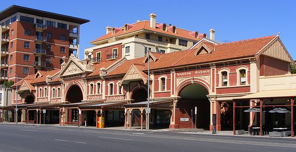
East Terrace, Adelaide
Encyclopedia
Adelaide city centre
The Adelaide city centre is the innermost locality of Greater Adelaide, known by locals simply as "The City" or "Town". The locality is split into two key geographical distinctions: the city "square mile", bordered by North, East, South and West Terraces; and that part of the Adelaide Parklands...
of Adelaide
Adelaide
Adelaide is the capital city of South Australia and the fifth-largest city in Australia. Adelaide has an estimated population of more than 1.2 million...
, the capital city of South Australia
South Australia
South Australia is a state of Australia in the southern central part of the country. It covers some of the most arid parts of the continent; with a total land area of , it is the fourth largest of Australia's six states and two territories.South Australia shares borders with all of the mainland...
. It is one of the main north-south thoroughfares through the east side of the city. Although the terrace essentially runs north-south between North Terrace
North Terrace, Adelaide
North Terrace is one of the four terraces that bound the central business and residential district of the city of Adelaide, the capital city of South Australia. It runs east-west, along the northern edge of the CBD.-North Side of North Terrace:...
and South Terrace
South Terrace, Adelaide
South Terrace is a street on the south side of the city centre of Adelaide, the capital of South Australia. It runs from Anzac Highway and connects to Glen Osmond Road. King William Street ends at South Terrace. It is the southern edge of the city centre, and is bounded by parklands to the south,...
, unlike Adelaide's other three terraces, its path is far from a straight line; travelling the entire length of East Terrace requires turning at right angle
Right angle
In geometry and trigonometry, a right angle is an angle that bisects the angle formed by two halves of a straight line. More precisely, if a ray is placed so that its endpoint is on a line and the adjacent angles are equal, then they are right angles...
s at most intersections. After crossing South Terrace, the street continues through the parklands
Adelaide Park Lands
The Adelaide Park Lands are the parks that surround the centre of the South Australian capital city of Adelaide. They measure approximately 7.6 square kilometres in a green belt encircling the city centre....
as Beaumont Road, but unlike other roads through the parklands it is not a thoroughfare; there is a break in the middle of it.
The terrace marks the eastern edge of Light's Vision
Light's Vision
The first surveyor-general of Adelaide, South Australia, Colonel William Light designed a layout and development programme for the city. This plan is now known as "Light's Vision"...
for the City of Adelaide
City of Adelaide
The City of Adelaide is a local government area in the metropolitan area of Adelaide, South Australia. It covers the original Adelaide city centre settlement, , North Adelaide, and the Adelaide Park Lands which surround North Adelaide and the city centre.Established in 1840, the organisation now...
. Between Grenfell Street and North Terrace, it also forms the boundary of Adelaide's "East End
East End, Adelaide
The East End is a small part of the Adelaide central business district, close to East Terrace and North Terrace. This area is a popular office and retail district and has an increasing residential interest from the building of high-density luxury apartments in the area.The retail centre of the East...
".
Additionally, part of it is used as part of the Adelaide Street Circuit
Adelaide Street Circuit
The Adelaide Street Circuit is a temporary street circuit in the East Parklands adjacent to the central business district of the city of Adelaide in South Australia....
, challenging due to its tight 90° corners.
East Terrace separates the city centre from the eastern parts of the Parklands
Adelaide Park Lands
The Adelaide Park Lands are the parks that surround the centre of the South Australian capital city of Adelaide. They measure approximately 7.6 square kilometres in a green belt encircling the city centre....
, running adjacent to Parks 13 (Rundle Park
Rundle Park, Adelaide
Rundle Park, also known as Park 13, is a part of the Adelaide Parklands. It is bounded by East Terrace, Botanic Road, Dequetteville Terrace and Rundle Road. In 2006 and 2007 this park was the site of the Garden of Unearthly Delights, a part of the Adelaide Fringe Festival, which featured a variety...
), 14 (Rymill Park
Rymill Park, Adelaide
Rymill Park, also known as Park 14 or Mullawirraburka in Kaurna, is a park located in the East Parklands of the South Australian capital of Adelaide. It is bordered by East and Dequetteville Terraces, and Rundle and Bartels Roads...
), 15 (Ityamaiitpinna) and 16 (Victoria Park
Victoria Park, Adelaide
Victoria Park, also known as Park 16, is a park located in the Southeastern Parklands of the South Australian capital of Adelaide. It is bordered by Fullarton Road, Greenhill Road, East Terrace and Wakefield Road...
). The western edge of the terrace is occupied by shops, restaurants, cafes, office buildings, professional, consulting and medical practises, residences, a school, and a number of churches and pubs.