
Daniel Boone National Forest
Encyclopedia
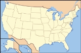
Daniel Boone National Forest is the only national forest
completely within the boundary of Kentucky
. Established in 1937, it was originally named the Cumberland National Forest, after the core region called the Cumberland Purchase Unit. About 2100000 acres (8,498.4 km²) are contained within its current proclamation boundary, of which 706000 acres (2,857.1 km²) are owned and managed by the United States Department of Agriculture
Forest Service
(as of April 2006), up from around 620000 acres (2,509.1 km²) in the early to mid-1990s.
The forest was named after Daniel Boone
, a frontiersman and explorer in the late 18th century who contributed greatly to the exploration and settlement of Kentucky.
There are two areas designated as Wilderness:
 In 1937, a national forest was established containing 1338214 acres (5,416 km²) within its proclamation boundary. As of June 1937, the Forest Service had purchased only 336692 acres (1,363 km²). Most early purchases were large, isolated tracts owned by lumber and coal companies with but few inhabitants. The Forest Service has since had difficulty acquiring more land within the proclamation boundary, the bulk of which was, and still remains, small owner-operated farms.
Due in part to World War II, funds for land acquisition were curtailed in the early 1940s. Substantial acquisition efforts could not resume until the mid-1960s. The lengthy cessation of land acquisitions, except for period during the forest's renaming, caused a highly fragmented ownership pattern.
Naming the forest entailed considerable debate. The name 'Daniel Boone National Forest' was advocated by various groups, and was favored by most local leaders in Kentucky, before the area's formal designation as the Cumberland National Forest soon after its inception. Protests began immediately after the national forest was named.
The naming issue was reopened in the late 1950s. The Forest Service investigated the name 'Cumberland', and found it came to Kentucky in 1750 when Thomas Walker
named the Cumberland River
in honor of Prince William Augustus, Duke of Cumberland
. The Duke had defeated the Scottish Highlanders
in 1746 at the Battle of Culloden
, an especially brutal conflict. Many Scottish families fled to America and ultimately Kentucky as a result of the event. The Forest Service found that for their descendants still living in eastern Kentucky, the name 'Cumberland' was particularly distasteful.
In addition, the Forest Service noted the influence of history on the names of places in Kentucky. While the settlement of the region began before the American Revolution
, the population grew dramatically after the Revolutionary War
, when many veterans received land grants in reward for military service. During this period of time, place names with British connotations fell out of favor and changes were made. For example, prior to the Revolution, the Kentucky River
was called the Louisa River (or Levisa), after the wife of the Duke of Cumberland.
 During the 1960s, a new movement to rename the national forest took place. The Kentucky Senate
passed a resolution in 1966 urging the Forest Service to change the name to 'Daniel Boone National Forest', and President Lyndon B. Johnson
signed a proclamation so renaming the forest in 1966.
Also during the 1960s, part of the national forest was designated a Primitive Weapons Area (renamed Pioneer Weapons Area) and set apart for hunting with longbow
, crossbow
, or muzzle-loading firearms
(either flintlock
or percussion
). In 1970, this was the only US area where deer could legally be hunted with crossbows. The park remains unique still for allowing only muzzle-loaded firearms.
In 1967, a large and disconnected addition to the national forest was created, called the Redbird Purchase Unit, after a key purchase from the Red Bird Timber Company. According to Robert F. Collins of the Forest Service, Thomas R. Frazier (born July 7, 1931; died February 1, 2008) was the first District Ranger of the Redbird Purchase Unit, and is credited as being a major factor in the success of the Redbird land purchasing unit ("A History of the Daniel Boone National Forest", dedication page, 1975).
 About a third of the land within the national forest proclamation boundary is owned or managed by the Forest Service. The pattern of land ownership is highly fragmented and changes relatively frequently. One of the goals of the Forest Service is to consolidate holdings into larger blocks, which is often done by trading tracts with other organizations. The boundaries of Forest Service lands are marked in various ways, including red paint on trees. The shifting boundaries and growing size of Forest Service lands sometimes results in local complaints and boundary disputes. In addition, it can be difficult for recreational users to know whether they are on Forest Service lands or not. "No Trespassing" signs are frequently used by landowners, and conflicts between landowners and recreational users are not uncommon.
As is common in many national forests, some recreational users trespass on private property, sometimes leaving litter, campfire rings, and causing other damage. In contrast, the population of eastern Kentucky has long been strong proponents of property rights. Feelings of local ownership traditionally extended into nearby public lands, used as woodlots, for hunting and herb gathering, and other such uses. The conflict between long-term local residents and recreational users is exacerbated by the highly fragmented pattern of land ownership.
On many commercially available maps, the whole region within the proclamation boundary is shown as solid green, but the national forest is actually a patchwork of tracts intermingled with private, county, and state properties. Tracts are often shuffled through swaps, barters and exchange, or purchase. One example is the nearly un-forested quarry tracts swapped near Clearfield's Clack Mountain for land on the Licking River
in Rowan County
.
Boundary disputes are often not contested in court when landowners find the commercial value of disputed land is less than the legal cost of fighting the Forest Service. Some of those affected claim the government takes advantage of archaic deed language and vague border markers or descriptions to shave away property in favor of forest holdings. Local county governments receive permanent fund
payments in lieu of property taxes from the USDA, which not only provides revenue but can increase their bond rating, providing further financial incentives for the process to continue.
Issues such as logging
and wildlife protection have resulted in lawsuits. Concerns have been raised about organizations promoting the introduction and population growth of animals such as bears, cougars, and red wolves. The successful introduction of red wolves to nearby Great Smoky Mountains National Park
, as well as failed attempts at other nearby areas, such as the Land Between the Lakes
, has generated concern and debate throughout the Appalachian region. The controversy over logging and loss of wildlife habitat
has resulted in several lawsuits.
United States National Forest
National Forest is a classification of federal lands in the United States.National Forests are largely forest and woodland areas owned by the federal government and managed by the United States Forest Service, part of the United States Department of Agriculture. Land management of these areas...
completely within the boundary of Kentucky
Kentucky
The Commonwealth of Kentucky is a state located in the East Central United States of America. As classified by the United States Census Bureau, Kentucky is a Southern state, more specifically in the East South Central region. Kentucky is one of four U.S. states constituted as a commonwealth...
. Established in 1937, it was originally named the Cumberland National Forest, after the core region called the Cumberland Purchase Unit. About 2100000 acres (8,498.4 km²) are contained within its current proclamation boundary, of which 706000 acres (2,857.1 km²) are owned and managed by the United States Department of Agriculture
United States Department of Agriculture
The United States Department of Agriculture is the United States federal executive department responsible for developing and executing U.S. federal government policy on farming, agriculture, and food...
Forest Service
United States Forest Service
The United States Forest Service is an agency of the United States Department of Agriculture that administers the nation's 155 national forests and 20 national grasslands, which encompass...
(as of April 2006), up from around 620000 acres (2,509.1 km²) in the early to mid-1990s.
The forest was named after Daniel Boone
Daniel Boone
Daniel Boone was an American pioneer, explorer, and frontiersman whose frontier exploits mad']'e him one of the first folk heroes of the United States. Boone is most famous for his exploration and settlement of what is now the Commonwealth of Kentucky, which was then beyond the western borders of...
, a frontiersman and explorer in the late 18th century who contributed greatly to the exploration and settlement of Kentucky.
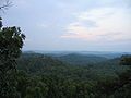
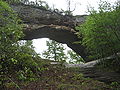
Notable features
Daniel Boone National Forest surrounds or contains a variety of popular and notable features, including:- One of the world's largest concentrations of caves. The counties of Wayne, Pulaski, and Rockcastle alone have 173 miles (278.4 km) of mapped passageways
- Cave Run LakeCave Run LakeCave Run Lake, located south of Morehead, Kentucky, USA along Kentucky Route 801, is an , reservoir built by the U.S. Army Corps of Engineers. The 148 ft , half-mile dam construction began in 1965 and was completed in 1973. Cave Run Lake is in the northern part of the Daniel Boone...
- a USACEUnited States Army Corps of EngineersThe United States Army Corps of Engineers is a federal agency and a major Army command made up of some 38,000 civilian and military personnel, making it the world's largest public engineering, design and construction management agency...
reservoir - Laurel River LakeLaurel River LakeLaurel River Lake, located west of Corbin, Kentucky, in the USA, is an reservoir built in 1977 by the U.S. Army Corps of Engineers on the Laurel River, a tributary of the Cumberland River, in the Daniel Boone National Forest. The lake covers parts of Laurel and Whitley counties.The 282 foot high...
- a USACE reservoir - Buckhorn Lake - a USACE reservoir
- Red River GorgeRed River GorgeThe Red River Gorge is a canyon system on the Red River in east-central Kentucky. Geologically, it is part of the Pottsville Escarpment.Much of the Gorge is located inside the Daniel Boone National Forest and has been subsequently reserved as the Red River Gorge Geological Area, an area of around...
Geologic Area - popular with hikers, campers, and rock climbers - Sheltowee Trace TrailSheltowee Trace TrailThe Sheltowee Trace Trail is a National Recreation Trail that was created in 1976 and stretches from Pickett State Park in Tennessee to northern Rowan County, Kentucky...
- Natural Bridge State Park (Kentucky)Natural Bridge State Park (Kentucky)Natural Bridge State Resort Park is a Kentucky state park located in Powell and Wolfe Counties along the Middle Fork of the Red River, adjacent to the Red River Gorge Geologic Area and surrounded by the Daniel Boone National Forest. Its namesake natural bridge is the centerpiece of the park. The...
- Yahoo ArchYahoo ArchYahoo Arch is located in the Daniel Boone National Forest, in McCreary County, Kentucky.A hiking trail leads from Yahoo Falls to the arch.- External links :*...
- Yahoo FallsYahoo FallsHistoric Yahoo Falls, known also using its possible Muscogee name as Ywahoo Falls, is located in McCreary County, Kentucky.-Description:...
- Cumberland FallsCumberland FallsCumberland Falls, sometimes called the Little Niagara, the Niagara of the South, or the Great Falls, is a large waterfall on the Cumberland River in southeastern Kentucky...
There are two areas designated as Wilderness:
- Clifty Wilderness
- Beaver Creek Wilderness
History
Due in part to World War II, funds for land acquisition were curtailed in the early 1940s. Substantial acquisition efforts could not resume until the mid-1960s. The lengthy cessation of land acquisitions, except for period during the forest's renaming, caused a highly fragmented ownership pattern.
Naming the forest entailed considerable debate. The name 'Daniel Boone National Forest' was advocated by various groups, and was favored by most local leaders in Kentucky, before the area's formal designation as the Cumberland National Forest soon after its inception. Protests began immediately after the national forest was named.
The naming issue was reopened in the late 1950s. The Forest Service investigated the name 'Cumberland', and found it came to Kentucky in 1750 when Thomas Walker
Thomas Walker (explorer)
Dr. Thomas Walker was a physician and explorer from Virginia who led an expedition to what is now the region beyond the Allegheny Mountains area of British North America in the mid-18th century...
named the Cumberland River
Cumberland River
The Cumberland River is a waterway in the Southern United States. It is long. It starts in Harlan County in far southeastern Kentucky between Pine and Cumberland mountains, flows through southern Kentucky, crosses into northern Tennessee, and then curves back up into western Kentucky before...
in honor of Prince William Augustus, Duke of Cumberland
Prince William Augustus, Duke of Cumberland
Prince William , was a younger son of George II of Great Britain and Caroline of Ansbach, and Duke of Cumberland from 1726. He is generally best remembered for his role in putting down the Jacobite Rising at the Battle of Culloden in 1746, and as such is also known as "Butcher" Cumberland...
. The Duke had defeated the Scottish Highlanders
Scottish Highlands
The Highlands is an historic region of Scotland. The area is sometimes referred to as the "Scottish Highlands". It was culturally distinguishable from the Lowlands from the later Middle Ages into the modern period, when Lowland Scots replaced Scottish Gaelic throughout most of the Lowlands...
in 1746 at the Battle of Culloden
Battle of Culloden
The Battle of Culloden was the final confrontation of the 1745 Jacobite Rising. Taking place on 16 April 1746, the battle pitted the Jacobite forces of Charles Edward Stuart against an army commanded by William Augustus, Duke of Cumberland, loyal to the British government...
, an especially brutal conflict. Many Scottish families fled to America and ultimately Kentucky as a result of the event. The Forest Service found that for their descendants still living in eastern Kentucky, the name 'Cumberland' was particularly distasteful.
In addition, the Forest Service noted the influence of history on the names of places in Kentucky. While the settlement of the region began before the American Revolution
American Revolution
The American Revolution was the political upheaval during the last half of the 18th century in which thirteen colonies in North America joined together to break free from the British Empire, combining to become the United States of America...
, the population grew dramatically after the Revolutionary War
American Revolutionary War
The American Revolutionary War , the American War of Independence, or simply the Revolutionary War, began as a war between the Kingdom of Great Britain and thirteen British colonies in North America, and ended in a global war between several European great powers.The war was the result of the...
, when many veterans received land grants in reward for military service. During this period of time, place names with British connotations fell out of favor and changes were made. For example, prior to the Revolution, the Kentucky River
Kentucky River
The Kentucky River is a tributary of the Ohio River, long, in the U.S. state of Kentucky. The river and its tributaries drain much of the central region of the state, with its upper course passing through the coal-mining regions of the Cumberland Mountains, and its lower course passing through the...
was called the Louisa River (or Levisa), after the wife of the Duke of Cumberland.
Kentucky Senate
The Kentucky Senate is the upper house of the Kentucky General Assembly. The Kentucky Senate is composed of 38 members elected from single-member districts throughout the Commonwealth. There are no term limits for Kentucky Senators...
passed a resolution in 1966 urging the Forest Service to change the name to 'Daniel Boone National Forest', and President Lyndon B. Johnson
Lyndon B. Johnson
Lyndon Baines Johnson , often referred to as LBJ, was the 36th President of the United States after his service as the 37th Vice President of the United States...
signed a proclamation so renaming the forest in 1966.
Also during the 1960s, part of the national forest was designated a Primitive Weapons Area (renamed Pioneer Weapons Area) and set apart for hunting with longbow
Longbow
A longbow is a type of bow that is tall ; this will allow its user a fairly long draw, at least to the jaw....
, crossbow
Crossbow
A crossbow is a weapon consisting of a bow mounted on a stock that shoots projectiles, often called bolts or quarrels. The medieval crossbow was called by many names, most of which derived from the word ballista, a torsion engine resembling a crossbow in appearance.Historically, crossbows played a...
, or muzzle-loading firearms
Muzzleloader
A muzzleloader is any firearm into which the projectile and usually the propellant charge is loaded from the muzzle of the gun . This is distinct from the more popular modern designs of breech-loading firearms...
(either flintlock
Flintlock
Flintlock is the general term for any firearm based on the flintlock mechanism. The term may also apply to the mechanism itself. Introduced at the beginning of the 17th century, the flintlock rapidly replaced earlier firearm-ignition technologies, such as the doglock, matchlock and wheellock...
or percussion
Percussion cap
The percussion cap, introduced around 1830, was the crucial invention that enabled muzzleloading firearms to fire reliably in any weather.Before this development, firearms used flintlock ignition systems which produced flint-on-steel sparks to ignite a pan of priming powder and thereby fire the...
). In 1970, this was the only US area where deer could legally be hunted with crossbows. The park remains unique still for allowing only muzzle-loaded firearms.
In 1967, a large and disconnected addition to the national forest was created, called the Redbird Purchase Unit, after a key purchase from the Red Bird Timber Company. According to Robert F. Collins of the Forest Service, Thomas R. Frazier (born July 7, 1931; died February 1, 2008) was the first District Ranger of the Redbird Purchase Unit, and is credited as being a major factor in the success of the Redbird land purchasing unit ("A History of the Daniel Boone National Forest", dedication page, 1975).
Recent controversies
As is common in many national forests, some recreational users trespass on private property, sometimes leaving litter, campfire rings, and causing other damage. In contrast, the population of eastern Kentucky has long been strong proponents of property rights. Feelings of local ownership traditionally extended into nearby public lands, used as woodlots, for hunting and herb gathering, and other such uses. The conflict between long-term local residents and recreational users is exacerbated by the highly fragmented pattern of land ownership.
On many commercially available maps, the whole region within the proclamation boundary is shown as solid green, but the national forest is actually a patchwork of tracts intermingled with private, county, and state properties. Tracts are often shuffled through swaps, barters and exchange, or purchase. One example is the nearly un-forested quarry tracts swapped near Clearfield's Clack Mountain for land on the Licking River
Licking River (Kentucky)
The Licking River is a tributary of the Ohio River in northeastern Kentucky in the United States. The river and its tributaries drain much of the region of northeastern Kentucky between the watersheds of the Kentucky River to the west and the Big Sandy River to the east.-Origin of name:The Native...
in Rowan County
Rowan County, Kentucky
Rowan County is a county located in the U.S. state of Kentucky. As of 2010, the population was 23,333. Its county seat is Morehead. The county was created in 1856 from adjacent counties originally part of Mason county, and named for John Rowan, who represented Kentucky in the U.S...
.
Boundary disputes are often not contested in court when landowners find the commercial value of disputed land is less than the legal cost of fighting the Forest Service. Some of those affected claim the government takes advantage of archaic deed language and vague border markers or descriptions to shave away property in favor of forest holdings. Local county governments receive permanent fund
Permanent fund
In the United States, a permanent fund is one of the five fund types established by GAAP classified as a government fund. Put simply a permanent fund may be used to generate and disperse money to those entitled to receive payments by qualification or agreement, as in the case of Alaska citizens or...
payments in lieu of property taxes from the USDA, which not only provides revenue but can increase their bond rating, providing further financial incentives for the process to continue.
Issues such as logging
Logging
Logging is the cutting, skidding, on-site processing, and loading of trees or logs onto trucks.In forestry, the term logging is sometimes used in a narrow sense concerning the logistics of moving wood from the stump to somewhere outside the forest, usually a sawmill or a lumber yard...
and wildlife protection have resulted in lawsuits. Concerns have been raised about organizations promoting the introduction and population growth of animals such as bears, cougars, and red wolves. The successful introduction of red wolves to nearby Great Smoky Mountains National Park
Great Smoky Mountains National Park
Great Smoky Mountains National Park is a United States National Park and UNESCO World Heritage Site that straddles the ridgeline of the Great Smoky Mountains, part of the Blue Ridge Mountains, which are a division of the larger Appalachian Mountain chain. The border between Tennessee and North...
, as well as failed attempts at other nearby areas, such as the Land Between the Lakes
Land Between the Lakes National Recreation Area
The Land Between The Lakes National Recreation Area is a United States National Recreation Area located in Kentucky and Tennessee between Lake Barkley and Kentucky Lake. The area was designated a national recreation area by President John F. Kennedy in 1963...
, has generated concern and debate throughout the Appalachian region. The controversy over logging and loss of wildlife habitat
Habitat (ecology)
A habitat is an ecological or environmental area that is inhabited by a particular species of animal, plant or other type of organism...
has resulted in several lawsuits.
Counties
The forest covers parts of 16 counties in eastern Kentucky. They are listed here in descending order of Forest Service land area. http://www.fs.fed.us/land/staff/lar/2007/TABLE_6.htm- Clay CountyClay County, Kentucky- Demographics :As of the census of 2011, there were 21,000 people, 8,556 households, and 6,442 families residing in the county. The population density was 52 people per square mile . There were 9,439 housing units at an average density of 20 per square mile...
- McCreary CountyMcCreary County, KentuckyMcCreary County is a county located in the U.S. state of Kentucky. As of 2000, the population was 17,080. Its county seat is Whitley City. The county is named for James B. McCreary, a Confederate war hero and Governor of Kentucky from 1875 to 1879. It is the only Kentucky county to not have a...
- Laurel CountyLaurel County, KentuckyLaurel County is a county in the U.S. state of Kentucky. The population was 58,849 in the 2010 Census. Its county seat is London.The London Micropolitan Statistical Area includes all of Laurel County....
- Rowan CountyRowan County, KentuckyRowan County is a county located in the U.S. state of Kentucky. As of 2010, the population was 23,333. Its county seat is Morehead. The county was created in 1856 from adjacent counties originally part of Mason county, and named for John Rowan, who represented Kentucky in the U.S...
- Jackson CountyJackson County, KentuckyJackson County is a county located in the Commonwealth of Kentucky. It was formed in 1858 and was named for President Andrew Jackson. As of 2000, the population was 13,495. Its county seat is McKee. It is a prohibition or dry county...
- Menifee CountyMenifee County, KentuckyMenifee County is a county located in the U.S. state of Kentucky. As of 2000, the population was 6,556. Its county seat is Frenchburg. The county is named for Richard Hickman Menefee, U.S. Congressman, although the spelling has changed. It is a prohibition or dry county.Menifee County is located...
- Whitley CountyWhitley County, KentuckyWhitley County is a county located in the state of Kentucky. 2005 census projections list its population at 38,029 . The county seat is at Williamsburg, though the largest city is Corbin, and the county's District Court sits in both cities...
- Pulaski CountyPulaski County, KentuckyPulaski County is a county located in the U.S. state of Kentucky. The population was 63,063 in the 2010 Census. Its county seat is Somerset6. The county is named for Count Kazimierz Pułaski. Most of the county is a prohibition or dry county...
- Bath CountyBath County, KentuckyBath County is a county located in the U.S. state of Kentucky. It was formed in 1811. As of 2010 the population is 11,591. Its county seat is Owingsville, Kentucky...
- Rockcastle CountyRockcastle County, KentuckyRockcastle County is a county located in the U.S. state of Kentucky. As of 2000, the population was 16,582. Its county seat is Mt. Vernon. The county is named for the Rockcastle River which runs through it...
- Wolfe CountyWolfe County, KentuckyWolfe County is a county located in the U.S. state of Kentucky. As of 2000, the population was 7,065. Its county seat is Campton. The county is named for Nathaniel Wolfe.- Geography :...
- Powell CountyPowell County, KentuckyPowell County is a county located in the U.S. state of Kentucky. As of 2000, the population is 13,237. Its county seat is Stanton. The county was formed January 7, 1852, by Kentucky Governor Lazarus W. Powell...
- Morgan CountyMorgan County, KentuckyMorgan County is a county located in the U.S. state of Kentucky. As of 2000, the population was 13,948. Its county seat is West Liberty. The county is among the dry counties, which means that the sale of alcohol is restricted or prohibited.- Geography :...
- Lee CountyLee County, KentuckyLee County is a county located in the U.S. state of Kentucky. As of 2000, the population was 7,916. Its county seat is Beattyville. It is a prohibition or dry county.-History:...
- Estill CountyEstill County, KentuckyEstill County is a county located in the U.S. state of Kentucky. It was formed in 1808. As of 2000, the population was 15,307. Its county seat is Irvine, Kentucky. Formed in 1808, the county is named after Captain James Estill, a Kentucky militia officer killed in the Battle of Little Mountain...
- Owsley CountyOwsley County, KentuckyOwsley County is a county located in the U.S. state of Kentucky. As of 2000, the population was 4,858. Its county seat is Booneville. The county is named for William Owsley, the Governor of Kentucky from 1844 to 1848. It is a prohibition or dry county...
- Wayne CountyWayne County, KentuckyWayne County is a county located in the U.S. state of Kentucky. As of 2000, the population was 19,923. Its county seat is Monticello. The county was named for Gen. Anthony Wayne. It is a prohibition or dry county.-History:...