

Cycling in Cardiff
Encyclopedia
Cycling
in Cardiff
, capital of Wales
, is facilitated by its easy gradients and large parks. In 2005, 4.3% of people commuted
to work by cycling
, compared to 2% in London
and 5% in Berlin
. However, cyclists in the city appear to be influenced by deterrents to cycling and as a result will need a greater level of improved facilities to increase cycling numbers, according to research by Cardiff University
.
As the busiest city, Cardiff is statistically the most dangerous place to cycle in Wales. Between 1999 and 2008, 1,000 cyclists were injured on the road, 20% of all cycling accidents in Wales, although the number of injuries to cyclists continues to fall.
The Cardiff cycle network is over 94 km (58.4 mi) long with 5-10 additional kilometres (3-6 miles) completed each year.
The council's Transport, Infrastructure and Waste service aims to ensure that an increase in cycling is matched with a reduction in the number of collisions involving cyclists.
Cardiff Council also provides off-road cycle training for school pupils to develop basic cycling skills based upon the National Cycling Proficiency Scheme. Training covers the Highway Code, negotiating obstacles, turning left and right, emergency stops and basic cycle maintenance. More than 1,500 children participate in this course every year in Cardiff, according to the council's Cycling Strategy.
The council produces a free map of the city, available from its offices or from cycle shops, highlighting cycle paths, lanes and suggested cycle routes.
In September 2011 it was announced that Sustrans Cymru were launching a new project in Cardiff funded by the Wales Government. This involved offering expert consultation to Cardiff householders to draw up personal travel plans, designed to reduce car journneys and encourage, amongst other things, increased use of bicycles.
, Cathays
(Crwys Road), Cathays
(Woodville Road), Gabalfa
, Grangetown
, Llandaff North
, Llanrumney
, Pontcanna
, Rhiwbina
, Roath
(Broadway), Roath
(Newport Road) and Whitchurch
.
is illegal, cyclists must generally cycle on the road
. Some roads in the city provide distinct cycle lanes to the left of the vehicle lane. According to the Cardiff Cycle Map, these include:
West Cardiff
North Cardiff
South Cardiff
East Cardiff
can be a shared pavement
with pedestrians, running alongside a road or through a park for example. This is denoted by a blue circular sign showing a bicycle and pedestrians. A cycle only route is denoted by blue circular sign showing a only bicycle. Much of the Taff Trail, Ely Trail and Rumney Trail are segregated from traffic. Other such routes in the city include:
West Cardiff
: through parkland area in Pontcanna
, connecting with the Taff Trail
North Cardiff
Gabalfa Interchange: routes run over and round the junction as an alternative to vehicle routes University Hospital of Wales
: routes run around Heath Hospital through King George Field
South Cardiff
in Canton
connecting to the Ely Trail Cardiff International Sports Village
: the vicinity has a network a segregated routes connected to the Ely Trail in the west, Grangetown
in the north, and Cardiff Bay
in the east Lloyd George Avenue: from the City Centre to Cardiff Bay, part of Route 8 Central Link: parallel to the east of Lloyd George Avenue Butetown
: a route runs through a housing estate to Cardiff Bay, parallel to the west of Lloyd George AvenueRover Way: through an industrial and commercial estate between Adamsdown
and Tremorfa
East Cardiff
s for parking in locations including the following:
West Cardiff
North Cardiff
South Cardiff
Cardiff City Centre
East Cardiff
and Cardiff Council announced plans to introduce a free cycle hire scheme in March 2009, with at least 12 bike racks, each with five to seven bikes, placed around the city, allowing people to pick up bikes and ride them to another point, where they will leave the bike. Money would also be put into creating more strategic cycle routes and cycle lanes.
The system, similar to those in other large cities, launched in September 2009, and includes 70 bikes and 35 hire points (initially 7) around the centre and the south of the city. The current stations are: Central Station; Cardiff Castle; Central Library; Queen Street Station; Churchill Way; City Hall; eastern Queen Street; Cardiff Bay Station; County Hall; and Cardiff Bay Visitors’ Centre.
It is necessary to register before using a bike. The first half an hour is free after which a small hourly fee is payable. The scheme, which is part of a £28.5 million plan to encourage residents in the capital to use sustainable transport and ease congestion, was welcomed by campaigners.
Pedal Power is a charity with their main bike centre in Pontcanna
offering cycle hire facilities. Cycle training and cycle assessments are also available.
, refurbishes and repairs unwanted cycles, saving old bikes from the landfill and revitalises them for new owners at cheaper prices. Cardiff Cycle Workshop has an agreement with Cardiff Council
for cages to be placed in the waste facilities in Fairwater
and Grangetown
for members of the public to leave their unwanted bicycles. Then the bikes are refurbished, checked for safety and have parts replaced. The bikes are then sold for anything from £10 to £150. Three year funding has come from the Big Lottery Fund
.
and south
of the city as of 2010, funded by the County Council, Visit Wales, and Countryside Council for Wales. So far completed is the northern section through St Fagans, Fairwater
and Ely
, and the southern section running from Leckwith
to the south along the River Ely
through Grangetown
, finishing at the Cardiff International Sports Village
. However, these sections are yet to be connected.
The route is connected to Cardiff City Centre
via an off-road north-south route through Butetown
. The Taff Trail at Cardiff Bay
can also be joined from the trail via Grangetown and Butetown.
in the east
of the city. Currently completed is the section between Llanedeyrn
and Rumney
. The Cardiff Cycle Map shows the route running off-road from Llanedeyrn Interchange, bypassing Llanrumney
to the west, briefly joining Newport Road (B4487), and then heading south of Rumney to Wentloog Avenue (B4239). However, an off-road section also runs north-south through Pentwyn
from Llanedeyrn.
 The 55 mile long Taff Trail
runs from Cardiff Bay
through Pontypridd
and Merthyr Tydfil
to Brecon
, forming part of the Lôn Las Cymru - the National Cycle Network
Route 8
to Holyhead
.
The route begins at Roald Dahl Plass
in Cardiff Bay
and runs mostly off-road through the city for 7.5 miles (12.1 km) north through the City Centre
, joining the River Taff
in Bute Park
before heading north-west through Llandaff
and Radyr
, leaving the city at Tongwynlais
.
to Margam Country Park
via Cardiff
.
for The People's Bridge) is a pedestrian and cyclist bridge spanning the River Ely
between Cardiff Bay
and Penarth
. Costing approximately £4.5 million, Pont y Werin crosses between the Cardiff International Sports Village
and Penarth
, allowing the public to travel to the Sports Village via Cogan railway station
.
Opened on 14 July 2010, the bascule bridge
completes the 6.5 miles (10.5 km) Cardiff Bay circular walk and cycle route, and incorporates a 20-metre opening section to allow river traffic to pass.
, which is operated by Arriva Trains Wales
. Most trains have spaces for two cycles. However they are not permitted on services from Caerphilly
, Radyr
(except the City Line
), Cadoxton
, and Ebbw Vale Parkway
to Cardiff Queen Street or Cardiff Central
between 07:00 and 09:30, or services in the reverse direction 16:00 to 18:00 on weekdays. Outside these times, carriage is still at the discretion of the guard. Folding cycles
can be carried folded-up at any time.
There is cycle storage at Cardiff Central station on platforms 3, 4, 6 and 7, at the rear of station and in the Riverside car park.
are recommended. Bikes must be carried in the designated area of the train and can’t be stored in aisles or vestibule areas. Cycles can not be carried on rail-replacement coach services. Folding bikes can be carried at all times as normal hand luggage.
Arriva Trains Wales also operates most of the Welsh rail network and its cycle policies apply to other services as well without the restrictions applied to the Cardiff rail network.
CrossCountry
, who operate from Cardiff Central to The Midlands
and The North
, advise to make a free reservation for cycles before travel. All trains have two reservable bike spaces. Bikes for which no reservation has been made will be accepted on a first come, first served basis and subject to space being available.
First Great Western
, who operate from Cardiff Central to South West Wales
, Bristol Temple Meads, London Paddington, Portsmouth Harbour
and Taunton
, make some cycle reservations compulsory. Six cycles can be carried in Coach A on HST
s, which are typically used on the London / South West Wales route. DMU trains, which are usually used on the Cardiff-Taunton and Cardiff-Southampton-Portsmouth route can carry at least two cycles at the end of the train. Most of they stations they operate have cycle storage and/or parking facilities. Restrictions, however, are that reservationss are compulsory on services that arrive into London Paddington between 07:00 and 10:00 and depart between 15:00 and 19:00 on weekdays.
which tows a cycle trailer to carry cycles. The X40 service to Aberystwyth
is one of the Traws Cambria services that does not carry cycles.
In April 2006 the Campaign pointed out that only 2.7% of people cycled to work in Cardiff. Campaigners cycled through Cardiff city centre during a rush hour period, accompanied by local councillors and a Welsh Assembly Member. A participating councillor was quoted as saying 'I was happy to rise to the challenge but at times it was frightening. The cycle lanes were sometimes inadequate and complicated, and if I hadn't been with the campaign I probably would have got lost'.
, designed to highlight the vulnerability of cyclists on the road and campaign for better cycling facilities. In June 2011 80 cyclists reportedly took part riding through the centre of Cardiff, many of them naked.
announced an investment of £28.5 million into an improved green transport system for Cardiff. According to Ieuan Wyn Jones
, Minister for Economy and Transport in Wales, the Welsh capital will receive the financial boost towards green travel solutions over the two years, including money for improved walking and cycling routes into and around the city centre.
Cycling
Cycling, also called bicycling or biking, is the use of bicycles for transport, recreation, or for sport. Persons engaged in cycling are cyclists or bicyclists...
in Cardiff
Cardiff
Cardiff is the capital, largest city and most populous county of Wales and the 10th largest city in the United Kingdom. The city is Wales' chief commercial centre, the base for most national cultural and sporting institutions, the Welsh national media, and the seat of the National Assembly for...
, capital of Wales
Wales
Wales is a country that is part of the United Kingdom and the island of Great Britain, bordered by England to its east and the Atlantic Ocean and Irish Sea to its west. It has a population of three million, and a total area of 20,779 km²...
, is facilitated by its easy gradients and large parks. In 2005, 4.3% of people commuted
Bicycle commuting
Bicycle commuting is the use of a bicycle to travel from home to a place of work or study — in contrast to the use of a bicycle for sport, recreation or touring....
to work by cycling
Cycling
Cycling, also called bicycling or biking, is the use of bicycles for transport, recreation, or for sport. Persons engaged in cycling are cyclists or bicyclists...
, compared to 2% in London
London
London is the capital city of :England and the :United Kingdom, the largest metropolitan area in the United Kingdom, and the largest urban zone in the European Union by most measures. Located on the River Thames, London has been a major settlement for two millennia, its history going back to its...
and 5% in Berlin
Berlin
Berlin is the capital city of Germany and is one of the 16 states of Germany. With a population of 3.45 million people, Berlin is Germany's largest city. It is the second most populous city proper and the seventh most populous urban area in the European Union...
. However, cyclists in the city appear to be influenced by deterrents to cycling and as a result will need a greater level of improved facilities to increase cycling numbers, according to research by Cardiff University
Cardiff University
Cardiff University is a leading research university located in the Cathays Park area of Cardiff, Wales, United Kingdom. It received its Royal charter in 1883 and is a member of the Russell Group of Universities. The university is consistently recognised as providing high quality research-based...
.
As the busiest city, Cardiff is statistically the most dangerous place to cycle in Wales. Between 1999 and 2008, 1,000 cyclists were injured on the road, 20% of all cycling accidents in Wales, although the number of injuries to cyclists continues to fall.
The Cardiff cycle network is over 94 km (58.4 mi) long with 5-10 additional kilometres (3-6 miles) completed each year.
Council policy
According to their Cycling Strategy (see below), Cardiff County Council aims to encourage citizens to cycle more, citing the improved health through increased fitness, reduced pollution and congestion of the local environment, economic gains through cycle tourism and leisure, independence for those people who cannot or do not wish to use a car, and the fact that cycling can be the quickest and most convenient form of transport in urban areas such as Cardiff. In 2002 they appointed a full-time Cycling Officer.The council's Transport, Infrastructure and Waste service aims to ensure that an increase in cycling is matched with a reduction in the number of collisions involving cyclists.
Cardiff Council also provides off-road cycle training for school pupils to develop basic cycling skills based upon the National Cycling Proficiency Scheme. Training covers the Highway Code, negotiating obstacles, turning left and right, emergency stops and basic cycle maintenance. More than 1,500 children participate in this course every year in Cardiff, according to the council's Cycling Strategy.
The council produces a free map of the city, available from its offices or from cycle shops, highlighting cycle paths, lanes and suggested cycle routes.
Strategy
The council's Cycling Strategy was adopted in 1998. The 2007 update showed that 2.7% of people living in Cardiff cycled to work in 2001, an increase from 2.6% in 1991. However, an Omnibus survey showed that in 2003 and 2005, 3.6% and 4.3% of people cycled to work respectively. Although, the number of children cycling to school fell from 5% to 2% since 1989-91. In the strategy, the council intends to:- encourage and promote cycling
- provide safe facilities such as wider cycle lanes and advanced stop lines at traffic signals
- conduct a trial scheme to assess the viability of allowing cycling through pedestrian areas in the city centre
- improve cycle links between residential and commercial areas
- facilitate integration with other modes of transport
- improve and maintain the cycle network
- develop and clearly sign routes
Sustrans Cymru
Sustrans is a UK sustainable transport charity that constructs safe cycle routes and other inititiatives to encourage people to walk or cycle. Their Valleys Cycle Network project aims to add 100 miles of vehicle-free routes in the Valleys of South Wales.In September 2011 it was announced that Sustrans Cymru were launching a new project in Cardiff funded by the Wales Government. This involved offering expert consultation to Cardiff householders to draw up personal travel plans, designed to reduce car journneys and encourage, amongst other things, increased use of bicycles.
Cycle facilities
Cycle Shops
The Cardiff Council cycle map lists 12 cycle shops (down from 14 in 2009) in the city: in CantonCanton, Cardiff
Canton is an inner-city district and community in the west of Cardiff, capital of Wales, lying west of the city's civic centre. One of the most ethnically diverse of Cardiff's suburbs, with a significant Asian population such as Pakistanis and Indians, Canton has a population just in excess of...
, Cathays
Cathays
Cathays is a district in the north of Cardiff, capital of Wales. It is an old suburb of Cardiff established in 1875. It is very densely populated and contains many older terraced houses giving it a Victorian era atmosphere...
(Crwys Road), Cathays
Cathays
Cathays is a district in the north of Cardiff, capital of Wales. It is an old suburb of Cardiff established in 1875. It is very densely populated and contains many older terraced houses giving it a Victorian era atmosphere...
(Woodville Road), Gabalfa
Gabalfa
Gabalfa is a district in the north of the city of Cardiff, capital of Wales. It is characterised by an enormous fly over road which is part of the large Gabalfa Interchange, and crosses the A48 road in a north-south direction. The area is also the site of the All Nations Centre.The name is derived...
, Grangetown
Grangetown, Cardiff
Grangetown is a community in the south of Cardiff, capital of Wales. It is one of the largest districts in the south of the city and is bordered by Riverside, Canton and Butetown. The River Taff winds its way through the area...
, Llandaff North
Llandaff North
Llandaff North , is a community in the north of Cardiff, the capital city of Wales. It is located in the north of Cardiff and can be considered a two part ward, each containing about half the population; a northern section of mainly middle class housing, and a southern section of mainly public...
, Llanrumney
Llanrumney
Llanrumney is a district and suburb in the east of Cardiff, the capital city of Wales.-History:The land where modern Llanrumney stands was left to Keynsham Abbey by the Lord of Glamorgan after the Norman Conquest...
, Pontcanna
Pontcanna
Pontcanna is a western district of the city of Cardiff, Wales. Its area is bounded approximately by Llandaff Fields to the north, the Riverside district and Cowbridge Road to the south, the River Taff to the west and the district of Canton to the east.Pontcanna is a very well to do area of wide...
, Rhiwbina
Rhiwbina
Rhiwbina is a prosperous northern suburb of Cardiff, capital of Wales. It used to be a separate village: its core is still locally called "the village" and is given a Welsh village appearance by Beulah United Reformed Church at the village crossroads.Capel Beulah/Beulah URC was a daughter chapel...
, Roath
Roath
Roath is a district in the east/north-east of the city of Cardiff, capital of Wales.It lies just east/north east of the city centre, stretching from Adamsdown in the south to Roath Park in the north. Roath contains the Plasnewydd electoral ward. The name is believed to originate from Irish ráth,...
(Broadway), Roath
Roath
Roath is a district in the east/north-east of the city of Cardiff, capital of Wales.It lies just east/north east of the city centre, stretching from Adamsdown in the south to Roath Park in the north. Roath contains the Plasnewydd electoral ward. The name is believed to originate from Irish ráth,...
(Newport Road) and Whitchurch
Whitchurch, Cardiff
Whitchurch is a suburb in the north of Cardiff, capital of Wales. It is approximately 3 miles north of the centre of the city on the A470 road and A4054 road. Its estimated population as of 2004 was 15,649. It falls within the Whitchurch & Tongwynlais ward.-History:Whitchurch draws its name from...
.
Cycle lanes
As cycling on the pavementSidewalk
A sidewalk, or pavement, footpath, footway, and sometimes platform, is a path along the side of a road. A sidewalk may accommodate moderate changes in grade and is normally separated from the vehicular section by a curb...
is illegal, cyclists must generally cycle on the road
Road
A road is a thoroughfare, route, or way on land between two places, which typically has been paved or otherwise improved to allow travel by some conveyance, including a horse, cart, or motor vehicle. Roads consist of one, or sometimes two, roadways each with one or more lanes and also any...
. Some roads in the city provide distinct cycle lanes to the left of the vehicle lane. According to the Cardiff Cycle Map, these include:
West Cardiff
- Cowbridge Road East and Castle Street: main western approach from CantonCanton, CardiffCanton is an inner-city district and community in the west of Cardiff, capital of Wales, lying west of the city's civic centre. One of the most ethnically diverse of Cardiff's suburbs, with a significant Asian population such as Pakistanis and Indians, Canton has a population just in excess of...
to the city centre - Wellington Street: parallel to Cowbridge Road East and part of the A4161 roadA4161 roadThe A4161 is a main road in Cardiff, Wales, United Kingdom.The road links Cardiff city centre with Ely and the M4 motorway via the A48 and the A4232 to the west and Cardiff city centre with Rumney and the A48 motorway via the A4232 and the A48 to the east.- History of the road number :The original...
- Pen-Hill Road and Cathedral Road: in PontcannaPontcannaPontcanna is a western district of the city of Cardiff, Wales. Its area is bounded approximately by Llandaff Fields to the north, the Riverside district and Cowbridge Road to the south, the River Taff to the west and the district of Canton to the east.Pontcanna is a very well to do area of wide...
- St Fagans Road and Pencisely Road: roads approaching Waun-Gron Park railway stationWaun-Gron Park railway stationWaun-Gron Park railway station is a railway station serving the Fairwater area of Cardiff, Wales. The station was built when the City Line 4 km west of Cardiff Central reopened to passenger services in 1987....
in FairwaterFairwater, CardiffFairwater is a district in the west of Cardiff, capital of Wales. It is located a few miles from Culverhouse Cross which connects Cardiff to the M4 motorway.- History :The name Tyllgoed, meaning "dark wood" goes back to the 15th century...
North Cardiff
- Caerphilly Road: a main road in BirchgroveBirchgrove, CardiffBirchgrove is a district of the city of Cardiff stretching between Llanishen and the Gabalfa interchange, along the A469 Caerphilly road.It centres on a crossroads dominated by the Birchgrove Inn which also lies between Heath and Whitchurch...
from the city centre to northern suburbs and part of the A469 roadA469 roadThe A469 is a road in south Wales. It links Cardiff and Caerphilly with Rhymney and the Heads of the Valleys Road .-References:* Cardiff & Newport A-Z Street Atlas 2007 Edition... - Excalibur Drive: leads from Caerphilly Road to Lisvane and Thornhill railway stationLisvane and Thornhill railway stationLisvane and Thornhill railway station is a railway station serving the Lisvane and Thornhill areas of north Cardiff. It is a stop on the Rhymney Line of the Valley Lines network....
in ThornhillThornhill, CardiffThornhill is a northern suburb in the city of Cardiff, capital of Wales, south of Caerphilly . It is a relatively modern area with housing stock dating mainly from the late 1980s and beyond... - Ty-Glas Road: leads from Caerphilly Road through LlanishenLlanishenLlanishen is a district in the north of Cardiff, the capital city of Wales. Llanishen is well-known as the home of the 'Tax Offices', the tallest buildings in north Cardiff and a landmark for miles around...
- Cathays Terrace: connects Crwys Road (the main road through CathaysCathaysCathays is a district in the north of Cardiff, capital of Wales. It is an old suburb of Cardiff established in 1875. It is very densely populated and contains many older terraced houses giving it a Victorian era atmosphere...
) and Corbett Road (around Cardiff UniversityCardiff UniversityCardiff University is a leading research university located in the Cathays Park area of Cardiff, Wales, United Kingdom. It received its Royal charter in 1883 and is a member of the Russell Group of Universities. The university is consistently recognised as providing high quality research-based...
) - Fairoak Road: connects Crwys Road and Wedal Road (near Roath ParkRoath ParkRoath Park Cardiff, Wales, is one of Cardiff's most popular parks, owned by Cardiff County Council and managed by the Parks Section. It retains a classic Victorian atmosphere and has many facilities. The park has recently been awarded the prestigious Green Flag award to recognise its high quality...
)
South Cardiff
- Penarth Road: part of the A4160 roadA4160 roadThe A4160 is the old road connecting central Penarth with Cardiff in Wales, although now the A4055 and A4232 has subsequently become the main route from Penarth to central Cardiff and Cardiff Bay...
leads from Callaghan Square near Cardiff CentralCardiff Central railway stationCardiff Central railway station is a major railway station on the South Wales Main Line in Cardiff, Wales.It is the largest and busiest station in Wales and one of the major stations of the British rail network, the tenth busiest station in the United Kingdom outside of London , based on 2007/08...
to GrangetownGrangetown, CardiffGrangetown is a community in the south of Cardiff, capital of Wales. It is one of the largest districts in the south of the city and is bordered by Riverside, Canton and Butetown. The River Taff winds its way through the area... - James Street: leads from GrangetownGrangetown, CardiffGrangetown is a community in the south of Cardiff, capital of Wales. It is one of the largest districts in the south of the city and is bordered by Riverside, Canton and Butetown. The River Taff winds its way through the area...
to Cardiff BayCardiff BayCardiff Bay is the area created by the Cardiff Barrage in South Cardiff, the capital of Wales. The regeneration of Cardiff Bay is now widely regarded as one of the most successful regeneration projects in the United Kingdom. The Bay is supplied by two rivers to form a freshwater lake round the...
East Cardiff
- Llanrumney Avenue: a main suburban road running through LlanrumneyLlanrumneyLlanrumney is a district and suburb in the east of Cardiff, the capital city of Wales.-History:The land where modern Llanrumney stands was left to Keynsham Abbey by the Lord of Glamorgan after the Norman Conquest...
Bus and cycle lanes
There are also lanes that cyclists share with buses, motorcycles and taxis, in which it is illegal to drive on in any other motor vehicle. Such lanes are on:- Newport Road: in RumneyRumney, CardiffRumney is a district in the east of the city of Cardiff, Wales. It lies east of the Rhymney River, and is historically part of Monmouthshire...
and RoathRoathRoath is a district in the east/north-east of the city of Cardiff, capital of Wales.It lies just east/north east of the city centre, stretching from Adamsdown in the south to Roath Park in the north. Roath contains the Plasnewydd electoral ward. The name is believed to originate from Irish ráth,...
, East Cardiff - Westgate Street, St Mary Street and Wood Street: in the City Centre
- Boulevard de Nantes and Dumfries Place: leading from Cathays ParkCathays ParkIn addition to the large lawn in front of the City Hall, Cathays Park includes three formal gardens. All of the spaces are within conservation areas and many of the surrounding buildings are listed. The open spaces are very important to the image of the city. Several important buildings overlook...
in the centre to Newport Road and East Cardiff - Cowbridge Road East: from CantonCanton, CardiffCanton is an inner-city district and community in the west of Cardiff, capital of Wales, lying west of the city's civic centre. One of the most ethnically diverse of Cardiff's suburbs, with a significant Asian population such as Pakistanis and Indians, Canton has a population just in excess of...
to Ely BridgeEly, CardiffEly is a community primarily dominated by council housing in western Cardiff, capital of Wales.-The Roman era:In Roman times, Ely was the site of a Roman villa, near the old racecourse...
in West Cardiff - Tudor Street: a main city centre approach from RiversideRiverside, CardiffRiverside is an inner-city southern area of Cardiff, capital of Wales. Riverside is also the name of the electoral ward, which can be split into two very different parts, Riverside and Pontcanna...
in West Cardiff
Segregated / off-road cycle paths
Segregated cycle facilitiesSegregated cycle facilities
Segregated cycle facilities are marked lanes, tracks, shoulders and paths designated for use by cyclists from which motorised traffic is generally excluded...
can be a shared pavement
Sidewalk
A sidewalk, or pavement, footpath, footway, and sometimes platform, is a path along the side of a road. A sidewalk may accommodate moderate changes in grade and is normally separated from the vehicular section by a curb...
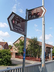
with pedestrians, running alongside a road or through a park for example. This is denoted by a blue circular sign showing a bicycle and pedestrians. A cycle only route is denoted by blue circular sign showing a only bicycle. Much of the Taff Trail, Ely Trail and Rumney Trail are segregated from traffic. Other such routes in the city include:
West Cardiff
Llandaff Fields
Llandaff Fields is a large parkland spanning parts of central and northern Cardiff, Wales.The park is owned by Cardiff Council and managed by its Parks department. The parkland is highly visible and accessed from local communities. The parkland is lined with avenues of trees and large grassed areas...
: through parkland area in Pontcanna
Pontcanna
Pontcanna is a western district of the city of Cardiff, Wales. Its area is bounded approximately by Llandaff Fields to the north, the Riverside district and Cowbridge Road to the south, the River Taff to the west and the district of Canton to the east.Pontcanna is a very well to do area of wide...
, connecting with the Taff Trail
North Cardiff
Tongwynlais
Tongwynlais is a village in the north of Cardiff, capital of Wales, in the Taff Valley.- Overview :Tongwynlais lies in the River Taff Valley. Its population is 1946 people....
Gabalfa Interchange: routes run over and round the junction as an alternative to vehicle routes University Hospital of Wales
University Hospital of Wales
University Hospital of Wales , opened in November 1971, is a major 1000-bed hospital situated in the inner city district of Heath in Cardiff, Wales...
: routes run around Heath Hospital through King George Field
South Cardiff
Ninian Park railway station
Ninian Park railway station serves the Leckwith and South Canton areas of Cardiff, which lies just outside Cardiff city centre.The station, which is situated west of Cardiff Central, was opened when the City Line reopened to passenger services in 1987, using platforms previously used only for...
in Canton
Canton, Cardiff
Canton is an inner-city district and community in the west of Cardiff, capital of Wales, lying west of the city's civic centre. One of the most ethnically diverse of Cardiff's suburbs, with a significant Asian population such as Pakistanis and Indians, Canton has a population just in excess of...
connecting to the Ely Trail Cardiff International Sports Village
Cardiff International Sports Village
Cardiff International Sports Village is located in Cardiff Bay in the city of Cardiff, Wales. It is one of the largest regeneration projects currently in the UK...
: the vicinity has a network a segregated routes connected to the Ely Trail in the west, Grangetown
Grangetown, Cardiff
Grangetown is a community in the south of Cardiff, capital of Wales. It is one of the largest districts in the south of the city and is bordered by Riverside, Canton and Butetown. The River Taff winds its way through the area...
in the north, and Cardiff Bay
Cardiff Bay
Cardiff Bay is the area created by the Cardiff Barrage in South Cardiff, the capital of Wales. The regeneration of Cardiff Bay is now widely regarded as one of the most successful regeneration projects in the United Kingdom. The Bay is supplied by two rivers to form a freshwater lake round the...
in the east Lloyd George Avenue: from the City Centre to Cardiff Bay, part of Route 8 Central Link: parallel to the east of Lloyd George Avenue Butetown
Butetown
Butetown is a community in the south of the city of Cardiff, the capital of Wales. It was originally a model housing estate built in the early nineteenth century by John Crichton-Stuart, 2nd Marquess of Bute, for whose title the area was named...
: a route runs through a housing estate to Cardiff Bay, parallel to the west of Lloyd George Avenue
Adamsdown
Adamsdown is an inner city area and community in the south of Cardiff, the capital city of Wales.-History:In mediaeval times, Adamsdown lay just outside the east walls of Cardiff and was owned by the lords of Glamorgan. The area may be named after an Adam Kygnot, a porter at Cardiff Castle around...
and Tremorfa
Tremorfa
Tremorfa is a district of the city of Cardiff, Wales. It falls into the Splott ward of Cardiff.-Transport:Tremorfa is the terminus of the 12/13 routes operating to Culverhouse Cross via Splott, Central Stn, Canton and Ely...
East Cardiff
- LlanedeyrnLlanedeyrn-Early history:The name "Llanedeyrn" is believed to be derived from a sixth century monk and a Celtic saint named St. Edeyrn. During the sixth century, St. Edeyrn and a fellow monk, St. Isan, were given the task of spreading the faith and establishing places of worship. The first location chosen by...
: a route runs through the housing estate from St Mellons Road to Llanederyn Interchange - Pentwyn Drive: a route runs along this road in PentwynPentwyn, CardiffPentwyn is a district in the east of Cardiff, Wales, located northeast of the city centre.- Amenities :Pentwyn has three pubs : The Village Inn, Hollybush and The Grand Slam. Pentwyn has its own shopping centre which has a Post Office, newsagent, fish and chips Shop, Pentwyn Balti, Betfred and the...
around Wern-goch Park and connects with the Rumney Trail - St MellonsSt MellonsSt Mellons is a district and suburb of eastern Cardiff, the capital city of Wales.-History:St Mellons began as a small commercial centre in the historic county of Monmouthshire, relying heavily on rural agriculture, farming and travel...
: routes connect various parts of the suburb - LlanrumneyLlanrumneyLlanrumney is a district and suburb in the east of Cardiff, the capital city of Wales.-History:The land where modern Llanrumney stands was left to Keynsham Abbey by the Lord of Glamorgan after the Norman Conquest...
: a route connects Llanrumney Avenue with Ball Road, near the Rumney Trail
Cycle parking
There are bicycle standBicycle stand
A bicycle stand,also called a bike rack, is a device to which bicycles may be securely attached. It may be free standing or securely attached to the ground or some stationary object such as a building. Indoor bike racks are commonly used for private bicycle parking, while outdoor bike racks are...
s for parking in locations including the following:
West Cardiff
- ElyEly, CardiffEly is a community primarily dominated by council housing in western Cardiff, capital of Wales.-The Roman era:In Roman times, Ely was the site of a Roman villa, near the old racecourse...
: Ely Library - CantonCanton, CardiffCanton is an inner-city district and community in the west of Cardiff, capital of Wales, lying west of the city's civic centre. One of the most ethnically diverse of Cardiff's suburbs, with a significant Asian population such as Pakistanis and Indians, Canton has a population just in excess of...
: Cowbridge Road East, Wellington Street and Llandaff Road - FairwaterFairwater, CardiffFairwater is a district in the west of Cardiff, capital of Wales. It is located a few miles from Culverhouse Cross which connects Cardiff to the M4 motorway.- History :The name Tyllgoed, meaning "dark wood" goes back to the 15th century...
: Fairwater Library
North Cardiff
- RhiwbinaRhiwbinaRhiwbina is a prosperous northern suburb of Cardiff, capital of Wales. It used to be a separate village: its core is still locally called "the village" and is given a Welsh village appearance by Beulah United Reformed Church at the village crossroads.Capel Beulah/Beulah URC was a daughter chapel...
: Rhiwbina railway stationRhiwbina railway stationRhiwbina railway station is a railway station serving Rhiwbina, Cardiff. It is located on the Coryton Line north of Cardiff Central.Passenger services are provided by Arriva Trains Wales as part of the Valley Lines network.... - CathaysCathaysCathays is a district in the north of Cardiff, capital of Wales. It is an old suburb of Cardiff established in 1875. It is very densely populated and contains many older terraced houses giving it a Victorian era atmosphere...
: North Road (A470 roadA470 roadThe A470 is a major long-distance connective spine road in Wales, running from Cardiff on the south coast to Llandudno on the north coast. It covers approximately 186 miles , over a zig-zagging route through the entirety of the country's mountainous central region, including the Brecon Beacons and...
) and Cathays Library - PenylanPenylanPenylan is a district in the east of Cardiff, the capital city of Wales, known for its Victorian era period houses and spacious tree lined roads and avenues....
: Penylan Library - RoathRoathRoath is a district in the east/north-east of the city of Cardiff, capital of Wales.It lies just east/north east of the city centre, stretching from Adamsdown in the south to Roath Park in the north. Roath contains the Plasnewydd electoral ward. The name is believed to originate from Irish ráth,...
: Roath Library
South Cardiff
- Cardiff BayCardiff BayCardiff Bay is the area created by the Cardiff Barrage in South Cardiff, the capital of Wales. The regeneration of Cardiff Bay is now widely regarded as one of the most successful regeneration projects in the United Kingdom. The Bay is supplied by two rivers to form a freshwater lake round the...
: around Mermaid QuayMermaid QuayMermaid Quay is a waterfront shopping and leisure district in Cardiff Bay, Cardiff, Wales. The 14,000 sq m development was opened in 1999, and includes restaurants, bars, cafes and shops.- Eating & Drinking at Mermaid Quay :...
, Wales Millennium CentreWales Millennium CentreWales Millennium Centre is an arts centre located in the Cardiff Bay area of Cardiff, Wales. The site covers a total area of . Phase 1 of the building was opened during the weekend of the 26–28 November 2004 and phase 2 opened on 22 January 2009 with an inaugural concert...
, Atlantic WharfAtlantic WharfAtlantic Wharf is a southern area of the city of Cardiff, Wales. It is primarily an area of new houses and apartments located on the west side of the disused Bute East Dock and to the east of Lloyd George Avenue. It also includes a number of refurbished dock warehouses, modern hotels, the Red...
and West Bute Street
Cardiff City Centre
Cardiff city centre
Cardiff city centre is the central business district of Cardiff, Wales. The area is tightly bounded by the River Taff to the west, the Civic centre to the north and railway lines and two railway stations - Central and Queen Street - to the south and east respectively...
- Central Square: for Central busCardiff Central bus stationCardiff Central bus station is the main bus transport interchange in Cardiff, the capital city of Wales. With 34 stands, it is the largest bus station in the city and in Wales. It is located adjacent to Cardiff Central railway station forming a major bus-rail-cycle-taxi interchange.The station used...
and railway stationsCardiff Central railway stationCardiff Central railway station is a major railway station on the South Wales Main Line in Cardiff, Wales.It is the largest and busiest station in Wales and one of the major stations of the British rail network, the tenth busiest station in the United Kingdom outside of London , based on 2007/08... - Castle Street: near Millennium StadiumMillennium StadiumThe Millennium Stadium is the national stadium of Wales, located in the capital, Cardiff. It is the home of the Wales national rugby union team and also frequently stages games of the Wales national football team, but is also host to many other large scale events, such as the Super Special Stage...
- Wood Street: at Millennium Plaza
- The Hayes: for Cardiff Central LibraryCardiff Central LibraryCardiff Central Library , is the main library in the city centre of Cardiff, Wales. Four buildings have been named as such, with the newest building opening on 14 March 2009 and officially being opened a few months later on 18 June 2009 by the Manic Street Preachers...
- Westgate Street: opposite Millennium Stadium
- The Friary: for Queen Street
- Park Place: for Queen Street
- Charles Street: for Queen Street
- Churchill Way: for Queen Street and Capitol Shopping Centre
- Queen Street: near junction with Newport Road
- Cardiff Queen Street railway stationCardiff Queen Street railway stationCardiff Queen Street railway station is Wales' second busiest railway station in Cardiff, Wales. It is one of 20 stations in the city and two in the city centre, the other being Cardiff Central...
- Callahagn Square
- Cathays ParkCathays ParkIn addition to the large lawn in front of the City Hall, Cathays Park includes three formal gardens. All of the spaces are within conservation areas and many of the surrounding buildings are listed. The open spaces are very important to the image of the city. Several important buildings overlook...
: at City HallCity Hall, CardiffCity Hall is a civic building in Cathays Park, Cardiff, Wales. Built of Portland stone, it became the fifth building to serve as Cardiff's centre of local government when it opened in October 1906. The competition to design a town hall and adjacent law courts for Cardiff was won in 1897 by the firm...
East Cardiff
- RumneyRumney, CardiffRumney is a district in the east of the city of Cardiff, Wales. It lies east of the Rhymney River, and is historically part of Monmouthshire...
: Rumney Library - LlanrumneyLlanrumneyLlanrumney is a district and suburb in the east of Cardiff, the capital city of Wales.-History:The land where modern Llanrumney stands was left to Keynsham Abbey by the Lord of Glamorgan after the Norman Conquest...
: Llanrumney Library - St MellonsSt MellonsSt Mellons is a district and suburb of eastern Cardiff, the capital city of Wales.-History:St Mellons began as a small commercial centre in the historic county of Monmouthshire, relying heavily on rural agriculture, farming and travel...
: St Mellons Library
Cycle hire: Cardiff Smart Bike / Pedal Power
The Welsh Assembly GovernmentWelsh Assembly Government
The Welsh Government is the devolved government of Wales. It is accountable to the National Assembly for Wales, the legislature which represents the interests of the people of Wales and makes laws for Wales...
and Cardiff Council announced plans to introduce a free cycle hire scheme in March 2009, with at least 12 bike racks, each with five to seven bikes, placed around the city, allowing people to pick up bikes and ride them to another point, where they will leave the bike. Money would also be put into creating more strategic cycle routes and cycle lanes.
The system, similar to those in other large cities, launched in September 2009, and includes 70 bikes and 35 hire points (initially 7) around the centre and the south of the city. The current stations are: Central Station; Cardiff Castle; Central Library; Queen Street Station; Churchill Way; City Hall; eastern Queen Street; Cardiff Bay Station; County Hall; and Cardiff Bay Visitors’ Centre.
It is necessary to register before using a bike. The first half an hour is free after which a small hourly fee is payable. The scheme, which is part of a £28.5 million plan to encourage residents in the capital to use sustainable transport and ease congestion, was welcomed by campaigners.
Pedal Power is a charity with their main bike centre in Pontcanna
Pontcanna
Pontcanna is a western district of the city of Cardiff, Wales. Its area is bounded approximately by Llandaff Fields to the north, the Riverside district and Cowbridge Road to the south, the River Taff to the west and the district of Canton to the east.Pontcanna is a very well to do area of wide...
offering cycle hire facilities. Cycle training and cycle assessments are also available.
Cycle refurbishment
Cardiff Cycle Workshop, a bike workshop launched in July 2010 in ElyEly, Cardiff
Ely is a community primarily dominated by council housing in western Cardiff, capital of Wales.-The Roman era:In Roman times, Ely was the site of a Roman villa, near the old racecourse...
, refurbishes and repairs unwanted cycles, saving old bikes from the landfill and revitalises them for new owners at cheaper prices. Cardiff Cycle Workshop has an agreement with Cardiff Council
Cardiff Council
The County Council of the City and County of Cardiff is the governing body for Cardiff, one of the Principal Areas of Wales. The council consists of 75 councillors, representing 29 electoral wards. The authority is properly styled as The County Council of the City and County of Cardiff or in...
for cages to be placed in the waste facilities in Fairwater
Fairwater, Cardiff
Fairwater is a district in the west of Cardiff, capital of Wales. It is located a few miles from Culverhouse Cross which connects Cardiff to the M4 motorway.- History :The name Tyllgoed, meaning "dark wood" goes back to the 15th century...
and Grangetown
Grangetown, Cardiff
Grangetown is a community in the south of Cardiff, capital of Wales. It is one of the largest districts in the south of the city and is bordered by Riverside, Canton and Butetown. The River Taff winds its way through the area...
for members of the public to leave their unwanted bicycles. Then the bikes are refurbished, checked for safety and have parts replaced. The bikes are then sold for anything from £10 to £150. Three year funding has come from the Big Lottery Fund
Big Lottery Fund
The Big Lottery Fund is a grant-making non-departmental public body in the United Kingdom created by the Government to administer the funding of "good causes" following the creation of the National Lottery. It has an annual expenditure of £630 million...
.
Ely Trail
The off-road Ely Trail is under development in the westCardiff West
Cardiff West or West Cardiff refers to the collection of communities in the west of Cardiff, Wales. Also the usage is unofficial and boundaries are only ambiguously defined, they generally share the postcodes CF5 or CF15, and the telephone code 029...
and south
Cardiff South
Cardiff South or South Cardiff can refer to the collection of communities in the south of Cardiff, Wales. Although the usage is unofficial and boundaries are only ambiguously defined, they generally share the postcodes CF10, CF11 or CF24 and the telephone code 029...
of the city as of 2010, funded by the County Council, Visit Wales, and Countryside Council for Wales. So far completed is the northern section through St Fagans, Fairwater
Fairwater, Cardiff
Fairwater is a district in the west of Cardiff, capital of Wales. It is located a few miles from Culverhouse Cross which connects Cardiff to the M4 motorway.- History :The name Tyllgoed, meaning "dark wood" goes back to the 15th century...
and Ely
Ely, Cardiff
Ely is a community primarily dominated by council housing in western Cardiff, capital of Wales.-The Roman era:In Roman times, Ely was the site of a Roman villa, near the old racecourse...
, and the southern section running from Leckwith
Leckwith
Leckwith is a district of western Cardiff, Wales, United Kingdom. It is home to Cardiff City F.C.'s and Cardiff Blues home ground Cardiff City Stadium, and to Fitzalan High School...
to the south along the River Ely
River Ely
The River Ely is a river in South Wales flowing generally south east, from Tonyrefail to the capital city of Cardiff.-Course of the river:...
through Grangetown
Grangetown, Cardiff
Grangetown is a community in the south of Cardiff, capital of Wales. It is one of the largest districts in the south of the city and is bordered by Riverside, Canton and Butetown. The River Taff winds its way through the area...
, finishing at the Cardiff International Sports Village
Cardiff International Sports Village
Cardiff International Sports Village is located in Cardiff Bay in the city of Cardiff, Wales. It is one of the largest regeneration projects currently in the UK...
. However, these sections are yet to be connected.
The route is connected to Cardiff City Centre
Cardiff city centre
Cardiff city centre is the central business district of Cardiff, Wales. The area is tightly bounded by the River Taff to the west, the Civic centre to the north and railway lines and two railway stations - Central and Queen Street - to the south and east respectively...
via an off-road north-south route through Butetown
Butetown
Butetown is a community in the south of the city of Cardiff, the capital of Wales. It was originally a model housing estate built in the early nineteenth century by John Crichton-Stuart, 2nd Marquess of Bute, for whose title the area was named...
. The Taff Trail at Cardiff Bay
Cardiff Bay
Cardiff Bay is the area created by the Cardiff Barrage in South Cardiff, the capital of Wales. The regeneration of Cardiff Bay is now widely regarded as one of the most successful regeneration projects in the United Kingdom. The Bay is supplied by two rivers to form a freshwater lake round the...
can also be joined from the trail via Grangetown and Butetown.
Rhymney Trail
The off-road Rhymney Trail is being developed by the Council as a commuting and recreational route along the Rhymney RiverRhymney River
The Rhymney River is a river in the Rhymney Valley, south-east Wales, flowing through Cardiff into the Severn estuary.The river forms the boundary between the historic counties of Glamorgan and Monmouthshire.-Path of the river:...
in the east
Cardiff East
Cardiff East may refer to:* Cardiff East * Cardiff East...
of the city. Currently completed is the section between Llanedeyrn
Llanedeyrn
-Early history:The name "Llanedeyrn" is believed to be derived from a sixth century monk and a Celtic saint named St. Edeyrn. During the sixth century, St. Edeyrn and a fellow monk, St. Isan, were given the task of spreading the faith and establishing places of worship. The first location chosen by...
and Rumney
Rumney, Cardiff
Rumney is a district in the east of the city of Cardiff, Wales. It lies east of the Rhymney River, and is historically part of Monmouthshire...
. The Cardiff Cycle Map shows the route running off-road from Llanedeyrn Interchange, bypassing Llanrumney
Llanrumney
Llanrumney is a district and suburb in the east of Cardiff, the capital city of Wales.-History:The land where modern Llanrumney stands was left to Keynsham Abbey by the Lord of Glamorgan after the Norman Conquest...
to the west, briefly joining Newport Road (B4487), and then heading south of Rumney to Wentloog Avenue (B4239). However, an off-road section also runs north-south through Pentwyn
Pentwyn, Cardiff
Pentwyn is a district in the east of Cardiff, Wales, located northeast of the city centre.- Amenities :Pentwyn has three pubs : The Village Inn, Hollybush and The Grand Slam. Pentwyn has its own shopping centre which has a Post Office, newsagent, fish and chips Shop, Pentwyn Balti, Betfred and the...
from Llanedeyrn.
Taff Trail
Taff Trail
The Taff Trail is a popular walking and cycle path that runs for between Cardiff Bay and Brecon in Wales. It is named so because it follows the course of the River Taff...
runs from Cardiff Bay
Cardiff Bay
Cardiff Bay is the area created by the Cardiff Barrage in South Cardiff, the capital of Wales. The regeneration of Cardiff Bay is now widely regarded as one of the most successful regeneration projects in the United Kingdom. The Bay is supplied by two rivers to form a freshwater lake round the...
through Pontypridd
Pontypridd
Pontypridd is both a community and a principal town of Rhondda Cynon Taf, Wales and is situated 12 miles/19 km north of the Welsh capital city of Cardiff...
and Merthyr Tydfil
Merthyr Tydfil
Merthyr Tydfil is a town in Wales, with a population of about 30,000. Although once the largest town in Wales, it is now ranked as the 15th largest urban area in Wales. It also gives its name to a county borough, which has a population of around 55,000. It is located in the historic county of...
to Brecon
Brecon
Brecon is a long-established market town and community in southern Powys, Mid Wales, with a population of 7,901. It was the county town of the historic county of Brecknockshire; although its role as such was eclipsed with the formation of Powys, it remains an important local centre...
, forming part of the Lôn Las Cymru - the National Cycle Network
National Cycle Network
The National Cycle Network is a network of cycle routes in the United Kingdom.The National Cycle Network was created by the charity Sustrans , and aided by a £42.5 million National Lottery grant. In 2005 it was used for over 230 million trips.Many routes hope to minimise contact with motor...
Route 8
National Cycle Route 8
The route passes through the heart of Wales, and is also known by its Welsh name Lôn Las Cymru . It is largely north-south from Holyhead to Cardiff and Chepstow, and in total measures some in length...
to Holyhead
Holyhead
Holyhead is the largest town in the county of Anglesey in the North Wales. It is also a major port adjacent to the Irish Sea serving Ireland....
.
The route begins at Roald Dahl Plass
Roald Dahl Plass
Roald Dahl Plass is a public plaza in Cardiff Bay, part of Cardiff, Wales. It is named after Cardiff-born author Roald Dahl, and is located on the coast along the south of the city centre. The square is home to the Senedd and the Wales Millennium Centre, a performing arts centre...
in Cardiff Bay
Cardiff Bay
Cardiff Bay is the area created by the Cardiff Barrage in South Cardiff, the capital of Wales. The regeneration of Cardiff Bay is now widely regarded as one of the most successful regeneration projects in the United Kingdom. The Bay is supplied by two rivers to form a freshwater lake round the...
and runs mostly off-road through the city for 7.5 miles (12.1 km) north through the City Centre
Cardiff city centre
Cardiff city centre is the central business district of Cardiff, Wales. The area is tightly bounded by the River Taff to the west, the Civic centre to the north and railway lines and two railway stations - Central and Queen Street - to the south and east respectively...
, joining the River Taff
River Taff
The River Taff is a large river in Wales. It rises as two rivers in the Brecon Beacons — the Taf Fechan and the Taf Fawr — before joining to form the Taff north of Merthyr Tydfil...
in Bute Park
Bute Park
Bute Park in Cardiff, Wales, is an extensive area of mature parkland easily accessible from the city centre. Flanked by the River Taff, Sophia Gardens, Pontcanna Fields and Cardiff Castle, Bute Park is a very popular 'green lung' full of historic and wildlife interest. Few cities have such a...
before heading north-west through Llandaff
Llandaff
Llandaff is a district in the north of Cardiff, capital of Wales, having been incorporated into the city in 1922. It is the seat of the Church in Wales Bishop of Llandaff, whose diocese covers the most populous area of South Wales. Much of the district is covered by parkland known as Llandaff...
and Radyr
Radyr
Radyr is an outer suburb of Cardiff, the capital of Wales. The suburb is situated in the west of the city, although it was originally a separate village, and is located around 5 miles north west of Cardiff city centre. According to 2009 estimates, the suburb has a population of 6,000...
, leaving the city at Tongwynlais
Tongwynlais
Tongwynlais is a village in the north of Cardiff, capital of Wales, in the Taff Valley.- Overview :Tongwynlais lies in the River Taff Valley. Its population is 1946 people....
.
Route 88: Coastal route
Route 88 is a proposed costal route from NewportNewport
Newport is a city and unitary authority area in Wales. Standing on the banks of the River Usk, it is located about east of Cardiff and is the largest urban area within the historic county boundaries of Monmouthshire and the preserved county of Gwent...
to Margam Country Park
Margam Country Park
Margam Country Park is a country park estate in Britain, of around 850 acres . It is situated in Margam, about 2 miles from Port Talbot in south Wales it was once owned by the Mansel Talbot family and is now owned and administered by the local council, Neath Port Talbot County Borough Council...
via Cardiff
Cardiff
Cardiff is the capital, largest city and most populous county of Wales and the 10th largest city in the United Kingdom. The city is Wales' chief commercial centre, the base for most national cultural and sporting institutions, the Welsh national media, and the seat of the National Assembly for...
.
Pont y Werin
Pont y Werin (WelshWelsh language
Welsh is a member of the Brythonic branch of the Celtic languages spoken natively in Wales, by some along the Welsh border in England, and in Y Wladfa...
for The People's Bridge) is a pedestrian and cyclist bridge spanning the River Ely
River Ely
The River Ely is a river in South Wales flowing generally south east, from Tonyrefail to the capital city of Cardiff.-Course of the river:...
between Cardiff Bay
Cardiff Bay
Cardiff Bay is the area created by the Cardiff Barrage in South Cardiff, the capital of Wales. The regeneration of Cardiff Bay is now widely regarded as one of the most successful regeneration projects in the United Kingdom. The Bay is supplied by two rivers to form a freshwater lake round the...
and Penarth
Penarth
Penarth is a town and seaside resort in the Vale of Glamorgan , Wales, 5.2 miles south west from the city centre of the Welsh capital city of Cardiff and lying on the north shore of the Severn Estuary at the southern end of Cardiff Bay...
. Costing approximately £4.5 million, Pont y Werin crosses between the Cardiff International Sports Village
Cardiff International Sports Village
Cardiff International Sports Village is located in Cardiff Bay in the city of Cardiff, Wales. It is one of the largest regeneration projects currently in the UK...
and Penarth
Penarth
Penarth is a town and seaside resort in the Vale of Glamorgan , Wales, 5.2 miles south west from the city centre of the Welsh capital city of Cardiff and lying on the north shore of the Severn Estuary at the southern end of Cardiff Bay...
, allowing the public to travel to the Sports Village via Cogan railway station
Cogan railway station
Cogan railway station is a railway station serving Cogan in the Vale of Glamorgan in Wales. It is located on the Vale of Glamorgan Line 2¾ miles south of Cardiff Central on the way to Barry Island and Bridgend....
.
Opened on 14 July 2010, the bascule bridge
Bascule bridge
A bascule bridge is a moveable bridge with a counterweight that continuously balances the span, or "leaf," throughout the entire upward swing in providing clearance for boat traffic....
completes the 6.5 miles (10.5 km) Cardiff Bay circular walk and cycle route, and incorporates a 20-metre opening section to allow river traffic to pass.
Cardiff rail network
Cycling is integrated into the city's urban rail networkValley Lines
Valleys & Cardiff Local Routes is the busy network of passenger suburban railway services radiating from Cardiff, Wales. It includes lines within the city itself, the Vale of Glamorgan and the South Wales Valleys....
, which is operated by Arriva Trains Wales
Arriva Trains Wales
Arriva Trains Wales is a train operating company, owned by Arriva, that operates urban and inter urban passenger services in Wales and the Welsh Marches...
. Most trains have spaces for two cycles. However they are not permitted on services from Caerphilly
Caerphilly railway station
Caerphilly railway station is a railway station serving the town of Caerphilly, south Wales. It is a stop on the Rhymney Line of the Valley Lines network. The station is located at Station Road in the South of the town. Facilities include a small shop and a Ticket Kiosk. A self-service Ticket...
, Radyr
Radyr railway station
Radyr railway station is a railway station serving the Radyr area of Cardiff. It is located at the foot of the hill at the eastern edge of the village, alongside the River Taff and adjacent to the Taff Trail.-History:...
(except the City Line
Cardiff City Line
The City Line is a commuter railway line in Cardiff that runs from Coryton to Radyr via Cardiff Central. Regular passenger services on this route started in 1987. Passenger trains run from Monday to Saturday. The line is also used as a diversionary route for trains to Merthyr, Aberdare and...
), Cadoxton
Cadoxton railway station
Cadoxton railway station is a railway station serving Cadoxton and Palmerstown near Barry, Vale of Glamorgan, Wales. It is located on the Vale of Glamorgan Line 10 km south of Cardiff Central towards Bridgend and Barry Island....
, and Ebbw Vale Parkway
Ebbw Vale Parkway railway station
Ebbw Vale Parkway railway station is the current terminus of the Ebbw Valley Railway. The station opened on 6 February 2008 when services to and from Cardiff Central commenced after 46 years of being a freight-only line...
to Cardiff Queen Street or Cardiff Central
Cardiff Central railway station
Cardiff Central railway station is a major railway station on the South Wales Main Line in Cardiff, Wales.It is the largest and busiest station in Wales and one of the major stations of the British rail network, the tenth busiest station in the United Kingdom outside of London , based on 2007/08...
between 07:00 and 09:30, or services in the reverse direction 16:00 to 18:00 on weekdays. Outside these times, carriage is still at the discretion of the guard. Folding cycles
Folding bicycle
A folding bicycle is a bicycle designed to fold into a compact form, facilitating transport and storage. When folded, the bikes can be more easily carried into buildings and workplaces or onto public transportation or more easily stored in compact living quarters or aboard a car, boat or plane...
can be carried folded-up at any time.
There is cycle storage at Cardiff Central station on platforms 3, 4, 6 and 7, at the rear of station and in the Riverside car park.
National rail network
Cycles are also permitted free of charge on the wider national network provided they can be safely stored in the designated areas and reservations through the train operatorTrain operating company
The term train operating company is used in the United Kingdom to describe the various businesses operating passenger trains on the railway system of Great Britain under the collective National Rail brand...
are recommended. Bikes must be carried in the designated area of the train and can’t be stored in aisles or vestibule areas. Cycles can not be carried on rail-replacement coach services. Folding bikes can be carried at all times as normal hand luggage.
Arriva Trains Wales also operates most of the Welsh rail network and its cycle policies apply to other services as well without the restrictions applied to the Cardiff rail network.
CrossCountry
CrossCountry
CrossCountry is the brand name of XC Trains Ltd., a British train operating company owned by Arriva...
, who operate from Cardiff Central to The Midlands
English Midlands
The Midlands, or the English Midlands, is the traditional name for the area comprising central England that broadly corresponds to the early medieval Kingdom of Mercia. It borders Southern England, Northern England, East Anglia and Wales. Its largest city is Birmingham, and it was an important...
and The North
Northern England
Northern England, also known as the North of England, the North or the North Country, is a cultural region of England. It is not an official government region, but rather an informal amalgamation of counties. The southern extent of the region is roughly the River Trent, while the North is bordered...
, advise to make a free reservation for cycles before travel. All trains have two reservable bike spaces. Bikes for which no reservation has been made will be accepted on a first come, first served basis and subject to space being available.
First Great Western
First Great Western
First Great Western is the operating name of First Greater Western Ltd, a British train operating company owned by FirstGroup that serves Greater London, the South East, South West and West Midlands regions of England, and South Wales....
, who operate from Cardiff Central to South West Wales
South West Wales
South West Wales is a region of Wales. A definition consisting of the unitary authorities of Swansea, Neath Port Talbot, Pembrokeshire and Carmarthenshire is used by a number of government agencies and private organisations including:*BBC...
, Bristol Temple Meads, London Paddington, Portsmouth Harbour
Portsmouth Harbour railway station
Portsmouth Harbour railway station is a railway station in Portsmouth, England. It is situated beside Gunwharf Quays in the city's harbour, and is an important transport terminal, with a bus interchange and ferry services to Gosport and the Isle of Wight. The station currently has four platforms:...
and Taunton
Taunton railway station
Taunton railway station is a junction station on the route from London to Penzance, from London Paddington station. It is situated in Taunton, Somerset, England and is operated by First Great Western...
, make some cycle reservations compulsory. Six cycles can be carried in Coach A on HST
InterCity 125
The InterCity 125 was the brand name of British Rail's High Speed Train fleet. The InterCity 125 train is made up of two power cars, one at each end of a fixed formation of Mark 3 carriages, and is capable of , making the train the fastest diesel-powered locomotive in regular service in the...
s, which are typically used on the London / South West Wales route. DMU trains, which are usually used on the Cardiff-Taunton and Cardiff-Southampton-Portsmouth route can carry at least two cycles at the end of the train. Most of they stations they operate have cycle storage and/or parking facilities. Restrictions, however, are that reservationss are compulsory on services that arrive into London Paddington between 07:00 and 10:00 and depart between 15:00 and 19:00 on weekdays.
Buses
Cycles can not be carried on bus services in Cardiff. However, a Beacons Bus runs on Sundays and Bank Holidays in summer to BreconBrecon
Brecon is a long-established market town and community in southern Powys, Mid Wales, with a population of 7,901. It was the county town of the historic county of Brecknockshire; although its role as such was eclipsed with the formation of Powys, it remains an important local centre...
which tows a cycle trailer to carry cycles. The X40 service to Aberystwyth
Aberystwyth
Aberystwyth is a historic market town, administrative centre and holiday resort within Ceredigion, Wales. Often colloquially known as Aber, it is located at the confluence of the rivers Ystwyth and Rheidol....
is one of the Traws Cambria services that does not carry cycles.
Cardiff Cycling Campaign
The Cardiff Cycling Campaign campaigns for better provisions for cyclists in the city, believing that the council's attitude is inadequate. While it welcomes the Council's commitment to consider the needs of cyclists, it argues that these should not be marginal in relation to the management of cars and buses. A sea-change in thinking is required and available Council funds need to be used imaginatively to create 'coherent and continuous routes' through the city for cyclists. For example, safe cycling routes through the city centre were lost with the construction of the new St Davids 2 shopping centre.In April 2006 the Campaign pointed out that only 2.7% of people cycled to work in Cardiff. Campaigners cycled through Cardiff city centre during a rush hour period, accompanied by local councillors and a Welsh Assembly Member. A participating councillor was quoted as saying 'I was happy to rise to the challenge but at times it was frightening. The cycle lanes were sometimes inadequate and complicated, and if I hadn't been with the campaign I probably would have got lost'.
Cycle Cardiff
Cycle Cardiff aims to raise awareness of cycling and organises bike rides in and around the city.World Naked Bike Ride
The Cardiff World Naked Bike Ride has taken place annually since 2008. This is part of a globally coordinated World Naked Bike RideWorld Naked Bike Ride
World Naked Bike Ride is an international clothing-optional bike ride in which participants plan, meet and ride together en masse on human-powered transport , to "deliver a vision of a cleaner, safer, body-positive world."The dress code motto is "Bare as you dare"...
, designed to highlight the vulnerability of cyclists on the road and campaign for better cycling facilities. In June 2011 80 cyclists reportedly took part riding through the centre of Cardiff, many of them naked.
Investment
On 11 March 2009, the Welsh Assembly GovernmentWelsh Assembly Government
The Welsh Government is the devolved government of Wales. It is accountable to the National Assembly for Wales, the legislature which represents the interests of the people of Wales and makes laws for Wales...
announced an investment of £28.5 million into an improved green transport system for Cardiff. According to Ieuan Wyn Jones
Ieuan Wyn Jones
Ieuan Wyn Jones, AM is a Welsh politician, who was the Deputy First Minister in the Welsh Assembly Government from 2007 until 2011. Jones is the current leader of Plaid Cymru and Member of the National Assembly for Wales for the Ynys Môn constituency...
, Minister for Economy and Transport in Wales, the Welsh capital will receive the financial boost towards green travel solutions over the two years, including money for improved walking and cycling routes into and around the city centre.
Commuter cycle route
A commuter route for cyclists is to be installed, aiming to improve transport links between Penarth and Cardiff Bay. The Vale of Glamorgan’s first contra-flow cycle lane, which allows cycling on one way streets, will be established in 2011.External links
- Cardiff Council cycling home page
- Unofficial Taff Trail Website
- Official Taff Trail Leaflet
- Taff Trail in Cardiff
- Keeping Cardiff Moving
- OYBike - Cardiff Smart Bike hire
- http://wiki.worldnakedbikeride.org/index.php?title=Cardiff Environmental protest held at Cardiff, and worldwide, annually
- Pedal Power Bike Hire