

Carling Avenue
Encyclopedia
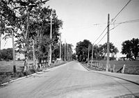
Road
A road is a thoroughfare, route, or way on land between two places, which typically has been paved or otherwise improved to allow travel by some conveyance, including a horse, cart, or motor vehicle. Roads consist of one, or sometimes two, roadways each with one or more lanes and also any...
in the west end of Ottawa
Ottawa
Ottawa is the capital of Canada, the second largest city in the Province of Ontario, and the fourth largest city in the country. The city is located on the south bank of the Ottawa River in the eastern portion of Southern Ontario...
, Ontario
Ontario
Ontario is a province of Canada, located in east-central Canada. It is Canada's most populous province and second largest in total area. It is home to the nation's most populous city, Toronto, and the nation's capital, Ottawa....
, Canada
Canada
Canada is a North American country consisting of ten provinces and three territories. Located in the northern part of the continent, it extends from the Atlantic Ocean in the east to the Pacific Ocean in the west, and northward into the Arctic Ocean...
. It runs from March Road
March Road
March Road is an arterial boulevard in the Kanata area of Ottawa, Ontario, Canada.The road begins at the point where Eagleson Road crosses The Queensway and turns to the west at the Dunrobin turnoff. The road continues past Carp, crosses The Queensway a second time and continues all the way to...
in Kanata
Kanata
Kanata is an aboriginal word meaning "village" or "settlement."- Name of Canada :Until the mid-20th century, the Mohawk word "kanata" was thought to have been the origin of Canada's name...
to Bronson Avenue in the Glebe
The Glebe
The Glebe is a neighbourhood in Ottawa, Ontario, Canada. It is located just south of Ottawa's downtown area, with its northern border being demarcated by the Queensway highway. It is bounded by the Rideau Canal to the south and east. Many maps show the western edge as Bronson Avenue, but some also...
. The road is named for John Carling
John Carling
Sir John Carling, PC, KCMG of the Carling Brewery was a prominent politician and businessman from London, Ontario, Canada...
, founder of Carling Brewery and Conservative MP and Senator, Postmaster General and Minister of Agriculture.
Road description
It begins north of Kanata and runs east until the Ottawa RiverOttawa River
The Ottawa River is a river in the Canadian provinces of Ontario and Quebec. For most of its length, it now defines the border between these two provinces.-Geography:...
where it bends south to go around Crystal Bay and Britannia Bay. At this point it runs in a straight direction towards the city core and ends at the fringes of the Glebe neighbourhood. It used to run all the way to O'Connor Street, one block east of Bank Street
Bank Street (Ottawa)
Bank Street is the major north-south road in Ottawa, Ontario, Canada. It runs south from Wellington Street in downtown Ottawa, south through the neighbourhoods of Centretown, The Glebe, Old Ottawa South, Alta Vista, Hunt Club, and then through the villages of Blossom Park, Leitrim, South...
, but the part east of Bronson was renamed Glebe Avenue in the 1970s. It is a four to six-lane principal arterial road for most of its urban length, with a speed limit of 60 km/h (37.3 mph). The portion through the Greenbelt
Greenbelt (Ottawa)
The Greenbelt is a crescent of land within the present-day boundaries of the city of Ottawa, Ontario, Canada, in which real estate development is strictly controlled. It begins at Shirleys Bay in the west and extends to Green's Creek in the east...
and into Kanata is generally a two-lane rural highway (although widening is planned, which would also remove a substandard underpass in the 3700 block about midway between March Road and Moodie Drive
Moodie Drive
Moodie Drive is a road in Ottawa's west end. It runs approximately south from Carling Avenue in Crystal Beach through Bells Corners, to Brophy Drive south of the Ottawa urban area. It is a four-lane route from Crystal Beach through Bells Corners but becomes a two-lane road at the intersection...
), with a speed limit of 80 km/h (49.7 mph).
In December 2005 one lane in each direction between Booth Street
Booth Street (Ottawa)
Booth Street is a major street just to the west of downtown Ottawa, Canada. North of Albert Street, Booth Street is designated as a city arterial road which proceeds to the Chaudière Bridge, connecting Ottawa to Gatineau. Once in Gatineau, it becomes Rue Eddy...
and Cambridge South just before Bronson was converted to a bus-only lane
Bus lane
A bus lane or bus only lane is a lane restricted to buses, and generally used to speed up public transport that would be otherwise held up by traffic congestion...
. This very short (roughly 150 m) bus-only section speeds up bus traffic through the Carling/Bronson intersection during rush-hour.
Features
Carling is home to Andrew Haydon ParkAndrew Haydon Park
Andrew Haydon Park is a park on the Ottawa River in the city of Ottawa. It is situated on Carling Avenue at Holly Acres Road.There is a bandshell for outdoor concerts and a picnic area. The Nepean Sailing Club is located nearby at Dick Bell Park...
, the Lincoln Fields Shopping Centre, Carlingwood Mall
Carlingwood Mall
Carlingwood Mall is a major mall located in the west end of the city of Ottawa, Ontario. It is operated by 20 Vic Management Incorporated. The mall opened in 1956 and was one of the city's first major shopping centres.-History:Simpsons-Sears department store was opened in 1955...
, Fairlawn Plaza, Westgate Mall, the Royal Ottawa Mental Health Centre, the Ottawa Civic Hospital and the Old Dominion Observatory, the Communications Research Centre
Communications Research Centre
The Communications Research Centre Canada is a Canadian government scientific laboratory for research and development in the field of advanced telecommunications. For over 40 years, it has made significant contributions to the information and communications technology sector in Canada and abroad...
, and Mitel
Mitel
Mitel Networks, is a high-tech company providing unified communications solutions for business. The company previously produced TDM PBX systems and applications but after a change in ownership in 2001 now focuses almost entirely on Voice-over-IP products.Mitel is headquartered in Ottawa,...
. It also runs along the northern boundaries of the Central Experimental Farm
Central Experimental Farm
The Central Experimental Farm is an agricultural facility, working farm, and research centre of the Research Branch of Agriculture and Agri-Food Canada. As the name indicates, this farm is centrally located in and completely surrounded by the City of Ottawa, Ontario, Canada...
and Commissioner's Park
Commissioner's Park
Commissioner's Park in Ottawa, is a major tulip viewing site with the highest concentration of tulips in the region during the annual Tulip Festival, numbering as many as 300,000....
.
Others
Carling is now known as Ottawa Road #38 but used to be Highway 17B east of Richmond Road until the Ontario government downloaded the highway to the local government. Until the 1970s, the western part of Carling was also part of Highway 17Highway 17 (Ontario)
King's Highway 17, more commonly known as Highway 17, is a provincially maintained highway and the primary route of the Trans-Canada Highway through the Canadian province of Ontario. It begins at the Manitoba border west of Kenora and ends south of Arnprior at the western terminus of Highway 417, ...
.
In every year from 2004 to 2007, Carling Avenue has been named one of Ontario's worst 20 roads in a CAA
Canadian Automobile Association
The Canadian Automobile Association , commonly known as CAA, is a non-profit federation, founded in 1913, of nine clubs across Canada, providing roadside assistance service, a complete range of auto touring and leisure travel services, insurance services, and member discounts with preferred...
survey, citing frequent bumps and potholes. Construction is underway through certain portions of it.
OC Transpo service
Key OC TranspoOC Transpo
OC Transpo is the urban transit service of the City of Ottawa, Ontario, Canada. An integrated hub-and-spoke system of services is available consisting of: regular buses travelling on fixed routes in mixed traffic, typical of most urban transit systems; a bus rapid transit system — a high...
bus routes on Carling Avenue include:
- 6 from Parkdale to Bronson, serving Carling O-Train StationCarling Station (OC Transpo)Carling O-Train Station an O-Train station, one block west of the intersection of Carling Avenue and Preston Street in Ottawa, Ontario. It is near Dow's Lake the western terminal of the Rideau Canal skating rink and a key site during the Canadian Tulip Festival in May. The station is also near...
, - 14 from Holland to Parkdale
- 16 from Lincoln Fields Transitway Terminus to Carlingwood,
- 85 from BayshoreBayshore Station (OC Transpo)Bayshore Transitway Station is a transit station on Ottawa, Ontario, Canada's transitway served by OC Transpo buses. It is located in the western transitway section at the Bayshore Shopping Centre...
to Bronson Avenue, serving Lincoln Fields Transitway Terminus and Carling StationCarling Station (OC Transpo)Carling O-Train Station an O-Train station, one block west of the intersection of Carling Avenue and Preston Street in Ottawa, Ontario. It is near Dow's Lake the western terminal of the Rideau Canal skating rink and a key site during the Canadian Tulip Festival in May. The station is also near... - 97 from Pinecrest Road (Richmond Road for eastbound trips) to Lincoln Fields
- 101 from the QueenswayQueensway (Ottawa)The Queensway is a major controlled-access freeway running through Ottawa, Ontario, Canada, from Kanata in the west to Orleans in the east. It is the primary east-west transportation artery in the Ottawa-Gatineau area....
to Booth, serving Carling StationCarling Station (OC Transpo)Carling O-Train Station an O-Train station, one block west of the intersection of Carling Avenue and Preston Street in Ottawa, Ontario. It is near Dow's Lake the western terminal of the Rideau Canal skating rink and a key site during the Canadian Tulip Festival in May. The station is also near... - 151 from Kirkwood to Merivale,
- 156 from Carlingwood to Maitland,
- 166 from Moodie/Grandview to Bayshore,
- 176 from Holland to Merivale, serving the Royal Ottawa Hospital, as well as Westgate Shopping Centre.
These are supplemented by peak hour routes:
- 102 from Holland to Booth, and Carling StationCarling Station (OC Transpo)Carling O-Train Station an O-Train station, one block west of the intersection of Carling Avenue and Preston Street in Ottawa, Ontario. It is near Dow's Lake the western terminal of the Rideau Canal skating rink and a key site during the Canadian Tulip Festival in May. The station is also near...
, - 116 from NortelNortelNortel Networks Corporation, formerly known as Northern Telecom Limited and sometimes known simply as Nortel, was a multinational telecommunications equipment manufacturer headquartered in Mississauga, Ontario, Canada...
to Lincoln Fields, - 150 from Churchill to Maitland,
- 155 from Kirkwood to Holland,
- 169 from Herzberg to Moodie,
- 182 from Herzberg to Moodie,
- 187 from Clyde to Churchill.
There is a Carling Station (OC Transpo)
Carling Station (OC Transpo)
Carling O-Train Station an O-Train station, one block west of the intersection of Carling Avenue and Preston Street in Ottawa, Ontario. It is near Dow's Lake the western terminal of the Rideau Canal skating rink and a key site during the Canadian Tulip Festival in May. The station is also near...
, presently servicing the O-Train, that connects with the aforementioned routes, as well as Route 3 from nearby Preston Avenue.
Major intersections
The addresses change erratically on Carling; they are not consistent from point to point and rise rapidly in the eastern part, then slow down to a very slow rise west of Bayshore.Major intersections (from west to east, approximate address point):
- March RoadMarch RoadMarch Road is an arterial boulevard in the Kanata area of Ottawa, Ontario, Canada.The road begins at the point where Eagleson Road crosses The Queensway and turns to the west at the Dunrobin turnoff. The road continues past Carp, crosses The Queensway a second time and continues all the way to...
(4100) - Moodie DriveMoodie DriveMoodie Drive is a road in Ottawa's west end. It runs approximately south from Carling Avenue in Crystal Beach through Bells Corners, to Brophy Drive south of the Ottawa urban area. It is a four-lane route from Crystal Beach through Bells Corners but becomes a two-lane road at the intersection...
(3500) - Holly Acres Road, an approach to Highway 417Highway 417 (Ontario)King's Highway 417, also known as Highway 417 and the Queensway through Ottawa is a 400-series highways in the Canadian province of Ontario which connects Montreal with Ottawa. It is the backbone of the transportation system in the Ottawa region, where it forms part of the Queensway along with...
(3200) - Bayshore Drive (3100)
- Pinecrest Road (2800)
- Richmond Road (2700)
- Ottawa River ParkwayOttawa River ParkwayThe Ottawa River Parkway is a four-lane scenic parkway along the Ottawa River in Ottawa, Ontario, Canada. It runs from Carling Avenue near Connaught Avenue, to Booth Street at the Canadian War Museum. It is maintained by the National Capital Commission. The speed limit is , enforced by the Royal...
(2500) - Woodroffe AvenueWoodroffe Avenue (Ottawa)Woodroffe Avenue is the major north-south arterial road in Ottawa, Ontario, Canada's west end. It runs south from the Ottawa River Parkway through Baseline Road to Prince of Wales Drive towards the communities of Manotick and Barrhaven. The road runs through the heart of Nepean in Ottawa's west end...
(2200) - Maitland Avenue (1800)
- QueenswayQueensway (Ottawa)The Queensway is a major controlled-access freeway running through Ottawa, Ontario, Canada, from Kanata in the west to Orleans in the east. It is the primary east-west transportation artery in the Ottawa-Gatineau area....
/Kirkwood Avenue (1500) - Merivale RoadMerivale Road (Ottawa)Merivale Road is an arterial road in the western part of Ottawa, Ontario, Canada. It starts at Island Park Drive just north of Highway 417 and continues south until it ends at Prince of Wales Drive in Rideau Glen...
(1300) - Fisher Avenue/Holland Avenue/Island Park DriveIsland Park DriveIsland Park Drive is a short, but important and scenic, north-south street in Ottawa, Ontario, Canada. It is one of several parkways in Ottawa administered by the National Capital Commission providing scenic routes throughout Canada's capital region....
/NCC Scenic Driveway (1100) - Parkdale Avenue (1000)
- Preston StreetPreston Street (Ottawa)Preston Street is a street in Ottawa, Ontario, Canada, running between Wellington Street and Carling Avenue. It is the main commercial district in Little Italy, home to numerous small business and Italian restaurants, and is synonymous with "Little Italy" to many Ottawa residents when referring to...
(800) - Booth StreetBooth Street (Ottawa)Booth Street is a major street just to the west of downtown Ottawa, Canada. North of Albert Street, Booth Street is designated as a city arterial road which proceeds to the Chaudière Bridge, connecting Ottawa to Gatineau. Once in Gatineau, it becomes Rue Eddy...
(600) - Bronson Avenue (300)
Neighbourhoods
- Crystal Beach
- Bayshore
- Michelle Heights
- BritanniaBritannia (Ottawa)Britannia is a neighbourhood and also a street in the west end of Ottawa, on the Ottawa River across from Aylmer.It was once a small cottage town to the west of Ottawa, but rapid growth in all directions during the 20th century meant that it was soon surrounded by the western suburb of Nepean. ...
- Pinewood
- Lincoln Heights
- Carlingwood
- WhitehavenWhitehaven (Ottawa)Whitehaven is a neighbourhood about 10 kilometres west of downtown Ottawa. It is bounded by Carling Avenue to the north, Woodroffe Avenue to the east, the OC Transpo Transitway to the west and highway 417 to the south....
- CarlingtonCarlingtonCarlington is a residential neighbourhood in the city of Ottawa, Ontario, Canada. It had a population of 12,585 in 2001, which dropped to 10,107 in 2006...
- Hampton Park
- Civic Hospital
- Glebe