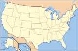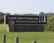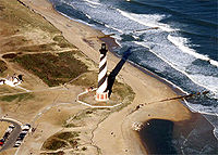
Cape Hatteras National Seashore
Encyclopedia

Outer Banks
The Outer Banks is a 200-mile long string of narrow barrier islands off the coast of North Carolina, beginning in the southeastern corner of Virginia Beach on the east coast of the United States....
of North Carolina
North Carolina
North Carolina is a state located in the southeastern United States. The state borders South Carolina and Georgia to the south, Tennessee to the west and Virginia to the north. North Carolina contains 100 counties. Its capital is Raleigh, and its largest city is Charlotte...
from Bodie Island
Bodie Island
Bodie Island is a long, narrow barrier peninsula that forms the northernmost portion of the Outer Banks of North Carolina. The land that is most commonly referred to as Bodie Island was at one time a true island, however the inlet separating it from the Currituck Banks peninsula in the north closed...
to Ocracoke Island, stretching over 70 miles (112.7 km). Included within this section of barrier islands along N.C. 12, but outside the National Seashore boundaries, are Pea Island National Wildlife Refuge
Pea Island National Wildlife Refuge
Pea Island National Wildlife Refuge is a National Wildlife Refuge located on the north end of North Carolina's Hatteras Island, a coastal barrier island and part of a chain of islands known as the Outer Banks, adjacent to Cape Hatteras National Seashore...
and several communities, such as Rodanthe
Rodanthe, North Carolina
Rodanthe is an unincorporated community located in Dare County, North Carolina, on Hatteras Island, part of North Carolina's Outer Banks. Rodanthe, along with Waves and Salvo, are part of the settlement of Chicamacomico...
, Buxton
Buxton, North Carolina
Buxton is an unincorporated community of nearly 1,500 people on Hatteras Island near Cape Hatteras. It is located in Dare County in the U.S. state of North Carolina. North Carolina Highway 12 links the community to other Outer Banks communities such as Avon, Frisco, and Hatteras...
, and Ocracoke
Ocracoke, North Carolina
Ocracoke is a census-designated place and unincorporated town located at the southern end of Ocracoke Island, located entirely within Hyde County, North Carolina. The population was 769 as of the 2000 census...
.
Once dubbed the "Graveyard of the Atlantic" for its treacherous currents, shoals, and storms, Cape Hatteras has a wealth of history relating to shipwreck
Shipwreck
A shipwreck is what remains of a ship that has wrecked, either sunk or beached. Whatever the cause, a sunken ship or a wrecked ship is a physical example of the event: this explains why the two concepts are often overlapping in English....
s, lighthouse
Lighthouse
A lighthouse is a tower, building, or other type of structure designed to emit light from a system of lamps and lenses or, in older times, from a fire, and used as an aid to navigation for maritime pilots at sea or on inland waterways....
s, and the US Lifesaving Service. The islands also provide a variety of habitats and are a valuable wintering area for migrating waterfowl. The park's fishing and surfing are considered the best on the East Coast.
Administrative history
The National Seashore was authorized on August 11, 1937, and established on January 12, 1953. Cape Hatteras National Seashore is co-managed with two other Outer BanksOuter Banks
The Outer Banks is a 200-mile long string of narrow barrier islands off the coast of North Carolina, beginning in the southeastern corner of Virginia Beach on the east coast of the United States....
parks, Wright Brothers National Memorial
Wright Brothers National Memorial
Wright Brothers National Memorial, located in Kill Devil Hills, North Carolina, commemorates the first successful, sustained, powered flights in a heavier-than-air machine. From 1900 to 1903, Wilbur and Orville Wright came here from Dayton, Ohio, based on information from the U.S. Weather Bureau...
and Fort Raleigh National Historic Site, and is headquartered at Fort Raleigh.

Closures
In October 2007, Defenders of WildlifeDefenders of Wildlife
Defenders of Wildlife is a United States-based, 501 non-profit organization founded in 1947, "dedicated to the protection of all native animals and plants in their natural communities." The organization is active in political interventions and lobbying aimed at protection of wildlife, and...
, along with the National Audubon Society
National Audubon Society
The National Audubon Society is an American non-profit environmental organization dedicated to conservation. Incorporated in 1905, Audubon is one of the oldest of such organizations in the world and uses science, education and grassroots advocacy to advance its conservation mission...
, sued the National Park Service
National Park Service
The National Park Service is the U.S. federal agency that manages all national parks, many national monuments, and other conservation and historical properties with various title designations...
at Cape Hatteras National Seashore for not properly protecting shorebird and sea turtle species that nest on the beaches of the Park.
The Park Service was allegedly not in compliance with an executive order requiring the establishment of policies and procedures regarding off-road vehicle use on the National Seashore, failing to implement management plans to adequately protect the shorebirds and sea turtles nesting in the park. The Defenders of Wildlife have claimed that the use of off-road vehicles on park lands has degraded the habitat used by the nesting birds, many of which are also federally protected species.
Many of of the beaches and beach access points have been placed off limits to off road vehicle use during the months when the birds are nesting. This has become a contentious issue among residents and users of Hatteras Island as ORV access is considered an important part of regional culture and economics.
The National Park Service has until December 2010 to create a new management plan after ongoing studies are completed. They then have until April 2011 to implement this new plan.
See also
- Cape Hatteras LightCape Hatteras LightCape Hatteras Light is a lighthouse located on Hatteras Island in the Outer Banks of North Carolina near the community of Buxton, and is part of the Cape Hatteras National Seashore....
- Bodie Island LightBodie Island LightThe current Bodie Island Lighthouse is the third that has stood in this vicinity of Bodie Island on the Outer Banks in North Carolina and was built in 1872. It stands tall and is located on the Roanoke Sound side of the first island that is part of the Cape Hatteras National Seashore. The...
- Ocracoke Light
- Ocracoke Island
External links
- "Cape Hatteras National Seashore". National Park Service
- "Little Kinnakeet Lifesaving Station: Home to Unsung Heroes". Teaching with Historic Places (TwHP) lesson plan. National Park Service
- "Graveyard of the Atlantic Museum".
- "Cape Hatteras Access Preservation Alliance".
- "Saving Hatteras Surf Fishing". KeepAmericaFishing™.
- "Guide to records (correspondence files) from the Cape Hatteras National Seashore".

