

Brace Mountain
Encyclopedia
Brace Mountain is the peak of a ridge in the southern Taconic Mountains
, near the tripoint
of the U.S. states of New York
, Connecticut
and Massachusetts
. Its 2311 feet (704.4 m) main summit is located in New York; it is the highest point in that state's Dutchess County
.
The New York and Massachusetts portions of the mountain are within protected area
s; Taconic State Park
and Mount Washington State Forest
respectively. The Connecticut portions are privately owned and conserved
.
It is a challenging yet popular hike since its summit, along with 2304 feet (702.3 m) subpeak South Brace Mountain, are along the 15.7 mi (25.3 km) South Taconic Trail
. Hikers approach the mountain either from the New York side on the west via the South Taconic or from another trail following the Connecticut-Massachusetts state line on the east, a route that allows them to visit both the tristate marker and the highest point in Connecticut, near the summit of Mount Frissell
, along the way. Brace's bald summit, marked by a large cairn
, offers views in all directions, particularly to the Hudson Valley
and Catskills
to the west. It has become a popular site for launching hang gliders
and paragliders
.
roughly paralleling the Connecticut and Massachusetts state lines, which runs north-south east of the summit, in North East, New York
, at the northeast corner of a narrow northward extension of Dutchess County. To its east is the largely undeveloped, privately owned Riga Plateau, with Riga Lake, Connecticut's highest at 533 m (1,748.7 ft), to the south in the town of Salisbury, Connecticut
. Due east, on the other escarpment, is 2316 feet (705.9 m) Bear Mountain
, Connecticut's highest summit. There is a 100-foot (30 m) drop into the col
between Brace and South Brace, a quarter-mile (250 m) to the south. The ridge continues to the south for several miles past the lower Mount Riga and Thorpe Mountain before ending where U.S. Route 44
crosses the state line.
One mile (1.6 km) to the northeast is the nearest other summit, 2453 feet (747.7 m) Mount Frissell
, located just over Connecticut's northern border in Mount Washington, Massachusetts
. A short distance from the summit, the state line reaches 2370 feet (722.4 m), the highest elevation in Connecticut. To its east is 2296 feet (699.8 m) Round Mountain, in Connecticut.
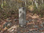
Approximately 0.3 mile (0.482802 km) north-northeast of Brace's summit is the tripoint
where New York, Connecticut and Massachusetts meet. The ridge continues north-northwest to 2250 feet (685.8 m) Alander Mountain
, in the western corner of Massachusetts, where the highest point in New York's Columbia County
is located at the state line below the summit. Beyond that it continues to Catamount Ski Area
, straddling the state line.
The west slope of the ridge drops steeply 1300 feet (396.2 m) to the narrow floor of the north end of the Harlem Valley, also known as the Oblong, the region of Dutchess County within a short distance of the state line, claimed by both New York and Connecticut during the colonial era. Here there are some farms and houses, with New York State Route 22
and the Harlem Valley Rail Trail
running through. Across the valley, in the town of Ancram
, rises 1346 feet (410.3 m) Fox Hill.
Four miles (6.4 km) to the south is the village of Millerton, New York
, the nearest large settlement. The small hamlet of Copake, New York
, is three miles (5 km) to the north-northwest. In Connecticut, Lakeville
is to the southwest of the Riga Plateau area.
The west side of Brace Mountain drains into the Noster Kill, then into Bash Bish Brook, the Roeliff Jansen Kill, thence the Hudson river
and the Atlantic Ocean. The southwest side drains into Webatuck Creek, Tenmile River, thence the Housatonic River
and Long Island Sound. The southeast side drains into Riga Lake and South Pond, then into Wachocostinook Brook, Salmon Creek, and the Housatonic River. The north side drains into Ashley Hill Brook, thence Bash Bish Brook, and the Roeliff Jansen Kill.
South Taconic Trail
traverses the summit. It provides for both access from the west, via its southern terminus, and the east via the connecting Mt. Frissell trail along the Connecticut-Massachusetts state line. An old, unmarked dirt road also connects to the South Taconic north of the summit from more directly east of the mountain. Other access routes that once approached from the Riga Lake area at the southeast have been closed in Connecticut by the landowner, their blazes removed in New York.
Approaching via the South Taconic from the west, entirely within New York, is a common route to the summit but also entails the greatest vertical ascent. The trailhead
for the South Taconic is located on Quarry Hill Road, a long dead-end street in the northern section of North East, at an elevation just under 1,000 feet (300 m). After passing along the edge of an old meadow, it enters the woods, crosses into Taconic State Park
and then climbs steeply past a series of cascades on the south side, at some points requiring that hikers scramble. It levels off at 1700 feet (518.2 m), where the first of many views over Dutchess and Columbia counties to the Catskill Escarpment
on the other side of the Hudson River
open up. At that point it turns north and goes through some private lands over South Brace to Brace. The total distance from the trailhead is 1.9 miles (3.1 km) with a 1300 feet (396.2 m) vertical gain.
 On the west the Mount Frissell Trail starts following red blazes at a trailhead on the state line, on an unpaved road known as East Street in Mount Washington and Mt. Washington Road in Salisbury. From an elevation of 1830 feet (557.8 m) It first bends into Massachusetts, then returns to Connecticut where it climbs to the open summit of Round Mountain, where Frissell and Brace can be seen ahead. Descending into the woods, it re-enters Massachusetts and makes a short but steep climb to the summit of Frissell. A register
for visitors to the Connecticut high point hangs from a tree; the highpoint itself is marked by a small survey stake a short distance further along the trail, after it descends slightly and follows the state line. From the highpoint it drops gently to pass the tri-state marker. Its western terminus, 2.2 miles (3.5 km) from the trailhead, is on the South Taconic approximately 0.3 miles (482.8 m) north of Brace's summit. It is thus 2.5 miles (4 km) via this approach, with a vertical gain of roughly 1,000 ft (300 m) due to the ascents of Round and Frissell required by the route.
The approach via the unofficial Brace Mountain Trail is the gentlest and shortest, but less used due to the limited parking and minimal maintenance of the trail, entirely on private land in Connecticut. The unblazed, gated road starts from a small parking area on Mount Washington Road two miles (3.2 km) north of the dam at South Pond in Lakeville, just south of where the road, the highest in Connecticut, crosses the shoulder of Gridley Mountain. From this 1900 feet (579.1 m) elevation it descends slightly to cross an unnamed tributary
of Monument Brook, after which an overgrown ascends gently to the state line marker, 1.3 miles (2.1 km) from the parking area. From there it is a more sustained climb 0.2 miles (321.9 m) to the South Taconic and an equivalent distance to the summit. The total distance for this approach is 1.7 miles (2.7 km) with a 460 feet (140.2 m) vertical gain from the brook crossing.
There are also two long approaches from the north. On the New York side, the red-blazed Robert Brook Trail leaves the blue-blazed Alander Brook Trail 450 feet (137.2 m) from that trail's head along Under Mountain Road in Ancram. From there it climbs 1050 feet (320 m) in 1.1 miles (1.8 km) to the South Taconic Trail just west of the state line, 2.6 miles (4.2 km) north of Brace's summit. In Massachusetts, the blue-blazed Ashley Hill Trail leaves the Alander Mountain Trail west of the Mount Washington State Forest
headquarters at the junction of East and West streets. Two possible forks allow for a 4-mile (6.4 km) route to Brace via the Mount Frissell Trail.
several feet high, with a small windsock
attached, sits on the highest ground. There are views available in all directions.
To the west are the highest mountains visible from Brace, the Catskills
. The dominant visible feature is the long Escarpment
to the north, with 4040 feet (1,231.4 m) Hunter Mountain
, the highest point of Greene County
, high above the peaks of the Devil's Path
beyond it. Further south are the peaks of Ulster County
, including Slide, the highest in the county and the Catskills at 4180 feet (1,274.1 m).
Northwest the Helderberg Escarpment
is visible, south of Albany
. Closer to the mountain, the lower hills of Columbia and Dutchess counties are below. In the latter, Stissing Mountain and its fire tower, south of Pine Plains stand out. The Hudson Highlands
are in the distant southwest.
To the east the landscape falls away into the Riga Plateau, with Gridley and Bear rising across it. Riga Lake can be seen to the south of them. The higher peaks of the vicinity, Frissell and Round, are visible on the northeast, although the former blocks the view of Mount Everett
, the 2602 feet (793.1 m) high peak of the south Taconics. Next to Frissell, in the distance on clear days, Mount Greylock
, Massachusetts' 3491 feet (1,064.1 m) highest peak, can be seen. Due north is Alander.
for hang gliding
and paragliding
from the summit. All such foot-launched aircraft pilots must sign in at the club, whether or not they are members. This is done under permit with the state Office of Parks, Recreation and Historic Preservation
; pilots who do not check in with the club can be cited and fined.
Pilots must obey some other rules as well. They must be current United States Hang Gliding and Paragliding Association
(USHPA) members with a rating of at least P3/H2 to fly without instructor supervision; P2/H2-rated pilots must have a minimum of 10 mountain flights from more than a thousand feet (300 m) above ground level
, witnessed by an instructor, in their logbooks in order to fly unsupervised, since the launch area at the summit is steep and narrow. No flights are permitted on days with winds of more than 26 miles per hour (11.6 m/s).
The windsock
on the summit cairn was placed to allow the pilots to judge conditions. They hike in either from the east via the old road or up the South Taconic from its southern trailhead. There are some other lower launch areas lower on the mountain, on private land. It is one of the more popular locations for hang gliding and paragliding in the Northeast
due to the gradual geography of the area and the thermal
s allowing smooth flight down the 1600 feet (487.7 m) to the LZ at the club facilities.
Taconic Mountains
The Taconic Mountains or Taconic Range are a physiographic section of the larger New England province and part of the Appalachian Mountains, running along the eastern border of New York State and adjacent New England from northwest Connecticut to western Massachusetts, north to central western...
, near the tripoint
Tripoint
A tripoint, or trijunction , is a geographical point at which the borders of three countries or subnational entities meet....
of the U.S. states of New York
New York
New York is a state in the Northeastern region of the United States. It is the nation's third most populous state. New York is bordered by New Jersey and Pennsylvania to the south, and by Connecticut, Massachusetts and Vermont to the east...
, Connecticut
Connecticut
Connecticut is a state in the New England region of the northeastern United States. It is bordered by Rhode Island to the east, Massachusetts to the north, and the state of New York to the west and the south .Connecticut is named for the Connecticut River, the major U.S. river that approximately...
and Massachusetts
Massachusetts
The Commonwealth of Massachusetts is a state in the New England region of the northeastern United States of America. It is bordered by Rhode Island and Connecticut to the south, New York to the west, and Vermont and New Hampshire to the north; at its east lies the Atlantic Ocean. As of the 2010...
. Its 2311 feet (704.4 m) main summit is located in New York; it is the highest point in that state's Dutchess County
Dutchess County, New York
Dutchess County is a county located in the U.S. state of New York, in the state's Mid-Hudson Region of the Hudson Valley. The 2010 census lists the population as 297,488...
.
The New York and Massachusetts portions of the mountain are within protected area
Protected area
Protected areas are locations which receive protection because of their recognised natural, ecological and/or cultural values. There are several kinds of protected areas, which vary by level of protection depending on the enabling laws of each country or the regulations of the international...
s; Taconic State Park
Taconic State Park
Taconic State Park is located in Columbia and Dutchess County, New York abutting Massachusetts and Connecticut within the Taconic Mountains. The state park is located off New York State Route 344 south of Interstate 90 and north of New York City...
and Mount Washington State Forest
Mount Washington State Forest
Mount Washington State Forest is a scenic state forest in the southern Taconic Mountains of the southwestern Berkshire region of Massachusetts. It has 30 miles of trails for hiking, as well as offering wilderness camping, fishing, horseback riding trails, and cross-country skiing...
respectively. The Connecticut portions are privately owned and conserved
Conservation area
A conservation areas is a tract of land that has been awarded protected status in order to ensure that natural features, cultural heritage or biota are safeguarded...
.
It is a challenging yet popular hike since its summit, along with 2304 feet (702.3 m) subpeak South Brace Mountain, are along the 15.7 mi (25.3 km) South Taconic Trail
South Taconic Trail
The South Taconic Trail is a hiking trail in the Taconic Mountains of southwest Massachusetts and adjacent New York. The trail extends from the village of Whitehouse Crossing in Millerton, New York, north along the ridgecrest of the southern Taconic Range and the border of New York and...
. Hikers approach the mountain either from the New York side on the west via the South Taconic or from another trail following the Connecticut-Massachusetts state line on the east, a route that allows them to visit both the tristate marker and the highest point in Connecticut, near the summit of Mount Frissell
Mount Frissell
Mount Frissell, , located on the border of southwest Massachusetts and northwest Connecticut, is a prominent peak of the Taconic Range. The peak and northern part of the mountain are located within Massachusetts. The southern slope of Mount Frissell is located within Connecticut and rises to the...
, along the way. Brace's bald summit, marked by a large cairn
Cairn
Cairn is a term used mainly in the English-speaking world for a man-made pile of stones. It comes from the or . Cairns are found all over the world in uplands, on moorland, on mountaintops, near waterways and on sea cliffs, and also in barren desert and tundra areas...
, offers views in all directions, particularly to the Hudson Valley
Hudson Valley
The Hudson Valley comprises the valley of the Hudson River and its adjacent communities in New York State, United States, from northern Westchester County northward to the cities of Albany and Troy.-History:...
and Catskills
Catskill Mountains
The Catskill Mountains, an area in New York State northwest of New York City and southwest of Albany, are a mature dissected plateau, an uplifted region that was subsequently eroded into sharp relief. They are an eastward continuation, and the highest representation, of the Allegheny Plateau...
to the west. It has become a popular site for launching hang gliders
Hang gliding
Hang gliding is an air sport in which a pilot flies a light and unmotorized foot-launchable aircraft called a hang glider ....
and paragliders
Paragliding
Paragliding is the recreational and competitive adventure sport of flying paragliders: lightweight, free-flying, foot-launched glider aircraft with no rigid primary structure...
.
Geography
Brace is near the south end of an escarpmentEscarpment
An escarpment is a steep slope or long cliff that occurs from erosion or faulting and separates two relatively level areas of differing elevations.-Description and variants:...
roughly paralleling the Connecticut and Massachusetts state lines, which runs north-south east of the summit, in North East, New York
North East, New York
North East is a town in Dutchess County, New York, United States. The population was 3,002 at the 2000 census.The Town of North East is in the northeastern part of the county...
, at the northeast corner of a narrow northward extension of Dutchess County. To its east is the largely undeveloped, privately owned Riga Plateau, with Riga Lake, Connecticut's highest at 533 m (1,748.7 ft), to the south in the town of Salisbury, Connecticut
Salisbury, Connecticut
Salisbury is a town in Litchfield County, Connecticut, United States. The town is the northwest-most in the State of Connecticut. The MA-NY-CT Tri-State Marker is located just on the border of Salisbury...
. Due east, on the other escarpment, is 2316 feet (705.9 m) Bear Mountain
Bear Mountain (Connecticut)
Bear Mountain, is prominent peak of the southern Taconic Mountains. It lies within the town of Salisbury, Connecticut, in the United States, and is the highest mountain summit in the state of Connecticut. The highest point in the state, however, is located on the south slope of Mount Frissell to...
, Connecticut's highest summit. There is a 100-foot (30 m) drop into the col
Col
-Things:* A col, a mountain pass or saddle* A col, region of lower air pressure between two high pressure areas: see trough -Languages:* col, ISO 639-3 language code of the Columbia-Wenatchi language* Col language-Abbreviations:...
between Brace and South Brace, a quarter-mile (250 m) to the south. The ridge continues to the south for several miles past the lower Mount Riga and Thorpe Mountain before ending where U.S. Route 44
U.S. Route 44
U.S. Route 44 is an east–west United States highway that runs for 237 miles through four states in the Northeastern region of the United States. The western terminus is at U.S. Route 209 and New York State Route 55 in Kerhonkson, a hamlet in the Hudson Valley region of New York...
crosses the state line.
One mile (1.6 km) to the northeast is the nearest other summit, 2453 feet (747.7 m) Mount Frissell
Mount Frissell
Mount Frissell, , located on the border of southwest Massachusetts and northwest Connecticut, is a prominent peak of the Taconic Range. The peak and northern part of the mountain are located within Massachusetts. The southern slope of Mount Frissell is located within Connecticut and rises to the...
, located just over Connecticut's northern border in Mount Washington, Massachusetts
Mount Washington, Massachusetts
Mount Washington is a town in Berkshire County, Massachusetts, United States. It is part of the Pittsfield, Massachusetts Metropolitan Statistical Area. The population was 130 at the 2000 census, making it the smallest town in Berkshire County and, after Gosnold and Monroe, the third smallest in...
. A short distance from the summit, the state line reaches 2370 feet (722.4 m), the highest elevation in Connecticut. To its east is 2296 feet (699.8 m) Round Mountain, in Connecticut.
Approximately 0.3 mile (0.482802 km) north-northeast of Brace's summit is the tripoint
Tripoint
A tripoint, or trijunction , is a geographical point at which the borders of three countries or subnational entities meet....
where New York, Connecticut and Massachusetts meet. The ridge continues north-northwest to 2250 feet (685.8 m) Alander Mountain
Alander Mountain
Alander Mountain, is a prominent peak of the south Taconic Mountains; it is located in southwest Massachusetts and adjacent New York. Part of the summit is grassy and open and part is covered with scrub oak and shrubs; the sides of the mountain are wooded with northern hardwood tree species....
, in the western corner of Massachusetts, where the highest point in New York's Columbia County
Columbia County, New York
Columbia County is a county located in the U.S. state of New York. As of the 2010 census, the population was 63,096. The county seat is Hudson. The name comes from the Latin feminine form of the name of Christopher Columbus, which was at the time of the formation of the county a popular proposal...
is located at the state line below the summit. Beyond that it continues to Catamount Ski Area
Catamount Ski Area
Catamount Ski Area is a ski resort located on Mount Fray of the Taconic Mountains in Hillsdale, New York and South Egremont, Massachusetts. It is one of the few remaining family-owned ski areas in New England.-History:...
, straddling the state line.
The west slope of the ridge drops steeply 1300 feet (396.2 m) to the narrow floor of the north end of the Harlem Valley, also known as the Oblong, the region of Dutchess County within a short distance of the state line, claimed by both New York and Connecticut during the colonial era. Here there are some farms and houses, with New York State Route 22
New York State Route 22
New York State Route 22 is a north–south state highway in eastern New York in the United States. It runs parallel to the state's eastern edge from the outskirts of New York City to a short distance south of the Canadian border. At , it is the state's longest north–south route and...
and the Harlem Valley Rail Trail
Harlem Valley Rail Trail
The Harlem Valley Rail Trail is a paved rail trail on an abandoned portion of the New York and Harlem Railroad, north of the Metro-North Railroad Harlem Line terminus in Wassaic. It is owned by the New York State Office of Parks, Recreation and Historic Preservation...
running through. Across the valley, in the town of Ancram
Ancram, New York
Ancram, New York is a town in Columbia County, New York, United States. The population was 1,513 at the 2000 census. The town was named after a location in Scotland.The Town of Ancram is in the eastern part of the county.- History :...
, rises 1346 feet (410.3 m) Fox Hill.
Four miles (6.4 km) to the south is the village of Millerton, New York
Millerton, New York
Millerton is a village in Dutchess County, New York, United States. The population was 925 at the 2000 census. It is part of the Poughkeepsie–Newburgh–Middletown, NY Metropolitan Statistical Area as well as the larger New York–Newark–Bridgeport, NY-NJ-CT-PA Combined...
, the nearest large settlement. The small hamlet of Copake, New York
Copake, New York
Copake is a town in Columbia County, United States. New York, United States. The population was 3,278 at the 2000 census. The town derives its name from a lake, which was known to the natives as Cook-pake, or Ack-kook-peek, meaning "Snake Pond." The town borders Taconic State Park.The Town of...
, is three miles (5 km) to the north-northwest. In Connecticut, Lakeville
Lakeville, Connecticut
Lakeville is a village and census-designated place in the town of Salisbury in Litchfield County, Connecticut, on Lake Wononskopomuc. The village includes Lakeville Historic District, which is listed on the National Register of Historic Places. The district represents about of the village center...
is to the southwest of the Riga Plateau area.
The west side of Brace Mountain drains into the Noster Kill, then into Bash Bish Brook, the Roeliff Jansen Kill, thence the Hudson river
Hudson River
The Hudson is a river that flows from north to south through eastern New York. The highest official source is at Lake Tear of the Clouds, on the slopes of Mount Marcy in the Adirondack Mountains. The river itself officially begins in Henderson Lake in Newcomb, New York...
and the Atlantic Ocean. The southwest side drains into Webatuck Creek, Tenmile River, thence the Housatonic River
Housatonic River
The Housatonic River is a river, approximately long, in western Massachusetts and western Connecticut in the United States. It flows south to southeast, and drains about of southwestern New England into Long Island Sound...
and Long Island Sound. The southeast side drains into Riga Lake and South Pond, then into Wachocostinook Brook, Salmon Creek, and the Housatonic River. The north side drains into Ashley Hill Brook, thence Bash Bish Brook, and the Roeliff Jansen Kill.
Access
The white-blazedTrail blazing
Trail blazing, or trailblazing, is the practice of marking paths in outdoor recreational areas with blazes, markings that follow each other at certain — though not necessarily exactly defined — distances and mark the direction of the trail...
South Taconic Trail
South Taconic Trail
The South Taconic Trail is a hiking trail in the Taconic Mountains of southwest Massachusetts and adjacent New York. The trail extends from the village of Whitehouse Crossing in Millerton, New York, north along the ridgecrest of the southern Taconic Range and the border of New York and...
traverses the summit. It provides for both access from the west, via its southern terminus, and the east via the connecting Mt. Frissell trail along the Connecticut-Massachusetts state line. An old, unmarked dirt road also connects to the South Taconic north of the summit from more directly east of the mountain. Other access routes that once approached from the Riga Lake area at the southeast have been closed in Connecticut by the landowner, their blazes removed in New York.
Approaching via the South Taconic from the west, entirely within New York, is a common route to the summit but also entails the greatest vertical ascent. The trailhead
Trailhead
A trailhead is the point at which a trail begins, where the trail is often intended for hiking, biking, horseback riding, or off-road vehicles...
for the South Taconic is located on Quarry Hill Road, a long dead-end street in the northern section of North East, at an elevation just under 1,000 feet (300 m). After passing along the edge of an old meadow, it enters the woods, crosses into Taconic State Park
Taconic State Park
Taconic State Park is located in Columbia and Dutchess County, New York abutting Massachusetts and Connecticut within the Taconic Mountains. The state park is located off New York State Route 344 south of Interstate 90 and north of New York City...
and then climbs steeply past a series of cascades on the south side, at some points requiring that hikers scramble. It levels off at 1700 feet (518.2 m), where the first of many views over Dutchess and Columbia counties to the Catskill Escarpment
Catskill Escarpment
The Catskill Escarpment, often referred to locally as just the Escarpment or the Great Wall of Manitou, and known as the Catskill Front to geologists, is the range forming the northeastern corner of the Catskill Mountains in Greene and Ulster counties in the U.S. state of New York...
on the other side of the Hudson River
Hudson River
The Hudson is a river that flows from north to south through eastern New York. The highest official source is at Lake Tear of the Clouds, on the slopes of Mount Marcy in the Adirondack Mountains. The river itself officially begins in Henderson Lake in Newcomb, New York...
open up. At that point it turns north and goes through some private lands over South Brace to Brace. The total distance from the trailhead is 1.9 miles (3.1 km) with a 1300 feet (396.2 m) vertical gain.
Summit register
A summit book is a record of visitors to the summit of a mountain, usually one without a maintained trail. It is usually enclosed in a weatherproof, animalproof metal canister. Some books are maintained in an informal manner by an individual or small group, while others are maintained by a club...
for visitors to the Connecticut high point hangs from a tree; the highpoint itself is marked by a small survey stake a short distance further along the trail, after it descends slightly and follows the state line. From the highpoint it drops gently to pass the tri-state marker. Its western terminus, 2.2 miles (3.5 km) from the trailhead, is on the South Taconic approximately 0.3 miles (482.8 m) north of Brace's summit. It is thus 2.5 miles (4 km) via this approach, with a vertical gain of roughly 1,000 ft (300 m) due to the ascents of Round and Frissell required by the route.
The approach via the unofficial Brace Mountain Trail is the gentlest and shortest, but less used due to the limited parking and minimal maintenance of the trail, entirely on private land in Connecticut. The unblazed, gated road starts from a small parking area on Mount Washington Road two miles (3.2 km) north of the dam at South Pond in Lakeville, just south of where the road, the highest in Connecticut, crosses the shoulder of Gridley Mountain. From this 1900 feet (579.1 m) elevation it descends slightly to cross an unnamed tributary
Tributary
A tributary or affluent is a stream or river that flows into a main stem river or a lake. A tributary does not flow directly into a sea or ocean...
of Monument Brook, after which an overgrown ascends gently to the state line marker, 1.3 miles (2.1 km) from the parking area. From there it is a more sustained climb 0.2 miles (321.9 m) to the South Taconic and an equivalent distance to the summit. The total distance for this approach is 1.7 miles (2.7 km) with a 460 feet (140.2 m) vertical gain from the brook crossing.
There are also two long approaches from the north. On the New York side, the red-blazed Robert Brook Trail leaves the blue-blazed Alander Brook Trail 450 feet (137.2 m) from that trail's head along Under Mountain Road in Ancram. From there it climbs 1050 feet (320 m) in 1.1 miles (1.8 km) to the South Taconic Trail just west of the state line, 2.6 miles (4.2 km) north of Brace's summit. In Massachusetts, the blue-blazed Ashley Hill Trail leaves the Alander Mountain Trail west of the Mount Washington State Forest
Mount Washington State Forest
Mount Washington State Forest is a scenic state forest in the southern Taconic Mountains of the southwestern Berkshire region of Massachusetts. It has 30 miles of trails for hiking, as well as offering wilderness camping, fishing, horseback riding trails, and cross-country skiing...
headquarters at the junction of East and West streets. Two possible forks allow for a 4-mile (6.4 km) route to Brace via the Mount Frissell Trail.
Summit
The summit of Brace is an open area with scrubby forest on the slopes. A cairnCairn
Cairn is a term used mainly in the English-speaking world for a man-made pile of stones. It comes from the or . Cairns are found all over the world in uplands, on moorland, on mountaintops, near waterways and on sea cliffs, and also in barren desert and tundra areas...
several feet high, with a small windsock
Windsock
A windsock is a conical textile tube designed to indicate wind direction and relative wind speed. Windsocks typically are used at airports and at chemical plants where there is risk of gaseous leakage...
attached, sits on the highest ground. There are views available in all directions.
To the west are the highest mountains visible from Brace, the Catskills
Catskill Mountains
The Catskill Mountains, an area in New York State northwest of New York City and southwest of Albany, are a mature dissected plateau, an uplifted region that was subsequently eroded into sharp relief. They are an eastward continuation, and the highest representation, of the Allegheny Plateau...
. The dominant visible feature is the long Escarpment
Catskill Escarpment
The Catskill Escarpment, often referred to locally as just the Escarpment or the Great Wall of Manitou, and known as the Catskill Front to geologists, is the range forming the northeastern corner of the Catskill Mountains in Greene and Ulster counties in the U.S. state of New York...
to the north, with 4040 feet (1,231.4 m) Hunter Mountain
Hunter Mountain (New York)
Hunter Mountain is in the towns of Hunter and Lexington, just south of the village of Hunter, in Greene County, New York, USA. At approximately 4,040 feet in elevation, it is the highest peak in the county and the second-highest peak in the Catskill Mountains.While the mountain is closely...
, the highest point of Greene County
Greene County, New York
Greene County is a county located in the U.S. state of New York. Its name is in honor of the American Revolutionary War general Nathanael Greene. Its county seat is Catskill...
, high above the peaks of the Devil's Path
Devil's Path (Catskills)
The Devil's Path is the name of a mountain range and hiking trail in the Greene County portion of New York's Catskill Mountains. The mountains commonly considered to be part of the Devil's Path are, from west to east, West Kill, Hunter, Plateau, Sugarloaf, Twin, and Indian Head.The name comes from...
beyond it. Further south are the peaks of Ulster County
Ulster County, New York
Ulster County is a county located in the state of New York, USA. It sits in the state's Mid-Hudson Region of the Hudson Valley. As of the 2010 census, the population was 182,493. Recent population estimates completed by the United States Census Bureau for the 12-month period ending July 1 are at...
, including Slide, the highest in the county and the Catskills at 4180 feet (1,274.1 m).
Northwest the Helderberg Escarpment
Helderberg Escarpment
The Helderberg Escarpment is an escarpment in eastern New York, roughly west of the city of Albany....
is visible, south of Albany
Albany, New York
Albany is the capital city of the U.S. state of New York, the seat of Albany County, and the central city of New York's Capital District. Roughly north of New York City, Albany sits on the west bank of the Hudson River, about south of its confluence with the Mohawk River...
. Closer to the mountain, the lower hills of Columbia and Dutchess counties are below. In the latter, Stissing Mountain and its fire tower, south of Pine Plains stand out. The Hudson Highlands
Hudson Highlands
The Hudson Highlands are mountains on both sides of the Hudson River in the U.S. state of New York, between Newburgh Bay and Haverstraw Bay, which form the northern region of the New York - New Jersey Highlands....
are in the distant southwest.
To the east the landscape falls away into the Riga Plateau, with Gridley and Bear rising across it. Riga Lake can be seen to the south of them. The higher peaks of the vicinity, Frissell and Round, are visible on the northeast, although the former blocks the view of Mount Everett
Mount Everett
Mount Everett at 2,624 ft - or 800 m - is the highest peak in the south Taconic Mountains of Massachusetts. The mountain is known for its expansive views of the southern Taconics and Berkshires; for its fragile ecosystem of old growth pitch pine and scrub oak; and for its rare plant and animal...
, the 2602 feet (793.1 m) high peak of the south Taconics. Next to Frissell, in the distance on clear days, Mount Greylock
Mount Greylock
Mount Greylock is the highest natural point in Massachusetts at . Its peak is located in the northwest corner of the state in the western part of the town of Adams in Berkshire County. Although geologically part of the Taconic Mountains, Mount Greylock is commonly associated with the abutting...
, Massachusetts' 3491 feet (1,064.1 m) highest peak, can be seen. Due north is Alander.
Hang gliding and paragliding
The Mount Brace Outdoor Club, based in the valley below the mountain, operates the landing zoneLanding Zone
A Landing Zone or "LZ" is a military term for any area where an aircraft can land.In the United States military, a landing zone is the actual point where aircraft land...
for hang gliding
Hang gliding
Hang gliding is an air sport in which a pilot flies a light and unmotorized foot-launchable aircraft called a hang glider ....
and paragliding
Paragliding
Paragliding is the recreational and competitive adventure sport of flying paragliders: lightweight, free-flying, foot-launched glider aircraft with no rigid primary structure...
from the summit. All such foot-launched aircraft pilots must sign in at the club, whether or not they are members. This is done under permit with the state Office of Parks, Recreation and Historic Preservation
New York State Office of Parks, Recreation and Historic Preservation
The New York State Office of Parks, Recreation and Historic Preservation operates :*168 state parks*35 state historic sites*76 developed beaches*53 water recreational facilities*27 golf courses*39 full service cottages*818 cabins...
; pilots who do not check in with the club can be cited and fined.
Pilots must obey some other rules as well. They must be current United States Hang Gliding and Paragliding Association
USHPA
The United States Hang Gliding and Paragliding Association is a non-profit organization supporting foot-launched soaring flight in the United States. It began in 1971 as the Southern California Hang Gliding Association and became national in scope by the mid-1970s. When paragliding became popular...
(USHPA) members with a rating of at least P3/H2 to fly without instructor supervision; P2/H2-rated pilots must have a minimum of 10 mountain flights from more than a thousand feet (300 m) above ground level
Above ground level
In aviation and atmospheric sciences, an altitude is said to be above ground level when it is measured with respect to the underlying ground surface. This is as opposed to above mean sea level , or in broadcast engineering, height above average terrain...
, witnessed by an instructor, in their logbooks in order to fly unsupervised, since the launch area at the summit is steep and narrow. No flights are permitted on days with winds of more than 26 miles per hour (11.6 m/s).
The windsock
Windsock
A windsock is a conical textile tube designed to indicate wind direction and relative wind speed. Windsocks typically are used at airports and at chemical plants where there is risk of gaseous leakage...
on the summit cairn was placed to allow the pilots to judge conditions. They hike in either from the east via the old road or up the South Taconic from its southern trailhead. There are some other lower launch areas lower on the mountain, on private land. It is one of the more popular locations for hang gliding and paragliding in the Northeast
Northeastern United States
The Northeastern United States is a region of the United States as defined by the United States Census Bureau.-Composition:The region comprises nine states: the New England states of Connecticut, Maine, Massachusetts, New Hampshire, Rhode Island and Vermont; and the Mid-Atlantic states of New...
due to the gradual geography of the area and the thermal
Thermal
A thermal column is a column of rising air in the lower altitudes of the Earth's atmosphere. Thermals are created by the uneven heating of the Earth's surface from solar radiation, and are an example of convection. The sun warms the ground, which in turn warms the air directly above it...
s allowing smooth flight down the 1600 feet (487.7 m) to the LZ at the club facilities.