
Mount Washington, Massachusetts
Encyclopedia
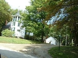
Mount Washington is a town
in Berkshire County
, Massachusetts
, United States
. It is part of the Pittsfield
, Massachusetts
Metropolitan Statistical Area. The population was 130 at the 2000 census, making it the smallest town in Berkshire County and, after Gosnold and Monroe, the third smallest in Massachusetts. The name, Mount Washington does not refer to Mount Washington
of New Hampshire, New England
's highest peak, but to an alternate, no longer used name for the southern Taconic Mountains
in which the town sits. The name Washington is a tribute to George Washington
, the first president of the United States.
In 1857, a portion of the town that was much less accessible from the rest of Mount Washington than from the adjacent town of Ancram
, New York
was ceded to New York State, and added to Ancram's territory; it is now regarded as the hamlet of Boston Corners
within its new town.
, the town has a total area of 22.4 square miles (57.9 km²), of which, 22.2 square miles (57.5 km²) of it is land and 0.2 square miles (0.4 km²) of it (0.67%) is water. Mount Washington is the westernmost and southwesternmost town in Massachusetts.
The town is bordered on the west by Columbia County
, New York
, on a .5 mile portion of its southern border by Dutchess County
, New York
, and on the rest of the southern border by Litchfield County
, Connecticut
. It is bordered on the north by Egremont
, on the east by Sheffield
, on the south by Salisbury
, Connecticut
, on the southwest by the Whitehouse Crossing section of North East
, New York
, and on the west by Ancram
and Copake
, New York
. Mount Washington is 33 miles (53.1 km) south-southwest of Pittsfield
, 58 miles (93.3 km) west of Springfield
, and 148 miles (238.2 km) west-southwest of Boston.
Mount Washington is located on a plateau in the Taconic Mountains
. To the east, Mount Everett
, the highest point in town and the highest point in the southern Taconic Mountains, rises 2602 feet (793.1 m) feet near the town's eastern border. To the north, several mountains and hills lie along the Egremont town line. Alander Mountain
and the western escarpment of the southern Taconic Mountains lie along the western border of Mount Washington at the Columbia County
, New York
line. To the south, along the Connecticut border, stand another series of peaks including Mount Frissell
. Although the summit of this mountain rests within the town of Mount Washington, its southern slope is located in Connecticut and is that state's highest elevation. Many brooks lie within the town, most of which feed into Roeliff Jansen Kill in Copake
, New York
. Mount Washington State Forest
makes up a large portion of the town, as does Mount Everett State Reservation
. The town is also home to Bash Bish Falls State Park
, which is centered around its eponymous falls. The Appalachian Trail
enters Massachusetts in Mount Washington, coming from Bear Mountain
, then turning east before following east of the town border, over Mount Race
and Mount Everett, before heading into Egremont.
Mount Washington is very remote, with only four roads that lead out of the town, and only one, East Street, connected to the rest of Massachusetts via Egremont. There are no state roads within the town, with only New York State Route 344
entering the town, primarily as access to Bash Bish Falls
from Route 22
. The nearest state route in Massachusetts accessible to the town is Route 23 in Egremont. The nearest interstate, Interstate 90
(the Massachusetts Turnpike
) is several miles north of the town, with the nearest exit, the "turn-around" exit 1, being in West Stockbridge. The nearest rail, bus and small airplane service is in Great Barrington, and the nearest national air service is at Bradley International Airport
in Windsor Locks
, Connecticut
.
of 2000, there were 130 people, 64 households, and 36 families residing in the town. The town is the smallest town of the 32 cities and towns in Berkshire County, and the third-smallest of the 351 cities and towns in Massachusetts (only Monroe
and Gosnold
are smaller). The population density
was 5.8 people per square mile (2.3/km²), the most sparsely populated town in the county and Commonwealth. There were 128 housing units at an average density of 5.8 per square mile (2.2/km²). The racial makeup of the town was 100.00% White.
There were 64 households out of which 15.6% had children under the age of 18 living with them, 48.4% were married couples
living together, 4.7% had a female householder with no husband present, and 42.2% were non-families. 37.5% of all households were made up of individuals and 10.9% had someone living alone who was 65 years of age or older. The average household size was 2.03 and the average family size was 2.70.
In the town the population was spread out with 16.9% under the age of 18, 2.3% from 18 to 24, 21.5% from 25 to 44, 43.8% from 45 to 64, and 15.4% who were 65 years of age or older. The median age was 52 years. For every 100 females there were 109.7 males. For every 100 females age 18 and over, there were 103.8 males.
The median income for a household in the town was $53,125, and the median income for a family was $55,750. Males had a median income of $40,417 versus $31,250 for females. The per capita income
for the town was $50,149. the highest in Berkshire County and the highest of any town in the four counties that make up Western Massachusetts
. There were 4.5% of families and 8.2% of the population living below the poverty line, including no under eighteens and none of those over 64.
form of government, and is led by a board of selectmen
and administrative assistant. The town has a small police and fire department, but has no post office (it is served by the Egremont's post office). The town has a small library which is connected to the regional library system.
On the state level, Mount Washington is represented in the Massachusetts House of Representatives
by the Fourth Berkshire district, which covers southern Berkshire County, as well as the westernmost towns in Hampden County. In the Massachusetts Senate
, the town is represented by the Berkshire, Hampshire and Franklin district, which includes all of Berkshire County and western Hampshire and Franklin Counties. The town is patrolled by the First (Lee) Station of Barracks "B" of the Massachusetts State Police
.
On the national level, Mount Washington is represented in the United States House of Representatives
as part of Massachusetts's 1st congressional district
, and has been represented by John Olver
of Amherst
since June 1991. Massachusetts is currently represented in the United States Senate
by senior Senator John Kerry
and junior senator Scott Brown
.
The nearest community college
is the South County Center of Berkshire Community College
in Great Barrington. The nearest state college is Westfield State College
, and the nearest state university is the University of Massachusetts Amherst
. The nearest private college is Bard College at Simon's Rock in Great Barrington.
New England town
The New England town is the basic unit of local government in each of the six New England states. Without a direct counterpart in most other U.S. states, New England towns are conceptually similar to civil townships in other states, but are incorporated, possessing powers like cities in other...
in Berkshire County
Berkshire County, Massachusetts
Berkshire County is a non-governmental county located on the western edge of the U.S. state of Massachusetts. As of the 2010 census, the population was 131,219. Its largest city and traditional county seat is Pittsfield...
, Massachusetts
Massachusetts
The Commonwealth of Massachusetts is a state in the New England region of the northeastern United States of America. It is bordered by Rhode Island and Connecticut to the south, New York to the west, and Vermont and New Hampshire to the north; at its east lies the Atlantic Ocean. As of the 2010...
, United States
United States
The United States of America is a federal constitutional republic comprising fifty states and a federal district...
. It is part of the Pittsfield
Pittsfield, Massachusetts
Pittsfield is the largest city and the county seat of Berkshire County, Massachusetts, United States. It is the principal city of the Pittsfield, Massachusetts Metropolitan Statistical Area which encompasses all of Berkshire County. Its area code is 413. Its ZIP code is 01201...
, Massachusetts
Massachusetts
The Commonwealth of Massachusetts is a state in the New England region of the northeastern United States of America. It is bordered by Rhode Island and Connecticut to the south, New York to the west, and Vermont and New Hampshire to the north; at its east lies the Atlantic Ocean. As of the 2010...
Metropolitan Statistical Area. The population was 130 at the 2000 census, making it the smallest town in Berkshire County and, after Gosnold and Monroe, the third smallest in Massachusetts. The name, Mount Washington does not refer to Mount Washington
Mount Washington (New Hampshire)
Mount Washington is the highest peak in the Northeastern United States at , famous for dangerously erratic weather. For 76 years, a weather observatory on the summit held the record for the highest wind gust directly measured at the Earth's surface, , on the afternoon of April 12, 1934...
of New Hampshire, New England
New England
New England is a region in the northeastern corner of the United States consisting of the six states of Maine, New Hampshire, Vermont, Massachusetts, Rhode Island, and Connecticut...
's highest peak, but to an alternate, no longer used name for the southern Taconic Mountains
Taconic Mountains
The Taconic Mountains or Taconic Range are a physiographic section of the larger New England province and part of the Appalachian Mountains, running along the eastern border of New York State and adjacent New England from northwest Connecticut to western Massachusetts, north to central western...
in which the town sits. The name Washington is a tribute to George Washington
George Washington
George Washington was the dominant military and political leader of the new United States of America from 1775 to 1799. He led the American victory over Great Britain in the American Revolutionary War as commander-in-chief of the Continental Army from 1775 to 1783, and presided over the writing of...
, the first president of the United States.
History
Mount Washington was first settled in 1692 and was officially incorporated in 1779.In 1857, a portion of the town that was much less accessible from the rest of Mount Washington than from the adjacent town of Ancram
Ancram, New York
Ancram, New York is a town in Columbia County, New York, United States. The population was 1,513 at the 2000 census. The town was named after a location in Scotland.The Town of Ancram is in the eastern part of the county.- History :...
, New York
New York
New York is a state in the Northeastern region of the United States. It is the nation's third most populous state. New York is bordered by New Jersey and Pennsylvania to the south, and by Connecticut, Massachusetts and Vermont to the east...
was ceded to New York State, and added to Ancram's territory; it is now regarded as the hamlet of Boston Corners
Boston Corners, New York
Boston Corner is a hamlet of the town of Ancram in Columbia County, New York, United States and the town of Northeast in Dutchess County, New York...
within its new town.
Geography
According to the United States Census BureauUnited States Census Bureau
The United States Census Bureau is the government agency that is responsible for the United States Census. It also gathers other national demographic and economic data...
, the town has a total area of 22.4 square miles (57.9 km²), of which, 22.2 square miles (57.5 km²) of it is land and 0.2 square miles (0.4 km²) of it (0.67%) is water. Mount Washington is the westernmost and southwesternmost town in Massachusetts.
The town is bordered on the west by Columbia County
Columbia County, New York
Columbia County is a county located in the U.S. state of New York. As of the 2010 census, the population was 63,096. The county seat is Hudson. The name comes from the Latin feminine form of the name of Christopher Columbus, which was at the time of the formation of the county a popular proposal...
, New York
New York
New York is a state in the Northeastern region of the United States. It is the nation's third most populous state. New York is bordered by New Jersey and Pennsylvania to the south, and by Connecticut, Massachusetts and Vermont to the east...
, on a .5 mile portion of its southern border by Dutchess County
Dutchess County, New York
Dutchess County is a county located in the U.S. state of New York, in the state's Mid-Hudson Region of the Hudson Valley. The 2010 census lists the population as 297,488...
, New York
New York
New York is a state in the Northeastern region of the United States. It is the nation's third most populous state. New York is bordered by New Jersey and Pennsylvania to the south, and by Connecticut, Massachusetts and Vermont to the east...
, and on the rest of the southern border by Litchfield County
Litchfield County, Connecticut
Litchfield County is a county located in the northwestern corner of the U.S. state of Connecticut. Litchfield County has the lowest population density of any county in Connecticut but is geographically the state's largest county. As of 2010 the population was 189,927...
, Connecticut
Connecticut
Connecticut is a state in the New England region of the northeastern United States. It is bordered by Rhode Island to the east, Massachusetts to the north, and the state of New York to the west and the south .Connecticut is named for the Connecticut River, the major U.S. river that approximately...
. It is bordered on the north by Egremont
Egremont, Massachusetts
Egremont is a town in Berkshire County, Massachusetts, United States. It is part of the Pittsfield, Massachusetts Metropolitan Statistical Area. The population was 1,225 at the 2010 census. Egremont consists of two villages, North Egremont and South Egremont....
, on the east by Sheffield
Sheffield, Massachusetts
Not to be confused with the city of Sheffield in the UK, or Sheffield, Vermont.Sheffield is a town in Berkshire County, Massachusetts, United States. It is part of the Pittsfield, Massachusetts Metropolitan Statistical Area. The population was 3,257 at the 2010 census. Sheffield is home to...
, on the south by Salisbury
Salisbury, Connecticut
Salisbury is a town in Litchfield County, Connecticut, United States. The town is the northwest-most in the State of Connecticut. The MA-NY-CT Tri-State Marker is located just on the border of Salisbury...
, Connecticut
Connecticut
Connecticut is a state in the New England region of the northeastern United States. It is bordered by Rhode Island to the east, Massachusetts to the north, and the state of New York to the west and the south .Connecticut is named for the Connecticut River, the major U.S. river that approximately...
, on the southwest by the Whitehouse Crossing section of North East
North East, New York
North East is a town in Dutchess County, New York, United States. The population was 3,002 at the 2000 census.The Town of North East is in the northeastern part of the county...
, New York
New York
New York is a state in the Northeastern region of the United States. It is the nation's third most populous state. New York is bordered by New Jersey and Pennsylvania to the south, and by Connecticut, Massachusetts and Vermont to the east...
, and on the west by Ancram
Ancram, New York
Ancram, New York is a town in Columbia County, New York, United States. The population was 1,513 at the 2000 census. The town was named after a location in Scotland.The Town of Ancram is in the eastern part of the county.- History :...
and Copake
Copake, New York
Copake is a town in Columbia County, United States. New York, United States. The population was 3,278 at the 2000 census. The town derives its name from a lake, which was known to the natives as Cook-pake, or Ack-kook-peek, meaning "Snake Pond." The town borders Taconic State Park.The Town of...
, New York
New York
New York is a state in the Northeastern region of the United States. It is the nation's third most populous state. New York is bordered by New Jersey and Pennsylvania to the south, and by Connecticut, Massachusetts and Vermont to the east...
. Mount Washington is 33 miles (53.1 km) south-southwest of Pittsfield
Pittsfield, Massachusetts
Pittsfield is the largest city and the county seat of Berkshire County, Massachusetts, United States. It is the principal city of the Pittsfield, Massachusetts Metropolitan Statistical Area which encompasses all of Berkshire County. Its area code is 413. Its ZIP code is 01201...
, 58 miles (93.3 km) west of Springfield
Springfield, Massachusetts
Springfield is the most populous city in Western New England, and the seat of Hampden County, Massachusetts, United States. Springfield sits on the eastern bank of the Connecticut River near its confluence with three rivers; the western Westfield River, the eastern Chicopee River, and the eastern...
, and 148 miles (238.2 km) west-southwest of Boston.
Mount Washington is located on a plateau in the Taconic Mountains
Taconic Mountains
The Taconic Mountains or Taconic Range are a physiographic section of the larger New England province and part of the Appalachian Mountains, running along the eastern border of New York State and adjacent New England from northwest Connecticut to western Massachusetts, north to central western...
. To the east, Mount Everett
Mount Everett
Mount Everett at 2,624 ft - or 800 m - is the highest peak in the south Taconic Mountains of Massachusetts. The mountain is known for its expansive views of the southern Taconics and Berkshires; for its fragile ecosystem of old growth pitch pine and scrub oak; and for its rare plant and animal...
, the highest point in town and the highest point in the southern Taconic Mountains, rises 2602 feet (793.1 m) feet near the town's eastern border. To the north, several mountains and hills lie along the Egremont town line. Alander Mountain
Alander Mountain
Alander Mountain, is a prominent peak of the south Taconic Mountains; it is located in southwest Massachusetts and adjacent New York. Part of the summit is grassy and open and part is covered with scrub oak and shrubs; the sides of the mountain are wooded with northern hardwood tree species....
and the western escarpment of the southern Taconic Mountains lie along the western border of Mount Washington at the Columbia County
Columbia County, New York
Columbia County is a county located in the U.S. state of New York. As of the 2010 census, the population was 63,096. The county seat is Hudson. The name comes from the Latin feminine form of the name of Christopher Columbus, which was at the time of the formation of the county a popular proposal...
, New York
New York
New York is a state in the Northeastern region of the United States. It is the nation's third most populous state. New York is bordered by New Jersey and Pennsylvania to the south, and by Connecticut, Massachusetts and Vermont to the east...
line. To the south, along the Connecticut border, stand another series of peaks including Mount Frissell
Mount Frissell
Mount Frissell, , located on the border of southwest Massachusetts and northwest Connecticut, is a prominent peak of the Taconic Range. The peak and northern part of the mountain are located within Massachusetts. The southern slope of Mount Frissell is located within Connecticut and rises to the...
. Although the summit of this mountain rests within the town of Mount Washington, its southern slope is located in Connecticut and is that state's highest elevation. Many brooks lie within the town, most of which feed into Roeliff Jansen Kill in Copake
Copake, New York
Copake is a town in Columbia County, United States. New York, United States. The population was 3,278 at the 2000 census. The town derives its name from a lake, which was known to the natives as Cook-pake, or Ack-kook-peek, meaning "Snake Pond." The town borders Taconic State Park.The Town of...
, New York
New York
New York is a state in the Northeastern region of the United States. It is the nation's third most populous state. New York is bordered by New Jersey and Pennsylvania to the south, and by Connecticut, Massachusetts and Vermont to the east...
. Mount Washington State Forest
Mount Washington State Forest
Mount Washington State Forest is a scenic state forest in the southern Taconic Mountains of the southwestern Berkshire region of Massachusetts. It has 30 miles of trails for hiking, as well as offering wilderness camping, fishing, horseback riding trails, and cross-country skiing...
makes up a large portion of the town, as does Mount Everett State Reservation
Mount Everett State Reservation
Mount Everett State Reservation is a state park located in the town of Mount Washington, Massachusetts, USA. The forest is managed by the Department of Conservation and Recreation.-Description:...
. The town is also home to Bash Bish Falls State Park
Bash Bish Falls State Park
Bash Bish Falls State Park is a Massachusetts state park located in Mount Washington which is named after Bash Bish Falls, Massachusetts' highest single-drop waterfall , which lies within its borders...
, which is centered around its eponymous falls. The Appalachian Trail
Appalachian Trail
The Appalachian National Scenic Trail, generally known as the Appalachian Trail or simply the AT, is a marked hiking trail in the eastern United States extending between Springer Mountain in Georgia and Mount Katahdin in Maine. It is approximately long...
enters Massachusetts in Mount Washington, coming from Bear Mountain
Bear Mountain (Connecticut)
Bear Mountain, is prominent peak of the southern Taconic Mountains. It lies within the town of Salisbury, Connecticut, in the United States, and is the highest mountain summit in the state of Connecticut. The highest point in the state, however, is located on the south slope of Mount Frissell to...
, then turning east before following east of the town border, over Mount Race
Mount Race
Mount Race, , is a prominent peak in the south Taconic Mountains of Massachusetts. The mountain is known for its waterfalls, ridgeline cliff face and expansive views of the Housatonic River valley and Berkshires to the east, and for its pitch pine and scrub oak summit ecosystem...
and Mount Everett, before heading into Egremont.
Mount Washington is very remote, with only four roads that lead out of the town, and only one, East Street, connected to the rest of Massachusetts via Egremont. There are no state roads within the town, with only New York State Route 344
New York State Route 344
New York State Route 344 is a state highway located in Columbia County, New York, United States. The route is in length and serves primarily as an access road to the Bash Bish Falls state parks on both sides of the New York – Massachusetts border. The western terminus of NY 344 is...
entering the town, primarily as access to Bash Bish Falls
Bash Bish Falls
Bash Bish Falls, a waterfall in Bash Bish Falls State Park in the Taconic Mountains of southwestern Massachusetts , is the highest waterfall in the state...
from Route 22
New York State Route 22
New York State Route 22 is a north–south state highway in eastern New York in the United States. It runs parallel to the state's eastern edge from the outskirts of New York City to a short distance south of the Canadian border. At , it is the state's longest north–south route and...
. The nearest state route in Massachusetts accessible to the town is Route 23 in Egremont. The nearest interstate, Interstate 90
Interstate 90
Interstate 90 is the longest Interstate Highway in the United States at . It is the northernmost coast-to-coast interstate, and parallels US 20 for the most part. Its western terminus is in Seattle, at Edgar Martinez Drive S. near Safeco Field and CenturyLink Field, and its eastern terminus is in...
(the Massachusetts Turnpike
Massachusetts Turnpike
The Massachusetts Turnpike is the easternmost stretch of Interstate 90. The Turnpike begins at the western border of Massachusetts in West Stockbridge connecting with the Berkshire Connector portion of the New York State Thruway...
) is several miles north of the town, with the nearest exit, the "turn-around" exit 1, being in West Stockbridge. The nearest rail, bus and small airplane service is in Great Barrington, and the nearest national air service is at Bradley International Airport
Bradley International Airport
Bradley International Airport is a joint civil-military public airport located in Windsor Locks on the border with East Granby and Suffield, in Hartford County, Connecticut, United States. It is owned by the State of Connecticut....
in Windsor Locks
Windsor Locks, Connecticut
Windsor Locks is a town located in Hartford County, Connecticut, United States. As of the 2000 census, its population was 12,043. It is the site of Bradley International Airport, which serves the Greater Hartford-Springfield region. It is also the site of the New England Air Museum...
, Connecticut
Connecticut
Connecticut is a state in the New England region of the northeastern United States. It is bordered by Rhode Island to the east, Massachusetts to the north, and the state of New York to the west and the south .Connecticut is named for the Connecticut River, the major U.S. river that approximately...
.
Demographics
As of the censusCensus
A census is the procedure of systematically acquiring and recording information about the members of a given population. It is a regularly occurring and official count of a particular population. The term is used mostly in connection with national population and housing censuses; other common...
of 2000, there were 130 people, 64 households, and 36 families residing in the town. The town is the smallest town of the 32 cities and towns in Berkshire County, and the third-smallest of the 351 cities and towns in Massachusetts (only Monroe
Monroe, Massachusetts
Monroe is a town in Franklin County, Massachusetts, United States. The population was 93 at the 2000 census. By area, population and population density, it is the smallest town in the county; and is the second-smallest town by population in the Commonwealth, with only Gosnold having fewer...
and Gosnold
Gosnold, Massachusetts
Gosnold is a town that encompasses the Elizabeth Islands in Dukes County, Massachusetts, United States. As of the 2010 census, the town population was 75, making it the least populous town in Massachusetts...
are smaller). The population density
Population density
Population density is a measurement of population per unit area or unit volume. It is frequently applied to living organisms, and particularly to humans...
was 5.8 people per square mile (2.3/km²), the most sparsely populated town in the county and Commonwealth. There were 128 housing units at an average density of 5.8 per square mile (2.2/km²). The racial makeup of the town was 100.00% White.
There were 64 households out of which 15.6% had children under the age of 18 living with them, 48.4% were married couples
Marriage
Marriage is a social union or legal contract between people that creates kinship. It is an institution in which interpersonal relationships, usually intimate and sexual, are acknowledged in a variety of ways, depending on the culture or subculture in which it is found...
living together, 4.7% had a female householder with no husband present, and 42.2% were non-families. 37.5% of all households were made up of individuals and 10.9% had someone living alone who was 65 years of age or older. The average household size was 2.03 and the average family size was 2.70.
In the town the population was spread out with 16.9% under the age of 18, 2.3% from 18 to 24, 21.5% from 25 to 44, 43.8% from 45 to 64, and 15.4% who were 65 years of age or older. The median age was 52 years. For every 100 females there were 109.7 males. For every 100 females age 18 and over, there were 103.8 males.
The median income for a household in the town was $53,125, and the median income for a family was $55,750. Males had a median income of $40,417 versus $31,250 for females. The per capita income
Per capita income
Per capita income or income per person is a measure of mean income within an economic aggregate, such as a country or city. It is calculated by taking a measure of all sources of income in the aggregate and dividing it by the total population...
for the town was $50,149. the highest in Berkshire County and the highest of any town in the four counties that make up Western Massachusetts
Western Massachusetts
Western Massachusetts is a loosely defined geographical region of the U.S. state of Massachusetts which contains the Berkshires, the Pioneer Valley, and some or all of the Swift River Valley. The region is always considered to include Berkshire, Franklin, Hampshire, and Hampden counties, and the...
. There were 4.5% of families and 8.2% of the population living below the poverty line, including no under eighteens and none of those over 64.
Government
Mount Washington employs the open town meetingOpen town meeting
An open town meeting is a form of town meeting in which all registered voters of a town may vote . This form of government is typical of smaller municipalities in the New England region of the United States....
form of government, and is led by a board of selectmen
Board of selectmen
The board of selectmen is commonly the executive arm of the government of New England towns in the United States. The board typically consists of three or five members, with or without staggered terms.-History:...
and administrative assistant. The town has a small police and fire department, but has no post office (it is served by the Egremont's post office). The town has a small library which is connected to the regional library system.
On the state level, Mount Washington is represented in the Massachusetts House of Representatives
Massachusetts House of Representatives
The Massachusetts House of Representatives is the lower house of the Massachusetts General Court, the state legislature of the Commonwealth of Massachusetts. It is composed of 160 members elected from single-member electoral districts across the Commonwealth. Representatives serve two-year terms...
by the Fourth Berkshire district, which covers southern Berkshire County, as well as the westernmost towns in Hampden County. In the Massachusetts Senate
Massachusetts Senate
The Massachusetts Senate is the upper house of the Massachusetts General Court, the bicameral state legislature of the Commonwealth of Massachusetts. The Senate comprises 40 elected members from 40 single-member senatorial districts in the state...
, the town is represented by the Berkshire, Hampshire and Franklin district, which includes all of Berkshire County and western Hampshire and Franklin Counties. The town is patrolled by the First (Lee) Station of Barracks "B" of the Massachusetts State Police
Massachusetts State Police
The Massachusetts State Police is an agency of the Commonwealth of Massachusetts' Executive Office of Public Safety and Security responsible for criminal law enforcement and traffic vehicle regulation across the state...
.
On the national level, Mount Washington is represented in the United States House of Representatives
United States House of Representatives
The United States House of Representatives is one of the two Houses of the United States Congress, the bicameral legislature which also includes the Senate.The composition and powers of the House are established in Article One of the Constitution...
as part of Massachusetts's 1st congressional district
Massachusetts's 1st congressional district
Massachusetts's 1st congressional district is in western and central Massachusetts. The largest Massachusetts district in area, it covers about one-third of the state and is more rural than the rest. It has the state's highest point, Mount Greylock...
, and has been represented by John Olver
John Olver
John Walter Olver is the U.S. Representative for , serving since 1991. He is a member of the Democratic Party. Early in his career, he was a chemistry professor and served in both chambers of the Massachusetts General Court....
of Amherst
Amherst, Massachusetts
Amherst is a town in Hampshire County, Massachusetts, United States in the Connecticut River valley. As of the 2010 census, the population was 37,819, making it the largest community in Hampshire County . The town is home to Amherst College, Hampshire College, and the University of Massachusetts...
since June 1991. Massachusetts is currently represented in the United States Senate
United States Senate
The United States Senate is the upper house of the bicameral legislature of the United States, and together with the United States House of Representatives comprises the United States Congress. The composition and powers of the Senate are established in Article One of the U.S. Constitution. Each...
by senior Senator John Kerry
John Kerry
John Forbes Kerry is the senior United States Senator from Massachusetts, the 10th most senior U.S. Senator and chairman of the Senate Foreign Relations Committee. He was the presidential nominee of the Democratic Party in the 2004 presidential election, but lost to former President George W...
and junior senator Scott Brown
Scott Brown
Scott Brown is a United States senator.Scott Brown may also refer to:-Sportsmen:*Scott Brown , American college football coach of Kentucky State...
.
Education
Mount Washington has an agreement with the South Berkshire Regional School District to send its students to the regional schools. Kindergarten and first grade students attend the South Egremont School, second through sixth grade students attend Undermountain School in Sheffield, and seventh through twelfth grade students attend Mount Everett Regional High School in Sheffield. Additionally, there are private schools in Sheffield, Great Barrington and Salisbury, Connecticut.The nearest community college
Community college
A community college is a type of educational institution. The term can have different meanings in different countries.-Australia:Community colleges carry on the tradition of adult education, which was established in Australia around mid 19th century when evening classes were held to help adults...
is the South County Center of Berkshire Community College
Berkshire Community College
Berkshire Community College is a two-year community college in Berkshire County, Massachusetts, United States. It offers associate degrees as well as a transfer program for students to earn credits for transfer to other colleges...
in Great Barrington. The nearest state college is Westfield State College
Westfield State College
Westfield State University is a comprehensive, coeducational, four-year public university in Westfield, Massachusetts. It was founded in 1838 by noted educator and social reformer Horace Mann as the first public co-educational college in America without barrier to race, gender and economic class...
, and the nearest state university is the University of Massachusetts Amherst
University of Massachusetts Amherst
The University of Massachusetts Amherst is a public research and land-grant university in Amherst, Massachusetts, United States and the flagship of the University of Massachusetts system...
. The nearest private college is Bard College at Simon's Rock in Great Barrington.