
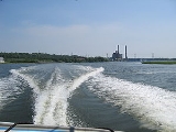
Housatonic River
Encyclopedia
The Housatonic River is a river, approximately 139 miles (223.7 km) long, in western Massachusetts
and western Connecticut
in the United States
. It flows south to southeast, and drains about 1950 square miles (5,050.5 km²) of southwestern New England
into Long Island Sound
. Its watershed
is just to the west of the watershed of the lower Connecticut River
.
in the Berkshire Mountains near the city of Pittsfield
. It flows southward through western Massachusetts through the Berkshires and into western Connecticut
, and empties into Long Island Sound
between the towns of Stratford
and Milford
.
The river's total fall is 1430 feet (435.9 m) (959 feet (292.3 m) from the confluence of its east and west branches). Its major tributaries are the Williams, Green and Konkapot River
s in Massachusetts, the Tenmile River in New York, and the Shepaug
, Pomperaug
, Naugatuck
, and Still Rivers in Connecticut. It receives the Naugatuck River
at Derby, Connecticut
, and the Still River south of New Milford, Connecticut
.
Five dams impounded the river in Connecticut to produce hydroelectricity
, the Falls Village
, Bulls Bridge, Shepaug, Stevenson
and Derby dams. The last three dams form a chain of lakes, Lake Lillinonah
, Lake Zoar
and Lake Housatonic, from New Milford
south to Shelton
.
phrase "usi-a-di-en-uk", translated as "beyond the mountain place".
Inspired by the river during his honeymoon, the American classical music composer Charles Ives
wrote The Housatonic at Stockbridge as part of his composition Three Places in New England
during the 1910s. The town of Stockbridge
is located in southwestern Massachusetts. The river enters Stockbridge on the east side of town then turns south towards Connecticut.
From about 1932 until 1977 the river received PCB
pollution
discharges from the General Electric
plant at Pittsfield, MA. Although the water quality
has improved in recent decades, the river continues to be contaminated by PCBs.
There is an American
nuclear weapon test of the same name
, although it is not known if the name came from the river or some other source.
The United States Navy
named a ship for the Housatonic River. The has the distinction of being the first ship in history to be sunk by a submarine, the confederate vessel CSS H.L. Hunley
.
and continuing to Gaylordsville
. Most of the river is quickwater and Class I whitewater with long sections of Class II-III whitewater. A deadly and extreme Class VI resides at Great Falls in Canaan
(Falls Village) and is most likely not able to be paddled. The most dangerous and difficult section that is navigable is by Bulls Bridge, with Class V whitewater.
There are several minor and major dams along the river that form lakes. Most notable are two lakes in Connecticut, Lake Zoar
, which borders Monroe
, Newtown
, Oxford
, and Southbury
, and Lake Lillinonah
. Both lakes are major water-sport recreation outlets for the surrounding towns.
Two of the three lakes formed by the dams are used for rowing
by clubs, schools, and to host regattas. Lake Lillinonah is used by the GMS Rowing Center and is host to the GMS Regatta. Lake Housatonic is used by the Yale University
Crew Team and the New Haven Rowing Club
and is host to the Derby Sweeps & Sculls and the Head of the Housatonic.
The Housatonic River is also a popular fly fishing
destination. Fly fishing on the Housatonic River (which is strictly catch and release) has been compared with western rivers and is among the finest for trout in the eastern United States. The most popular area for fly fishing is between the Falls Village Dam and the town of Cornwall Bridge in Litchfield County
.
The Appalachian Trail
follows the river along this section from the Bulls Bridge covered wooden bridge near Kent to Falls Village.
Massachusetts
The Commonwealth of Massachusetts is a state in the New England region of the northeastern United States of America. It is bordered by Rhode Island and Connecticut to the south, New York to the west, and Vermont and New Hampshire to the north; at its east lies the Atlantic Ocean. As of the 2010...
and western Connecticut
Connecticut
Connecticut is a state in the New England region of the northeastern United States. It is bordered by Rhode Island to the east, Massachusetts to the north, and the state of New York to the west and the south .Connecticut is named for the Connecticut River, the major U.S. river that approximately...
in the United States
United States
The United States of America is a federal constitutional republic comprising fifty states and a federal district...
. It flows south to southeast, and drains about 1950 square miles (5,050.5 km²) of southwestern New England
New England
New England is a region in the northeastern corner of the United States consisting of the six states of Maine, New Hampshire, Vermont, Massachusetts, Rhode Island, and Connecticut...
into Long Island Sound
Long Island Sound
Long Island Sound is an estuary of the Atlantic Ocean, located in the United States between Connecticut to the north and Long Island, New York to the south. The mouth of the Connecticut River at Old Saybrook, Connecticut, empties into the sound. On its western end the sound is bounded by the Bronx...
. Its watershed
Drainage basin
A drainage basin is an extent or an area of land where surface water from rain and melting snow or ice converges to a single point, usually the exit of the basin, where the waters join another waterbody, such as a river, lake, reservoir, estuary, wetland, sea, or ocean...
is just to the west of the watershed of the lower Connecticut River
Connecticut River
The Connecticut River is the largest and longest river in New England, and also an American Heritage River. It flows roughly south, starting from the Fourth Connecticut Lake in New Hampshire. After flowing through the remaining Connecticut Lakes and Lake Francis, it defines the border between the...
.
Geography
The Housatonic rises from four sources in far western MassachusettsMassachusetts
The Commonwealth of Massachusetts is a state in the New England region of the northeastern United States of America. It is bordered by Rhode Island and Connecticut to the south, New York to the west, and Vermont and New Hampshire to the north; at its east lies the Atlantic Ocean. As of the 2010...
in the Berkshire Mountains near the city of Pittsfield
Pittsfield, Massachusetts
Pittsfield is the largest city and the county seat of Berkshire County, Massachusetts, United States. It is the principal city of the Pittsfield, Massachusetts Metropolitan Statistical Area which encompasses all of Berkshire County. Its area code is 413. Its ZIP code is 01201...
. It flows southward through western Massachusetts through the Berkshires and into western Connecticut
Connecticut
Connecticut is a state in the New England region of the northeastern United States. It is bordered by Rhode Island to the east, Massachusetts to the north, and the state of New York to the west and the south .Connecticut is named for the Connecticut River, the major U.S. river that approximately...
, and empties into Long Island Sound
Long Island Sound
Long Island Sound is an estuary of the Atlantic Ocean, located in the United States between Connecticut to the north and Long Island, New York to the south. The mouth of the Connecticut River at Old Saybrook, Connecticut, empties into the sound. On its western end the sound is bounded by the Bronx...
between the towns of Stratford
Stratford, Connecticut
Stratford is a town in Fairfield County, Connecticut, United States, located on Long Island Sound at the mouth of the Housatonic River. It was founded by Puritans in 1639....
and Milford
Milford, Connecticut
Milford is a coastal city in southwestern New Haven County, Connecticut, United States, located between Bridgeport and New Haven. The population was 52,759 at the 2010 census...
.
The river's total fall is 1430 feet (435.9 m) (959 feet (292.3 m) from the confluence of its east and west branches). Its major tributaries are the Williams, Green and Konkapot River
Konkapot River
The Konkapot River is a river in southwestern Massachusetts and northern Connecticut. It is a tributary of the Housatonic River, not to be confused with the smaller Konkapot Brook in Stockbridge ....
s in Massachusetts, the Tenmile River in New York, and the Shepaug
Shepaug River
The Shepaug River is a river in Connecticut, in the United States. The river originates in Warren and runs south through Washington, Roxbury, and Southbury, where it empties into the Housatonic River at Lake Lillinonah , thereafter flowing into the Long Island Sound...
, Pomperaug
Pomperaug River
The Pomperaug River is a river in the US state of Connecticut. The two main tributaries to the Pomperaug are the Nonnewaug River and the Weekeepeemee River. It is at the confluence of these two rivers in Woodbury that the Pomperaug forms...
, Naugatuck
Naugatuck River
The Naugatuck River is a river in the US state of Connecticut. It carves out the Naugatuck River Valley. The river flows from northwest Connecticut southward into the Housatonic River in Derby, Connecticut. One of the river's main uses is hydropower, which is used to power industrial plants...
, and Still Rivers in Connecticut. It receives the Naugatuck River
Naugatuck River
The Naugatuck River is a river in the US state of Connecticut. It carves out the Naugatuck River Valley. The river flows from northwest Connecticut southward into the Housatonic River in Derby, Connecticut. One of the river's main uses is hydropower, which is used to power industrial plants...
at Derby, Connecticut
Derby, Connecticut
Derby is a city in New Haven County, Connecticut, United States. The population was 12,391 at the 2000 census. With of land area, Derby is Connecticut's smallest municipality.The city has a Metro-North railroad station called Derby – Shelton.-History:...
, and the Still River south of New Milford, Connecticut
New Milford, Connecticut
New Milford is a town in southern Litchfield County, Connecticut, United States north of Danbury, on the Housatonic River. It is the largest town in the state in terms of land area at nearly . The population was 28,671 according to the Census Bureau's 2006 estimates...
.
Five dams impounded the river in Connecticut to produce hydroelectricity
Hydroelectricity
Hydroelectricity is the term referring to electricity generated by hydropower; the production of electrical power through the use of the gravitational force of falling or flowing water. It is the most widely used form of renewable energy...
, the Falls Village
Falls Village, Connecticut
Falls Village is a village and census-designated place in the town of Canaan, Connecticut. Because Falls Village is the town center and principal constituent village in Canaan, the entire town is often referred to as "Falls Village." That usage also avoids confusion of the town with Canaan Village...
, Bulls Bridge, Shepaug, Stevenson
Stevenson Dam Hydroelectric Plant
The Stevenson Dam Hydroelectric Plant is a hydroelectric power plant located on the Housatonic River at the boundary between the towns of Monroe and Oxford, Connecticut. The plant was built in 1917 and was listed on the National Register of Historic Places in 2000...
and Derby dams. The last three dams form a chain of lakes, Lake Lillinonah
Lake Lillinonah
Lake Lillinonah is located in Fairfield and Litchfield counties of western Connecticut, in the northeastern United States. It is the second largest lake in Connecticut, smaller only than Lake Candlewood. The lake is bordered by six towns: Brookfield, Bridgewater, Newtown, New Milford, Roxbury, and...
, Lake Zoar
Lake Zoar
Lake Zoar is a reservoir on the Housatonic River in the U.S. state of Connecticut. It is formed by Stevenson Dam. The towns of Monroe, Newtown, Oxford, and Southbury border Lake Zoar.-Lake Zoar Authority:...
and Lake Housatonic, from New Milford
New Milford, Connecticut
New Milford is a town in southern Litchfield County, Connecticut, United States north of Danbury, on the Housatonic River. It is the largest town in the state in terms of land area at nearly . The population was 28,671 according to the Census Bureau's 2006 estimates...
south to Shelton
Shelton, Connecticut
Shelton is a city in Fairfield County, Connecticut, United States. The population was 39,559 at the 2010 census.-Origins:Shelton was settled by the English as part of the town of Stratford, Connecticut, in 1639...
.
History
The river's name comes from the MohicanMohican
-Native Americans:* Mahican , a Native American tribe who lived in and around the Hudson Valley* Mohegan, a functional confederation of several branches of Native Americans during the 16th century and the beginning of the 17th century...
phrase "usi-a-di-en-uk", translated as "beyond the mountain place".
Inspired by the river during his honeymoon, the American classical music composer Charles Ives
Charles Ives
Charles Edward Ives was an American modernist composer. He is one of the first American composers of international renown, though Ives' music was largely ignored during his life, and many of his works went unperformed for many years. Over time, Ives came to be regarded as an "American Original"...
wrote The Housatonic at Stockbridge as part of his composition Three Places in New England
Three Places in New England
The Three Places in New England is a composition for orchestra by Charles Ives. It was composed across a long span of time , however the bulk was written between 1911 and 1914. The piece is famous for its use of musical quotation and paraphrasing, as explained later in this article...
during the 1910s. The town of Stockbridge
Stockbridge, Massachusetts
Stockbridge is a town in Berkshire County in Western Massachusetts. It is part of the Pittsfield, Massachusetts, Metropolitan Statistical Area. The population was 1,947 at the 2010 census...
is located in southwestern Massachusetts. The river enters Stockbridge on the east side of town then turns south towards Connecticut.
From about 1932 until 1977 the river received PCB
Polychlorinated biphenyl
Polychlorinated biphenyls are a class of organic compounds with 2 to 10 chlorine atoms attached to biphenyl, which is a molecule composed of two benzene rings. The chemical formula for PCBs is C12H10-xClx...
pollution
Water pollution
Water pollution is the contamination of water bodies . Water pollution occurs when pollutants are discharged directly or indirectly into water bodies without adequate treatment to remove harmful compounds....
discharges from the General Electric
General Electric
General Electric Company , or GE, is an American multinational conglomerate corporation incorporated in Schenectady, New York and headquartered in Fairfield, Connecticut, United States...
plant at Pittsfield, MA. Although the water quality
Water quality
Water quality is the physical, chemical and biological characteristics of water. It is a measure of the condition of water relative to the requirements of one or more biotic species and or to any human need or purpose. It is most frequently used by reference to a set of standards against which...
has improved in recent decades, the river continues to be contaminated by PCBs.
There is an American
United States
The United States of America is a federal constitutional republic comprising fifty states and a federal district...
nuclear weapon test of the same name
Operation Dominic I and II
Operation Dominic was a series of 105 nuclear test explosions conducted in 1962 by the United States. Those conducted in the Pacific are sometimes called Dominic I. The blasts in Nevada are known as Dominic II. This test series was scheduled quickly, in order to respond in kind to the Soviet...
, although it is not known if the name came from the river or some other source.
The United States Navy
United States Navy
The United States Navy is the naval warfare service branch of the United States Armed Forces and one of the seven uniformed services of the United States. The U.S. Navy is the largest in the world; its battle fleet tonnage is greater than that of the next 13 largest navies combined. The U.S...
named a ship for the Housatonic River. The has the distinction of being the first ship in history to be sunk by a submarine, the confederate vessel CSS H.L. Hunley
H. L. Hunley (submarine)
H. L. Hunley was a submarine of the Confederate States of America that played a small part in the American Civil War, but a large role in the history of naval warfare. The Hunley demonstrated both the advantages and the dangers of undersea warfare...
.
Covered wooden bridges
Two wooden covered bridges cross the river: one at Bulls Bridge between Gaylordsville and Kent, and another at West Cornwall. Both bridges have been reinforced with present-day materials and support normal traffic, albeit in only one direction at a time.Recreation
The Housatonic River is a popular whitewater paddling destination beginning at Falls Village, ConnecticutFalls Village, Connecticut
Falls Village is a village and census-designated place in the town of Canaan, Connecticut. Because Falls Village is the town center and principal constituent village in Canaan, the entire town is often referred to as "Falls Village." That usage also avoids confusion of the town with Canaan Village...
and continuing to Gaylordsville
Gaylordsville, Connecticut
Gaylordsville is a village located in the northwest corner of the Town of New Milford, Litchfield County, Connecticut. It was founded in 1725 by William Gaylord.-History:...
. Most of the river is quickwater and Class I whitewater with long sections of Class II-III whitewater. A deadly and extreme Class VI resides at Great Falls in Canaan
Canaan, Connecticut
Canaan is a town in Litchfield County, Connecticut, United States. The population was 1,081 at the 2000 census. The town of Canaan is often referred to locally by the name of its principal constituent village, Falls Village.-Geography:...
(Falls Village) and is most likely not able to be paddled. The most dangerous and difficult section that is navigable is by Bulls Bridge, with Class V whitewater.
There are several minor and major dams along the river that form lakes. Most notable are two lakes in Connecticut, Lake Zoar
Lake Zoar
Lake Zoar is a reservoir on the Housatonic River in the U.S. state of Connecticut. It is formed by Stevenson Dam. The towns of Monroe, Newtown, Oxford, and Southbury border Lake Zoar.-Lake Zoar Authority:...
, which borders Monroe
Monroe, Connecticut
Monroe is a town in Fairfield County, Connecticut, United States. The population was 19,479 at the 2010 census. The current first selectman is Steve Vavrek....
, Newtown
Newtown, Connecticut
Newtown is a town in Fairfield County, Connecticut, United States. The population was 27,560 at the 2010 census. Newtown was founded in 1705 and incorporated in 1711.-Government:...
, Oxford
Oxford, Connecticut
Oxford is a town located in western New Haven County, Connecticut, United States. The population was 12,272 at the 2010 Census. There are several areas in Oxford: Quaker Farms, Riverside and Oxford Center. Oxford belongs to the Naugatuck Valley Economic Development Region and the Central...
, and Southbury
Southbury, Connecticut
Southbury is a town located in western New Haven County, Connecticut, USA. Southbury is located north of Oxford and Newtown; it also is east of Brookfield. Southbury's population was 18,567 at the 2000 census....
, and Lake Lillinonah
Lake Lillinonah
Lake Lillinonah is located in Fairfield and Litchfield counties of western Connecticut, in the northeastern United States. It is the second largest lake in Connecticut, smaller only than Lake Candlewood. The lake is bordered by six towns: Brookfield, Bridgewater, Newtown, New Milford, Roxbury, and...
. Both lakes are major water-sport recreation outlets for the surrounding towns.
Two of the three lakes formed by the dams are used for rowing
Rowing (sport)
Rowing is a sport in which athletes race against each other on rivers, on lakes or on the ocean, depending upon the type of race and the discipline. The boats are propelled by the reaction forces on the oar blades as they are pushed against the water...
by clubs, schools, and to host regattas. Lake Lillinonah is used by the GMS Rowing Center and is host to the GMS Regatta. Lake Housatonic is used by the Yale University
Yale University
Yale University is a private, Ivy League university located in New Haven, Connecticut, United States. Founded in 1701 in the Colony of Connecticut, the university is the third-oldest institution of higher education in the United States...
Crew Team and the New Haven Rowing Club
New Haven Rowing Club
The New Haven Rowing Club is a private, non-profit, rowing club on the Housatonic River in Oxford, Connecticut, United States of America. Founded in 1970 by Tony Johnson, Yale University Rowing coach, to allow him to continue training his athletes throughout the summer...
and is host to the Derby Sweeps & Sculls and the Head of the Housatonic.
The Housatonic River is also a popular fly fishing
Fly fishing
Fly fishing is an angling method in which an artificial 'fly' is used to catch fish. The fly is cast using a fly rod, reel, and specialized weighted line. Casting a nearly weightless fly or 'lure' requires casting techniques significantly different from other forms of casting...
destination. Fly fishing on the Housatonic River (which is strictly catch and release) has been compared with western rivers and is among the finest for trout in the eastern United States. The most popular area for fly fishing is between the Falls Village Dam and the town of Cornwall Bridge in Litchfield County
Litchfield County, Connecticut
Litchfield County is a county located in the northwestern corner of the U.S. state of Connecticut. Litchfield County has the lowest population density of any county in Connecticut but is geographically the state's largest county. As of 2010 the population was 189,927...
.
The Appalachian Trail
Appalachian Trail
The Appalachian National Scenic Trail, generally known as the Appalachian Trail or simply the AT, is a marked hiking trail in the eastern United States extending between Springer Mountain in Georgia and Mount Katahdin in Maine. It is approximately long...
follows the river along this section from the Bulls Bridge covered wooden bridge near Kent to Falls Village.
See also
External links
- Housatonic Valley Association
- Housatonic River Initiativer-Riverkeeper
- GE's Website reviewing the options for Housatonic River cleanup
- Housatonic River Restoration
- Charles Ives' Three Places in New England
- Watershed map
- Connecticut Explorer's Guide Online paddling map of the Housatonic River
- GE/Housatonic River Site: Introduction - US EPA