

Ancram, New York
Encyclopedia
Town
A town is a human settlement larger than a village but smaller than a city. The size a settlement must be in order to be called a "town" varies considerably in different parts of the world, so that, for example, many American "small towns" seem to British people to be no more than villages, while...
in Columbia County
Columbia County, New York
Columbia County is a county located in the U.S. state of New York. As of the 2010 census, the population was 63,096. The county seat is Hudson. The name comes from the Latin feminine form of the name of Christopher Columbus, which was at the time of the formation of the county a popular proposal...
, New York
New York
New York is a state in the Northeastern region of the United States. It is the nation's third most populous state. New York is bordered by New Jersey and Pennsylvania to the south, and by Connecticut, Massachusetts and Vermont to the east...
, United States
United States
The United States of America is a federal constitutional republic comprising fifty states and a federal district...
. The population was 1,513 at the 2000 census. The town was named after a location in Scotland
Scotland
Scotland is a country that is part of the United Kingdom. Occupying the northern third of the island of Great Britain, it shares a border with England to the south and is bounded by the North Sea to the east, the Atlantic Ocean to the north and west, and the North Channel and Irish Sea to the...
.
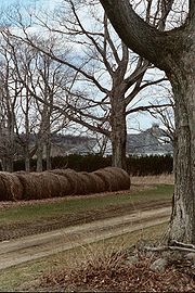
The Town of Ancram is in the eastern part of the county.
History
Originally part of the Land Grant to the Livingston family, this area on the Roeliff-Jansen Kill was originally called "Livingston Forge" after the iron foundry on the river. Throughout the eighteenth century. the Livingston forge created metal products for the community, and the town was sometimes known as "Scotchtown" due to the immigrants of Scottish ancestry to flocked there. As the Revolution drew near, the factory produced shot, cannonballs, and perhaps most importantly, the chain which stretched across the Hudson River at West Point.After the Revolution, the town was established from part of the Town of Livingston
Livingston, New York
Livingston is a town in Columbia County, New York, United States. The population was 3,424 at the 2000 census. The town is named after its founding father....
in 1803, but was then called the "Town of Gallatin." In 1814, the name was changed to "Ancram," after the town in Scotland where the Livingstons had their origins. Part of Ancram was taken to form a new Town of Gallatin
Gallatin, New York
Gallatin is a town in Columbia County, New York, United States. The population was 1,499 at the 2000 census.The Town of Gallatin is on the south border of Columbia County and located 100 miles north of New York City.- History :...
in 1830.
Mining of iron
Iron
Iron is a chemical element with the symbol Fe and atomic number 26. It is a metal in the first transition series. It is the most common element forming the planet Earth as a whole, forming much of Earth's outer and inner core. It is the fourth most common element in the Earth's crust...
and lead
Lead
Lead is a main-group element in the carbon group with the symbol Pb and atomic number 82. Lead is a soft, malleable poor metal. It is also counted as one of the heavy metals. Metallic lead has a bluish-white color after being freshly cut, but it soon tarnishes to a dull grayish color when exposed...
was important in the early economy, and the town of Ancramdale was originally known as "Ancram Lead Mines"
The hamlet of Boston Corners
Boston Corners, New York
Boston Corner is a hamlet of the town of Ancram in Columbia County, New York, United States and the town of Northeast in Dutchess County, New York...
was formerly part of the town of Mount Washington
Mount Washington, Massachusetts
Mount Washington is a town in Berkshire County, Massachusetts, United States. It is part of the Pittsfield, Massachusetts Metropolitan Statistical Area. The population was 130 at the 2000 census, making it the smallest town in Berkshire County and, after Gosnold and Monroe, the third smallest in...
, Massachusetts
Massachusetts
The Commonwealth of Massachusetts is a state in the New England region of the northeastern United States of America. It is bordered by Rhode Island and Connecticut to the south, New York to the west, and Vermont and New Hampshire to the north; at its east lies the Atlantic Ocean. As of the 2010...
, and was annexed to Ancram on April 13, 1857.
Geography
According to the United States Census BureauUnited States Census Bureau
The United States Census Bureau is the government agency that is responsible for the United States Census. It also gathers other national demographic and economic data...
, the town has a total area of 42.8 square miles (110.9 km²), of which, 42.6 square miles (110.3 km²) of it is land and 0.2 square mile (0.517997622 km²) of it (0.44%) is water.
The east town line is the border of Massachusetts
Massachusetts
The Commonwealth of Massachusetts is a state in the New England region of the northeastern United States of America. It is bordered by Rhode Island and Connecticut to the south, New York to the west, and Vermont and New Hampshire to the north; at its east lies the Atlantic Ocean. As of the 2010...
and Dutchess County
Dutchess County, New York
Dutchess County is a county located in the U.S. state of New York, in the state's Mid-Hudson Region of the Hudson Valley. The 2010 census lists the population as 297,488...
, New York. The south town line also borders Dutchess County.
Demographics
As of the censusCensus
A census is the procedure of systematically acquiring and recording information about the members of a given population. It is a regularly occurring and official count of a particular population. The term is used mostly in connection with national population and housing censuses; other common...
of 2000, there were 1,513 people, 595 households, and 430 families residing in the town. The population density
Population density
Population density is a measurement of population per unit area or unit volume. It is frequently applied to living organisms, and particularly to humans...
was 35.5 people per square mile (13.7/km²). There were 823 housing units at an average density of 19.3 per square mile (7.5/km²). The racial makeup of the town was 97.69% White, 1.06% African American, 0.13% Native American, 0.13% Asian, and 0.99% from two or more races. Hispanic or Latino of any race were 0.93% of the population.
There were 595 households out of which 30.4% had children under the age of 18 living with them, 58.7% were married couples
Marriage
Marriage is a social union or legal contract between people that creates kinship. It is an institution in which interpersonal relationships, usually intimate and sexual, are acknowledged in a variety of ways, depending on the culture or subculture in which it is found...
living together, 8.6% had a female householder with no husband present, and 27.6% were non-families. 20.5% of all households were made up of individuals and 8.1% had someone living alone who was 65 years of age or older. The average household size was 2.54 and the average family size was 2.91.
In the town the population was spread out with 22.4% under the age of 18, 5.7% from 18 to 24, 26.5% from 25 to 44, 28.3% from 45 to 64, and 17.1% who were 65 years of age or older. The median age was 42 years. For every 100 females there were 104.7 males. For every 100 females age 18 and over, there were 99.3 males.
The median income for a household in the town was $45,726, and the median income for a family was $47,708. Males had a median income of $31,196 versus $25,625 for females. The per capita income
Per capita income
Per capita income or income per person is a measure of mean income within an economic aggregate, such as a country or city. It is calculated by taking a measure of all sources of income in the aggregate and dividing it by the total population...
for the town was $22,541. About 5.1% of families and 7.4% of the population were below the poverty line, including 5.4% of those under age 18 and 12.0% of those age 65 or over.
Communities and other locations
- Ancram – The hamletHamlet (place)A hamlet is usually a rural settlement which is too small to be considered a village, though sometimes the word is used for a different sort of community. Historically, when a hamlet became large enough to justify building a church, it was then classified as a village...
of Ancram is in the northwest part of the town on Routes 7 and 82. - Ancramdale – A hamlet southeast of Ancram village.
- Boston Corner – A hamlet of Ancram which was formerly in MassachusettsMassachusettsThe Commonwealth of Massachusetts is a state in the New England region of the northeastern United States of America. It is bordered by Rhode Island and Connecticut to the south, New York to the west, and Vermont and New Hampshire to the north; at its east lies the Atlantic Ocean. As of the 2010...
. The community is adjacent to the Massachusetts border. - Taconic State ParkTaconic State ParkTaconic State Park is located in Columbia and Dutchess County, New York abutting Massachusetts and Connecticut within the Taconic Mountains. The state park is located off New York State Route 344 south of Interstate 90 and north of New York City...
– Part of the park is in the northeast part of the town. - Weed Mines – A location by the north town line.
- Whitehouse Crossing – A location at the east town line.