

Bald Mountain (California)
Encyclopedia
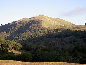
- In Sugarloaf Ridge State ParkSugarloaf Ridge State ParkSugarloaf Ridge State Park is a state park in Northern California, U.S.A.. Located in the Mayacamas Mountains north of Kenwood, the park straddles the boundary between Sonoma and Napa counties...
there are two Bald Mountain summits, both located on the SonomaSonoma County, CaliforniaSonoma County, located on the northern coast of the U.S. state of California, is the largest and northernmost of the nine San Francisco Bay Area counties. Its population at the 2010 census was 483,878. Its largest city and county seat is Santa Rosa....
-Napa CountyNapa County, CaliforniaNapa County is a county located north of the San Francisco Bay Area in the U.S. state of California. It is coterminous with the Napa, California, Metropolitan Statistical Area. As of 2010 the population is 136,484. The county seat is Napa....
border:- The northern one, at 38°27′27"N 122°30′34"W, rises to an elevation of 2730 ft (832 m). Sonoma CreekSonoma CreekSonoma Creek is a stream in northern California. It is one of two principal drainages of southern Sonoma County, California, with headwaters rising in the rugged hills of Sugarloaf Ridge State Park and discharging to San Pablo Bay, the northern arm of San Francisco Bay. The watershed drained by...
rises from its southeastern flank, the source of Bear CreekBear Creek (Sonoma Creek)Bear Creek is a stream in eastern Sonoma County, California, United States, a tributary of Sonoma Creek.-Course:The stream originates near the Sonoma-Napa county line, about north of the northern Bald Mountain summit...
is on its northern flank, and its northeastern flank drains to the Napa RiverNapa RiverThe Napa River, approximately 55 miles long, is a river in the U.S. state of California. It drains a famous wine-growing region, called the Napa Valley, in the mountains northeast of San Francisco. Milliken Creek is a tributary of the Napa River....
. - The southern one, at 38°25′46"N 122°29′36"W, rises to an elevation of 2260 ft (689 m).
- The northern one, at 38°27′27"N 122°30′34"W, rises to an elevation of 2730 ft (832 m). Sonoma Creek
- In Los Angeles CountyLos Angeles County, CaliforniaLos Angeles County is a county in the U.S. state of California. As of 2010 U.S. Census, the county had a population of 9,818,605, making it the most populous county in the United States. Los Angeles County alone is more populous than 42 individual U.S. states...
there is a Bald Mountain at 34°44′39"N 118°43′40"W that rises to an elevation of 4528 ft (1,380 m).
- In Humboldt CountyHumboldt County, CaliforniaHumboldt County is a county in the U.S. state of California, located on the far North Coast 200 miles north of San Francisco. According to 2010 Census Data, the county’s population was 134,623...
there is a Bald Mountain at 40°52′56"N 123°51′56"W west of McKinleyvilleMcKinleyville, CaliforniaMcKinleyville is a census-designated place in Humboldt County, California, United States. McKinleyville is located north of Arcata, at an elevation of . The population was 15,177 at the 2010 census, up from 13,599 at the 2000 census. This unincorporated community is the third largest community,...
that rises to an elevation of 3150 ft (960 m).
- In San Benito CountySan Benito County, CaliforniaSan Benito County is a county located in the Coast Range Mountains of the U.S. state of California, south of San Jose. As of 2010 the population was 55,269. The county seat is Hollister, which includes nearly two-thirds of the county's population. El Camino Real passes through the county and...
there is a Bald Mountain at 36°34′14"N 121°05′24"W that rises to an elevation of 2920 ft (890 m). - In Santa Cruz CountySanta Cruz County, CaliforniaSanta Cruz County is a county located on the Pacific coast of the U.S. state of California, on the California Central Coast. The county forms the northern coast of the Monterey Bay. . As of the 2010 U.S. Census, its population was 262,382. The county seat is Santa Cruz...
there is a Bald Mountain at 37°01′30"N 122°08′26"W that rises to an elevation of 1309 ft (399 m).
- In Fresno CountyFresno County, CaliforniaFresno County is a county located in the Central Valley of the U.S. state of California, south of Stockton and north of Bakersfield. As of the 2010 census, it is the tenth most populous county in California with a population of 930,450, and the sixth largest in size with an area of . The county...
there are four:- a Bald Mountain at 37°06′14"N 119°12′20"W that rises to an elevation of 7838 ft (2,389 m).
- a Bald Mountain at 36°11′44"N 120°35′43"W that rises to an elevation of 3799 ft (1,158 m).
- a Bald Mountain at 36°45′58"N 119°12′13"W that rises to an elevation of 3510 ft (1,070 m).
- a Bald Mountain at 37°03′44"N 119°24′01"W that rises to an elevation of 4810 ft (1,466 m).
- In Santa Clara CountySanta Clara County, CaliforniaSanta Clara County is a county located at the southern end of the San Francisco Bay Area in the U.S. state of California. As of 2010 it had a population of 1,781,642. The county seat is San Jose. The highly urbanized Santa Clara Valley within Santa Clara County is also known as Silicon Valley...
there is a Bald Mountain at 37°09′36"N 121°52′02"W that rises to an elevation of 2382 ft (726 m). - In San Joaquin CountySan Joaquin County, CaliforniaSan Joaquin County is a county located in Central Valley of the U.S. state of California, just east of the San Francisco Bay Area. As of the 2010 census, the population was 685,306. The county seat is Stockton.-History:...
there is a Bald Mountain at 37°34′47"N 121°31′04"W that rises to an elevation of 2844 ft (867 m).
- In Calaveras CountyCalaveras County, CaliforniaCalaveras County is a county located in the Gold Country of the U.S. state of California. Calaveras is the Spanish word for skulls; the county was reportedly named for the remains of Native Americans discovered by the Spanish explorer Captain Gabriel Moraga. As of the 2010 census, the county had a...
there are three:- a Bald Mountain at 38°08′18"N 120°57′02"W that rises to an elevation of 502 ft (153 m).
- a Bald Mountain at 38°25′10"N 120°26′37"W that rises to an elevation of 4091 ft (1,247 m).
- a Bald Mountain at 38°05′31"N 120°27′25"W that rises to an elevation of 2192 ft (668 m).
- In Tuolumne CountyTuolumne County, CaliforniaTuolumne County is a county in the Sierra Nevada of the U.S. state of California. The northern half of Yosemite National Park is located in the eastern part of the county. As of the 2010 census, the population was 55,365, up from 54,501 at the 2000 census...
there are three:- a Bald Mountain at 38°08′41"N 120°05′14"W that rises to an elevation of 5810 ft (1,771 m).
- a Bald Mountain at 37°51′19"N 119°47′25"W that rises to an elevation of 7244 ft (2,208 m).
- a Bald Mountain at 38°00′30"N 120°21′47"W that rises to an elevation of 3333 ft (1,016 m).
- In Yolo CountyYolo County, CaliforniaYolo County is a county located in the northern part of the U.S. state of California, bordered by the other counties of Sacramento, Solano, Napa, Lake, Colusa, and Sutter. The city of Woodland is its county seat, though Davis is its largest city....
there is a Bald Mountain at 38°47′13"N 122°07′23"W that rises to an elevation of 1811 ft (552 m).
- In El Dorado CountyEl Dorado County, CaliforniaEl Dorado County is a county located in the historic Gold Country in the Sierra Nevada Mountains and foothills of the U.S. state of California. The 2010 population was 181,058. The El Dorado county seat is in Placerville....
there are two:- a Bald Mountain at 38°54′15"N 120°42′19"W that rises to an elevation of 4580 ft (1,396 m).
- a Bald Mountain at 38°46′01"N 120°13′20"W that rises to an elevation of 6991 ft (2,131 m).
- In Lake CountyLake County, CaliforniaLake County is a county located in the north central portion of the U.S. state of California, north of the San Francisco Bay Area. It takes its name from Clear Lake, the dominant geographic feature in the county and the largest natural lake wholly within California...
there is a Bald Mountain at 38°58′44"N 122°38′42"W that rises to an elevation of 2165 ft (660 m). - In Placer CountyPlacer County, CaliforniaPlacer County is a county located in both the Sacramento Valley and Sierra Nevada regions of the U.S. state of California, in what is known as the Gold Country. It stretches from the suburbs of Sacramento to Lake Tahoe and the Nevada border. Because of the expansion of the Greater Sacramento,...
there is a Bald Mountain at 39°17′49"N 120°10′58"W that rises to an elevation of 6758 ft (2,060 m).
- In Mendocino CountyMendocino County, CaliforniaMendocino County is a county located on the north coast of the U.S. state of California, north of the greater San Francisco Bay Area and west of the Central Valley. As of the 2010 census, the population was 87,841, up from 86,265 at the 2000 census...
there are six:- a Bald Mountain at 39°48′09"N 123°37′14"W that rises to an elevation of 3455 ft (1,053 m).
- a Bald Mountain at 39°58′06"N 123°17′04"W that rises to an elevation of 3894 ft (1,187 m).
- a Bald Mountain at 39°33′47"N 123°11′07"W that rises to an elevation of 4196 ft (1,279 m).
- a Bald Mountain at 39°34′21"N 123°21′20"W that rises to an elevation of 2297 ft (700 m).
- a Bald Mountain at 39°42′52"N 123°10′38"W that rises to an elevation of 2320 ft (707 m).
- a Bald Mountain at 39°37′14"N 122°58′26"W that rises to an elevation of 6732 ft (2,052 m).
- In Shasta CountyShasta County, CaliforniaShasta County is a county located in the northern portion of the U.S. state of California. The county occupies the northern reaches of the Sacramento Valley, with portions extending into the southern reaches of the Cascade Range. As of the 2010 census, the population was 177,223, up from 163,256...
there are three:- a Bald Mountain at 41°05′49"N 121°51′19"W that rises to an elevation of 5377 ft (1,639 m).
- a Bald Mountain at 41°06′00"N 122°09′58"W that rises to an elevation of 4623 ft (1,409 m).
- a Bald Mountain at 40°54′02"N 121°22′40"W that rises to an elevation of 5558 ft (1,694 m).
- In Modoc CountyModoc County, CaliforniaModoc County is a county located in the far northeast corner of the U.S. state of California, bounded by the state of Oregon to the north and the state of Nevada to the east. As of the 2010 census, its population was 9,686, up from 9,449 at the 2000 census. The current county seat is Alturas, the...
there are three:- a Bald Mountain at 41°36′36"N 120°16′12"W that rises to an elevation of 8261 ft (2,518 m).
- a Bald Mountain at 41°11′14"N 120°33′29"W that rises to an elevation of 5896 ft (1,797 m).
- a Bald Mountain at 41°15′02"N 120°13′47"W that rises to an elevation of 7697 ft (2,346 m).
- In Lassen CountyLassen County, CaliforniaLassen County is a county located in the northeastern portion of the U.S. state of California. As of the 2010 census, the population was 34,895, up from 33,828 at the 2000 census...
there are two:- a Bald Mountain at 40°20′19"N 120°27′28"W that rises to an elevation of 5210 ft (1,588 m).
- a Bald Mountain at 40°55′02"N 121°05′36"W that rises to an elevation of 6069 ft (1,850 m).
- In Riverside CountyRiverside County, CaliforniaRiverside County is a county in the U.S. state of California. One of 58 California counties, it covers in the southern part of the state, and stretches from Orange County to the Colorado River, which forms the state border with Arizona. The county derives its name from the city of Riverside,...
there is a Bald Mountain at 33°40′29"N 116°32′36"W that rises to an elevation of 4409 ft (1,344 m).
- In Santa Barbara CountySanta Barbara County, CaliforniaSanta Barbara County is a county located in the southern portion of the U.S. state of California, on the Pacific coast. As of 2010 the county had a population of 423,895. The county seat is Santa Barbara and the largest city is Santa Maria.-History:...
there are two:- at 34°31′53"N 120°05′28"W that rises to an elevation of 2612 ft (796 m).
- at 34°48′45"N 119°56′07"W that rises to an elevation of 3966 ft (1,209 m).
- In Tulare CountyTulare County, CaliforniaTulare County is a county located in the Central Valley of the U.S. state of California, south of Fresno. Sequoia National Park is located in the county, as are part of Kings Canyon National Park, in its northeast corner , and part of Mount Whitney, on its eastern border...
there are two:- a Bald Mountain at 35°48′42"N 118°49′41"W that rises to an elevation of 2382 ft (726 m).
- a Bald Mountain at 36°01′11"N 118°15′14"W that rises to an elevation of 9383 ft (2,860 m).
- In Sierra CountySierra County, CaliforniaSierra County is a county located in the Sierra Nevada of the U.S. state of California, northeast of Sacramento on the border with Nevada. As of the 2010 census the population was 3,240, down from 3,555 at the 2000 census. The county seat is Downieville....
there are two:- a Bald Mountain at 39°30′25"N 120°49′49"W that rises to an elevation of 5791 ft (1,765 m).
- a Bald Mountain at 39°34′31"N 120°53′53"W that rises to an elevation of 5515 ft (1,681 m).
- In Mono CountyMono County, CaliforniaMono County is a county located in the east central portion of the U.S. state of California, to the east of the Sierra Nevada between Yosemite National Park and Nevada. As of the 2010 census, the population was 14,202, up from 12,853 at the 2000 census...
there is a Bald Mountain at 37°47′02"N 118°54′04"W that rises to an elevation of 9085 ft (2,769 m).
- In Nevada CountyNevada County, CaliforniaNevada County is a county located in the Sierra Nevada of California, in the Mother Lode country. As of 2010 its population was 98,764. The county seat is Nevada City.-History:Nevada County was created in 1851 from parts of Yuba County....
there are two:- a Bald Mountain at 39°20′04"N 121°00′48"W that rises to an elevation of 3113 ft (949 m).
- a Bald Mountain at 39°07′06"N 121°10′40"W that rises to an elevation of 1463 ft (446 m).
- In San Luis Obispo CountySan Luis Obispo County, CaliforniaSan Luis Obispo County is a county located along the Pacific Ocean in the Central Coast of the U.S. state of California, between Los Angeles and the San Francisco Bay Area. As of the 2010 census its population was 269,637, up from 246,681 at the 2000 census...
there are two:- a Bald Mountain at 35°08′57"N 120°18′33"W that rises to an elevation of 2044 ft (623 m).
- a Bald Mountain at 35°14′23"N 120°30′11"W that rises to an elevation of 2805 ft (855 m).
- In Monterey CountyMonterey County, CaliforniaMonterey County is a county located on the Pacific coast of the U.S. state of California, its northwestern section forming the southern half of Monterey Bay. The northern half of the bay is in Santa Cruz County. As of 2010, the population was 415,057. The county seat and largest city is Salinas...
there is a Bald Mountain at 35°51′48"N 121°07′27"W that rises to an elevation of 2136 ft (651 m). - In Mariposa CountyMariposa County, CaliforniaMariposa County is a county in the U.S. state of California, located in the western foothills of the Sierra Nevada mountains. It lies north of Fresno, east of Merced, and southeast of Stockton. As of the 2010 census, the population was 18,251 up from 17,130 at the 2000 census...
there is a Bald Mountain at 37°43′34"N 120°09′52"W that rises to an elevation of 3173 ft (967 m).
- In Siskiyou CountySiskiyou County, CaliforniaSiskiyou County is a county located in the far northernmost part of the U.S. state of California, in the Shasta Cascade region on the Oregon border. Yreka is the county seat. Because of its substantial natural beauty, outdoor recreation opportunities, and Gold Rush era history, it is an important...
there are two:- a Bald Mountain at 41°23′31"N 123°34′32"W that rises to an elevation of 4419 ft (1,347 m).
- a Bald Mountain at 41°46′43"N 122°56′22"W that rises to an elevation of 5387 ft (1,642 m).
- In Butte CountyButte County, CaliforniaButte County is a county located in the Central Valley of the US state of California, north of the state capital of Sacramento. As of the 2010 census, it had a population of 220,000. The county seat is Oroville. Butte County is the "Land of Natural Wealth and Beauty."Butte County is watered by the...
there is a Bald Mountain at 39°57′10"N 121°28′57"W that rises to an elevation of 5777 ft (1,761 m).