
Ain River
Encyclopedia
The Ain is a river
in eastern France
. In the Franco-Provençal language
it is known as the En.
, in the Jurassic
limestone
of the southern end of the Jura mountains
and flows into the Rhône
about 40 kilometres above Lyon
, some 190 kilometres down the Ain.
Its source is in the old county: Franche-Comté
. It flows south through the combined lengths of the two départements of
On the way it passes through the towns of Champagnole
. (05°54'28"E 46°44'53"N) and Pont-d'Ain
(05°20'13"E 46°02'56"N).
The Ain flows into the river Rhône
, on the Rhône's right bank, opposite the village of Anthon
, approximately 40 km east of Lyon
.
is, of course, Jurassic but it includes less clay than the Jurassic of England
so Upper or Middle Jurassic means limestone of some sort, possibly marl
(EB 13). The lower river passes over Holocene
deposits from the river's own activity amongst rocks of the Middle or Upper Pleistocene
(CG).
The Jura consists of limestone strata
crushed into ridges between the forces of the spreading rift valley
of the Saône and the Alps
, the latter raised by a collision of the Italian tectonic plate
with Europe. The highest ridge is the easternmost and the Ain flows southwards in the lowest valley, which lies towards the western side of the Jura. The westernmost ridge is again rather higher as the plain of the Saône valley is subducted
below the Jurassic rocks (Dercourt). The whole has been glaciated but there is relatively little till
remaining in the Jura.
The lower Ain flows on the plain where there is much Pleistocene material, much of it glacial till
. However, the low scarp between the Pays de Dombes
and the river is Miocene
(CG).
, in the Ange valley which is parallel with the Ain. According to the legend, St Léger gave the monopoly of comb making to Oyonnax in 630. The traditional small products of the region, wood-turning
, horn combs and trinkets led to the development of a specialism in the injection moulding
, vacuum forming
and so on of plastics
, beginning with celluloid
in 1880. The town's population in 1999 was 24,636 but it is the exception for the river basin
(ext links).
The timber
is the region's most obvious asset. Some was marketed down river and some converted into charcoal which permitted the rise of water-powered forges working iron from smelters in the Saône valley. There is also pasture producing cheese specialities. In the 20th century, the water power was diverted to the production of hydro-electricity, a fact which aided the early introduction of the plastics industry at Oyonnax. In this, the Ain is central.
This is an area of unusually high rainfall for France. But in the summer season, the weather is usually kind. The woodland walks, fishing, sailing and impressive scenery have permitted the development of the outdoor kind of tourism.
in a small area of lower Cretaceous
rock. The top picture on this site gives an idea of it. The young river is soon joined by streams from other similar sources. The growing stream tumbles down in waterfalls like le saut de Mailly to and through a place called Perte-de-l'Ain (Generally, une perte is a 'loss' but here, a 'swallow' hole.) The small stream disappears briefly in a deep fissure, passing underground in the limestone
. It comes into the open again, in the form of a waterfall. Here, at Bourg-de-Sirod, is the first of the hydrological
stations on the river. At the Forges de Syam
it gathers the waters of the river Saine from its left, turning sharply to the north-west towards Champagnole
where it used to provide power for many forge
s and other small industries such as tanneries, grinding mills, sawmills and wood-turning workshops.
. This represents the water impounded in the upper Jurassic of the valley bottom by the dam
, the Barrage de Vouglans. The lake, 605 million cubic metres of it, is adapted to leisure use for boating and so on, with various monuments enhancing the landscape of its shores but its purpose is as the main reservoir of the Électricité de France
(EDF) scheme which extends from here, down the valley. By the dam are an EDF power station and the new village of Vouglans.
The D470 crosses it at Pont-de-la-Pyle where there was a Roman bridge and all sorts of crossings of the river since. They have not all withstood the river in spate. It is an ancient crossing point as it is opposite a gap in the hill ridge to the west, which continues the Côte de l'Heute southwards. In a land where such ridges are a feature of the landscape, such a gap has a name: a cluse. This is La Cluse de la Pyle.
The last of the old bridges was of metal but it went in 1968 as the road had to be raised above the level of the new lake which also drowned 16 square kilometres of land. On that land were several villages and hamlets and the charterhouse of Vaucluse, (vallis clausa). It had been founded in 1125 in the 'enclosed valley'. This collection of buildings, built on a terrace supported by an arcade alongside the river and reached by a ferry was to be demolished. Thanks to a group of friends, the main features were dismantled and re-erected above the reach of the lake. What is now hidden is the range of old industrial sites which used the river's power.
In general, the upper Jurassic rocks are heavily forested while the lower Cretaceous and Pleistocene deposits are free of trees. Thus, for most of the stretch below Champagnole, the trees are at a distance from the river but from about two kilometres south of the head of the lake, Pont-de-Poitte
, the trees clad its shores. In part, this is the Forêt de Vaucluse on the hillside above the site of the monastery
.
This zone of Jurassic rocks down which a glacier has flowed, having spilled out from the Swiss plateau
in the vicinity of Lake Neuchâtel
, is riddled with faults
, ridges and valleys from the Alpine
orogeny
. The features all tend north-east to south-west in the vicinity of the source of the river and become north to south by the time Vouglans is passed. To the west of the valley, the Jurassic and Triassic
rocks rise to the ridge beyond which the Pays de Bresse
which is composed of overlying Pleistocene and Pliocene
deposits, tilts gently towards the River Saône. Beyond the Bresse plain, the Jurassic rises again in the Côte d'Or
, backed by the mass of the Morvan
.
One of the cluster of villages below the Barrage is Menouille, where rafts of timber used to be assembled for the passage down-river to Lyon
.
At Chancia
, the water enters another lake where the Ain receives its tributary, the Bienne. The side valley too, is dammed and has its power station at the Barrage de Cézinet. On the Ain, the Barrage de Coiselet is the dam retaining the lake we have been following and it has its EDF plant. This was where the first of the hydro-electric generators was installed, in 1901. The dangerous gorge gave way to the waters of the present Barrage de Coiselet which turned the confluence of the River Bienne with the Ain into the head of the lake. The lake now made a convenient place for assembling the timber rafts of their handlers, the radeliers. From there the lake and river form the boundary between the départements of Jura and Ain and we have followed the river for about half its length.
Shortly below the Barrage de Coiselet the Ain gathers the waters of the river Oignin which flows northwards in the same fold in the land as is occupied by the lake. This is a good example of the trellised nature of the drainage pattern in the region. The Ain flows southwards and is joined by the Oignin which flows northwards but the main tributary of the latter is the Ange which flows southwards. The Ange valley is where Oyonnax lies. That town is just over the ridge, five kilometres as the crow flies, from the dam at Coiselet.
The united rivers turn westwards and make another kink, gathering a tributary in the next fold, this time from the right and called the River Valouse. The bottom of this fold is a fault along which the rivers flow. It sets the conditions for the next segment of the valley. These are the Gorges de l'Ain in which there are four EDF plants in 30 km. The river is still mainly on upper Jurassic geology but with small patches of lower Cretaceous, middle and lower Jurassic. Nearby, there are small areas of Pleistocene and Triassic. The mixture is not surprising on such faulted and glaciated ground.
For about 13 km, from the head of the lake at Chancia to the confluence with the Valouse, the Ain forms the boundary between the départements of Jura and Ain and 7 km beyond that it reaches the "Epaulette de Cize", a name which comes from the shape of a small but pronounced meander near the village of Cize. The water is now pounded into the bottom of the gorge by the dam there and the old economy of its shore is replaced by catering for anglers and campers. This happened around 1930 until when, they built river craft at Thiorette and milled at Corveissiat. At the EDF dam, the river breaks away from the fault and makes its tight loop. In the middle of the loop is the Cize-Bolozon viaduct
, with the Bourg en Bresse to Saint Claude railway on the top level from which the trains enter straight into a tunnel. On the lower deck is the local road from Poncin to Thoirette.
s, airfields and industrial estates. It begins with the A40 bridge just above Poncin, in the last of the Jura.
But we have not quite left the hills yet. Viewed from downstream, this entrance to the narrow valleys was obviously seen as important. There are the remains of several castles in the area around the entrance to the narrow part of the Ain Valley, as there are in a similar position on the Rhône but in that case, the transition between plain and hills is not so clearly defined. The Ain castles may be found at Abergement-de-Varay, Ambronay
, La Ceuille, Chenavel, Chiloup, Hauterive
, Jujurieux
, Neuville
, Oussiat, Pinel
, Poncin
, Pont-d'Ain, Saint-Gras, Saint-Martin-du-Mont
, Varambon
and Varey.
The A40 Autoroute crosses just above Poncin and just below the village, where the Jurassic banks narrow the river for the last time, it passes the Upper Palaeolithic (early Magdalenian
) archaeological site, discovered in 1913, la Colombière. Here, what may be the earliest representation of an arrow was found engraved on a stone. The presence of the site here may not be coincidental. The people of 20,000 years ago were hunter-gatherers who will have spent at least part of their year hunting herds in the increasingly cold climate. It is at the entrances to narrow valleys that the herds from the plain often concentrate in the course of their migrations up a valley. The Cro-Magnon people will have been here to make use of that seasonal bounty in a way comparable with the medieval view of the same area.
. Geologically, it is part of the Pays de Bresse but its traditional form of 'agriculture' is fish farming. It is therefore strewn with hundreds of mostly artificial lakes. The Dombes and the Ain valley in the Jura have an economic factor in common though; their markets were down-river in or through Lyon.
At Oussiat, there is a reminder of another, later traditional trade of the region, an old silk mill. The silk trade of the region was marketed through Lyon. It was typical of the markets through which Charles Worth
learned his business as a draper, a knowledge which he put to use in founding the House of Worth
.
About seven kilometres from la Colombière, the river reaches the N84 and A42 as it comes to the margin of the Dombes at and just below Pont d'Ain. Here is the fourth of the river's hydrological stations.
Pont d'Ain was the centre for the governing of the region when it was in the hands of the Dukes of Savoy
. Their castle remains. See Philibert le Beau of Savoy. Among the modern structures, there remain the buildings of the old grinding mills. Now in the plain, the river is not impounded for hydro-electrical use so the watercourse itself remains in a more natural state as a braided river
. Immediately below the motorway bridge, from the right, it receives its last tributary from the Jurassic valleys, the Suran. This is near Varambon, an old river port, overlooked by its castle, the château De Boissieu but it now looks across the river at the motorway.
The bridge of Pont-de-l'Ain carries the N 75. Here on the plain there is room for the old main roads to be straight. For about eight kilometres, between here and Villieu-Loyes-Mollon
, the river flows at one edge of its flood plain along the small escarpment
at the edge of the Pays de Dombes. The spaces between the villages such as Villette-sur-Ain and Priay. on the côte are small, all the way along. On the higher side of the flood plain is the small town of Ambérieu-en-Bugey
. To the east of that, the lower end of the Jura can still be seen. The river rambles over its bed between temporary islands of pebbles or silt and makes a fine terrain for lovers of fly-fishing and it was here that the young Antoine de Saint Exupéry came from Lyon for the swimming. The plain is riddled with small streams of which the Albarine
is most notable. The small region of the river plain, between the Ain and the Jura hills is known as the Bugey
.
The current becomes stronger as the stream passes among banks of pebbles and against gabion
s put in to protect the banks past Mollon but it opens out to its ramblings again before passing under the N84, the road which links the Jura with Lyon. At almost the same point it crosses the A42, the motorway linking Lyon with the eastern side of the Saône valley and with the Jura. Just below these crossings, at Chazay-sur-Ain is situated the fifth and lowest of its hydrological stations, about fifteen kilometres short of its confluence with the Rhône. From here on, the eastern border of the pays de Bugey is marked by the Rhône.
The Ain rambles its last few kilometres through open country but the large military Camp de la Valbone and the Bergères and Plaine de l'Ain industrial estates are not far away, neither is the atomic power station, the Centrale Nucléaire de Bugey. Having passed through the last woods and past the last villages, the Ain enters the Rhône about ten kilometres short of the Lyon-Saint-Exupéry
airport, named after Antoine, the aviator and the town where he was born.
Numerous birds populate the river's banks: duck, egret, swans, heron, and snipe. Beavers are also present and construct numerous dams while wild boar and roe deer are found in the woods and forests bordering the stream. Otters have once more been seen since 2003, so demonstrating a general improvement in the quality of the waters.
), set up under a French law. Its aim is to conserve and make the best use of the whole hydrological system by viewing it as a unit. That involves reconciling the hydro-electric stations with the boating, fishing, swimming and perhaps water extraction in view of the tendency to industrial development on the reclaimed delta land at its confluence with the Rhone at its southern end.
Hydrographic
River
A river is a natural watercourse, usually freshwater, flowing towards an ocean, a lake, a sea, or another river. In a few cases, a river simply flows into the ground or dries up completely before reaching another body of water. Small rivers may also be called by several other names, including...
in eastern France
France
The French Republic , The French Republic , The French Republic , (commonly known as France , is a unitary semi-presidential republic in Western Europe with several overseas territories and islands located on other continents and in the Indian, Pacific, and Atlantic oceans. Metropolitan France...
. In the Franco-Provençal language
Franco-Provençal language
Franco-Provençal , Arpitan, or Romand is a Romance language with several distinct dialects that form a linguistic sub-group separate from Langue d'Oïl and Langue d'Oc. The name Franco-Provençal was given to the language by G.I...
it is known as the En.
Global position
The river rises at an altitude of some 700 metres, near the village of La FavièreLa Favière
La Favière is a commune in the Jura department in Franche-Comté in eastern France.-References:*...
, in the Jurassic
Jurassic
The Jurassic is a geologic period and system that extends from about Mya to Mya, that is, from the end of the Triassic to the beginning of the Cretaceous. The Jurassic constitutes the middle period of the Mesozoic era, also known as the age of reptiles. The start of the period is marked by...
limestone
Limestone
Limestone is a sedimentary rock composed largely of the minerals calcite and aragonite, which are different crystal forms of calcium carbonate . Many limestones are composed from skeletal fragments of marine organisms such as coral or foraminifera....
of the southern end of the Jura mountains
Jura mountains
The Jura Mountains are a small mountain range located north of the Alps, separating the Rhine and Rhone rivers and forming part of the watershed of each...
and flows into the Rhône
Rhône River
The Rhone is one of the major rivers of Europe, rising in Switzerland and running from there through southeastern France. At Arles, near its mouth on the Mediterranean Sea, the river divides into two branches, known as the Great Rhone and the Little Rhone...
about 40 kilometres above Lyon
Lyon
Lyon , is a city in east-central France in the Rhône-Alpes region, situated between Paris and Marseille. Lyon is located at from Paris, from Marseille, from Geneva, from Turin, and from Barcelona. The residents of the city are called Lyonnais....
, some 190 kilometres down the Ain.
Its source is in the old county: Franche-Comté
Franche-Comté
Franche-Comté the former "Free County" of Burgundy, as distinct from the neighbouring Duchy, is an administrative region and a traditional province of eastern France...
. It flows south through the combined lengths of the two départements of
- Jura (named after the mountains: and
- AinAinAin is a department named after the Ain River on the eastern edge of France. Being part of the region Rhône-Alpes and bordered by the rivers Saône and Rhône, the department of Ain enjoys a privileged geographic situation...
: (named after the river).
On the way it passes through the towns of Champagnole
Champagnole
Champagnole is a commune in the Jura department in Franche-Comté in eastern France.-Geography:Champagnole has the publicity tag of "Pearl of the Jura" and is a small town at the geographical centre of Jura tourism. It stands on the right bank of the young River Ain at the foot of Mont Rivel...
. (05°54'28"E 46°44'53"N) and Pont-d'Ain
Pont-d'Ain
Pont-d'Ain is a commune in the Ain department in eastern France.-Population:-References:*...
(05°20'13"E 46°02'56"N).
The Ain flows into the river Rhône
Rhône River
The Rhone is one of the major rivers of Europe, rising in Switzerland and running from there through southeastern France. At Arles, near its mouth on the Mediterranean Sea, the river divides into two branches, known as the Great Rhone and the Little Rhone...
, on the Rhône's right bank, opposite the village of Anthon
Anthon, Isère
Anthon is a commune in the Isère department in south-eastern France.-Geography:Anton stands on the left bank of the River Rhône opposite its confluence with the River Ain, about 30 kilometres upstream from the centre of Lyon. Its inhabitants are Anthonois....
, approximately 40 km east of Lyon
Lyon
Lyon , is a city in east-central France in the Rhône-Alpes region, situated between Paris and Marseille. Lyon is located at from Paris, from Marseille, from Geneva, from Turin, and from Barcelona. The residents of the city are called Lyonnais....
.
Geology
The river flows through two regions. The JuraJura mountains
The Jura Mountains are a small mountain range located north of the Alps, separating the Rhine and Rhone rivers and forming part of the watershed of each...
is, of course, Jurassic but it includes less clay than the Jurassic of England
England
England is a country that is part of the United Kingdom. It shares land borders with Scotland to the north and Wales to the west; the Irish Sea is to the north west, the Celtic Sea to the south west, with the North Sea to the east and the English Channel to the south separating it from continental...
so Upper or Middle Jurassic means limestone of some sort, possibly marl
Marl
Marl or marlstone is a calcium carbonate or lime-rich mud or mudstone which contains variable amounts of clays and aragonite. Marl was originally an old term loosely applied to a variety of materials, most of which occur as loose, earthy deposits consisting chiefly of an intimate mixture of clay...
(EB 13). The lower river passes over Holocene
Holocene
The Holocene is a geological epoch which began at the end of the Pleistocene and continues to the present. The Holocene is part of the Quaternary period. Its name comes from the Greek words and , meaning "entirely recent"...
deposits from the river's own activity amongst rocks of the Middle or Upper Pleistocene
Pleistocene
The Pleistocene is the epoch from 2,588,000 to 11,700 years BP that spans the world's recent period of repeated glaciations. The name pleistocene is derived from the Greek and ....
(CG).
The Jura consists of limestone strata
Stratum
In geology and related fields, a stratum is a layer of sedimentary rock or soil with internally consistent characteristics that distinguish it from other layers...
crushed into ridges between the forces of the spreading rift valley
Rift valley
A rift valley is a linear-shaped lowland between highlands or mountain ranges created by the action of a geologic rift or fault. This action is manifest as crustal extension, a spreading apart of the surface which is subsequently further deepened by the forces of erosion...
of the Saône and the Alps
Alps
The Alps is one of the great mountain range systems of Europe, stretching from Austria and Slovenia in the east through Italy, Switzerland, Liechtenstein and Germany to France in the west....
, the latter raised by a collision of the Italian tectonic plate
Plate tectonics
Plate tectonics is a scientific theory that describes the large scale motions of Earth's lithosphere...
with Europe. The highest ridge is the easternmost and the Ain flows southwards in the lowest valley, which lies towards the western side of the Jura. The westernmost ridge is again rather higher as the plain of the Saône valley is subducted
Subduction
In geology, subduction is the process that takes place at convergent boundaries by which one tectonic plate moves under another tectonic plate, sinking into the Earth's mantle, as the plates converge. These 3D regions of mantle downwellings are known as "Subduction Zones"...
below the Jurassic rocks (Dercourt). The whole has been glaciated but there is relatively little till
Till
thumb|right|Closeup of glacial till. Note that the larger grains in the till are completely surrounded by the matrix of finer material , and this characteristic, known as matrix support, is diagnostic of till....
remaining in the Jura.
The lower Ain flows on the plain where there is much Pleistocene material, much of it glacial till
Moraine
A moraine is any glacially formed accumulation of unconsolidated glacial debris which can occur in currently glaciated and formerly glaciated regions, such as those areas acted upon by a past glacial maximum. This debris may have been plucked off a valley floor as a glacier advanced or it may have...
. However, the low scarp between the Pays de Dombes
Dombes
The Dombes is an area in South-Eastern France, once an independent municipality, formerly part of the province of Burgundy, and now a district comprised in the département of Ain, and bounded W. by the Saône River, by the Rhône, E. by the Ain and N...
and the river is Miocene
Miocene
The Miocene is a geological epoch of the Neogene Period and extends from about . The Miocene was named by Sir Charles Lyell. Its name comes from the Greek words and and means "less recent" because it has 18% fewer modern sea invertebrates than the Pliocene. The Miocene follows the Oligocene...
(CG).
Economy
The economy is not generally such as to provide riches. Neither is it one which used to require large towns as other than external markets in which to sell. The population is therefore dispersed. The exception to this is the town of OyonnaxOyonnax
Oyonnax is a commune in the Ain department in the Rhône-Alpes region in eastern France.It is the second largest commune in the department. Its residents are known as Oyonnaxiens.-Population:-Miscellaneous:...
, in the Ange valley which is parallel with the Ain. According to the legend, St Léger gave the monopoly of comb making to Oyonnax in 630. The traditional small products of the region, wood-turning
Turning
Turning is the process whereby a single point cutting tool is parallel to the surface. It can be done manually, in a traditional form of lathe, which frequently requires continuous supervision by the operator, or by using a computer controlled and automated lathe which does not. This type of...
, horn combs and trinkets led to the development of a specialism in the injection moulding
Injection moulding
Injection molding is a manufacturing process for producing parts from both thermoplastic and thermosetting plastic materials. Material is fed into a heated barrel, mixed, and forced into a mold cavity where it cools and hardens to the configuration of the cavity...
, vacuum forming
Vacuum forming
Vacuum forming, commonly known as vacuuforming, is a simplified version of thermoforming, whereby a sheet of plastic is heated to a forming temperature, stretched onto or into a single-surface mold , and held against the mold by applying vacuum between the mold surface and the sheet.The vacuum...
and so on of plastics
Thermoplastic
Thermoplastic, also known as a thermosoftening plastic, is a polymer that turns to a liquid when heated and freezes to a very glassy state when cooled sufficiently...
, beginning with celluloid
Celluloid
Celluloid is the name of a class of compounds created from nitrocellulose and camphor, plus dyes and other agents. Generally regarded to be the first thermoplastic, it was first created as Parkesine in 1862 and as Xylonite in 1869, before being registered as Celluloid in 1870. Celluloid is...
in 1880. The town's population in 1999 was 24,636 but it is the exception for the river basin
Drainage basin
A drainage basin is an extent or an area of land where surface water from rain and melting snow or ice converges to a single point, usually the exit of the basin, where the waters join another waterbody, such as a river, lake, reservoir, estuary, wetland, sea, or ocean...
(ext links).
The timber
Timber
Timber may refer to:* Timber, a term common in the United Kingdom and Australia for wood materials * Timber, Oregon, an unincorporated community in the U.S...
is the region's most obvious asset. Some was marketed down river and some converted into charcoal which permitted the rise of water-powered forges working iron from smelters in the Saône valley. There is also pasture producing cheese specialities. In the 20th century, the water power was diverted to the production of hydro-electricity, a fact which aided the early introduction of the plastics industry at Oyonnax. In this, the Ain is central.
This is an area of unusually high rainfall for France. But in the summer season, the weather is usually kind. The woodland walks, fishing, sailing and impressive scenery have permitted the development of the outdoor kind of tourism.
Infancy
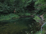
The river rises from a spring in the Jurassic limestone at the bottom of a deep grottoGrotto
A grotto is any type of natural or artificial cave that is associated with modern, historic or prehistoric use by humans. When it is not an artificial garden feature, a grotto is often a small cave near water and often flooded or liable to flood at high tide...
in a small area of lower Cretaceous
Cretaceous
The Cretaceous , derived from the Latin "creta" , usually abbreviated K for its German translation Kreide , is a geologic period and system from circa to million years ago. In the geologic timescale, the Cretaceous follows the Jurassic period and is followed by the Paleogene period of the...
rock. The top picture on this site gives an idea of it. The young river is soon joined by streams from other similar sources. The growing stream tumbles down in waterfalls like le saut de Mailly to and through a place called Perte-de-l'Ain (Generally, une perte is a 'loss' but here, a 'swallow' hole.) The small stream disappears briefly in a deep fissure, passing underground in the limestone
Limestone
Limestone is a sedimentary rock composed largely of the minerals calcite and aragonite, which are different crystal forms of calcium carbonate . Many limestones are composed from skeletal fragments of marine organisms such as coral or foraminifera....
. It comes into the open again, in the form of a waterfall. Here, at Bourg-de-Sirod, is the first of the hydrological
Hydrology
Hydrology is the study of the movement, distribution, and quality of water on Earth and other planets, including the hydrologic cycle, water resources and environmental watershed sustainability...
stations on the river. At the Forges de Syam
Forges de Syam
The Forges de Syam are forge works and sheet metal mills which are still active in 2005, although the buildings were erected in the 19th century and part of the machinery from that time is still in use...
it gathers the waters of the river Saine from its left, turning sharply to the north-west towards Champagnole
Champagnole
Champagnole is a commune in the Jura department in Franche-Comté in eastern France.-Geography:Champagnole has the publicity tag of "Pearl of the Jura" and is a small town at the geographical centre of Jura tourism. It stands on the right bank of the young River Ain at the foot of Mont Rivel...
where it used to provide power for many forge
Forge
A forge is a hearth used for forging. The term "forge" can also refer to the workplace of a smith or a blacksmith, although the term smithy is then more commonly used.The basic smithy contains a forge, also known as a hearth, for heating metals...
s and other small industries such as tanneries, grinding mills, sawmills and wood-turning workshops.
Youth
After this, for about 25 kilometres, it runs on glacial deposits which overlie the upper Jurassic. First, it flows westwards to just above Pont-du-Navoy where it comes against one of the many ridges of the Jura. This one, the Côte de l'Heute rises to some 750 metres but the valley is fairly broad and open as the glacial till of the plain de Montigny rises to the east but gently. At Pont-du-Navoy the Jura D471 road runs alongside the river and on it, by a pool is a place called les Forges; again, indicating the industry formerly in the valley. At Marigny is another pool, another factory and another hydrological station. The Lac de Chalain lies back from the river, in a fold in the ground to the east. At Châtillon, the river crosses the D39 then collects the river Hérisson on its left. At this point it broadens into the pool of the dam at Blye: again, a factory. It continues, still on the till, to the N78 at Pont-de-Poitte where the small gorge it once passed through is now flooded by the top reach of the lake of the dam at Vouglans.Lac de Vouglans
But before the end of the till is reached, it begins to broaden into a long sinuous lake, the Lac de VouglansLac de Vouglans
The Lac de Vouglans is the reservoir of the hydro-electric power station at Vouglans on the River Ain in the département of Jura in the region of Franche-Comté in eastern France. The dam, the Barrage de Vouglans is at coordinates .-Description:...
. This represents the water impounded in the upper Jurassic of the valley bottom by the dam
Dam
A dam is a barrier that impounds water or underground streams. Dams generally serve the primary purpose of retaining water, while other structures such as floodgates or levees are used to manage or prevent water flow into specific land regions. Hydropower and pumped-storage hydroelectricity are...
, the Barrage de Vouglans. The lake, 605 million cubic metres of it, is adapted to leisure use for boating and so on, with various monuments enhancing the landscape of its shores but its purpose is as the main reservoir of the Électricité de France
Électricité de France
Électricité de France S.A. is the second largest French utility company. Headquartered in Paris, France, with €65.2 billion in revenues in 2010, EDF operates a diverse portfolio of 120,000+ megawatts of generation capacity in Europe, Latin America, Asia, the Middle East and Africa.EDF is one of...
(EDF) scheme which extends from here, down the valley. By the dam are an EDF power station and the new village of Vouglans.
The D470 crosses it at Pont-de-la-Pyle where there was a Roman bridge and all sorts of crossings of the river since. They have not all withstood the river in spate. It is an ancient crossing point as it is opposite a gap in the hill ridge to the west, which continues the Côte de l'Heute southwards. In a land where such ridges are a feature of the landscape, such a gap has a name: a cluse. This is La Cluse de la Pyle.
The last of the old bridges was of metal but it went in 1968 as the road had to be raised above the level of the new lake which also drowned 16 square kilometres of land. On that land were several villages and hamlets and the charterhouse of Vaucluse, (vallis clausa). It had been founded in 1125 in the 'enclosed valley'. This collection of buildings, built on a terrace supported by an arcade alongside the river and reached by a ferry was to be demolished. Thanks to a group of friends, the main features were dismantled and re-erected above the reach of the lake. What is now hidden is the range of old industrial sites which used the river's power.
In general, the upper Jurassic rocks are heavily forested while the lower Cretaceous and Pleistocene deposits are free of trees. Thus, for most of the stretch below Champagnole, the trees are at a distance from the river but from about two kilometres south of the head of the lake, Pont-de-Poitte
Pont-de-Poitte
Pont-de-Poitte is a commune in the Jura department in Franche-Comté in eastern France.-Demographics:As of the census of 1999, the population was 582.The estimate for 2004 was 619.-References:*...
, the trees clad its shores. In part, this is the Forêt de Vaucluse on the hillside above the site of the monastery
Monastery
Monastery denotes the building, or complex of buildings, that houses a room reserved for prayer as well as the domestic quarters and workplace of monastics, whether monks or nuns, and whether living in community or alone .Monasteries may vary greatly in size – a small dwelling accommodating only...
.
This zone of Jurassic rocks down which a glacier has flowed, having spilled out from the Swiss plateau
Swiss plateau
The Swiss Plateau or Central Plateau constitutes one of the three major landscapes in Switzerland alongside the Jura mountains and the Swiss Alps. It covers about 30% of the Swiss surface...
in the vicinity of Lake Neuchâtel
Lake Neuchâtel
Lake Neuchâtel is a lake in Romandy, Switzerland . The lake lies mainly in the canton of Neuchâtel, but is also shared by the cantons of Vaud, of Fribourg, and of Bern....
, is riddled with faults
Geologic fault
In geology, a fault is a planar fracture or discontinuity in a volume of rock, across which there has been significant displacement along the fractures as a result of earth movement. Large faults within the Earth's crust result from the action of tectonic forces...
, ridges and valleys from the Alpine
Geology of the Alps
The Alps form part of a Tertiary orogenic belt of mountain chains, called the Alpide belt, that stretches through southern Europe and Asia from the Atlantic all the way to the Himalayas. This belt of mountain chains was formed during the Alpine orogeny. A gap in these mountain chains in central...
orogeny
Orogeny
Orogeny refers to forces and events leading to a severe structural deformation of the Earth's crust due to the engagement of tectonic plates. Response to such engagement results in the formation of long tracts of highly deformed rock called orogens or orogenic belts...
. The features all tend north-east to south-west in the vicinity of the source of the river and become north to south by the time Vouglans is passed. To the west of the valley, the Jurassic and Triassic
Triassic
The Triassic is a geologic period and system that extends from about 250 to 200 Mya . As the first period of the Mesozoic Era, the Triassic follows the Permian and is followed by the Jurassic. Both the start and end of the Triassic are marked by major extinction events...
rocks rise to the ridge beyond which the Pays de Bresse
Bresse
Bresse is a former French province. It is located in the regions of Rhône-Alpes, Bourgogne, and Franche-Comté of eastern France. The geographical term Bresse has two meanings: Bresse bourguignonne , which is situated in the east of the department of Saône-et-Loire, and Bresse, which is located...
which is composed of overlying Pleistocene and Pliocene
Pliocene
The Pliocene Epoch is the period in the geologic timescale that extends from 5.332 million to 2.588 million years before present. It is the second and youngest epoch of the Neogene Period in the Cenozoic Era. The Pliocene follows the Miocene Epoch and is followed by the Pleistocene Epoch...
deposits, tilts gently towards the River Saône. Beyond the Bresse plain, the Jurassic rises again in the Côte d'Or
Côte d'Or (escarpment)
The Côte d'Or is a limestone escarpment in Burgundy, France that lends its name to the department which was formed around it...
, backed by the mass of the Morvan
Morvan
The Morvan is a mountainous massif lying just to the west of the Côte d'Or escarpment in Burgundy, France. It is a northerly extension of the Massif Central and is of Variscan age. It is composed of granites and basalts and formed a promontory extending northwards into the Jurassic sea.-Music:The...
.
One of the cluster of villages below the Barrage is Menouille, where rafts of timber used to be assembled for the passage down-river to Lyon
Lyon
Lyon , is a city in east-central France in the Rhône-Alpes region, situated between Paris and Marseille. Lyon is located at from Paris, from Marseille, from Geneva, from Turin, and from Barcelona. The residents of the city are called Lyonnais....
.
Gorges de l'Ain
Below the main reservoir of the hydro-electric scheme, the Lac de Vouglans, the hills begin to close in. There is a succession of smaller barrages each with its power station. So none of this part of the river is in its natural state, though the setting is generally rural and near the river at least, wooded. A couple of kilometres down form the EDF station is another at le-Saut-Mortier where the river runs close to the steep hillside to its west and the really difficult part of the passage for the timber rafts used to begin.At Chancia
Chancia
For the Cambrian trilobite genus, see Chancia .Chancia is a commune in the Jura department in Franche-Comté in eastern France.-References:*...
, the water enters another lake where the Ain receives its tributary, the Bienne. The side valley too, is dammed and has its power station at the Barrage de Cézinet. On the Ain, the Barrage de Coiselet is the dam retaining the lake we have been following and it has its EDF plant. This was where the first of the hydro-electric generators was installed, in 1901. The dangerous gorge gave way to the waters of the present Barrage de Coiselet which turned the confluence of the River Bienne with the Ain into the head of the lake. The lake now made a convenient place for assembling the timber rafts of their handlers, the radeliers. From there the lake and river form the boundary between the départements of Jura and Ain and we have followed the river for about half its length.
Shortly below the Barrage de Coiselet the Ain gathers the waters of the river Oignin which flows northwards in the same fold in the land as is occupied by the lake. This is a good example of the trellised nature of the drainage pattern in the region. The Ain flows southwards and is joined by the Oignin which flows northwards but the main tributary of the latter is the Ange which flows southwards. The Ange valley is where Oyonnax lies. That town is just over the ridge, five kilometres as the crow flies, from the dam at Coiselet.
The united rivers turn westwards and make another kink, gathering a tributary in the next fold, this time from the right and called the River Valouse. The bottom of this fold is a fault along which the rivers flow. It sets the conditions for the next segment of the valley. These are the Gorges de l'Ain in which there are four EDF plants in 30 km. The river is still mainly on upper Jurassic geology but with small patches of lower Cretaceous, middle and lower Jurassic. Nearby, there are small areas of Pleistocene and Triassic. The mixture is not surprising on such faulted and glaciated ground.
For about 13 km, from the head of the lake at Chancia to the confluence with the Valouse, the Ain forms the boundary between the départements of Jura and Ain and 7 km beyond that it reaches the "Epaulette de Cize", a name which comes from the shape of a small but pronounced meander near the village of Cize. The water is now pounded into the bottom of the gorge by the dam there and the old economy of its shore is replaced by catering for anglers and campers. This happened around 1930 until when, they built river craft at Thiorette and milled at Corveissiat. At the EDF dam, the river breaks away from the fault and makes its tight loop. In the middle of the loop is the Cize-Bolozon viaduct
Cize-Bolozon viaduct
The viaduct is a road-rail bridge crossing the Ain gorge in France.The viaduct was originally constructed in 1875; it was destroyed in World War 2,. and then reconstructed as an urgent post-war project due to its position on a main line to Paris. The viaduct reopened in May 1950.The bridge carries...
, with the Bourg en Bresse to Saint Claude railway on the top level from which the trains enter straight into a tunnel. On the lower deck is the local road from Poncin to Thoirette.
Environmental borderlands
About seven km downstream from Cize, the river crosses the D979, a winding road of steep gradients, where the Gorge de l'Ain compresses the river most at Serrieres. As on the D470, the old suspension bridge was replaced to bring the road above the waters of an EDF dam, this one is where La Ceuille and Allement face each other across the river. Apart from the dam, La Ceuille is notable for its castle. By now, in the Jura, we have become accustomed to this pattern of narrow valley and raised waters but things are about to change. Below this dam, the Barrage d'Allement, 17 km downstream from Cize, the Ain is about to leave the Jura geology beyond which it has cut a valley into a plain of Middle and Upper Pleistocene deposits. Though, it has stirred them up so that immediately around the river, they are classed as Holocene. Here, the valley is host to railways, routes nationales, AutorouteAutoroutes of France
The Autoroute system in France consists largely of toll roads, except around large cities and in parts of the north. It is a network of worth of motorways. Autoroute destinations are shown in blue, while destinations reached through a combination of autoroutes are shown with an added autoroute logo...
s, airfields and industrial estates. It begins with the A40 bridge just above Poncin, in the last of the Jura.
But we have not quite left the hills yet. Viewed from downstream, this entrance to the narrow valleys was obviously seen as important. There are the remains of several castles in the area around the entrance to the narrow part of the Ain Valley, as there are in a similar position on the Rhône but in that case, the transition between plain and hills is not so clearly defined. The Ain castles may be found at Abergement-de-Varay, Ambronay
Ambronay
Ambronay is a commune in the Ain department in the Rhône-Alpes region in eastern France. It is situated some north of Ambérieu-en-Bugey.-Abbey:...
, La Ceuille, Chenavel, Chiloup, Hauterive
Hauterive
Hauterive may refer to:*In Switzerland:**Hauterive, Neuchâtel**Hauterive, Fribourg*In France:**Hauterive, Allier**Hauterive, Orne**Hauterive, Yonne*In Canada:**Hauterive, Quebec, now part of Baie-Comeau-See also:...
, Jujurieux
Jujurieux
Jujurieux is a commune in the Ain department in eastern France.-Population:...
, Neuville
Neuville-sur-Ain
Neuville-sur-Ain is a commune in the Ain department in eastern France.-Population:-References:*...
, Oussiat, Pinel
Pinel
Pinel is the surname of:* Raquel Pinel, Spanish football forward currently playing for Valencia CF in the Spanish league* Marcel Pinel , French footballer* Suzanne Pinel, CM is a Canadian children's entertainer and citizenship judge...
, Poncin
Poncin
Poncin is a commune in the Ain department in eastern France.It lies on the banks of the Ain River.-History:Of strategic importance during medieval times, Poncin is surrounded by city walls that are still in perfect shape despite their age. The village was originally intended to receive the same...
, Pont-d'Ain, Saint-Gras, Saint-Martin-du-Mont
Saint-Martin-du-Mont
Saint-Martin-du-Mont is the name of 3 communes in France:* Saint-Martin-du-Mont, in the Ain department* Saint-Martin-du-Mont, in the Côte-d'Or department* Saint-Martin-du-Mont, in the Saône-et-Loire department...
, Varambon
Varambon
Varambon is a commune in the Ain department in eastern France.-Population:...
and Varey.
The A40 Autoroute crosses just above Poncin and just below the village, where the Jurassic banks narrow the river for the last time, it passes the Upper Palaeolithic (early Magdalenian
Magdalenian
The Magdalenian , refers to one of the later cultures of the Upper Paleolithic in western Europe, dating from around 17,000 BP to 9,000 BP...
) archaeological site, discovered in 1913, la Colombière. Here, what may be the earliest representation of an arrow was found engraved on a stone. The presence of the site here may not be coincidental. The people of 20,000 years ago were hunter-gatherers who will have spent at least part of their year hunting herds in the increasingly cold climate. It is at the entrances to narrow valleys that the herds from the plain often concentrate in the course of their migrations up a valley. The Cro-Magnon people will have been here to make use of that seasonal bounty in a way comparable with the medieval view of the same area.
Maturity
However, the plain to the west of the river is still quite rural. It is known as the Pays de DombesDombes
The Dombes is an area in South-Eastern France, once an independent municipality, formerly part of the province of Burgundy, and now a district comprised in the département of Ain, and bounded W. by the Saône River, by the Rhône, E. by the Ain and N...
. Geologically, it is part of the Pays de Bresse but its traditional form of 'agriculture' is fish farming. It is therefore strewn with hundreds of mostly artificial lakes. The Dombes and the Ain valley in the Jura have an economic factor in common though; their markets were down-river in or through Lyon.
At Oussiat, there is a reminder of another, later traditional trade of the region, an old silk mill. The silk trade of the region was marketed through Lyon. It was typical of the markets through which Charles Worth
Charles Frederick Worth
Charles Frederick Worth , widely considered the Father of Haute couture, was an English fashion designer of the 19th century, whose works were produced in Paris.-Career:...
learned his business as a draper, a knowledge which he put to use in founding the House of Worth
House of Worth
The House of Worth is a Haute Couture fashion house founded in the 1850s by Charles Frederick Worth. Today the house is owned by Shaneel Enterprises, entrepreneurs of Indian descent, based in the UK...
.
About seven kilometres from la Colombière, the river reaches the N84 and A42 as it comes to the margin of the Dombes at and just below Pont d'Ain. Here is the fourth of the river's hydrological stations.
Pont d'Ain was the centre for the governing of the region when it was in the hands of the Dukes of Savoy
House of Savoy
The House of Savoy was formed in the early 11th century in the historical Savoy region. Through gradual expansion, it grew from ruling a small county in that region to eventually rule the Kingdom of Italy from 1861 until the end of World War II, king of Croatia and King of Armenia...
. Their castle remains. See Philibert le Beau of Savoy. Among the modern structures, there remain the buildings of the old grinding mills. Now in the plain, the river is not impounded for hydro-electrical use so the watercourse itself remains in a more natural state as a braided river
Braided river
A braided river is one of a number of channel types and has a channel that consists of a network of small channels separated by small and often temporary islands called braid bars or, in British usage, aits or eyots. Braided streams occur in rivers with high slope and/or large sediment load...
. Immediately below the motorway bridge, from the right, it receives its last tributary from the Jurassic valleys, the Suran. This is near Varambon, an old river port, overlooked by its castle, the château De Boissieu but it now looks across the river at the motorway.
The bridge of Pont-de-l'Ain carries the N 75. Here on the plain there is room for the old main roads to be straight. For about eight kilometres, between here and Villieu-Loyes-Mollon
Villieu-Loyes-Mollon
Villieu-Loyes-Mollon is a commune in the Ain department in eastern France.It lies between Meximieux and Pont-d'Ain.-Population:-References:*...
, the river flows at one edge of its flood plain along the small escarpment
Escarpment
An escarpment is a steep slope or long cliff that occurs from erosion or faulting and separates two relatively level areas of differing elevations.-Description and variants:...
at the edge of the Pays de Dombes. The spaces between the villages such as Villette-sur-Ain and Priay. on the côte are small, all the way along. On the higher side of the flood plain is the small town of Ambérieu-en-Bugey
Ambérieu-en-Bugey
Ambérieu-en-Bugey is a commune in the department of Ain in eastern France.It is the largest town in the arrondissement of Belley and the seat of the Ambérieu-en-Bugey canton, as well as the capital of the historic region of Bugey.-Geography:...
. To the east of that, the lower end of the Jura can still be seen. The river rambles over its bed between temporary islands of pebbles or silt and makes a fine terrain for lovers of fly-fishing and it was here that the young Antoine de Saint Exupéry came from Lyon for the swimming. The plain is riddled with small streams of which the Albarine
Albarine
The Albarine is a long river in the Ain département, eastern France. Its source is at Brénod. It flows generally southwest. It is a left tributary of the Ain into which it flows at Châtillon-la-Palud, northeast of Lyon.-Communes along its course:...
is most notable. The small region of the river plain, between the Ain and the Jura hills is known as the Bugey
Bugey
The Bugey is a historical region in the département of Ain , France. It is located in a loop of the Rhône River in the southeast of the département...
.
The current becomes stronger as the stream passes among banks of pebbles and against gabion
Gabion
Gabions are cages, cylinders, or boxes filled with soil or sand that are used in civil engineering, road building, and military applications. For erosion control caged riprap is used. For dams or foundation construction, cylindrical metal structures are used...
s put in to protect the banks past Mollon but it opens out to its ramblings again before passing under the N84, the road which links the Jura with Lyon. At almost the same point it crosses the A42, the motorway linking Lyon with the eastern side of the Saône valley and with the Jura. Just below these crossings, at Chazay-sur-Ain is situated the fifth and lowest of its hydrological stations, about fifteen kilometres short of its confluence with the Rhône. From here on, the eastern border of the pays de Bugey is marked by the Rhône.
The Ain rambles its last few kilometres through open country but the large military Camp de la Valbone and the Bergères and Plaine de l'Ain industrial estates are not far away, neither is the atomic power station, the Centrale Nucléaire de Bugey. Having passed through the last woods and past the last villages, the Ain enters the Rhône about ten kilometres short of the Lyon-Saint-Exupéry
Saint-Exupéry International Airport
Lyon-Saint Exupéry Airport , formerly known as Lyon Satolas Airport, is one of the two airports located in the agglomeration of Lyon, France. The airport was named in 2000 in honour of the French writer and pilot Antoine de Saint-Exupéry, a native of Lyon, on the centenary of his birth.The...
airport, named after Antoine, the aviator and the town where he was born.
Fauna
The Ain is very rich in fish, including trout, in particular Salmo trutta fario; grayling, especially the common grayling Thymallys thymallus; pike, perch, barbel, bream, carp, tench, roach, Eurasian minnow, chub and loach.Numerous birds populate the river's banks: duck, egret, swans, heron, and snipe. Beavers are also present and construct numerous dams while wild boar and roe deer are found in the woods and forests bordering the stream. Otters have once more been seen since 2003, so demonstrating a general improvement in the quality of the waters.
Development
The river's natural surroundings remain relatively wild, and are the subject of an environmental scheme by the name of a SDAGE (Schéma Directeur d’Aménagement et de Gestion des EauxSchéma directeur d'aménagement et de gestion des eaux
In France, the schéma directeur d'aménagement et de gestion des eaux aims to put into effect the principles of the law of 3 January 1992 on the level of the major hydrographic basins. In translation, its name is outline for the organization of the development and management of water...
), set up under a French law. Its aim is to conserve and make the best use of the whole hydrological system by viewing it as a unit. That involves reconciling the hydro-electric stations with the boating, fishing, swimming and perhaps water extraction in view of the tendency to industrial development on the reclaimed delta land at its confluence with the Rhone at its southern end.
HydrographicHydrographyHydrography is the measurement of the depths, the tides and currents of a body of water and establishment of the sea, river or lake bed topography and morphology. Normally and historically for the purpose of charting a body of water for the safe navigation of shipping...
statistics
| Hydrological station Hydrology Hydrology is the study of the movement, distribution, and quality of water on Earth and other planets, including the hydrologic cycle, water resources and environmental watershed sustainability... | Area of basin Drainage basin A drainage basin is an extent or an area of land where surface water from rain and melting snow or ice converges to a single point, usually the exit of the basin, where the waters join another waterbody, such as a river, lake, reservoir, estuary, wetland, sea, or ocean... (km²) | Mean annual flow rate (m³/s) |
|---|---|---|
| Perte-de-l'Ain | 210 | 9.590 |
| Marigny | 650 | 27.40 |
| Barrage de Voulgans | 1120 | 40.80 |
| Pont-d'Ain | 2760 | 105.0 |
| Chazey-sur-Ain | 3630 | 123.0 |
External links
- Cartographical details of the source. In French
- The dairy component of the economy
- Plastics valley
- Small manufacturing
Learned paper
- MAYET, L. y PISSOT, J. (1915): Abri sous roche préhistorique de La Colombière près Pocin (Ain). Faculté des Sciences de Lyon. Laboratoire de Géologie et Paléontologie. section d'Anthropologie et Paléontologie, Lyon. 193 pp.