

Wombourne
Encyclopedia
Wombourne is a very large village
(sometimes claimed to be the largest village in England
) and civil parish
located in the district of South Staffordshire
, in the county of Staffordshire
, 4 miles (6 km) south-west of Wolverhampton
. Local affairs are run by a parish council. At the 2001 census
it had a population of 13,691. It is just outside the West Midlands
metropolitan county
, and only narrowly outside the West Midlands conurbation
, so it is, to some extent an urban fringe settlement or dormitory village, although it also has a distinctive centre and a long history.
Burna was one of the terms for a stream used in the earliest Anglo-Saxon
place names, and the stream was presumably itself called the Wom Bourn. However, today it is always distinguished from the village by the name Wom Brook, from another, slightly later, Old English term for a stream: brōca. The Wom Brook, which has required considerable work to ameliorate its flooding, originates on Penn
Common and is a tributary of the Smestow Brook
, which it meets just south of Wombourne.
The spelling "Wombourne" is now preferred for official use. However, the village is marked "Wombourn" on the 1775 William Yates Map of the County of Stafford and as late as the 1945-48 series Ordnance Survey
maps. There has been considerable feeling about the issue and road signs were regularly amended unofficially with spray paint until the 1990s at least.
origins, and was part of the large central kingdom of Mercia
, which was settled by Angles
. The whole region was wooded when the Germanic settlers arrived, and hamlet names like Bratch ("newly-cleared-land) and Blakeley ("dark clearing") attest to the need to clear land for settlement. The settlers reared large herds of pigs, which were easily fed in the beech, oak and birch woods, which are the naturally-predominant vegetation in the region. Local toponyms like Kingswinford
("royal pig crossing") and Swindon
("pig hill") confirm the importance of pig rearing in Anglo-Saxon times.
and was clearly a medium-sized village by the standards of the time. Before the Norman Conquest, it was owned by an Anglo-Saxon nobleman called Thorsten. By the time of the survey, probably 1086, William, Fitz Ansculf, held seven hides of land, some of them let from him by one Ralph of Wombourne. William was an important landowner throughout the West Midlands, the son of Ansculf of Picquigny
, a Picard baron who came to England with William the Conqueror and built a castle at Dudley
. William's total holding at Wombourne supported 8 ploughs and was worth £3. There were 13 villagers (probably not including dependents, so perhaps thirty to forty people in total); a priest, and so perhaps some sort of church; as well as two mills, the first evidence for the importance of water power in the area. Wombourne was part of the Seisdon
Hundred.
The Priors of Dudley built or rebuilt the Parish Church of St. Benedict Biscop
around 1170, the only parish church dedicated to this Anglo-Saxon cleric. The building as it is seen today, however, is the result of numerous reconstructions and refurbishments, particularly in the 18th and 19th centuries. The parish of Wombourne extended far from the village, taking in Orton and Swindon
.
and the Stour
were lined with small iron bloomeries
and forges, using local reserves of charcoal and water. The Industrial Revolution
brought coke-fired furnaces. In 1772, the Staffordshire and Worcestershire Canal
was opened, with major canal locks at the Bratch
and Bumble Hole, integrating the area more closely into industrial Britain. Iron production concentrated in a smaller number of centres - at Swindon
, in the southern part of the Wombourn parish, at Gothersley, at the Hyde near Kinver
, and increasingly in the nearby Black Country
- using the canal to bring ore, coal and limestone to the works. Other villages, however, remained centres for smithing, with cheaper and more available iron greatly increasing the number of workers. Increasingly, Wombourne became a centre for nail-making. The Wom and the Smestow continued to provide both power and cooling water, with several large mills along each stream by the late 18th century.
Perhaps the largest water-driven forge was to the west of the village, where, an 1817 history remarks, "has been erected an iron-work called the Heath-forge, with genteel mansion". This works had a large mill pool, supplied by the Meryyhill Brook and by a contour canal from the River Smestow. Water fell thence in several stages to the Wom, which then joined the Smestow a short distance to the west. The forge mill was later converted into a corn mill, which functioned until the 1930's. The Heath Mill industrial estate on the main Bridgnorth road preserves the name of the complex. The mansion building, now converted into flats, is still to be seen in the Poolhouse estate, itself named after the poolhouse that stood at the dam. The water mill is clearly marked on the 1775 Yates map of Staffordshire, along with one at the Wodehouse, and another just south of the village centre, the remains of which are now the Pool Dam.
It was around the same time that the Hellier family reached the peak of their influence in the area. The Helliers lived at the Wodehouse
, on the Wom Brook, to the east of the village. It was the fourth Samuel Hellier, knighted in 1762, who turned the Jacobean house into a centre of culture. He had the grounds laid out in fashionable style, with a hermitage
, a temple to the memory of Handel
, and a music room. He spent a fortune on musical instruments and books of music, building up a private collection and endowing both the church at Wombourne and St. John's, Wolverhampton. The family collection included the Stradivarius named after them
. Dying without issue in 1784, he left his property to a family friend, the Reverend Thomas Shaw, on condition he change his name to Hellier. One of his descendents spent years as commandant of the Royal Military School of Music
at Kneller Hall
. It is claimed that the Wodehouse has not been sold for over 900 years.
In 1851, Wombourne was described by William White as a large village, "occupied chiefly by nailors, who work for the neighbouring manufacturers". Nail-making remained important into the 20th century. As White implies, it was mainly the preserve of outworkers, who operated small-scale machinery in, or attached to, their own homes, fetching iron sheet or rod from the foundries and returning the finished product.
White tells us that the main landowners in the area in the mid-19th century were John Wrottesley, 2nd Baron Wrottesley
, a notable astronomer, and Lord Ward - at this time the Reverend William Humble Ward, the tenth Baron, a relative of the Earl of Dudley
. The Wards made their wealth not merely from land, but what lay under it: the coal and limestone of the West Midlands. Another important landowner, the Reverend William Dalton, was an Evangelical clergyman from Ulster, but he owed his wealth to marriage to the widow of a Bilston
iron master.
The area around the green, the original village of Wombourne, evolved as the commercial and cultural centre. The green was surrounded by small, independent shops, which remain a distinctive feature of the village's commercial life. A new civic centre, housing local council services, was constructed near Lower End, just south west of the centre. Suburban housing grew to form a wide ring around it, absorbing most of the hamlets.
In the 1950s, several hundred council houses were built around Wombourne by Wolverhampton council as part of an overspill rehousing programme for residents of the large town's slums.
Large housing developments of the 1960s and 1970s around Giggetty and Brickbridge, to the west, were followed by a still larger westward extension in the Poolhouse estate of the 1980s, which absorbed the former Heath Mill. Meanwhile, light industry developed along the canal and the River Smestow, particularly beyond the main Bridgnorth Road, with industrial estates replacing former foundries. A new bypass was driven through to the south of the village in 1988, carrying Bridgnorth
and Telford
traffic around Wombourne and Himley, and clearly separating much of the industrial area from the residential section. Housing development continued into the new millennium, with building to the west of the canal between Ounsdale and the Bratch.
Today the village population works partly locally, and partly in the larger centres of Wolverhampton
, the Black Country
, Birmingham
and Telford
.
 The Staffordshire and Worcestershire Canal
runs north-south through the western side of the village and Bratch
Locks are located just to the north-west. Another popular local spot is the South Staffordshire Railway Walk which follows the path of a now disused railway which was in use in the 1950s and 60s mainly as a goods railway, but also as a passenger line for a few years. Wombourne village green, which resembles an archetypal 'English Village' as it is in the centre of the village adjacent to the church, regularly plays host to local cricket
matches.
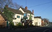
The main commercial area is around the village green and on the neighbouring streets. This contains a considerable range of small, independent shops, as well as banks, cafes and other services. There are also small developments of shops and services in outlying areas of the village, particularly at Giggetty and Blakeley.
Wombourne has a Retained Fire Station, run by Staffordshire Fire and Rescue Service, which is currently being refurbished. The Station houses one pumping appliance and is located on Giggety Lane next to Wombourne Ambulance Station. The Ambulance Station is run by West Midlands Ambulance Service and is manned full time. Wombourne Police Station can be found on the High Street and is part of Staffordshire Police. Police officers work from police station all hours: however, enquiry office staff are only available at certain times.
The village is served by a wide variety of churches, many based around the village green, which do much in the way of maintaining village traditions and in serving the more needy people in the parish. There was considerable volunteer support to the mental health centre in Planks Lane, before it closed. The Hand in Hand centre is well supported by Christians, and a number of activities are run, and paid for by volunteers, for older members of the village.
entirely within the boundaries of the village. It stretches for about 1.5 miles (2.6 km) along both sides of the Wom Brook, traversing the village from east to west. It contains a mix of meadow and woodland. It was established after some years of work by a local conservation group, the Friends of Wom Brook. There has been great excitement over the arrival of Wombourne's very first Little Egret in October/November 2010. It was seen hunting and roosting around the Wombrook on a number of occasions and Daniel Traynor captured the very first image of the bird which was later shown in the Parish News.
and Dudley
. It intersects with the Wom Brook Walk at the western end of Ham Meadow. To the north, it connects with the Wolverhampton Railway Walk, affording a pedestrian route into Wolverhampton via the Smestow Valley LNR. The former Wombourne station at the Bratch
has car parking facilities, as well as a café and information.
also runs north-south through the western part of Wombourne, roughly parallel with the South Staffordshire Railway Walk
and intersecting with the Wom Brook Walk at Giggetty. It forms part of a conservation area and can be followed as far as Kidderminster
and Stourport on Severn to the south and Wolverhampton and Stafford
to the north.
Baggeridge Country Park
,
Highgate Common
,
Himley Hall
and Kinver Edge
Wombourne also has a parish council. This was originally established in 1894 and took its present form in 1974.
Wombourne is part of the South Staffordshire (UK Parliament constituency), which is not coterminous with the district of the same name. It is also part of the large West Midlands (European Parliament constituency)
, which has seven MEPs
.
Before the local government reforms of the 19th century, the local parish or vestry
was both a civil and an ecclesiastical unit within the Seisdon Hundred of the historic county
of Staffordshire. In Victorian times, it became part of the Seisdon Poor Law Union
.
stepped down in the 2010 general election . He is a Conservative
. In elections to the European Parliament
, Wombourne is part of the very large West Midlands constituency which is represented by a total of seven MEPs: 3 Conservative, 2 Labour
, 1 Liberal Democrat
and 1 UK Independence Party. All nine of Wombourn's district councillors are Conservative and the district council is Conservative-controlled.
bus routes 255, 256, 255s and 256s all serve Wombourne, with the 255s and 256s serving Ounsdale High School along with Staffordshire CC sponsored route 584 (operated by Choice Travel
. Timetables for these buses can all be found on the internet. There used to be a railway line but this closed to passenger services in 1932 . Also, this area is near the main A449 road
.
Village
A village is a clustered human settlement or community, larger than a hamlet with the population ranging from a few hundred to a few thousand , Though often located in rural areas, the term urban village is also applied to certain urban neighbourhoods, such as the West Village in Manhattan, New...
(sometimes claimed to be the largest village in England
Largest village in England
Several places claim to be the largest village in England. This title is disputed as there is no standard definition of a village and size might be determined by population or area....
) and civil parish
Civil parish
In England, a civil parish is a territorial designation and, where they are found, the lowest tier of local government below districts and counties...
located in the district of South Staffordshire
South Staffordshire
South Staffordshire is a local government district in Staffordshire, England. The district lies to the north and west of Wolverhampton and the West Midlands, bordering Shropshire to the west and Worcestershire to the south...
, in the county of Staffordshire
Staffordshire
Staffordshire is a landlocked county in the West Midlands region of England. For Eurostat purposes, the county is a NUTS 3 region and is one of four counties or unitary districts that comprise the "Shropshire and Staffordshire" NUTS 2 region. Part of the National Forest lies within its borders...
, 4 miles (6 km) south-west of Wolverhampton
Wolverhampton
Wolverhampton is a city and metropolitan borough in the West Midlands, England. For Eurostat purposes Walsall and Wolverhampton is a NUTS 3 region and is one of five boroughs or unitary districts that comprise the "West Midlands" NUTS 2 region...
. Local affairs are run by a parish council. At the 2001 census
United Kingdom Census 2001
A nationwide census, known as Census 2001, was conducted in the United Kingdom on Sunday, 29 April 2001. This was the 20th UK Census and recorded a resident population of 58,789,194....
it had a population of 13,691. It is just outside the West Midlands
West Midlands (county)
The West Midlands is a metropolitan county in western central England with a 2009 estimated population of 2,638,700. It came into existence as a metropolitan county in 1974 after the passage of the Local Government Act 1972, formed from parts of Staffordshire, Worcestershire and Warwickshire. The...
metropolitan county
Metropolitan county
The metropolitan counties are a type of county-level administrative division of England. There are six metropolitan counties, which each cover large urban areas, typically with populations of 1.2 to 2.8 million...
, and only narrowly outside the West Midlands conurbation
West Midlands conurbation
The West Midlands conurbation is the name given to the large conurbation that includes the cities of Birmingham and Wolverhampton and the large towns of Dudley, Walsall, West Bromwich, Solihull, Stourbridge, Halesowen in the English West Midlands....
, so it is, to some extent an urban fringe settlement or dormitory village, although it also has a distinctive centre and a long history.
Etymology and usage
The Old English word burna signifies a stream, and a stream is a notable feature of the village. Formerly the village name was thought to mean "Womb Stream", or stream in a hollow, because this is a reasonable description of the situation. However, more recent scholarship explains the name as meaning a Crooked Stream, which is at least as good a description.Burna was one of the terms for a stream used in the earliest Anglo-Saxon
Anglo-Saxon
Anglo-Saxon may refer to:* Anglo-Saxons, a group that invaded Britain** Old English, their language** Anglo-Saxon England, their history, one of various ships* White Anglo-Saxon Protestant, an ethnicity* Anglo-Saxon economy, modern macroeconomic term...
place names, and the stream was presumably itself called the Wom Bourn. However, today it is always distinguished from the village by the name Wom Brook, from another, slightly later, Old English term for a stream: brōca. The Wom Brook, which has required considerable work to ameliorate its flooding, originates on Penn
Penn, West Midlands
Penn is an area now divided between Wolverhampton in the West Midlands and South Staffordshire. Originally, it was a village in the historic county of Staffordshire. There is considerable confusion about exactly which areas fall within Penn...
Common and is a tributary of the Smestow Brook
Smestow Brook
The Smestow Brook, sometimes called the river Smestow, is a small river that plays an important part in the drainage of Wolverhampton, South Staffordshire, and parts of Dudley in the United Kingdom, and has contributed to the industrial development of the Black Country...
, which it meets just south of Wombourne.
The spelling "Wombourne" is now preferred for official use. However, the village is marked "Wombourn" on the 1775 William Yates Map of the County of Stafford and as late as the 1945-48 series Ordnance Survey
Ordnance Survey
Ordnance Survey , an executive agency and non-ministerial government department of the Government of the United Kingdom, is the national mapping agency for Great Britain, producing maps of Great Britain , and one of the world's largest producers of maps.The name reflects its creation together with...
maps. There has been considerable feeling about the issue and road signs were regularly amended unofficially with spray paint until the 1990s at least.
Origins
The village has Anglo-SaxonAnglo-Saxon
Anglo-Saxon may refer to:* Anglo-Saxons, a group that invaded Britain** Old English, their language** Anglo-Saxon England, their history, one of various ships* White Anglo-Saxon Protestant, an ethnicity* Anglo-Saxon economy, modern macroeconomic term...
origins, and was part of the large central kingdom of Mercia
Mercia
Mercia was one of the kingdoms of the Anglo-Saxon Heptarchy. It was centred on the valley of the River Trent and its tributaries in the region now known as the English Midlands...
, which was settled by Angles
Angles
The Angles is a modern English term for a Germanic people who took their name from the ancestral cultural region of Angeln, a district located in Schleswig-Holstein, Germany...
. The whole region was wooded when the Germanic settlers arrived, and hamlet names like Bratch ("newly-cleared-land) and Blakeley ("dark clearing") attest to the need to clear land for settlement. The settlers reared large herds of pigs, which were easily fed in the beech, oak and birch woods, which are the naturally-predominant vegetation in the region. Local toponyms like Kingswinford
Kingswinford
Kingswinford is a suburban area in the West Midlands.Historically within Staffordshire, the area is mentioned in the Domesday Book its name relates to a ford for the King's swine - Latin Swinford Regis. The current significance is probably in tourism, education and housing...
("royal pig crossing") and Swindon
Swindon, Staffordshire
Swindon is a village located in Staffordshire, just outside the West Midlands conurbation. The nearest major town is Dudley, approximately five miles eastwards. It stands halfway between the small town of Kingswinford and village of Wombourne....
("pig hill") confirm the importance of pig rearing in Anglo-Saxon times.
The medieval village
Wombourne is mentioned in Domesday BookDomesday Book
Domesday Book , now held at The National Archives, Kew, Richmond upon Thames in South West London, is the record of the great survey of much of England and parts of Wales completed in 1086...
and was clearly a medium-sized village by the standards of the time. Before the Norman Conquest, it was owned by an Anglo-Saxon nobleman called Thorsten. By the time of the survey, probably 1086, William, Fitz Ansculf, held seven hides of land, some of them let from him by one Ralph of Wombourne. William was an important landowner throughout the West Midlands, the son of Ansculf of Picquigny
Picquigny
Picquigny is a commune in the Somme department in Picardie in northern France.-Geography:Picquigny is situated at the junction of the N235, the D141 and D3 roads, on the banks of the Somme River, some northwest of Amiens...
, a Picard baron who came to England with William the Conqueror and built a castle at Dudley
Dudley
Dudley is a large town in the West Midlands county of England. At the 2001 census , the Dudley Urban Sub Area had a population of 194,919, making it the 26th largest settlement in England, the second largest town in the United Kingdom behind Reading, and the largest settlement in the UK without...
. William's total holding at Wombourne supported 8 ploughs and was worth £3. There were 13 villagers (probably not including dependents, so perhaps thirty to forty people in total); a priest, and so perhaps some sort of church; as well as two mills, the first evidence for the importance of water power in the area. Wombourne was part of the Seisdon
Seisdon
Seisdon is a rural village in the county of Staffordshire approximately six miles west of Wolverhampton.-Etymology:The name appears to mean "hill of the Saxons", deriving from the Anglo-Saxon words Seis meaning Saxon and Dun meaning hill.-History:...
Hundred.
The Priors of Dudley built or rebuilt the Parish Church of St. Benedict Biscop
Benedict Biscop
Benedict Biscop , also known as Biscop Baducing, was an Anglo-Saxon abbot and founder of Monkwearmouth-Jarrow Priory and was considered a saint after his death.-Early career:...
around 1170, the only parish church dedicated to this Anglo-Saxon cleric. The building as it is seen today, however, is the result of numerous reconstructions and refurbishments, particularly in the 18th and 19th centuries. The parish of Wombourne extended far from the village, taking in Orton and Swindon
Swindon, Staffordshire
Swindon is a village located in Staffordshire, just outside the West Midlands conurbation. The nearest major town is Dudley, approximately five miles eastwards. It stands halfway between the small town of Kingswinford and village of Wombourne....
.
Industrial developments
For most of its history Wombourne was mainly an agricultural village. However, its involvement with industry began unusually early. From the Middle Ages, the Smestow BrookSmestow Brook
The Smestow Brook, sometimes called the river Smestow, is a small river that plays an important part in the drainage of Wolverhampton, South Staffordshire, and parts of Dudley in the United Kingdom, and has contributed to the industrial development of the Black Country...
and the Stour
River Stour, Worcestershire
The Stour is a river flowing through the counties of Worcestershire, the West Midlands and Staffordshire in the West Midlands region of England. The Stour is a major tributary of the River Severn, and it is about in length...
were lined with small iron bloomeries
Bloomery
A bloomery is a type of furnace once widely used for smelting iron from its oxides. The bloomery was the earliest form of smelter capable of smelting iron. A bloomery's product is a porous mass of iron and slag called a bloom. This mix of slag and iron in the bloom is termed sponge iron, which...
and forges, using local reserves of charcoal and water. The Industrial Revolution
Industrial Revolution
The Industrial Revolution was a period from the 18th to the 19th century where major changes in agriculture, manufacturing, mining, transportation, and technology had a profound effect on the social, economic and cultural conditions of the times...
brought coke-fired furnaces. In 1772, the Staffordshire and Worcestershire Canal
Staffordshire and Worcestershire Canal
The Staffordshire and Worcestershire Canal is a narrow navigable canal in the English Midlands, passing through the counties of Staffordshire and Worcestershire....
was opened, with major canal locks at the Bratch
Bratch
The Bratch is an area of Wombourne in Southern Staffordshire, England, noted for its industrial heritage and as a way station for walkers, riders and cyclists...
and Bumble Hole, integrating the area more closely into industrial Britain. Iron production concentrated in a smaller number of centres - at Swindon
Swindon, Staffordshire
Swindon is a village located in Staffordshire, just outside the West Midlands conurbation. The nearest major town is Dudley, approximately five miles eastwards. It stands halfway between the small town of Kingswinford and village of Wombourne....
, in the southern part of the Wombourn parish, at Gothersley, at the Hyde near Kinver
Kinver
Kinver is a large village in South Staffordshire district, Staffordshire, England. It is in the far south-west of the county, at the end of the narrow finger of land surrounded by the counties of Shropshire, Worcestershire and the West Midlands. The nearest towns are Stourbridge in the West...
, and increasingly in the nearby Black Country
Black Country
The Black Country is a loosely defined area of the English West Midlands conurbation, to the north and west of Birmingham, and to the south and east of Wolverhampton. During the industrial revolution in the 19th century this area had become one of the most intensely industrialised in the nation...
- using the canal to bring ore, coal and limestone to the works. Other villages, however, remained centres for smithing, with cheaper and more available iron greatly increasing the number of workers. Increasingly, Wombourne became a centre for nail-making. The Wom and the Smestow continued to provide both power and cooling water, with several large mills along each stream by the late 18th century.
Perhaps the largest water-driven forge was to the west of the village, where, an 1817 history remarks, "has been erected an iron-work called the Heath-forge, with genteel mansion". This works had a large mill pool, supplied by the Meryyhill Brook and by a contour canal from the River Smestow. Water fell thence in several stages to the Wom, which then joined the Smestow a short distance to the west. The forge mill was later converted into a corn mill, which functioned until the 1930's. The Heath Mill industrial estate on the main Bridgnorth road preserves the name of the complex. The mansion building, now converted into flats, is still to be seen in the Poolhouse estate, itself named after the poolhouse that stood at the dam. The water mill is clearly marked on the 1775 Yates map of Staffordshire, along with one at the Wodehouse, and another just south of the village centre, the remains of which are now the Pool Dam.
It was around the same time that the Hellier family reached the peak of their influence in the area. The Helliers lived at the Wodehouse
The Wodehouse
The Wodehouse is a country house near Wombourne, Staffordshire, notable as the seat of the Georgian landscape designer and musicologist Sir Samuel Hellier and, a century later, Colonel Thomas Bradney Shaw-Hellier, director of the Royal Military School of Music. For almost 200 years the family...
, on the Wom Brook, to the east of the village. It was the fourth Samuel Hellier, knighted in 1762, who turned the Jacobean house into a centre of culture. He had the grounds laid out in fashionable style, with a hermitage
Hermitage (religious retreat)
Although today's meaning is usually a place where a hermit lives in seclusion from the world, hermitage was more commonly used to mean a settlement where a person or a group of people lived religiously, in seclusion.-Western Christian Tradition:...
, a temple to the memory of Handel
HANDEL
HANDEL was the code-name for the UK's National Attack Warning System in the Cold War. It consisted of a small console consisting of two microphones, lights and gauges. The reason behind this was to provide a back-up if anything failed....
, and a music room. He spent a fortune on musical instruments and books of music, building up a private collection and endowing both the church at Wombourne and St. John's, Wolverhampton. The family collection included the Stradivarius named after them
Hellier Stradivarius
The Hellier Stradivarius of circa 1679 is a violin made by Antonio Stradivari of Cremona, Italy. It derives its name from the Hellier family, who might well have bought it directly from the luthier himself....
. Dying without issue in 1784, he left his property to a family friend, the Reverend Thomas Shaw, on condition he change his name to Hellier. One of his descendents spent years as commandant of the Royal Military School of Music
Royal Military School of Music
The Royal Military School of Music in Twickenham, west London, trains musicians for the British Army's twenty-nine bands. It is part of the Corps of Army Music...
at Kneller Hall
Kneller Hall
Kneller Hall is a stately home in the Twickenham area of west London, and takes its name from Sir Godfrey Kneller, court painter to British monarchs from Charles II to George I...
. It is claimed that the Wodehouse has not been sold for over 900 years.
In 1851, Wombourne was described by William White as a large village, "occupied chiefly by nailors, who work for the neighbouring manufacturers". Nail-making remained important into the 20th century. As White implies, it was mainly the preserve of outworkers, who operated small-scale machinery in, or attached to, their own homes, fetching iron sheet or rod from the foundries and returning the finished product.
White tells us that the main landowners in the area in the mid-19th century were John Wrottesley, 2nd Baron Wrottesley
John Wrottesley, 2nd Baron Wrottesley
John Wrottesley, 2nd Baron Wrottesley FRS FRAS was an English astronomer.Wrottesley was the son of John Wrottesley, 1st Baron Wrottesley, and his first wife Lady Caroline Bennet, daughter of Charles Bennet, 4th Earl of Tankerville. He succeeded his father in the barony on March 16, 1841...
, a notable astronomer, and Lord Ward - at this time the Reverend William Humble Ward, the tenth Baron, a relative of the Earl of Dudley
Earl of Dudley
Earl of Dudley, of Dudley Castle in the County of Stafford, is a title that has been created twice in the Peerage of the United Kingdom, both times for members of the Ward family. This family descends from Sir Humble Ward, the son of a wealthy goldsmith and jeweller to King Charles I...
. The Wards made their wealth not merely from land, but what lay under it: the coal and limestone of the West Midlands. Another important landowner, the Reverend William Dalton, was an Evangelical clergyman from Ulster, but he owed his wealth to marriage to the widow of a Bilston
Bilston
Bilston is a town in the English county of West Midlands, situated in the southeastern corner of the City of Wolverhampton. Three wards of Wolverhampton City Council cover the town: Bilston East and Bilston North, which almost entirely comprise parts of the historic Borough of Bilston, and...
iron master.
The modern village
Although the parish had a population approaching 2000 by the mid-19th century, the village itself remained quite small - essentially confined to the area around the present village green. The hamlets of Giggetty, Blakeley, Ounsdale, and the Bratch were quite separate from the village and were only absorbed into it as suburban housing spread from the mid-20th century. This changed the whole character and structure of the village.The area around the green, the original village of Wombourne, evolved as the commercial and cultural centre. The green was surrounded by small, independent shops, which remain a distinctive feature of the village's commercial life. A new civic centre, housing local council services, was constructed near Lower End, just south west of the centre. Suburban housing grew to form a wide ring around it, absorbing most of the hamlets.
In the 1950s, several hundred council houses were built around Wombourne by Wolverhampton council as part of an overspill rehousing programme for residents of the large town's slums.
Large housing developments of the 1960s and 1970s around Giggetty and Brickbridge, to the west, were followed by a still larger westward extension in the Poolhouse estate of the 1980s, which absorbed the former Heath Mill. Meanwhile, light industry developed along the canal and the River Smestow, particularly beyond the main Bridgnorth Road, with industrial estates replacing former foundries. A new bypass was driven through to the south of the village in 1988, carrying Bridgnorth
Bridgnorth
Bridgnorth is a town in Shropshire, England, along the Severn Valley. It is split into Low Town and High Town, named on account of their elevations relative to the River Severn, which separates the upper town on the right bank from the lower on the left...
and Telford
Telford
Telford is a large new town in the borough of Telford and Wrekin and ceremonial county of Shropshire, England, approximately east of Shrewsbury, and west of Birmingham...
traffic around Wombourne and Himley, and clearly separating much of the industrial area from the residential section. Housing development continued into the new millennium, with building to the west of the canal between Ounsdale and the Bratch.
Today the village population works partly locally, and partly in the larger centres of Wolverhampton
Wolverhampton
Wolverhampton is a city and metropolitan borough in the West Midlands, England. For Eurostat purposes Walsall and Wolverhampton is a NUTS 3 region and is one of five boroughs or unitary districts that comprise the "West Midlands" NUTS 2 region...
, the Black Country
Black Country
The Black Country is a loosely defined area of the English West Midlands conurbation, to the north and west of Birmingham, and to the south and east of Wolverhampton. During the industrial revolution in the 19th century this area had become one of the most intensely industrialised in the nation...
, Birmingham
Birmingham
Birmingham is a city and metropolitan borough in the West Midlands of England. It is the most populous British city outside the capital London, with a population of 1,036,900 , and lies at the heart of the West Midlands conurbation, the second most populous urban area in the United Kingdom with a...
and Telford
Telford
Telford is a large new town in the borough of Telford and Wrekin and ceremonial county of Shropshire, England, approximately east of Shrewsbury, and west of Birmingham...
.
Amenities
Staffordshire and Worcestershire Canal
The Staffordshire and Worcestershire Canal is a narrow navigable canal in the English Midlands, passing through the counties of Staffordshire and Worcestershire....
runs north-south through the western side of the village and Bratch
Bratch
The Bratch is an area of Wombourne in Southern Staffordshire, England, noted for its industrial heritage and as a way station for walkers, riders and cyclists...
Locks are located just to the north-west. Another popular local spot is the South Staffordshire Railway Walk which follows the path of a now disused railway which was in use in the 1950s and 60s mainly as a goods railway, but also as a passenger line for a few years. Wombourne village green, which resembles an archetypal 'English Village' as it is in the centre of the village adjacent to the church, regularly plays host to local cricket
Cricket
Cricket is a bat-and-ball game played between two teams of 11 players on an oval-shaped field, at the centre of which is a rectangular 22-yard long pitch. One team bats, trying to score as many runs as possible while the other team bowls and fields, trying to dismiss the batsmen and thus limit the...
matches.
The main commercial area is around the village green and on the neighbouring streets. This contains a considerable range of small, independent shops, as well as banks, cafes and other services. There are also small developments of shops and services in outlying areas of the village, particularly at Giggetty and Blakeley.
Wombourne has a Retained Fire Station, run by Staffordshire Fire and Rescue Service, which is currently being refurbished. The Station houses one pumping appliance and is located on Giggety Lane next to Wombourne Ambulance Station. The Ambulance Station is run by West Midlands Ambulance Service and is manned full time. Wombourne Police Station can be found on the High Street and is part of Staffordshire Police. Police officers work from police station all hours: however, enquiry office staff are only available at certain times.
The village is served by a wide variety of churches, many based around the village green, which do much in the way of maintaining village traditions and in serving the more needy people in the parish. There was considerable volunteer support to the mental health centre in Planks Lane, before it closed. The Hand in Hand centre is well supported by Christians, and a number of activities are run, and paid for by volunteers, for older members of the village.
Walks and Local Countryside
A number of important footpaths cross Wombourne, constituting an important leisure amenity as well as providing safe access to the village and surrounding countryside for walkers and cyclists.The Wom Brook Walk
The Wom Brook Walk is a Local Nature ReserveLocal Nature Reserve
Local nature reserve or LNR is a designation for nature reserves in the United Kingdom. The designation has its origin in the recommendations of the Wild Life Conservation Special Committee which established the framework for nature conservation in the United Kingdom and suggested a national suite...
entirely within the boundaries of the village. It stretches for about 1.5 miles (2.6 km) along both sides of the Wom Brook, traversing the village from east to west. It contains a mix of meadow and woodland. It was established after some years of work by a local conservation group, the Friends of Wom Brook. There has been great excitement over the arrival of Wombourne's very first Little Egret in October/November 2010. It was seen hunting and roosting around the Wombrook on a number of occasions and Daniel Traynor captured the very first image of the bird which was later shown in the Parish News.
The South Staffordshire Railway Walk
The South Staffordshire Railway Walk is another Local Nature Reserve. It follows the course of the former Wombourne Branch Line, traversing Wombourne from north to south, before swinging east towards HimleyHimley
Himley is a village located in Staffordshire, England. It is most notable for being the location of Himley Hall and the location of the death or capture of a group of conspirators following the Gunpowder Plot of 1605.- The area :...
and Dudley
Dudley
Dudley is a large town in the West Midlands county of England. At the 2001 census , the Dudley Urban Sub Area had a population of 194,919, making it the 26th largest settlement in England, the second largest town in the United Kingdom behind Reading, and the largest settlement in the UK without...
. It intersects with the Wom Brook Walk at the western end of Ham Meadow. To the north, it connects with the Wolverhampton Railway Walk, affording a pedestrian route into Wolverhampton via the Smestow Valley LNR. The former Wombourne station at the Bratch
Bratch
The Bratch is an area of Wombourne in Southern Staffordshire, England, noted for its industrial heritage and as a way station for walkers, riders and cyclists...
has car parking facilities, as well as a café and information.
The Staffordshire and Worcestershire Canal
The tow path of the Staffordshire and Worcestershire CanalStaffordshire and Worcestershire Canal
The Staffordshire and Worcestershire Canal is a narrow navigable canal in the English Midlands, passing through the counties of Staffordshire and Worcestershire....
also runs north-south through the western part of Wombourne, roughly parallel with the South Staffordshire Railway Walk
South Staffordshire Railway Walk
The South Staffordshire Railway Walk is located in Staffordshire, EnglandIt runs for five and a half miles [about 8.85km] from Castlecroft to Wall Heath.-History:...
and intersecting with the Wom Brook Walk at Giggetty. It forms part of a conservation area and can be followed as far as Kidderminster
Kidderminster
Kidderminster is a town, in the Wyre Forest district of Worcestershire, England. It is located approximately seventeen miles south-west of Birmingham city centre and approximately fifteen miles north of Worcester city centre. The 2001 census recorded a population of 55,182 in the town...
and Stourport on Severn to the south and Wolverhampton and Stafford
Stafford
Stafford is the county town of Staffordshire, in the West Midlands region of England. It lies approximately north of Wolverhampton and south of Stoke-on-Trent, adjacent to the M6 motorway Junction 13 to Junction 14...
to the north.
Surrounding Area
As well as the walks in or passing through Wombourne, there are also many country parks and places to walk in the surrounding area including:Baggeridge Country Park
Baggeridge Country Park
Baggeridge Country Park is located within the South Staffordshire district of Staffordshire, England. Its entrance is on the A463 just west of Gospel End, a small Staffordshire village just beyond the borders of the Wolverhampton and the Metropolitan Borough of Dudley.-Main information:Baggeridge...
,
Highgate Common
Highgate Common
Highgate Common is a small area of heath land, a popular leisure destination and a Site of Special Scientific Interest, located in Southern Staffordshire, England.-Location:...
,
Himley Hall
Himley Hall
Himley Hall is a country house situated in Staffordshire, England. It is situated in the south of the county near the villages of Wombourne and Kingswinford, and the town of Sedgley...
and Kinver Edge
Kinver Edge
Kinver Edge is a high heath and woodland escarpment just west of Kinver, about four miles west of Stourbridge, and four miles north of Kidderminster, and is on the border between Worcestershire and Staffordshire, England. It is now owned by the National Trust....
Governance
Wombourne is part of a two-tier local government structure, typical of rural county areas in England.- It is situated within the districtNon-metropolitan districtNon-metropolitan districts, or colloquially shire districts, are a type of local government district in England. As created, they are sub-divisions of non-metropolitan counties in a so-called "two-tier" arrangement...
of South StaffordshireSouth StaffordshireSouth Staffordshire is a local government district in Staffordshire, England. The district lies to the north and west of Wolverhampton and the West Midlands, bordering Shropshire to the west and Worcestershire to the south...
. This is based in CodsallCodsallCodsall is a large village in the South Staffordshire district of Staffordshire, England. It is situated north west of the city of Wolverhampton.-History:...
, to the north of Wombourne, although it has district offices locally. It was established in 1974 by the merging of Seisdon Rural DistrictSeisdon Rural DistrictSeisdon was a rural district in Staffordshire, England from 1894 to 1974. It lay west of Wolverhampton and was formed under the Local Government Act 1894 based on the Seisdon rural sanitary district....
, to which Wombourne had belonged, with Cannock Rural DistrictCannock Rural DistrictCannock was a rural district in Staffordshire, England from 1894 to 1974.It was created by the Local Government Act 1894, based on the Cannock rural sanitary district, and has the town of Cannock on its eastern border...
. Wombourne consists of three district council wards, each represented by three councillors: Wombourne North and Lower Penn; Wombourne South West; Wombourne South East.
- South Staffordshire itself is contained within the county of StaffordshireStaffordshireStaffordshire is a landlocked county in the West Midlands region of England. For Eurostat purposes, the county is a NUTS 3 region and is one of four counties or unitary districts that comprise the "Shropshire and Staffordshire" NUTS 2 region. Part of the National Forest lies within its borders...
. This was established as an administrative countyAdministrative countyAn administrative county was an administrative division in England and Wales and Ireland used for the purposes of local government. They are now abolished, although in Northern Ireland their former areas are used as the basis for lieutenancy....
in 1889. Wombourne constitutes a single division in County Council elections: South Staffordshire - Wombourne.
Wombourne also has a parish council. This was originally established in 1894 and took its present form in 1974.
Wombourne is part of the South Staffordshire (UK Parliament constituency), which is not coterminous with the district of the same name. It is also part of the large West Midlands (European Parliament constituency)
West Midlands (European Parliament constituency)
West Midlands is a constituency of the European Parliament. For 2009 it elected 6 MEPs using the d'Hondt method of party-list proportional representation. The constituency will also elect a "virtual MEP" who will be able to sit in the Parliament if the Treaty of Lisbon comes into effect...
, which has seven MEPs
Member of the European Parliament
A Member of the European Parliament is a person who has been elected to the European Parliament. The name of MEPs differ in different languages, with terms such as europarliamentarian or eurodeputy being common in Romance language-speaking areas.When the European Parliament was first established,...
.
Before the local government reforms of the 19th century, the local parish or vestry
Vestry
A vestry is a room in or attached to a church or synagogue in which the vestments, vessels, records, etc., are kept , and in which the clergy and choir robe or don their vestments for divine service....
was both a civil and an ecclesiastical unit within the Seisdon Hundred of the historic county
Historic counties of England
The historic counties of England are subdivisions of England established for administration by the Normans and in most cases based on earlier Anglo-Saxon kingdoms and shires...
of Staffordshire. In Victorian times, it became part of the Seisdon Poor Law Union
Poor Law Union
A Poor Law Union was a unit used for local government in the United Kingdom from the 19th century. The administration of the Poor Law was the responsibility of parishes, which varied wildly in their size, populations, financial resources, rateable values and requirements...
.
Politics
Wombourne's Member of Parliament is Gavin Williamson, who represents the South Staffordshire (UK Parliament constituency) in the House of Commons after Sir Patrick CormackPatrick Cormack
Patrick Cormack, Baron Cormack, FSA DL is a British politician, historian, journalist and author. He was a Conservative Party Member of Parliament from 1970 to 2010.-Early life:...
stepped down in the 2010 general election . He is a Conservative
Conservative Party (UK)
The Conservative Party, formally the Conservative and Unionist Party, is a centre-right political party in the United Kingdom that adheres to the philosophies of conservatism and British unionism. It is the largest political party in the UK, and is currently the largest single party in the House...
. In elections to the European Parliament
European Parliament
The European Parliament is the directly elected parliamentary institution of the European Union . Together with the Council of the European Union and the Commission, it exercises the legislative function of the EU and it has been described as one of the most powerful legislatures in the world...
, Wombourne is part of the very large West Midlands constituency which is represented by a total of seven MEPs: 3 Conservative, 2 Labour
Labour Party (UK)
The Labour Party is a centre-left democratic socialist party in the United Kingdom. It surpassed the Liberal Party in general elections during the early 1920s, forming minority governments under Ramsay MacDonald in 1924 and 1929-1931. The party was in a wartime coalition from 1940 to 1945, after...
, 1 Liberal Democrat
Liberal Democrats
The Liberal Democrats are a social liberal political party in the United Kingdom which supports constitutional and electoral reform, progressive taxation, wealth taxation, human rights laws, cultural liberalism, banking reform and civil liberties .The party was formed in 1988 by a merger of the...
and 1 UK Independence Party. All nine of Wombourn's district councillors are Conservative and the district council is Conservative-controlled.
Transport
National Express West MidlandsNational Express West Midlands
National Express West Midlands , formerly known as Travel West Midlands , is the trade name of West Midlands Travel Ltd , a company which operates bus services from depots in the cities of Birmingham, and Wolverhampton, as well as the boroughs of Dudley, Sandwell, Solihull and Walsall in the West...
bus routes 255, 256, 255s and 256s all serve Wombourne, with the 255s and 256s serving Ounsdale High School along with Staffordshire CC sponsored route 584 (operated by Choice Travel
Choice Travel
Midland, previously known as Choice Travel is a limited bus company operating mostly in the Wolverhampton area of the West Midlands. Some services also operate in the Staffordshire area.-History:...
. Timetables for these buses can all be found on the internet. There used to be a railway line but this closed to passenger services in 1932 . Also, this area is near the main A449 road
A449 road
The A449 is a major road in the United Kingdom. It runs north from junction 24 of the M4 motorway at Newport in South Wales to Stafford in Staffordshire....
.
Schools
There are four primary schools in Wombourne; Westfield, St. Bernadettes R.C, Blakeley Heath primary and St. Benedict Biscop. There is also a secondary school, Ounsdale High School, that takes many of the local primary schools pupils on. Students also come from local areas on coach and bus services to the school. There is also Cherry Tree's special school and Adult Education centres operating in several locations around the village, including Ounsdale High School and the Library.Around Wombourne
A large Sainsburys supermarket was completed in Spring of 2010, along with major road adaptations to the B4176 and community investments such as a local free shuttle bus. This was preceded by a long contest with Tesco to secure a site and planning permission near the village. The supermarket is located to the south of the village centre, just off the main road to Bridgnorth, in a commercial estate.Further reading
- May Griffiths. Around Pattingham & Wombourne in Old Photographs. 1992
- May Griffiths. Wombourne What Was. 1990
External links
- Wombourne.net Local Website for Wombourne
- Wombourne News Local Digital Newspaper for Wombourne
- Staffordshire Past Track Maps, photos and historic documents for all areas of the county.
- Genuki page for Wombourne, with links to local history resources.
- South Staffordshire District Council
- Wombourne Online Community Website for Wombourne